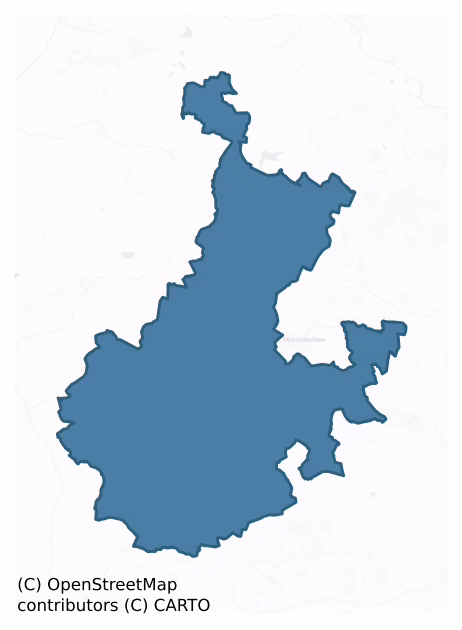
Tiaquin is a barony of County Galway, in the historical province of Connacht (Irish: Tigh Dachoinne), covering 446 km² of land. The barony records 633 NMS archaeological sites and 71 NIAH listed buildings, placing it at around the 29th percentile among 280 ROI baronies for sites per km². This means it is in the bottom third of all baronies for sites per km². Dated archaeological evidence runs from the Neolithic through to the Modern, spanning 8 of 9 archaeological periods, placing the barony in the 77th percentile among 280 ROI baronies for chronological depth. This means it is in the top third of all baronies for chronological depth. The largest dated subset of recorded sites dates to the Early Medieval. Logainm flags 58 placenames in the barony as carrying a recognised heritage root; the largest share — around 52% — are names associated with early Christian church and monastic foundations.
Heritage at a glance
Percentile rankings throughout this profile compare each barony only against the other 279 Republic of Ireland baronies.
The recorded heritage of Tiaquin
The National Monuments Service Sites and Monuments Record (SMR) is the statutory inventory of archaeological sites for the Republic of Ireland, maintained by the Department of Tourism, Culture, Arts, Gaeltacht, Sport and Media. Sites recorded here include earthworks, ringforts, megalithic tombs, ecclesiastical remains, and post-medieval features; not every record is legally protected, but each is registered as a monument of archaeological interest.
The National Monuments Service records 633 archaeological sites in Tiaquin, putting it at the 29th percentile among 280 ROI baronies for sites per km². This means it is in the bottom third of all baronies for sites per km². Of these, 475 (75%) fall within a recorded monument protection zone. The dominant category is defensive sites — ringforts, enclosures, hillforts, and stone forts (271 sites, 43% of the record). The most diagnostically specific type is Ringfort – unclassified (67 records, 11% of the barony's NMS total) — compared to an ROI average of 4% across all baronies where this type occurs. Ringfort – unclassified is a circular Early Medieval settlement enclosure where surviving evidence does not allow distinction between earthen and stone forms. The broader 'Enclosure' classification — which catches unclassified ringforts and field enclosures — accounts for a further 87 records (14%) and reflects the difficulty of sub-classifying degraded earthworks from surface evidence alone. Other significant types include Ringfort – rath (54) — an earthen ringfort enclosed by a bank and external ditch — the most common Early Medieval farmstead, broadly dated 500–1000 AD. Across the barony's 446 km², this gives a recorded density of 1.42 sites per km².
Most common monument types
Hover or tap a monument type to see its definition.
| Type | Count |
|---|---|
| Enclosure a banked or ditched feature of uncertain type, used as a catch-all where the original function cannot be determined from surface evidence | 87 |
| Ringfort – unclassified a circular Early Medieval settlement enclosure where surviving evidence does not allow distinction between earthen and stone forms | 67 |
| Ringfort – rath an earthen ringfort enclosed by a bank and external ditch — the most common Early Medieval farmstead, broadly dated 500–1000 AD | 54 |
| Quarry a place where stone, sand, gravel or clay was extracted | 39 |
| Children's burial ground an unconsecrated medieval and early-modern burial ground for unbaptised or stillborn children, often called a cillín or ceallúnach | 35 |
| Church a building used for public Christian worship, of any date from c. 500 AD onwards | 29 |
| Graveyard a burial area associated with a church, in use from the medieval period onwards | 22 |
Chronological distribution
The dated archaeological record for Tiaquin spans from the Neolithic through to the Modern, with activity attested across 8 of 9 archaeological periods. This is the 77th percentile across ROI baronies for chronological depth — an above-average span. Every period from earliest to latest is represented in the record — an unbroken sequence of dated activity across the full chronological span. Activity concentrates most heavily in the Early Medieval (162 sites, 45% of dated material), with the Iron Age forming a secondary peak (141 sites, 39%). A further 271 recorded sites (43% of the overall NMS register for the barony) carry no period attribution — appearing as 'Unknown' in the bar chart below. This typically reflects either records that pre-date the standardised period vocabulary or sites awaiting specialist dating review, rather than a genuine absence of chronological evidence.
Sample of recorded monuments
Show 25 sample monuments (of 633 total)
A representative sample of 25 recorded monuments drawn from the barony’s 633 total NMS entries. Sites within a recorded monument protection zone and rarer site types are prioritised so the list shows a meaningful cross-section rather than only the most common type. Each entry shows the official Sites and Monuments Record reference number and the description published by the National Monuments Service.
Cairn – wayside cairn
On E-facing slope of a ridge in grassland, 410m SW of Boyounagh graveyard (GA006-030001-). Named in OS Letters (O'Flanagan 1927, Vol. 1, 81) as 'Leacht Mhaire Ni Thuathail' and described as 'a large ash tree with a carn…
On E-facing slope of a ridge in grassland, 410m SW of Boyounagh graveyard (GA006-030001-). Named in OS Letters (O'Flanagan 1927, Vol. 1, 81) as 'Leacht Mhaire Ni Thuathail' and described as 'a large ash tree with a carn of stones around its base'. It consists of a small, partially degraded, subrectangular flat-topped mound of earth and stone (N-S 3m, E-W 1.6m, H 1.2m max.). Local tradition states that it was dedicated to a woman who, when being taken to the above graveyard for burial, fell from the shoulders of her pall-bearers at this spot. As a result, the mound was constructed as 'it is a custom in the country to raise a pile of stones on every spot where a corpse was laid down' (ibid.). The ash tree was afterwards planted in her memory by a friend. (Kinght c. 1975, 2-3)
The above description is derived from the published 'Archaeological Inventory of County Galway Vol. II – North Galway'. Compiled by Olive Alcock, Kathy de hÓra and Paul Gosling (Dublin: Stationery Office, 1999).
Date of upload: 05 August 2010
Monumental structure
In undulating grassland. Known locally as 'Cloch an Bhreithínas' (Judgement Stone), it consists of a large rectangular recumbent limestone boulder (L 2.1m, Wth 2m, H 0.6m). During Cromwellian times, people who were…
In undulating grassland. Known locally as 'Cloch an Bhreithínas' (Judgement Stone), it consists of a large rectangular recumbent limestone boulder (L 2.1m, Wth 2m, H 0.6m). During Cromwellian times, people who were caught attending mass in a nearby valley were tried here and if found guilty were hanged from a tree to SW.
The above description is derived from the published 'Archaeological Inventory of County Galway Vol. II – North Galway'. Compiled by Olive Alcock, Kathy de hÓra and Paul Gosling (Dublin: Stationery Office, 1999).
Date of upload: 05 August 2010
Ritual site – holy tree/bush
Some 150m N of Castle Bellew (GA045-009001-). A dried-up holy well (GA045-010002-), the site of which is marked by a pile of rubble and a group of trees. According to Claffey (1983, 149), 'The tree to the north-east of…
Some 150m N of Castle Bellew (GA045-009001-). A dried-up holy well (GA045-010002-), the site of which is marked by a pile of rubble and a group of trees. According to Claffey (1983, 149), 'The tree to the north-east of the group is reputed to have curative water that lodges in a hollow in its trunk'.
The above description is derived from the published 'Archaeological Inventory of County Galway Vol. II – North Galway'. Compiled by Olive Alcock, Kathy de hÓra and Paul Gosling (Dublin: Stationery Office, 1999).
Date of upload: 08 August 2016
Castle – hall-house
Within a rectangular enclosure (GA045-029002-). A rectangular 13th-C keep (Claffey 1983, 157-8), in fair condition, surviving to a height of three storeys. The SW wall has almost completely collapsed. The robbed-out…
Within a rectangular enclosure (GA045-029002-). A rectangular 13th-C keep (Claffey 1983, 157-8), in fair condition, surviving to a height of three storeys. The SW wall has almost completely collapsed. The robbed-out doorway, near E corner of SE wall on 1st floor, is flanked by beam slots which supported a wooden stairs leading up to it. An intramural stairs in N corner connects 1st and 2nd floors. All the floors were wooden. Apart from large robbed-out windows on 1st floor, the remainder consist of rectangular slits or single lights with flat heads. A church (GA045-033001-) lay 110m to ESE. (O'Flanagan 1927, Vol. 1, 233; Waterman 1956, 73-6)
The above description is derived from the published 'Archaeological Inventory of County Galway Vol. II – North Galway'. Compiled by Olive Alcock, Kathy de hÓra and Paul Gosling (Dublin: Stationery Office, 1999).
Date of upload: 05 August 2010
The following images have been uploaded:
GA045-029001-_01.jpg View from S
GA045-029001-_03.jpg View from S
GA045-029001-_04.jpg SE wall
GA045-029001-_05.jpg NE wall
GA045-029001-_06.jpg Slit window, NE wall
GA045-029001-_07.jpg NW wall
GA045-029001-_08.jpg View of interior from SSW
Kiln – lime
The Archaeological Survey of Ireland (ASI) is in the process of providing information on all monuments on The Historic Environment Viewer (HEV). Currently the information for this record has not been uploaded. To…
The Archaeological Survey of Ireland (ASI) is in the process of providing information on all monuments on The Historic Environment Viewer (HEV). Currently the information for this record has not been uploaded. To access available information for research purposes please make an appointment in advance with the Archive Unit (open Fridays 10.00 am – 5.00 pm), Department of Culture, Heritage and the Gaeltacht, The Custom House, Dublin 1 D01W6XO or email nmarchive@chg.gov.ie.
Architectural fragment
The Archaeological Survey of Ireland (ASI) is in the process of providing information on all monuments on The Historic Environment Viewer (HEV). Currently the information for this record has not been uploaded. To…
The Archaeological Survey of Ireland (ASI) is in the process of providing information on all monuments on The Historic Environment Viewer (HEV). Currently the information for this record has not been uploaded. To access available information for research purposes please make an appointment in advance with the Archive Unit (open Fridays 10.00 am – 5.00 pm), Department of Culture, Heritage and the Gaeltacht, The Custom House, Dublin 1 D01W6XO or email nmarchive@chg.gov.ie.
Megalithic tomb – court tomb
In flat pasture. The tomb comprises the remains of a ruined gallery (L 5.5, Wth c 2m), aligned NW-SE. Its overall length would indicate that it had at least two chambers. Four sidestones are present on N and two on S…
In flat pasture. The tomb comprises the remains of a ruined gallery (L 5.5, Wth c 2m), aligned NW-SE. Its overall length would indicate that it had at least two chambers. Four sidestones are present on N and two on S side of the gallery, and a backstone stands at its NW end. Finally, a single corbel or displaced roofstone protrudes from the ground at S side of the gallery. The structure is incorporated at SE end of a long low mound (L 27.5m, Wth 12m at SE, narrowing to c. 3m at NW). (Ó Nualláin 1989, 118)
The above description is derived from the published 'Archaeological Inventory of County Galway Vol. II – North Galway'. Compiled by Olive Alcock, Kathy de hÓra and Paul Gosling (Dublin: Stationery Office, 1999).
Date of upload: 05 August 2010
Penitential station
On a gentle S-facing slope in pastureland. Marked on 1st ed. of OS 6-inch map as a small area of scrub and bushes. Known locally as 'St Patrick's Footprint', it consists of the rough outline of a foot (L 0.32m, Wth…
On a gentle S-facing slope in pastureland. Marked on 1st ed. of OS 6-inch map as a small area of scrub and bushes. Known locally as 'St Patrick's Footprint', it consists of the rough outline of a foot (L 0.32m, Wth 0.13m max.) on the upper face of a flat natural limestone boulder: probably a product of natural erosion.
The above description is derived from the published 'Archaeological Inventory of County Galway Vol. II – North Galway'. Compiled by Olive Alcock, Kathy de hÓra and Paul Gosling (Dublin: Stationery Office, 1999).
Date of upload: 05 August 2010
Icehouse
The Archaeological Survey of Ireland (ASI) is in the process of providing information on all monuments on The Historic Environment Viewer (HEV). Currently the information for this record has not been uploaded. To…
The Archaeological Survey of Ireland (ASI) is in the process of providing information on all monuments on The Historic Environment Viewer (HEV). Currently the information for this record has not been uploaded. To access available information for research purposes please make an appointment in advance with the Archive Unit (open Fridays 10.00 am – 5.00 pm), Department of Culture, Heritage and the Gaeltacht, The Custom House, Dublin 1 D01W6XO or email nmarchive@chg.gov.ie.
Mausoleum
The following description is from the National Inventory of Architectural Heritage web site: https://www.buildingsofireland.ie/buildings-search/building/30407110/ffrench-mausoleum-monivea-demesne-co-galway last accessed…
The following description is from the National Inventory of Architectural Heritage web site: https://www.buildingsofireland.ie/buildings-search/building/30407110/ffrench-mausoleum-monivea-demesne-co-galway last accessed 3 November 2020.
This highly unusual mausoleum, commissioned by Kathleen de Kindiard in 1897 to house the remains of her father, is in the form of a medieval towerhouse, and took four years to build. The architect was reportedly Francis Persse, younger brother of Lady Augusta Gregory, founder of the Abbey Theatre. When Kathleen died in 1938 she too was laid to rest in the crypt of the mausoleum. A stunning feature in the forest, the mausoleum is a unique and beautifully crafted structure.
The main architectural features include:
Overhanging crenellated parapet with stepped corner merlons, supported on stone corbels. Squared and snecked Wicklow granite walls with battered base. Carved shield and decoration set in rectangular recess above entrance. Trefoil stone vents to base. Pair of ogee-headed stained-glass windows to north and south, granite surround with weathered sill, relieving arch above. Lancet-headed tripartite stained-glass granite-framed window completed by Mayer of Munich, with trefoil tracery and label-moulding above to rear. Slim lancet-headed openings to rear of tower. Lancet-headed double-leaf sheeted oak entrance door with decorative wrought-iron hinges, granite label-moulding above and Gothic-style roll moulded door surround, accessed by…
Cross – Wayside cross
On roadside, 1.6km E of church (GA072-014001-). Only the butt of the rectangular shaft of this limestone cross (L 0.2m, Wth 0.15m, H 0.3m) survives, set in a roughly square base. Though much weathered, the edges of the…
On roadside, 1.6km E of church (GA072-014001-). Only the butt of the rectangular shaft of this limestone cross (L 0.2m, Wth 0.15m, H 0.3m) survives, set in a roughly square base. Though much weathered, the edges of the shaft are chamfered and end in plain triangular stops just above the socket. The limestone base (L 0.55m, Wth 0.5m, H 0.35m) stands on the summit of a small grassed-over mound (L 3m, Wth 1m, H 0.6m). According to local information, this was the burial place of St Molua. It was a traditional resting place for funeral processions leading to the church.
The above description is derived from the published 'Archaeological Inventory of County Galway Vol. II – North Galway'. Compiled by Olive Alcock, Kathy de hÓra and Paul Gosling (Dublin: Stationery Office, 1999).
Date of upload: 05 August 2010
Bawn
The Archaeological Survey of Ireland (ASI) is in the process of providing information on all monuments on The Historic Environment Viewer (HEV). Currently the information for this record has not been uploaded. To…
The Archaeological Survey of Ireland (ASI) is in the process of providing information on all monuments on The Historic Environment Viewer (HEV). Currently the information for this record has not been uploaded. To access available information for research purposes please make an appointment in advance with the Archive Unit (open Fridays 10.00 am – 5.00 pm), Department of Culture, Heritage and the Gaeltacht, The Custom House, Dublin 1 D01W6XO or email nmarchive@chg.gov.ie.
Ecclesiastical site
In a somewhat convoluted passage, the OS Letters (O'Flanagan 1927, vol. 1, 80) record a local tradition that 'there was a monastery to the east of this old grave yard of Bweeounagh [GA006-030—-] … traces of the…
In a somewhat convoluted passage, the OS Letters (O'Flanagan 1927, vol. 1, 80) record a local tradition that 'there was a monastery to the east of this old grave yard of Bweeounagh [GA006-030—-] … traces of the foundations of a small abbey called An Mainistir, are pointed out a short distance to the east of the old church' (ibid.). No visible surface traces were noted.
The above description is derived from the published 'Archaeological Inventory of County Galway Vol. II – North Galway'. Compiled by Olive Alcock, Kathy de hÓra and Paul Gosling (Dublin: Stationery Office, 1999).
Date of upload: 05 August 2010
Cross-inscribed stone
Associated with a children's burial ground (GA045-022001-). According to local information, there was 'a stone with a cross on it' in the burial ground. On inspection it was not visible.
Compiled by: Olive…
Associated with a children's burial ground (GA045-022001-). According to local information, there was 'a stone with a cross on it' in the burial ground. On inspection it was not visible.
Compiled by: Olive Alcock
Date of upload: 10 February 2023
Mass-rock
The Archaeological Survey of Ireland (ASI) is in the process of providing information on all monuments on The Historic Environment Viewer (HEV). Currently the information for this record has not been uploaded. To…
The Archaeological Survey of Ireland (ASI) is in the process of providing information on all monuments on The Historic Environment Viewer (HEV). Currently the information for this record has not been uploaded. To access available information for research purposes please make an appointment in advance with the Archive Unit (open Fridays 10.00 am – 5.00 pm), Department of Culture, Heritage and the Gaeltacht, The Custom House, Dublin 1 D01W6XO or email nmarchive@chg.gov.ie.
Religious house – Cistercian monks
On a gentle S-facing slope in pastureland, near Abbeyknockmoy village, it overlooks the Abbert River to S. A Cistercian monastery founded in 1189-90 by Cathal Crobderg O'Conor, King of Connacht (Glynn 1904; Gwynn and…
On a gentle S-facing slope in pastureland, near Abbeyknockmoy village, it overlooks the Abbert River to S. A Cistercian monastery founded in 1189-90 by Cathal Crobderg O'Conor, King of Connacht (Glynn 1904; Gwynn and Hadcock 1970, 124). A Nat. Mon., the remains comprise a large conserved Transitional style church (E-W; L 60m) of early 13th-C date (Leask 1960a, 37-9) consisting of an aisled nave, a chancel and two transepts (see Cochrane 1904, 246). The chancel has a fine ribbed vault and E windows, while the transepts both contain two barrel-vaulted chapels at their E ends. Three of the arches of the crossing are walled up, possibly 15th-C work coeval with the insertion of the now largely ruined central tower (Killanin and Duignan 1967, 51). The N wall of the chancel bears 15th-C mural paintings depicting the Holy Trinity, the martyrdom of St Sebastian and the Three Dead and Three Live Kings (Crawford 1919; Leask 1960b, 174-5). The claustural buildings and ruined cloister lie to S, but only E wing, including the sacristy, chapter house and a later garderobe, is well preserved. The ruins of a rectangular building (E-W; L 11.35m, Wth 5m) (GA058-004002-), probably of post-medieval date (Sweetman 1987, 9-11), lie immediately to N. A modern mill (GA058-004005-), 325m to W, is said to occupy the site of the original abbey mill (Cochrane 1904, 247-8). A field system (GA058-004004-) and three holy wells (GA058-004007-) are also associated. (Crawford 1913, 152; Harbison 1975, 96)…
Religious house – Carmelite friars
On roadside on NE outskirts of Caltra village. Probably the site of the friary of 'Caltra' or 'Kaltraghne-Pallice', a house of Carmelite friars founded by the Berminghams, barons of Athenry, c. 1320. Apparently…
On roadside on NE outskirts of Caltra village. Probably the site of the friary of 'Caltra' or 'Kaltraghne-Pallice', a house of Carmelite friars founded by the Berminghams, barons of Athenry, c. 1320. Apparently dissolved by 1589 but listed, c. 1737, as one of the convents which had been restored (Gwynn and Hadcock 1970, 288). Archdall (quoted in O'Flanagan 1927, Vol. 1, 241) records that is was dedicated to the Virgin Mary. According to OS Letters (ibid., 240-41), 'there was a nunnery … at Caltra village … where the parish chapel is now. The wall of the chapel attached to which lies the old burying ground of Caltra, belonged … originally to the nunnery, which was called Mainisteair na Cealtraighe'. This is probably the site named but not clearly marked on 1st ed. of OS 6-inch map as 'Grave Yard', alongside which the words 'RC Chapel' and 'Vault' also appear. The site is now occupied by a modern RC church (built 1938-9) and graveyard, and no visible surface trace survives. See also GA060-026001- and GA060-129—-. A number of architectural fragments, including pieces of tracery and a window-head from an ogee window, have been recorded from the graveyard (GA060-027—-): these undoubtedly came from the friary (pers. comm. M. Mannion). (Nolan 1901b, 123)
The above description is derived from the published 'Archaeological Inventory of County Galway Vol. II – North Galway'. Compiled by Olive Alcock, Kathy de hÓra and Paul Gosling (Dublin: Stationery Office, 1999). In t…
Sheela-na-gig (present location)
In the entrance porch of the Catholic church at Newcaslte. It consists of a damaged corbel on teh under-surface of which is a weathered carving of a Sheela-na-gig. The original location of this corbel is unknown though…
In the entrance porch of the Catholic church at Newcaslte. It consists of a damaged corbel on teh under-surface of which is a weathered carving of a Sheela-na-gig. The original location of this corbel is unknown though it is likely to have been of local provenance. In that regard, it has been suggested (Mannion 2008, 18) that it may have been associated with Templemoyle medieval church (GA084-127002-).
See attached screenshots of 3D model of Sheela-na-gig created by Digital Heritage Age. 3D model can be accessed on the Sketchfab website at: https://skfb.ly/6qPxA
J. Mannion, 'Tech Saxan. An Anglo-Saxon monastic settlement in early medieval east Galway.' Journal of the Galway Archaeological and Historical Society 60(2008), 17-18, Pl. 3.
Compiled by: Paul Walsh
Date of upload: 20 December 2011
Memorial stone
Within a graveyard (GA071-023001-). A circular spring well (GA071-023002-), dedicated to St Patrick, is situated in the NE corner of a drystone-built well-chamber (L/Wth 2.5m). A step at S leads down to the water. On…
Within a graveyard (GA071-023001-). A circular spring well (GA071-023002-), dedicated to St Patrick, is situated in the NE corner of a drystone-built well-chamber (L/Wth 2.5m). A step at S leads down to the water. On the E wall, a plaque (H 0.7m, Wth 0.5m) depicting St Patrick standing on a snake and holding a double-armed cross bears the following inscription: PRAY.FOR / FA.THOM / AS.KIEGH / RY.WH / O.MADE / THIS.IMA / GE.IN.REME / MBRANCE / 1688 (pers. comm. H. Carey).
Compiled by: Paul Walsh
Date of upload: 24 October 2012
Moated site
In undulating grassland. Well-preserved rectangular moated site (N-S 41m, E-W 30m) defined by two banks and an intervening fosse. The inner bank is present near SE corner; elsewhere a scarp forms the enclosing element.…
In undulating grassland. Well-preserved rectangular moated site (N-S 41m, E-W 30m) defined by two banks and an intervening fosse. The inner bank is present near SE corner; elsewhere a scarp forms the enclosing element. The fosse and outer bank are clearly visible. Quarrying has disturbed the N and E sides of the monument. Within the interior is a horseshoe-shaped depression (L c. 9m). (Claffey 1983, 156)
The above description is derived from the published 'Archaeological Inventory of County Galway Vol. II – North Galway'. Compiled by Olive Alcock, Kathy de hÓra and Paul Gosling (Dublin: Stationery Office, 1999).
Date of upload: 05 August 2010
Megalithic tomb – wedge tomb
In a broad valley near W end of an isolated terrace of cragland, 1.6km S of Knockroe Hill. The monument, extant in 1960, has since been destroyed and no visible surface trace survives. It consisted of a long narrow…
In a broad valley near W end of an isolated terrace of cragland, 1.6km S of Knockroe Hill. The monument, extant in 1960, has since been destroyed and no visible surface trace survives. It consisted of a long narrow gallery (L 8.2m, Wth 1.9m at W, narrowing to 1m at E), aligned roughly E-W. Five displaced slabs lay along it; these may have been fragments of the roof. The N side was represented by five orthostats and S side by seven; a backstone was in position at E end. Two outer wall-stones were exposed on N side and two on S side. The tomb was incorporated in a subrectangular mound (L 13, Wth < 8m). (de Valera and Ó Nualláin 1972, 12-13; 6 Nualláin 1989, 137)
The above description is derived from the published 'Archaeological Inventory of County Galway Vol. II – North Galway'. Compiled by Olive Alcock, Kathy de hÓra and Paul Gosling (Dublin: Stationery Office, 1999).
Date of upload: 05 August 2010
See linked document with details from Ruaidhrí de Valera and Seán Ó Nualláin, Survey of the Megalithic Tombs of Ireland. Volume III. Counties Galway, Roscommon, Leitrim, Longford, Westmeath, Laoighis, Offaly, Kildare, Cavan. (Dublin: Stationery Office, 1972).
Settlement deserted – medieval
To S and SW of a tower house (GA058-045001-). Traces of earthworks are visible covering an area 300m E-W by 200m N-S. These include the foundations of at least eleven drystone-built rectangular houses (L c. 11m Wth c.…
To S and SW of a tower house (GA058-045001-). Traces of earthworks are visible covering an area 300m E-W by 200m N-S. These include the foundations of at least eleven drystone-built rectangular houses (L c. 11m Wth c. 4.5m) and associated field walls which form no obvious pattern. A possible roadway (L 50m, Wth 10m), defined by two parallel drystone walls, is also visible.
The above description is derived from the published 'Archaeological Inventory of County Galway Vol. II – North Galway'. Compiled by Olive Alcock, Kathy de hÓra and Paul Gosling (Dublin: Stationery Office, 1999).
Date of upload: 05 August 2010
Settlement deserted – medieval
The Archaeological Survey of Ireland (ASI) is in the process of providing information on all monuments on The Historic Environment Viewer (HEV). Currently the information for this record has not been uploaded. To…
The Archaeological Survey of Ireland (ASI) is in the process of providing information on all monuments on The Historic Environment Viewer (HEV). Currently the information for this record has not been uploaded. To access available information for research purposes please make an appointment in advance with the Archive Unit (open Fridays 10.00 am – 5.00 pm), Department of Culture, Heritage and the Gaeltacht, The Custom House, Dublin 1 D01W6XO or email nmarchive@chg.gov.ie.
Mound
On a low esker ridge. The 3rd ed. of OS 6-inch map (1932) shows a small subcircular enclosure (c. 30m by c. 25m) through which a stream appears to flow. Only a slight rise is now visible at the spot, bounded along SW by…
On a low esker ridge. The 3rd ed. of OS 6-inch map (1932) shows a small subcircular enclosure (c. 30m by c. 25m) through which a stream appears to flow. Only a slight rise is now visible at the spot, bounded along SW by a small stream. Possibly a barrow or a tumulus. A group of miscellaneous burials (GA059-031—-) was found c. 125m to W.
The above description is derived from the published 'Archaeological Inventory of County Galway Vol. II – North Galway'. Compiled by Olive Alcock, Kathy de hÓra and Paul Gosling (Dublin: Stationery Office, 1999).
Date of upload: 05 August 2010
Enclosure
On the summit of a hill in undulating grassland with bogland visible to N and SE. Marked on 3rd ed. of OS 6-inch map (1930) as a subcircular enclosure (NW-SE 36.5m, NE-SW 30m). The monument has been greatly disturbed by…
On the summit of a hill in undulating grassland with bogland visible to N and SE. Marked on 3rd ed. of OS 6-inch map (1930) as a subcircular enclosure (NW-SE 36.5m, NE-SW 30m). The monument has been greatly disturbed by quarrying and a large pit has been dug into E half. A squared-off scarp defines W half.
The above description is derived from the published 'Archaeological Inventory of County Galway Vol. II – North Galway'. Compiled by Olive Alcock, Kathy de hÓra and Paul Gosling (Dublin: Stationery Office, 1999).
Date of upload: 05 August 2010
Listed buildings
The National Inventory of Architectural Heritage (NIAH) is a state survey appraising buildings of architectural, historical, archaeological, artistic, cultural, scientific, social, or technical interest. Each surveyed structure receives a rating from International (the highest, for buildings of European importance) through National, Regional, Local, and Record-Only.
The NIAH records 71 listed buildings in Tiaquin (39th percentile across ROI baronies). All recorded buildings carry Regional or lower grading; the barony does not contain any structures appraised as being of National or International architectural importance. Construction dates concentrate most heavily in the Victorian (1830-1900) period.
Terrain and environment
Mean elevation across the barony is 78m — the 39th percentile among 280 ROI baronies for elevation. This means it is in the lower half of all baronies for elevation. Elevation matters for heritage because higher-altitude baronies typically favour defensive monuments — ringforts and hilltop forts placed on prominent ground — while lowland baronies are more likely to carry the dense settlement and church networks of intensive agricultural landscapes. Mean slope is 2.1° — the 10th percentile among 280 ROI baronies for slope. This means it is in the bottom fifth of all baronies for slope. This is broadly flat terrain, the kind of landscape best suited to intensive agriculture. Slope is a key control on both land use and archaeological preservation: steep ground resists ploughing and tends to preserve earthworks intact, while gentle slopes favour intensive cultivation that damages or destroys surface archaeology over time. The Topographic Wetness Index averages 11.7, the 88th percentile among 280 ROI baronies for wetness. This means it is in the top fifth of all baronies for wetness. This is wet, slow-draining ground by ROI standards — the kind of landscape that may carry waterlogged archaeological sites of unusual preservation value. Drainage matters for heritage because poorly-drained ground preserves organic archaeology (wooden trackways, leather, textiles, and on rare occasions human remains) far better than free-draining soil; well-drained ground favours arable use but destroys organic material rapidly. The land cover is dominated by improved grassland (86%) and woodland (11%).
Terrain measurements
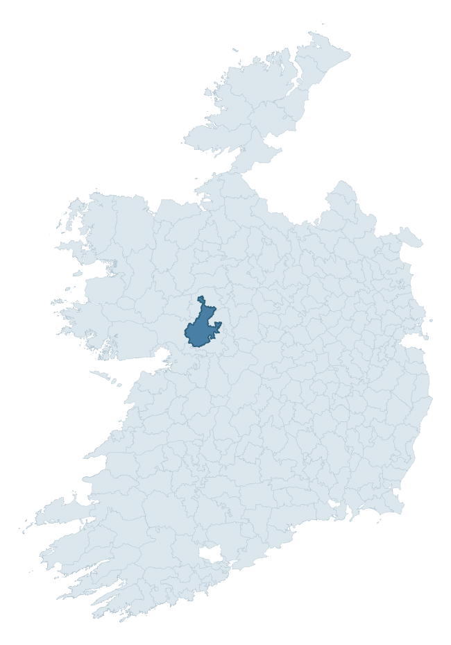
Where this barony sits in the Republic of Ireland
Geology and preservation
Bedrock geology shapes the landscape long before any settlement begins — controlling soil drainage, agricultural potential, the survival of upstanding monuments, and the preservation of buried archaeology. The figures below come from the Geological Survey Ireland 1:100,000 bedrock map.
The bedrock underlying Tiaquin is predominantly limestone (67% of the barony by area), laid down during the Carboniferous period (100% by area, around 359 to 299 million years ago). Limestone is the most heritage-rich bedrock in Ireland. It supports fertile, well-drained soils that favoured dense Early Medieval settlement and Norman manorial agriculture, and it weathers into karst features — sinkholes, caves, swallow holes, and souterrains — that frequently carry archaeology. Where peat overlies limestone, organic preservation can be exceptional. A substantial secondary geology of limestones (28%) adds further variety to the underlying landscape. The single largest mapped unit is the Burren Formation (48% of the barony's bedrock).
Rock type composition
Largest mapped unit: Burren Formation (48% of the barony)
Placename evidence
Logainm records 58 heritage-diagnostic placenames for Tiaquin, drawn from townland and civil-parish names across the barony. The dominant stratum is Early Christian ecclesiastical — cill-, teampall-, and domhnach-prefixed names that record the dense network of early church foundations established between the fifth and tenth centuries. The leading diagnostic roots are cill- (25 — church), lios- (14 — ringfort or enclosure), and cathair- (4 — stone fort). This is above the ROI average of 30.7 heritage placenames per barony. The presence of multiple heritage strata side by side indicates layered occupation of the landscape across successive prehistoric and historic periods. Logainm records 389 placenames for Tiaquin (predominantly townland names). Of these, 58 (15%) carry one of the diagnostic Gaelic roots tracked above; the remainder draw on more generic landscape vocabulary that does not encode a heritage period.
Pre-Christian / Early Medieval Defensive
| Root | Count | Meaning |
|---|---|---|
| lios- | 14 | ringfort or enclosure |
| cathair- | 4 | stone fort |
| dún- | 2 | hilltop or promontory fort |
| caiseal- | 2 | stone ringfort |
| ráth- | 1 | earthen ringfort |
Early Christian Ecclesiastical
| Root | Count | Meaning |
|---|---|---|
| cill- | 25 | church (early) |
| teampall- | 3 | church (later medieval) |
| mainistir- | 1 | monastery |
| gráinseach- | 1 | monastic farm / grange |
Burial, Ritual, and Norse-Contact
| Root | Count | Meaning |
|---|---|---|
| tuaim- | 2 | burial mound |
| leacht- | 2 | grave monument |
| gall- | 2 | foreigner — Norse settlement marker |
| sián- | 1 | fairy mound |
Other baronies in Galway
- Killian
- Ballymoe
- Leitrim
- Ross
- Loughrea
- Moycarn
- Clonmacnowen
- Clonmacnowen
- Moycullen
- Rosclogher — Leitrim
See all 280 baronies in the Republic of Ireland Heritage Tool.

Explore further
Grounding History: 10 Maps of Northern Ireland’s Past
If you’re interested in Irish heritage more widely, the companion report for Northern Ireland brings together the analysis of all 462 NI wards into one place through 10 high-quality maps — covering monument density, archaeological periods, placename heritage, terrain, wetland, and the historic landscape at first survey. Take a look.
About this profile
Click any section below to expand.
What is a barony?
A barony is a historic administrative unit in Ireland, broadly equivalent to an English hundred. The 280 baronies used here are from the OSi 2019 National Statutory Boundaries (generalised 20m), covering the 26 counties of the Republic of Ireland. Baronies derive from the Norman period, were formalised in the 17th century, and have not been redrawn for statistical purposes. They vary enormously in area, from compact urban baronies in Dublin to vast upland baronies in Connacht, and should not be compared by raw site count without accounting for area differences.
What counts as a site?
This profile combines three distinct heritage registers, each with its own definition of what constitutes a recordable site:
- Archaeological sites (NMS). The National Monuments Service Sites and Monuments Record (SMR) catalogues every known archaeological monument or site of archaeological interest in the Republic, from prehistoric burial mounds and ringforts to medieval churches and post-medieval defensive works. Inclusion does not require legal protection — only that the site has been identified, surveyed, and assessed as having archaeological value. A separate subset of these sites lies within a recorded protection zone, which gives them statutory protection under the National Monuments Acts.
- Listed buildings (NIAH). The National Inventory of Architectural Heritage records buildings of architectural, historical, archaeological, artistic, cultural, scientific, social, or technical interest. Each surveyed structure is appraised on a five-tier scale: International, National, Regional, Local, and Record-Only. The NIAH appraisal is informational rather than strictly statutory, but it underpins local-authority Record of Protected Structures (RPS) listings.
- Heritage placenames (Logainm). Logainm is the authoritative database of Irish placenames maintained by the Placenames Branch. This profile applies a heritage-diagnostic classifier to the Irish-language form of each townland name, flagging roots that signal defensive sites (ráth-, lios-, dún-, caiseal-, cathair-), ecclesiastical foundations (cill-, teampall-, domhnach-, mainistir-), prehistoric burial-ritual features (tuaim-, carn-, leaba-), or Norse-contact settlement (gall-). Townlands without one of these diagnostic roots are not flagged here — they may still carry historical significance, but that significance is not encoded in the name itself.
Editorial principles
The narrative sections of this profile follow several explicit principles:
- Evidential. Every claim about this barony’s heritage character is anchored in the underlying register data. Where a site count, a placename count, or a percentile rank is cited, it is computed from the source datasets at export time, not estimated.
- Comparative. Counts and metrics are reported alongside their percentile rank against the other 279 ROI baronies. A barony with 50 ringforts in absolute terms could be unusually high or unusually low depending on its size and regional context; percentile ranking removes that ambiguity.
- Transparent on limits. Where a register has known coverage gaps, survey biases, or data-quality issues that affect this barony’s figures, the profile flags them rather than presenting the numbers as definitive.
- No interpretation beyond what the data supports. The narrative does not speculate about historical events, social dynamics, or cultural meaning beyond what the recorded heritage and placename evidence directly attests.
Data caveats and limits
- NMS Sites and Monuments Record is the product of survey campaigns conducted at different intensities across different counties and decades. Some baronies have been surveyed more thoroughly than others, and absolute counts should be read in that light. Sites destroyed by development before survey are typically not represented; sites in heavily forested or upland terrain are sometimes under-recorded.
- NIAH coverage is broadly complete for the Republic of Ireland but the survey was conducted on a rolling county-by-county basis, and the most recent appraisal date varies. Buildings demolished or substantially altered after their original survey may still appear in the register; conversely, recent buildings of merit may not yet have been appraised.
- Logainm classification applies a deliberately conservative pattern-matching approach to the Irish-language townland forms. The classifier prioritises true positives over recall: a townland may carry a heritage signal that the classifier doesn’t recognise, particularly where the diagnostic root has been heavily anglicised or where the townland name draws on a less common term. The 60,000+ townland records and ~9,800 classified placenames give a substantial signal at barony scale, but individual townland names should be checked against Logainm directly for definitive interpretation.
- Period attribution. The chronological distribution reflects only those NMS sites that carry a recognised period attribution in the source data. Sites listed as “Unknown” period are excluded from the dated subset.
- Boundary changes. Some baronies have undergone minor boundary adjustments since their 19th-century definition; the OSi 2019 generalised boundaries used here are the current statutory definition and may differ slightly from historical maps in border areas.
- Bedrock geology is mapped at 1:100,000 scale, which means local variation within a barony — small pockets of different rock type, mineral veins, alluvium overlying bedrock — is generalised. The dominant-system and rocktype figures are area-weighted, so a barony reading “70% Carboniferous limestone” may still contain small but archaeologically important pockets of older or younger rock. Around 3% of GSI polygons do not match the lexicon and contribute no rocktype or system attribution.
Data sources
- National Monuments Service — Sites and Monuments Record (SMR) https://data.gov.ie/dataset/national-monuments-service-archaeological-survey-of-ireland
- National Inventory of Architectural Heritage (NIAH) https://data.gov.ie/dataset/national-inventory-of-architectural-heritage-niah-national-dataset
- Logainm — Placenames Database of Ireland https://www.logainm.ie/
- Ordnance Survey Ireland — National Statutory Barony Boundaries 2019 https://data-osi.opendata.arcgis.com/
- EURODEM — European Digital Elevation Model https://www.mapsforeurope.org/datasets/euro-dem
- ESA WorldCover https://esa-worldcover.org/en
- Geological Survey Ireland — 1:100,000 Bedrock Geology https://www.gsi.ie/en-ie/data-and-maps/Pages/Bedrock.aspx
Explore more: Search any of the 280 ROI baronies, browse by historical province, or read the methodology and data sources for the full Republic of Ireland Heritage Tool.