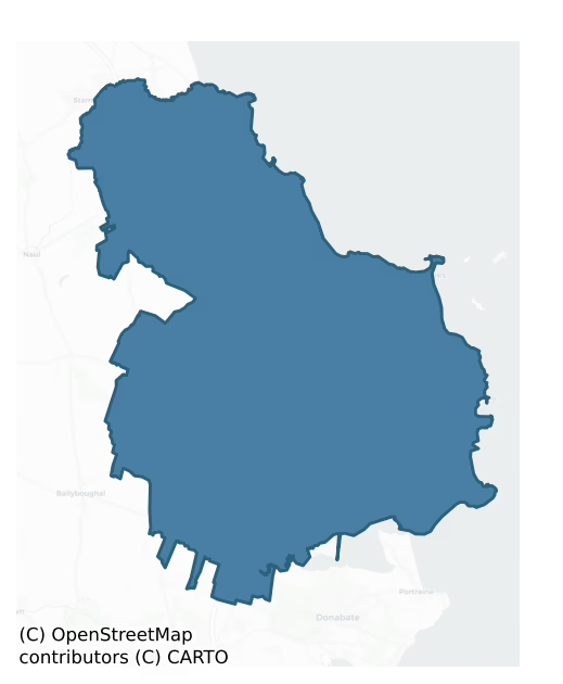
Balrothery East is a barony of County Dublin, in the historical province of Leinster (Irish: Baile an Ridire Thoir), covering 122 km² of land. The barony records 480 NMS archaeological sites and 177 NIAH listed buildings, placing it at around the 92nd percentile among 280 ROI baronies for sites per km². This means it is in the top tenth of all baronies for sites per km². Dated archaeological evidence runs from the Mesolithic through to the Modern, spanning 9 of 9 archaeological periods, placing the barony in the 97th percentile among 280 ROI baronies for chronological depth. This means it is in the top tenth of all baronies for chronological depth. The largest dated subset of recorded sites dates to the Iron Age. Logainm flags 17 placenames in the barony as carrying a recognised heritage root; the largest share — around 53% — are names associated with early Christian church and monastic foundations.
Heritage at a glance
Percentile rankings throughout this profile compare each barony only against the other 279 Republic of Ireland baronies.
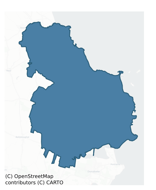
The recorded heritage of Balrothery East
The National Monuments Service Sites and Monuments Record (SMR) is the statutory inventory of archaeological sites for the Republic of Ireland, maintained by the Department of Tourism, Culture, Arts, Gaeltacht, Sport and Media. Sites recorded here include earthworks, ringforts, megalithic tombs, ecclesiastical remains, and post-medieval features; not every record is legally protected, but each is registered as a monument of archaeological interest.
The National Monuments Service records 480 archaeological sites in Balrothery East, putting it at the 92nd percentile among 280 ROI baronies for sites per km². This means it is in the top tenth of all baronies for sites per km². Of these, 405 (84%) fall within a recorded monument protection zone. The record is dominated by defensive sites — ringforts, enclosures, hillforts, and stone forts (140 sites, 29% of the total), with burial and ritual monuments forming a substantial secondary presence (87 sites, 18%). The most diagnostically specific type is Ring-ditch (58 records, 12% of the barony's NMS total) — compared to an ROI average of 6% across all baronies where this type occurs. Ring-ditch is a circular ditch under 20m across, often the ploughed-out remains of a barrow, ring-barrow or roundhouse. The broader 'Enclosure' classification — which catches unclassified ringforts and field enclosures — accounts for a further 100 records (21%) and reflects the difficulty of sub-classifying degraded earthworks from surface evidence alone. Across the barony's 122 km², this gives a recorded density of 3.94 sites per km².
Most common monument types
Hover or tap a monument type to see its definition.
| Type | Count |
|---|---|
| Enclosure a banked or ditched feature of uncertain type, used as a catch-all where the original function cannot be determined from surface evidence | 100 |
| Ring-ditch a circular ditch under 20m across, often the ploughed-out remains of a barrow, ring-barrow or roundhouse | 58 |
| Field system a group of related fields forming a coherent agricultural landscape, of any date from the Neolithic onwards | 26 |
| Fulacht fia a horseshoe-shaped Bronze Age burnt mound built around a sunken trough beside a water source, traditionally interpreted as a cooking site | 22 |
| Earthwork an unclassified earthen structure with no diagnostic features that allow a more specific classification | 19 |
| Ritual site – holy well a well or spring traditionally associated with a saint, often credited with healing properties; many trace earlier ritual origins but devotion is documented from the medieval period onwards | 16 |
| Excavation – miscellaneous | 13 |
Chronological distribution
The dated archaeological record for Balrothery East spans from the Mesolithic through to the Modern, with activity attested across 9 of 9 archaeological periods. This places Balrothery East in the top 3% of ROI baronies for chronological depth — few baronies record evidence across as many distinct archaeological periods. Every period from earliest to latest is represented in the record — an unbroken sequence of dated activity across the full chronological span. Activity concentrates most heavily in the Iron Age (133 sites, 38% of dated material), with the Middle Late Bronze Age forming a secondary peak (83 sites, 24%). A further 134 recorded sites (28% of the overall NMS register for the barony) carry no period attribution — appearing as 'Unknown' in the bar chart below. This typically reflects either records that pre-date the standardised period vocabulary or sites awaiting specialist dating review, rather than a genuine absence of chronological evidence.
Sample of recorded monuments
Show 25 sample monuments (of 480 total)
A representative sample of 25 recorded monuments drawn from the barony’s 480 total NMS entries. Sites within a recorded monument protection zone and rarer site types are prioritised so the list shows a meaningful cross-section rather than only the most common type. Each entry shows the official Sites and Monuments Record reference number and the description published by the National Monuments Service.
House – fortified house
Located north of Balbriggan town, this is the manorial seat of the Barnewall family from 14th-Century. Described in the Civil survey (1654-6) as a 'burnt castle' (Simington, 1945, 4; Anon 1914, 271; Mc Dix1887, Xl, May…
Located north of Balbriggan town, this is the manorial seat of the Barnewall family from 14th-Century. Described in the Civil survey (1654-6) as a 'burnt castle' (Simington, 1945, 4; Anon 1914, 271; Mc Dix1887, Xl, May 1st, 68). The castle is thought to have been under construction by 1546 since a bridal mantlepiece tree, part of the hall chimney piece, which annunciates the marriage of James Barnewall to Margaret Lawrence, took place around that year (Johnson 2007, 249-260). The castle suffered badly in the Confederate wars in 1641 but was later renovated. At present restoration works are in progress by the Parks Department of Fingal County Council.
Comprises an L-shaped range of buildings, rising to two-storeys (H 4m) with slight external batter. The main E-W block (ext. dims. L22m, Wth 10.5m, Max. Wth of W wall 1.98m) is built of coursed masonry and dressed limestone quoins. A barrel-vault over ground floor shows traces of wicker-centring. Opening in S wall of E-W range gives access to two compartments. W compartment (dims. 15m E-W, 16m N-S) lit by slit ope and rectangular, chamfered limestone ope on S wall. Corbels for 1st floor visible in W compartment. E compartment of E-W range has two chambers. S chamber has bread kiln. N-S range (dims.24m N-S, 12m E-W) lit by 16th-century round-headed, chamfered limestone ope. Gun loop in E wall of N-S range.
A drawing by Austin Cooper dated 1783 shows the west elevation. Above the first floor hall were two further upper…
Barrow – unclassified
Three circular areas defined by banks (diams. av. 6.25m) were identified near the shoreline immediately S of Bremore passage tomb cemetery in the 1950s (Hartnett 1957, 264). Geophysical survey (Licence no. 06R0050)…
Three circular areas defined by banks (diams. av. 6.25m) were identified near the shoreline immediately S of Bremore passage tomb cemetery in the 1950s (Hartnett 1957, 264). Geophysical survey (Licence no. 06R0050) identified an enclosure located approximately 110m SW of Mound I (DU002-007001-) that may correspond with one of Harnett's sites. The geophysical anomaly comprises as a circular ditch (25m diam.). No internal features were identified. The remaining two sites were not identified by the geophysical survey (Gimson 2006, 10). The field is under tillage. Not visible at ground level. The Bremore headland was also subject to a constraint study carried out by Margaret Gowen & Company Ltd. in advance of a proposed port. In addition fieldwalking and lithic analysis was undertaken for an MA study (Collins, 2007).
Compiled by: Geraldine Stout
Updated by: Christine Baker
Date of upload: 16 April 2015
Chapel
Named 'Site of chapel' on the 1837 ed. OS 6-inch map. Located in field of rough pasture described locally as 'chapel meadow' (Healy 1975, 17). Within field of rough pasture sloping down to stream on south side of which…
Named 'Site of chapel' on the 1837 ed. OS 6-inch map. Located in field of rough pasture described locally as 'chapel meadow' (Healy 1975, 17). Within field of rough pasture sloping down to stream on south side of which is a tower house (DU005-004—-). In the fields immediately to the east an organised medieval settlement including metalled trackway, at least two dry-stone buildings, a number of metalled surfaces, possible wall remains, and cereal drying kilns has been excavated (Long 2010, Kyle 2011). Radiocarbon and ceramic analysis indicate a 13th/14th date. Interpreted by the excavators as a medieval village or hamlet c.420m (NW/SE) and a possible width of c.180m with at least 5/6 medieval structures. Possible Folkstown chapel may have served religious needs of population whom are most likely to have been tenants of de Rosel family (Kyle 2011, 12). Not visible at ground level.
Compiled by: Geraldine Stout
Updated by: Christine Baker
Date of upload: 7 November 2014
Religious house – Augustinian canons
The 18th-century bell-tower of a church in the centre of Holmpatrick (Inis Pádraig/Patrick's Island) graveyard stands on the site of the medieval parish church which was built in 1220 as an Augustinian priory and was…
The 18th-century bell-tower of a church in the centre of Holmpatrick (Inis Pádraig/Patrick's Island) graveyard stands on the site of the medieval parish church which was built in 1220 as an Augustinian priory and was dissolved in 1537 (Gwynn and Hadcock 1970, 154). The church (DU005-031001-) and graveyard (DU005-031002-) of Holmpatrick stands 720m to the S of Skerries and 200m W of the Dublin coast with St. Patrick's Island (DU005-019—-) 2.1km to the NE. According to Gwynn and Hadcock (ibid., 178) the 'convent of St. Patrick's Island [DU005-019—-] was moved to a more commodious place, Holm Patric (on the mainland, Co. Dublin), in 1220 by Henry of London, abp. [archbishop] of Dublin. The old name was retained, at any rate for a time. Philip was pr[ior]. of the Island of St. Patrick in 1229. Pr[ior]. Peter Manne d[ied]. 1537. His successor, Philip Corre, on 13 Dec. 1537 was granted a pension of £8 from the previous Easter, and in 1540 the jurors reported that the priory church had been parochial from time immemorial, other buildings on the 3-acre site being necessary for the farmer and not valued; the possessions included c. 1,000 acres with many messuages, cottages and unmeasured plots, a water-mill, and the rectory, val[ued]. £69 8s. 6d; in 1548 the farmers, the executors of Robert Cowley, deceased, and John Parker, were over £119 in arrears. The property was granted to Thomas Fitz Wiliams in 1578'. Medieval floor tiles were recovered from a grave 37m ENE of the…
Castle – Anglo-Norman masonry castle
Situated on a prominent hill overlooking the coast. Described by Austin Cooper in 1783 as a quadrangular court flanked by four towers attached to the west end of Baldongan church (DU005-037001) (Anon.1914, 250). It was…
Situated on a prominent hill overlooking the coast. Described by Austin Cooper in 1783 as a quadrangular court flanked by four towers attached to the west end of Baldongan church (DU005-037001) (Anon.1914, 250). It was illustrated in the 18th-century for Grosse's Antiquities of Ireland (ibid) and had a similar plan to St. John's Priory, Newtown, Trim Co. Meath, which belonged to the Fratres Cruciferi (Sweetman 1991, 88-104). the last remains were removed in 1975. Traditionally associated with the Knights Templars (Gwynn & Hadcock 1988, 325). It was the family seat of the Birminghams and the Barnewalls until the sixteenth century when it passed to the Lords of Howth (D'Alton, 1976 (2nd ed) 225; Healy 1975, 18). Site now traversed by pathway to Baldongan church within an arable field. There are no visible remains.
Compiled by: Geraldine Stout
Updated by: Christine Baker
Date of upload: 15 November 2014
Fish-pond
There is no surface trace of the fish ponds described by Austin Cooper in 1783 (Anon 1914, 251). They were located at a break in slope at the bottom of a field. These have been filled in leaving no visible…
There is no surface trace of the fish ponds described by Austin Cooper in 1783 (Anon 1914, 251). They were located at a break in slope at the bottom of a field. These have been filled in leaving no visible remains.
Compiled by: Geraldine Stout
Updated by: Christine Baker
Date of upload: 15 November 2014
Inn
Known as the White Hart Inn-large two-storey vernacular building of seven bays and central doorway. Modified by the division of the building into two properties and the insertion of a second door next to the original.…
Known as the White Hart Inn-large two-storey vernacular building of seven bays and central doorway. Modified by the division of the building into two properties and the insertion of a second door next to the original. Walls of stone and the roof of modern slate (formerly partially corrugated iron and before that thatched). Chimney on the east gable is stone of post medieval type. Tradition that James II lodged here on way to the Battle of the Boyne. Extensive associated outbuildings. Also a Protected Structure.
Compiled by: Geraldine Stout
Updated by: Christine Baker
Date of upload: 15 November 2014
Religious house – Augustinian, of Arrouaise nuns
Located in low-lying field of tillage. This site is associated with the Priory of St. Mary which was endowed for nuns by John Comyn, archbishop of Dublin, c. 1190 (Gwynn & Hadcock 1988, 311, 371). The convent of…
Located in low-lying field of tillage. This site is associated with the Priory of St. Mary which was endowed for nuns by John Comyn, archbishop of Dublin, c. 1190 (Gwynn & Hadcock 1988, 311, 371). The convent of Arroasian nuns moved from Lusk to Gracedieu after 1195 AD. All that survives of the nunnery is the SE corner containing a segmental arched doorway and vaulted passage. It is built of roughly coursed masonry. There is a recess in S wall of entrance. The south wall extends intermittently (L c. 18-20m). Significant vegetation growth. St Bridget's well lies W of site (DU007-015003-) and Lady well in field to S (DU007-015004-). Excavations to the W of the nunnery exposed remains of three structures; a medieval building which had been demolished in the 17th century defined by two substantial, earth-bonded walls (int dims. L 17m, Wth 13m; Wth 1m) rising to two courses and built directly on a cobbled surface. Also exposed were the foundations of side walls of a possible post-medieval house/farm (L 7.3m, Wth 4m, T 0.7m) a cobbled surface, likely to represent a laneway (Wth 6m) bounded by a lintel drain and a ditch which fed a millrace to the S of the site (Gowen 1989, 16-17).
Compiled by: Geraldine Stout
Updated by: Christine Baker
Date of upload: 29 November 2014
Castle – unclassified
Named on Duncan's map (1821) as 'Castle in ruins'. Site accessible from laneway off Skerries-Lusk road. Located in low-lying field under tillage. Owner's grandmother talked of the castle in the 'Lane field'. Suggestion…
Named on Duncan's map (1821) as 'Castle in ruins'. Site accessible from laneway off Skerries-Lusk road. Located in low-lying field under tillage. Owner's grandmother talked of the castle in the 'Lane field'. Suggestion that the house (constructed in the early 19th century) stables and wall which incorporate large stones may have re-used stones from the castle. No visible surface remains.
Compiled by: Geraldine Stout
Updated by: Christine Baker
Date of upload: 5 December 2014
Tomb – unclassified
Within the church interior are two fragments of a Mensa tomb (1631) bearing a crucifixion scene surrounded by an inscription contained within a border.
Compiled by: Geraldine Stout
Date of upload: 26 August 2011
Round tower
Located within St Macullin's graveyard, the round tower forms a detached north-east turret to the 15th century belfry tower at Lusk. It is built of coursed limestone masonry and contains eight floors under a conical…
Located within St Macullin's graveyard, the round tower forms a detached north-east turret to the 15th century belfry tower at Lusk. It is built of coursed limestone masonry and contains eight floors under a conical roof (H c. 34m). The wall is slightly battered and the thickness of the wall is reduced from the bottom to the top (T 1.4m-0.9m). The tower is entered in the ESE through a doorway which has a plain moulding. A trap door in the interior provides access to the basement of the tower (int. dims.2.2m-2.5m). The interior is lit by narrow slit opes (Healy 1975, 20; Barrow 1975, 65-67, 8:10 (03)). The conical roof was restored in 1860 by William reeves, rector of Lusk at the time.
Compiled by: Geraldine Stout
Updated by: Christine Baker
Date of upload: 15 December 2014
Midden
Midden material containing a possible microlith was found underneath a passage tomb (DU008-013001-) situated on a small headland S of Loughshinney Village (Flanagan 1984, 15).
Compiled by: Geraldine Stout
Date of…
Midden material containing a possible microlith was found underneath a passage tomb (DU008-013001-) situated on a small headland S of Loughshinney Village (Flanagan 1984, 15).
Compiled by: Geraldine Stout
Date of upload: 26 August 2011
Moated site
Located off the Dublin-Belfast Road in a field of pasture that slopes down gradually eastwards to Corduff stream. This site was identified from aerial photographs taken in 1972 (FSI 367/6). It survives as a roughly…
Located off the Dublin-Belfast Road in a field of pasture that slopes down gradually eastwards to Corduff stream. This site was identified from aerial photographs taken in 1972 (FSI 367/6). It survives as a roughly rectangular raised platform (dims. c. 45m N-S; 35m E-W; H 1-1.3m) with enclosing fosse (Wth 7.5m; D 0.45m). Drains run from the E, NE, NW and SW sections of the platform. Accessed by fording the Corduff river and the field entrance marked by two stone piers. It was marked on 19th century lease maps as the 'Fancy field'. According to the landowner there is a tradition that the field is the site of the 'town' of Newtown Corduff.
Compiled by: Geraldine Stout
Updated by: Christine Baker
Date of upload: 15 December 2014
Burial mound
In a low-lying field under tillage. A burial mound (Diam. 25m, H 2m) containing a number of partially stone-lined graves was found here in 1958 (NMI 1958:37A and B). Excavations revealed three graves, two of which were…
In a low-lying field under tillage. A burial mound (Diam. 25m, H 2m) containing a number of partially stone-lined graves was found here in 1958 (NMI 1958:37A and B). Excavations revealed three graves, two of which were partially stone-protected. Grave 1 cist was rectangular in outline with a long axis running E-W (L 1.4m, wth 0.4m, H 0.2m) and contained the disarticulated remains of two adults with a calibrated date of 418-605 AD. Grave 2 was a simple pit aligned E-W which contained an extended inhumation which dated to 692-962 AD. Grave 3 was a partially slab-lined grave which contained two extended inhumation burials aligned W-E (Cahill & Sikora 2011, 21-28). Not visible at ground level (Waddell 1990, 80).In a low-lying field under tillage. A burial mound containing a long cist was found here in 1958 (NMI 1958:37A and B). Not visible at ground level (Waddell 1990, 80).
Compiled by: Geraldine Stout
Date of upload: 13 February 2013
Cairn – unclassified
Situated to the north-west end of a low ridge above the beach at Barnageeragh. Extensive views of eastern coast of Ireland north to the Mourne Mountains. This is a circular round-topped cairn (diam. 15m; H 2m) c. 200m…
Situated to the north-west end of a low ridge above the beach at Barnageeragh. Extensive views of eastern coast of Ireland north to the Mourne Mountains. This is a circular round-topped cairn (diam. 15m; H 2m) c. 200m NNW of the site of another cairn (DU005-017001-) (Hartnett 1957, 266). Cairn site overgrown with scrub-has been treated and scrub cut back in recent past. Cairn site disturbed by local landowner George Hamilton in the mid-19th century (Hamilton, 1846). As part of pre-development investigations geophysical survey (magnetometry and resitivity) took place at this relatively intact cairn. It was recorded as being oval in plan and divided into several irregular-shaped features. Anomalies close to the cairn were interpreted as pits (PZP 2004, 10).
Compiled by: Geraldine Stout
Updated by: Christine Baker
Date of upload: 7 November 2014
Hilltop enclosure
An aerial photograph shows a group of circular and sub-circular cropmarks of enclosures covering an area of c. 8 acres (CUCAP, BDS 37). Located on a N facing hillside E of Balrothery village. Pre-development testing in…
An aerial photograph shows a group of circular and sub-circular cropmarks of enclosures covering an area of c. 8 acres (CUCAP, BDS 37). Located on a N facing hillside E of Balrothery village. Pre-development testing in 1998 identified a complex of concentric ditches associated with occupation layers which follow the contours in the field (Baker & Swan 1998, 51-2). Further excavations in the S quadrant revealed a hilltop enclosure comprising a large number of ditches, burnt features, structures and souterrains (DU005-013003-). There was human burial at the top of the hill. The finds- E Ware, bronze pins, iron knives, bone comb, a spindle whorl and glass beads – and radiocarbon dates suggest the site was occupied throughout the first millennium AD. The hilltop enclosure was defended by ditched fortifications from the 3rd century to the 7th/8th century. An open settlement evolved but had fallen out of use by the 9th century (Carroll 2008, 21). The remainder of the ditched enclosures and cropmarks are preserved within the open space of the housing estate.
Compiled by: Geraldine Stout
Updated by: Christine Baker
Date of upload: 15 November 2014
Inscribed stone
Located within a graveyard (DU005-009003-), just SW of a church (DU005-009001-). A number of squat, irregularly shaped headstones bear 'folk art'. Commemorative inscriptions dating mainly to the first half of the…
Located within a graveyard (DU005-009003-), just SW of a church (DU005-009001-). A number of squat, irregularly shaped headstones bear 'folk art'. Commemorative inscriptions dating mainly to the first half of the 18th-century are framed by incised decorative motifs, including ‘lose’ or open spirals, lozenges and hearts.
Compiled by: Geraldine Stout
Updated by: Gearóid Conroy
Date of upload: 30 September 2021
Tomb – table tomb
A table tomb in Holmpatrick graveyard (DU005-031002-) dedicated to Elizabeth Finglas, wife of Thomas Hussey of Holmpatrick (d. 1577). Inscription on the 16th-century tomb was recorded by E. R. McC. Dix in May, 1904…
A table tomb in Holmpatrick graveyard (DU005-031002-) dedicated to Elizabeth Finglas, wife of Thomas Hussey of Holmpatrick (d. 1577). Inscription on the 16th-century tomb was recorded by E. R. McC. Dix in May, 1904 as follows; 'The following inscription is copied from a slab hearing the Hussey coat-of-arms, impaling that of the Finglas family. Over the former are the initials T. H., and over the latter E. F. ' The Hussey Arms resemble those of the Barons of Galtrim, viz.' : —
"Barry of six, ermine and gules, on a canton of the last a cross or."
'The Finglas Arms are' : —
"Per pale, sable and argent, a fleur-de-lys counterchanged."
The inscription, Mr. Dix states, has been recut in recent years by a person (judging by the blunders) ignorant of Latin. For instance, the QVE OBIIT now appears as QVF OBMT, &c.
'In the original inscription several of the letters were conjoined. It apparently read ':
HIC • IACET • ELIZABETH
FINGLAS . QVONDAM
VXOR • THOMAE • HVSSEI
DE • HOLMPATRICK • GENEROSI
QVE • OBIIT XXVII • DIE
NOVEMBRIS • A° • 1577
QVIVS • AIE • PPICIETVR • DE'
'The last line means " On whose soul may God have mercy.' The first P has a prolongation of the curved portion slanting downwards, which is a contraction for PRO; and the large commalike object after the DE is also a contraction, and represents US' (McC. Dix 1906, 266).
McC. Dix, E. R. 1906 Holmpatrick Old Churchyard. Journal of the Association for the Preservation of the Memorials of the Dead in…
House – 18th/19th century
An 18th century brick house with continuous, straighly-extended wings in Vanbrugh manner, terminating in small pavilions which have brick straight wings. The doorcase is of a type found in the Upper Castle Yard in…
An 18th century brick house with continuous, straighly-extended wings in Vanbrugh manner, terminating in small pavilions which have brick straight wings. The doorcase is of a type found in the Upper Castle Yard in Dublin. The narrow windows in their flush frames suggest a date in the first quarter of the 18th century (Craig 1976, 27).
Compiled by: Geraldine Stout
Date of upload: 26 August 2011
Kiln
Pre-development investigations in 2002 uncovered an hourglass-shaped dark deposit which revealed a bowl and flue suggesting a kiln (L 2.3m, Wth 1m). Oxidised clay lined the bowl. Four rolled and polished stones were…
Pre-development investigations in 2002 uncovered an hourglass-shaped dark deposit which revealed a bowl and flue suggesting a kiln (L 2.3m, Wth 1m). Oxidised clay lined the bowl. Four rolled and polished stones were identified in the fill and some animal bone was noted. There was no evidence in the form of seed or metalworking to suggest the function (Mc Cabe, 2004, 176).
Compiled by: Geraldine Stout
Date of upload: 26 August 2011
Bullaun stone (present location)
This bullaun stone now lies outside entrance to St Macculin's modern R.C. church. It was the stone which formerly lay inside the tower of the medieval church (DU008-010004-) at Lusk. Hunt (1974, 146) recorded that;…
This bullaun stone now lies outside entrance to St Macculin's modern R.C. church. It was the stone which formerly lay inside the tower of the medieval church (DU008-010004-) at Lusk. Hunt (1974, 146) recorded that; 'Within the tower is a 17th century font, bullaun stone and portion of a fireplace removed from Bremore castle, decorated in false relief with six shields bearing arms surrounding the Annunciation (Roe 1979, 140)'.
Cross-reference with DU008-010001-
Compiled and Revised by: Caimin O'Brien
Date of revised upload: 26 July 2023
Sheela-na-gig
Unlocated possible sheela-na-gig located inside Lusk Church (DU008-010004-) where it was recorded and described by antiquarian Austin Cooper in 1783 as following; ‘the human features fancifully hideous; the face being…
Unlocated possible sheela-na-gig located inside Lusk Church (DU008-010004-) where it was recorded and described by antiquarian Austin Cooper in 1783 as following; ‘the human features fancifully hideous; the face being seven inches broad, and the head without neck or body, being attached to a pair of kneeling thighs and legs’ (Anon 1914, 253; Guest 1936, 111). This figure was locally known as ‘The Idol’ (Clibborn 1844, 575). According to Guest this figure had been buried 1844 by the Rev. Mr Tyrrell. This event appears to have occurred at least a year earlier in 1843 if not earlier (Freitag 2004, 111). Its current location is unknown.
Compiled by: Caimin O'Brien
Date of upload: 28 May 2012
Cross (present location)
This cross which bears a late medieval carving of the Crucifixion formerly lay near the remains of the late-medieval church (DU002-002002-) at Bremore (see DU002-002004-). It was brought to Ardgillan Castle in 2009 for…
This cross which bears a late medieval carving of the Crucifixion formerly lay near the remains of the late-medieval church (DU002-002002-) at Bremore (see DU002-002004-). It was brought to Ardgillan Castle in 2009 for safe-keeping where it is stored.
Compiled by: Paul Walsh
Date of upload: 14 June 2012
Enclosure – large enclosure
A series of enclosures which may be centered on a single circular enclosure 9diam. c. 76m) visible as a crop mark on an aerial photograph (SMR file; pers. comm. T. Condit).
See attached drone aerial images courtesy…
A series of enclosures which may be centered on a single circular enclosure 9diam. c. 76m) visible as a crop mark on an aerial photograph (SMR file; pers. comm. T. Condit).
See attached drone aerial images courtesy of Ian Lennon
Compiled by: David O’Connor
Revised by: Caimin O'Brien
Date of revised upload: 27 July 2023
Enclosure
Located in low-lying, poorly drained pasture. An aerial photograph (CUCAP, BGL 6) taken in 1971 shows a cropmark of a roughly circular enclosure (diam. c. 50m) with a levelled field bank radiating from the N. Not…
Located in low-lying, poorly drained pasture. An aerial photograph (CUCAP, BGL 6) taken in 1971 shows a cropmark of a roughly circular enclosure (diam. c. 50m) with a levelled field bank radiating from the N. Not visible at ground level.
Compiled by: Geraldine Stout
Updated by Christine Baker
Date of upload: 24 October 2014
Listed buildings
The National Inventory of Architectural Heritage (NIAH) is a state survey appraising buildings of architectural, historical, archaeological, artistic, cultural, scientific, social, or technical interest. Each surveyed structure receives a rating from International (the highest, for buildings of European importance) through National, Regional, Local, and Record-Only.
The NIAH records 177 listed buildings in Balrothery East, the 72nd percentile across ROI baronies for listed-building density. Among these, 11 are graded National — buildings of interest to the whole of Ireland rather than only its region. The Republic holds 937 National-graded buildings in total, so this barony accounts for around 1% of the national total. Construction dates concentrate most heavily in the Victorian (1830-1900) period. The most-recorded building type is house (61 examples, 34% of the listed stock).
Terrain and environment
Mean elevation across the barony is 38m — the 9th percentile among 280 ROI baronies for elevation. This means it is in the bottom tenth of all baronies for elevation. This is a relatively low-lying landscape by ROI standards. Elevation matters for heritage because higher-altitude baronies typically favour defensive monuments — ringforts and hilltop forts placed on prominent ground — while lowland baronies are more likely to carry the dense settlement and church networks of intensive agricultural landscapes. Mean slope is 2.4° — the 25th percentile among 280 ROI baronies for slope. This means it is in the bottom third of all baronies for slope. Slope is a key control on both land use and archaeological preservation: steep ground resists ploughing and tends to preserve earthworks intact, while gentle slopes favour intensive cultivation that damages or destroys surface archaeology over time. The Topographic Wetness Index averages 11.5, the 73rd percentile among 280 ROI baronies for wetness. This means it is in the top third of all baronies for wetness. Drainage matters for heritage because poorly-drained ground preserves organic archaeology (wooden trackways, leather, textiles, and on rare occasions human remains) far better than free-draining soil; well-drained ground favours arable use but destroys organic material rapidly. Urban land covers 8% of the barony (the 94th percentile among 280 ROI baronies for urban cover. This means it is in the top tenth of all baronies for urban cover). Heavy urban coverage compresses heritage analysis: many archaeological features have been buried or destroyed by development, but the surviving record is concentrated in protected city-centre cores, and the NIAH listed-buildings count is typically high. The land-cover mosaic combines arable farmland (42%), improved grassland (41%), and woodland (8%), giving a mixed agricultural and semi-natural landscape. In overall character, this is low-lying, gently-sloping terrain — characteristic of Ireland's central plain and coastal lowlands, with land use dominated by arable farmland.
Terrain measurements
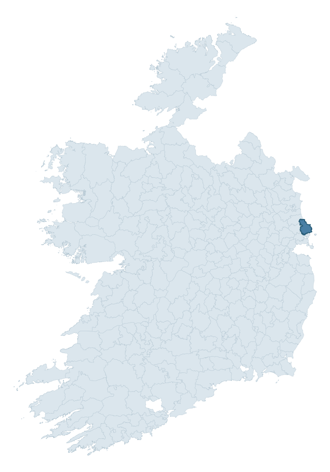
Where this barony sits in the Republic of Ireland
Geology and preservation
Bedrock geology shapes the landscape long before any settlement begins — controlling soil drainage, agricultural potential, the survival of upstanding monuments, and the preservation of buried archaeology. The figures below come from the Geological Survey Ireland 1:100,000 bedrock map.
The bedrock underlying Balrothery East is predominantly limestone (52% of the barony by area), laid down during the Carboniferous period (69% by area, around 359 to 299 million years ago). Limestone is the most heritage-rich bedrock in Ireland. It supports fertile, well-drained soils that favoured dense Early Medieval settlement and Norman manorial agriculture, and it weathers into karst features — sinkholes, caves, swallow holes, and souterrains — that frequently carry archaeology. Where peat overlies limestone, organic preservation can be exceptional. A substantial secondary geology of sandstone and siltstone (17%) and andesite, pillow breccia, tuff, mudstone (13%) adds further variety to the underlying landscape. With 8 distinct rock types mapped, the barony sits in the top third of ROI baronies for geological diversity (83rd percentile) — typically a sign of complex tectonic history or coastal mosaics of differing rock units.
Rock type composition
Largest mapped unit: Lucan Formation (23% of the barony)
Placename evidence
Logainm records 17 heritage-diagnostic placenames for Balrothery East, drawn from townland and civil-parish names across the barony. The dominant stratum is Early Christian ecclesiastical — cill-, teampall-, and domhnach-prefixed names that record the dense network of early church foundations established between the fifth and tenth centuries. The leading diagnostic roots are ráth- (5 — earthen ringfort), cill- (5 — church), and tobar- (2 — holy well). This is below the ROI average of 30.7 heritage placenames per barony, suggesting either lighter survey coverage or a townland-naming tradition that draws more on generic landscape vocabulary. The presence of multiple heritage strata side by side indicates layered occupation of the landscape across successive prehistoric and historic periods. Logainm records 161 placenames for Balrothery East (predominantly townland names). Of these, 17 (11%) carry one of the diagnostic Gaelic roots tracked above; the remainder draw on more generic landscape vocabulary that does not encode a heritage period.
Pre-Christian / Early Medieval Defensive
| Root | Count | Meaning |
|---|---|---|
| ráth- | 5 | earthen ringfort |
| dún- | 1 | hilltop or promontory fort |
Early Christian Ecclesiastical
| Root | Count | Meaning |
|---|---|---|
| cill- | 5 | church (early) |
| tobar- | 2 | holy well |
| gráinseach- | 2 | monastic farm / grange |
Burial, Ritual, and Norse-Contact
| Root | Count | Meaning |
|---|---|---|
| tuaim- | 1 | burial mound |
| carn- | 1 | cairn |
Other baronies in Dublin
About this profile
Click any section below to expand.
What is a barony?
A barony is a historic administrative unit in Ireland, broadly equivalent to an English hundred. The 280 baronies used here are from the OSi 2019 National Statutory Boundaries (generalised 20m), covering the 26 counties of the Republic of Ireland. Baronies derive from the Norman period, were formalised in the 17th century, and have not been redrawn for statistical purposes. They vary enormously in area, from compact urban baronies in Dublin to vast upland baronies in Connacht, and should not be compared by raw site count without accounting for area differences.
What counts as a site?
This profile combines three distinct heritage registers, each with its own definition of what constitutes a recordable site:
- Archaeological sites (NMS). The National Monuments Service Sites and Monuments Record (SMR) catalogues every known archaeological monument or site of archaeological interest in the Republic, from prehistoric burial mounds and ringforts to medieval churches and post-medieval defensive works. Inclusion does not require legal protection — only that the site has been identified, surveyed, and assessed as having archaeological value. A separate subset of these sites lies within a recorded protection zone, which gives them statutory protection under the National Monuments Acts.
- Listed buildings (NIAH). The National Inventory of Architectural Heritage records buildings of architectural, historical, archaeological, artistic, cultural, scientific, social, or technical interest. Each surveyed structure is appraised on a five-tier scale: International, National, Regional, Local, and Record-Only. The NIAH appraisal is informational rather than strictly statutory, but it underpins local-authority Record of Protected Structures (RPS) listings.
- Heritage placenames (Logainm). Logainm is the authoritative database of Irish placenames maintained by the Placenames Branch. This profile applies a heritage-diagnostic classifier to the Irish-language form of each townland name, flagging roots that signal defensive sites (ráth-, lios-, dún-, caiseal-, cathair-), ecclesiastical foundations (cill-, teampall-, domhnach-, mainistir-), prehistoric burial-ritual features (tuaim-, carn-, leaba-), or Norse-contact settlement (gall-). Townlands without one of these diagnostic roots are not flagged here — they may still carry historical significance, but that significance is not encoded in the name itself.
Editorial principles
The narrative sections of this profile follow several explicit principles:
- Evidential. Every claim about this barony’s heritage character is anchored in the underlying register data. Where a site count, a placename count, or a percentile rank is cited, it is computed from the source datasets at export time, not estimated.
- Comparative. Counts and metrics are reported alongside their percentile rank against the other 279 ROI baronies. A barony with 50 ringforts in absolute terms could be unusually high or unusually low depending on its size and regional context; percentile ranking removes that ambiguity.
- Transparent on limits. Where a register has known coverage gaps, survey biases, or data-quality issues that affect this barony’s figures, the profile flags them rather than presenting the numbers as definitive.
- No interpretation beyond what the data supports. The narrative does not speculate about historical events, social dynamics, or cultural meaning beyond what the recorded heritage and placename evidence directly attests.
Data caveats and limits
- NMS Sites and Monuments Record is the product of survey campaigns conducted at different intensities across different counties and decades. Some baronies have been surveyed more thoroughly than others, and absolute counts should be read in that light. Sites destroyed by development before survey are typically not represented; sites in heavily forested or upland terrain are sometimes under-recorded.
- NIAH coverage is broadly complete for the Republic of Ireland but the survey was conducted on a rolling county-by-county basis, and the most recent appraisal date varies. Buildings demolished or substantially altered after their original survey may still appear in the register; conversely, recent buildings of merit may not yet have been appraised.
- Logainm classification applies a deliberately conservative pattern-matching approach to the Irish-language townland forms. The classifier prioritises true positives over recall: a townland may carry a heritage signal that the classifier doesn’t recognise, particularly where the diagnostic root has been heavily anglicised or where the townland name draws on a less common term. The 60,000+ townland records and ~9,800 classified placenames give a substantial signal at barony scale, but individual townland names should be checked against Logainm directly for definitive interpretation.
- Period attribution. The chronological distribution reflects only those NMS sites that carry a recognised period attribution in the source data. Sites listed as “Unknown” period are excluded from the dated subset.
- Boundary changes. Some baronies have undergone minor boundary adjustments since their 19th-century definition; the OSi 2019 generalised boundaries used here are the current statutory definition and may differ slightly from historical maps in border areas.
- Bedrock geology is mapped at 1:100,000 scale, which means local variation within a barony — small pockets of different rock type, mineral veins, alluvium overlying bedrock — is generalised. The dominant-system and rocktype figures are area-weighted, so a barony reading “70% Carboniferous limestone” may still contain small but archaeologically important pockets of older or younger rock. Around 3% of GSI polygons do not match the lexicon and contribute no rocktype or system attribution.
Data sources
- National Monuments Service — Sites and Monuments Record (SMR) https://data.gov.ie/dataset/national-monuments-service-archaeological-survey-of-ireland
- National Inventory of Architectural Heritage (NIAH) https://data.gov.ie/dataset/national-inventory-of-architectural-heritage-niah-national-dataset
- Logainm — Placenames Database of Ireland https://www.logainm.ie/
- Ordnance Survey Ireland — National Statutory Barony Boundaries 2019 https://data-osi.opendata.arcgis.com/
- EURODEM — European Digital Elevation Model https://www.mapsforeurope.org/datasets/euro-dem
- ESA WorldCover https://esa-worldcover.org/en
- Geological Survey Ireland — 1:100,000 Bedrock Geology https://www.gsi.ie/en-ie/data-and-maps/Pages/Bedrock.aspx
Explore more: Search any of the 280 ROI baronies, browse by historical province, or read the methodology and data sources for the full Republic of Ireland Heritage Tool.