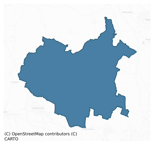
Balrothery West is a barony of County Dublin, in the historical province of Leinster (Irish: Baile an Ridire Thiar), covering 102 km² of land. The barony records 170 NMS archaeological sites and 57 NIAH listed buildings, placing it at around the 41st percentile among 280 ROI baronies for sites per km². This means it is in the lower half of all baronies for sites per km². Dated archaeological evidence runs from the Early Bronze Age through to the Post Medieval, spanning 6 of 9 archaeological periods, placing the barony in the 15th percentile among 280 ROI baronies for chronological depth. This means it is in the bottom fifth of all baronies for chronological depth. The largest dated subset of recorded sites dates to the Iron Age.
Heritage at a glance
Percentile rankings throughout this profile compare each barony only against the other 279 Republic of Ireland baronies.
The recorded heritage of Balrothery West
The National Monuments Service Sites and Monuments Record (SMR) is the statutory inventory of archaeological sites for the Republic of Ireland, maintained by the Department of Tourism, Culture, Arts, Gaeltacht, Sport and Media. Sites recorded here include earthworks, ringforts, megalithic tombs, ecclesiastical remains, and post-medieval features; not every record is legally protected, but each is registered as a monument of archaeological interest.
The National Monuments Service records 170 archaeological sites in Balrothery West, putting it at the 41st percentile among 280 ROI baronies for sites per km². This means it is in the lower half of all baronies for sites per km². Protection coverage is near-universal — 168 sites (99%) fall within a recorded monument protection zone, indicating an extensively surveyed landscape. The record is dominated by defensive sites — ringforts, enclosures, hillforts, and stone forts (52 sites, 31% of the total), with burial and ritual monuments forming a substantial secondary presence (48 sites, 28%). Ring-ditch is the most prevalent type, making up 22% of the barony's recorded sites (38 records) — well above the ROI average of 6% across all baronies where this type occurs. Ring-ditch is a circular ditch under 20m across, often the ploughed-out remains of a barrow, ring-barrow or roundhouse. Other significant types include Enclosure (34) and Church (11). Enclosure is a banked or ditched feature of uncertain type, used as a catch-all where the original function cannot be determined from surface evidence; Church is a building used for public Christian worship, of any date from c. 500 AD onwards. Across the barony's 102 km², this gives a recorded density of 1.67 sites per km².
Most common monument types
Hover or tap a monument type to see its definition.
| Type | Count |
|---|---|
| Ring-ditch a circular ditch under 20m across, often the ploughed-out remains of a barrow, ring-barrow or roundhouse | 38 |
| Enclosure a banked or ditched feature of uncertain type, used as a catch-all where the original function cannot be determined from surface evidence | 34 |
| Church a building used for public Christian worship, of any date from c. 500 AD onwards | 11 |
| Graveyard a burial area associated with a church, in use from the medieval period onwards | 10 |
| Ritual site – holy well a well or spring traditionally associated with a saint, often credited with healing properties; many trace earlier ritual origins but devotion is documented from the medieval period onwards | 7 |
| Ringfort – unclassified a circular Early Medieval settlement enclosure where surviving evidence does not allow distinction between earthen and stone forms | 7 |
| Field system a group of related fields forming a coherent agricultural landscape, of any date from the Neolithic onwards | 6 |
| Earthwork an unclassified earthen structure with no diagnostic features that allow a more specific classification | 6 |
Chronological distribution
The dated archaeological record for Balrothery West spans from the Early Bronze Age through to the Post Medieval, with activity attested across 6 of 9 archaeological periods. This is the 15th percentile across ROI baronies — a relatively narrow chronological band, with much of Irish prehistory not represented in the dated record. Every period from earliest to latest is represented in the record — an unbroken sequence of dated activity across the full chronological span. Activity concentrates most heavily in the Iron Age (38 sites, 30% of dated material), with the Early Medieval forming a secondary peak (24 sites, 19%). A further 44 recorded sites (26% of the overall NMS register for the barony) carry no period attribution — appearing as 'Unknown' in the bar chart below. This typically reflects either records that pre-date the standardised period vocabulary or sites awaiting specialist dating review, rather than a genuine absence of chronological evidence.
Sample of recorded monuments
Show 25 sample monuments (of 170 total)
A representative sample of 25 recorded monuments drawn from the barony’s 170 total NMS entries. Sites within a recorded monument protection zone and rarer site types are prioritised so the list shows a meaningful cross-section rather than only the most common type. Each entry shows the official Sites and Monuments Record reference number and the description published by the National Monuments Service.
Hilltop enclosure
The site encloses a hilltop (556ft. OD)south-west of Garristown village. There are extensive views westwards to Tara and east to the coast. Reputedly the site of Rath Esa which is mentioned in the Metrical Dindsenchus…
The site encloses a hilltop (556ft. OD)south-west of Garristown village. There are extensive views westwards to Tara and east to the coast. Reputedly the site of Rath Esa which is mentioned in the Metrical Dindsenchus (Morris 1939, 179-89). The enclosure is oval in plan (int. dims 90m N-S; 82m E-W) and is defined by a counterscarp bank (Wth 2.5-3m; internal H 0.7m; external H 1.8m). There is an entrance in the S (Wth 2.5m). Ground drops steeply to east and north beyond the enclosure, more gently to south and west. Remains of a windmill (DU003-004002-), built in 1736 by Marie and Edward Walsh of Borranstown, cap the summit. It has been suggested that this enclosure is possibly contemporaneous with the windmill and was constructed to keep cattle away from the sails of the windmill as is the case at Skerries windmill (DU005-028—-) (SMR File 05/10/1995).
Compiled by: Geraldine Stout
Updated by: Christine Baker
Revised by: Caimin O'Brien
Date of revised upload: 7 March 2023
Windmill
Squat tower of windmill (NIAH Reg. No. 11313005) built of randomly coursed masonry, situated on the summit of a hill measuring 556 ft. OD. with commanding views of the surrounding countryside. On the 1837 ed. OSi 6-inch…
Squat tower of windmill (NIAH Reg. No. 11313005) built of randomly coursed masonry, situated on the summit of a hill measuring 556 ft. OD. with commanding views of the surrounding countryside. On the 1837 ed. OSi 6-inch map the Windmill is depicted standing in the centre of an earthwork (DU003-004001-) which is not depicted as an antiquity with a 'Drying Kiln' and 'Quarry' depicted immediately to N of the earthwork and a pathway traversing the E quadrant on a N-S axis. The earthwork enclosing the windmill was described by Morris (1939, 186) as follows; 'Around the windmill is a circular rampart 275 yards in circumference, which is older than the windmill, as the quarrying of stones for the erection of the latter cut into this rampart. This rampart is 2 feet [0.6m] high on the inside and 5 [1.5m] to 8 feet 2.4m] on the outside'. It has been suggested that this enclosure is possibly contemporaneous with the windmill and was constructed to keep cattle away from the sails of the windmill as is the case at Skerries windmill (DU005-028—-) (SMR File 05/10/1995).
Upper stages missing. An external plaque reads 'This Mill was built by Edward & Mary Walsh of Boranstown anno 1736'. There is an internal plaque to east but the names were removed by pocking of the stone. Above it is another stone marked 1827. The two entrances were infilled from the base to prevent cattle lodging within the structure. The 'Windmill of Garristown' is depicted on Rocque's 1760 Map of County Dublin….
Barrow – stepped barrow
This barrow is situated on a hilltop under pasture beside the Naul to Fourknocks road and near the Ford of Fyne. A circular dome-shaped mound (diam. 15m; H 2.5m) which rests on a circular earthen platform (diam.30m;…
This barrow is situated on a hilltop under pasture beside the Naul to Fourknocks road and near the Ford of Fyne. A circular dome-shaped mound (diam. 15m; H 2.5m) which rests on a circular earthen platform (diam.30m; H2m). (Healy 1975, 16; Scully 1972-3, 103). Slopes down steeply to north and south to circular tree-lined enclosure. marked on the OS 25" as a 'moat'. Directly to the north on the other side of the Delvin is the Fourknocks ridge. When the grass is down large stones are visible.
The monument was recently surveyed by Trim Archaeology Projects Ltd., the results of which were summarised as follows; 'The monument site was enclosed by a ring of trees which formed a small plantation in a former designed landscape of Westown Demesne. Today there are trees along the boundary to the SW and there are hedgerows forming boundaries from the SE around to the north of the monument with occasional large trees along them. It is adjacent to a former Gate lodge and avenue to Westown House, constructed c.1890. A garden centre now occupies the adjacent site which is attached to the gate lodge.
The monument appears to be composed of an upper mound and lower mound. The lower mound measures 23.8m in diameter and its height is 1.2m. It’s lower break of slope is recorded at 85.7m OD, while the upper break of slope measures 86.9m OD. The upper mound is located in the centre of the lower mound. It measures 10m in diameter and 1m in height. It’s shape is more bulbous than the lower mo…
Castle – unclassified
Naul Castle originally built by the Cruise (Crues/Cruwes) family of Cruwys Morchard, Devonshire, in the late 12th or early 13th-century. The castle also known as the 'Black Castle' stands on the E edge of a ravine…
Naul Castle originally built by the Cruise (Crues/Cruwes) family of Cruwys Morchard, Devonshire, in the late 12th or early 13th-century. The castle also known as the 'Black Castle' stands on the E edge of a ravine overlooking the Delvin River which marks the county boundary with Meath. A holy well (DU004-045003-) lies 155m to E, Naul church (DU004-045004-) and graveyard (DU004-045005-) stands 80m to S, watermill (DU004-045001-) 200m to W, bridge (DU004-045008-) and castle (ME034-010—-) 165m and 330m to WNW respectively and a mill (ME034-009—-) 85m to NNW. The castle siting in the Glen of the Naul was described in the early 19th century as at; 'a bend of the glen, on one of those rocky precipices, is the keep of the ancient castle of the Naul; a few yards above it is the church, and on the opposite side of the glen is Naul Park and a large corn-mill, the mill-dam being sustained by a natural ledge of rock. Westown, the seat of A. S. Hussey, Esq. is a little above the village' (Fraser 1844, 592). The cliff-edge siting of 'The Black Castle of the Naul' is now obscured by trees but the dramatic siting of the castle was captured in an engraving dated 1820 by John Greig from a drawing by George Petrie for the Excursions through Ireland (NLI, ET A415; Grose 1791, 31-2). On the 1837 ed. OSi 6-inch map a quarry is depicted immediately to the S and SE of the castle.
In 1185 Stephen de Crues, held the manor of Naul, as recorded in Archbishop Alen’s Register (McNeill 1950…
Cross
The cross at the E end of the 18th century chantry chapel at Naul built by the Hussey family in 1710 dates from the 18th/19th century.
Compiled by: Geraldine Stout
Revised by: Caimin O'Brien
Date of revised…
The cross at the E end of the 18th century chantry chapel at Naul built by the Hussey family in 1710 dates from the 18th/19th century.
Compiled by: Geraldine Stout
Revised by: Caimin O'Brien
Date of revised upload: 14 February 2023
Barrow – bowl-barrow
Situated on the northern slope of a saddle-backed ridge. The site comprises a rounded mound (diam. 10m; H 1.5m) which is eroded at the east and north-east and overgrown with gorse. It is part of what is considered to be…
Situated on the northern slope of a saddle-backed ridge. The site comprises a rounded mound (diam. 10m; H 1.5m) which is eroded at the east and north-east and overgrown with gorse. It is part of what is considered to be an extensive barrow cemetery identified by Keeling (1983, 70, Site VI).
Compiled by: Geraldine Stout
Updated by: Christine Baker
Date of upload: 29 October 2014
Barrow – ring-barrow
Located on the northern slope of a saddle-backed ridge to the south of a townland boundary, c.17m east barrow of DU004-012004-. Tillage right up to the base. The site comprises a subcircular, flat-topped mound (diam.…
Located on the northern slope of a saddle-backed ridge to the south of a townland boundary, c.17m east barrow of DU004-012004-. Tillage right up to the base. The site comprises a subcircular, flat-topped mound (diam. 11.5m; H 1.5m) with a shallow depression near the centre of the flattened top. It was formerly enclosed by a fosse (Hartnett 1957, 267). Part of an extensive barrow cemetery identified by Keeling (1983, 70, Site II).
See attached photographs courtesy of Ian Lennon
Compiled by: Geraldine Stout
Updated by: Christine Baker
Date of upload: 29 October 2014
Ceremonial enclosure
The domed summit of this saddle-backed ridge contains a barrow cemetery, which is partly enclosed by a levelled bank with a contiguous silted up internal fosse (ext. dims. 330m N-S; 350m E-W). Originally identified from…
The domed summit of this saddle-backed ridge contains a barrow cemetery, which is partly enclosed by a levelled bank with a contiguous silted up internal fosse (ext. dims. 330m N-S; 350m E-W). Originally identified from aerial photographs (Keeling 1983, 71-4). More recent aerial coverage of the monument shows evidence for a possible inner palisade trench along the SW and SE quadrants (OS 8/9862).
Geophysical survey (Licence no. 13R084) was undertaken at the site by the Discovery Programme as part of the LIARI project. It uncovered a significant enclosure fosse (2-5m in width) that enclosed the summit of the hill a total of 8.5 hectares. A natural spring emanating within an arc-shaped depression that extends from the E side of the enclosure appears to have been deliberately subsumed within the enclosure boundary. There is a significant break is to SW where the fosse is substituted by up to three discontinuous anomalies, which mark the line of a former field division shown on the Ordnance Survey maps (1837, 1938). Extensive previously unknown archaeological features including ring-ditches and pits have been identified by the survey both inside and surrounding the hilltop enclosure (Dowling 2015, 8).
Compiled by: Geraldine Stout
Updated by: Christine Baker
Date of upload: 30 January 2015
Barrow – mound barrow
Located on the summit of a saddle-backed ridge under tillage within the site of a hilltop enclosure (DU014-012001-). The site comprises a low circular flat-topped mound (diam. 9m; H 0.75m). A trigonometrical pillar…
Located on the summit of a saddle-backed ridge under tillage within the site of a hilltop enclosure (DU014-012001-). The site comprises a low circular flat-topped mound (diam. 9m; H 0.75m). A trigonometrical pillar (586') was placed on the site by the OSi. Charcoal deposits were found near the centre of site during the burial of a sheep (Hartnett 1957, 266-7). This site is part of an extensive barrow cemetery identified by Keeling (1983, 70, Site III). Gorse covered low mound, square shaped around base of mound which provides some semblance of a buffer. Amazing views, north to Mourne Mountains, south to Dublin and Wicklow Mountains east to Lambay and west as far as the eye can see. Geophysical survey undertaken by The Discovery Programme (13R0084) uncovered extensive remains in the vicinity of the barrow.
See attached photographs courtesy of Ian Lennon
Compiled by: Geraldine Stout
Updated by: Christine Baker
Date of upload: 31 October 2014
Castle – motte
Situated immediately south of road, on a south-facing slope under pasture. The site comprises a flat-topped circular mound (diam. at base 21m E-W; 27m N-S, diam. at top 8m; H 5m). Waterlogged area around base in the S…
Situated immediately south of road, on a south-facing slope under pasture. The site comprises a flat-topped circular mound (diam. at base 21m E-W; 27m N-S, diam. at top 8m; H 5m). Waterlogged area around base in the S may indicate the presence of a fosse. It has been defaced by livestock (Healy 1975, 16; Morris 1939, 189).
Laneway located at its base to west. Curved bank west of laneway. Bank c.1m h., earthen with well-established tree line (c.3m width). Extends for c.16m. Extensive panoramic views from Lambay (E) to Howth/Dublin Mts (S) and Kildare (SW).
Compiled by: Geraldine Stout
Updated by: Christine Baker
Date of upload: 31 October 2014
Mill – unclassified
A marshy enclosed area S of the road east of 'Old Mill Bridge' over the Delvin river. The Civil survey (1654-6) describes a 'mill pond' at Reynoldstowne (Simington 1945, 35). The mill associated with this mill pond is…
A marshy enclosed area S of the road east of 'Old Mill Bridge' over the Delvin river. The Civil survey (1654-6) describes a 'mill pond' at Reynoldstowne (Simington 1945, 35). The mill associated with this mill pond is in Tullog, County Meath (ME034-008—-). These lands were part of the monastic estate of St Mary's Abbey (O Conbhui 1963, 1939).
Compiled by: Geraldine Stout
Updated by: Christine Baker
Date of upload: 6 November 2014
Inn
Rectangular building annotated 'Hall' on the Cassini ed. OSi 6-inch map appears to be the same structure that is depicted on Rocque's 1760 map of County Dublin and this building may have been the original 'Naul Inn'. …
Rectangular building annotated 'Hall' on the Cassini ed. OSi 6-inch map appears to be the same structure that is depicted on Rocque's 1760 map of County Dublin and this building may have been the original 'Naul Inn'. The 1641 Deposition of Katherine Magee of Newtown recorded that on of the rebels included 'farmor Peeter Cruse of the Naall in the said Countie of Dublin gent Christofer Cruse of the same Inkeeper' (Clarke 2017, 283). A notice from the Dublin Evening Post dated Thursday 27 September 1787 recorded that 'John Tiernan, proprietor of the Naul Inn, respectfully thanks his Friends and the Public for past favours, begs leave to acquaint Gentlemen who travel the North roads, that the Naul-road (turnpike free) is now in thorough repair, that he has fitted up his House and Stables in the best manner, and will always be provided with good accomodation'.
The 'Hall' is aligned on an E-W axis with the gable end facing onto the present road which leads from the village of Naul to the town of Drogheda. Attached to the N side of this building is a public house which is aligned on a N-S axis. Present remains consist of a two-storey stone-building with a gabled and slated roof. The latter was reconstructed and gables raised to give a Dutch Billy effect in the 1940s. A chimney projects outwards mid-way along the lateral N wall of the building. Formerly served as an inn (Vernacular Building Survey County Dublin 1993). The irregular layout of the two buildings the tall projec…
Castle – tower house
Westown House is an 18th-century mansion which incorporates portion of an earlier tower house and the ground floor of a possible hall (Knight of Glin, Griffin & Robinson Reprint 1889, 67; VBSCD 1993). The later may be…
Westown House is an 18th-century mansion which incorporates portion of an earlier tower house and the ground floor of a possible hall (Knight of Glin, Griffin & Robinson Reprint 1889, 67; VBSCD 1993). The later may be the building referred to in the Civil survey (1654-6) as a stone house, which was partly slated (Simington 1945, 33). In 1993 the mansion and rear courtyard containing finely built out buildings were still in relatively good condition. The rear of the mansion and the outbuildings have since been demolished.
Compiled by: Geraldine Stout
Date of upload: 26 August 2011
Armorial plaque
A limestone plaque bearing four coats of arms originally located in the Court, was removed to the threshing shed of a farmyard at Wyestown (DU007-027—-). All the buildings at the Court as indicated on the 1927 ed. OS…
A limestone plaque bearing four coats of arms originally located in the Court, was removed to the threshing shed of a farmyard at Wyestown (DU007-027—-). All the buildings at the Court as indicated on the 1927 ed. OS 6-inch map have been removed. There is a local tradition that there was a convent here which was linked to Gracedieu (VBSCD 1994).
Compiled by: Geraldine Stout
Updated by: Christine Baker
Date of upload: 28 November 2014
Ritual site – holy/saint's stone
Immediately outside the entrance to Grallagh graveyard (DU007-001004-) on the N side and adjacent to the public road there is a water eroded boulder (dims. c. L 1m) with water channels forming irregular shaped hollow on…
Immediately outside the entrance to Grallagh graveyard (DU007-001004-) on the N side and adjacent to the public road there is a water eroded boulder (dims. c. L 1m) with water channels forming irregular shaped hollow on the stone which is traditionally believed to be the mark of St. Michael and a cure for backache (Ó Danachair 1958, 75). The following folklore collected by Oldtown School recorded the following traditions about this stone which was associated with St Patrick rather than St Michael; 'There is a stone outside the gate of the Churchyard and there are five holes in it where Saint Patrick put his fingers. Anyone with sore hands who puts their fingers into the holes will get cured' (The Schools’ Collection, Volume 0787, Page 50; https://www.duchas.ie/en/cbes/4428183/4384596). A second tradition also collected from Oldtown School recorded that; ' There is a stone with a big hole in it outside the Church-yard of the Grallagh and if you twist your arm around it three times it will cure a backache, because when Saint Patrick was blessing the well he tied his horse to the stone' (The Schools’ Collection, Volume 0787, Pages 37-8; https://www.duchas.ie/en/cbes/4428183/4384563).
Compiled by: Geraldine Stout
Updated by: Christine Baker
Revised by: Caimin O'Brien
Date of revised upload: 4 April 2023
Armorial plaque (present location)
This plaque, originally from the Court at Ballymadun, is located in the threshing shed of a farmyard at Wyestown. The stone is limestone (L 0.57m, Wth. 0.40m, T 0.12m). It bears four shields with cross shields enclosed…
This plaque, originally from the Court at Ballymadun, is located in the threshing shed of a farmyard at Wyestown. The stone is limestone (L 0.57m, Wth. 0.40m, T 0.12m). It bears four shields with cross shields enclosed in two panels with a floral design.
Compiled by: Geraldine Stout
Date of upload: 26 August 2011
Tomb – effigial
Three fragments of a possible 15th century effigial slab (Slab A, C and D) that was discovered in the graveyard (DU003-011003-) of Garristown church (DU003-011001-) in 1990 by Mary McMahon while carrying out a survey on…
Three fragments of a possible 15th century effigial slab (Slab A, C and D) that was discovered in the graveyard (DU003-011003-) of Garristown church (DU003-011001-) in 1990 by Mary McMahon while carrying out a survey on behalf of the Dublin Archaeological Society of medieval churches in North Dublin (McMahon 1991, 26). Mary and Henry Wheeler discovered fragments of effigy tombs that had been reused as grave-markers. This fragment was described by Mary McMahon as; 'Slab A measures 1.18m long by 1m wide and consists of the lower half (below the waist) of a female figure. Her heavy woollen skirt falls in regular parallel folds to her feet. The front is raised to reveal a smock underneath. Her feet rest on a tasseled cushion. The skirt measures 0.39m wide at the top and 0.7m at the bottom. There is a raised band, c. 100 mm wide, along the right margin of the slab, but there is no sign of an inscription on it. The lower left corner of the slab is broken away' (ibid.). It portrays a heavy woolen skirt which is raised to reveal a smock underneath. Her feet rest on a tasseled cushion. Two smaller fragments were also discovered and a side slab of the tomb chest. This slab has been dated to the 15th century and represents a Pale school of figure sculpture (McMahon 1991, 26). The second fragment was described by Mary McMahon as Slab D which she described as; 'This is the top left corner of an effigy slab, probably slab A. It measures approximately 0.6m long by 0.3m wide. There is a…
Building
Westown House is an 18th-century mansion which incorporates the ground floor of a possible hall (Knight ofGlin, Griffin & Robinson (Reprint 1889, 67; VBSCD 1993). The latter may be the building referred to in the Civil…
Westown House is an 18th-century mansion which incorporates the ground floor of a possible hall (Knight ofGlin, Griffin & Robinson (Reprint 1889, 67; VBSCD 1993). The latter may be the building referred to in the Civil survey (1654-6) as a stone house, which was partly slated (Simington 1945, 33). In 1993 the mansion and rear courtyard containing finely built outbuildings were still in relatively good condition. The rear of the mansion and the outbuildings have since been demolished.
Accessed by long grass tree-lined avenue leading westwards from Naul village. House facing north, three bay over basement. The main ground floor chamber has a broad, round arch opening in the south-east corner where an entrance down into a passageway is located, the roof of which contains brickwork and is secured with wooden joists. Rumoured to be some sort of tunnel but possibly leads to cellar/icehouse-externally to the north-west of the gable is an outer shute which possibly links the two. Area to rear of house has also been cleared-some architectural fragments stockpiled.
Compiled by: Geraldine Stout
Updated by: Christine Baker
Date of upload: 6 November 2014
Bridge
The vernacular Building Survey of County Dublin in 1994 describes a stone, single-arched bridge near the entrance to Westpalstown House (3/156). There were no obvious signs of wicker centering.
Compiled by: Geraldine…
The vernacular Building Survey of County Dublin in 1994 describes a stone, single-arched bridge near the entrance to Westpalstown House (3/156). There were no obvious signs of wicker centering.
Compiled by: Geraldine Stout
Date of upload: 26 August 2011
Bawn
Possible bawn of Naul castle located on the E edge of a ravine on the S bank of the Delvin River, with holy well (DU004-045003-) 155m to E, church (DU004-045004-), graveyard (DU004-045005-) 80m to S, watermill…
Possible bawn of Naul castle located on the E edge of a ravine on the S bank of the Delvin River, with holy well (DU004-045003-) 155m to E, church (DU004-045004-), graveyard (DU004-045005-) 80m to S, watermill (DU004-045001-) 200m to W, bridge (DU004-045008-) and castle (ME034-010—-) 165m and 330m to WNW respectively and a mill (ME034-009—-) 85m to NNW.
The 1654-6 Civil Survey of Dublin recorded that in 'The Naal', there stood, 'one old Castle with an old Hall covered with straw one Orchard one garden plott tenn tenem[en]ts Valued by ye Jury at one hundred & seaventy five poundes'(Simington 1945, 30). On these lands there also stood 'one open stone Quarry also a grove of Ashtrees set for ornament' (ibid.).
The possible bawn of Naul Castle also known as ‘The Black Castle’ was described by McDix (1896, 244) as follows; ‘The Castle is built close to a kind of rough angle formed by a turning in the rock or cliff, and a portion of a wall, or perhaps it might be called a buttress, projects from the north-east corner along the edge of the rock. This might, however, have been a portion of the external wall surrounding the bawn or yard. There appears, from the roof-pitch on the face of the north wall, that a building had been erected here against the Castle at a later date'.
Geophysical survey (Licence no. 10R0077) was undertaken in the vicinity of Naul castle (DU004-045002-). A possible curving enclosure ditch was identified which corresponds to a possible ditch and…
Ringfort – rath
Located on a south-facing slope, down from the crest of a ridge which rises to the NNE, is a sub-circular enclosure. There are restricted views upslope to the NNE, broad views to Knockbrack hill at the E where some of…
Located on a south-facing slope, down from the crest of a ridge which rises to the NNE, is a sub-circular enclosure. There are restricted views upslope to the NNE, broad views to Knockbrack hill at the E where some of the barrows (DU004-01207–) in the barrow cemetery are visible, very extensive views S to the Dublin mountains and somewhat restricted aspect along the ridge to the W.
The cropmark was first identified by the landowner, Mr. Francis Macken, from his tractor as he applied fertilizer in a field of pasture in July 2018. This field has been known to the landowners as the kiln field. The cropmark was observed as a broad ring of additional darker grass growth set against a background of stunted lighter-shaded grass during the dry summer of June to July 2018. With the assistance of his nephew Mr. Warren Macken, a drone survey was commissioned from (Drone Services Ireland) which highlighted the monument and identified several other features in the same field (DU004-075—- cropmarks).
The enclosure is sub-circular (dims 44m E-W; 43m N-S ) with squared corners at the N, E and S. It measures 44m (E-W) internally to the inner edge of the fosse which is 2.8m wide. The fosse terminates sharply in linear terminals at the ESE with the entrance causeway measuring 3.8m in width. On the basis of the setting, scale and form this cropmark has been interpreted as a ringfort – rath. Within the interior at the eastern side of the monument a rectangular shaped crop-mark is trace…
Tomb – effigial (present location)
Three fragments of an effigial slab (Slab A, C and D) of possible 15th-century date that was discovered in the graveyard (DU003-011003-) of Garristown church (DU003-011001-) in 1990 by Mary McMahon while carrying out a…
Three fragments of an effigial slab (Slab A, C and D) of possible 15th-century date that was discovered in the graveyard (DU003-011003-) of Garristown church (DU003-011001-) in 1990 by Mary McMahon while carrying out a survey on behalf of the Dublin Archaeological Society of medieval churches in North Dublin (McMahon 1991, 26). Mary and Henry Wheeler discovered fragments of effigy tombs that had been reused as grave-markers. This fragment was described by Mary McMahon as; 'Slab A measures 1.18m long by 1m wide and consists of the lower half (below the waist) of a female figure. Her heavy woollen skirt falls in regular parallel folds to her feet. The front is raised to reveal a smock underneath. Her feet rest on a tasseled cushion. The skirt measures 0.39m wide at the top and 0.7m at the bottom. There is a raised band, c. 100 mm wide, along the right margin of the slab, but there is no sign of an inscription on it. The lower left corner of the slab is broken away' (ibid.). It portrays a heavy woolen skirt which is raised to reveal a smock underneath. Her feet rest on a tasseled cushion. Two smaller fragments were also discovered and a side slab of the tomb chest. This slab has been dated to the 15th century and represents a Pale school of figure sculpture (McMahon 1991, 26). The second fragment was described by Mary McMahon as Slab D which she described as; 'This is the top left corner of an effigy slab, probably slab A. It measures approximately 0.6m long by 0.3m wide….
Tomb – chest tomb
The precise location of a fragment or side panel of a possible chest tomb in Garristown graveyard (DU003-011003-) has not been located. Side panel of a possible chest-tomb that was discovered in the graveyard of…
The precise location of a fragment or side panel of a possible chest tomb in Garristown graveyard (DU003-011003-) has not been located. Side panel of a possible chest-tomb that was discovered in the graveyard of Garristown church (DU003-011001-) in 1990 by Mary McMahon while carrying out a survey on behalf of the Dublin Archaeological Society of medieval churches in North Dublin. Mary and Henry Wheeler discovered fragments of effigy tombs, reused as grave-markers. This fragment was described by Mary McMahon as Slab B which she recorded as follows; 'Slab B- side slab of a tomb chest – Slab B, which is broken at one end, measures 1.6m long by 0.64m wide. There is a circular reserve carved in the slab, within which a shield is upheld by two kneeling figures and an angel at the top. The shield is blank. The slab in its complete form would have been approximately 2m long' .
McMahon, M. 1991 Garristown Church, Garristown. In I. Bennett (ed.), Excavations 1990: summary accounts of archaeological excavations in Ireland, No. 35, 26. Bray. Wordwell.
Compiled by: Caimin O'Brien
Date of upload: 14 February 2023
Headstone
The precise location of a 17th century headstone Garristown graveyard (DU003-011003-) has not been located. Headstone was recorded by the Fingal Historic Graveyards Project, which stated that 'The earliest visible stone…
The precise location of a 17th century headstone Garristown graveyard (DU003-011003-) has not been located. Headstone was recorded by the Fingal Historic Graveyards Project, which stated that 'The earliest visible stone dates to the early 17th century and was excavated during the digging of new plots in the graveyard. It is inscribed as follows "Here lieth the body of Catrine Russel who died the 12th of May 1637 aged 65 years' (Fingal Historic Graveyards Project, Vol. 2, Garristown Graveyard).
Compiled by: Caimin O'Brien
Date of upload: 14 February 2023
Ring-ditch
An aerial photograph (CUCAP BGL 7) shows a circular cropmark of a ring ditch (diam. c. 15m). Situated in slightly elevated position under tillage. Not visible at ground level.
Compiled by: Geraldine Stout
Date of…
An aerial photograph (CUCAP BGL 7) shows a circular cropmark of a ring ditch (diam. c. 15m). Situated in slightly elevated position under tillage. Not visible at ground level.
Compiled by: Geraldine Stout
Date of upload: 7 October 2014
Listed buildings
The National Inventory of Architectural Heritage (NIAH) is a state survey appraising buildings of architectural, historical, archaeological, artistic, cultural, scientific, social, or technical interest. Each surveyed structure receives a rating from International (the highest, for buildings of European importance) through National, Regional, Local, and Record-Only.
The NIAH records 57 listed buildings in Balrothery West (27th percentile across ROI baronies). The highest-graded structure include 1 of National significance. The Republic holds 937 National-graded buildings in total, so this barony accounts for around 0% of the national total. Construction dates concentrate most heavily in the Victorian (1830-1900) period.
Terrain and environment
Mean elevation across the barony is 81m — the 41st percentile among 280 ROI baronies for elevation. This means it is in the lower half of all baronies for elevation. Elevation matters for heritage because higher-altitude baronies typically favour defensive monuments — ringforts and hilltop forts placed on prominent ground — while lowland baronies are more likely to carry the dense settlement and church networks of intensive agricultural landscapes. Mean slope is 2.4° — the 23rd percentile among 280 ROI baronies for slope. This means it is in the bottom third of all baronies for slope. This is broadly flat terrain, the kind of landscape best suited to intensive agriculture. Slope is a key control on both land use and archaeological preservation: steep ground resists ploughing and tends to preserve earthworks intact, while gentle slopes favour intensive cultivation that damages or destroys surface archaeology over time. The Topographic Wetness Index averages 11.5, the 72nd percentile among 280 ROI baronies for wetness. This means it is in the top third of all baronies for wetness. Drainage matters for heritage because poorly-drained ground preserves organic archaeology (wooden trackways, leather, textiles, and on rare occasions human remains) far better than free-draining soil; well-drained ground favours arable use but destroys organic material rapidly. The land-cover mosaic combines improved grassland (56%), arable farmland (37%), and woodland (6%), giving a mixed agricultural and semi-natural landscape.
Terrain measurements
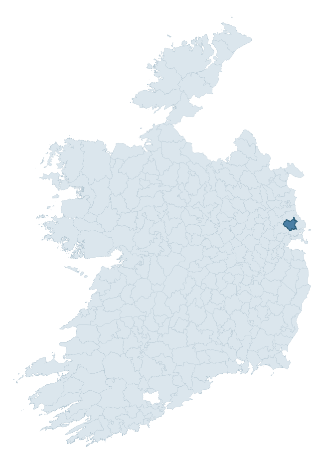
Where this barony sits in the Republic of Ireland
Geology and preservation
Bedrock geology shapes the landscape long before any settlement begins — controlling soil drainage, agricultural potential, the survival of upstanding monuments, and the preservation of buried archaeology. The figures below come from the Geological Survey Ireland 1:100,000 bedrock map.
The bedrock underlying Balrothery West is predominantly limestone (83% of the barony by area), laid down during the Carboniferous period (98% by area, around 359 to 299 million years ago). Limestone is the most heritage-rich bedrock in Ireland. It supports fertile, well-drained soils that favoured dense Early Medieval settlement and Norman manorial agriculture, and it weathers into karst features — sinkholes, caves, swallow holes, and souterrains — that frequently carry archaeology. Where peat overlies limestone, organic preservation can be exceptional. The single largest mapped unit is the Lucan Formation (66% of the barony's bedrock).
Rock type composition
Largest mapped unit: Lucan Formation (66% of the barony)
Placename evidence
Logainm records 8 heritage-diagnostic placenames for Balrothery West, a modest sample drawn predominantly from the townland record. The dominant stratum is pre-christian defensive. The most frequent diagnostic roots are ráth- (2) and dún- (2). With a sample of this size the count should be treated as indicative rather than definitive.
Pre-Christian / Early Medieval Defensive
| Root | Count | Meaning |
|---|---|---|
| ráth- | 2 | earthen ringfort |
| dún- | 2 | hilltop or promontory fort |
Early Christian Ecclesiastical
| Root | Count | Meaning |
|---|---|---|
| tobar- | 1 | holy well |
| cillín- | 1 | unconsecrated burial ground |
| gráinseach- | 1 | monastic farm / grange |
Burial, Ritual, and Norse-Contact
| Root | Count | Meaning |
|---|---|---|
| uaimh- | 1 | cave / souterrain |
Other baronies in Dublin
About this profile
Click any section below to expand.
What is a barony?
A barony is a historic administrative unit in Ireland, broadly equivalent to an English hundred. The 280 baronies used here are from the OSi 2019 National Statutory Boundaries (generalised 20m), covering the 26 counties of the Republic of Ireland. Baronies derive from the Norman period, were formalised in the 17th century, and have not been redrawn for statistical purposes. They vary enormously in area, from compact urban baronies in Dublin to vast upland baronies in Connacht, and should not be compared by raw site count without accounting for area differences.
What counts as a site?
This profile combines three distinct heritage registers, each with its own definition of what constitutes a recordable site:
- Archaeological sites (NMS). The National Monuments Service Sites and Monuments Record (SMR) catalogues every known archaeological monument or site of archaeological interest in the Republic, from prehistoric burial mounds and ringforts to medieval churches and post-medieval defensive works. Inclusion does not require legal protection — only that the site has been identified, surveyed, and assessed as having archaeological value. A separate subset of these sites lies within a recorded protection zone, which gives them statutory protection under the National Monuments Acts.
- Listed buildings (NIAH). The National Inventory of Architectural Heritage records buildings of architectural, historical, archaeological, artistic, cultural, scientific, social, or technical interest. Each surveyed structure is appraised on a five-tier scale: International, National, Regional, Local, and Record-Only. The NIAH appraisal is informational rather than strictly statutory, but it underpins local-authority Record of Protected Structures (RPS) listings.
- Heritage placenames (Logainm). Logainm is the authoritative database of Irish placenames maintained by the Placenames Branch. This profile applies a heritage-diagnostic classifier to the Irish-language form of each townland name, flagging roots that signal defensive sites (ráth-, lios-, dún-, caiseal-, cathair-), ecclesiastical foundations (cill-, teampall-, domhnach-, mainistir-), prehistoric burial-ritual features (tuaim-, carn-, leaba-), or Norse-contact settlement (gall-). Townlands without one of these diagnostic roots are not flagged here — they may still carry historical significance, but that significance is not encoded in the name itself.
Editorial principles
The narrative sections of this profile follow several explicit principles:
- Evidential. Every claim about this barony’s heritage character is anchored in the underlying register data. Where a site count, a placename count, or a percentile rank is cited, it is computed from the source datasets at export time, not estimated.
- Comparative. Counts and metrics are reported alongside their percentile rank against the other 279 ROI baronies. A barony with 50 ringforts in absolute terms could be unusually high or unusually low depending on its size and regional context; percentile ranking removes that ambiguity.
- Transparent on limits. Where a register has known coverage gaps, survey biases, or data-quality issues that affect this barony’s figures, the profile flags them rather than presenting the numbers as definitive.
- No interpretation beyond what the data supports. The narrative does not speculate about historical events, social dynamics, or cultural meaning beyond what the recorded heritage and placename evidence directly attests.
Data caveats and limits
- NMS Sites and Monuments Record is the product of survey campaigns conducted at different intensities across different counties and decades. Some baronies have been surveyed more thoroughly than others, and absolute counts should be read in that light. Sites destroyed by development before survey are typically not represented; sites in heavily forested or upland terrain are sometimes under-recorded.
- NIAH coverage is broadly complete for the Republic of Ireland but the survey was conducted on a rolling county-by-county basis, and the most recent appraisal date varies. Buildings demolished or substantially altered after their original survey may still appear in the register; conversely, recent buildings of merit may not yet have been appraised.
- Logainm classification applies a deliberately conservative pattern-matching approach to the Irish-language townland forms. The classifier prioritises true positives over recall: a townland may carry a heritage signal that the classifier doesn’t recognise, particularly where the diagnostic root has been heavily anglicised or where the townland name draws on a less common term. The 60,000+ townland records and ~9,800 classified placenames give a substantial signal at barony scale, but individual townland names should be checked against Logainm directly for definitive interpretation.
- Period attribution. The chronological distribution reflects only those NMS sites that carry a recognised period attribution in the source data. Sites listed as “Unknown” period are excluded from the dated subset.
- Boundary changes. Some baronies have undergone minor boundary adjustments since their 19th-century definition; the OSi 2019 generalised boundaries used here are the current statutory definition and may differ slightly from historical maps in border areas.
- Bedrock geology is mapped at 1:100,000 scale, which means local variation within a barony — small pockets of different rock type, mineral veins, alluvium overlying bedrock — is generalised. The dominant-system and rocktype figures are area-weighted, so a barony reading “70% Carboniferous limestone” may still contain small but archaeologically important pockets of older or younger rock. Around 3% of GSI polygons do not match the lexicon and contribute no rocktype or system attribution.
Data sources
- National Monuments Service — Sites and Monuments Record (SMR) https://data.gov.ie/dataset/national-monuments-service-archaeological-survey-of-ireland
- National Inventory of Architectural Heritage (NIAH) https://data.gov.ie/dataset/national-inventory-of-architectural-heritage-niah-national-dataset
- Logainm — Placenames Database of Ireland https://www.logainm.ie/
- Ordnance Survey Ireland — National Statutory Barony Boundaries 2019 https://data-osi.opendata.arcgis.com/
- EURODEM — European Digital Elevation Model https://www.mapsforeurope.org/datasets/euro-dem
- ESA WorldCover https://esa-worldcover.org/en
- Geological Survey Ireland — 1:100,000 Bedrock Geology https://www.gsi.ie/en-ie/data-and-maps/Pages/Bedrock.aspx
Explore more: Search any of the 280 ROI baronies, browse by historical province, or read the methodology and data sources for the full Republic of Ireland Heritage Tool.