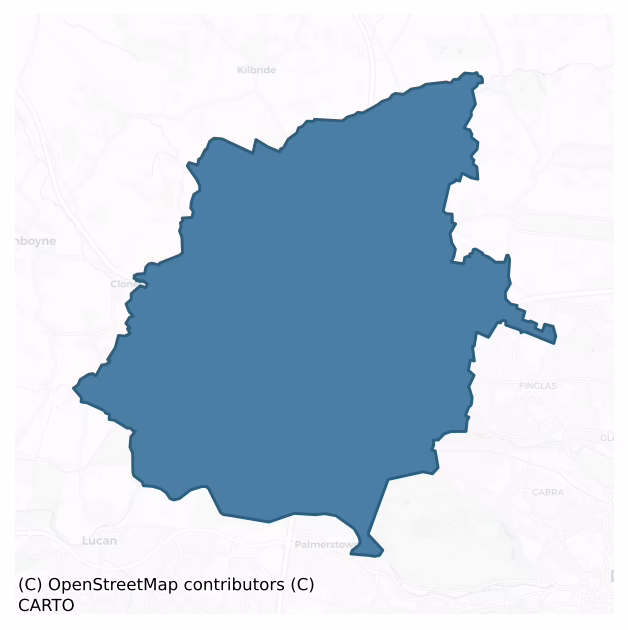
Castleknock is a barony of County Dublin, in the historical province of Leinster (Irish: Caisleán Cnucha), covering 68 km² of land. The barony records 123 NMS archaeological sites and 673 NIAH listed buildings, placing it at around the 46th percentile among 280 ROI baronies for sites per km². This means it is in the lower half of all baronies for sites per km². Dated archaeological evidence runs from the Early Bronze Age through to the Modern, spanning 7 of 9 archaeological periods, placing the barony in the 24th percentile among 280 ROI baronies for chronological depth. This means it is in the bottom third of all baronies for chronological depth. The largest dated subset of recorded sites dates to the Iron Age.
Heritage at a glance
Percentile rankings throughout this profile compare each barony only against the other 279 Republic of Ireland baronies.
The recorded heritage of Castleknock
The National Monuments Service Sites and Monuments Record (SMR) is the statutory inventory of archaeological sites for the Republic of Ireland, maintained by the Department of Tourism, Culture, Arts, Gaeltacht, Sport and Media. Sites recorded here include earthworks, ringforts, megalithic tombs, ecclesiastical remains, and post-medieval features; not every record is legally protected, but each is registered as a monument of archaeological interest.
The National Monuments Service records 123 archaeological sites in Castleknock, putting it at the 46th percentile among 280 ROI baronies for sites per km². This means it is in the lower half of all baronies for sites per km². Of these, 97 (79%) fall within a recorded monument protection zone. The record is dominated by defensive sites — ringforts, enclosures, hillforts, and stone forts (45 sites, 37% of the total), with ecclesiastical sites forming a substantial secondary presence (23 sites, 19%). The most diagnostically specific type is Ring-ditch (11 records, 9% of the barony's NMS total) — compared to an ROI average of 6% across all baronies where this type occurs. Ring-ditch is a circular ditch under 20m across, often the ploughed-out remains of a barrow, ring-barrow or roundhouse. The broader 'Enclosure' classification — which catches unclassified ringforts and field enclosures — accounts for a further 25 records (20%) and reflects the difficulty of sub-classifying degraded earthworks from surface evidence alone. Across the barony's 68 km², this gives a recorded density of 1.82 sites per km².
Most common monument types
Hover or tap a monument type to see its definition.
| Type | Count |
|---|---|
| Enclosure a banked or ditched feature of uncertain type, used as a catch-all where the original function cannot be determined from surface evidence | 25 |
| Ring-ditch a circular ditch under 20m across, often the ploughed-out remains of a barrow, ring-barrow or roundhouse | 11 |
| Church a building used for public Christian worship, of any date from c. 500 AD onwards | 9 |
| Earthwork an unclassified earthen structure with no diagnostic features that allow a more specific classification | 8 |
| Ritual site – holy well a well or spring traditionally associated with a saint, often credited with healing properties; many trace earlier ritual origins but devotion is documented from the medieval period onwards | 6 |
| Graveyard a burial area associated with a church, in use from the medieval period onwards | 6 |
Chronological distribution
The dated archaeological record for Castleknock spans from the Early Bronze Age through to the Modern, with activity attested across 7 of 9 archaeological periods. This is the 24th percentile across ROI baronies — a relatively narrow chronological band, with much of Irish prehistory not represented in the dated record. Every period from earliest to latest is represented in the record — an unbroken sequence of dated activity across the full chronological span. Activity concentrates most heavily in the Iron Age (32 sites, 39% of dated material), with the Early Medieval forming a secondary peak (25 sites, 30%). A further 41 recorded sites (33% of the overall NMS register for the barony) carry no period attribution — appearing as 'Unknown' in the bar chart below. This typically reflects either records that pre-date the standardised period vocabulary or sites awaiting specialist dating review, rather than a genuine absence of chronological evidence.
Sample of recorded monuments
Show 25 sample monuments (of 123 total)
A representative sample of 25 recorded monuments drawn from the barony’s 123 total NMS entries. Sites within a recorded monument protection zone and rarer site types are prioritised so the list shows a meaningful cross-section rather than only the most common type. Each entry shows the official Sites and Monuments Record reference number and the description published by the National Monuments Service.
House – 18th/19th century
The Down Survey (1655-6) map mentions a 'Fayre House'. It has been suggested that Newpark House could be the site of or incorporated this dwelling. A single wall with hearth visible, possible remains of Newpark House…
The Down Survey (1655-6) map mentions a 'Fayre House'. It has been suggested that Newpark House could be the site of or incorporated this dwelling. A single wall with hearth visible, possible remains of Newpark House were demolished. Surviving stable building to north. Located within a yard used for machinery storage and plant hire.
Compiled by: Geraldine Stout
Updated by: Christine Baker
Date of upload: 09 January 2015
Inn
An article in the Fingal Independent dated 23 December 1994 reports on the discovery of a 16th century arch in the White House, a public house at the Ward, county Dublin. It is a bow-shaped arch which is unlikely to be…
An article in the Fingal Independent dated 23 December 1994 reports on the discovery of a 16th century arch in the White House, a public house at the Ward, county Dublin. It is a bow-shaped arch which is unlikely to be pre-1700 in date. It has been extensively ribbon pointed.
Compiled by: Geraldine Stout
Updated by: Christine Baker
Date of upload: 09 January 2015
Ecclesiastical enclosure
The ecclesiastical enclosure is visible as a cropmark on aerial photographs (OS 8/7584). There is a possible outer enclosure which the road bends to respect (L. E-W c. 150m, Wth N-S c. 110m). These remains were levelled…
The ecclesiastical enclosure is visible as a cropmark on aerial photographs (OS 8/7584). There is a possible outer enclosure which the road bends to respect (L. E-W c. 150m, Wth N-S c. 110m). These remains were levelled between 1971-76. Today this is an area of lowland tillage which has experienced large scale field fence removal. No visible surface trace. Aerial photograph (GB89. AE.10) provides a view of the location of a curvilinear enclosure defined by two widely spaced fosses surrounding the early church site. The curve of the modern road respects the western edge of the outer enclosure.
Compiled by: Geraldine Stout
Updated by: Christine Baker
Date of upload: 18 January 2015
Graveslab
There is a tombstone in the graveyard of the 19th-century Church of Ireland erected to Frances Lady Newcomen of Sutton d. 1687 (Ball 1906, 20-21). Located south of church aligned the graveslab is recumbent within a…
There is a tombstone in the graveyard of the 19th-century Church of Ireland erected to Frances Lady Newcomen of Sutton d. 1687 (Ball 1906, 20-21). Located south of church aligned the graveslab is recumbent within a tarmacademed area. Extensive cracked the southwest corner of the has been replaced by concrete. Stone is flaking. Lettering hard to make out but for the moss.
Compiled by: Geraldine Stout
Updated by: Christine Baker
Date of upload: 19 January 2015
Barrow – ring-barrow
Situated beside the railway line at Greenmount in the paddock are three conjoined circular features, comprising external bank (av. dims. Wth 2.5m; H 0.6m), internal fosse (av. dims. Wth 2m; D 0.25m) and raised interiors…
Situated beside the railway line at Greenmount in the paddock are three conjoined circular features, comprising external bank (av. dims. Wth 2.5m; H 0.6m), internal fosse (av. dims. Wth 2m; D 0.25m) and raised interiors (av. ext. diams.11m). Test excavation (Licence no. 06E0348) was undertaken to determine the exact nature of three conjoined ringbarrows possible barrows. Testing on the east-west axis located a ditch along the interior of the bank of one of the three conjoined circular embanked features. Its presence strongly suggests that the feature is a type of barrow and, by inference, that the other two circular features belong to the same monument typology (Lynch 2006; https://excavations.ie/report/2006/Dublin/0015328/).
See attached Google Earth orthoimage taken 28/01/2017 showing the conjoined barrows
Compiled by: Geraldine Stout
Updated by: Christine Baker
Date of upload: 19 January 2015
Mill – unclassified
Named 'corn mill' on the 1837 OS 6-inch map. This 19th century, four bay, three storey mill probably occupies the site of an earlier mill. Described in the Civil Survey (1654-6) as 'one waste mill' belonging to Simon…
Named 'corn mill' on the 1837 OS 6-inch map. This 19th century, four bay, three storey mill probably occupies the site of an earlier mill. Described in the Civil Survey (1654-6) as 'one waste mill' belonging to Simon Luttrell (Simington 1945, 242). Test excavation (Licence no. 08E0147) was undertaken in the vicinity in advance of the Blanchardstown Regional Water Scheme but no archaeological remains were identified.
Compiled by: Geraldine Stout
Updated by: Christine Baker
Date of upload: 20 January 2015
Castle – motte
Shown on the 1837-1937 OS maps as a substantial circular mound with an enclosing fosse titled 'Kilshane Moat'. The site was subject to geophysical survey (Licence no. 07R093) which confirmed the presence of…
Shown on the 1837-1937 OS maps as a substantial circular mound with an enclosing fosse titled 'Kilshane Moat'. The site was subject to geophysical survey (Licence no. 07R093) which confirmed the presence of archaeological responses at the site of the motte. The responses are sub-circular in form surrounded by an enclosing ditch (67m NS x 62m EW). Internal responses may indicate plough damaged occupational activity (Harrison 2007, 11). The responses correspond to a prominent mound in the northwest corner of a large open tillage field. The owner has been farming it since 1955 and noticed lots of stone in the area as the plough would have to be raised. A crop-mark illustrating an extent of the earthwork is visible on digital globe measuring 67.5 N-S and 72.8 E-W. This aerial view was created on the 9 June 2016. Additional information provided from an aerial photograph taken in the dry spell in July 2018 shows a tapering avenue defined by a pair of ditches extending out from the SE side of the monument and visible for approximately 140m.
Compiled by: Geraldine Stout
Updated by: Christine Baker and Margaret Keane
Date of upload: 21 January 2015
Castle – tower house
Gabriel Beranger's drawing of 1776 shows a three-storey tower at the south-eastern corner of a walled enclosure (Harbison 1998, 68-9). In 1778 when Austin Cooper visited Cappoge Castle it stood as a three-storey tower…
Gabriel Beranger's drawing of 1776 shows a three-storey tower at the south-eastern corner of a walled enclosure (Harbison 1998, 68-9). In 1778 when Austin Cooper visited Cappoge Castle it stood as a three-storey tower house with corner turret in the SE (Price 1942, 37). It was associated with the Woodcock family from the 13th to the 16th century (Ball 1920, 18-19). Demolished before 1860 (Healy 1975, 27). Not visible at ground level.
Excavations (Licence nos. 06E0228ext and 08E0032ext) were undertaken north of the site of Cappogue castle in advance of the Ballycoolin Road Realignment. The standing remains of a structure appear to have incorporated part of the remains of the gatehouse of the castle but no definite remains of the tower house were identified on this site and it is highly likely that the stone from this structure was re-used after it fell into disuse in the 17th century (McQuade 2010, 87).
Compiled by: Geraldine Stout
Updated by: Christine Baker
Date of upload: 23 January 2015
Castle – motte and bailey
Located on a steep natural rise west of the Vincentian College. Along with Windmill Hill it is the highest point in landscape with extensive views. The motte is oval in plan (c.30m NE-SW; c. 25m NW-SE; H 18.5m see Ball…
Located on a steep natural rise west of the Vincentian College. Along with Windmill Hill it is the highest point in landscape with extensive views. The motte is oval in plan (c.30m NE-SW; c. 25m NW-SE; H 18.5m see Ball 1920, 2-5) with a keep and curtain wall. Inner keep has castle remains (DU017-012002-) at east end and curtain wall along north to east where there is a sheer drop down. South defined by a tree line behind which is also a sheer drop. The Priest's graveyard is within the enclosed area.
The motte is enclosed by two fosses which were better preserved when inspected by Ball in 1920; the upper fosse is only visible along the NW and is silted up in the ESE where there is pathway to the keep (DU017-012002-); (dims. after Ball 1920, 2-5; upper fosse Wth 5m, D 3m; lower fosse Wth c. 10m, D c. 4.5m). Outer hedged along exterior. Fosse bottoms flat-based and relatively clear-may reflect use as pathways.
Compiled by: Geraldine Stout
Updated by: Christine Baker
Date of upload: 29 January 2015
Castle – Anglo-Norman masonry castle
Located on a natural prominence west of the present Vincentian College. The W side of a polygonal keep with it's W section of curtain wall stands at the E end of a motte (DU017-012001-). The keep rises to two storeys.…
Located on a natural prominence west of the present Vincentian College. The W side of a polygonal keep with it's W section of curtain wall stands at the E end of a motte (DU017-012001-). The keep rises to two storeys. It is built of regular blocks of coursed limestone masonry with slate packing. Traces of a staircase were visible to first floor level (wall Wth 2.25m). An opening through the W section of keep is supported by concrete additions. Traces of machiolation survive above this opening. The base of the castle appears to have been damaged by ivy removal and there are substantial stone missing. Massively overgrown with ivy.
Built by Sir Hugh Tyrell Governor of Trim in c.1174. In 1316 Edward Bruce brother of Robert laid seige to it. A 1698 sketch shows a substantial structure four storeys high with battlements, a base batter and large windows at first floor level (Sweetman 1999, 85). There is a straight seam between the curtain wall and keep which indicates two phases of construction. The area enclosed by the curtain wall (H 2.6m) is irregular in plan (dims. c. 30m E-W, c. 20m N-S, 2.60m). It serves as a cemetery for the Vincentian Order. In the junction between the keep and curtain wall there are traces of a vaulted opening overlooking the earthen defences. The inner face of the curtain wall is under-cut. There is a base batter around the exterior in the W section and remains of garderobe chute. An arched recess in the interior of the curtain wall is probably a late…
Burial
Located on the grounds of the Vincentian college beside Castleknock village. This is a natural hillock known as Windmill Hill. Test excavation (Licence no. 07E0682Ext.) was undertaken around the water tower in advance…
Located on the grounds of the Vincentian college beside Castleknock village. This is a natural hillock known as Windmill Hill. Test excavation (Licence no. 07E0682Ext.) was undertaken around the water tower in advance of the insertion of a new water tank. Four gravecuts with human skeletal remains were identified east of the extant tower. Development was redesigned to allow for preservation in situ (McLoughlin 2007). Subsequent geophysical survey (Licence no. 07R233) identified the eponymous windmill (DU017-013002-).
Compiled by: Christine Baker
Date of upload: 29 January 2015
Windmill
Natural hillock known as Windmill Hill, located south of Castlenock motte (DU017-012001-). Along with motte it is the highest point in the landscape with extensive views. Topped with a circular water tower. Geophysical…
Natural hillock known as Windmill Hill, located south of Castlenock motte (DU017-012001-). Along with motte it is the highest point in the landscape with extensive views. Topped with a circular water tower. Geophysical survey was undertaken (Licence no. 07R223) in advance of the insertion of a new water tank identified a 'criss-cross pattern of potential interest' (Nicholls 2007). This is likely to be the base of the original windmill. No visible remains.
Compiled by: Christine Baker
Date of upload: 29 January 2015
Industrial site
Excavations in advance of the N2 Finglas-Ashbourne Road Scheme revealed an industrial site. Located on top of a hillock. This comprised an enclosed area defined by a sequence of postholes in the S and E and a…
Excavations in advance of the N2 Finglas-Ashbourne Road Scheme revealed an industrial site. Located on top of a hillock. This comprised an enclosed area defined by a sequence of postholes in the S and E and a steep-sided slot trench to the W. In the N there were two enigmatic barbell-shaped features consisting of two circular postholes connected by a thin channel that produced probable Souterrain ware. Subsequently, a kiln was inserted into the W part of the site (NRA).
Compiled by: Geraldine Stout
Date of upload: 26 August 2011
Weir – fish
Went (1954, 52-53, 58) mentions an early fishery S of Glenmaroon.The exact location of this monument is unknown.
Compiled by: Geraldine Stout
Date of upload: 26 August 2011
Field system
The 1837 OS 6-inch map shows an irregular pattern of small fields which may be part of a medieval settlement. This field system was visible on aerial photography taken in 1971 (FSI 24181/417). Built over. Not visible at…
The 1837 OS 6-inch map shows an irregular pattern of small fields which may be part of a medieval settlement. This field system was visible on aerial photography taken in 1971 (FSI 24181/417). Built over. Not visible at ground level.
Compiled by: Geraldine Stout
Updated by: Christine Baker
Date of upload: 18 January 2015
Mound
Located at eastern end of open space for Warrenstown housing estate, close to a stream that runs into the Tolka. The mound (diam.28m; H 2m) is completely overgrown with brambles and the area appears to have been used…
Located at eastern end of open space for Warrenstown housing estate, close to a stream that runs into the Tolka. The mound (diam.28m; H 2m) is completely overgrown with brambles and the area appears to have been used for construction scarping and dumping as well as domestic dumping. The mound is within an area designated as a flood plain.
Compiled by: Geraldine Stout
Updated by: Christine Baker
Date of upload: 19 January 2015
Mound
Comprises a large earthen mound (diam.50m, H 3m). Located within the IDA Industrial estate, large landscaped mound serving as a roundabout. Treeplanting has become established and drainage inserted into…
Comprises a large earthen mound (diam.50m, H 3m). Located within the IDA Industrial estate, large landscaped mound serving as a roundabout. Treeplanting has become established and drainage inserted into base.
Compiled by: Geraldine Stout
Updated by: Christine Baker
Date of upload: 19 January 2015
Souterrain
Within one of three enclosures identified as cropmarks on an aerial photograph (CUCAP, BDR 29) is a 'tadpole' shaped feature (DU014-014002-). This is probably the site of a souterrain (Clinton 1998, 122-123). Not…
Within one of three enclosures identified as cropmarks on an aerial photograph (CUCAP, BDR 29) is a 'tadpole' shaped feature (DU014-014002-). This is probably the site of a souterrain (Clinton 1998, 122-123). Not visible at ground level. Built over by North Western Business Park.
Compiled by: Geraldine Stout
Updated by; Christine Baker
Date of upload: 22 January 2015
Souterrain
Two sections of passage of a possible rock-cut souterrain were exposed during drainage operations around 1978 (L 12m; H 1.2-1.67m; Wth 0.7-0.8m). Excavations in 1981 (ÓhEailidhe 1982) produced two hammerstones (Clinton…
Two sections of passage of a possible rock-cut souterrain were exposed during drainage operations around 1978 (L 12m; H 1.2-1.67m; Wth 0.7-0.8m). Excavations in 1981 (ÓhEailidhe 1982) produced two hammerstones (Clinton 198, 123-4).
Compiled by: Geraldine Stout
Date of upload: 26 August 2011
Castle – unclassified
Luttrellstown castle is associated with the Anglo-Norman family of Luttrells (Ball 1906 1-19; Guinness & Ryan 1971, 139-43 ). It is shown as a large Tudor style dwelling with surrounding walls on the Down Survey…
Luttrellstown castle is associated with the Anglo-Norman family of Luttrells (Ball 1906 1-19; Guinness & Ryan 1971, 139-43 ). It is shown as a large Tudor style dwelling with surrounding walls on the Down Survey (1655-6) map. According to the Dublin Hearth Money Roll for 1664 the house had eleven chimneys, and was surrounded by pleasure grounds, ornamental plantations and orchards (Ball 1906). In 1800 the Luttrell family sold the property to Luke White who changed the name of the property to 'Woodlands' and encased the castle in early 19th-century Gothic architecture. (Bence-Jones 1995, 196, 2nd ed. ). Later re-building has made it difficult to identify the medieval portions of this Gothic mansion. It may incorporate portion of an earlier fortification in its make-up in the central area of the North range. The basement level which carries the octagonal hall contains a spiral staircase which is partially within the thickness of the wall, the S and E wall (T 1.37m) is also comparitively thick. This basement level (L 8.20m, Wth 5.90m) is vaulted with cusped recesses. The 17th mansion survives in the NE at the junction of the N and S range (DU017-004001-).
Compiled by: Geraldine Stout
Date of upload: 26 August 2011
Field system
Aerial photographs (GB89. AF 07 & 08 and GB89. AE.10) show an extensive field system, comprising rectilinear fields and two integrated trackways, surrounding the church site and its associated ecclesiastical enclosure.…
Aerial photographs (GB89. AF 07 & 08 and GB89. AE.10) show an extensive field system, comprising rectilinear fields and two integrated trackways, surrounding the church site and its associated ecclesiastical enclosure. Trackway visible on Bing Bird's Eye (Viewed 18/01/2015).
Compiled by: Geraldine Stout
Updated by: Christine Baker
Date of upload: 18 January 2015
Kiln – corn-drying
A corn-drying kiln associated with a collection of pits and gullies was excavated ahead of the Tyrrelstown to N2 Cherryhound Interchange link road in 2008 (E3920). The kiln was a SE-NW orientated, steep-sided hollow…
A corn-drying kiln associated with a collection of pits and gullies was excavated ahead of the Tyrrelstown to N2 Cherryhound Interchange link road in 2008 (E3920). The kiln was a SE-NW orientated, steep-sided hollow with a concave oxidised base. It contained four stratified deposits representing successive phases of use. Charcoal remains of alder, hazel, cherries, elm and Maloideae were present. It was radiocarbon dated to AD1020-1180 . A single piece of flint and a single fragment of Dublin-type ware were recoved in the topsoil (O' Hara , R. 2011, 104).
Compiled by: Geraldine Stout
Date of upload: 27 August 2012
Kiln – corn-drying
This monument was subject to geophysical survey (Licence no. 09R195) and test excavation (Licence no. 10E0462) as part of the proposed Metro West development. A comma-shaped corn-drying kiln and the probable flue of a…
This monument was subject to geophysical survey (Licence no. 09R195) and test excavation (Licence no. 10E0462) as part of the proposed Metro West development. A comma-shaped corn-drying kiln and the probable flue of a second corn-drying kiln were located to the S of an enclosure (DU014-122001-). The former (2.1m wide and 0.51m deep) contained three fills (O’Donovan 2010, 17).
Compiled by: Christine Baker
Date of upload: 6 February 2015
Fulacht fia
Excavations (Licence no. 03E1356 ext) prior to the construction of the N2 Finglas-Ashbourne Road scheme in 2004 revealed a fulacht fia near the Ward river. This comprised an irregularly shaped spread of burnt mound…
Excavations (Licence no. 03E1356 ext) prior to the construction of the N2 Finglas-Ashbourne Road scheme in 2004 revealed a fulacht fia near the Ward river. This comprised an irregularly shaped spread of burnt mound material immediately adjacent to the S tributary of the Ward River. Beneath the burnt spread two troughs were discovered. No archaeological finds were recovered.
Compiled by: Geraldine Stout
Updated by: Christine Baker
Date of upload: 09 January 2015
Enclosure
Situated in tillage close to the Pinkeen River. An aerial photograph taken in 1968 (CUCAP, AVR 58) shows cropmark evidence for a roughly circular enclosure (diam. c. 35m). Visible on Bing (viewed 18/01/2015). There…
Situated in tillage close to the Pinkeen River. An aerial photograph taken in 1968 (CUCAP, AVR 58) shows cropmark evidence for a roughly circular enclosure (diam. c. 35m). Visible on Bing (viewed 18/01/2015). There appears to be an entrance in the SE. Not visible at ground level.
Compiled by: Geraldine Stout
Updated by: Christine Baker
Date of upload: 18 January 2015
Listed buildings
The National Inventory of Architectural Heritage (NIAH) is a state survey appraising buildings of architectural, historical, archaeological, artistic, cultural, scientific, social, or technical interest. Each surveyed structure receives a rating from International (the highest, for buildings of European importance) through National, Regional, Local, and Record-Only.
The National Inventory of Architectural Heritage records 673 listed buildings in Castleknock, placing it in the top 3% of ROI baronies for listed-building density. This includes 1 structure of International significance and 24 of National significance — buildings of the highest architectural and historic interest. The Republic holds 13 International-graded and 937 National-graded buildings in total, so this barony accounts for around 3% of the highest-tier national stock. Construction dates concentrate most heavily in the Victorian (1830-1900) period. The most-recorded building type is house (294 examples, 44% of the listed stock).
Terrain and environment
Mean elevation across the barony is 68m — the 30th percentile among 280 ROI baronies for elevation. This means it is in the bottom third of all baronies for elevation. Elevation matters for heritage because higher-altitude baronies typically favour defensive monuments — ringforts and hilltop forts placed on prominent ground — while lowland baronies are more likely to carry the dense settlement and church networks of intensive agricultural landscapes. Mean slope is 2.9° — the 35th percentile among 280 ROI baronies for slope. This means it is in the lower half of all baronies for slope. Slope is a key control on both land use and archaeological preservation: steep ground resists ploughing and tends to preserve earthworks intact, while gentle slopes favour intensive cultivation that damages or destroys surface archaeology over time. The Topographic Wetness Index averages 11.3, the 67th percentile among 280 ROI baronies for wetness. This means it is in the top third of all baronies for wetness. Drainage matters for heritage because poorly-drained ground preserves organic archaeology (wooden trackways, leather, textiles, and on rare occasions human remains) far better than free-draining soil; well-drained ground favours arable use but destroys organic material rapidly. Urban land covers 29% of the barony (the 99th percentile among 280 ROI baronies for urban cover. This means it is in the top tenth of all baronies for urban cover). Heavy urban coverage compresses heritage analysis: many archaeological features have been buried or destroyed by development, but the surviving record is concentrated in protected city-centre cores, and the NIAH listed-buildings count is typically high. The land-cover mosaic combines improved grassland (35%), urban land (29%), and woodland (19%), giving a mixed agricultural and semi-natural landscape.
Terrain measurements
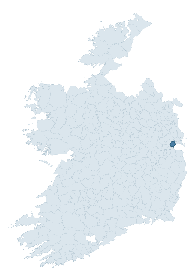
Where this barony sits in the Republic of Ireland
Geology and preservation
Bedrock geology shapes the landscape long before any settlement begins — controlling soil drainage, agricultural potential, the survival of upstanding monuments, and the preservation of buried archaeology. The figures below come from the Geological Survey Ireland 1:100,000 bedrock map.
The bedrock underlying Castleknock is predominantly limestone (65% of the barony by area), laid down during the Carboniferous period (100% by area, around 359 to 299 million years ago). Limestone is the most heritage-rich bedrock in Ireland. It supports fertile, well-drained soils that favoured dense Early Medieval settlement and Norman manorial agriculture, and it weathers into karst features — sinkholes, caves, swallow holes, and souterrains — that frequently carry archaeology. Where peat overlies limestone, organic preservation can be exceptional. A substantial secondary geology of calcareous shale (30%) adds further variety to the underlying landscape. The single largest mapped unit is the Lucan Formation (55% of the barony's bedrock).
Rock type composition
Largest mapped unit: Lucan Formation (55% of the barony)
Placename evidence
Logainm records 9 heritage-diagnostic placenames for Castleknock, a modest sample drawn predominantly from the townland record. The dominant stratum is early christian ecclesiastical. The most frequent diagnostic roots are cill- (5) and ráth- (2). With a sample of this size the count should be treated as indicative rather than definitive.
Pre-Christian / Early Medieval Defensive
| Root | Count | Meaning |
|---|---|---|
| ráth- | 2 | earthen ringfort |
| dún- | 1 | hilltop or promontory fort |
Early Christian Ecclesiastical
| Root | Count | Meaning |
|---|---|---|
| cill- | 5 | church (early) |
| gráinseach- | 1 | monastic farm / grange |
Burial, Ritual, and Norse-Contact
| Root | Count | Meaning |
|---|---|---|
| gall- | 2 | foreigner — Norse settlement marker |
Other baronies in Dublin
About this profile
Click any section below to expand.
What is a barony?
A barony is a historic administrative unit in Ireland, broadly equivalent to an English hundred. The 280 baronies used here are from the OSi 2019 National Statutory Boundaries (generalised 20m), covering the 26 counties of the Republic of Ireland. Baronies derive from the Norman period, were formalised in the 17th century, and have not been redrawn for statistical purposes. They vary enormously in area, from compact urban baronies in Dublin to vast upland baronies in Connacht, and should not be compared by raw site count without accounting for area differences.
What counts as a site?
This profile combines three distinct heritage registers, each with its own definition of what constitutes a recordable site:
- Archaeological sites (NMS). The National Monuments Service Sites and Monuments Record (SMR) catalogues every known archaeological monument or site of archaeological interest in the Republic, from prehistoric burial mounds and ringforts to medieval churches and post-medieval defensive works. Inclusion does not require legal protection — only that the site has been identified, surveyed, and assessed as having archaeological value. A separate subset of these sites lies within a recorded protection zone, which gives them statutory protection under the National Monuments Acts.
- Listed buildings (NIAH). The National Inventory of Architectural Heritage records buildings of architectural, historical, archaeological, artistic, cultural, scientific, social, or technical interest. Each surveyed structure is appraised on a five-tier scale: International, National, Regional, Local, and Record-Only. The NIAH appraisal is informational rather than strictly statutory, but it underpins local-authority Record of Protected Structures (RPS) listings.
- Heritage placenames (Logainm). Logainm is the authoritative database of Irish placenames maintained by the Placenames Branch. This profile applies a heritage-diagnostic classifier to the Irish-language form of each townland name, flagging roots that signal defensive sites (ráth-, lios-, dún-, caiseal-, cathair-), ecclesiastical foundations (cill-, teampall-, domhnach-, mainistir-), prehistoric burial-ritual features (tuaim-, carn-, leaba-), or Norse-contact settlement (gall-). Townlands without one of these diagnostic roots are not flagged here — they may still carry historical significance, but that significance is not encoded in the name itself.
Editorial principles
The narrative sections of this profile follow several explicit principles:
- Evidential. Every claim about this barony’s heritage character is anchored in the underlying register data. Where a site count, a placename count, or a percentile rank is cited, it is computed from the source datasets at export time, not estimated.
- Comparative. Counts and metrics are reported alongside their percentile rank against the other 279 ROI baronies. A barony with 50 ringforts in absolute terms could be unusually high or unusually low depending on its size and regional context; percentile ranking removes that ambiguity.
- Transparent on limits. Where a register has known coverage gaps, survey biases, or data-quality issues that affect this barony’s figures, the profile flags them rather than presenting the numbers as definitive.
- No interpretation beyond what the data supports. The narrative does not speculate about historical events, social dynamics, or cultural meaning beyond what the recorded heritage and placename evidence directly attests.
Data caveats and limits
- NMS Sites and Monuments Record is the product of survey campaigns conducted at different intensities across different counties and decades. Some baronies have been surveyed more thoroughly than others, and absolute counts should be read in that light. Sites destroyed by development before survey are typically not represented; sites in heavily forested or upland terrain are sometimes under-recorded.
- NIAH coverage is broadly complete for the Republic of Ireland but the survey was conducted on a rolling county-by-county basis, and the most recent appraisal date varies. Buildings demolished or substantially altered after their original survey may still appear in the register; conversely, recent buildings of merit may not yet have been appraised.
- Logainm classification applies a deliberately conservative pattern-matching approach to the Irish-language townland forms. The classifier prioritises true positives over recall: a townland may carry a heritage signal that the classifier doesn’t recognise, particularly where the diagnostic root has been heavily anglicised or where the townland name draws on a less common term. The 60,000+ townland records and ~9,800 classified placenames give a substantial signal at barony scale, but individual townland names should be checked against Logainm directly for definitive interpretation.
- Period attribution. The chronological distribution reflects only those NMS sites that carry a recognised period attribution in the source data. Sites listed as “Unknown” period are excluded from the dated subset.
- Boundary changes. Some baronies have undergone minor boundary adjustments since their 19th-century definition; the OSi 2019 generalised boundaries used here are the current statutory definition and may differ slightly from historical maps in border areas.
- Bedrock geology is mapped at 1:100,000 scale, which means local variation within a barony — small pockets of different rock type, mineral veins, alluvium overlying bedrock — is generalised. The dominant-system and rocktype figures are area-weighted, so a barony reading “70% Carboniferous limestone” may still contain small but archaeologically important pockets of older or younger rock. Around 3% of GSI polygons do not match the lexicon and contribute no rocktype or system attribution.
Data sources
- National Monuments Service — Sites and Monuments Record (SMR) https://data.gov.ie/dataset/national-monuments-service-archaeological-survey-of-ireland
- National Inventory of Architectural Heritage (NIAH) https://data.gov.ie/dataset/national-inventory-of-architectural-heritage-niah-national-dataset
- Logainm — Placenames Database of Ireland https://www.logainm.ie/
- Ordnance Survey Ireland — National Statutory Barony Boundaries 2019 https://data-osi.opendata.arcgis.com/
- EURODEM — European Digital Elevation Model https://www.mapsforeurope.org/datasets/euro-dem
- ESA WorldCover https://esa-worldcover.org/en
- Geological Survey Ireland — 1:100,000 Bedrock Geology https://www.gsi.ie/en-ie/data-and-maps/Pages/Bedrock.aspx
Explore more: Search any of the 280 ROI baronies, browse by historical province, or read the methodology and data sources for the full Republic of Ireland Heritage Tool.