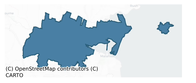
Nethercross is a barony of County Dublin, in the historical province of Leinster (Irish: An Chrois Íochtarach), covering 89 km² of land. The barony records 296 NMS archaeological sites and 107 NIAH listed buildings, placing it at around the 87th percentile among 280 ROI baronies for sites per km². This means it is in the top fifth of all baronies for sites per km². Dated archaeological evidence runs from the Mesolithic through to the Modern, spanning 9 of 9 archaeological periods, placing the barony in the 93rd percentile among 280 ROI baronies for chronological depth. This means it is in the top tenth of all baronies for chronological depth. The largest dated subset of recorded sites dates to the Iron Age. Logainm flags 21 placenames in the barony as carrying a recognised heritage root; the largest share — around 62% — are names associated with early Christian church and monastic foundations.

Heritage at a glance
Percentile rankings throughout this profile compare each barony only against the other 279 Republic of Ireland baronies.
The recorded heritage of Nethercross
The National Monuments Service Sites and Monuments Record (SMR) is the statutory inventory of archaeological sites for the Republic of Ireland, maintained by the Department of Tourism, Culture, Arts, Gaeltacht, Sport and Media. Sites recorded here include earthworks, ringforts, megalithic tombs, ecclesiastical remains, and post-medieval features; not every record is legally protected, but each is registered as a monument of archaeological interest.
The National Monuments Service records 296 archaeological sites in Nethercross, putting it at the 87th percentile among 280 ROI baronies for sites per km². This means it is in the top fifth of all baronies for sites per km². Protection coverage is near-universal — 282 sites (95%) fall within a recorded monument protection zone, indicating an extensively surveyed landscape. The record is dominated by defensive sites — ringforts, enclosures, hillforts, and stone forts (93 sites, 31% of the total), with burial and ritual monuments forming a substantial secondary presence (70 sites, 24%). The most diagnostically specific type is Ring-ditch (42 records, 14% of the barony's NMS total) — compared to an ROI average of 6% across all baronies where this type occurs. Ring-ditch is a circular ditch under 20m across, often the ploughed-out remains of a barrow, ring-barrow or roundhouse. The broader 'Enclosure' classification — which catches unclassified ringforts and field enclosures — accounts for a further 60 records (20%) and reflects the difficulty of sub-classifying degraded earthworks from surface evidence alone. Across the barony's 89 km², this gives a recorded density of 3.31 sites per km².
Most common monument types
Hover or tap a monument type to see its definition.
| Type | Count |
|---|---|
| Enclosure a banked or ditched feature of uncertain type, used as a catch-all where the original function cannot be determined from surface evidence | 60 |
| Ring-ditch a circular ditch under 20m across, often the ploughed-out remains of a barrow, ring-barrow or roundhouse | 42 |
| Field system a group of related fields forming a coherent agricultural landscape, of any date from the Neolithic onwards | 12 |
| Church a building used for public Christian worship, of any date from c. 500 AD onwards | 11 |
| Earthwork an unclassified earthen structure with no diagnostic features that allow a more specific classification | 11 |
| Ritual site – holy well a well or spring traditionally associated with a saint, often credited with healing properties; many trace earlier ritual origins but devotion is documented from the medieval period onwards | 10 |
| Graveyard a burial area associated with a church, in use from the medieval period onwards | 10 |
Chronological distribution
The dated archaeological record for Nethercross spans from the Mesolithic through to the Modern, with activity attested across 9 of 9 archaeological periods. This places Nethercross in the top 7% of ROI baronies for chronological depth — few baronies record evidence across as many distinct archaeological periods. Every period from earliest to latest is represented in the record — an unbroken sequence of dated activity across the full chronological span. Activity concentrates most heavily in the Iron Age (67 sites, 33% of dated material), with the Early Medieval forming a secondary peak (45 sites, 22%). A further 92 recorded sites (31% of the overall NMS register for the barony) carry no period attribution — appearing as 'Unknown' in the bar chart below. This typically reflects either records that pre-date the standardised period vocabulary or sites awaiting specialist dating review, rather than a genuine absence of chronological evidence.
Sample of recorded monuments
Show 25 sample monuments (of 296 total)
A representative sample of 25 recorded monuments drawn from the barony’s 296 total NMS entries. Sites within a recorded monument protection zone and rarer site types are prioritised so the list shows a meaningful cross-section rather than only the most common type. Each entry shows the official Sites and Monuments Record reference number and the description published by the National Monuments Service.
Quay
Immediately E of Raheen Point on the S side of Rogerstown estuary. The site formerly comprised two roughly parallel banks with a marshy hollow in between where the tide comes in. These banks measured c. 60m in extent.…
Immediately E of Raheen Point on the S side of Rogerstown estuary. The site formerly comprised two roughly parallel banks with a marshy hollow in between where the tide comes in. These banks measured c. 60m in extent. They are levelled and all that remains is this elongated hollow.
Compiled by: Geraldine Stout
Date of upload: 26 August 2011
Bullaun stone
In the 1992 report, a possible bullaun stone was identified within the ground floor of the tower of the medieval church at Portraine (DU008-031001-). It is no longer evident.
Compiled by: Geraldine Stout
Updated…
In the 1992 report, a possible bullaun stone was identified within the ground floor of the tower of the medieval church at Portraine (DU008-031001-). It is no longer evident.
Compiled by: Geraldine Stout
Updated by: Christine Baker
Date of upload: 19 December 2014
Castle – motte and bailey
Located within the Ward river valley north of Knocksedan bridge and east of the old coach road north through Fingal. Abutted to north and west by road and south by river, the site comprises a flat-topped mound…
Located within the Ward river valley north of Knocksedan bridge and east of the old coach road north through Fingal. Abutted to north and west by road and south by river, the site comprises a flat-topped mound (diam.25m; H 6m) which is surrounded by a deep V-shaped fosse best preserved at north and northeast (Wth 8m; D 1.5m). There are faint traces of an outer bank along the west side. The bailey, is recorded as being located on the opposite side of the road as a level raised area (dims.56m E-W; 70m N-S H 0.5m) (Healy 1975, 23). However to the east of the now overgrown mound is a flat area that slopes down and could constitute part of the bailey. The motte will be included in the planned Ward River Valley Park.
Compiled by: Geraldine Stout
Updated by: Christine Baker
Date of upload: 03 January 2015
This monument is subject to a preservation order made under the National Monuments Acts 1930 to 2014 (PO no. 8/1983).
Fish-pond
Located south of the Ward river valley and defined by two broad (c.13m) top width) undulating banks that are topped by trees and brambles, it was originally recorded as a fish pond. The western third is within the…
Located south of the Ward river valley and defined by two broad (c.13m) top width) undulating banks that are topped by trees and brambles, it was originally recorded as a fish pond. The western third is within the grounds of Brackenstown House and has been cleared, but still retains its form, and is currently in use as a horse riding paddock. The majority of the feature is located north of playing fields abutting sprawling housing estates. The base of the site is waterlogged towards the east end. The section to the south is used as a walkway and is defined by well-established trees and outer ditch. The ‘old pond’ is fact a canal, part of Robert Molesworth's 'landscape of Breckdenston' that was constructed between 1714-1719. Described as 'thirty yards broad and flanked double on each side by two walks, a higher and a lower, the higher walk being planted with trees’ it was part of a model landscape which reflected Whig philosophy, Italianate design and ‘a farmlike way’ of gardening (O’Kane 2004, 25). It was also used for fish.
Compiled by: Geraldine Stout
Updated by: Christine Baker
Date of upload: 03 January 2015
Castle – Anglo-Norman masonry castle
Situated on rising ground at the NE end of Swords Village. Built c. 1200 as the manorial residence of the Archbishop of Dublin (Anon 1914, 260-261). The curtain wall forms an irregular polygon in plan enclosing an area…
Situated on rising ground at the NE end of Swords Village. Built c. 1200 as the manorial residence of the Archbishop of Dublin (Anon 1914, 260-261). The curtain wall forms an irregular polygon in plan enclosing an area of one and one third acres. The entrance is in the S through a barrel-vaulted archway, which provides access to a range of buildings in the E and W.
To the E is the chapel with a residential tower that rises to three storeys with a vaulted ground floor. There is a double-light, trefoil-headed window with transom in the S wall of the 2nd floor of the tower. The chapel is entered from the E wall of the tower and through round-headed doorways in the N wall of the chapel. Fourteenth century tiles were found during excavations of the chapel in the 1970's (Fanning 1975, 47-82). In the SE angle of the curtain wall are traces of a two-storey building with four plain windows and a fireplace in the E wall. This is thought to have been an oratory. A medieval tile pavement came to light in this building during excavations (Fanning 1975, 61ff). Along the E section of curtain wall is a three storey tower immediately S of a building referred to as the 'Great hall' (Anon 1914, 260-261). It has a vaulted ground floor and a stairwell in the NE angle. The first floor is lit by a large window with red sandstone moulding and tracery. There is a domestic range W of the entrance to the castle. The curtain wall is battlemented with parapet walks defended by towers in the E, N a…
Round tower
Associated with the monastic enclosure is a round tower which rises to four storeys and is entered in the east through a lintelled doorway with inclined jambs (dims. H.26m, wall Wth 1.30m, int. diam 2.40m). The interior…
Associated with the monastic enclosure is a round tower which rises to four storeys and is entered in the east through a lintelled doorway with inclined jambs (dims. H.26m, wall Wth 1.30m, int. diam 2.40m). The interior is lit by plain square-headed opes above the doorway and at same level in the N and S. There is a corbelled roof over the first floor with timber floors on second and third. The upper portion of the tower is a later reconstruction and topped with an undecorated Latin cross (DU011-034006-).
Compiled by: Geraldine Stout
Updated by: Christine Baker
Date of upload: 08 January 2015
Cross-slab
There is an inscribed Early Christian grave slab fragment built into the base of the residental tower of the church (DU011-034004-) in the SE. It has a lunette-shaped terminal (Swords, K.2009, 103).
Compiled by:…
There is an inscribed Early Christian grave slab fragment built into the base of the residental tower of the church (DU011-034004-) in the SE. It has a lunette-shaped terminal (Swords, K.2009, 103).
Compiled by: Geraldine Stout
Updated by: Christine Baker
Date of upload: 08 January 2015
Mill – unclassified
The Down Survey (1655-6) map shows a mill at the north end of Swords village. The corn mill marked on the first edition OS 6-inch map probably occupies the site. A painting by George Holmes c.1790 illustrates a mill…
The Down Survey (1655-6) map shows a mill at the north end of Swords village. The corn mill marked on the first edition OS 6-inch map probably occupies the site. A painting by George Holmes c.1790 illustrates a mill wheel to the south of the bridge which is marked on cartographic sources as the Mill bridge. There is a weir at this point in the river. Photographs of a mill wheel and weir from c.1900 are in the National Library collections. A millrace runs along the west side of Swords Castle.
Compiled by: Geraldine Stout
Updated by: Christine Baker
Date of upload: 08 January 2015
Architectural fragment
There are a number of re-used architectural fragments including a section of medieval window moulding in the graveyard of the Church of Ireland.
Compiled by: Geraldine Stout
Updated by: Christine Baker
Date of…
There are a number of re-used architectural fragments including a section of medieval window moulding in the graveyard of the Church of Ireland.
Compiled by: Geraldine Stout
Updated by: Christine Baker
Date of upload: 08 January 2015
Water mill – unclassified
The Civil survey (1654-6) mentions a mill at Killossery belonging to Philip Hore of Kilsallaghan. This is also marked on the Down Survey (1655-6) map. To the N of Killossery Church (DU011-005—-) tucked into a…
The Civil survey (1654-6) mentions a mill at Killossery belonging to Philip Hore of Kilsallaghan. This is also marked on the Down Survey (1655-6) map. To the N of Killossery Church (DU011-005—-) tucked into a hillslope is a mill complex comprising the mill building which stands to the W of the yard and a dwelling that runs at right angles to it with some later out-buildings off to the N. The mill building is oriented roughly N-S and changes from a two-storey building to one storey as it ascends the hillslope. It has stone foundations with mud walls and gables which are hipped (ext. dims. L16.4m, Wth 6.6m). There are remains of a millrace that runs along the N gable. The thatched roof is covered in galvanised iron. Most of the mill works are present in the N end of the building. There is a kiln in the S end.
Compiled by: Geraldine Stout
Date of upload: 26 August 2011
Font (present location)
Located in porch at north doorway of RC church. This is a round bowl-shaped font decorated with a vine leaf ornamentation. It rests on top of a later pedestal (diam.0.44m, D 0.34m). It has a flat-bottomed interior.…
Located in porch at north doorway of RC church. This is a round bowl-shaped font decorated with a vine leaf ornamentation. It rests on top of a later pedestal (diam.0.44m, D 0.34m). It has a flat-bottomed interior. Thought to have come from Killossery (DU011-005001-). Now planted with flowers.
Compiled by: Geraldine Stout
Updated by: Christine Baker
Date of upload: 09 January 2015
Wall monument (present location)
There are 18th-century and earlier graveslabs in the porch of St Patrick's church of Ireland including one dedicated to John Fitzsimon (d. 1709) and a monument to Patrick Barnewall of Staffordstown and his wife Begnot…
There are 18th-century and earlier graveslabs in the porch of St Patrick's church of Ireland including one dedicated to John Fitzsimon (d. 1709) and a monument to Patrick Barnewall of Staffordstown and his wife Begnot de La Hoyde who died in 1592. The later contains an inscription and two coats of arms (Healy 1975, 25).
Compiled by: Geraldine Stout
Updated by: Christine Baker
Date of upload: 16 January 2015
Ringfort – cashel
Aerial photographs (CUCAP, BDS 50-56) show four circular cropmarks (diams. av. c. 60m) with associated field systems. These are probably levelled ringforts (Stout and Stout 1992, 17-18). This site was subject to…
Aerial photographs (CUCAP, BDS 50-56) show four circular cropmarks (diams. av. c. 60m) with associated field systems. These are probably levelled ringforts (Stout and Stout 1992, 17-18). This site was subject to geophysical survey (Licence no. 08R117) and test excavation (Licence no. 09E0448) as part of the proposed Metro North development. A central enclosure ditch (48m x 38) is partially encompassed by a second elliptical enclosing ditch which was only identified on the eastern and southern extent of the complex. An outer enclosing ditch (73m x 64m) was also identified enclosing the central and elliptical enclosures and appears to define the extent of the archaeological complex. A rectilinear enclosure or possible annexe (14m x 7m) was also identified on the southeastern side of complex. While no diagnostic material was recovered during the testing programme the site is interpreted as a bi-vallate ringfort (Hession 2009, 20).
Compiled by: Geraldine Stout
Updated by: Christine Baker
Date of upload: 16 January 2015
House – indeterminate date
In the field to the rear of the ruins of Mountstuart House (DU011-006002-) are low earthworks, which may represent house sites with associated field systems. The southern site comprises a sunken area, roughly…
In the field to the rear of the ruins of Mountstuart House (DU011-006002-) are low earthworks, which may represent house sites with associated field systems. The southern site comprises a sunken area, roughly sub-rectangular in plan, aligned E-W (L. c. 20m, Wth.15m) defined by a single bank (Wth 3.5m, H 0.5m). The north site has an irregular interior defined by a bank (Wth 4m, H 0.7m) and outer fosse (Wth 0.2m, D 0.25-30m).
Compiled by: Geraldine Stout
Updated by: Christine Baker
Date of upload: 02 January 2015
House – fortified house
Located in level terrain in the west end of the Island. This castle may incorporate the fortress built on Lambay in 1467 on land leased to John Tiptoft, Earl of Worcester, Lord Deputy for Edward IV which would prevent…
Located in level terrain in the west end of the Island. This castle may incorporate the fortress built on Lambay in 1467 on land leased to John Tiptoft, Earl of Worcester, Lord Deputy for Edward IV which would prevent pirates harbouring there and plundering traffic on the Irish Sea. The castle with its four projecting angle towers was later incorporated by Lutyens in the early 20th century as an integral element of his design for a new castle (Brown 1996, 99-103). It stands two storeys high with angle towers or bastions constructed at such an angle to defend all of the walls (Cooney 1993, 27; Scantlebury 1945, 88-89). Triangular shaped musket holes in the angle towers provide flanking cover and indicate a 16th/17th century date. The ground floor has a main chamber which is rectangular in plan (L .90m, Wth 4.50m) and entered through a doorway in the E. There is a fireplace in the E wall (Wth 2.45m, H 1.20m, D 0.76m) and a splayed window embrasure in the W wall. The W wall of the main chamber (T1.30m) is thicker than the other walls suggesting that it may be part of an earlier structure. Originally, all the angle towers in the SW (L 4.50m, Wth 3.60m); NW (L 4.90m, Wth 3.75), SE (4.60m. Sq. ) and NE were accessible from the main chamber. However, access to the SW angle tower off the main chamber was removed by the insertion of a fireplace in its NW angle and the NE corner of the castle has been re-modelled to incorporate a later drawing room. Interiors of the angle towers hav…
Moated site
Located on level, sheltered pasture in the west of the Island. Comprises a rectangular area aligned NW- SE (L 40m, Wth 28m) which is defined by an inner and outer bank with interveening fosse. There is a narrow causeway…
Located on level, sheltered pasture in the west of the Island. Comprises a rectangular area aligned NW- SE (L 40m, Wth 28m) which is defined by an inner and outer bank with interveening fosse. There is a narrow causeway through the banks and fosse midway along the E side (Wth 3.50m). The outer flat-topped bank is best preserved along the N side (H 1.20m, Wth at base 4.40m, Top 2.40m) but is denuded in the SE. It has been badly damaged in the S. The inner fosse is wide and flat-bottomed, broadest in the S (Wth 5.20m, D.0.28) and deepest in the W (D 0.85m). The inner bank has raised corners with the exception of that in the NE where it has been partially removed. It is best preserved in the W (Wth at base 10.20m, Top 4m, H 0.80m). The interior has been cultivated. In the twelfth century Lambay was granted to the Archbishop of Dublin shortly after the Anglo-Norman invasion. The rectilinear earthwork with a broad ditch lying to the S of the present castle was probably built sometime after this (Scantlebury 1945, 88).
Geophysical survey (Licence no. 03R0074) in the area showed that the moated site respects a double circular enclosure associated with the church (DU009-001007-). The inner area of the moated site is lower than exterior. The fosse is under long grass.
Compiled by: Geraldine Stout
Updated by: Christine Baker
Date of upload: 31 December 2014
Barrow – ring-barrow
Geophysical survey (Licence no. 03R0074) undertaken identified two ring barrows external to the bank pf promontory fort (DU009-001013-) and circular structures within (Cooney 2009, 21). Further geophysical survey…
Geophysical survey (Licence no. 03R0074) undertaken identified two ring barrows external to the bank pf promontory fort (DU009-001013-) and circular structures within (Cooney 2009, 21). Further geophysical survey (Licence no. 12R078) of the promontory was carried out by The Discovery Programme for the LIARI Project which confirmed the presence of previously identified internal circular anomalies (Dowling 2014).
Compiled by: Geraldine Stout
Updated by: Christine Baker
Date of upload: 31 December 2014
Barrow – unclassified
Identified during pre-development testing on the Airport-Balbriggan Bypass (Lynch 2004, 127). Comprises a circular ring barrow with an entrance at the N and W part of the ring. A deer antler was found directly opposite…
Identified during pre-development testing on the Airport-Balbriggan Bypass (Lynch 2004, 127). Comprises a circular ring barrow with an entrance at the N and W part of the ring. A deer antler was found directly opposite the W causeway. A deposit of cremated bone was found within the ditch and on the E side of the site. The NE side of the ring-ditch was cut through by five inhumations oriented east-west. Beside these inhumations were four others, oriented north-east/south-west.
Compiled by: Geraldine Stout
Date of upload: 26 August 2011
Battlefield
The Battle of Kilsallaghan was fought in 1642 between c. 2,000-3000 Insurgents led by Colonel Hugh Byrne and Government forces, approximately 2,800 strong under the command of the Earl of Ormond. Most of the fighting…
The Battle of Kilsallaghan was fought in 1642 between c. 2,000-3000 Insurgents led by Colonel Hugh Byrne and Government forces, approximately 2,800 strong under the command of the Earl of Ormond. Most of the fighting took place in the immediate vicinity of Kilsallaghan castle and the neighbouring churchyard of St. David's (Clinton 2005, 58-59).
Compiled by: Geraldine Stout
Date of upload: 26 August 2011
Historic town
Archbishop Comyn established a borough in Swords in the late 12th century and confirmed the burgesses of Swords in their burgages with an established annual rent of 1s. per burgage (Mc Neill 1950, 32; Bradley and King,…
Archbishop Comyn established a borough in Swords in the late 12th century and confirmed the burgesses of Swords in their burgages with an established annual rent of 1s. per burgage (Mc Neill 1950, 32; Bradley and King, 1988, 306-310). An extent of the manor in 1326 noted that there were the 122 burgesses. The settlement was granted a new charter by Elizabeth 1 In 1578 which established it as a parliamentary borough and this was confirmed in 1603 on the accession of James 1.
According to D'Alton (1838, 141) the town was considered one of the walled towns of Dublin in 1578. The long linear boundary delimiting the properties on the E side of Main Street is an obvious line for these defences but the S boundary is unclear. The stream would have provided a defence on the W and the parish church (DU011-034004-) may have been protected by remnants of its ecclesiastical enclosure (DU011-034002-).
The medieval town was linear in form and was laid out along the present Main Street, which is called High Street in in medieval documentation (Mc Neill 1950, 285) focused onto the gates of the Archbishop's castle. There is a reference in a 14th century deed to a lane called Le Camerothe. It ran in an E-W direction and could possibly be the modern Well Road or Seatown Road. A weekly market was confirmed to the archbishops in 1395 and this was located in Main street which expands noticeably towards its N end to accommodate it.
There are many references to burgages and individual proper…
Water mill – horizontal-wheeled
Identified by test-excavation (Licence no. 08E0303) the monument consists of a medieval watermill with a horizontal millwheel, associated millrace and various other channels used for water management. The remains…
Identified by test-excavation (Licence no. 08E0303) the monument consists of a medieval watermill with a horizontal millwheel, associated millrace and various other channels used for water management. The remains consist of the foundations of a sub-square mill building (2.1m) with a funnel-shaped flume channel opening into its N side and a tail race exiting from the S. A possible millpond was located immediately upslope to the N. To the W of the mill a 2.2m wide, shallow, V-shaped water channel metalled with stone was uncovered. Between this channel and the mill, 2m from it, were two N–S drystone wall foundations running parallel to the building: their function is unknown but they appear to relate to the strengthening of the V-shaped channel. Other features discovered included two metalled floor surfaces. Medieval pottery suggests that the mill may have continued in use beyond the 12th century AD to perhaps some time during the 14th – 16th century (Frazer 2008, 37).
Compiled by: Christine Baker
Date of upload: 4 February 2015
Flat cemetery
Geophysical survey (Licence no. 12R078) undertaken by The Discovery Programme for the ‘Late Iron Age and “Roman” Ireland’ project, identified a series of features at South Point. A total of six annular, penannular and…
Geophysical survey (Licence no. 12R078) undertaken by The Discovery Programme for the ‘Late Iron Age and “Roman” Ireland’ project, identified a series of features at South Point. A total of six annular, penannular and arcuate features with diameters ranging from 7m to 16m, some of which overlap were identified. On the basis of their size, form and layout, these features can be provisionally described as ring-ditches (Dowling 2014, 9).
Compiled by: Christine Baker
Date of upload: 5 February 2015
House – Bronze Age
This monument was subject to geophysical survey (Licence no. 08R029) and test excavation (Licence no. 10E0121) in advance of the Portrane, Donabate and Lusk Waste Water Treatment scheme. A circular structure (6m diam.)…
This monument was subject to geophysical survey (Licence no. 08R029) and test excavation (Licence no. 10E0121) in advance of the Portrane, Donabate and Lusk Waste Water Treatment scheme. A circular structure (6m diam.) was identified represented by a curvilinear slot trench and external postholes (average 0.18m diam.) located at irregular intervals. Located within an area of possible multi-period habitation (DU012-095001-) the structure is associated with an enclosure and a series of pits indicative of domestic occupation (McQuade 2011, 31).
Compiled by: Christine Baker
Date of upload: 5 February 2015
House – 17th century
This detached three-bay, two-storey dwelling is a former vicarage and dates to c.1675 (see www.buildingsofireland reg. no. 11343004). It has a projecting two-bay, two-storey block attached to the right-hand side. There…
This detached three-bay, two-storey dwelling is a former vicarage and dates to c.1675 (see www.buildingsofireland reg. no. 11343004). It has a projecting two-bay, two-storey block attached to the right-hand side. There is a gable-fronted wing, possibly a former chapel, attached to the left-hand side. A three-bay, single-storey return with half-dormer attic was added to the rear c.1750 and a five-bay two-storey former coach house was added c.1875. The house was extensively renovated c. 1997 and converted to apartments. A number of burials were recovered in the course of the renovations which pre-date the construction of the vicarage (see DU011-034018-).
Compiled by: Paul Walsh
Date of upload: 12 May 2016
Enclosure
An aerial photograph taken by in 1971 (FSI 587/588) shows part of a possible enclosure visible as a curving cropmark (diam. c. 100m). There is a corresponding curve in the nearby field boundary. The site is located in…
An aerial photograph taken by in 1971 (FSI 587/588) shows part of a possible enclosure visible as a curving cropmark (diam. c. 100m). There is a corresponding curve in the nearby field boundary. The site is located in low-lying pasture close to Rogerstown estuary. Not visible at ground level. Now incorporated into Turvey Nature Reserve. Geophysical survey (Licence no. 06R0154) was undertaken to identify the extent and location of the enclosure site. However no clear responses suggestive of an enclosure were identified. Isolated responses were recorded probably the result of natural variations in the sub-soil (Leigh 2006, 2).
Compiled by: Geraldine Stout
Updated by: Christine Baker
Date of upload: 19 December 2014
Listed buildings
The National Inventory of Architectural Heritage (NIAH) is a state survey appraising buildings of architectural, historical, archaeological, artistic, cultural, scientific, social, or technical interest. Each surveyed structure receives a rating from International (the highest, for buildings of European importance) through National, Regional, Local, and Record-Only.
The NIAH records 107 listed buildings in Nethercross (52nd percentile across ROI baronies). Among these, 5 are graded National — buildings of interest to the whole of Ireland rather than only its region. The Republic holds 937 National-graded buildings in total, so this barony accounts for around 1% of the national total. Construction dates concentrate most heavily in the Victorian (1830-1900) period.
Terrain and environment
Mean elevation across the barony is 34m — the 8th percentile among 280 ROI baronies for elevation. This means it is in the bottom tenth of all baronies for elevation. This is a relatively low-lying landscape by ROI standards. Elevation matters for heritage because higher-altitude baronies typically favour defensive monuments — ringforts and hilltop forts placed on prominent ground — while lowland baronies are more likely to carry the dense settlement and church networks of intensive agricultural landscapes. Mean slope is 2.4° — the 23rd percentile among 280 ROI baronies for slope. This means it is in the bottom third of all baronies for slope. This is broadly flat terrain, the kind of landscape best suited to intensive agriculture. Slope is a key control on both land use and archaeological preservation: steep ground resists ploughing and tends to preserve earthworks intact, while gentle slopes favour intensive cultivation that damages or destroys surface archaeology over time. The Topographic Wetness Index averages 11.6, the 78th percentile among 280 ROI baronies for wetness. This means it is in the top third of all baronies for wetness. This is wet, slow-draining ground by ROI standards — the kind of landscape that may carry waterlogged archaeological sites of unusual preservation value. Drainage matters for heritage because poorly-drained ground preserves organic archaeology (wooden trackways, leather, textiles, and on rare occasions human remains) far better than free-draining soil; well-drained ground favours arable use but destroys organic material rapidly. Urban land covers 10% of the barony (the 95th percentile among 280 ROI baronies for urban cover. This means it is in the top tenth of all baronies for urban cover). Heavy urban coverage compresses heritage analysis: many archaeological features have been buried or destroyed by development, but the surviving record is concentrated in protected city-centre cores, and the NIAH listed-buildings count is typically high. The land-cover mosaic combines improved grassland (46%), arable farmland (31%), and woodland (12%), giving a mixed agricultural and semi-natural landscape. In overall character, this is low-lying, gently-sloping terrain — characteristic of Ireland's central plain and coastal lowlands, with land use dominated by improved grassland.
Terrain measurements
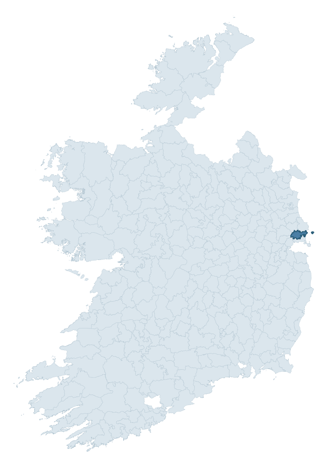
Where this barony sits in the Republic of Ireland
Geology and preservation
Bedrock geology shapes the landscape long before any settlement begins — controlling soil drainage, agricultural potential, the survival of upstanding monuments, and the preservation of buried archaeology. The figures below come from the Geological Survey Ireland 1:100,000 bedrock map.
The bedrock underlying Nethercross is predominantly limestone (59% of the barony by area), laid down during the Carboniferous period (94% by area, around 359 to 299 million years ago). Limestone is the most heritage-rich bedrock in Ireland. It supports fertile, well-drained soils that favoured dense Early Medieval settlement and Norman manorial agriculture, and it weathers into karst features — sinkholes, caves, swallow holes, and souterrains — that frequently carry archaeology. Where peat overlies limestone, organic preservation can be exceptional. A substantial secondary geology of calcareous shale (23%) adds further variety to the underlying landscape. The single largest mapped unit is the Malahide Formation (41% of the barony's bedrock).
Rock type composition
Largest mapped unit: Malahide Formation (41% of the barony)
Placename evidence
Logainm records 21 heritage-diagnostic placenames for Nethercross, drawn from townland and civil-parish names across the barony. The dominant stratum is Early Christian ecclesiastical — cill-, teampall-, and domhnach-prefixed names that record the dense network of early church foundations established between the fifth and tenth centuries. The leading diagnostic roots are cill- (10 — church), ráth- (4 — earthen ringfort), and lios- (3 — ringfort or enclosure). This is below the ROI average of 30.7 heritage placenames per barony, suggesting either lighter survey coverage or a townland-naming tradition that draws more on generic landscape vocabulary. Logainm records 122 placenames for Nethercross (predominantly townland names). Of these, 21 (17%) carry one of the diagnostic Gaelic roots tracked above; the remainder draw on more generic landscape vocabulary that does not encode a heritage period.
Pre-Christian / Early Medieval Defensive
| Root | Count | Meaning |
|---|---|---|
| ráth- | 4 | earthen ringfort |
| lios- | 3 | ringfort or enclosure |
| dún- | 1 | hilltop or promontory fort |
Early Christian Ecclesiastical
| Root | Count | Meaning |
|---|---|---|
| cill- | 10 | church (early) |
| domhnach- | 2 | pre-Patrician or earliest Patrician church |
| tobar- | 1 | holy well |
Other baronies in Dublin
About this profile
Click any section below to expand.
What is a barony?
A barony is a historic administrative unit in Ireland, broadly equivalent to an English hundred. The 280 baronies used here are from the OSi 2019 National Statutory Boundaries (generalised 20m), covering the 26 counties of the Republic of Ireland. Baronies derive from the Norman period, were formalised in the 17th century, and have not been redrawn for statistical purposes. They vary enormously in area, from compact urban baronies in Dublin to vast upland baronies in Connacht, and should not be compared by raw site count without accounting for area differences.
What counts as a site?
This profile combines three distinct heritage registers, each with its own definition of what constitutes a recordable site:
- Archaeological sites (NMS). The National Monuments Service Sites and Monuments Record (SMR) catalogues every known archaeological monument or site of archaeological interest in the Republic, from prehistoric burial mounds and ringforts to medieval churches and post-medieval defensive works. Inclusion does not require legal protection — only that the site has been identified, surveyed, and assessed as having archaeological value. A separate subset of these sites lies within a recorded protection zone, which gives them statutory protection under the National Monuments Acts.
- Listed buildings (NIAH). The National Inventory of Architectural Heritage records buildings of architectural, historical, archaeological, artistic, cultural, scientific, social, or technical interest. Each surveyed structure is appraised on a five-tier scale: International, National, Regional, Local, and Record-Only. The NIAH appraisal is informational rather than strictly statutory, but it underpins local-authority Record of Protected Structures (RPS) listings.
- Heritage placenames (Logainm). Logainm is the authoritative database of Irish placenames maintained by the Placenames Branch. This profile applies a heritage-diagnostic classifier to the Irish-language form of each townland name, flagging roots that signal defensive sites (ráth-, lios-, dún-, caiseal-, cathair-), ecclesiastical foundations (cill-, teampall-, domhnach-, mainistir-), prehistoric burial-ritual features (tuaim-, carn-, leaba-), or Norse-contact settlement (gall-). Townlands without one of these diagnostic roots are not flagged here — they may still carry historical significance, but that significance is not encoded in the name itself.
Editorial principles
The narrative sections of this profile follow several explicit principles:
- Evidential. Every claim about this barony’s heritage character is anchored in the underlying register data. Where a site count, a placename count, or a percentile rank is cited, it is computed from the source datasets at export time, not estimated.
- Comparative. Counts and metrics are reported alongside their percentile rank against the other 279 ROI baronies. A barony with 50 ringforts in absolute terms could be unusually high or unusually low depending on its size and regional context; percentile ranking removes that ambiguity.
- Transparent on limits. Where a register has known coverage gaps, survey biases, or data-quality issues that affect this barony’s figures, the profile flags them rather than presenting the numbers as definitive.
- No interpretation beyond what the data supports. The narrative does not speculate about historical events, social dynamics, or cultural meaning beyond what the recorded heritage and placename evidence directly attests.
Data caveats and limits
- NMS Sites and Monuments Record is the product of survey campaigns conducted at different intensities across different counties and decades. Some baronies have been surveyed more thoroughly than others, and absolute counts should be read in that light. Sites destroyed by development before survey are typically not represented; sites in heavily forested or upland terrain are sometimes under-recorded.
- NIAH coverage is broadly complete for the Republic of Ireland but the survey was conducted on a rolling county-by-county basis, and the most recent appraisal date varies. Buildings demolished or substantially altered after their original survey may still appear in the register; conversely, recent buildings of merit may not yet have been appraised.
- Logainm classification applies a deliberately conservative pattern-matching approach to the Irish-language townland forms. The classifier prioritises true positives over recall: a townland may carry a heritage signal that the classifier doesn’t recognise, particularly where the diagnostic root has been heavily anglicised or where the townland name draws on a less common term. The 60,000+ townland records and ~9,800 classified placenames give a substantial signal at barony scale, but individual townland names should be checked against Logainm directly for definitive interpretation.
- Period attribution. The chronological distribution reflects only those NMS sites that carry a recognised period attribution in the source data. Sites listed as “Unknown” period are excluded from the dated subset.
- Boundary changes. Some baronies have undergone minor boundary adjustments since their 19th-century definition; the OSi 2019 generalised boundaries used here are the current statutory definition and may differ slightly from historical maps in border areas.
- Bedrock geology is mapped at 1:100,000 scale, which means local variation within a barony — small pockets of different rock type, mineral veins, alluvium overlying bedrock — is generalised. The dominant-system and rocktype figures are area-weighted, so a barony reading “70% Carboniferous limestone” may still contain small but archaeologically important pockets of older or younger rock. Around 3% of GSI polygons do not match the lexicon and contribute no rocktype or system attribution.
Data sources
- National Monuments Service — Sites and Monuments Record (SMR) https://data.gov.ie/dataset/national-monuments-service-archaeological-survey-of-ireland
- National Inventory of Architectural Heritage (NIAH) https://data.gov.ie/dataset/national-inventory-of-architectural-heritage-niah-national-dataset
- Logainm — Placenames Database of Ireland https://www.logainm.ie/
- Ordnance Survey Ireland — National Statutory Barony Boundaries 2019 https://data-osi.opendata.arcgis.com/
- EURODEM — European Digital Elevation Model https://www.mapsforeurope.org/datasets/euro-dem
- ESA WorldCover https://esa-worldcover.org/en
- Geological Survey Ireland — 1:100,000 Bedrock Geology https://www.gsi.ie/en-ie/data-and-maps/Pages/Bedrock.aspx
Explore more: Search any of the 280 ROI baronies, browse by historical province, or read the methodology and data sources for the full Republic of Ireland Heritage Tool.