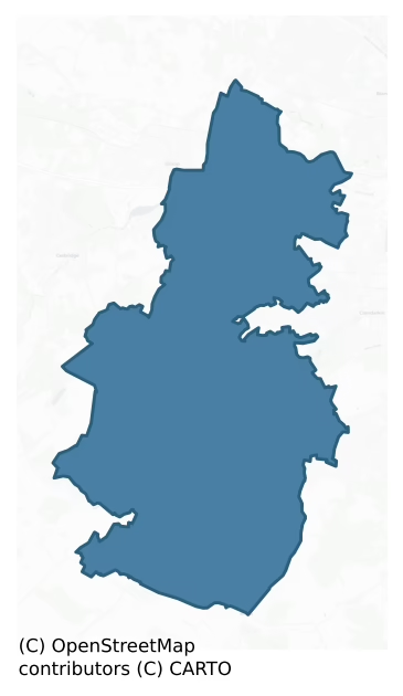
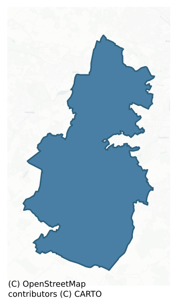
Newcastle is a barony of County Dublin, in the historical province of Leinster (Irish: An Caisleán Nua), covering 92 km² of land. The barony records 209 NMS archaeological sites and 366 NIAH listed buildings, placing it at around the 65th percentile among 280 ROI baronies for sites per km². This means it is in the upper half of all baronies for sites per km². Dated archaeological evidence runs from the Mesolithic through to the Modern, spanning 9 of 9 archaeological periods, placing the barony in the 97th percentile among 280 ROI baronies for chronological depth. This means it is in the top tenth of all baronies for chronological depth. The largest dated subset of recorded sites dates to the Medieval.
Heritage at a glance
Percentile rankings throughout this profile compare each barony only against the other 279 Republic of Ireland baronies.
The recorded heritage of Newcastle
The National Monuments Service Sites and Monuments Record (SMR) is the statutory inventory of archaeological sites for the Republic of Ireland, maintained by the Department of Tourism, Culture, Arts, Gaeltacht, Sport and Media. Sites recorded here include earthworks, ringforts, megalithic tombs, ecclesiastical remains, and post-medieval features; not every record is legally protected, but each is registered as a monument of archaeological interest.
The National Monuments Service records 209 archaeological sites in Newcastle, putting it at the 65th percentile among 280 ROI baronies for sites per km². This means it is in the upper half of all baronies for sites per km². Protection coverage is near-universal — 205 sites (98%) fall within a recorded monument protection zone, indicating an extensively surveyed landscape. The record is dominated by defensive sites — ringforts, enclosures, hillforts, and stone forts (56 sites, 27% of the total), with ecclesiastical sites forming a substantial secondary presence (46 sites, 22%). Barrow – ring-barrow is the most prevalent type, making up 7% of the barony's recorded sites (14 records) — well above the ROI average of 3% across all baronies where this type occurs. Barrow – ring-barrow is a Bronze/Iron Age burial monument: a low circular area enclosed by ditch and outer bank. Other significant types include Enclosure (14) and Ritual site – holy well (13). Enclosure is a banked or ditched feature of uncertain type, used as a catch-all where the original function cannot be determined from surface evidence; Ritual site – holy well is a well or spring traditionally associated with a saint, often credited with healing properties; many trace earlier ritual origins but devotion is documented from the medieval period onwards. Across the barony's 92 km², this gives a recorded density of 2.27 sites per km².
Most common monument types
Hover or tap a monument type to see its definition.
| Type | Count |
|---|---|
| Barrow – ring-barrow a Bronze/Iron Age burial monument: a low circular area enclosed by ditch and outer bank | 14 |
| Enclosure a banked or ditched feature of uncertain type, used as a catch-all where the original function cannot be determined from surface evidence | 14 |
| Ritual site – holy well a well or spring traditionally associated with a saint, often credited with healing properties; many trace earlier ritual origins but devotion is documented from the medieval period onwards | 13 |
| Church a building used for public Christian worship, of any date from c. 500 AD onwards | 12 |
| Earthwork an unclassified earthen structure with no diagnostic features that allow a more specific classification | 11 |
| Graveyard a burial area associated with a church, in use from the medieval period onwards | 10 |
| Castle – tower house a fortified residential tower of four or five storeys, mostly built by lords in the 15th and 16th centuries and often within a defended bawn | 10 |
| Ring-ditch a circular ditch under 20m across, often the ploughed-out remains of a barrow, ring-barrow or roundhouse | 9 |
Chronological distribution
The dated archaeological record for Newcastle spans from the Mesolithic through to the Modern, with activity attested across 9 of 9 archaeological periods. This places Newcastle in the top 3% of ROI baronies for chronological depth — few baronies record evidence across as many distinct archaeological periods. Every period from earliest to latest is represented in the record — an unbroken sequence of dated activity across the full chronological span. Activity concentrates most heavily in the Medieval (40 sites, 26% of dated material), with the Iron Age forming a secondary peak (37 sites, 24%). A further 53 recorded sites (25% of the overall NMS register for the barony) carry no period attribution — appearing as 'Unknown' in the bar chart below. This typically reflects either records that pre-date the standardised period vocabulary or sites awaiting specialist dating review, rather than a genuine absence of chronological evidence.
Sample of recorded monuments
Show 25 sample monuments (of 209 total)
A representative sample of 25 recorded monuments drawn from the barony’s 209 total NMS entries. Sites within a recorded monument protection zone and rarer site types are prioritised so the list shows a meaningful cross-section rather than only the most common type. Each entry shows the official Sites and Monuments Record reference number and the description published by the National Monuments Service.
House – fortified house
Ballyowen Castle is a 16th/17th century fortified house (Gowen 1995, unpub. ). A drawing by Beranger (1766) shows a large rectangular building with a projecting corner turret (Harbison 1998, 56-7). The existing…
Ballyowen Castle is a 16th/17th century fortified house (Gowen 1995, unpub. ). A drawing by Beranger (1766) shows a large rectangular building with a projecting corner turret (Harbison 1998, 56-7). The existing structure is rectangular in plan (L 11.6m, Wth 5.7m) which survives to first floor level with a projecting NE corner turret. It is built of roughly coursed masonry. The main chamber is entered from the ground floor through round arched doorway (now blocked) which is centrally placed. The external face of the door has a carved stone surround with a rounded arch and protruding keystone. It displays a bar-bolt recess. There are also later inserted doorways in the E wall. The interior is lit by a small rectangular window in the N wall between the doorway and the turret, and a possible ope with a segmented arch in the W wall. The square turret rises to two storeys and is lit by plain square opes. There are four entrances into it, an external blocked doorwayin the E wall, an entrance at ground floor level in the S wall, a second entrance at first floor level in the S wall and a possible entrance at second floor level in the S wall. A series of beam slots suggest that the turret originally had a semi-basement. Musket loops are located at thislevel in the N and W wall (Simpson 1996, Joyce 1912, 355; Irish Builder 1897, 22). A scar of a wall which was bonded into the turret indicates the former existence of a N range. Excavations in 1995, prior to development identified a cl…
Castle – motte
Located in a level field of pasture W of the medieval church in the village of Newcastle (DU020-003005-). This is a broad flat-topped mound (diam. of base 26m; diam. of top 14m; H 5m). There is no evidence for a bailey.…
Located in a level field of pasture W of the medieval church in the village of Newcastle (DU020-003005-). This is a broad flat-topped mound (diam. of base 26m; diam. of top 14m; H 5m). There is no evidence for a bailey. It was constructed c. 1200 AD (O'Keeffe 1986, 44-5). Austin Cooper writing in 1780 describes a very deep, wide fosse which is no longer apparent (Price (ed.) 1942, 27).
DU020-003001-_01 Photograph courtesy of Tomás Maher, https://hdl.handle.net/10599/3707 © South Dublin Libraries – Local Studies
DU020-003001-_02 Photograph courtesy of Patrick Healy, https://hdl.handle.net/10599/2069 © South Dublin Libraries – Local Studies
DU020-003001-_02 Photograph courtesy of Rocshot.com/Rob O'Connor, https://hdl.handle.net/10599/10691, © South Dublin Libraries – Local Studies
Compiled by: Geraldine Stout
Revised by: Caimin O'Brien
Date of revised upload: 25 January 2023
Well
Situated in the NW corner of a long narrow holding opposite the medieval parish church at Newcastle Lyons. It is bounded on the E by a patch of spade cultivation. Traces of mortared wall protruding from beneath the sod…
Situated in the NW corner of a long narrow holding opposite the medieval parish church at Newcastle Lyons. It is bounded on the E by a patch of spade cultivation. Traces of mortared wall protruding from beneath the sod were interpreted as a possible site of a tower house (O'Keefe 1986, 55, No. 5). Recent clearance has revealed that the mortared wall was actually a covering for a well.
Compiled by Geraldine Stout
Cist
This possible cist burial was discovered during ploughing operations in 1944. The remains comprised a pit lined with stones (dims. 0.95m E-W, 0.70m N-S , D 0.35m) and covered with the capstones (NMI Coorrespondence…
This possible cist burial was discovered during ploughing operations in 1944. The remains comprised a pit lined with stones (dims. 0.95m E-W, 0.70m N-S , D 0.35m) and covered with the capstones (NMI Coorrespondence 26/4/44). There are no visible surface remains.
Compiled by Geraldine Stout
Graveslab
Austin Cooper's mentions a second cross inscribed graveslab at Rathcoole church (DU021-030001-)(Price 1942, 54). The precise location of this monument is unknown.
Compiled by Geraldine Stout
House – 17th century
The Poitín Stíl, situated at the W end of Rathcoole village, close to the road to Naas, is reputedly dated to 1649. The bar is a two-storey, three bay building with an external chimney stack on the N gable. The roof is…
The Poitín Stíl, situated at the W end of Rathcoole village, close to the road to Naas, is reputedly dated to 1649. The bar is a two-storey, three bay building with an external chimney stack on the N gable. The roof is hipped and thatched with rye with first floor windows as dormers. In the mid-17th century Rathcoole is said to have contained many good houses (Ball 1902-20, 2, 123). The Down Survey (1655-6) map shows numerous dwellings at Rathcoole.
Compiled by: Geraldine Stout and Margaret Keane
Uploaded on: 8 December 2011
Revised on: 8 March 2018
Architectural fragment
A granite finial of Saggart medieval church (DU021-034002-) was originally discovered in 1956 c. 4m out from the SW section of the graveyard (DU021-034003-) wall. It has now been placed inside the mausoleum of Edward…
A granite finial of Saggart medieval church (DU021-034002-) was originally discovered in 1956 c. 4m out from the SW section of the graveyard (DU021-034003-) wall. It has now been placed inside the mausoleum of Edward Byrne at the E end of the church and graveyard. The lower portion is roughly shaped into blunt point. Both arms have a rectangular cross-section terminating in vertical face (dims. Wth 0.6m x T 0.42m x D 0.47m). There appears to be decoration on the underside.
Compiled by: Geraldine Stout
Revised by: Caimin O'Brien
Date of revised upload: 24 March 2023
Windmill
Situated on top of Windmill Hill. The site comprises a circular tower that rises to two storeys. It is built of randomly coursed masonry (int. diam.2.8m, wall T 1.20m). There are segmental arched doorways in the NE and…
Situated on top of Windmill Hill. The site comprises a circular tower that rises to two storeys. It is built of randomly coursed masonry (int. diam.2.8m, wall T 1.20m). There are segmental arched doorways in the NE and SW, which are rebated with bar holes. A fireplace lies to the W on the ground floor. In the SE is an inter-mural pointed recess. Stone stairs lead to first floor. The interior is lit by plain rectangular opes in NE and S sides. This windmill is probably 18th century in date but it occupies the site of an earlier windmill referred to in 1413 AD. (D'Alton 1838, 677).
Compiled by Geraldine Stout
Uploaded on: 18 January 2013
Standing stone – pair
Situated in a field of pasture at the base of the S slope of Saggart Hill. The stones are aligned NW-SE and are 1.3m apart. The SE stone is a three-sided granite pyramid (H 1.4m; 1.2-1.5m), the NW stone is a…
Situated in a field of pasture at the base of the S slope of Saggart Hill. The stones are aligned NW-SE and are 1.3m apart. The SE stone is a three-sided granite pyramid (H 1.4m; 1.2-1.5m), the NW stone is a rectangular, granite, pillar (H 1.6m; L 1-1.3m; Wth 0.8-0.9m). Known locally as the 'Adam and Eve' stones (McDix 1899, 125-9).
Compiled by: Geraldine Stout
Revised by: Caimin O'Brien
Date of revised upload: 20 April 2023
Children's burial ground
Situated in pastureland on the brow of a small valley overlooking a stream. A children's burial ground traditionally used for the burial unbaptised children. It is located with a circular enclosure which maybe the…
Situated in pastureland on the brow of a small valley overlooking a stream. A children's burial ground traditionally used for the burial unbaptised children. It is located with a circular enclosure which maybe the remains of an early ecclesiastical enclosure (DU024-001003-). Also within the enclosure a church remains as an oblong mound (DU024-001001-; Healy 1975, 1-19; Ua Broin 1943, 87-88).
Compiled by: Geraldine Stout and Padraig Clancy
Revised upload on: 6 July 2018
Cross-inscribed stone
Situated to the E of a river valley and the N81. A block of stone with a cross-inscribed formerly stood near the well known as 'Toberna gcluas' (DU024-012001-, Ua Broin 1957, 45). This was cleared away when the modern…
Situated to the E of a river valley and the N81. A block of stone with a cross-inscribed formerly stood near the well known as 'Toberna gcluas' (DU024-012001-, Ua Broin 1957, 45). This was cleared away when the modern sanitorium was erected.
Compiled by: Geraldine Stout and Padraig Clancy
Revised upload on: 6 July 2018
Standing stone
Situated to the E of the N81 and the river valley. A granite standing stone (H 2.3m) is situated at a break in slope, in a field of rough pasture on ground that falls away to the W. It has a trapezoidal-shaped ground…
Situated to the E of the N81 and the river valley. A granite standing stone (H 2.3m) is situated at a break in slope, in a field of rough pasture on ground that falls away to the W. It has a trapezoidal-shaped ground plan (S 1.3m; N 0.95m; W 0.84m; E 1.3m). The S face has been decorated with c. 28 cupmarks largely concentrated in one area (average diam. 0.06m). Some of these form a petal-like pattern (Briley 1898, 173-4; Ua Broin 1957; Healy 1975, 1-19).
Compiled by: Geraldine Stout and Padraig Clancy
Revised upload ob: 6 July 2018
Prehistoric site – lithic scatter
Pre-development testing in low -lying fields on the south bank of the Liffey produced substantial collections of Early Mesolithic flint assemblages (Mullins 1996, 12-3).
Compiled by: Geraldine Stout
Date of upload:…
Pre-development testing in low -lying fields on the south bank of the Liffey produced substantial collections of Early Mesolithic flint assemblages (Mullins 1996, 12-3).
Compiled by: Geraldine Stout
Date of upload: 26 August 2011
Settlement deserted – medieval
Newcastle was first mentioned as a royal manor in 1215 and had borough status by the late fifteenth century. The settlement was a linear one based on a single street, running east-west. The marketplace was located in…
Newcastle was first mentioned as a royal manor in 1215 and had borough status by the late fifteenth century. The settlement was a linear one based on a single street, running east-west. The marketplace was located in the roughly sub-triangular space in front of the church.
Compiled by Geraldine Stout
Settlement cluster
The borough of Rathcoole was established by the Archbishops of Dublin as early as 1242 (McNeill 1950, 67). An extent of 1326 states that there was 66 burgesses (ibid 183-4). The settlement form is linear and consists of…
The borough of Rathcoole was established by the Archbishops of Dublin as early as 1242 (McNeill 1950, 67). An extent of 1326 states that there was 66 burgesses (ibid 183-4). The settlement form is linear and consists of a single main street. A triangular marketplace was located at the W end of this.
Compiled by Geraldine Stout
Uploaded on 17 January 2012
Kiln – corn-drying
Excavations on low-lying well-drained pastureland in 2003 revealed a figure of eight -shaped kiln (L1.8m N-S, Wth 0.8m) Three post-holes lay 8m Sof the kiln. No dateable artifacts were recovered (Phelan, S.2006, 106).
Religious house – unclassified
The placename 'Chapel field' suggests there was an ecclesiastical building or nunnery on the site which is associated with a burial ground (DU024-003001-).
Compiled by: Geraldine Stout and Padraig Clancy
Revised…
The placename 'Chapel field' suggests there was an ecclesiastical building or nunnery on the site which is associated with a burial ground (DU024-003001-).
Compiled by: Geraldine Stout and Padraig Clancy
Revised upload on: 6 July 2018
Burnt spread
Located in a field of stubble near the Camac river which is prone to flooding. Pre-development testing in 2009 revealed a burnt spread of charcoal and burnt stone (L 4m x D 0.06m(F10). It was truncated by a roughly E-W…
Located in a field of stubble near the Camac river which is prone to flooding. Pre-development testing in 2009 revealed a burnt spread of charcoal and burnt stone (L 4m x D 0.06m(F10). It was truncated by a roughly E-W gully. This had been identified in geophysical results.
Burial
In September 1976 a quantity of human remains were discovered while digging building foundations. They comprised the remains of two adult skeletons. No artefacts were found in association with the burials…
In September 1976 a quantity of human remains were discovered while digging building foundations. They comprised the remains of two adult skeletons. No artefacts were found in association with the burials (NMI)
Compiled by: Geraldine Stout
Date of upload: 26 August 2011
Holed stone
A holed stone located 6m NE of the granite cross (DU021-030004-) within the graveyard (DU021-030002-) at Rathcoole. The stone is embedded in a sloping ground surface to the SE of the church (DU021-030001-), There are…
A holed stone located 6m NE of the granite cross (DU021-030004-) within the graveyard (DU021-030002-) at Rathcoole. The stone is embedded in a sloping ground surface to the SE of the church (DU021-030001-), There are with extensive views to the S and W but views to the N and E restricted by adjacent houses. It comprises a thin slab just 0.1m in depth, roughly shaped along its long edges but somewhat rounded at the top, measuring 0.73m in height, and 0.62m wide with a central sub-circular perforation (Wth 0.24m x H 0.2m).
To see a 3D model of this stone visit https://skfb.ly/oI6M6
Compiled by: Margaret Keane
Revised by: Caimin O'Brien
Date of revised upload: 9 June 2023
Cairn – burial cairn
On the summit of Windmill Hill, is a broad low circular cairn, (Diam 40m ; H 1.5m ) commanding extensive views in all directions. The cairn is grass covered and was first reported by Ó Lionáin and Davis having been…
On the summit of Windmill Hill, is a broad low circular cairn, (Diam 40m ; H 1.5m ) commanding extensive views in all directions. The cairn is grass covered and was first reported by Ó Lionáin and Davis having been identified in 2014 from lidar survey and analysis (see attachment DU021-013—-_2). On the southern quadrant of the denuded cairn is a windmill (DU021-038—-). Both monuments lie directly NNE of an enclosure identified by geophysical analysis (Target 2018) DU021-114—-. which itself sits centrally within a ceremonial enclosure DU021-115—- . The cairn is situated off-centre within another enclosure (DU021-116—-) which can be traced intermittently following the contours of the ridge on of Windmill hill, possibly representing a hillfort first reported by O’ Lionáin and Davis. Approximately 150m to the SE of the cairn, beyond both enclosing monuments, is a ring-ditch DU021- 117—-.
Compiled by: Margaret Keane
Updated on: 29 November 2018
Ceremonial enclosure
This regular circular enclosure has been described as a series of narrow and weakly magnetic curving responses and trends (Target, 2018). It is most clearly visible in imagery from W to S to E, it fades from view…
This regular circular enclosure has been described as a series of narrow and weakly magnetic curving responses and trends (Target, 2018). It is most clearly visible in imagery from W to S to E, it fades from view further NE and NW and is truncated at the N by the current edge of the quarry which runs from NW to NE. It was first identified in geophysical analysis carried out on foot of previous research (Ó Lionáin and Davis, 2014). The enclosure (diam. 170m) encircles the hilltop at Windmill hill containing DU021-010—-, a continuous ring-ditch at its centre. Just off-centre to the NE of DU021-010—, is DU021-009—- a cairn, and the windmill DU021-038—-. It is most clearly visible in imagery from W to S to E, it fades from view further NE and NW and is truncated at the N by the current edge of the quarry which runs from NW to NE. It lies within the confines of a hillfort possible DU021-112—-. Beyond the ceremonial enclosure, approximately 80m to the south-east, is a ring-ditch DU021-013—-.
Compiled by: Margaret Keane
Uploaded on: 14 January 2019
Hillfort
An irregular oval enclosure which appears to enclose parts of the summit of Windmill Hill. The monument was first reported (Ní Lionáin and Davis, 2014) in 2014 on the basis of lidar survey and analysis and subsequent…
An irregular oval enclosure which appears to enclose parts of the summit of Windmill Hill. The monument was first reported (Ní Lionáin and Davis, 2014) in 2014 on the basis of lidar survey and analysis and subsequent geophysical analysis (Target, 2018) further clarified its features. The monument is most clearly seen at the W as a poorly defined series of positive and negative linear responses, curving at the W and extending in overall length 215m to the ENE. Additional curved lengths are visible at the ENE edge of the ridge with N and S sides more linear and less obvious. The monument measures 114m N-S in form is probably a hill fort enclosing a total area of 2.5 HA. DU021-038 a windmill, DU021-109—- a cairn, DU021-111—- a ceremonial enclosure with associated enclosure DU021-110—- lie within the confines of the hillfort. To the SE of the hillfort is a ring-ditch DU021-113—-.
Compiled by: Margaret Keane
Uploaded on: 15 January 2019
Pit circle
Cropmark of a possible pit-circle (diam. c. 7m) c. 10m to WSW of ring-ditch (DU017-094—–) with traces of a larger outer enclosing pit-circle visible on OSi Bluesky orthoimage taken 2018…
Cropmark of a possible pit-circle (diam. c. 7m) c. 10m to WSW of ring-ditch (DU017-094—–) with traces of a larger outer enclosing pit-circle visible on OSi Bluesky orthoimage taken 2018 (https://sdublincoco.maps.arcgis.com/apps/webappviewer/index.html?id=e0c5595b033341dea7661e248d2e9ee9). The ring-ditch appears to be located just inside the line of the large pit-circle.
See attached OSi | Bluesky orthoimage taken 2018 provided by Donal Lucey and Apple Maps orthoimage from Jean-Charles Caillère
Compiled by: Caimin O'Brien based on details provided by Donal Lucey and Jean-Charles Caillère
Date of upload: 30 November 2022
Barrow – ring-barrow
Excavations in 1995 of a circular mound revealed an enclosing fosse (Wth 0.7m; D 0.25) which produced flint flakes and modern pottery. A copper-alloy brooch pin was found at the edge of the mound. The removal of the…
Excavations in 1995 of a circular mound revealed an enclosing fosse (Wth 0.7m; D 0.25) which produced flint flakes and modern pottery. A copper-alloy brooch pin was found at the edge of the mound. The removal of the mound exposed an earlier ditch that produced cremated bone and a funnel-shaped pit complex which produced iron slag and an unidentified iron object (Mullins 1996, 13).
Compiled by: Geraldine Stout
Date of upload: 26 August 2011
Listed buildings
The National Inventory of Architectural Heritage (NIAH) is a state survey appraising buildings of architectural, historical, archaeological, artistic, cultural, scientific, social, or technical interest. Each surveyed structure receives a rating from International (the highest, for buildings of European importance) through National, Regional, Local, and Record-Only.
The National Inventory of Architectural Heritage records 366 listed buildings in Newcastle, placing it in the top 9% of ROI baronies for listed-building density. The highest-graded structures include 3 of National significance. The Republic holds 937 National-graded buildings in total, so this barony accounts for around 0% of the national total. Construction dates concentrate most heavily in the Victorian (1830-1900) period. The most-recorded building type is house (151 examples, 41% of the listed stock).
Terrain and environment
Mean elevation across the barony is 118m — the 71st percentile among 280 ROI baronies for elevation. This means it is in the top third of all baronies for elevation. This is a relatively elevated landscape by ROI standards. Elevation matters for heritage because higher-altitude baronies typically favour defensive monuments — ringforts and hilltop forts placed on prominent ground — while lowland baronies are more likely to carry the dense settlement and church networks of intensive agricultural landscapes. The barony reaches 403m at its highest point — a vertical span of more than 285m within its boundary, indicating significant topographic diversity. Mean slope is 3.5° — the 48th percentile among 280 ROI baronies for slope. This means it is in the lower half of all baronies for slope. Slope is a key control on both land use and archaeological preservation: steep ground resists ploughing and tends to preserve earthworks intact, while gentle slopes favour intensive cultivation that damages or destroys surface archaeology over time. The Topographic Wetness Index averages 11.0, the 55th percentile among 280 ROI baronies for wetness. This means it is in the upper half of all baronies for wetness. Drainage matters for heritage because poorly-drained ground preserves organic archaeology (wooden trackways, leather, textiles, and on rare occasions human remains) far better than free-draining soil; well-drained ground favours arable use but destroys organic material rapidly. Urban land covers 16% of the barony (the 96th percentile among 280 ROI baronies for urban cover. This means it is in the top tenth of all baronies for urban cover). Heavy urban coverage compresses heritage analysis: many archaeological features have been buried or destroyed by development, but the surviving record is concentrated in protected city-centre cores, and the NIAH listed-buildings count is typically high. The land-cover mosaic combines improved grassland (48%), arable farmland (18%), and urban land (16%), giving a mixed agricultural and semi-natural landscape.
Terrain measurements
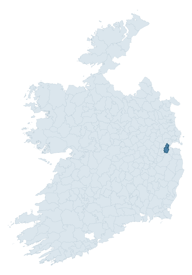
Where this barony sits in the Republic of Ireland
Geology and preservation
Bedrock geology shapes the landscape long before any settlement begins — controlling soil drainage, agricultural potential, the survival of upstanding monuments, and the preservation of buried archaeology. The figures below come from the Geological Survey Ireland 1:100,000 bedrock map.
The bedrock underlying Newcastle is predominantly limestone (61% of the barony by area), laid down during the Carboniferous period (63% by area, around 359 to 299 million years ago). Limestone is the most heritage-rich bedrock in Ireland. It supports fertile, well-drained soils that favoured dense Early Medieval settlement and Norman manorial agriculture, and it weathers into karst features — sinkholes, caves, swallow holes, and souterrains — that frequently carry archaeology. Where peat overlies limestone, organic preservation can be exceptional. The single largest mapped unit is the Lucan Formation (60% of the barony's bedrock). With 7 distinct rock types mapped, the barony sits in the top third of ROI baronies for geological diversity (75th percentile) — typically a sign of complex tectonic history or coastal mosaics of differing rock units.
Rock type composition
Largest mapped unit: Lucan Formation (60% of the barony)
Placename evidence
Logainm records 13 heritage-diagnostic placenames for Newcastle, a modest sample drawn predominantly from the townland record. The dominant stratum is early christian ecclesiastical. The most frequent diagnostic roots are cill- (7) and ráth- (4). With a sample of this size the count should be treated as indicative rather than definitive.
Pre-Christian / Early Medieval Defensive
| Root | Count | Meaning |
|---|---|---|
| ráth- | 4 | earthen ringfort |
Early Christian Ecclesiastical
| Root | Count | Meaning |
|---|---|---|
| cill- | 7 | church (early) |
| tobar- | 1 | holy well |
| gráinseach- | 1 | monastic farm / grange |
Burial, Ritual, and Norse-Contact
| Root | Count | Meaning |
|---|---|---|
| gall- | 1 | foreigner — Norse settlement marker |
Other baronies in Dublin
About this profile
Click any section below to expand.
What is a barony?
A barony is a historic administrative unit in Ireland, broadly equivalent to an English hundred. The 280 baronies used here are from the OSi 2019 National Statutory Boundaries (generalised 20m), covering the 26 counties of the Republic of Ireland. Baronies derive from the Norman period, were formalised in the 17th century, and have not been redrawn for statistical purposes. They vary enormously in area, from compact urban baronies in Dublin to vast upland baronies in Connacht, and should not be compared by raw site count without accounting for area differences.
What counts as a site?
This profile combines three distinct heritage registers, each with its own definition of what constitutes a recordable site:
- Archaeological sites (NMS). The National Monuments Service Sites and Monuments Record (SMR) catalogues every known archaeological monument or site of archaeological interest in the Republic, from prehistoric burial mounds and ringforts to medieval churches and post-medieval defensive works. Inclusion does not require legal protection — only that the site has been identified, surveyed, and assessed as having archaeological value. A separate subset of these sites lies within a recorded protection zone, which gives them statutory protection under the National Monuments Acts.
- Listed buildings (NIAH). The National Inventory of Architectural Heritage records buildings of architectural, historical, archaeological, artistic, cultural, scientific, social, or technical interest. Each surveyed structure is appraised on a five-tier scale: International, National, Regional, Local, and Record-Only. The NIAH appraisal is informational rather than strictly statutory, but it underpins local-authority Record of Protected Structures (RPS) listings.
- Heritage placenames (Logainm). Logainm is the authoritative database of Irish placenames maintained by the Placenames Branch. This profile applies a heritage-diagnostic classifier to the Irish-language form of each townland name, flagging roots that signal defensive sites (ráth-, lios-, dún-, caiseal-, cathair-), ecclesiastical foundations (cill-, teampall-, domhnach-, mainistir-), prehistoric burial-ritual features (tuaim-, carn-, leaba-), or Norse-contact settlement (gall-). Townlands without one of these diagnostic roots are not flagged here — they may still carry historical significance, but that significance is not encoded in the name itself.
Editorial principles
The narrative sections of this profile follow several explicit principles:
- Evidential. Every claim about this barony’s heritage character is anchored in the underlying register data. Where a site count, a placename count, or a percentile rank is cited, it is computed from the source datasets at export time, not estimated.
- Comparative. Counts and metrics are reported alongside their percentile rank against the other 279 ROI baronies. A barony with 50 ringforts in absolute terms could be unusually high or unusually low depending on its size and regional context; percentile ranking removes that ambiguity.
- Transparent on limits. Where a register has known coverage gaps, survey biases, or data-quality issues that affect this barony’s figures, the profile flags them rather than presenting the numbers as definitive.
- No interpretation beyond what the data supports. The narrative does not speculate about historical events, social dynamics, or cultural meaning beyond what the recorded heritage and placename evidence directly attests.
Data caveats and limits
- NMS Sites and Monuments Record is the product of survey campaigns conducted at different intensities across different counties and decades. Some baronies have been surveyed more thoroughly than others, and absolute counts should be read in that light. Sites destroyed by development before survey are typically not represented; sites in heavily forested or upland terrain are sometimes under-recorded.
- NIAH coverage is broadly complete for the Republic of Ireland but the survey was conducted on a rolling county-by-county basis, and the most recent appraisal date varies. Buildings demolished or substantially altered after their original survey may still appear in the register; conversely, recent buildings of merit may not yet have been appraised.
- Logainm classification applies a deliberately conservative pattern-matching approach to the Irish-language townland forms. The classifier prioritises true positives over recall: a townland may carry a heritage signal that the classifier doesn’t recognise, particularly where the diagnostic root has been heavily anglicised or where the townland name draws on a less common term. The 60,000+ townland records and ~9,800 classified placenames give a substantial signal at barony scale, but individual townland names should be checked against Logainm directly for definitive interpretation.
- Period attribution. The chronological distribution reflects only those NMS sites that carry a recognised period attribution in the source data. Sites listed as “Unknown” period are excluded from the dated subset.
- Boundary changes. Some baronies have undergone minor boundary adjustments since their 19th-century definition; the OSi 2019 generalised boundaries used here are the current statutory definition and may differ slightly from historical maps in border areas.
- Bedrock geology is mapped at 1:100,000 scale, which means local variation within a barony — small pockets of different rock type, mineral veins, alluvium overlying bedrock — is generalised. The dominant-system and rocktype figures are area-weighted, so a barony reading “70% Carboniferous limestone” may still contain small but archaeologically important pockets of older or younger rock. Around 3% of GSI polygons do not match the lexicon and contribute no rocktype or system attribution.
Data sources
- National Monuments Service — Sites and Monuments Record (SMR) https://data.gov.ie/dataset/national-monuments-service-archaeological-survey-of-ireland
- National Inventory of Architectural Heritage (NIAH) https://data.gov.ie/dataset/national-inventory-of-architectural-heritage-niah-national-dataset
- Logainm — Placenames Database of Ireland https://www.logainm.ie/
- Ordnance Survey Ireland — National Statutory Barony Boundaries 2019 https://data-osi.opendata.arcgis.com/
- EURODEM — European Digital Elevation Model https://www.mapsforeurope.org/datasets/euro-dem
- ESA WorldCover https://esa-worldcover.org/en
- Geological Survey Ireland — 1:100,000 Bedrock Geology https://www.gsi.ie/en-ie/data-and-maps/Pages/Bedrock.aspx
Explore more: Search any of the 280 ROI baronies, browse by historical province, or read the methodology and data sources for the full Republic of Ireland Heritage Tool.