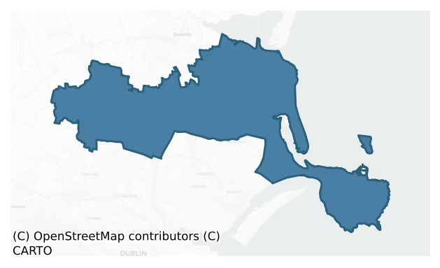
Coolock is a barony of County Dublin, in the historical province of Leinster (Irish: An Chúlóg), covering 71 km² of land. The barony records 254 NMS archaeological sites and 721 NIAH listed buildings, placing it at around the 90th percentile among 280 ROI baronies for sites per km². This means it is in the top tenth of all baronies for sites per km². Dated archaeological evidence runs from the Mesolithic through to the Modern, spanning 9 of 9 archaeological periods, placing the barony in the 89th percentile among 280 ROI baronies for chronological depth. This means it is in the top fifth of all baronies for chronological depth. The largest dated subset of recorded sites dates to the Iron Age. Logainm flags 24 placenames in the barony as carrying a recognised heritage root; the largest share — around 83% — are names associated with early Christian church and monastic foundations.

Heritage at a glance
Percentile rankings throughout this profile compare each barony only against the other 279 Republic of Ireland baronies.
The recorded heritage of Coolock
The National Monuments Service Sites and Monuments Record (SMR) is the statutory inventory of archaeological sites for the Republic of Ireland, maintained by the Department of Tourism, Culture, Arts, Gaeltacht, Sport and Media. Sites recorded here include earthworks, ringforts, megalithic tombs, ecclesiastical remains, and post-medieval features; not every record is legally protected, but each is registered as a monument of archaeological interest.
The National Monuments Service records 254 archaeological sites in Coolock, putting it at the 90th percentile among 280 ROI baronies for sites per km². This means it is in the top tenth of all baronies for sites per km². Protection coverage is near-universal — 232 sites (91%) fall within a recorded monument protection zone, indicating an extensively surveyed landscape. The record is dominated by defensive sites — ringforts, enclosures, hillforts, and stone forts (88 sites, 35% of the total), with ecclesiastical sites forming a substantial secondary presence (44 sites, 17%). The most diagnostically specific type is Ring-ditch (26 records, 10% of the barony's NMS total) — compared to an ROI average of 6% across all baronies where this type occurs. Ring-ditch is a circular ditch under 20m across, often the ploughed-out remains of a barrow, ring-barrow or roundhouse. The broader 'Enclosure' classification — which catches unclassified ringforts and field enclosures — accounts for a further 52 records (20%) and reflects the difficulty of sub-classifying degraded earthworks from surface evidence alone. Across the barony's 71 km², this gives a recorded density of 3.58 sites per km².
Most common monument types
Hover or tap a monument type to see its definition.
| Type | Count |
|---|---|
| Enclosure a banked or ditched feature of uncertain type, used as a catch-all where the original function cannot be determined from surface evidence | 52 |
| Ring-ditch a circular ditch under 20m across, often the ploughed-out remains of a barrow, ring-barrow or roundhouse | 26 |
| Ritual site – holy well a well or spring traditionally associated with a saint, often credited with healing properties; many trace earlier ritual origins but devotion is documented from the medieval period onwards | 13 |
| Church a building used for public Christian worship, of any date from c. 500 AD onwards | 12 |
| Ringfort – unclassified a circular Early Medieval settlement enclosure where surviving evidence does not allow distinction between earthen and stone forms | 11 |
| Earthwork an unclassified earthen structure with no diagnostic features that allow a more specific classification | 9 |
| Graveyard a burial area associated with a church, in use from the medieval period onwards | 9 |
| Field system a group of related fields forming a coherent agricultural landscape, of any date from the Neolithic onwards | 8 |
Chronological distribution
The dated archaeological record for Coolock spans from the Mesolithic through to the Modern, with activity attested across 9 of 9 archaeological periods. This is the 89th percentile across ROI baronies for chronological depth — an above-average span. Every period from earliest to latest is represented in the record — an unbroken sequence of dated activity across the full chronological span. Activity concentrates most heavily in the Iron Age (74 sites, 40% of dated material), with the Medieval forming a secondary peak (38 sites, 20%). A further 68 recorded sites (27% of the overall NMS register for the barony) carry no period attribution — appearing as 'Unknown' in the bar chart below. This typically reflects either records that pre-date the standardised period vocabulary or sites awaiting specialist dating review, rather than a genuine absence of chronological evidence.
Sample of recorded monuments
Show 25 sample monuments (of 254 total)
A representative sample of 25 recorded monuments drawn from the barony’s 254 total NMS entries. Sites within a recorded monument protection zone and rarer site types are prioritised so the list shows a meaningful cross-section rather than only the most common type. Each entry shows the official Sites and Monuments Record reference number and the description published by the National Monuments Service.
Windmill
Located on the summit of Feltrim Hill. According to Flanagan this was erected as a woolen mill after 1667 using Dutch bricks (1984, 52, 59). It was converted to a corn mill in the 19th century. Originally this was of…
Located on the summit of Feltrim Hill. According to Flanagan this was erected as a woolen mill after 1667 using Dutch bricks (1984, 52, 59). It was converted to a corn mill in the 19th century. Originally this was of cylindrical shape and tapers towards the top rising to three-storeys in height. Demolished Oct.23rd 1973 except for the base. Substantial base remains located on a precipice overlooking the quarry. Very overgrown.
Compiled by: Geraldine Stout
Updated by: Christine Baker
Date of upload: 16 January 2015
Crucifixion plaque
Above the door of the chapel (DU014-005002-) is an inscribed limestone tablet with symbols of the passion, a date of 1573 A. D. and initials J. P. M. D. D. S. i. e. John Plunkett, Miles de Dunsoghley, and wife's surname…
Above the door of the chapel (DU014-005002-) is an inscribed limestone tablet with symbols of the passion, a date of 1573 A. D. and initials J. P. M. D. D. S. i. e. John Plunkett, Miles de Dunsoghley, and wife's surname 'Sarsefield'. Verigated.
Compiled by: Geraldine Stout
Updated by: Christine Baker
Date of upload: 22 January 2015
House – 18th/19th century
The medieval manor of Santry which consisted of a hall, chambers, stables a bakery, 200 apple trees, 100 pear trees, 30,000 great ash trees and 1000 large alder trees was originally granted to the de Feypo family but it…
The medieval manor of Santry which consisted of a hall, chambers, stables a bakery, 200 apple trees, 100 pear trees, 30,000 great ash trees and 1000 large alder trees was originally granted to the de Feypo family but it was Barry family that built Santry Court in 1703. The house was ‘a stately mansion of brick, containing many spacious apartments, ornamented with numerous family portraits, a valuable collection of historical and scriptural paintings by the best masters and many items of fine arts’. The demesne covered ‘140 acres laid out in pleasure grounds and richly embellished with trees’.
Sir Charles Compton William Domville embarked on a transformation of Santry Court in 1857. The 130 rooms were redecorated, the gardens and out offices restored, a water supply was laid on to the house from the river and ornamental gas lamps lit the avenue to a replica of the Phoenix monument erected in the grounds. On the night of the 24th October 1941 the house was destroyed by fire. It lay derelict until demolition in 1959. All that remains of the house are the front steps that lead up to a grassed platform where the house used to stand, and a walled garden. Plaster friezes (the imagery based on the Parthenon) are located in the rear of the walls of the entrance piers.
A polished stone axehead was found in Santry Demesne in 1947, indicating prehistoric activity in the vicinity. Archaeological monitoring of a 20ha commercial development within Santry Demesne led to the identific…
Ogham stone
It is alleged that an ogham stone was broken up at St Marnock's Well (DU015-007002-) beside St Marnock's church in 1854 (Ó Danachair 1958, 78). Supposedly thrown into the fill of the well at this time, or used as…
It is alleged that an ogham stone was broken up at St Marnock's Well (DU015-007002-) beside St Marnock's church in 1854 (Ó Danachair 1958, 78). Supposedly thrown into the fill of the well at this time, or used as building material, it was roughly sketched in 1868 by Rev. J. Shearman (Skyvova 2005, 60; Macalister 1945, 20-21, no. 18).
Compiled by: Nora White
Date of upload: 28 June 2016
Wall monument
There is a memorial stone that lies recumbent near the northern wall of the chancel of the chapel behind the railing. Extensively cracked. It reads 'This stone was erected by Oliver Barnewall of Dublin, Marchant. For…
There is a memorial stone that lies recumbent near the northern wall of the chancel of the chapel behind the railing. Extensively cracked. It reads 'This stone was erected by Oliver Barnewall of Dublin, Marchant. For himself and his wife Mary Galtrim and there children One who lies soules. Oure Lord God, Have Mercie Amen. Oliver Barnewall Mar Died the 3 of September 1690'.
Compiled by: Geraldine Stout
Updated by: Christine Baker
Date of upload: 25 January 2015
Tide mill – unclassified
According to Flanagan (1984, 108) there was an early tidal mill at the mouth of the river. From the 12th century the Portmarnock corn mill and surrounding lands were owned by the Abbey of St Mary, Dublin. By 1650 there…
According to Flanagan (1984, 108) there was an early tidal mill at the mouth of the river. From the 12th century the Portmarnock corn mill and surrounding lands were owned by the Abbey of St Mary, Dublin. By 1650 there was only one mill, the tide water mill at Connyborough, situated just east of Portmarnock bridge and connected to the land by a causeway. It is shown on Rocque's map (1760). In 1799 Thomas Dickinson of Drumnigh took a lease of the mill and a year later knocked it down, rebuilding to three storeys. By 1867 the mill was unused as it had no water power. Damaged by a storm in 1903 and unroofed by 1912 it was taken down in the 1940s (Ahern 2013, 207). The remains of the mill comprise the footing of walls, sluice gate, 19th century mill race and fragmentary remains of the walls revetting the mill pond and inlet.
Compiled by: Geraldine Stout
Updated by: Christine Baker
Date of upload: 25 January 2015
Gatehouse
The gate house is located on the north side of a courtyard attached to Howth Castle (DU015-027001-) by a rubble stone bawn wall, c.1525, with round headed integral carriageway, gun loops and crow stepped crenellated…
The gate house is located on the north side of a courtyard attached to Howth Castle (DU015-027001-) by a rubble stone bawn wall, c.1525, with round headed integral carriageway, gun loops and crow stepped crenellated parapet (NIAH). It stands three storeys high with a battlemented parapet and a NE tower which projects above parapet level. Built of randomly coursed rubble with dressed quoins. A studded wooden gate is still present on the E side of the gateway below a round arch formed from sandstone and limestone which alternate to create a banding effect. The gateway has a segmental arched vault running E-W. There are buttresses to first floor level on the E and S sides. Two high vaulted chambers are entered off the N side of entrance passage through round-arched passages. Their interior is lit by single slit opes (L 6.40m, Wth 4.20m). The S side is defended by a musket hole. Entrance to upper floors is through the attached outbuildings in the W.
The NE tower contains a stone spiral staircase which is entered through a square-headed doorway of chamfered limestone. There is a fireplace with plain segmental arch on N side on the first floor. The east window is a double-light with a mullion and transom and cusped ogee-heads and a crack in the base of the window arch. A mural chamber off the first floor is lit by plain rectangular windows. Second floor is entered through a pointed arched doorway of chamfered limestone. The fireplace in the NW corner is a later insertion. Th…
Cist
A cist (L 9m; Wth 0.7m) was exposed during house construction work in 1897 (Shearman 1866-9, 330-32). It was constructed of limestone blocks and was covered by a mound (Westropp 1922, 64). Not visible at ground…
A cist (L 9m; Wth 0.7m) was exposed during house construction work in 1897 (Shearman 1866-9, 330-32). It was constructed of limestone blocks and was covered by a mound (Westropp 1922, 64). Not visible at ground level.
Compiled by: Geraldine Stout
Date of upload: 26 August 2011
House – fortified house
Known as the College of Howth, this is a T-shaped three- storey building of probable late 15th-sixteenth-century date. It fronts onto Abbey Street and is located south of St Mary's Church (DU015-029001-). It's longer…
Known as the College of Howth, this is a T-shaped three- storey building of probable late 15th-sixteenth-century date. It fronts onto Abbey Street and is located south of St Mary's Church (DU015-029001-). It's longer axis runs east-west (int. dims. max. L 16m, max Wth 7m) and there is a small projection in the centre of the east wall which according to Leask (1960, III, 28-30) contained the garderobes. Built of roughly coursed blocks of Howth stone, volcanic type rocks and limestone with dressed limestone used in quoins, windows and doors.
Formerly the E end of the building was divided into two compartments each containing fireplaces in gable walls. An entrance passage divided the west end of building into two compartments. Access was through elliptical arched doorway with chamfered jambs that have been hammer dressed. Ground floor was lit by an elliptical arched window with plain hood moulding. The eastern projection is lit by slit opes. The first floor contains round arched windows formed of chamfered limestone jambs.
A number of archaeological investigations were undertaken prior to its conversion to a domestic house. A survey revealed that the inside had been lowered in modern times, the original ground floor was 1.7m higher than the present floor. It also identified a mortared foundation within the footprint of the building which was suggestive of an earlier structure or a cellar (Simpson, L. 2006, 161). Hand excavation (Licence no. 03E1804) of four pits (aver…
Megalithic tomb – portal tomb
The tomb is ituated by a pathway under tree cover at the edge of Deer Park golf course at the foot of Muck Rock on the north side of Howth Head. There is an entrance in SE to a single chamber (L 2.6m; Wth 1.1m). This is…
The tomb is ituated by a pathway under tree cover at the edge of Deer Park golf course at the foot of Muck Rock on the north side of Howth Head. There is an entrance in SE to a single chamber (L 2.6m; Wth 1.1m). This is indicated by two portals (H 2.75m and 2.45m respectively). The doorstone has partially collapsed into the chamber. The large roofstone (L 5.2m; Wth 4.2m; D 1.9m) still rests on the upper edge of the portals above the collapsed chamber (Borlase 1897, 2, 376-9; Ó Nualláin 1983, 82, 96).
Compiled by: Geraldine Stout
Updated by: Christine Baker
Date of upload: 27 January 2015
Rabbit warren
The Civil survey (1654-6) mentions a small warren at Baldoyle (Simington 1654-6, 174). There is a field called 'Burrrow Field' on the 1979 edition of the OS 6-inch map, near the coast at the south-eastern corner of the…
The Civil survey (1654-6) mentions a small warren at Baldoyle (Simington 1654-6, 174). There is a field called 'Burrrow Field' on the 1979 edition of the OS 6-inch map, near the coast at the south-eastern corner of the townland which may be the site.
Compiled by: Geraldine Stout
Date of upload: 26 August 2011
Castle – motte
In 1775 Gabriel Beranger made a sketch showing a large flat- topped mound with an outer ring and a fosse (Harbison 1992, 24-5). Thought by Westropp (1922, 63-4) to be the mote-castle of Almoric, founder of the family…
In 1775 Gabriel Beranger made a sketch showing a large flat- topped mound with an outer ring and a fosse (Harbison 1992, 24-5). Thought by Westropp (1922, 63-4) to be the mote-castle of Almoric, founder of the family line of Howth. All that remains is the flat natural spur on which a martello tower stands (DU016-020002-).
Compiled by: Geraldine Stout
Updated by: Christine Baker
Date of upload: 29 January 2015
Hilltop enclosure
The natural knoll known as 'Dung Hill' is a regular oval platform (L 41m, Wth 30m) defined by a steep, exposed rock scarp. It occupies an imposing position with dramatic views onto Howth harbour and Dublin Bay.…
The natural knoll known as 'Dung Hill' is a regular oval platform (L 41m, Wth 30m) defined by a steep, exposed rock scarp. It occupies an imposing position with dramatic views onto Howth harbour and Dublin Bay. According to Westropp there had been evidence for revetment and dry-stone walling around the knoll in the late 19th-century (1922, 58-59). The headland was subject to gorse fire over the summer of 2013 revealing field walls to the SW and possible cairn material or collapsed revetment to the W. There is a cairn in the NW end of the monument (DU019-004001-).
Compiled by: Geraldine Stout
Updated by: Christine Baker
Date of upload: 29 January 2015
Barrow – mound barrow
Located at the NW end of a natural knoll known as 'Dun Hill' which has been enclosed in antiquity (DU019-004002-). A later cairn was apparently built on top of a low earthen mound thought by Westropp (1922, 58-9) to be…
Located at the NW end of a natural knoll known as 'Dun Hill' which has been enclosed in antiquity (DU019-004002-). A later cairn was apparently built on top of a low earthen mound thought by Westropp (1922, 58-9) to be a barrow.
Compiled by: Geraldine Stout
Updated by: Christine Baker
Date of upload: 29 January 2015
Standing stone
A standing stone was identified on the Fás Finglas Heritage Project in 1988/89(pers.comm. Marcus Nolan). Supposedly located in a field on a turn of bend across from Dunsoghley Castle ((DU014-005001-), a neglected field…
A standing stone was identified on the Fás Finglas Heritage Project in 1988/89(pers.comm. Marcus Nolan). Supposedly located in a field on a turn of bend across from Dunsoghley Castle ((DU014-005001-), a neglected field adjacent to an old farmyard which is being currently used as a garage. The site is completely overgrown with evidence of dumped material. No local knowledge of a stone.
Compiled by: Geraldine Stout
Updated by: Christine Baker
Date of upload: 23 January 2015
Armorial plaque (present location)
An armorial plaque (DU019-001002-) was originally set into an external wall of Watermill cottage (DU019-001001-). The armorial plaque is now concreted into the northern façade of the stable block above an entranceway at…
An armorial plaque (DU019-001002-) was originally set into an external wall of Watermill cottage (DU019-001001-). The armorial plaque is now concreted into the northern façade of the stable block above an entranceway at Howth Castle. It shows the arms of the St. Lawrence family, Howth, 20th Baron of Howth and wife Elizabeth (Plunkett), the initials C.S. and E.P. and a date 1572 (Bowen 1963, 75-76).
Compiled by: Geraldine Stout
Updated by: Christine Baker
Date of upload: 26 January 2015
House – medieval
The remains of this medieval house were discovered in the course of excavations undertaken in 1992 (license no. 92E0010; Hayden 1993). The building proved to be of 13th- or 14th-century date and measured 8.6m east-west…
The remains of this medieval house were discovered in the course of excavations undertaken in 1992 (license no. 92E0010; Hayden 1993). The building proved to be of 13th- or 14th-century date and measured 8.6m east-west by 4m north-south internally and had walls up to 0.95m in thickness, standing to a maximum height of 0.60m. The building is likely to have had more than one storey judging from the stoutness of the walls and the entrance was situated at its east end. Three floor levels were uncovered in the interior and took the form of mortar or clay floors with associated occupation deposits. Initially the ground floor may have been a single room but during a second phase, when the second floor level was laid, it was divided into two rooms by a stone footing presumably carrying a wooden superstructure. The building was set in a trench partly cut into the rising ground below the cliff to the south and water seeping down the cliff face appears to have been a problem. This was alleviated by the construction of underfoot drains and a sump at the second level. The building appears to have gone out of use and been demolished by the 15th or 16th century possibly as a result of the area being inundated by the sea when large sand banks were laid down (Hayden 1993).
Compiled by: Paul Walsh
Date of upload: 23 June 2015
Metalworking site
A residential development has been completed where the monument stood. Nothing remains. Entirely removed by excavation under licence 16E0613 in advance of development. The results of this excavation were summarised by…
A residential development has been completed where the monument stood. Nothing remains. Entirely removed by excavation under licence 16E0613 in advance of development. The results of this excavation were summarised by Gill McLoughlin as follows; 'The excavation comprised the remains of a large sub‐surface ditched enclosure (DU015‐014001-) adjacent to the upstanding Portmarnock mound (DU015‐014—-), east of the railway line at Portmarnock and south of Station Road. The archaeological excavation took place over fourteen weeks from the 9th January 2017 with a team of ten archaeologists and six general operatives. Excavation at the site followed previous archaeological monitoring and excavation in relation to Phase 1A of a permitted development immediately to the west of the enclosure site (Planning Ref. F13A/0248). The excavation that is the subject of this report is referred to as Phase 1B (Area 3). During the phase 1A archaeological investigations targeted testing was carried out on the phase 1B enclosure to confirm its existence and its nature and extent. The enclosure was slightly elliptical or sub‐circular in plan and measured a maximum external diameter of 77m east‐west x 70m north‐south (68m east‐west x 60m north‐south internal diameter), with an entrance to the east.
Smithing heath C138 – C138 was a small pit located in the south of the enclosure, c.6m north‐east of burial C151 [DU015-014003-]. It was roughly circular in plan and measured 0.82m by 0.78 and was…
Architectural fragment
The apex on the exterior of the S door of the church (DU012-031001-) contains a carving of a 'mitred head'.
Compiled by: Geraldine Stout
Updated by: Christine Baker
Date of upload: 16 January 2015
Tomb – effigial
15th-century effigial tomb described in 1904 as; 'the tomb of "The Maid of Malahide,"' whose sorrows Gerald Griffin has immortalised in "The Joybells are ringing in fair Malahide." It is situated in the nave, and is…
15th-century effigial tomb described in 1904 as; 'the tomb of "The Maid of Malahide,"' whose sorrows Gerald Griffin has immortalised in "The Joybells are ringing in fair Malahide." It is situated in the nave, and is railed round. I think that it is made of limestone. It has a shield on each side, supported by three angels in a circle. It is an altar-tomb, relieved only by a square moulding. On top, in high relief, is sculptured the fair Maud Plunkett. A horned cap adorns her head, which lies on a quaint pillow; her hands are folded praying, and she is clothed in a plain-looking dress with many folds, over a trailing skirt of similar appearance. Her feet rest on a cushion. The features are quite worn away, and the neck is much mutilated. The coats-of-arms are more modern. 'On the east end of the tomb is a shield bearing the emblems of the Crucifixion, viz. :—cross (forming the division line). On sinister side, pincers, ladder, scourge, and crown of thorns. On dexter side, three nails, seamless robe (remarkably like the Holy Coat of Treves) and spear. On West end, a heart pierced by two swords, hilts from base. On the north side, the shield bears a bendlet-couped meeting a pallet-couped. In dexter-chief is a castle. In sinister, nine little squares — I know not what to call them. On the south side, in dexter, a lion rampant ; in sinister chief, a castle, and a bend sinister couped' (Fowler 1906, 272-3).
Effigial tomb of Maud Plunket described by Hunt (1974, 146-7) as…
Prehistoric site – lithic scatter
A major assemblage of flint artifacts and a stone axe found during systematic field collecting and excavation on Paddy's Hill in the early 1980s. A total of 2, 809 artifacts were classified from the site (Keeley…
A major assemblage of flint artifacts and a stone axe found during systematic field collecting and excavation on Paddy's Hill in the early 1980s. A total of 2, 809 artifacts were classified from the site (Keeley 1989-90, 65-80, Keeling and Keeley 1994, 1-24). These included cores, blades, arrowheads and scrapers. They range in date from the Neolithic to the Early Bronze Age, the most frequently occurring finds being Neolithic in date (Flanagan 1984, 12-18). The only structural evidence was two pits, the contents of which, produced dates of 4120+70 cal. BC and 4040+70 cal. BC.
Compiled by: Geraldine Stout
Date of upload: 26 August 2011
House – indeterminate date
East of Dunsoghly castle (DU014-005001-) two square trenched areas are visible on an aerial photograph (CUCAP AID57). The site has been partially built on since the photographs were taken. The general area is disturbed.…
East of Dunsoghly castle (DU014-005001-) two square trenched areas are visible on an aerial photograph (CUCAP AID57). The site has been partially built on since the photographs were taken. The general area is disturbed. Not visible at ground level.
Compiled by: Geraldine Stout
Date of upload: 26 August 2011
House – indeterminate date
According to Adams (1881, 492) Dubber House was built out of the ruins of Dubber castle.
Compiled by: Geraldine Stout
Updated by: Christine Baker
Date of upload: 22 January 2015
Inn
The OS 6-inch map shows the Old Red Lion. It is mentioned in the Finglas, County Dublin, Vestry Books for the year 1675 (1916, 33). Site within overgrown uneven pasture beside road. No visible remains.
Compiled by:…
The OS 6-inch map shows the Old Red Lion. It is mentioned in the Finglas, County Dublin, Vestry Books for the year 1675 (1916, 33). Site within overgrown uneven pasture beside road. No visible remains.
Compiled by: Geraldine Stout
Updated by: Christine Baker
Date of upload: 23 January 2015
Enclosure
Situated on a slight rise in a large open field of tillage. An oval-shaped, single-ditched enclosure (max. dims. L 33m; Wth. 30m ) appears as a cropmark on a Cambridge aerial photograph (CUCAP, BGM 68). Visible on Bing…
Situated on a slight rise in a large open field of tillage. An oval-shaped, single-ditched enclosure (max. dims. L 33m; Wth. 30m ) appears as a cropmark on a Cambridge aerial photograph (CUCAP, BGM 68). Visible on Bing (Viewed 22 January 2015). Entrance to the east. Not visible at ground level.
Compiled by: Geraldine Stout
Updated by: Christine Baker
Date of upload: 22 January 2015
Listed buildings
The National Inventory of Architectural Heritage (NIAH) is a state survey appraising buildings of architectural, historical, archaeological, artistic, cultural, scientific, social, or technical interest. Each surveyed structure receives a rating from International (the highest, for buildings of European importance) through National, Regional, Local, and Record-Only.
The National Inventory of Architectural Heritage records 721 listed buildings in Coolock, placing it in the top 2% of ROI baronies for listed-building density. This includes 2 structures of International significance and 37 of National significance — buildings of the highest architectural and historic interest. The Republic holds 13 International-graded and 937 National-graded buildings in total, so this barony accounts for around 4% of the highest-tier national stock. Construction dates concentrate most heavily in the Victorian (1830-1900) period. The most-recorded building type is house (281 examples, 39% of the listed stock).
Terrain and environment
Mean elevation across the barony is 42m — the 11th percentile among 280 ROI baronies for elevation. This means it is in the bottom fifth of all baronies for elevation. This is a relatively low-lying landscape by ROI standards. Elevation matters for heritage because higher-altitude baronies typically favour defensive monuments — ringforts and hilltop forts placed on prominent ground — while lowland baronies are more likely to carry the dense settlement and church networks of intensive agricultural landscapes. A maximum elevation of 167m gives the barony meaningful vertical relief. Mean slope is 3.1° — the 38th percentile among 280 ROI baronies for slope. This means it is in the lower half of all baronies for slope. Slope is a key control on both land use and archaeological preservation: steep ground resists ploughing and tends to preserve earthworks intact, while gentle slopes favour intensive cultivation that damages or destroys surface archaeology over time. The Topographic Wetness Index averages 11.3, the 66th percentile among 280 ROI baronies for wetness. This means it is in the upper half of all baronies for wetness. Drainage matters for heritage because poorly-drained ground preserves organic archaeology (wooden trackways, leather, textiles, and on rare occasions human remains) far better than free-draining soil; well-drained ground favours arable use but destroys organic material rapidly. Urban land covers 23% of the barony (the 97th percentile among 280 ROI baronies for urban cover. This means it is in the top tenth of all baronies for urban cover). Heavy urban coverage compresses heritage analysis: many archaeological features have been buried or destroyed by development, but the surviving record is concentrated in protected city-centre cores, and the NIAH listed-buildings count is typically high. The land-cover mosaic combines improved grassland (42%), urban land (23%), and woodland (18%), giving a mixed agricultural and semi-natural landscape.
Terrain measurements
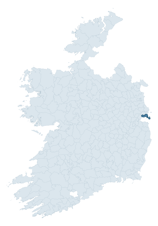
Where this barony sits in the Republic of Ireland
Geology and preservation
Bedrock geology shapes the landscape long before any settlement begins — controlling soil drainage, agricultural potential, the survival of upstanding monuments, and the preservation of buried archaeology. The figures below come from the Geological Survey Ireland 1:100,000 bedrock map.
The bedrock underlying Coolock is predominantly limestone (54% of the barony by area), laid down during the Carboniferous period (89% by area, around 359 to 299 million years ago). Limestone is the most heritage-rich bedrock in Ireland. It supports fertile, well-drained soils that favoured dense Early Medieval settlement and Norman manorial agriculture, and it weathers into karst features — sinkholes, caves, swallow holes, and souterrains — that frequently carry archaeology. Where peat overlies limestone, organic preservation can be exceptional. A substantial secondary geology of calcareous shale (35%) adds further variety to the underlying landscape. The single largest mapped unit is the Malahide Formation (36% of the barony's bedrock).
Rock type composition
Largest mapped unit: Malahide Formation (36% of the barony)
Placename evidence
Logainm records 24 heritage-diagnostic placenames for Coolock, drawn from townland and civil-parish names across the barony. The dominant stratum is Early Christian ecclesiastical — cill-, teampall-, and domhnach-prefixed names that record the dense network of early church foundations established between the fifth and tenth centuries. The leading diagnostic roots are cill- (11 — church), gráinseach- (5 — grange), and ráth- (2 — earthen ringfort). This is broadly in line with the ROI average of 30.7 heritage placenames per barony. Logainm records 149 placenames for Coolock (predominantly townland names). Of these, 24 (16%) carry one of the diagnostic Gaelic roots tracked above; the remainder draw on more generic landscape vocabulary that does not encode a heritage period.
Pre-Christian / Early Medieval Defensive
| Root | Count | Meaning |
|---|---|---|
| ráth- | 2 | earthen ringfort |
| dún- | 2 | hilltop or promontory fort |
Early Christian Ecclesiastical
| Root | Count | Meaning |
|---|---|---|
| cill- | 11 | church (early) |
| gráinseach- | 5 | monastic farm / grange |
| teampall- | 2 | church (later medieval) |
| domhnach- | 1 | pre-Patrician or earliest Patrician church |
| tobar- | 1 | holy well |
Other baronies in Dublin
About this profile
Click any section below to expand.
What is a barony?
A barony is a historic administrative unit in Ireland, broadly equivalent to an English hundred. The 280 baronies used here are from the OSi 2019 National Statutory Boundaries (generalised 20m), covering the 26 counties of the Republic of Ireland. Baronies derive from the Norman period, were formalised in the 17th century, and have not been redrawn for statistical purposes. They vary enormously in area, from compact urban baronies in Dublin to vast upland baronies in Connacht, and should not be compared by raw site count without accounting for area differences.
What counts as a site?
This profile combines three distinct heritage registers, each with its own definition of what constitutes a recordable site:
- Archaeological sites (NMS). The National Monuments Service Sites and Monuments Record (SMR) catalogues every known archaeological monument or site of archaeological interest in the Republic, from prehistoric burial mounds and ringforts to medieval churches and post-medieval defensive works. Inclusion does not require legal protection — only that the site has been identified, surveyed, and assessed as having archaeological value. A separate subset of these sites lies within a recorded protection zone, which gives them statutory protection under the National Monuments Acts.
- Listed buildings (NIAH). The National Inventory of Architectural Heritage records buildings of architectural, historical, archaeological, artistic, cultural, scientific, social, or technical interest. Each surveyed structure is appraised on a five-tier scale: International, National, Regional, Local, and Record-Only. The NIAH appraisal is informational rather than strictly statutory, but it underpins local-authority Record of Protected Structures (RPS) listings.
- Heritage placenames (Logainm). Logainm is the authoritative database of Irish placenames maintained by the Placenames Branch. This profile applies a heritage-diagnostic classifier to the Irish-language form of each townland name, flagging roots that signal defensive sites (ráth-, lios-, dún-, caiseal-, cathair-), ecclesiastical foundations (cill-, teampall-, domhnach-, mainistir-), prehistoric burial-ritual features (tuaim-, carn-, leaba-), or Norse-contact settlement (gall-). Townlands without one of these diagnostic roots are not flagged here — they may still carry historical significance, but that significance is not encoded in the name itself.
Editorial principles
The narrative sections of this profile follow several explicit principles:
- Evidential. Every claim about this barony’s heritage character is anchored in the underlying register data. Where a site count, a placename count, or a percentile rank is cited, it is computed from the source datasets at export time, not estimated.
- Comparative. Counts and metrics are reported alongside their percentile rank against the other 279 ROI baronies. A barony with 50 ringforts in absolute terms could be unusually high or unusually low depending on its size and regional context; percentile ranking removes that ambiguity.
- Transparent on limits. Where a register has known coverage gaps, survey biases, or data-quality issues that affect this barony’s figures, the profile flags them rather than presenting the numbers as definitive.
- No interpretation beyond what the data supports. The narrative does not speculate about historical events, social dynamics, or cultural meaning beyond what the recorded heritage and placename evidence directly attests.
Data caveats and limits
- NMS Sites and Monuments Record is the product of survey campaigns conducted at different intensities across different counties and decades. Some baronies have been surveyed more thoroughly than others, and absolute counts should be read in that light. Sites destroyed by development before survey are typically not represented; sites in heavily forested or upland terrain are sometimes under-recorded.
- NIAH coverage is broadly complete for the Republic of Ireland but the survey was conducted on a rolling county-by-county basis, and the most recent appraisal date varies. Buildings demolished or substantially altered after their original survey may still appear in the register; conversely, recent buildings of merit may not yet have been appraised.
- Logainm classification applies a deliberately conservative pattern-matching approach to the Irish-language townland forms. The classifier prioritises true positives over recall: a townland may carry a heritage signal that the classifier doesn’t recognise, particularly where the diagnostic root has been heavily anglicised or where the townland name draws on a less common term. The 60,000+ townland records and ~9,800 classified placenames give a substantial signal at barony scale, but individual townland names should be checked against Logainm directly for definitive interpretation.
- Period attribution. The chronological distribution reflects only those NMS sites that carry a recognised period attribution in the source data. Sites listed as “Unknown” period are excluded from the dated subset.
- Boundary changes. Some baronies have undergone minor boundary adjustments since their 19th-century definition; the OSi 2019 generalised boundaries used here are the current statutory definition and may differ slightly from historical maps in border areas.
- Bedrock geology is mapped at 1:100,000 scale, which means local variation within a barony — small pockets of different rock type, mineral veins, alluvium overlying bedrock — is generalised. The dominant-system and rocktype figures are area-weighted, so a barony reading “70% Carboniferous limestone” may still contain small but archaeologically important pockets of older or younger rock. Around 3% of GSI polygons do not match the lexicon and contribute no rocktype or system attribution.
Data sources
- National Monuments Service — Sites and Monuments Record (SMR) https://data.gov.ie/dataset/national-monuments-service-archaeological-survey-of-ireland
- National Inventory of Architectural Heritage (NIAH) https://data.gov.ie/dataset/national-inventory-of-architectural-heritage-niah-national-dataset
- Logainm — Placenames Database of Ireland https://www.logainm.ie/
- Ordnance Survey Ireland — National Statutory Barony Boundaries 2019 https://data-osi.opendata.arcgis.com/
- EURODEM — European Digital Elevation Model https://www.mapsforeurope.org/datasets/euro-dem
- ESA WorldCover https://esa-worldcover.org/en
- Geological Survey Ireland — 1:100,000 Bedrock Geology https://www.gsi.ie/en-ie/data-and-maps/Pages/Bedrock.aspx
Explore more: Search any of the 280 ROI baronies, browse by historical province, or read the methodology and data sources for the full Republic of Ireland Heritage Tool.