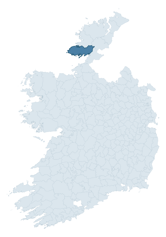
Banagh is a barony of County Donegal, in the historical province of Ulster (Irish: Báinigh), covering 723 km² of land. The barony records 633 NMS archaeological sites and 285 NIAH listed buildings, placing it at around the 7th percentile among 280 ROI baronies for sites per km². This means it is in the bottom tenth of all baronies for sites per km². Dated archaeological evidence runs from the Mesolithic through to the Modern, spanning 9 of 9 archaeological periods, placing the barony in the 93rd percentile among 280 ROI baronies for chronological depth. This means it is in the top tenth of all baronies for chronological depth. The largest dated subset of recorded sites dates to the Early Medieval. Logainm flags 50 placenames in the barony as carrying a recognised heritage root; the largest share — around 46% — are names associated with early Christian church and monastic foundations.
Heritage at a glance
Percentile rankings throughout this profile compare each barony only against the other 279 Republic of Ireland baronies.
The recorded heritage of Banagh
The National Monuments Service Sites and Monuments Record (SMR) is the statutory inventory of archaeological sites for the Republic of Ireland, maintained by the Department of Tourism, Culture, Arts, Gaeltacht, Sport and Media. Sites recorded here include earthworks, ringforts, megalithic tombs, ecclesiastical remains, and post-medieval features; not every record is legally protected, but each is registered as a monument of archaeological interest.
The National Monuments Service records 633 archaeological sites in Banagh, putting it at the 7th percentile among 280 ROI baronies for sites per km². This means it is in the bottom tenth of all baronies for sites per km². A sparse recorded total of this kind in Ireland often reflects survey priority rather than genuine absence of past activity. Protection coverage is near-universal — 596 sites (94%) fall within a recorded monument protection zone, indicating an extensively surveyed landscape. The record is dominated by defensive sites — ringforts, enclosures, hillforts, and stone forts (156 sites, 25% of the total), with ecclesiastical sites forming a substantial secondary presence (136 sites, 21%). Hut site is the most prevalent type, making up 11% of the barony's recorded sites (71 records) — well above the ROI average of 5% across all baronies where this type occurs. Hut site is a low stone or earthen foundation enclosing a small circular or oval area, generally interpreted as a former dwelling, of any date from prehistory to the medieval period. Other significant types include Enclosure (47) and Ringfort – rath (44). Enclosure is a banked or ditched feature of uncertain type, used as a catch-all where the original function cannot be determined from surface evidence; Ringfort – rath is an earthen ringfort enclosed by a bank and external ditch — the most common Early Medieval farmstead, broadly dated 500–1000 AD. Across the barony's 723 km², this gives a recorded density of 0.88 sites per km².
Most common monument types
Hover or tap a monument type to see its definition.
| Type | Count |
|---|---|
| Hut site a low stone or earthen foundation enclosing a small circular or oval area, generally interpreted as a former dwelling, of any date from prehistory to the medieval period | 71 |
| Enclosure a banked or ditched feature of uncertain type, used as a catch-all where the original function cannot be determined from surface evidence | 47 |
| Ringfort – rath an earthen ringfort enclosed by a bank and external ditch — the most common Early Medieval farmstead, broadly dated 500–1000 AD | 44 |
| Cross-slab a stone slab inscribed with a cross, used as a grave-marker or memorial, dated pre-1200 AD | 38 |
| Ritual site – holy well a well or spring traditionally associated with a saint, often credited with healing properties; many trace earlier ritual origins but devotion is documented from the medieval period onwards | 34 |
| Ringfort – cashel the stone-walled equivalent of the rath, found mainly in upland or western areas, broadly dated 500–1000 AD | 34 |
| Cairn – unclassified a stone mound that cannot be assigned to a specific cairn type | 28 |
| Bullaun stone a boulder or rock outcrop with hemispherical hollows ('bulláin'), commonly associated with ecclesiastical sites and holy wells | 20 |
Chronological distribution
The dated archaeological record for Banagh spans from the Mesolithic through to the Modern, with activity attested across 9 of 9 archaeological periods. This places Banagh in the top 7% of ROI baronies for chronological depth — few baronies record evidence across as many distinct archaeological periods. Every period from earliest to latest is represented in the record — an unbroken sequence of dated activity across the full chronological span. Activity concentrates most heavily in the Early Medieval (191 sites, 41% of dated material), with the Iron Age forming a secondary peak (99 sites, 21%). A further 170 recorded sites (27% of the overall NMS register for the barony) carry no period attribution — appearing as 'Unknown' in the bar chart below. This typically reflects either records that pre-date the standardised period vocabulary or sites awaiting specialist dating review, rather than a genuine absence of chronological evidence.
Sample of recorded monuments
Show 25 sample monuments (of 633 total)
A representative sample of 25 recorded monuments drawn from the barony’s 633 total NMS entries. Sites within a recorded monument protection zone and rarer site types are prioritised so the list shows a meaningful cross-section rather than only the most common type. Each entry shows the official Sites and Monuments Record reference number and the description published by the National Monuments Service.
Stone head
Church of Ireland church that was built in 1830. Inside the church there is a carved head which would appear to be of an ecclesiastic, probably a bishop. The face of the head is carved but the rear is unworked, it would…
Church of Ireland church that was built in 1830. Inside the church there is a carved head which would appear to be of an ecclesiastic, probably a bishop. The face of the head is carved but the rear is unworked, it would appear that the whole was intended to be set in a wall. Beneath the head are the remains of a moulded window, top or could have been top of a tomb or wall niche. The rector of the church told us that the tradition is that the head is that of Captain Mard, the beneficiary of Killynard Church, and perhaps that a second head, depicting his wife also existed at one time, perhaps up to the 1940's. These two heads stood on the gateposts of Killynard old church and graveyard (Donegal Archaeological Survey).
Date of revision : 17 May 2009
Caimin O'Brien
Historic town
Described in the Urban Survey of Donegal as 'Killybegs lies at the head of the fine natural harbour to which it gives its name. The placename is normally spelled as Cealebeg or Cellebeg in documents of the sixteenth and…
Described in the Urban Survey of Donegal as 'Killybegs lies at the head of the fine natural harbour to which it gives its name. The placename is normally spelled as Cealebeg or Cellebeg in documents of the sixteenth and seventeenth century and is normally translated as "little churches" (Bradley & Dunne 1989, 40). During the middle ages Killybegs appears to have belonged to the bishops of Raphoe and they it was who built a castle overlooking the harbour in the fourteenth century. The date of the initial settlement at Killybegs is not known but there are indications that by the end of the sixteenth century there was a small fishing village there. Like Ballyshannon, Killybegs rose to prominence in the later middle ages because of its potential importance as a sea port. The first cargo of Spanish arms to reach Ireland was landed here in 1596 and four years later, in 1600, another Spanish ship landed with 2000 calivers and 2000 pikes together with Mathias de Oviedo, the titular archbishop of Dublin, who promised the arrival of a Spanish army of liberation to O'Donnell and O'Neill. This army, when it arrived, landed not at Killybegs but at Kinsale. Nonetheless these references indicate the strategic significance of Killybegs and explain why the english government selected it as one of the seven potential boroughs which they proposed to erect in Donegal in 1609. Initially the proposed boroughs were to have forty burgesses but by 1611 when Sir Henry Foliot was required to set out…
Graveslab (present location)
Medieval coffin-shaped graveslab known locally as the 'McSyne Grave Slab'. Originally located at the Franciscan friary in Ballysaggart (DG098-031001-) but now located in a glass display case outside St. Mary's R.C.…
Medieval coffin-shaped graveslab known locally as the 'McSyne Grave Slab'. Originally located at the Franciscan friary in Ballysaggart (DG098-031001-) but now located in a glass display case outside St. Mary's R.C. Church in Killybegs. Described in the Urban Survey as 'Tombslab. 16th cent. St Catherine's RC Church. Alleged to be the tomb of Niall Mor MacSweeney (Bradley & Dunne 1989, 44). Set against the exterior face of the W gable of St. Catherines Catholic church in Killybegs is a medieval tomb-slab (DG098-031003-). It was brought to Killybegs from Fan an Chartha friary on St John's Point in 1868 (Patterson 1872, 129). The trapezoidal sandstone slab measures 1.98m by.72m tapering to .46m. The sides are bevelled and, the surface of the slab is divided into nine panels by one vertical and four horizontal broad bands of ribbon interlacing; all carving is in shallow false relief, some of which is now very weathered. Left hand side: The uppermost panel contains a figure, helmeted and plumed, holding a battle axe in his right hand and a sword hanging by his left side. He is wearing a cowl and jack (or coat of mail?) which comes to the knee and is belted at the waist; undoubtedly the representation of a gallowglass (See Hayes-McCoy 1937, 104-6). The left arm is not depicted and the protrusion at shoulder level is merely an extension of the weathered band of interlace. Diagonally above and below the gallowglass are two very weathered animal like figures. The second panel cont…
Architectural fragment
Fan an Charta Friary, a Franciscan Third Order Regular friary, was founded by MacSwiney Banagh, probably in the second half of the 15th century; the community was driven out soon after the Irish defeat at Kinsale in…
Fan an Charta Friary, a Franciscan Third Order Regular friary, was founded by MacSwiney Banagh, probably in the second half of the 15th century; the community was driven out soon after the Irish defeat at Kinsale in 1601 (Gwynn and Hadcock 1970, 269).
The surviving church ruins (DG098-031001-) stand beside the shore on the E side of St. John's Point. In 1907, the W gable fell and there was a large gap below the E window (Bigger 1908, 6-7). About 30 years ago the latter was built up and the interior and exterior faces of the S and E walls repointed. The shaft and capital from the E side were removed in 1868, to St. Catherine's Catholic Church in Killybegs and are built into the pier of a garden gate opposite the W gable of the Church.
Settlement deserted – medieval
The Archaeological Survey of Ireland (ASI) is in the process of providing information on all monuments on The Historic Environment Viewer (HEV). Currently the information for this record has not been uploaded. To…
The Archaeological Survey of Ireland (ASI) is in the process of providing information on all monuments on The Historic Environment Viewer (HEV). Currently the information for this record has not been uploaded. To access available information for research purposes please make an appointment in advance with the Archive Unit (open Fridays 10.00 am – 5.00 pm), Department of Culture, Heritage and the Gaeltacht, The Custom House, Dublin 1 D01W6XO or email nmarchive@chg.gov.ie.
Cairn – burial cairn
Situated atop high ground on a ridge on the S tip of St. John's Point with good views in all directions. A flat topped steep sided cairn (top diam. 12m; base diam. 28.1m) which has a World War II look-out post built on…
Situated atop high ground on a ridge on the S tip of St. John's Point with good views in all directions. A flat topped steep sided cairn (top diam. 12m; base diam. 28.1m) which has a World War II look-out post built on top of the cairn which has resulted in the levelling and partial removal of some cairn material from the top of the monument. The remains of a small rectangular platform at the base of the cairn on the SE side of the monument was probably built as a base for the support of a flagstaff for the look out tower. (Lacy et al. 1983, 151, no. 901)
The look-out post is one of 83 such structures erected at strategic locations around the coast of Ireland between 1939 and 1942 in response to the need to protect the neutrality that the government had declared in September 1939. These posts were manned by soldiers and the institution they formed was called the Marine and Coastwatching Service (established in 1939). Each post was built on site to an identical design from 137 pre-cast blocks. The Coastwatchers were responsible for identifying and reporting on shipping or aircraft movements and on any communications or movements between ship and shore. Coastwatchers worked around the clock 24 hours in groups of two on eight or twelve hour shifts. One man remained inside the post operating the phone, the other patrolled outside. They had to report every military activity the observed in the sea and air in the vicinity of thei post. The service was disbanded in October 194…
Standing stone – pair
Two standing stones. Stone A is 2.3m in height c. 0.6m in width orientated roughly ENE-WSW. Stone B (DG098-015002-) is orientated ESE-WNW. Stone B is 1.86m in height and is .17m in width, it is orientated ESE-WNW. …
Two standing stones. Stone A is 2.3m in height c. 0.6m in width orientated roughly ENE-WSW. Stone B (DG098-015002-) is orientated ESE-WNW. Stone B is 1.86m in height and is .17m in width, it is orientated ESE-WNW. They are located in fairly good pasture.
The above description was derived from the 'Archaeological Survey of County Donegal. A description of the field antiquities of the County from the Mesolithic Period to the 17th century.' Compiled by: Brian Lacey with Eamon Cody, Claire Cotter, Judy Cuppage, Noel Dunne, Vincent Hurley, Celie O'Rahilly, Paul Walsh and Seán Ó Nualláin (Lifford: Donegal County Council, 1983). In certain instances the entries have been revised and updated.
Date of upload/revision: 03 August 2012
Religious house – Franciscan Third Order Regular
Fan an Charta Friary, a Franciscan Third Order Regular friary, was founded by MacSwiney Banagh, probably in the second half of the 15th century; the community was driven out soon after the Irish defeat at Kinsale in…
Fan an Charta Friary, a Franciscan Third Order Regular friary, was founded by MacSwiney Banagh, probably in the second half of the 15th century; the community was driven out soon after the Irish defeat at Kinsale in 1601 (Gwynn and Hadcock 1970, 269).
The surviving church ruins stand beside the shore on the E side of St. John's Point. The remains are in a parlous condition. In 1907, the W gable fell and there was a large gap below the E window (Bigger 1908, 6-7). About 30 years ago the latter was built up and the interior and exterior faces of the S and E walls repointed. The church consists of nave and chancel without structural division, 20.25m by 6.20m internally, and is built of roughly coursed rubble and split stone. The E gable, almost at full height, has the remains of a two-light, pointed window with chamfered hood-mould and splayed ingoings. Though mullion and switch-line bars are missing the remaining tracery indicates a vesica-shaped centrepiece with ogee-pointed bottom, above the pointed lights. The upper voussoirs of the double-chamfered rear-arch have fallen away. The sill and the wall below it are modern. Piercing the base of the wall beneath the window is a small rectangular drain-like feature which may have been inserted when the wall was rebuilt. A small corbel-like stone, 30cms square and of unknown function, projects from the interior face, 60cms above present ground level. At the E end of the S wall are a wall-press and the ruins of a single-light win…
House – 18th/19th century
The mid-nineteenth century Lough Eske Castle occupies the site of an earlier mansion of 1751 (Rowan 1979, 408), which was itself probably a rebuilding of an earlier 17th century house (DG094-005-), as is indicated by a…
The mid-nineteenth century Lough Eske Castle occupies the site of an earlier mansion of 1751 (Rowan 1979, 408), which was itself probably a rebuilding of an earlier 17th century house (DG094-005-), as is indicated by a surviving date stone built into the wall at the SE corner of an out-building in the yard behind the castle; the inscription, in false relief reads WH, IM and the date 1621.
Barrow – pond barrow
Situated in a wet hollow area of marshy land in upland region with higher ground to E. Large circular area (approx. diam. 35m) enclosed by a heather covered drystone wall (H 0.7m; T 0.7m) with low roughly rectangular…
Situated in a wet hollow area of marshy land in upland region with higher ground to E. Large circular area (approx. diam. 35m) enclosed by a heather covered drystone wall (H 0.7m; T 0.7m) with low roughly rectangular shaped flat-topped drystone cairn (DG096-031001-) or leacht type feature located in the centre of the waterlogged interior. Local tradition asserts that this was the burial site of warriors killed in an ancient battle (pers. comm. S O'Beirne). The interior of this enclosure is very unusual in that it is very wet and marshy. The presence of so much sphagnum, which sinks down quite considerably as one walks over the surface, suggest that the original surface of the interior was much lower than the present level. It is possible that the interior of this site was slighly hollow or concave and that the field drains taking water from the mountain slope directly behind the monument have since blocked up causing the interior of this monument to become waterlogged in more recent times. There is evidence of an inner bank of earth and stone visible in the E quadrant of the interior, this feature does not fully enclose the interior. From higher ground the presence of the low cairn or leacht in the centre, the waterlogged interior, the hollow amphitheatre like location and the double enclosing feature and the possibility that the interior was once hollow or slightly concave gives the monument the appearance of a burial monument such as a possible pond barrow or some other…
Burial mound
A small S-facing promontory known locally as 'Doon Point' or 'the fort' (DG089-019001-). The approaching narrow neck of land is traversed by a valley/fosse/ditch but there is no sign of any bank. There were a number of…
A small S-facing promontory known locally as 'Doon Point' or 'the fort' (DG089-019001-). The approaching narrow neck of land is traversed by a valley/fosse/ditch but there is no sign of any bank. There were a number of 'huts' (DG089-019002-) on the promontory but these were cleared about the beginning of this century. The interior is now flat grassland sloping to the E with some evidence of recent cultivation.
Located 324m north of the southern point of 'The Doon' there are the remains of a low earthen bank (top Wth 0.7m; base wth 1.5m; int. H 0.2m) with outer fosse (Wth 1m; ext. D 0.2m) which runs for a distance of 50m from east to west cutting off the headland known as 'The Doon' to form a fortified headland or promontory fort. This low earthwork appears to be the original outermost defensive element of the promontory fort. The remains of a small earthen mound (H 0.4m; top diam. 2.4m, base diam. 4.6m) (DG089-019003-) wth slightly concave summit is located in the northern edge of the promontory fort. According to local information this mound traditionally marks the site of a grave or burial.
Cairn – ring-cairn
Situated on NW facing slope of poorly drained moorland overlooking the village of Cashel/Glencolumbkille to the NW. In area of reclaimed bogland the remains of a circular area (diam. 7.05m E-W; 6.7m N-S) defined a…
Situated on NW facing slope of poorly drained moorland overlooking the village of Cashel/Glencolumbkille to the NW. In area of reclaimed bogland the remains of a circular area (diam. 7.05m E-W; 6.7m N-S) defined a double row of contiguous orthostats with evidence of cairn material (Wth 0.75m) between the inner and outer row of orthostats. Approximately 18 orthostats survive of the inner kerb with the height varying from 0.5m to 0.2m. The orthostats of the inner and outer kerb are best preserved at ENE where there is evidence of cairn material between the inner and outer kerbstones There is no clear evidence of an entrance feature which would argue against a hut site classification, although this classification cannot be definitely ruled out. However there is a gap (Wth 2.65m) in the row of orthostats at NE which may be the result of robbing or may mark an entrance feature. If this was an original entrance feature it would suggest that this kerbing belongs to a hut-circle rather than a ring-cairn. The poorly preserved remains suggest that this may be the remains of a possible ring-cairn that has been exposed as a result of land improvement works where the heather covered sod has been removed.
Cairn – wayside cairn
Situated on N side of public road opposite cross-slab (DG080-017001-) which is 15m to the S, on the outskirts of the village of Glencolumbkille. This penitential cairn is part of the turas of Glencolumbkille. The…
Situated on N side of public road opposite cross-slab (DG080-017001-) which is 15m to the S, on the outskirts of the village of Glencolumbkille. This penitential cairn is part of the turas of Glencolumbkille. The monument consists of a circular cairn (diam. 2.7m; H 1m) with upright orthostats froming the kerb around the base of the cairn.
Compiled by: Caimin O'Brien
Date of upload/revision: : 19 July 2010
Terrace
Along the N face of hillside are a series of terraces cut into the rocky hillface running E-W whch appears to have a drystone wall acting as a revetment along the N side. The lowermost terrace has a souterrain like…
Along the N face of hillside are a series of terraces cut into the rocky hillface running E-W whch appears to have a drystone wall acting as a revetment along the N side. The lowermost terrace has a souterrain like feature (DG080-032001-) built into and under the W face of the terraced hillside. The dating of this terracing is uncertain, however its close proximity to St Fanad's Cell (DG080-024) which is 285m to the E. Other monuments located nearby include St. Connell's Well (DG080-023), St Fanad's Well (DG080-024004-), bullaun stone (DG080-024001-), souterrain (DG080-024003-), standing stone (DG080-024005-) and burial ground (DG080-024007-) which are all located c. 280m to the E. This close proximity to a concentration of early medieval ecclesiastical monuments may suggest contemporaneity. These terraces with their drystone revetment are not found in this mountain valley and the terracing appears to be localised to this hillside only. They are similar in form and construction to the terracing on the monastic site at Sceilg Mhichil in Co. Kerry. A small 18th/19th century cottage is located 50m N of this terracing and it cannot be ruled out that the terracing may have been built in the 18th/19th century by the people who lived in this cottage.
Kiln
Incorporated into the west wall of the structure (DG089-018008) is keyhole-shaped feature visible as a circular, stone-lined depression, 0.6m in diameter, and a short passage, 1.1m long, leading into it from the west.…
Incorporated into the west wall of the structure (DG089-018008) is keyhole-shaped feature visible as a circular, stone-lined depression, 0.6m in diameter, and a short passage, 1.1m long, leading into it from the west. These appear to be the remains of a kiln or furnace. (Walsh 1983, 60-1)
Compiled by: Paul Walsh
Date of upload: 2 February 2014
Image DG089-018009-_01 (taken 21 July 1983): a view looking north of the western component of the house stucture (DG089-018008-) with the possible kiln marked by a ranging rod.
Image DG089-018009-_02 (taken 21 July 1983): a close-up view of the possible bowl feature.
Barrow – bowl-barrow
Situated atop Sentry Hill with commanding views of the surrounding countryside. Impressive well-preserved monument (overall diam. 19m N-S; 17.6m E-W) consisting of a circular-shaped round topped earthen mound (top…
Situated atop Sentry Hill with commanding views of the surrounding countryside. Impressive well-preserved monument (overall diam. 19m N-S; 17.6m E-W) consisting of a circular-shaped round topped earthen mound (top diam. 8.5m N-S; 8m E-W; H 1-1.7m; base diam. 13.5m N-S; 13.4m E-W) enclosed by a well preserved waterlogged fosse (base Wth 1-2m; top Wth 2.5-3.5m; ext. D 0.3-0.5m) with traces of a poorly preserved external earthen bank (Wth 2m; ext. H 0.2m). It is curious that the mound is not depicted as an antiquity on any edition of the Ordnance Survey six-inch map. A trig. station marking the spot height 217ft OD is depicted on the OS 6-inch map where the mound is located.
Compiled by: Caimin O’Brien
Date of upload: 29 September 2015
Altar
Located in the N of a graveyard (DG084-001002-), which is enclosed within the S half of an ecclesiastical enclosure (DG084-001001-). Not shown on the 1836 OS 6-inch map, but indicated as ‘Altar’ on the 1907 edition,…
Located in the N of a graveyard (DG084-001002-), which is enclosed within the S half of an ecclesiastical enclosure (DG084-001001-). Not shown on the 1836 OS 6-inch map, but indicated as ‘Altar’ on the 1907 edition, this altar (Wth 1.05m; D 0.0.45m; H 0.63m) is roughly constructed of drystone walling. It is built against the NW side of a raised area (H c. 2m at N) of rock outcrop and boulders, which is largely obscured by sod and vegetation cover, with a rowan tree growing out of it. Three stone objects -a fragment of a quernstone, a cylindrical stone simply decorated around its circumference with grooves, and an undecorated cylindrical stone- rest on the flat slab that forms the top of the altar; another stone with a modern carving of a face was added in 2011. (Beglane et al. 2016, Appendix 2; Appendix 3). Mass was celebrated here during Penal times (Meehan 1997, 15). There is a penitential cairn (DG084-001005-) immediately to SE, and two others (DG084-001006-; DG084-001007-) c. 8m to SSW.
Compiled by: Jane O'Shaughnessy
Date of upload: 9 August 2017
Ecclesiastical site
Marked as the site of an 'abbey' on the 2nd and 3rd editions of the OS 6-inch map. No trace survives. Nearby to the NW is a 'holy well' (DG073-042002-) which consists of a circular, drystone-lined spring. A penannular…
Marked as the site of an 'abbey' on the 2nd and 3rd editions of the OS 6-inch map. No trace survives. Nearby to the NW is a 'holy well' (DG073-042002-) which consists of a circular, drystone-lined spring. A penannular mortared wall has been built around it above ground level. The site is located just SE of the coast on good grassland.
The above description was derived from the 'Archaeological Survey of County Donegal. A description of the field antiquities of the County from the Mesolithic Period to the 17th century.' Compiled by: Brian Lacey with Eamon Cody, Claire Cotter, Judy Cuppage, Noel Dunne, Vincent Hurley, Celie O'Rahilly, Paul Walsh and Seán Ó Nualláin (Lifford: Donegal County Council, 1983). In certain instances the entries have been revised and updated.
Date of upload: 22 September 2008
Hermitage
Known locally as St. Faned's Cell. Located in area of fairly good pasture land on south flank of Glencolumbkille valley floor and overlooking the eastern end of the valley floor. It is suggested that this is the site of…
Known locally as St. Faned's Cell. Located in area of fairly good pasture land on south flank of Glencolumbkille valley floor and overlooking the eastern end of the valley floor. It is suggested that this is the site of a third pilgrimage round (St. Faned's turas) but all tradition about it is lost (Herity 1971). Small stone walled structure built up against a low rock face and now incorporated into a modern field wall boundary. The cell uses the rock face to form its south and west sides with walling added to form the north and east sides. Internal dimensions of cell are 3.75m E-W by 1.6m N-S, wall measures 1.48m high. Jagged rock face, sloping inwards, forms the south side of cell. Rock face extends out at right angles for distance of 1.3m to form the west side of the cell. Height of rock face on west side is 0.8m, dry stone walling of height 0.35m built on top of rock face of west side, (therefore total height of west wall is 1.15m). North wall of cell is crudely built , dry stone walled, coursing of large, flat thick slabs with spaces between these slabs infilled with smaller stones. Width of east wall measures 0.62m. Entrance on east wall measuring 1m high by 0.59m wide. North jamb of entrance consisting of coursing of fairly regular, squared, flat slabs. South jamb of entrance formed by two large, rounded, flat faced boulders that are laid end to end, on and continuing, the line of the rock face on south side of cell. Entrance roofed by lintel slab measuring 1.03m lo…
Ritual site – holy/saint's stone
The Archaeological Survey of Ireland (ASI) is in the process of providing information on all monuments on The Historic Environment Viewer (HEV). Currently the information for this record has not been uploaded. To…
The Archaeological Survey of Ireland (ASI) is in the process of providing information on all monuments on The Historic Environment Viewer (HEV). Currently the information for this record has not been uploaded. To access available information for research purposes please make an appointment in advance with the Archive Unit (open Fridays 10.00 am – 5.00 pm), Department of Culture, Heritage and the Gaeltacht, The Custom House, Dublin 1 D01W6XO or email nmarchive@chg.gov.ie.
Anomalous stone group
This feature, not shown on OS 6-inch maps, is listed in the SMR for County Donegal (1987) as a possible megalithic tomb. It consists of a shallow round depression, less than 2m across and c. 0.3m deep. The southern half…
This feature, not shown on OS 6-inch maps, is listed in the SMR for County Donegal (1987) as a possible megalithic tomb. It consists of a shallow round depression, less than 2m across and c. 0.3m deep. The southern half of its perimeter is faced with small upright stones, some now loose. The origin and nature of this artificial feature are unclear, but it is certainly not a megalithic tomb.
SMR 1987, 81:4; RMP 1995, 81:4.
The above description was published in the 'Survey of the Megalithic Tombs of Ireland. Volume VI, County Donegal.' Compiled by: Eamon Cody (Dublin: Stationery Office, 2002).
Date of upload: 22 September 2008
Stone circle
Marked 'Cloghbrack Burial Ground' on the 2nd and 3rd editions of the OS 6-inch maps. The site consists of part of a circle of standing stones, the N and E sides only surviving. Nine stones survive. The interior is…
Marked 'Cloghbrack Burial Ground' on the 2nd and 3rd editions of the OS 6-inch maps. The site consists of part of a circle of standing stones, the N and E sides only surviving. Nine stones survive. The interior is covered with a light scatter of stones but there is no evidence for the 'central grave' recorded here by Davies in 1940. A discontinuous wall runs for 33.5m N-S from the highest surviving stone of the circle. The wall is made up of orthostats and flat-topped boulders. 19m E of this wall, a second wall runs roughly NNE-SSW for 15m. The site is located in rough pasture with rock outcrop and blanket bog.
The above description was derived from the 'Archaeological Survey of County Donegal. A description of the field antiquities of the County from the Mesolithic Period to the 17th century.' Compiled by: Brian Lacey with Eamon Cody, Claire Cotter, Judy Cuppage, Noel Dunne, Vincent Hurley, Celie O'Rahilly, Paul Walsh and Seán Ó Nualláin (Lifford: Donegal County Council, 1983). In certain instances the entries have been revised and updated.
Date of upload: 22 September 2008
Clochan
The Archaeological Survey of Ireland (ASI) is in the process of providing information on all monuments on The Historic Environment Viewer (HEV). Currently the information for this record has not been uploaded. To…
The Archaeological Survey of Ireland (ASI) is in the process of providing information on all monuments on The Historic Environment Viewer (HEV). Currently the information for this record has not been uploaded. To access available information for research purposes please make an appointment in advance with the Archive Unit (open Fridays 10.00 am – 5.00 pm), Department of Culture, Heritage and the Gaeltacht, The Custom House, Dublin 1 D01W6XO or email nmarchive@chg.gov.ie.
Cist
During turf cutting operations c. 40 years ago a cist 3ft by 11/2ft was found 21/2ft under the bog and on the subsoil. The sides were constructed of dry-stone walling and the cist was covered by a slab. A quantity of…
During turf cutting operations c. 40 years ago a cist 3ft by 11/2ft was found 21/2ft under the bog and on the subsoil. The sides were constructed of dry-stone walling and the cist was covered by a slab. A quantity of red ash was found in the interior. A flint arrowhead and some flakes were found in the vicinity of the cist. The site is located in an undulating area of blanket bog and rock outcrop.
The above description was derived from the 'Archaeological Survey of County Donegal. A description of the field antiquities of the County from the Mesolithic Period to the 17th century.' Compiled by: Brian Lacey with Eamon Cody, Claire Cotter, Judy Cuppage, Noel Dunne, Vincent Hurley, Celie O'Rahilly, Paul Walsh and Seán Ó Nualláin (Lifford: Donegal County Council, 1983). In certain instances the entries have been revised and updated.
Date of upload: 22 September 2008
Hut site
This possible house is located immediately north-west of the south-western entrance to the enclosure (DG089-018004-). It is described by Herity (1995, 92) as ‘the foundations of a roughly rectangular building greatly…
This possible house is located immediately north-west of the south-western entrance to the enclosure (DG089-018004-). It is described by Herity (1995, 92) as ‘the foundations of a roughly rectangular building greatly robbed and degraded, over five metres long on a north-east south-west axis and a little over three metres wide. Its entrance seems to be in the southern comer, controlling the entrance to the enclosure surrounding the knoll. The placing suggests a guard-house; the size might suggest use as a guest-house.’
Compiled by: Paul Walsh
Date of upload: 2 February 2014
Image DG089-018013-_01 (taken 21 July 1983): a view looking east with the remains of this house site in the foreground and two others (DG089-018028- and DG089-018029-) in the background.
Listed buildings
The National Inventory of Architectural Heritage (NIAH) is a state survey appraising buildings of architectural, historical, archaeological, artistic, cultural, scientific, social, or technical interest. Each surveyed structure receives a rating from International (the highest, for buildings of European importance) through National, Regional, Local, and Record-Only.
The NIAH records 285 listed buildings in Banagh, the 87th percentile across ROI baronies for listed-building density. All recorded buildings carry Regional or lower grading; the barony does not contain any structures appraised as being of National or International architectural importance. Construction dates concentrate most heavily in the Victorian (1830-1900) period. The most-recorded building type is house (107 examples, 38% of the listed stock).
Terrain and environment
Mean elevation across the barony is 160m — the 90th percentile among 280 ROI baronies for elevation. This means it is in the top tenth of all baronies for elevation. This is a relatively elevated landscape by ROI standards. Elevation matters for heritage because higher-altitude baronies typically favour defensive monuments — ringforts and hilltop forts placed on prominent ground — while lowland baronies are more likely to carry the dense settlement and church networks of intensive agricultural landscapes. The barony reaches 671m at its highest point — a vertical span of more than 510m within its boundary, indicating significant topographic diversity. Mean slope is 8.5° — the 95th percentile among 280 ROI baronies for slope. This means it is in the top tenth of all baronies for slope. This is consistently steep terrain by ROI standards, the kind of landscape that tends to preserve upstanding archaeological features well. Slope is a key control on both land use and archaeological preservation: steep ground resists ploughing and tends to preserve earthworks intact, while gentle slopes favour intensive cultivation that damages or destroys surface archaeology over time. Localised maximum slopes reach 23°, typical of stream-cut valleys, escarpments, or coastal bluffs within the wider landscape. The Topographic Wetness Index averages 9.1, the 5th percentile among 280 ROI baronies for wetness. This means it is in the bottom tenth of all baronies for wetness. This is well-drained ground by ROI standards — typical of upland or steeply-sloping country that sheds water rapidly. Drainage matters for heritage because poorly-drained ground preserves organic archaeology (wooden trackways, leather, textiles, and on rare occasions human remains) far better than free-draining soil; well-drained ground favours arable use but destroys organic material rapidly. The land cover is dominated by improved grassland (83%) and woodland (15%). In overall character, this is an upland landscape of steep, elevated terrain, with land use dominated by improved grassland.
Terrain measurements
Where this barony sits in the Republic of Ireland
Geology and preservation
Bedrock geology shapes the landscape long before any settlement begins — controlling soil drainage, agricultural potential, the survival of upstanding monuments, and the preservation of buried archaeology. The figures below come from the Geological Survey Ireland 1:100,000 bedrock map.
The bedrock underlying Banagh is predominantly schist (24% of the barony by area), laid down during the Precambrian period (64% by area, over 540 million years ago). Schist forms upland, often steep terrain with thin soils that limited agriculture but favoured the construction of stone-built monuments and field walls. Schist landscapes commonly carry megalithic monuments and prehistoric ritual sites. A substantial secondary geology of quartzite (16%) and schists (16%) adds further variety to the underlying landscape. With 11 distinct rock types mapped, the barony sits in the top third of ROI baronies for geological diversity (94th percentile) — typically a sign of complex tectonic history or coastal mosaics of differing rock units.
Rock type composition
Largest mapped unit: Termon Formation (23% of the barony)
Placename evidence
Logainm records 50 heritage-diagnostic placenames for Banagh, drawn from townland and civil-parish names across the barony. The dominant stratum is Early Christian ecclesiastical — cill-, teampall-, and domhnach-prefixed names that record the dense network of early church foundations established between the fifth and tenth centuries. The leading diagnostic roots are cill- (22 — church), caiseal- (9 — stone ringfort), and dún- (5 — hilltop fort or promontory fort). This is above the ROI average of 30.7 heritage placenames per barony. The presence of multiple heritage strata side by side indicates layered occupation of the landscape across successive prehistoric and historic periods. Logainm records 433 placenames for Banagh (predominantly townland names). Of these, 50 (12%) carry one of the diagnostic Gaelic roots tracked above; the remainder draw on more generic landscape vocabulary that does not encode a heritage period.
Pre-Christian / Early Medieval Defensive
| Root | Count | Meaning |
|---|---|---|
| caiseal- | 9 | stone ringfort |
| dún- | 5 | hilltop or promontory fort |
| lios- | 3 | ringfort or enclosure |
| ráth- | 2 | earthen ringfort |
Early Christian Ecclesiastical
| Root | Count | Meaning |
|---|---|---|
| cill- | 22 | church (early) |
| díseart- | 1 | hermitage |
Burial, Ritual, and Norse-Contact
| Root | Count | Meaning |
|---|---|---|
| carn- | 4 | cairn |
| leacht- | 3 | grave monument |
| dumha- | 1 | mound |
Other baronies in Donegal
About this profile
Click any section below to expand.
What is a barony?
A barony is a historic administrative unit in Ireland, broadly equivalent to an English hundred. The 280 baronies used here are from the OSi 2019 National Statutory Boundaries (generalised 20m), covering the 26 counties of the Republic of Ireland. Baronies derive from the Norman period, were formalised in the 17th century, and have not been redrawn for statistical purposes. They vary enormously in area, from compact urban baronies in Dublin to vast upland baronies in Connacht, and should not be compared by raw site count without accounting for area differences.
What counts as a site?
This profile combines three distinct heritage registers, each with its own definition of what constitutes a recordable site:
- Archaeological sites (NMS). The National Monuments Service Sites and Monuments Record (SMR) catalogues every known archaeological monument or site of archaeological interest in the Republic, from prehistoric burial mounds and ringforts to medieval churches and post-medieval defensive works. Inclusion does not require legal protection — only that the site has been identified, surveyed, and assessed as having archaeological value. A separate subset of these sites lies within a recorded protection zone, which gives them statutory protection under the National Monuments Acts.
- Listed buildings (NIAH). The National Inventory of Architectural Heritage records buildings of architectural, historical, archaeological, artistic, cultural, scientific, social, or technical interest. Each surveyed structure is appraised on a five-tier scale: International, National, Regional, Local, and Record-Only. The NIAH appraisal is informational rather than strictly statutory, but it underpins local-authority Record of Protected Structures (RPS) listings.
- Heritage placenames (Logainm). Logainm is the authoritative database of Irish placenames maintained by the Placenames Branch. This profile applies a heritage-diagnostic classifier to the Irish-language form of each townland name, flagging roots that signal defensive sites (ráth-, lios-, dún-, caiseal-, cathair-), ecclesiastical foundations (cill-, teampall-, domhnach-, mainistir-), prehistoric burial-ritual features (tuaim-, carn-, leaba-), or Norse-contact settlement (gall-). Townlands without one of these diagnostic roots are not flagged here — they may still carry historical significance, but that significance is not encoded in the name itself.
Editorial principles
The narrative sections of this profile follow several explicit principles:
- Evidential. Every claim about this barony’s heritage character is anchored in the underlying register data. Where a site count, a placename count, or a percentile rank is cited, it is computed from the source datasets at export time, not estimated.
- Comparative. Counts and metrics are reported alongside their percentile rank against the other 279 ROI baronies. A barony with 50 ringforts in absolute terms could be unusually high or unusually low depending on its size and regional context; percentile ranking removes that ambiguity.
- Transparent on limits. Where a register has known coverage gaps, survey biases, or data-quality issues that affect this barony’s figures, the profile flags them rather than presenting the numbers as definitive.
- No interpretation beyond what the data supports. The narrative does not speculate about historical events, social dynamics, or cultural meaning beyond what the recorded heritage and placename evidence directly attests.
Data caveats and limits
- NMS Sites and Monuments Record is the product of survey campaigns conducted at different intensities across different counties and decades. Some baronies have been surveyed more thoroughly than others, and absolute counts should be read in that light. Sites destroyed by development before survey are typically not represented; sites in heavily forested or upland terrain are sometimes under-recorded.
- NIAH coverage is broadly complete for the Republic of Ireland but the survey was conducted on a rolling county-by-county basis, and the most recent appraisal date varies. Buildings demolished or substantially altered after their original survey may still appear in the register; conversely, recent buildings of merit may not yet have been appraised.
- Logainm classification applies a deliberately conservative pattern-matching approach to the Irish-language townland forms. The classifier prioritises true positives over recall: a townland may carry a heritage signal that the classifier doesn’t recognise, particularly where the diagnostic root has been heavily anglicised or where the townland name draws on a less common term. The 60,000+ townland records and ~9,800 classified placenames give a substantial signal at barony scale, but individual townland names should be checked against Logainm directly for definitive interpretation.
- Period attribution. The chronological distribution reflects only those NMS sites that carry a recognised period attribution in the source data. Sites listed as “Unknown” period are excluded from the dated subset.
- Boundary changes. Some baronies have undergone minor boundary adjustments since their 19th-century definition; the OSi 2019 generalised boundaries used here are the current statutory definition and may differ slightly from historical maps in border areas.
- Bedrock geology is mapped at 1:100,000 scale, which means local variation within a barony — small pockets of different rock type, mineral veins, alluvium overlying bedrock — is generalised. The dominant-system and rocktype figures are area-weighted, so a barony reading “70% Carboniferous limestone” may still contain small but archaeologically important pockets of older or younger rock. Around 3% of GSI polygons do not match the lexicon and contribute no rocktype or system attribution.
Data sources
- National Monuments Service — Sites and Monuments Record (SMR) https://data.gov.ie/dataset/national-monuments-service-archaeological-survey-of-ireland
- National Inventory of Architectural Heritage (NIAH) https://data.gov.ie/dataset/national-inventory-of-architectural-heritage-niah-national-dataset
- Logainm — Placenames Database of Ireland https://www.logainm.ie/
- Ordnance Survey Ireland — National Statutory Barony Boundaries 2019 https://data-osi.opendata.arcgis.com/
- EURODEM — European Digital Elevation Model https://www.mapsforeurope.org/datasets/euro-dem
- ESA WorldCover https://esa-worldcover.org/en
- Geological Survey Ireland — 1:100,000 Bedrock Geology https://www.gsi.ie/en-ie/data-and-maps/Pages/Bedrock.aspx
Explore more: Search any of the 280 ROI baronies, browse by historical province, or read the methodology and data sources for the full Republic of Ireland Heritage Tool.