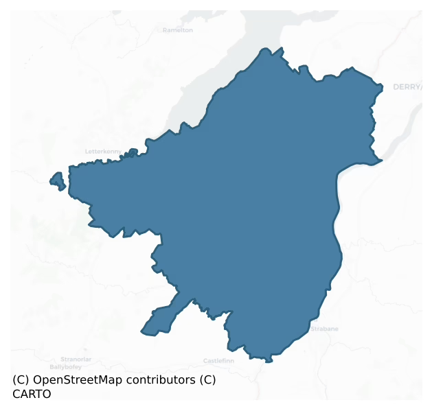
Raphoe North is a barony of County Donegal, in the historical province of Ulster (Irish: Ráth Bhoth Thuaidh), covering 327 km² of land. The barony records 312 NMS archaeological sites and 272 NIAH listed buildings, placing it at around the 11th percentile among 280 ROI baronies for sites per km². This means it is in the bottom fifth of all baronies for sites per km². Dated archaeological evidence runs from the Mesolithic through to the Modern, spanning 9 of 9 archaeological periods, placing the barony in the 100th percentile among 280 ROI baronies for chronological depth. This means it is in the top tenth of all baronies for chronological depth. The largest dated subset of recorded sites dates to the Early Bronze Age. Logainm flags 34 placenames in the barony as carrying a recognised heritage root; the largest share — around 56% — are names associated with pre-christian defensive.

Heritage at a glance
Percentile rankings throughout this profile compare each barony only against the other 279 Republic of Ireland baronies.
The recorded heritage of Raphoe North
The National Monuments Service Sites and Monuments Record (SMR) is the statutory inventory of archaeological sites for the Republic of Ireland, maintained by the Department of Tourism, Culture, Arts, Gaeltacht, Sport and Media. Sites recorded here include earthworks, ringforts, megalithic tombs, ecclesiastical remains, and post-medieval features; not every record is legally protected, but each is registered as a monument of archaeological interest.
The National Monuments Service records 312 archaeological sites in Raphoe North, putting it at the 11th percentile among 280 ROI baronies for sites per km². This means it is in the bottom fifth of all baronies for sites per km². A sparse recorded total of this kind in Ireland often reflects survey priority rather than genuine absence of past activity. Protection coverage is near-universal — 308 sites (99%) fall within a recorded monument protection zone, indicating an extensively surveyed landscape. The record is dominated by prehistoric ritual monuments — standing stones, stone circles, and rock art (103 sites, 33% of the total), with defensive sites forming a substantial secondary presence (103 sites, 33%). Standing stone is the most prevalent type, making up 30% of the barony's recorded sites (95 records) — well above the ROI average of 4% across all baronies where this type occurs. Standing stone is a deliberately set upright stone, used variously as a Bronze/Iron Age burial marker, route marker or commemorative monument. Other significant types include Enclosure (34) and Souterrain (24). Enclosure is a banked or ditched feature of uncertain type, used as a catch-all where the original function cannot be determined from surface evidence; Souterrain is an underground stone-built passage and chamber, generally Early Medieval and often associated with ringforts as a defensive or storage feature. Across the barony's 327 km², this gives a recorded density of 0.95 sites per km².
Most common monument types
Hover or tap a monument type to see its definition.
| Type | Count |
|---|---|
| Standing stone a deliberately set upright stone, used variously as a Bronze/Iron Age burial marker, route marker or commemorative monument | 95 |
| Enclosure a banked or ditched feature of uncertain type, used as a catch-all where the original function cannot be determined from surface evidence | 34 |
| Souterrain an underground stone-built passage and chamber, generally Early Medieval and often associated with ringforts as a defensive or storage feature | 24 |
| Ringfort – unclassified a circular Early Medieval settlement enclosure where surviving evidence does not allow distinction between earthen and stone forms | 19 |
| Ringfort – rath an earthen ringfort enclosed by a bank and external ditch — the most common Early Medieval farmstead, broadly dated 500–1000 AD | 14 |
| Megalithic tomb – unclassified a megalithic tomb whose form cannot be assigned to court, portal, passage, or wedge categories | 14 |
| Graveyard a burial area associated with a church, in use from the medieval period onwards | 11 |
| Church a building used for public Christian worship, of any date from c. 500 AD onwards | 9 |
Chronological distribution
The dated archaeological record for Raphoe North spans from the Mesolithic through to the Modern, with activity attested across 9 of 9 archaeological periods. This places Raphoe North in the top 0% of ROI baronies for chronological depth — few baronies record evidence across as many distinct archaeological periods. Every period from earliest to latest is represented in the record — an unbroken sequence of dated activity across the full chronological span. Activity concentrates most heavily in the Early Bronze Age (106 sites, 38% of dated material), with the Early Medieval forming a secondary peak (82 sites, 29%). A further 33 recorded sites (11% of the overall NMS register for the barony) carry no period attribution — appearing as 'Unknown' in the bar chart below. This typically reflects either records that pre-date the standardised period vocabulary or sites awaiting specialist dating review, rather than a genuine absence of chronological evidence.
Sample of recorded monuments
Show 25 sample monuments (of 312 total)
A representative sample of 25 recorded monuments drawn from the barony’s 312 total NMS entries. Sites within a recorded monument protection zone and rarer site types are prioritised so the list shows a meaningful cross-section rather than only the most common type. Each entry shows the official Sites and Monuments Record reference number and the description published by the National Monuments Service.
Castle – motte
The 1st edition of the OS 6-inch map shows a single-ringed 'Fort' at this location. The site consists of a modified natural mound sub-rectangular in shape, 27m NWSE and 22.5m SW-NE. A fosse encloses the site for the…
The 1st edition of the OS 6-inch map shows a single-ringed 'Fort' at this location. The site consists of a modified natural mound sub-rectangular in shape, 27m NWSE and 22.5m SW-NE. A fosse encloses the site for the most part and is particularly evident on the W side where the mound has been deliberately divided to give it its present appearance. There are slight traces of a bank outside the fosse and on the N side there is a curving field boundary. The mound is c. 4m high and is tree-covered but there are no signs of any structures visible. This site, or another closeby, is usually identified as the location of 'Culmacatreine' a small castle or tower house shown on a map of c. 1600.* There is now no trace of this castle. The site is located on a slight rise overlooking low-lying reclaimed land, which seems to have been marshy and possibly even tidal up to the seventeenth century.*(PRO MPF 335) see DG047-015.
The above description was derived from the 'Archaeological Survey of County Donegal. A description of the field antiquities of the County from the Mesolithic Period to the 17th century.' Compiled by: Brian Lacey with Eamon Cody, Claire Cotter, Judy Cuppage, Noel Dunne, Vincent Hurley, Celie O'Rahilly, Paul Walsh and Seán Ó Nualláin (Lifford: Donegal County Council, 1983). In certain instances the entries have been revised and updated.
Date of upload: 22 September 2008
Cairn – unclassified
Marked 'Carn' on the 1st edition of the OS 6-inch map this site does not seem to survive. However at about the point indicated there is a section of rock outcrop c. 2m × 1m. The site is on the E slope of a ridge of good…
Marked 'Carn' on the 1st edition of the OS 6-inch map this site does not seem to survive. However at about the point indicated there is a section of rock outcrop c. 2m × 1m. The site is on the E slope of a ridge of good land.
The above description was derived from the 'Archaeological Survey of County Donegal. A description of the field antiquities of the County from the Mesolithic Period to the 17th century.' Compiled by: Brian Lacey with Eamon Cody, Claire Cotter, Judy Cuppage, Noel Dunne, Vincent Hurley, Celie O'Rahilly, Paul Walsh and Seán Ó Nualláin (Lifford: Donegal County Council, 1983). In certain instances the entries have been revised and updated.
Date of upload: 22 September 2008
Religious house – Franciscan Third Order Regular
Balleeghan Friary: Founded by O'Donnell for the Franciscan Third Order Regular probably in the later 15th century. The site was subsequently granted to James Fullerton in 1603(Gwynn and Hadcock 1970, 268).
The…
Balleeghan Friary: Founded by O'Donnell for the Franciscan Third Order Regular probably in the later 15th century. The site was subsequently granted to James Fullerton in 1603(Gwynn and Hadcock 1970, 268).
The ivy-covered ruins stand close to the E shore of Lough Swilly and are built of granite blocks and slate pinnings with sandstone and greenstone dressings. The church, 24.9m by 6.45m internally, consists of nave and chancel without structural division. The gables and side walls stand to full height; the latter are c. 5.6m high. The E window is of three lights, transomed with curvilinear tracery. The exterior hollow-chamfered hood-mould has two head terminals; the N is damaged. Another badly weathered head, forms the keystone of the relieving arch above the hood-mould. The splayed ingoings have dressed scontions and the pointed rear-arch is double-chamfered. A flight of steps protrudes from the inner face of the E gable; they probably gave access to the furnishings of the altar and window from behind the former. There are two windows in the S wall. The E is blocked up and the exterior is covered with ivy; below it is a sedilia recess with a wall-press beside it on the E. Only the upper jambs, cusped W-spandrel and part of the hood-mould of the other window survive; all are very weathered. The sill has fallen away; the ope was probably c. 3m high. The scontions and splayed round-headed rear-arch are of dressed sandstone. Beside it is a wall-press. The rear-arch of the do…
School
The Archaeological Survey of Ireland (ASI) is in the process of providing information on all monuments on The Historic Environment Viewer (HEV). Currently the information for this record has not been uploaded. To…
The Archaeological Survey of Ireland (ASI) is in the process of providing information on all monuments on The Historic Environment Viewer (HEV). Currently the information for this record has not been uploaded. To access available information for research purposes please make an appointment in advance with the Archive Unit (open Fridays 10.00 am – 5.00 pm), Department of Culture, Heritage and the Gaeltacht, The Custom House, Dublin 1 D01W6XO or email nmarchive@chg.gov.ie.
Crannog
Marked 'Castle in ruins' on the 2nd and 3rd editions of the OS 6-inch maps. An artificial island now submerged in Portlough, formerly O'Lappan's Lough, was revealed in 1832 and 1848. The island was formed on a…
Marked 'Castle in ruins' on the 2nd and 3rd editions of the OS 6-inch maps. An artificial island now submerged in Portlough, formerly O'Lappan's Lough, was revealed in 1832 and 1848. The island was formed on a foundation composed of a platform of beams of wood (oak and willow), notched and pinned together. On top of this was an octagonal building of stone and lime each side 10ft long and about 4ft high. No door was found but several iron hinges and hooks were. In addition a piece of an iron 'Hatchet', 'Rude fragments of pottery, bones of sheep and deer', and a pair of iron fetters 3ft 4in long and weighing 10lbs were found. It seems probable that the site was a crannog on which a later medieval building was erected. (UJA 1858, 168-9).
The above description was derived from the 'Archaeological Survey of County Donegal. A description of the field antiquities of the County from the Mesolithic Period to the 17th century.' Compiled by: Brian Lacey with Eamon Cody, Claire Cotter, Judy Cuppage, Noel Dunne, Vincent Hurley, Celie O'Rahilly, Paul Walsh and Seán Ó Nualláin (Lifford: Donegal County Council, 1983). In certain instances the entries have been revised and updated.
Date of upload: 22 September 2008
Inscribed stone
In 1956 a souterrain (DG055-025001-) was reported here (NMI). It was about 14ft long × 4ft deep × 3ft wide. Halfway along, the passage narrowed to about 2ft 2in and then widened again. It was built of stone and the…
In 1956 a souterrain (DG055-025001-) was reported here (NMI). It was about 14ft long × 4ft deep × 3ft wide. Halfway along, the passage narrowed to about 2ft 2in and then widened again. It was built of stone and the report suggests that there were indications of other such structures possibly other chambers, on the site also. An inscribed slab now in private possession was said to have been found in the souterrain.
The above description was published in the 'Archaeological Survey of County Donegal. A description of the field antiquities of the County from the Mesolithic Period to the 17th century.' Compiled by: Brian Lacey with Eamon Cody, Claire Cotter, Judy Cuppage, Noel Dunne, Vincent Hurley, Celie O'Rahilly, Paul Walsh and Seán Ó Nualláin (Lifford: Donegal County Council, 1983).
Date of upload: 22 September 2008
Stone row
Three stones stand beside one another in a roughly N-S alignment. The middle one is a standing stone 1.25m high and 0.8m square in plan. The other two are granite boulders and their archaeological significance is…
Three stones stand beside one another in a roughly N-S alignment. The middle one is a standing stone 1.25m high and 0.8m square in plan. The other two are granite boulders and their archaeological significance is uncertain, Situated on rough pasture land.
The above description was derived from the 'Archaeological Survey of County Donegal. A description of the field antiquities of the County from the Mesolithic Period to the 17th century.' Compiled by: Brian Lacey with Eamon Cody, Claire Cotter, Judy Cuppage, Noel Dunne, Vincent Hurley, Celie O'Rahilly, Paul Walsh and Seán Ó Nualláin (Lifford: Donegal County Council, 1983). In certain instances the entries have been revised and updated.
Date of upload: 22 September 2008
Megalithic tomb – court tomb
This monument stands on good, generally level pasture around halfway between the River Deele, c. 6km to the N, and the River Finn, c. 7km to the S, and 3.8km S of the village of Convoy. The view to the W is restricted…
This monument stands on good, generally level pasture around halfway between the River Deele, c. 6km to the N, and the River Finn, c. 7km to the S, and 3.8km S of the village of Convoy. The view to the W is restricted by a gentle rise in ground level, but there is an extensive outlook in other directions.
The monument is a dual-court tomb aligned almost N-S. Entry to a large, reasonably well-preserved full court at the N is via an entrance passage flanked at either side by a single facade-stone. The opposite end of this court opens onto a roofless gallery now 10.5m long and up to 3.5m wide. A slight inturn of the W side of the gallery may mark a point of segmentation. At the southern end of the monument is a greatly ruined full court, smaller than that at the northern end, in front of which there are four stones, the arrangement of which suggests that they represent an entrance passage. This court leads to the scant remains of an unroofed gallery, now 9m long and also up to 3.5m wide. This gallery lacks any reliable indication of segmentation. The open ends of both galleries are 5m apart, and so it appears that they may have had separate backstones. A modern field wall meanders along the entire length of the monument; it incorporates in its course the W side of the northern court, the front of the northern gallery and the E sides of both galleries and it crosses the southern court and runs along the E side of the entrance thereto. A number of large stones now in the field…
Stone sculpture
Raphoe Cathedral (DG070-003001-): Adomnán (c. 624-704) ninth abbot of Iona and author of the famous 'Life' of his kinsman Colmcille was closely connected with the monastery at Raphoe. In the 12th century, Raphoe was…
Raphoe Cathedral (DG070-003001-): Adomnán (c. 624-704) ninth abbot of Iona and author of the famous 'Life' of his kinsman Colmcille was closely connected with the monastery at Raphoe. In the 12th century, Raphoe was established as a Diocesan See. There was formerly a round tower at Raphoe. It was demolished by Bishop John Leslie when he built his palace in 1636-7 (Wood 1937, 304-5). It can be inferred from a reference to it in John Lynch's De Praesulibus Hibernicis (O'Doherty, ed. I, 1944, 243) that the bishop's palace occupies the site of this tower (Ó Gallachair 1973, 323 also Barrow 1979, 74-75) The only visible remains of the monastery are two pieces of a sculptured door-lintel (DG070-003002-). The left half is preserved in the vestibule of the cathedral and is carved with the representation of the arrest of Christ, St. Peter cutting the ear of the High Priest's servant Malchus and in the lower right hand corner, a soldier kneels with a lance below the left arm of the crucifixion (Longinus?). The remaining section of the crucifixion now very spalled and weathered, is represented on the right hand half of the lintel which is set in the external face of the N wall of the nave. There is a winged figure above the right hand arm and below it are traces of the head and lance of another soldier (the chalice bearer,Stephaton?). Only fragmentary outlines of the remaining figure-carving are discernible. On stylistic grounds, the lintel has been dated to the ninth-tenth centuries…
Round tower
There was formerly a round tower at Raphoe. It was demolished by Bishop John Leslie when he built his palace in 1636-7 (Wood 1937, 304-5). It can be inferred from a reference to it in John Lynch's De Praesulibus…
There was formerly a round tower at Raphoe. It was demolished by Bishop John Leslie when he built his palace in 1636-7 (Wood 1937, 304-5). It can be inferred from a reference to it in John Lynch's De Praesulibus Hibernicis (O'Doherty, ed. I, 1944, 243) that the bishop's palace occupies the site of this tower (Ó Gallachair 1973, 323 also Barrow 1979, 74-75).
The above description was derived from the 'Archaeological Survey of County Donegal. A description of the field antiquities of the County from the Mesolithic Period to the 17th century.' Compiled by: Brian Lacey with Eamon Cody, Claire Cotter, Judy Cuppage, Noel Dunne, Vincent Hurley, Celie O'Rahilly, Paul Walsh and Seán Ó Nualláin (Lifford: Donegal County Council, 1983). In certain instances the entries have been revised and updated.
Date of upload: 22 September 2008
Stone circle
This monument, on a hilltop with an extensive outlook in all directions, is known as Beltany Stone Circle. It lies 3.2km NNW of the cemetery of megalithic tombs centred on Kilmonaster Middle townland. It consists of a…
This monument, on a hilltop with an extensive outlook in all directions, is known as Beltany Stone Circle. It lies 3.2km NNW of the cemetery of megalithic tombs centred on Kilmonaster Middle townland. It consists of a disturbed artificial platform now c. 0.5m high, perhaps the base of a cairn, bounded by a circle of large stones. The circle is c. 45m in diameter. At present 64 stones stand in the circle, and there may originally have been up to 80. Some large stones are exposed in the disturbed interior. It has been suggested that there may have been a megalithic chamber within the circle (O.D. 1939), perhaps a passage tomb (Ó Nualláin 1995, 15).
The earliest accounts of the site seem to be those in the unpublished documentation of the Ordnance Survey dating to the years shortly before the mid-19th century. It is clear that the monument was considerably disturbed at this stage. According to the OS Memoir (1836), there had been a cairn or 'vast heap of stones' within the circle, but it had been removed to form fences in the vicinity. Thomas Fagan (1845-8), who saw the monument in 1846, observed that both the interior and the enclosing circle of stones were much disfigured. He was informed that 'the interior was raised with earth and stones covering and encircling sepulchral graves' and that decayed bones were unearthed here. Excavation would be required to determine whether the enclosed platform is the base of a cairn and whether there was any form of megalithic chamber he…
Anomalous stone group
No archaeological significance.
NGR 22734 39764
Excavation Licence No. 05E0801
Pre-development testing was carried out on 18 July 2005 at a site in advance of its development at Kilmonaster Middle townland,…
No archaeological significance.
NGR 22734 39764
Excavation Licence No. 05E0801
Pre-development testing was carried out on 18 July 2005 at a site in advance of its development at Kilmonaster Middle townland, Ballindrait, Co. Donegal. The proposed development, which consisted of the construction of a silage pit, dung pit, effluent containment tank and dry-bed cattle shed, was located within the constraint area for an archaeological complex, the Kilmonaster Passage Tomb cemetery. The nearest monument of the complex, a passage tomb, was 5m from the proposed containment tank. The cattle shed was 24m from the same monument. As the groundworks involved in the construction of the cattle shed consisted of four pits (1m by 1m by 1m deep) located along one side of the proposed structure, it was decided to concentrate the test-trenches at the proposed containment tank location.
Three trenches were excavated, which measured 16.3m, 33m and 36.3m long, 0.9-1.3m wide and 0.1-1m deep. Below the topsoil were fill, grey/brown friable silt loam, orange/brown loose loamy sand and bedrock. A number of modern pottery sherds and one worked piece of flint were found in the topsoil. The fill consisted of soil and rocks and was located along the line of a field boundary. The friable silt loam contained a small number of animal bone fragments (from a calf) at c. 0.3m below the surface. The loamy sand was sterile.
The landowner had informed me prior to the testing that livestock had been buried a…
Hillfort
Internal diam. c. 85m. A roughly circular area enclosed by a grass-grown collapsed stone wall in places up to 5m wide and 1m high but at others hardly perceptible. A field boundary cuts off the W side and beyond this…
Internal diam. c. 85m. A roughly circular area enclosed by a grass-grown collapsed stone wall in places up to 5m wide and 1m high but at others hardly perceptible. A field boundary cuts off the W side and beyond this the outline of the wall is very vague. There are several gaps but one at the SE could be original as it is lined with set stones. There are extensive surfaces of rock outcrop within the enclosure. Near the centre of the interior is the passage-tomb (DG070-074002-), a mound 21m in diameter and 3m high. The site is situated on the summit of Croaghan Hill, which it exploits, and it dominates an extensive area including the ancient territory of Magh Itha.
The above description was derived from the 'Archaeological Survey of County Donegal. A description of the field antiquities of the County from the Mesolithic Period to the 17th century.' Compiled by: Brian Lacey with Eamon Cody, Claire Cotter, Judy Cuppage, Noel Dunne, Vincent Hurley, Celie O'Rahilly, Paul Walsh and Seán Ó Nualláin (Lifford: Donegal County Council, 1983). In certain instances the entries have been revised and updated.
Date of upload: 22 September 2008
This monument is subject to a preservation order made under the National Monuments Acts 1930 to 2014 (PO no. 14/1987).
Water mill – unclassified
The Archaeological Survey of Ireland (ASI) is in the process of providing information on all monuments on The Historic Environment Viewer (HEV). Currently the information for this record has not been uploaded. To…
The Archaeological Survey of Ireland (ASI) is in the process of providing information on all monuments on The Historic Environment Viewer (HEV). Currently the information for this record has not been uploaded. To access available information for research purposes please make an appointment in advance with the Archive Unit (open Fridays 10.00 am – 5.00 pm), Department of Culture, Heritage and the Gaeltacht, The Custom House, Dublin 1 D01W6XO or email nmarchive@chg.gov.ie.
Ecclesiastical enclosure
Clonleigh graveyard (DG071-002005-) is believed to be the site of an early ecclesiastical settlement founded in the 6th century (Gwynn and Hadcock 1970, 377). The graveyard contains fragmentary sections of the N and S…
Clonleigh graveyard (DG071-002005-) is believed to be the site of an early ecclesiastical settlement founded in the 6th century (Gwynn and Hadcock 1970, 377). The graveyard contains fragmentary sections of the N and S walls of a church (DG071-002002-) 6.8m wide internally. Built of rubble, the N wall is 6.1m long by 4.15m high by .93m thick; the lower courses, 1.1m high, of the interior central section are set out .27m from the wall face. W of this is a blocked-up opening with segmental rear-arch, probably a window. No visible trace of this opening survives on the exterior; the masonry indicates that this area was refaced. The S wall, 4.75m long by 4.5m high by 1.2m thick, contains an opposing blocked-up window with segment-headed rear-arch. The splayed ingoings are partially blocked by a bricked-in memorial; traces of wicker centering survive on the rear-arch soffit. This S wall forms part of the graveyard boundary. A sub-rectangular projection of the graveyard wall some 9.7m to the E might have been associated with the church. No visible trace of the E or W gables remains. Recent work at the graveyard by Donegal County Council (after the completion of the survey) has revealed three fragments of medieval carved mouldings (DG071-002003-) partially buried in the soil. In addition a recumbent slab (DG071-002004-), 1.68m × 0.38m at top, .32m at bottom, has been revealed. Near the wider end of the slab is a deeply carved Maltese cross .32m × 0.32m with a raised boss 9 cms in d…
Cross-slab
Clonleigh graveyard (DG071-002005-) is believed to be the site of an early ecclesiastical settlement founded in the 6th century (Gwynn and Hadcock 1970, 377). The graveyard contains fragmentary sections of the N and S…
Clonleigh graveyard (DG071-002005-) is believed to be the site of an early ecclesiastical settlement founded in the 6th century (Gwynn and Hadcock 1970, 377). The graveyard contains fragmentary sections of the N and S walls of a church (DG071-002002-) 6.8m wide internally. Built of rubble, the N wall is 6.1m long by 4.15m high by .93m thick; the lower courses, 1.1m high, of the interior central section are set out .27m from the wall face. W of this is a blocked-up opening with segmental rear-arch, probably a window. No visible trace of this opening survives on the exterior; the masonry indicates that this area was refaced. The S wall, 4.75m long by 4.5m high by 1.2m thick, contains an opposing blocked-up window with segment-headed rear-arch. The splayed ingoings are partially blocked by a bricked-in memorial; traces of wicker centering survive on the rear-arch soffit. This S wall forms part of the graveyard boundary. A sub-rectangular projection of the graveyard wall some 9.7m to the E might have been associated with the church. No visible trace of the E or W gables remains. Recent work at the graveyard by Donegal County Council (after the completion of the survey) has revealed three fragments of medieval carved mouldings (DG071-002003-) partially buried in the soil. In addition a recumbent slab (DG071-002004-), 1.68m × 0.38m at top, .32m at bottom, has been revealed. Near the wider end of the slab is a deeply carved Maltese cross .32m × 0.32m with a raised boss 9 cms in d…
Stone head
A small rectangular disused graveyard (DG079-009001-) consisting of an overgrown mound with no discernible structures. Cemented onto the top of the N gatepost into the graveyard is a stone which seems to be the…
A small rectangular disused graveyard (DG079-009001-) consisting of an overgrown mound with no discernible structures. Cemented onto the top of the N gatepost into the graveyard is a stone which seems to be the weathered remains of a carved stone head. It is .3m high and 0.25m x .25m. It is extremely defaced but the suggestions of two eyes and a nose can be seen. It is possible that this is another example of the type of head recorded in the Raphoe area by Rynne (1972, 86-88).
The above description was derived from the 'Archaeological Survey of County Donegal. A description of the field antiquities of the County from the Mesolithic Period to the 17th century.' Compiled by: Brian Lacey with Eamon Cody, Claire Cotter, Judy Cuppage, Noel Dunne, Vincent Hurley, Celie O'Rahilly, Paul Walsh and Seán Ó Nualláin (Lifford: Donegal County Council, 1983). In certain instances the entries have been revised and updated.
Date of upload: 22 September 2008
House – medieval
Previously unmarked on the OS 6-inch maps this site was indicated by aerial photograph (St. Joseph, ATB. 103). There was no surface indication of it when the site was inspected. It would appear to have been c. 80m in…
Previously unmarked on the OS 6-inch maps this site was indicated by aerial photograph (St. Joseph, ATB. 103). There was no surface indication of it when the site was inspected. It would appear to have been c. 80m in diameter with two internal divisions in the SE quadrant. An old field system can be detected adjoining it. It is situated on excellent rolling land.
The above description was derived from the 'Archaeological Survey of County Donegal. A description of the field antiquities of the County from the Mesolithic Period to the 17th century.' Compiled by: Brian Lacey with Eamon Cody, Claire Cotter, Judy Cuppage, Noel Dunne, Vincent Hurley, Celie O'Rahilly, Paul Walsh and Seán Ó Nualláin (Lifford: Donegal County Council, 1983). In certain instances the entries have been revised and updated.
Date of upload: 22 September 2008
House – 16th/17th century
The physical layout of the town is described in the Urban Survey as 'The core of the seventeenth century Lifford was concentrated on the Diamond and on the street running SW from it towards the modern bridge, then the…
The physical layout of the town is described in the Urban Survey as 'The core of the seventeenth century Lifford was concentrated on the Diamond and on the street running SW from it towards the modern bridge, then the site of a ferry. It was presumably in this area that the twentyone houses, built for Sir Richard Hansard by 1611, were located. The presence of a burgage plot pattern on the street running NW from the town, past Ballyduff House, suggests that it too may be of seventeenth century origin. Indeed it may have been the location of the 27 cottages referred to in 1611. In 1603 Sir Henry Dowcra was granted the right to hold a weekly market at Lifford, while in the incorporation charter of 1612 it is stated that the market should be held on Mondays. The market place was evidently located in the Diamond. An account of 1600 refers to Lifford as having "some eighty houses" (CSPI 1600-1, 93). There is no information on the form of these houses, however. By 1611 there were some 21 half-timbered houses in the town and 37 cottages, while in 1622 the town had at least 54 houses. Evidence for inns is indicated by the fact that the inhabitants of Lifford were "able to give entertainment to passengers" shortly after the foundation of the town (Robinson 1984, 173).' (Bradley & Dunne 1989, 53-4).
Town defences
The physical layout of the town is described in the Urban Survey as 'The core of the seventeenth century Lifford was concentrated on the Diamond and on the street running SW from it towards the modern bridge, then the…
The physical layout of the town is described in the Urban Survey as 'The core of the seventeenth century Lifford was concentrated on the Diamond and on the street running SW from it towards the modern bridge, then the site of a ferry. It was presumably in this area that the twentyone houses, built for Sir Richard Hansard by 1611, were located. The presence of a burgage plot pattern on the street running NW from the town, past Ballyduff House, suggests that it too may be of seventeenth century origin. Indeed it may have been the location of the 27 cottages referred to in 1611. An account of the settlement, written in 1600, describes it as lying beside the river and "encompassed by an old ditch" (CSPI 1600-1, 93). An outline of these defences is shown on a map, prepared perhaps to accompany this account, now in the library of Trinity College Dublin (Ms. 1209 (17)). No trace of this ditch now survives' (Bradley & Dunne 1989, 53-4).
Ecclesiastical site
Clonleigh graveyard (DG071-002005-) is believed to be the site of an early ecclesiastical settlement founded in the 6th century (Gwynn and Hadcock 1970, 377). The graveyard contains fragmentary sections of the N and S…
Clonleigh graveyard (DG071-002005-) is believed to be the site of an early ecclesiastical settlement founded in the 6th century (Gwynn and Hadcock 1970, 377). The graveyard contains fragmentary sections of the N and S walls of a church (DG071-002002-) 6.8m wide internally. Built of rubble, the N wall is 6.1m long by 4.15m high by .93m thick; the lower courses, 1.1m high, of the interior central section are set out .27m from the wall face. W of this is a blocked-up opening with segmental rear-arch, probably a window. No visible trace of this opening survives on the exterior; the masonry indicates that this area was refaced. The S wall, 4.75m long by 4.5m high by 1.2m thick, contains an opposing blocked-up window with segment-headed rear-arch. The splayed ingoings are partially blocked by a bricked-in memorial; traces of wicker centering survive on the rear-arch soffit. This S wall forms part of the graveyard boundary. A sub-rectangular projection of the graveyard wall some 9.7m to the E might have been associated with the church. No visible trace of the E or W gables remains. Recent work at the graveyard by Donegal County Council (after the completion of the survey) has revealed three fragments of medieval carved mouldings (DG071-002003-) partially buried in the soil. In addition a recumbent slab (DG071-002004-), 1.68m × 0.38m at top, .32m at bottom, has been revealed. Near the wider end of the slab is a deeply carved Maltese cross .32m × 0.32m with a raised boss 9 cms in d…
Wall monument – effigial
Clonleigh Parish Church (DG071-008001-): Erected under the will of Sir Richard Hansard and the foundations laid by 1622, the present church is of late 18th century appearance (Rowan 1979, 348). In the S wall is a…
Clonleigh Parish Church (DG071-008001-): Erected under the will of Sir Richard Hansard and the foundations laid by 1622, the present church is of late 18th century appearance (Rowan 1979, 348). In the S wall is a segment-headed recess containing two kneeling figures in Jacobean attire facing each other across a draped predieu — part of the monument of Sir Richard Hansard Kt. and Dame Anne, his wife (for whom see Loeber 1977-80, 238-9). The tablet bears the following inscription: ERECTED TO THE MEMORY OF SR RICHARD HANSARD/KNIGHT BORNE AT BISKERTHORPE IN THE COVNTY OF LINCOLNE IN/ENGLAND WHO DYED THE 5 OF OCTOBER 1619 AND OF DAME ANNE HIS WIFE/DAUGHTER TO SR EDWARD MARBVRY OF GEISBY IN, THE SAID COVNTY KNIGHT/WHO DYED THE 3 DAY OF OCTOBER 1619 SR RICHARD HANSARD AFTER HE HAD/OF ART IN CAMBRIDGE TOOKE VPON HIM THE PREFESSION OF A SOLIDER IN THE PRIME OF/LIFE HE HAD DIVERS SINDRY HONORABLE PLACES OF COMAND IN THE WARES HE/WAS MAD GOVERNOR OF LIFFORD AND THE PARTS ADIOYNING WHER HE DID MANY GOOD/SERVES IN THE TIME OF TYRONES REBELION AND LAST OF AL IN SR CAHIR O DOHERLES REBELIONIKING JAMES THE FIRST GAVE HIM THIS TOWNE OF LIFORD AND FOWER QVARTERS OF CROHAN TO/PLANT A CORPORACON THERE WHICH HE EFECTED AT HIS DEATH HE DISPOSED BY WIL OF THESE LANDS AND OTHERS TO DIVERS OF HIS NAME NOT NEARE OF KINDRED TO HIM BVT FOR WANT/OF A FEOFTMIENT TO ENABLE HIM TO DISPOSE OF HIS LANDS BY WIL BY LAWE ITFEL A[L]/TO HIS YONGER BROTHER WILLIAM HANSARD OF BISKERTHORPE IN LINCOLNSHIRE ESQVIRE/…
Midden
Described in 2001 as 'To the north of the western edge of the railway embankment at Blanket Nook an area of shoreline on the edge of the adjacent field has, through erosion, on occasions produced traces of shell middens…
Described in 2001 as 'To the north of the western edge of the railway embankment at Blanket Nook an area of shoreline on the edge of the adjacent field has, through erosion, on occasions produced traces of shell middens one of which has produced a sample for C14 dating Beta 155378 5130+-60bp' (Woodman & Milner 2001, 29-30; Milner & Woodman 2007, 104-5, No. 9).
Compiled by: Caimin O'Brien
Date of upload: 17 August 2010
Fulacht fia
The proposed development would involve the construction of 34 houses and include the construction of roadways and footpaths, connection of foul and storm drainage to the existing public drainage system, provision of…
The proposed development would involve the construction of 34 houses and include the construction of roadways and footpaths, connection of foul and storm drainage to the existing public drainage system, provision of services, landscaping of open area space and paths and all ancillary site works. The proposed development area measures 24,824m2. The excavation of fourteen test-trenches throughout the proposed development area revealed the presence of a previously unidentified spread of burnt stone in the eastern end of the proposed land-take. The method statement submitted for the testing suggested that this general area, due to its low-lying and slightly waterlogged nature, had the potential to contain previously unrecorded fulachta fiadh. A spread of burnt stone was identified in Trench 9 and three additional trenches, Trenches 9b, 9c and 9d, were excavated to help define its extent, character and condition. Testing suggests that the feature measures c. 13m east–west by 12m and continues to the ditch, which forms the eastern boundary of the proposed development area, and which is also a townland and parish boundary. Limited hand investigation showed the stone spread to have a probable depth of c. 0.15m. Excavation of the remainder of the trenches failed to reveal either archaeological features or artefacts. The burnt spread was preserved in situ under a geotextile layer, which was gradually sealed by broken stone to a height of c. 1.3m. Monitoring of topsoil-stripping a…
Standing stone
This standing stone was extant in the early 1980’s when it was described as follows: ‘A standing stone, triangular in plan at base and almost 1m high. Situated on the S facing slope of a hill overlooking the Lagan…
This standing stone was extant in the early 1980’s when it was described as follows: ‘A standing stone, triangular in plan at base and almost 1m high. Situated on the S facing slope of a hill overlooking the Lagan Valley.’ (Lacy et al. 1983, 84, no. 449). It was subsequently removed and there is now no visible trace at ground level (Ryan Hanley 2020, 309 (11-25)).
Compiled by: Jane O’Shaughnessy
Date of revised upload: 27 January 2021
Listed buildings
The National Inventory of Architectural Heritage (NIAH) is a state survey appraising buildings of architectural, historical, archaeological, artistic, cultural, scientific, social, or technical interest. Each surveyed structure receives a rating from International (the highest, for buildings of European importance) through National, Regional, Local, and Record-Only.
The NIAH records 272 listed buildings in Raphoe North, the 85th percentile across ROI baronies for listed-building density. The highest-graded structures include 4 of National significance. The Republic holds 937 National-graded buildings in total, so this barony accounts for around 0% of the national total. Construction dates concentrate most heavily in the Victorian (1830-1900) period. The most-recorded building type is house (81 examples, 30% of the listed stock).
Terrain and environment
Mean elevation across the barony is 68m — the 30th percentile among 280 ROI baronies for elevation. This means it is in the bottom third of all baronies for elevation. Elevation matters for heritage because higher-altitude baronies typically favour defensive monuments — ringforts and hilltop forts placed on prominent ground — while lowland baronies are more likely to carry the dense settlement and church networks of intensive agricultural landscapes. The barony reaches 281m at its highest point — a vertical span of more than 212m within its boundary, indicating significant topographic diversity. Mean slope is 4.5° — the 69th percentile among 280 ROI baronies for slope. This means it is in the top third of all baronies for slope. Slope is a key control on both land use and archaeological preservation: steep ground resists ploughing and tends to preserve earthworks intact, while gentle slopes favour intensive cultivation that damages or destroys surface archaeology over time. The Topographic Wetness Index averages 10.3, the 30th percentile among 280 ROI baronies for wetness. This means it is in the bottom third of all baronies for wetness. Drainage matters for heritage because poorly-drained ground preserves organic archaeology (wooden trackways, leather, textiles, and on rare occasions human remains) far better than free-draining soil; well-drained ground favours arable use but destroys organic material rapidly. The land-cover mosaic combines improved grassland (73%), woodland (14%), and arable farmland (10%), giving a mixed agricultural and semi-natural landscape.
Terrain measurements
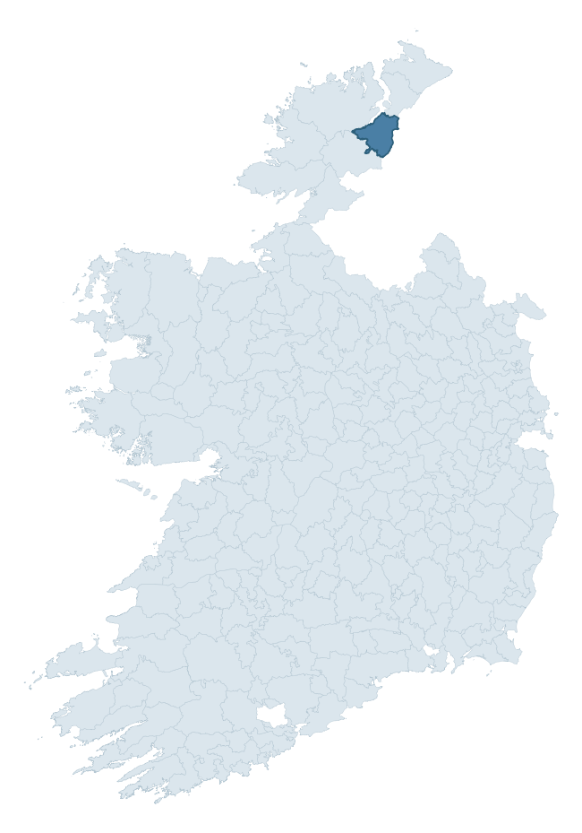
Where this barony sits in the Republic of Ireland
Geology and preservation
Bedrock geology shapes the landscape long before any settlement begins — controlling soil drainage, agricultural potential, the survival of upstanding monuments, and the preservation of buried archaeology. The figures below come from the Geological Survey Ireland 1:100,000 bedrock map.
The bedrock underlying Raphoe North is predominantly schist (52% of the barony by area), laid down during the Precambrian period (100% by area, over 540 million years ago). Schist forms upland, often steep terrain with thin soils that limited agriculture but favoured the construction of stone-built monuments and field walls. Schist landscapes commonly carry megalithic monuments and prehistoric ritual sites. A substantial secondary geology of marble (38%) adds further variety to the underlying landscape. The single largest mapped unit is the Lough Foyle Succession undifferentiated (40% of the barony's bedrock).
Rock type composition
Largest mapped unit: Lough Foyle Succession undifferentiated (40% of the barony)
Placename evidence
Logainm records 34 heritage-diagnostic placenames for Raphoe North, drawn from townland and civil-parish names across the barony. The dominant stratum is pre-Christian and Early Medieval defensive — ráth-, lios-, dún-, and caiseal-prefixed names that mark Iron Age and early historic settlement. The leading diagnostic roots are lios- (11 — ringfort or enclosure), cill- (9 — church), and dún- (5 — hilltop fort or promontory fort). This is broadly in line with the ROI average of 30.7 heritage placenames per barony. The presence of multiple heritage strata side by side indicates layered occupation of the landscape across successive prehistoric and historic periods. Logainm records 384 placenames for Raphoe North (predominantly townland names). Of these, 34 (9%) carry one of the diagnostic Gaelic roots tracked above; the remainder draw on more generic landscape vocabulary that does not encode a heritage period.
Pre-Christian / Early Medieval Defensive
| Root | Count | Meaning |
|---|---|---|
| lios- | 11 | ringfort or enclosure |
| dún- | 5 | hilltop or promontory fort |
| ráth- | 3 | earthen ringfort |
Early Christian Ecclesiastical
| Root | Count | Meaning |
|---|---|---|
| cill- | 9 | church (early) |
| tobar- | 2 | holy well |
| domhnach- | 1 | pre-Patrician or earliest Patrician church |
| mainistir- | 1 | monastery |
Burial, Ritual, and Norse-Contact
| Root | Count | Meaning |
|---|---|---|
| gall- | 3 | foreigner — Norse settlement marker |
| carn- | 2 | cairn |
Other baronies in Donegal
About this profile
Click any section below to expand.
What is a barony?
A barony is a historic administrative unit in Ireland, broadly equivalent to an English hundred. The 280 baronies used here are from the OSi 2019 National Statutory Boundaries (generalised 20m), covering the 26 counties of the Republic of Ireland. Baronies derive from the Norman period, were formalised in the 17th century, and have not been redrawn for statistical purposes. They vary enormously in area, from compact urban baronies in Dublin to vast upland baronies in Connacht, and should not be compared by raw site count without accounting for area differences.
What counts as a site?
This profile combines three distinct heritage registers, each with its own definition of what constitutes a recordable site:
- Archaeological sites (NMS). The National Monuments Service Sites and Monuments Record (SMR) catalogues every known archaeological monument or site of archaeological interest in the Republic, from prehistoric burial mounds and ringforts to medieval churches and post-medieval defensive works. Inclusion does not require legal protection — only that the site has been identified, surveyed, and assessed as having archaeological value. A separate subset of these sites lies within a recorded protection zone, which gives them statutory protection under the National Monuments Acts.
- Listed buildings (NIAH). The National Inventory of Architectural Heritage records buildings of architectural, historical, archaeological, artistic, cultural, scientific, social, or technical interest. Each surveyed structure is appraised on a five-tier scale: International, National, Regional, Local, and Record-Only. The NIAH appraisal is informational rather than strictly statutory, but it underpins local-authority Record of Protected Structures (RPS) listings.
- Heritage placenames (Logainm). Logainm is the authoritative database of Irish placenames maintained by the Placenames Branch. This profile applies a heritage-diagnostic classifier to the Irish-language form of each townland name, flagging roots that signal defensive sites (ráth-, lios-, dún-, caiseal-, cathair-), ecclesiastical foundations (cill-, teampall-, domhnach-, mainistir-), prehistoric burial-ritual features (tuaim-, carn-, leaba-), or Norse-contact settlement (gall-). Townlands without one of these diagnostic roots are not flagged here — they may still carry historical significance, but that significance is not encoded in the name itself.
Editorial principles
The narrative sections of this profile follow several explicit principles:
- Evidential. Every claim about this barony’s heritage character is anchored in the underlying register data. Where a site count, a placename count, or a percentile rank is cited, it is computed from the source datasets at export time, not estimated.
- Comparative. Counts and metrics are reported alongside their percentile rank against the other 279 ROI baronies. A barony with 50 ringforts in absolute terms could be unusually high or unusually low depending on its size and regional context; percentile ranking removes that ambiguity.
- Transparent on limits. Where a register has known coverage gaps, survey biases, or data-quality issues that affect this barony’s figures, the profile flags them rather than presenting the numbers as definitive.
- No interpretation beyond what the data supports. The narrative does not speculate about historical events, social dynamics, or cultural meaning beyond what the recorded heritage and placename evidence directly attests.
Data caveats and limits
- NMS Sites and Monuments Record is the product of survey campaigns conducted at different intensities across different counties and decades. Some baronies have been surveyed more thoroughly than others, and absolute counts should be read in that light. Sites destroyed by development before survey are typically not represented; sites in heavily forested or upland terrain are sometimes under-recorded.
- NIAH coverage is broadly complete for the Republic of Ireland but the survey was conducted on a rolling county-by-county basis, and the most recent appraisal date varies. Buildings demolished or substantially altered after their original survey may still appear in the register; conversely, recent buildings of merit may not yet have been appraised.
- Logainm classification applies a deliberately conservative pattern-matching approach to the Irish-language townland forms. The classifier prioritises true positives over recall: a townland may carry a heritage signal that the classifier doesn’t recognise, particularly where the diagnostic root has been heavily anglicised or where the townland name draws on a less common term. The 60,000+ townland records and ~9,800 classified placenames give a substantial signal at barony scale, but individual townland names should be checked against Logainm directly for definitive interpretation.
- Period attribution. The chronological distribution reflects only those NMS sites that carry a recognised period attribution in the source data. Sites listed as “Unknown” period are excluded from the dated subset.
- Boundary changes. Some baronies have undergone minor boundary adjustments since their 19th-century definition; the OSi 2019 generalised boundaries used here are the current statutory definition and may differ slightly from historical maps in border areas.
- Bedrock geology is mapped at 1:100,000 scale, which means local variation within a barony — small pockets of different rock type, mineral veins, alluvium overlying bedrock — is generalised. The dominant-system and rocktype figures are area-weighted, so a barony reading “70% Carboniferous limestone” may still contain small but archaeologically important pockets of older or younger rock. Around 3% of GSI polygons do not match the lexicon and contribute no rocktype or system attribution.
Data sources
- National Monuments Service — Sites and Monuments Record (SMR) https://data.gov.ie/dataset/national-monuments-service-archaeological-survey-of-ireland
- National Inventory of Architectural Heritage (NIAH) https://data.gov.ie/dataset/national-inventory-of-architectural-heritage-niah-national-dataset
- Logainm — Placenames Database of Ireland https://www.logainm.ie/
- Ordnance Survey Ireland — National Statutory Barony Boundaries 2019 https://data-osi.opendata.arcgis.com/
- EURODEM — European Digital Elevation Model https://www.mapsforeurope.org/datasets/euro-dem
- ESA WorldCover https://esa-worldcover.org/en
- Geological Survey Ireland — 1:100,000 Bedrock Geology https://www.gsi.ie/en-ie/data-and-maps/Pages/Bedrock.aspx
Explore more: Search any of the 280 ROI baronies, browse by historical province, or read the methodology and data sources for the full Republic of Ireland Heritage Tool.