
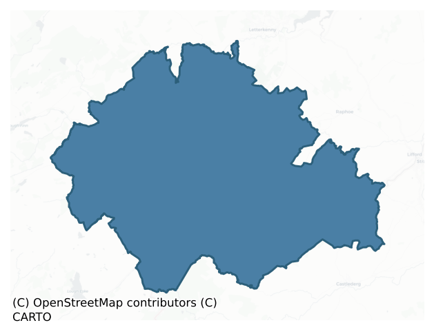
Raphoe South is a barony of County Donegal, in the historical province of Ulster (Irish: Ráth Bhoth Theas), covering 570 km² of land. The barony records 268 NMS archaeological sites and 166 NIAH listed buildings, placing it at around the 2nd percentile among 280 ROI baronies for sites per km². This means it is in the bottom tenth of all baronies for sites per km². Dated archaeological evidence runs from the Mesolithic through to the Modern, spanning 9 of 9 archaeological periods, placing the barony in the 96th percentile among 280 ROI baronies for chronological depth. This means it is in the top tenth of all baronies for chronological depth. The largest dated subset of recorded sites dates to the Early Medieval. Logainm flags 42 placenames in the barony as carrying a recognised heritage root; the largest share — around 52% — are names associated with pre-christian defensive.
Heritage at a glance
Percentile rankings throughout this profile compare each barony only against the other 279 Republic of Ireland baronies.
The recorded heritage of Raphoe South
The National Monuments Service Sites and Monuments Record (SMR) is the statutory inventory of archaeological sites for the Republic of Ireland, maintained by the Department of Tourism, Culture, Arts, Gaeltacht, Sport and Media. Sites recorded here include earthworks, ringforts, megalithic tombs, ecclesiastical remains, and post-medieval features; not every record is legally protected, but each is registered as a monument of archaeological interest.
The National Monuments Service records 268 archaeological sites in Raphoe South, putting it at the 2nd percentile among 280 ROI baronies for sites per km². This means it is in the bottom tenth of all baronies for sites per km². A sparse recorded total of this kind in Ireland often reflects survey priority rather than genuine absence of past activity. Protection coverage is near-universal — 260 sites (97%) fall within a recorded monument protection zone, indicating an extensively surveyed landscape. The record is dominated by defensive sites — ringforts, enclosures, hillforts, and stone forts (123 sites, 46% of the total), with prehistoric ritual monuments forming a substantial secondary presence (56 sites, 21%). Standing stone is the most prevalent type, making up 21% of the barony's recorded sites (56 records) — well above the ROI average of 4% across all baronies where this type occurs. Standing stone is a deliberately set upright stone, used variously as a Bronze/Iron Age burial marker, route marker or commemorative monument. Other significant types include Ringfort – unclassified (39) and Ringfort – rath (27). Ringfort – unclassified is a circular Early Medieval settlement enclosure where surviving evidence does not allow distinction between earthen and stone forms; Ringfort – rath is an earthen ringfort enclosed by a bank and external ditch — the most common Early Medieval farmstead, broadly dated 500–1000 AD. Across the barony's 570 km², this gives a recorded density of 0.47 sites per km².
Most common monument types
Hover or tap a monument type to see its definition.
| Type | Count |
|---|---|
| Standing stone a deliberately set upright stone, used variously as a Bronze/Iron Age burial marker, route marker or commemorative monument | 56 |
| Ringfort – unclassified a circular Early Medieval settlement enclosure where surviving evidence does not allow distinction between earthen and stone forms | 39 |
| Ringfort – rath an earthen ringfort enclosed by a bank and external ditch — the most common Early Medieval farmstead, broadly dated 500–1000 AD | 27 |
| Ringfort – cashel the stone-walled equivalent of the rath, found mainly in upland or western areas, broadly dated 500–1000 AD | 24 |
| Enclosure a banked or ditched feature of uncertain type, used as a catch-all where the original function cannot be determined from surface evidence | 17 |
| Ritual site – holy well a well or spring traditionally associated with a saint, often credited with healing properties; many trace earlier ritual origins but devotion is documented from the medieval period onwards | 11 |
| Souterrain an underground stone-built passage and chamber, generally Early Medieval and often associated with ringforts as a defensive or storage feature | 10 |
Chronological distribution
The dated archaeological record for Raphoe South spans from the Mesolithic through to the Modern, with activity attested across 9 of 9 archaeological periods. This places Raphoe South in the top 4% of ROI baronies for chronological depth — few baronies record evidence across as many distinct archaeological periods. Every period from earliest to latest is represented in the record — an unbroken sequence of dated activity across the full chronological span. Activity concentrates most heavily in the Early Medieval (103 sites, 41% of dated material), with the Early Bronze Age forming a secondary peak (72 sites, 29%). A further 21 recorded sites (8% of the overall NMS register for the barony) carry no period attribution — appearing as 'Unknown' in the bar chart below. This typically reflects either records that pre-date the standardised period vocabulary or sites awaiting specialist dating review, rather than a genuine absence of chronological evidence.
Sample of recorded monuments
Show 25 sample monuments (of 268 total)
A representative sample of 25 recorded monuments drawn from the barony’s 268 total NMS entries. Sites within a recorded monument protection zone and rarer site types are prioritised so the list shows a meaningful cross-section rather than only the most common type. Each entry shows the official Sites and Monuments Record reference number and the description published by the National Monuments Service.
Road – road/trackway
An old roadway which can be traced at a number of points over a distance of a little in excess of one mile. The road was originally paved with stone but is now completely overgrown. It is 2.5m to 3m in width. It is…
An old roadway which can be traced at a number of points over a distance of a little in excess of one mile. The road was originally paved with stone but is now completely overgrown. It is 2.5m to 3m in width. It is located in an area of fairly poor pasture. Some sections of this roadway are shown on the 3rd edition of the OS 6-inch map and other short sections can be traced.
Four trenches were opened on the site of a small food-smoking facility (NGR 19896/39699) in the townland of Falgarrow by Mary Henry of Mary Henry Archaeological Services Ltd under licence No. 07E0535. The site is located just to the south of an archaeological monument classified as a road. Both the monument and the development site are set within a coniferous forest. Nothing of archaeological provenance was discovered in any of the test-trenches (Bennett 2010, 78).
The above description was derived from the 'Archaeological Survey of County Donegal. A description of the field antiquities of the County from the Mesolithic Period to the 17th century.' Compiled by: Brian Lacey with Eamon Cody, Claire Cotter, Judy Cuppage, Noel Dunne, Vincent Hurley, Celie O'Rahilly, Paul Walsh and Seán Ó Nualláin (Lifford: Donegal County Council, 1983). In certain instances the entries have been revised and updated.
Compiled by Caimin O'Brien
Date of upload/revision: 18 November 2011
Clochan
The Archaeological Survey of Ireland (ASI) is in the process of providing information on all monuments on The Historic Environment Viewer (HEV). Currently the information for this record has not been uploaded. To…
The Archaeological Survey of Ireland (ASI) is in the process of providing information on all monuments on The Historic Environment Viewer (HEV). Currently the information for this record has not been uploaded. To access available information for research purposes please make an appointment in advance with the Archive Unit (open Fridays 10.00 am – 5.00 pm), Department of Culture, Heritage and the Gaeltacht, The Custom House, Dublin 1 D01W6XO or email nmarchive@chg.gov.ie.
Megalithic structure
There is here, in rough boggy land, a large slab c. 2.5m by 2m by 1.5m thick deliberately placed in a more or less horizontal position on three points of outcropping rock. Two pad-stones are interposed between the base…
There is here, in rough boggy land, a large slab c. 2.5m by 2m by 1.5m thick deliberately placed in a more or less horizontal position on three points of outcropping rock. Two pad-stones are interposed between the base of the raised slab and the top of one of the pieces of outcrop. This arrangement outlines one side, and low stones set on edge in the bog represent the remaining three sides, of a rectangular space measuring 4.5m by 1.5m. The nature and age of this feature are not known, but it is not a megalithic tomb.
Verling 1990, 126; RMP 1995, 77:25.
The above description was published in the 'Survey of the Megalithic Tombs of Ireland. Volume VI, County Donegal.' Compiled by: Eamon Cody (Dublin: Stationery Office, 2002).
Date of upload: 22 September 2008
Standing stone – pair
The 2nd edition of the OS 6-inch maps marks two standing stones here but only one is now extant. It is 1.75m high × 1m wide at base × 0.4m thick; E-W. Situated on good pasture land on the S slopes of a hill.
Site…
The 2nd edition of the OS 6-inch maps marks two standing stones here but only one is now extant. It is 1.75m high × 1m wide at base × 0.4m thick; E-W. Situated on good pasture land on the S slopes of a hill.
Site revisited in 2003 and described as the stone is aligned NNE-SSW. There are at least six large buttressing stones, now lying flat at its base.
The above description was derived from the 'Archaeological Survey of County Donegal. A description of the field antiquities of the County from the Mesolithic Period to the 17th century.' Compiled by: Brian Lacey with Eamon Cody, Claire Cotter, Judy Cuppage, Noel Dunne, Vincent Hurley, Celie O'Rahilly, Paul Walsh and Seán Ó Nualláin (Lifford: Donegal County Council, 1983). In certain instances the entries have been revised and updated.
Complied by Caimin O'Brien
Date of upload: 19 May 2010
Megalithic tomb – passage tomb
This monument, demolished sometime between 1985 and 1991, stood 1.75km SSE of Site A in Kilmonaster Middle townland. It has been interpreted as a cruciform passage tomb (Ó Nualláin 1983a). Before its destruction there…
This monument, demolished sometime between 1985 and 1991, stood 1.75km SSE of Site A in Kilmonaster Middle townland. It has been interpreted as a cruciform passage tomb (Ó Nualláin 1983a). Before its destruction there were five set stones and a number of displaced slabs at the site. A terminal chamber at the SW and a side- chamber at right angles to it toward the S appeared to be present. Two opposed orthostats, large well-matched slabs, seemed to represent the sides of the terminal chamber. This measured lm wide and at least 2.5m long. A low stone, possibly a sill, and a tall stone opposite it seemed to mark the front and back of the side-chamber, which was 0.8m long. The fifth set stone at the site stood where a presumed passage would have opened onto the chambers. It was low and may have been a sillstone.
Fagan 1845-8, book 12, 5; Ó Nualláin 1983a, 37, no. 87; SMR 1987, 79:7; Ó Nualláin 1989, 128; RMP 1995, 79:7.
The above description was published in the 'Survey of the Megalithic Tombs of Ireland. Volume VI, County Donegal.' Compiled by: Eamon Cody (Dublin: Stationery Office, 2002).
Date of upload: 22 September 2008
Hilltop enclosure
Internal diam. 95m. A large circular area enclosed by a collapsed stone wall, many of the stones of which have been used to build sheep folds against the wall. There is a large amount of rock outcrop inside the…
Internal diam. 95m. A large circular area enclosed by a collapsed stone wall, many of the stones of which have been used to build sheep folds against the wall. There is a large amount of rock outcrop inside the enclosure including some on each side of a gap in the wall to the NW which may have been the entrance. It is situated on a slightly higher and drier ridge on a wet boggy hillside above Lough Mourne and the ancient route-way through the Barnesmore Gap to the SW which it commands. Named 'Cashelnabean' on the 1906 OS 6-inch map.
The above description was derived from the 'Archaeological Survey of County Donegal. A description of the field antiquities of the County from the Mesolithic Period to the 17th century.' Compiled by: Brian Lacey with Eamon Cody, Claire Cotter, Judy Cuppage, Noel Dunne, Vincent Hurley, Celie O'Rahilly, Paul Walsh and Seán Ó Nualláin (Lifford: Donegal County Council, 1983). In certain instances the entries have been revised and updated.
Date of revised upload: 7 December 2017
Cairn – burial cairn
In mountainous, blanket bog-covered terrain, located on a natural elevation at the NE end of Lough Mourne. The location provides views towards Barnesmore Gap, an important natural routeway through the Blue Stack…
In mountainous, blanket bog-covered terrain, located on a natural elevation at the NE end of Lough Mourne. The location provides views towards Barnesmore Gap, an important natural routeway through the Blue Stack Mountains, which lies c. 5km to SE.
This cairn is shown on the 1836 and 1906 OS 6-inch map as an oblong feature named ‘Giants Bed’. A cluster of stones (DG086-002002-), shown immediately to SW of the cairn, is named ‘Stones’ on the 1836 edition and ‘Standing stones’ on the 1906 edition.
When recorded by the Megalithic Survey of Ireland, the cairn appeared as a long, low, largely peat-covered mound, roughly trapezoidal in plan (25.5m NE-SW; 15m NW−SE at E, c. 8m at W), rising 0.5-1m above the surrounding boggy ground; it was interpreted as the remains of a megalithic tomb of unclassified type (Cody 2002, 63-64, no. 43). The cairn was damaged and partly robbed of stones in the past; Cody (ibid) records that ‘Thomas Fagan's account (1845-8), which includes a rudimentary sketch, describes a large disturbed cairn, at the NE end of which a pit 12 feet by 8 feet (c. 3.65m by 2.4m) and a 'few' feet deep had been dug 'in search of supposed hidden treasure' sometime before his visit there in 1846.’
In advance of the proposed construction of a dam at Lough Mourne, which will raise water levels and partly flood the area, archaeological test trenching took place at the cairn in 2010, and a programme of full excavation (licence no. 10E0309, 10R0103) followed in 2011 (Delan…
Barrow – ring-barrow
Situated in on a NNE-facing slope immediately above the high, steep SSW bank of the River Finn. Rough mountainous terrain. Grass-covered, dome-shaped mound of earth and stone (dims. 5.2m ENE-WSW – 4.8m NNW-SSE; H 0.25m…
Situated in on a NNE-facing slope immediately above the high, steep SSW bank of the River Finn. Rough mountainous terrain. Grass-covered, dome-shaped mound of earth and stone (dims. 5.2m ENE-WSW – 4.8m NNW-SSE; H 0.25m – 0.92). It is higher and better-defined at the ESE half of the site then the WNW. There is a well-defined depression (Wth. c. 1m; D 0.6m) immediately WNW of centre. The mound is encircled by a well-defined, flat-bottomed, steep-sided fosse (Wth. 1.25m – 1.5m). At the outer lip of the fosse is a substantial bank of earth and stone (Wth. 1.4m – 2.1m; H above fosse 0.65m – 1.2m; H above ext. ground level 0.3m – 0.55m). The site is divided into unequal portions by a modern E-W post-and-wire fence. The much larger portion lies to the N of this.
Compiled by: Caimin O'Brien
Date of upload/revision: : 19 May 2010
House – 18th/19th century
Built into the main gate-lodge of Convoy House (DG069-017003-) are a number of 'primitive carved faces, coats-of-arms and date-stones'. These apparently belong to the 17th century house, of the Montgomery family, which…
Built into the main gate-lodge of Convoy House (DG069-017003-) are a number of 'primitive carved faces, coats-of-arms and date-stones'. These apparently belong to the 17th century house, of the Montgomery family, which no longer survives (Rowan 1979, 214).
The above description was derived from the 'Archaeological Survey of County Donegal. A description of the field antiquities of the County from the Mesolithic Period to the 17th century.' Compiled by: Brian Lacey with Eamon Cody, Claire Cotter, Judy Cuppage, Noel Dunne, Vincent Hurley, Celie O'Rahilly, Paul Walsh and Seán Ó Nualláin (Lifford: Donegal County Council, 1983). In certain instances the entries have been revised and updated.
Date of upload: 22 September 2008
Architectural fragment
Built into the main gate-lodge of Convoy House (DG069-017003-) are a number of 'primitive carved faces, coats-of-arms and date-stones'. These apparently belong to the 17th century house (DG069-017-), of the Montgomery…
Built into the main gate-lodge of Convoy House (DG069-017003-) are a number of 'primitive carved faces, coats-of-arms and date-stones'. These apparently belong to the 17th century house (DG069-017-), of the Montgomery family, which no longer survives (Rowan 1979, 214).
The above description was derived from the 'Archaeological Survey of County Donegal. A description of the field antiquities of the County from the Mesolithic Period to the 17th century.' Compiled by: Brian Lacey with Eamon Cody, Claire Cotter, Judy Cuppage, Noel Dunne, Vincent Hurley, Celie O'Rahilly, Paul Walsh and Seán Ó Nualláin (Lifford: Donegal County Council, 1983). In certain instances the entries have been revised and updated.
Date of upload: 22 September 2008
Burnt mound
Excavation licence number 98E0232. The borrow pit field, which is under improved grassland, slopes moderately steeply down from the present R252 road line. It then levels out into a long, undulating terrace, which runs…
Excavation licence number 98E0232. The borrow pit field, which is under improved grassland, slopes moderately steeply down from the present R252 road line. It then levels out into a long, undulating terrace, which runs from west to east, roughly parallel to the course of the River Finn. This terrace has two pronounced but relatively flat-topped hillocks, which together form the crest of a very steep slope that falls down to the river valley bottom. It was these hillocks that, during initial survey, presented themselves as possible areas of archaeological potential, particularly as on a similar terrace (albeit slightly upslope) lies a good example of a rath.
Using a 4ft-wide blade bucket six trenches were excavated. The first was opened along the crest of the ridge, angled to cross the summit of each of the hillocks. Nothing of archaeological significance was noted. Ploughsoil rested directly on natural that varied from yellow/brown, sandy gravel to yellow/ brown, stony gravel. It was apparent that the hillocks were the product of local undulations in the underlying bedrock.
Four trenches were opened running perpendicular to the main east-west trench. Nothing of interest was noted in three of the four. The exception was the extreme eastern trench. The topography at this end of the field was different, consisting of a shallow depression open to the south. The base of this depression was relatively flat, and the test-trench was aligned to run across this level area.
The de…
Historic town
In 1618/19 Nicholas Pynnar recorded that near to the bawn of the house (DG079-023001-) of Sir John Kingsmill 'is built a Village consisting of 30 Houses, being all inhabited with English Families' (Hill 1877, 518). In…
In 1618/19 Nicholas Pynnar recorded that near to the bawn of the house (DG079-023001-) of Sir John Kingsmill 'is built a Village consisting of 30 Houses, being all inhabited with English Families' (Hill 1877, 518). In 1631, Sir John Kingsmill was regranted the lands of Castlefinn which were created into the manor of Castlefyn with the power to hold 'a market every Monday, and two fairs at Castlefyn, one on Tuesday and Wednesday after the feast of Pentecost, and the other on St. Martin's Day (November 11), in winter, to continue two days' (Hill 1877, 518). The OS Memoirs recorded in 1836 that 'There is a market house (DG079-046002-) here built about 230 years, and the number of inhabitants amount to about 700. As usual the proportion of houses licensed to retail whiskey is very great as compared to shops of all other descriptions in the town. There is a weekly market on Mondays, a post office, and the mail to and from Londonderry and Sligo passes daily through the town'. The present village of Castlefinn is built on the footprint of the 17th century plantation village established by Sir John Kingsmill as part of the Crown plantation of Donegal.
Compiled by Caimin O'Brien
Date of upload/revision : 15 November 2011
Market-house
In 1631, Sir John Kingsmill was regranted the lands of Castlefinn which were created into the manor of Castlefyn (DG079-046001-) with the power to hold 'a market every Monday, and two fairs at Castlefyn, one on Tuesday…
In 1631, Sir John Kingsmill was regranted the lands of Castlefinn which were created into the manor of Castlefyn (DG079-046001-) with the power to hold 'a market every Monday, and two fairs at Castlefyn, one on Tuesday and Wednesday after the feast of Pentecost, and the other on St. Martin's Day (November 11), in winter, to continue two days' (Hill 1877, 518). The OS Memoirs recorded in 1836 that 'There is a market house (DG079-046002-) here built about 230 years, and the number of inhabitants amount to about 700. As usual the proportion of houses licensed to retail whiskey is very great as compared to shops of all other descriptions in the town. There is a weekly market on Mondays, a post office, and the mail to and from Londonderry and Sligo passes daily through the town'. In 1836 the OS memoirs recorded that a 'man named Scott, employed as a spy by King William's army, was taken by King James and hanged over the southern arch of the market house (1688). It was roofed about 20 years since'. A market house is depicted on the first edition of the OS 6-inch map in the centre of the diamond in the village of Castlefinn and this building is indicated on the latest edition of the OS maps.
Compiled by Caimin O'Brien
Date of upload/revision : 15 November 2011
Kiln – corn-drying
A programme of assessment and testing was carried out at by Eoghan Kieran of Moore Archaeological and Environmental Services under licence No. 06E1116 at Navenny, Ballybofey Co. Donegal. The assessment was designed to…
A programme of assessment and testing was carried out at by Eoghan Kieran of Moore Archaeological and Environmental Services under licence No. 06E1116 at Navenny, Ballybofey Co. Donegal. The assessment was designed to fulfil planning conditions attached to two planning applications. The assessment area was divided into four areas, Fields A–D. Testing recorded the presence of significant archaeological deposits in the north-eastern corner of Field B. These deposits consisted of the remains of a corn-drying kiln and a burnt pit. Excavation of foundation trenches for three proposed houses in this area will have the potential to directly and negatively impact on these features and any other as yet undiscovered deposits in the area (Bennett 2009, 100).
Compiled by Caimin O'Brien
Date of upload/revision : 17 November 2011
Hearth
These hearths underlay the foundation levels of a Neolithic cairn (DG086-002001-), located on a low ridge at the NE end of Lough Mourne. They were discovered and fully excavated in 2011 during an archaeological…
These hearths underlay the foundation levels of a Neolithic cairn (DG086-002001-), located on a low ridge at the NE end of Lough Mourne. They were discovered and fully excavated in 2011 during an archaeological excavation at the cairn undertaken in advance of the proposed development of a dam at Lough Mourne (Delaney 2013).
The hearths consisted of a cluster of charcoal spreads, shallow pits and a clay spread. A charcoal sample (hazel) from one hearth produced a C14 date of 3783-3659 BC (UBA 19994), and a sample from a second hearth produced a date of 3783-3659 (dates calibrated to two sigma). Six Neolithic flint artefacts, a single convex end scraper, a large retouched blade, and 4 flake fragments, were recovered from the clay spread. The hearths point to a phase of Neolithic activity on this low ridge that predates the construction of the cairn. (Delaney 2013, 8-9).
The excavation also uncovered several other monuments in close proximity to the Neolithic cairn (DG086-002001-), including a burnt spread (DG086-002005-), a pit (DG086-002006-), and a fulacht fia (DG086-002007-), all indicating that this location continued to be an important focus of activity throughout the Bronze Age. (Delaney 2013).
Compiled by: Jane O'Shaughnessy
Date of upload: 16 January 2018
Pit
Located on a natural elevation at the NE end of Lough Mourne, immediately SE of a Neolithic cairn (DG086-002001-). Discovered and fully excavated in 2011 during an archaeological excavation at the cairn carried out in…
Located on a natural elevation at the NE end of Lough Mourne, immediately SE of a Neolithic cairn (DG086-002001-). Discovered and fully excavated in 2011 during an archaeological excavation at the cairn carried out in advance of the proposed development of a dam at Lough Mourne (Delaney 2013).
This consisted of a subcircular pit (1.3m by 1.2m; D 0.43m) with a rounded base. There was evidence that the pit may have had a clay lining. A spread (7.8m by 6.4m; D 0.1m) of burnt material, interpreted as the remains of a bonfire, overlay and was centred on the pit, and a smaller burnt deposit lay immediately to NE.
Charcoal fragments were identified as belonging to three species, oak, hazel and a species of the hawthorn/mountain ash family. A sample of alder charcoal sent for radiocarbon analysis retuned a middle Bronze Age date, 1436-1309 BC (UBA 19991) (calibrated to 2 sigma). An assemblage of flint quartz artefacts recovered from the pit and the burnt layer also dated to the Bronze age (Delaney 2013, 18-19).
The pit is one of several Bronze Age monuments found in close proximity to the Neolithic cairn (DG086-002001-): An Early Bronze Age wedge tomb (DG086-002004-) was found 30m to W of the pit, a burnt spread (DG 086-002005-), located c. 25m to SE, was also dated to the middle Bronze Age, and a Late Bronze Age fulacht fia (DG086-002007-) was found c. 30m to NW. (Delaney 2013).
Compiled by: Jane O'Shaughnessy
Date of upload: 16 January 2018
Fulacht fia
Located at the top edge of a slope, which originally formed the side of a natural pond, on a natural elevation at the NE end of Lough Mourne, immediately to NE of a Neolithic cairn (DG086-002001-). The fulacht fia was…
Located at the top edge of a slope, which originally formed the side of a natural pond, on a natural elevation at the NE end of Lough Mourne, immediately to NE of a Neolithic cairn (DG086-002001-). The fulacht fia was discovered and fully excavated in 2011 during an archaeological excavation carried out at the cairn in advance of the proposed development of a dam at Lough Mourne (Delaney 2013).
The fulacht fia consisted of a roughly horseshoe-shaped mound (L 15m; Wth 13m; D 0.45m) of heat-shattered sandstone, enclosing on the NW side a timber-lined trough. The rectangular trough pit (L 1.6m NE−SW; Wth 1.1m; D 0.44m) was cut through a layer of peat into subsoil. It was lined with split timber planks and lengths of roundwood, wedged in place with internal corner pegs. The trough base was lined with nine planks, and the sides were each three planks high. The trough timbers were predominately alder, with one piece of bog oak. The trough had been disturbed and the N side was gone. The trough was filled with remnants of moss and angular heat-shattered sandstone fragments in charcoal-rich peaty soil. The charcoal fragments were identified as belonging to four species, oak, alder, hazel and a species of the hawthorn/mountain ash family. This primary fill was overlain by natural slippage from the mound, which had slumped into the trough after the fulacht fia had gone out of use.
A sample of alder wood, taken from the trough for radiocarbon analysis, returned a Late Bronze Age dat…
Children's burial ground
The 'Children's Burial Ground' marked on the 2nd and 3rd editions of the OS 6-inch maps consists of a rectangular platform 22.2m N-S and 26.7m E-W enclosed by a collapsed stone wall. It is very overgrown and situated in…
The 'Children's Burial Ground' marked on the 2nd and 3rd editions of the OS 6-inch maps consists of a rectangular platform 22.2m N-S and 26.7m E-W enclosed by a collapsed stone wall. It is very overgrown and situated in an area of marshy pasture land.
The above description was derived from the 'Archaeological Survey of County Donegal. A description of the field antiquities of the County from the Mesolithic Period to the 17th century.' Compiled by: Brian Lacey with Eamon Cody, Claire Cotter, Judy Cuppage, Noel Dunne, Vincent Hurley, Celie O'Rahilly, Paul Walsh and Seán Ó Nualláin (Lifford: Donegal County Council, 1983). In certain instances the entries have been revised and updated.
Date of upload: 22 September 2008
House – 16th/17th century
Built into the main gate-lodge of Convoy House (DG069-017003-) are a number of 'primitive carved faces, coats-of-arms and date-stones' (DG069-017002-). These apparently belong to the 17th century house (DG069-017-), of…
Built into the main gate-lodge of Convoy House (DG069-017003-) are a number of 'primitive carved faces, coats-of-arms and date-stones' (DG069-017002-). These apparently belong to the 17th century house (DG069-017-), of the Montgomery family, which no longer survives (Rowan 1979, 214).
The above description was derived from the 'Archaeological Survey of County Donegal. A description of the field antiquities of the County from the Mesolithic Period to the 17th century.' Compiled by: Brian Lacey with Eamon Cody, Claire Cotter, Judy Cuppage, Noel Dunne, Vincent Hurley, Celie O'Rahilly, Paul Walsh and Seán Ó Nualláin (Lifford: Donegal County Council, 1983). In certain instances the entries have been revised and updated.
Date of upload: 22 September 2008
House – 16th/17th century
The 1st and 2nd editions of the OS 6-inch maps show this single-ringed 'Fort' (DG069-022001-) to the E of 'Killynure Castle' site. A modern house of that name now occupies the area. R. Hunter (per. comm.) identifies…
The 1st and 2nd editions of the OS 6-inch maps show this single-ringed 'Fort' (DG069-022001-) to the E of 'Killynure Castle' site. A modern house of that name now occupies the area. R. Hunter (per. comm.) identifies this 'castle' as the plantation house erected by Wilson prior to 1622 (Treadwell 1953-4, 516) and said to have been built on 'a mount called Dundree'. Fagan in 1846 (Bk. 10, 8) when describing the remains of the nearby castle recorded that 'it seems to have for its site an artificial and oval-shaped fort raised of earth and stone considerably above the adjoining ground but now much disfigured'. It is difficult to determine now if any remains of this 'Fort' survives as the mound has a natural appearance. The owner of the house on the site records the tradition of a 'souterrain' (DG069-022004-) nearby. The site is located on a slight rise, on good land just S of the River Deel.
Killynure Castle (site of): By 1619, William Wilson had built a castle and a bawn (DG069-022005-). In 1622, it was described as a 'house of lime and stone and birch timber, slated, standing on a mount called Dundree, 50 ft long and 18 ft wide with 2 returns . . . a bawn from the forefront of the house of lime and stone 100 ft square and 12 ft high' (Hill 1877, 515; Treadwell 1953-5, 516). The Civil Survey, 1654-6, records it as 'a ruinous castle belonging to ye haire of Mr Wilson called Wilson's fort' (Simmington 1937, 23). Some small sections of bawn and castle walls which 'preclude a m…
Children's burial ground
Marked as a 'Caldragh' or 'Burying Ground for Children' on the 2nd edition of the OS 6-inch map. There are now no surface features. It was situated in rolling pasture land.
The above description was derived from the…
Marked as a 'Caldragh' or 'Burying Ground for Children' on the 2nd edition of the OS 6-inch map. There are now no surface features. It was situated in rolling pasture land.
The above description was derived from the 'Archaeological Survey of County Donegal. A description of the field antiquities of the County from the Mesolithic Period to the 17th century.' Compiled by: Brian Lacey with Eamon Cody, Claire Cotter, Judy Cuppage, Noel Dunne, Vincent Hurley, Celie O'Rahilly, Paul Walsh and Seán Ó Nualláin (Lifford: Donegal County Council, 1983). In certain instances the entries have been revised and updated.
Date of upload: 22 September 2008
Ecclesiastical site
There is no trace of 'Templemonaghan' the 'old church' marked on, the OS 6-inch maps. It is traditionally believed to have been the site of an 'Abbey' and was situated in cultivated land on the S side of the valley of…
There is no trace of 'Templemonaghan' the 'old church' marked on, the OS 6-inch maps. It is traditionally believed to have been the site of an 'Abbey' and was situated in cultivated land on the S side of the valley of the River Finn.
The above description was derived from the 'Archaeological Survey of County Donegal. A description of the field antiquities of the County from the Mesolithic Period to the 17th century.' Compiled by: Brian Lacey with Eamon Cody, Claire Cotter, Judy Cuppage, Noel Dunne, Vincent Hurley, Celie O'Rahilly, Paul Walsh and Seán Ó Nualláin (Lifford: Donegal County Council, 1983). In certain instances the entries have been revised and updated.
Date of upload: 22 September 2008
Ecclesiastical site
Local tradition records the location of a monastery in the 'Abbey Field' here. There are no visible remains. It was situated in good pasture on the S bank of the River Finn.
The above description was derived from the…
Local tradition records the location of a monastery in the 'Abbey Field' here. There are no visible remains. It was situated in good pasture on the S bank of the River Finn.
The above description was derived from the 'Archaeological Survey of County Donegal. A description of the field antiquities of the County from the Mesolithic Period to the 17th century.' Compiled by: Brian Lacey with Eamon Cody, Claire Cotter, Judy Cuppage, Noel Dunne, Vincent Hurley, Celie O'Rahilly, Paul Walsh and Seán Ó Nualláin (Lifford: Donegal County Council, 1983). In certain instances the entries have been revised and updated.
Date of upload: 22 September 2008
Megalithic tomb – wedge tomb
This monument, not shown on any edition of the OS 6-inch map, came to notice in 1989. It is in a large, mature, coniferous forest, planted 30 or more years ago on a rock-strewn, boggy, S-facing hillside c. 6km SW of…
This monument, not shown on any edition of the OS 6-inch map, came to notice in 1989. It is in a large, mature, coniferous forest, planted 30 or more years ago on a rock-strewn, boggy, S-facing hillside c. 6km SW of Ballybofey. Though evidently damaged during the planting process, the main features of the tomb are still apparent. Since its recognition the immediately surrounding trees have been felled, and it now stands in a small clearing.
The monument consists of the remains of a gallery orientated almost W-E that seems to have been at least 3.5m long and is divided by a septal-stone into a portico and main chamber. Two outer-wall stones are visible at the N, and there is a single facade-stone at the SW. Further structure may remain buried toward the E. A hole dug in the western half of the gallery opens into a drain running to the SW from the front of the monument. This disturbed area is indicated by a dotted line on the plan. Just E of the septal-stone is a tree stump (not on plan), and immediately beyond this a large displaced slab lies across the gallery. This measures 1.3m by 1m by 0.15m thick. A smaller displaced stone, 0.7m by 0.35m and at least 0.15m thick, protrudes from under the E edge of this.
The relative positions of the facade-stone and the septal-stone indicate that the portico was c. 1m long. The westernmost of the four sidestones representing the S side of the gallery is set outside the septal-stone and forms part of the portico side. The rest of the…
Standing stone
This record refers to a cluster of stones indicated on the 1836 and 1906 OS 6-inch maps; they are named ‘Stones’ on the 1836 edition and ‘Standing stones’ on the 1906 edition. On both maps they are shown to SW of an…
This record refers to a cluster of stones indicated on the 1836 and 1906 OS 6-inch maps; they are named ‘Stones’ on the 1836 edition and ‘Standing stones’ on the 1906 edition. On both maps they are shown to SW of an oblong feature, named ‘Giants Bed’, which excavation in 2011 confirm as a Neolithic cairn (DG086-002001-). The standing stones were not evident when this location was inspected in the 20th century (Lacy 1983, 92; Cody 2002, 63). It remains unclear as to what the ‘Standing stones’ represented. It is possible that they represented a monument, or an element of the cairn, that was destroyed in the past, perhaps in the 19th century when it is known that the cairn was partly robbed of stones. Alternatively, they may equate to a wedge tomb (DG086-002004-), which was discovered during excavation in 2011 immediately to SW of the cairn (Delaney 2013).
Compiled by: Jane O'Shaughnessy
Date of revised upload: 12 January 2018
Listed buildings
The National Inventory of Architectural Heritage (NIAH) is a state survey appraising buildings of architectural, historical, archaeological, artistic, cultural, scientific, social, or technical interest. Each surveyed structure receives a rating from International (the highest, for buildings of European importance) through National, Regional, Local, and Record-Only.
The NIAH records 166 listed buildings in Raphoe South, the 70th percentile across ROI baronies for listed-building density. The highest-graded structures include 2 of National significance. The Republic holds 937 National-graded buildings in total, so this barony accounts for around 0% of the national total. Construction dates concentrate most heavily in the Victorian (1830-1900) period. The most-recorded building type is house (38 examples, 23% of the listed stock).
Terrain and environment
Mean elevation across the barony is 158m — the 88th percentile among 280 ROI baronies for elevation. This means it is in the top fifth of all baronies for elevation. This is a relatively elevated landscape by ROI standards. Elevation matters for heritage because higher-altitude baronies typically favour defensive monuments — ringforts and hilltop forts placed on prominent ground — while lowland baronies are more likely to carry the dense settlement and church networks of intensive agricultural landscapes. The barony reaches 637m at its highest point — a vertical span of more than 479m within its boundary, indicating significant topographic diversity. Mean slope is 5.6° — the 79th percentile among 280 ROI baronies for slope. This means it is in the top third of all baronies for slope. This is consistently steep terrain by ROI standards, the kind of landscape that tends to preserve upstanding archaeological features well. Slope is a key control on both land use and archaeological preservation: steep ground resists ploughing and tends to preserve earthworks intact, while gentle slopes favour intensive cultivation that damages or destroys surface archaeology over time. The Topographic Wetness Index averages 9.8, the 17th percentile among 280 ROI baronies for wetness. This means it is in the bottom fifth of all baronies for wetness. This is well-drained ground by ROI standards — typical of upland or steeply-sloping country that sheds water rapidly. Drainage matters for heritage because poorly-drained ground preserves organic archaeology (wooden trackways, leather, textiles, and on rare occasions human remains) far better than free-draining soil; well-drained ground favours arable use but destroys organic material rapidly. The land cover is dominated by improved grassland (73%) and woodland (25%). In overall character, this is an upland landscape of steep, elevated terrain, with land use dominated by improved grassland.
Terrain measurements
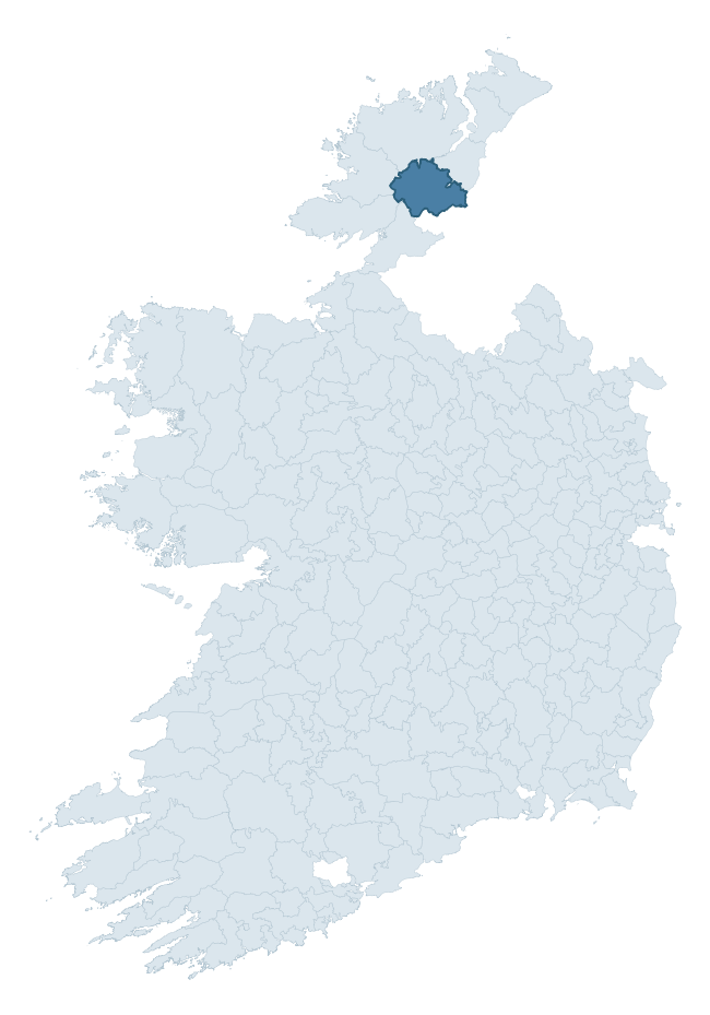
Where this barony sits in the Republic of Ireland
Geology and preservation
Bedrock geology shapes the landscape long before any settlement begins — controlling soil drainage, agricultural potential, the survival of upstanding monuments, and the preservation of buried archaeology. The figures below come from the Geological Survey Ireland 1:100,000 bedrock map.
The bedrock underlying Raphoe South is predominantly psammite (42% of the barony by area), laid down during the Precambrian period (96% by area, over 540 million years ago). A substantial secondary geology of schist (19%) and marble (12%) adds further variety to the underlying landscape. With 8 distinct rock types mapped, the barony sits in the top third of ROI baronies for geological diversity (82nd percentile) — typically a sign of complex tectonic history or coastal mosaics of differing rock units.
Rock type composition
Largest mapped unit: Lough Eske Psammite Formation (22% of the barony)
Placename evidence
Logainm records 42 heritage-diagnostic placenames for Raphoe South, drawn from townland and civil-parish names across the barony. The dominant stratum is pre-Christian and Early Medieval defensive — ráth-, lios-, dún-, and caiseal-prefixed names that mark Iron Age and early historic settlement. The leading diagnostic roots are cill- (11 — church), lios- (10 — ringfort or enclosure), and dún- (5 — hilltop fort or promontory fort). This is above the ROI average of 30.7 heritage placenames per barony. The presence of multiple heritage strata side by side indicates layered occupation of the landscape across successive prehistoric and historic periods. Logainm records 316 placenames for Raphoe South (predominantly townland names). Of these, 42 (13%) carry one of the diagnostic Gaelic roots tracked above; the remainder draw on more generic landscape vocabulary that does not encode a heritage period.
Pre-Christian / Early Medieval Defensive
| Root | Count | Meaning |
|---|---|---|
| lios- | 10 | ringfort or enclosure |
| dún- | 5 | hilltop or promontory fort |
| caiseal- | 4 | stone ringfort |
| ráth- | 3 | earthen ringfort |
Early Christian Ecclesiastical
| Root | Count | Meaning |
|---|---|---|
| cill- | 11 | church (early) |
| domhnach- | 2 | pre-Patrician or earliest Patrician church |
| teampall- | 1 | church (later medieval) |
Burial, Ritual, and Norse-Contact
| Root | Count | Meaning |
|---|---|---|
| carn- | 2 | cairn |
| uaimh- | 2 | cave / souterrain |
| gall- | 2 | foreigner — Norse settlement marker |
| leaba- | 1 | megalithic tomb |
| leacht- | 1 | grave monument |
Other baronies in Donegal
About this profile
Click any section below to expand.
What is a barony?
A barony is a historic administrative unit in Ireland, broadly equivalent to an English hundred. The 280 baronies used here are from the OSi 2019 National Statutory Boundaries (generalised 20m), covering the 26 counties of the Republic of Ireland. Baronies derive from the Norman period, were formalised in the 17th century, and have not been redrawn for statistical purposes. They vary enormously in area, from compact urban baronies in Dublin to vast upland baronies in Connacht, and should not be compared by raw site count without accounting for area differences.
What counts as a site?
This profile combines three distinct heritage registers, each with its own definition of what constitutes a recordable site:
- Archaeological sites (NMS). The National Monuments Service Sites and Monuments Record (SMR) catalogues every known archaeological monument or site of archaeological interest in the Republic, from prehistoric burial mounds and ringforts to medieval churches and post-medieval defensive works. Inclusion does not require legal protection — only that the site has been identified, surveyed, and assessed as having archaeological value. A separate subset of these sites lies within a recorded protection zone, which gives them statutory protection under the National Monuments Acts.
- Listed buildings (NIAH). The National Inventory of Architectural Heritage records buildings of architectural, historical, archaeological, artistic, cultural, scientific, social, or technical interest. Each surveyed structure is appraised on a five-tier scale: International, National, Regional, Local, and Record-Only. The NIAH appraisal is informational rather than strictly statutory, but it underpins local-authority Record of Protected Structures (RPS) listings.
- Heritage placenames (Logainm). Logainm is the authoritative database of Irish placenames maintained by the Placenames Branch. This profile applies a heritage-diagnostic classifier to the Irish-language form of each townland name, flagging roots that signal defensive sites (ráth-, lios-, dún-, caiseal-, cathair-), ecclesiastical foundations (cill-, teampall-, domhnach-, mainistir-), prehistoric burial-ritual features (tuaim-, carn-, leaba-), or Norse-contact settlement (gall-). Townlands without one of these diagnostic roots are not flagged here — they may still carry historical significance, but that significance is not encoded in the name itself.
Editorial principles
The narrative sections of this profile follow several explicit principles:
- Evidential. Every claim about this barony’s heritage character is anchored in the underlying register data. Where a site count, a placename count, or a percentile rank is cited, it is computed from the source datasets at export time, not estimated.
- Comparative. Counts and metrics are reported alongside their percentile rank against the other 279 ROI baronies. A barony with 50 ringforts in absolute terms could be unusually high or unusually low depending on its size and regional context; percentile ranking removes that ambiguity.
- Transparent on limits. Where a register has known coverage gaps, survey biases, or data-quality issues that affect this barony’s figures, the profile flags them rather than presenting the numbers as definitive.
- No interpretation beyond what the data supports. The narrative does not speculate about historical events, social dynamics, or cultural meaning beyond what the recorded heritage and placename evidence directly attests.
Data caveats and limits
- NMS Sites and Monuments Record is the product of survey campaigns conducted at different intensities across different counties and decades. Some baronies have been surveyed more thoroughly than others, and absolute counts should be read in that light. Sites destroyed by development before survey are typically not represented; sites in heavily forested or upland terrain are sometimes under-recorded.
- NIAH coverage is broadly complete for the Republic of Ireland but the survey was conducted on a rolling county-by-county basis, and the most recent appraisal date varies. Buildings demolished or substantially altered after their original survey may still appear in the register; conversely, recent buildings of merit may not yet have been appraised.
- Logainm classification applies a deliberately conservative pattern-matching approach to the Irish-language townland forms. The classifier prioritises true positives over recall: a townland may carry a heritage signal that the classifier doesn’t recognise, particularly where the diagnostic root has been heavily anglicised or where the townland name draws on a less common term. The 60,000+ townland records and ~9,800 classified placenames give a substantial signal at barony scale, but individual townland names should be checked against Logainm directly for definitive interpretation.
- Period attribution. The chronological distribution reflects only those NMS sites that carry a recognised period attribution in the source data. Sites listed as “Unknown” period are excluded from the dated subset.
- Boundary changes. Some baronies have undergone minor boundary adjustments since their 19th-century definition; the OSi 2019 generalised boundaries used here are the current statutory definition and may differ slightly from historical maps in border areas.
- Bedrock geology is mapped at 1:100,000 scale, which means local variation within a barony — small pockets of different rock type, mineral veins, alluvium overlying bedrock — is generalised. The dominant-system and rocktype figures are area-weighted, so a barony reading “70% Carboniferous limestone” may still contain small but archaeologically important pockets of older or younger rock. Around 3% of GSI polygons do not match the lexicon and contribute no rocktype or system attribution.
Data sources
- National Monuments Service — Sites and Monuments Record (SMR) https://data.gov.ie/dataset/national-monuments-service-archaeological-survey-of-ireland
- National Inventory of Architectural Heritage (NIAH) https://data.gov.ie/dataset/national-inventory-of-architectural-heritage-niah-national-dataset
- Logainm — Placenames Database of Ireland https://www.logainm.ie/
- Ordnance Survey Ireland — National Statutory Barony Boundaries 2019 https://data-osi.opendata.arcgis.com/
- EURODEM — European Digital Elevation Model https://www.mapsforeurope.org/datasets/euro-dem
- ESA WorldCover https://esa-worldcover.org/en
- Geological Survey Ireland — 1:100,000 Bedrock Geology https://www.gsi.ie/en-ie/data-and-maps/Pages/Bedrock.aspx
Explore more: Search any of the 280 ROI baronies, browse by historical province, or read the methodology and data sources for the full Republic of Ireland Heritage Tool.