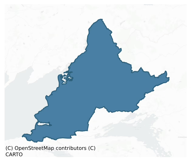
Tirhugh is a barony of County Donegal, in the historical province of Ulster (Irish: Tír Aodha), covering 520 km² of land. The barony records 418 NMS archaeological sites and 292 NIAH listed buildings, placing it at around the 5th percentile among 280 ROI baronies for sites per km². This means it is in the bottom tenth of all baronies for sites per km². Dated archaeological evidence runs from the Mesolithic through to the Post Medieval, spanning 8 of 9 archaeological periods, placing the barony in the 49th percentile among 280 ROI baronies for chronological depth. This means it is in the lower half of all baronies for chronological depth. The largest dated subset of recorded sites dates to the Early Medieval. Logainm flags 28 placenames in the barony as carrying a recognised heritage root; the largest share — around 43% — are names associated with early Christian church and monastic foundations.
Heritage at a glance
Percentile rankings throughout this profile compare each barony only against the other 279 Republic of Ireland baronies.
The recorded heritage of Tirhugh
The National Monuments Service Sites and Monuments Record (SMR) is the statutory inventory of archaeological sites for the Republic of Ireland, maintained by the Department of Tourism, Culture, Arts, Gaeltacht, Sport and Media. Sites recorded here include earthworks, ringforts, megalithic tombs, ecclesiastical remains, and post-medieval features; not every record is legally protected, but each is registered as a monument of archaeological interest.
The National Monuments Service records 418 archaeological sites in Tirhugh, putting it at the 5th percentile among 280 ROI baronies for sites per km². This means it is in the bottom tenth of all baronies for sites per km². A sparse recorded total of this kind in Ireland often reflects survey priority rather than genuine absence of past activity. Protection coverage is near-universal — 398 sites (95%) fall within a recorded monument protection zone, indicating an extensively surveyed landscape. The dominant category is defensive sites — ringforts, enclosures, hillforts, and stone forts (220 sites, 53% of the record). Ringfort – rath is the most prevalent type, making up 24% of the barony's recorded sites (99 records), broadly in line with the ROI average of 20% across all baronies where this type occurs. Ringfort – rath is an earthen ringfort enclosed by a bank and external ditch — the most common Early Medieval farmstead, broadly dated 500–1000 AD. Other significant types include Enclosure (59) and Ringfort – cashel (27). Enclosure is a banked or ditched feature of uncertain type, used as a catch-all where the original function cannot be determined from surface evidence; Ringfort – cashel is the stone-walled equivalent of the rath, found mainly in upland or western areas, broadly dated 500–1000 AD. Across the barony's 520 km², this gives a recorded density of 0.80 sites per km².
Most common monument types
Hover or tap a monument type to see its definition.
| Type | Count |
|---|---|
| Ringfort – rath an earthen ringfort enclosed by a bank and external ditch — the most common Early Medieval farmstead, broadly dated 500–1000 AD | 99 |
| Enclosure a banked or ditched feature of uncertain type, used as a catch-all where the original function cannot be determined from surface evidence | 59 |
| Ringfort – cashel the stone-walled equivalent of the rath, found mainly in upland or western areas, broadly dated 500–1000 AD | 27 |
| Standing stone a deliberately set upright stone, used variously as a Bronze/Iron Age burial marker, route marker or commemorative monument | 24 |
| Souterrain an underground stone-built passage and chamber, generally Early Medieval and often associated with ringforts as a defensive or storage feature | 16 |
| Church a building used for public Christian worship, of any date from c. 500 AD onwards | 14 |
| Hut site a low stone or earthen foundation enclosing a small circular or oval area, generally interpreted as a former dwelling, of any date from prehistory to the medieval period | 13 |
| Ritual site – holy well a well or spring traditionally associated with a saint, often credited with healing properties; many trace earlier ritual origins but devotion is documented from the medieval period onwards | 13 |
Chronological distribution
The dated archaeological record for Tirhugh spans from the Mesolithic through to the Post Medieval, with activity attested across 8 of 9 archaeological periods. Every period from earliest to latest is represented in the record — an unbroken sequence of dated activity across the full chronological span. Activity concentrates most heavily in the Early Medieval (147 sites, 44% of dated material), with the Iron Age forming a secondary peak (89 sites, 27%). A further 88 recorded sites (21% of the overall NMS register for the barony) carry no period attribution — appearing as 'Unknown' in the bar chart below. This typically reflects either records that pre-date the standardised period vocabulary or sites awaiting specialist dating review, rather than a genuine absence of chronological evidence.
Sample of recorded monuments
Show 25 sample monuments (of 418 total)
A representative sample of 25 recorded monuments drawn from the barony’s 418 total NMS entries. Sites within a recorded monument protection zone and rarer site types are prioritised so the list shows a meaningful cross-section rather than only the most common type. Each entry shows the official Sites and Monuments Record reference number and the description published by the National Monuments Service.
Religious house – Franciscan friars
Donegal Friary is a National Monument in State care (No.175). It was founded for the Franciscan Observant friars by Aodh Rua O' Donnell and his wife Nuala O' Brien, the date of commencement of the building was 1473 or…
Donegal Friary is a National Monument in State care (No.175). It was founded for the Franciscan Observant friars by Aodh Rua O' Donnell and his wife Nuala O' Brien, the date of commencement of the building was 1473 or 1474, or less probably 1472 (Mooney 1954-5, 20). It survived intact until 1588 when English forces pillaged it and, soon afterwards, garrisoned the buildings. They were driven out by Red Hugh O' Donnell in 1592 and the friars returned and repaired the place. In 1601, it was again seized by English forces commanded by the renegade Niall Garbh O'Donnell. During the ensuing siege of the friary by Red Hugh O'Donnell, a mysterious explosion and fire wrecked the buildings. In the following year, Red Hugh was succeeded by his brother Rory as O'Donnell and Earl of Tirconnell and before the latter's departure for Spain, in 1607, he had set about repairing the friary for the Franciscans. The friary was granted in 1607 to Sir Basil Brooke and the Church was subsequently used for Protestant worship (Mooney 1952, passim).
Though the explosion and fire of 1601 were without doubt responsible for the fragmentary condition of the ruins, the ·prolonged use of the friary as a place of burial (DG093-013005-) in modern times has raised the ground level (as much as 1.75m in places) and obscured much detail. The limits of many of the buildings were disclosed in the excavations carried out by the OPW when conserving the remains and some sections were raised to present ground level…
Religious house – Franciscan Third Order Regular
Magherabeg Friary: founded in the 15th century for the Franciscan Third Order Regular by O'Donnell. The friary was occupied in 1601 by the forces of Niall Garbh O'Donnell supporting the English against his cousin, Red…
Magherabeg Friary: founded in the 15th century for the Franciscan Third Order Regular by O'Donnell. The friary was occupied in 1601 by the forces of Niall Garbh O'Donnell supporting the English against his cousin, Red Hugh O'Donnell. It was subsequently in the possession of Sir Paul Gore (Gwynn and Hadcock 1970, 273; Treadwell
1953-5, 513). The ivy-covered ruins consist of a church 28.65m by 6.73m internally and the E range of domestic buildings. The walls are built of roughly-coursed, dressed, blocks with small pinnings; sections of this facing have fallen away, particularly along the interior S wall of the church. The church comprises nave and chancel without structural division. The N and S walls survive to a maximum height of c. 5.2m; most of the E and W gables have fallen. The E window is represented by the N splayed ingoing and a single moulded jamb-and-sill fragment. The window probably had three lights. The SE quoin of the church is obscured by fallen masonry. A large ragged gap about midway along the S wall and a corresponding opening opposite it in the N wall probably indicate the positions of windows. W of the gap in the S wall are the lower jambs, mullion and sill of a blocked-up two-light window with splayed ingoings. The pointed doorway in the S wall has a broach-stop-chamfered W jamb and the E jamb stones are damaged but retain a small bolt-hole in the interior rebate. The cracked lintelled rear-arch has modern iron supports; the fallen ingoings were rebuil…
Building
It is traditionally believed that a monastic settlement was founded here in the fifth century by St. Patrick who installed Dabheoc as the first abbot. There are forty-six islands in Lough Derg but only two of them are…
It is traditionally believed that a monastic settlement was founded here in the fifth century by St. Patrick who installed Dabheoc as the first abbot. There are forty-six islands in Lough Derg but only two of them are of archaeological interest. The original monastic settlement is believed to have been located on Saint's (formerly St. Dabheog's) Island. This became a priory dependant on the Augustinian Abbey of SS Peter and Paul, Armagh in the 1130's and was suppressed and abandoned towards the end of the sixteenth century. The chief concern of the monastery was to minister to the needs of the pilgrimages to the cave, known as St. Patrick's Purgatory, on nearby Station Island. Some sources suggest that the original cave had been located on Saint's Island and that the pilgrimage was later transferred to its present location (Leslie 1961, 9-10). The Lough Derg pilgrimage was famous throughout Europe in the middle ages and a large literature grew up around it (Curtayne 1962, 160-62). An ancient roadway to the pilgrimage site from the village of Pettigo passes Rathnacross ringfort (DG105-002-) and Templecarn old church and burial ground (DG105-003; DG105-015-). The roadway continues to a point on the SW shore of the lake where a wooden bridge (DG101-002-) connected it to Saint's Island. Natural boulders projecting from the lake may be the remains of the supports for this bridge. On the SE shore of the lake is a natural L-shaped stone known as St. Brigid's Chair. St. Dabheoc's…
Quay
It is traditionally believed that a monastic settlement was founded here in the fifth century by St. Patrick who installed Dabheoc as the first abbot. There are forty-six islands in Lough Derg but only two of them are…
It is traditionally believed that a monastic settlement was founded here in the fifth century by St. Patrick who installed Dabheoc as the first abbot. There are forty-six islands in Lough Derg but only two of them are of archaeological interest. The original monastic settlement is believed to have been located on Saint's (formerly St. Dabheog's) Island. This became a priory dependant on the Augustinian Abbey of SS Peter and Paul, Armagh in the 1130's and was suppressed and abandoned towards the end of the sixteenth century. The chief concern of the monastery was to minister to the needs of the pilgrimages to the cave, known as St. Patrick's Purgatory, on nearby Station Island. Some sources suggest that the original cave had been located on Saint's Island and that the pilgrimage was later transferred to its present location (Leslie 1961, 9-10). The Lough Derg pilgrimage was famous throughout Europe in the middle ages and a large literature grew up around it (Curtayne 1962, 160-62). An ancient roadway to the pilgrimage site from the village of Pettigo passes Rathnacross ringfort (DG105-002-) and Templecarn old church and burial ground (DG105-003; DG105-015-). The roadway continues to a point on the SW shore of the lake where a wooden bridge (DG101-002-) connected it to Saint's Island. Natural boulders projecting from the lake may be the remains of the supports for this bridge. On the SE shore of the lake is a natural L-shaped stone known as St. Brigid's Chair. St. Dabheoc's…
Font
It is traditionally believed that a monastic settlement was founded here in the fifth century by St. Patrick who installed Dabheoc as the first abbot. There are forty-six islands in Lough Derg but only two of them are…
It is traditionally believed that a monastic settlement was founded here in the fifth century by St. Patrick who installed Dabheoc as the first abbot. There are forty-six islands in Lough Derg but only two of them are of archaeological interest. The original monastic settlement is believed to have been located on Saint's (formerly St. Dabheog's) Island (DG101-001001/002/003/004/005/006/008-). This became a priory dependant on the Augustinian Abbey of SS Peter and Paul, Armagh in the 1130's and was suppressed and abandoned towards the end of the sixteenth century. The chief concern of the monastery was to minister to the needs of the pilgrimages to the cave, known as St. Patrick's Purgatory, on nearby Station Island. Some sources suggest that the original cave had been located on Saint's Island and that the pilgrimage was later transferred to its present location (Leslie 1961, 9-10). The Lough Derg pilgrimage was famous throughout Europe in the middle ages and a large literature grew up around it (Curtayne 1962, 160-62). An ancient roadway to the pilgrimage site from the village of Pettigo passes Rathnacross ringfort (DG105-002-) and Templecarn old church and burial ground (DG105-003; DG105-015-). The roadway continues to a point on the SW shore of the lake where a wooden bridge (DG101-002-) connected it to Saint's Island. Natural boulders projecting from the lake may be the remains of the supports for this bridge. On the SE shore of the lake is a natural L-shaped stone kno…
Stone sculpture
It is traditionally believed that a monastic settlement was founded here in the fifth century by St. Patrick who installed Dabheoc as the first abbot. There are forty-six islands in Lough Derg but only two of them are…
It is traditionally believed that a monastic settlement was founded here in the fifth century by St. Patrick who installed Dabheoc as the first abbot. There are forty-six islands in Lough Derg but only two of them are of archaeological interest. The original monastic settlement is believed to have been located on Saint's (formerly St. Dabheog's) Island (DG101-001001/002/003/004/005/006/008-). This became a priory dependant on the Augustinian Abbey of SS Peter and Paul, Armagh in the 1130's and was suppressed and abandoned towards the end of the sixteenth century. The chief concern of the monastery was to minister to the needs of the pilgrimages to the cave, known as St. Patrick's Purgatory, on nearby Station Island. Some sources suggest that the original cave had been located on Saint's Island and that the pilgrimage was later transferred to its present location (Leslie 1961, 9-10). The Lough Derg pilgrimage was famous throughout Europe in the middle ages and a large literature grew up around it (Curtayne 1962, 160-62). An ancient roadway to the pilgrimage site from the village of Pettigo passes Rathnacross ringfort (DG105-002-) and Templecarn old church and burial ground (DG105-003; DG105-015-). The roadway continues to a point on the SW shore of the lake where a wooden bridge (DG101-002-) connected it to Saint's Island. Natural boulders projecting from the lake may be the remains of the supports for this bridge. On the SE shore of the lake is a natural L-shaped stone kno…
Hilltop enclosure
McGonigle's Fort, a massive earthwork, clearly of a defensive nature. The site consists of an oval area (80m E-W; 60m N-S) probably scarped on the N and S sides with an earthen bank at the E and a massive earthen bank…
McGonigle's Fort, a massive earthwork, clearly of a defensive nature. The site consists of an oval area (80m E-W; 60m N-S) probably scarped on the N and S sides with an earthen bank at the E and a massive earthen bank 3m to 4m high on the W where the site is most vulnerable. Outside this oval area and below it on the hillside is a massive fosse with an outer earthen bank enclosing the site for most of its circuit. This outer bank has been incorporated into field boundaries and a lane-way, which leads to the site from the S, and it is not clear to what extent it is a primary feature of the site. In the NE sector of the interior there is an earthen mound (DG103-017002-) at a point where there is a change in ground level. The mound is c. 5m high on the E side. The site is located on the E side of a long drumlin-type ridge. It has excellent views in all directions and although set on good land overlooks a boggy valley running in from the sea to the N. Local tradition says that the site is the burial place of a king of Tir Conaill. The site has been claimed as a possible motte-and-bailey (McNeil 1975, 54) but it has been more usually treated as a hillfort (Raftery 1972, 40 and Evans 1966, 87). However, the site definitely does not exploit the contours of the summit of the hill, as this is located outside the enclosure a little to the W. The site has been identified with Ard Fothadh mentioned in early Irish sources. (Allingham 1879, 111-2).
The above description was derived f…
Anomalous stone group
This feature, not shown on OS 6-inch maps, is listed in the SMR for County Donegal (1987) as a megalithic tomb. There are three low stones here, lying approximately NE-SW, but, although they appear deliberately set,…
This feature, not shown on OS 6-inch maps, is listed in the SMR for County Donegal (1987) as a megalithic tomb. There are three low stones here, lying approximately NE-SW, but, although they appear deliberately set, they are not part of a megalithic tomb.
SMR 1987, 103:49; RMP 1995, 103:49.
The above description was published in the 'Survey of the Megalithic Tombs of Ireland. Volume VI, County Donegal.' Compiled by: Eamon Cody (Dublin: Stationery Office, 2002).
Date of upload: 22 September 2008
Cliff-edge fort
Internal diam. 34.8m NE-SW. Situated on N edge of the ridge is a semicircular area enclosed by an earth/stone bank c. 1.6m in height and bounded along its N sector by a steep precipice. A fosse c. 2m in width surrounds…
Internal diam. 34.8m NE-SW. Situated on N edge of the ridge is a semicircular area enclosed by an earth/stone bank c. 1.6m in height and bounded along its N sector by a steep precipice. A fosse c. 2m in width surrounds the site. There is an entrance and causeway in the NE sector. A small field [c. 40m NW-SE; c. 40m NE-SW] enclosed by a low wall adjoins the site to the S.
The above description was derived from the 'Archaeological Survey of County Donegal. A description of the field antiquities of the County from the Mesolithic Period to the 17th century.' Compiled by: Brian Lacey with Eamon Cody, Claire Cotter, Judy Cuppage, Noel Dunne, Vincent Hurley, Celie O'Rahilly, Paul Walsh and Seán Ó Nualláin (Lifford: Donegal County Council, 1983). In certain instances the entries have been revised and updated.
Date of upload: 3 November 2014
Field boundary
Located at the NE end of Twomilestone ridge. First recorded by Davies (1942, 102, site ‘i’) who described the following feature: ‘At ‘i’, in a marshy hollow, are two rough blocks of weathered sandstone 1 ft. 11 ins.…
Located at the NE end of Twomilestone ridge. First recorded by Davies (1942, 102, site ‘i’) who described the following feature: ‘At ‘i’, in a marshy hollow, are two rough blocks of weathered sandstone 1 ft. 11 ins. apart. The eastern is roughly pointed, the western flat-topped. They have no obvious purpose and are not in a field-wall.’ The two stones were recorded in the Archaeological Survey of County Donegal (Lacy et al. 1983, 154, no. 925) as follows: ‘Two very weathered blocks of limestone situated at the bar of the ridge, at its E end. These are possibly the remains of an old field boundary standing .58m apart, both are .9m in height. Isolated stones c. 300m to the SW may also have been incorporated originally in a field boundary.’ The location of the stones as shown on Davies’s map (1942, 99) places them at the base of the NE end of the ridge. An inspection of the area was undertaken in 2015 but no trace of the stones was found. It seems likely that the two stones were removed during land reclamation.
Compiled by: Jane O’Shaughnessy
Date of revised upload: 20 July 2016
Cist
A cist (c. 0.76m x 0.76m; D 0.6m), described as 'a short cist of Bronze Age type', was found at approximately this location in 1966, but was destroyed before it could be fully recorded. A flint thumbnail scraper was…
A cist (c. 0.76m x 0.76m; D 0.6m), described as 'a short cist of Bronze Age type', was found at approximately this location in 1966, but was destroyed before it could be fully recorded. A flint thumbnail scraper was recovered from the cist (NMI; Lucas 1969, 96). In 1964 a pit burial (DG103-064—-) was found c. 180m to N.
Compiled by: Jane O'Shaughnessy
Date of revised upload: 6 December 2017
Settlement cluster
'The lands of Termon McGrath were granted to James, son of Archbishop Myler McGrath in 1610 (Hill 1877, 183-4). In 1611 Carew records that the 'Archbishop of Cashill hath begune a prittie castle at Termon Magragh w'ch…
'The lands of Termon McGrath were granted to James, son of Archbishop Myler McGrath in 1610 (Hill 1877, 183-4). In 1611 Carew records that the 'Archbishop of Cashill hath begune a prittie castle at Termon Magragh w'ch he entends speedily to finish, havinge his materials ready at the place wher he meanes to buyld a bawne and finish the castle' (Hunter 1975, 82). In the campaign of 1649-50 Termon McGrath Castle was bombarded by Cromwellian troops and the N wall of the tower-house destroyed; it has remained a ruin ever since (Rowan 1979, 453)'.
'Tarmon McGragh Castle & Towne' is marked on the Down Survey (1655-6) map of the Parish of Cam, Barony of Tyrehugh. It appears that a small village grew up around the castle [DG105-014001- and DG105-014003-] (Ó Gallachair n.d. 17). A number of drains (DG105-014003-) criss-cross the area to the E and W of the roadway leading to the castle entrance and the aerial photograph (St. Joseph AJT 52) seems to show additional evidence of the layout of the 'town' or possibly of a garden.
The above description was derived from the 'Archaeological Survey of County Donegal. A description of the field antiquities of the County from the Mesolithic Period to the 17th century.' Compiled by: Brian Lacey with Eamon Cody, Claire Cotter, Judy Cuppage, Noel Dunne, Vincent Hurley, Celie O'Rahilly, Paul Walsh and Seán Ó Nualláin (Lifford: Donegal County Council, 1983). In certain instances the entries have been revised and updated.
Date of upload: 08…
Religious house – Cistercian monks
Assaroe Abbey (DG107-044001-): This Cistercian monastery, a daughter house of Boyle, was founded in 1178. It was plundered in 1398 by Niall Óg O'Neill and was suppressed in the later 16th century (Gwynn and Hadcock…
Assaroe Abbey (DG107-044001-): This Cistercian monastery, a daughter house of Boyle, was founded in 1178. It was plundered in 1398 by Niall Óg O'Neill and was suppressed in the later 16th century (Gwynn and Hadcock 1970, 127). The only identifiable remains are those of the church and comprise the ivy-covered section of the S wall and W gable with its N return; c. 9m high. Built of rubble and split stone with sandstone dressings, only the NW ashlar quoin with chamfered arris is in situ. The S wall which acts as the graveyard (DG107-0044002-) boundary is 15.8m in length to the interior return of the W gable, represented by a few protruding bond stones. Sheds have been built against the exterior face of the wall. It is joined to the surviving N section of the W gable by a modern graveyard wall. The N splayed ingoing for a window survives in the upper section of this gable. Some .7m of attached N wall remains giving an internal church width of 8.39m. Many moulded fragments (DG107-044003-) of late 12th/early 13th century date are scattered throughout the cemetery and others including three capitals and one cusped piece of tracery were built into the graveyard wall when it was constructed in the 19th century at the instigation of Dr. D. MacGettigan, Catholic Bishop of Raphoe, 1861-70 (Moran ed. I, 1873, 176).
The Ballyshannon sewerage scheme involved the monitoring by Giles Dawkes of Archaeological Development Services Ltd under licence No. 07E0620 of a series of machine-exca…
Cave
The Archaeological Survey of Ireland (ASI) is in the process of providing information on all monuments on The Historic Environment Viewer (HEV). Currently the information for this record has not been uploaded. To…
The Archaeological Survey of Ireland (ASI) is in the process of providing information on all monuments on The Historic Environment Viewer (HEV). Currently the information for this record has not been uploaded. To access available information for research purposes please make an appointment in advance with the Archive Unit (open Fridays 10.00 am – 5.00 pm), Department of Culture, Heritage and the Gaeltacht, The Custom House, Dublin 1 D01W6XO or email nmarchive@chg.gov.ie.
Bastioned fort
This fort, named ‘Mullanashee Fort’, is represented on the OS 1st ed. 6-inch map (surveyed 1834) as a roughly square-shaped enclosure with expansions at the east, south and west corners suggestive of bastions. Hugh…
This fort, named ‘Mullanashee Fort’, is represented on the OS 1st ed. 6-inch map (surveyed 1834) as a roughly square-shaped enclosure with expansions at the east, south and west corners suggestive of bastions. Hugh Allingham, in his 'Ballyshannon: its history and antiquities’ recorded that the last vestige of the mound on Mullaghnashee having been, it is said, obliterated in 1798, when a star fort was constructed on the hill top, hence the spot is now called Fort-hill.’ (1879, 18) Allingham undoubtedly derived this information from a note by O’Donovan in his edition of the Annals of the Four Masters where he states: ‘According to the tradition at Ballyshannon, an ancient earthen fort, and the mound of Aedh Ruadh, or Red Hugh, were destroyed in 1798, to form a modern English star-fort which now crowns the summit of Mullaghnashee.’ (AFM, vi, 2029, note x) The fort clearly dates from an earlier period and, indeed, it may have been built in 1597 as part of the campaign by Sir Conyers Clifford, de facto Crown governor of Connaught, who went north at the end of July of that year to subdue O’Donnell. At the end of that month Tibbot ne Long Burke arrived under sail from Galway, to revictual Clifford’s forces with provisions ‘ordered by sea’, and to re-equip them with ‘two small field pieces’. Clifford, who had camped at Assaroe, now moved his troops into position around the artillery at Mullach-Sithe-Aedha (Mullaghnashee) where, over the next three days, his forces carried out a b…
Ecclesiastical enclosure
Marked as a 'burial ground' (DG107-078003-) on the OS 6-inch maps. This site was destroyed without record very recently. It was undoubtedly the remains of an important early ecclesiastical site. 'Substantial banks and…
Marked as a 'burial ground' (DG107-078003-) on the OS 6-inch maps. This site was destroyed without record very recently. It was undoubtedly the remains of an important early ecclesiastical site. 'Substantial banks and the foundations of a church (DG107-078002-)' were visible. Oval in shape (DG107-078001-), it would appear to have been c. 130m long E-W and c. 90m N-S. The maps show that about three quarters of the enclosing element survived. Before destruction it was probably the best preserved site of a type which is very rare in Donegal.
The above description was derived from the 'Archaeological Survey of County Donegal. A description of the field antiquities of the County from the Mesolithic Period to the 17th century.' Compiled by: Brian Lacey with Eamon Cody, Claire Cotter, Judy Cuppage, Noel Dunne, Vincent Hurley, Celie O'Rahilly, Paul Walsh and Seán Ó Nualláin (Lifford: Donegal County Council, 1983). In certain instances the entries have been revised and updated.
Date of upload: 22 September 2008
Burial
The Archaeological Survey of Ireland (ASI) is in the process of providing information on all monuments on The Historic Environment Viewer (HEV). Currently the information for this record has not been uploaded. To…
The Archaeological Survey of Ireland (ASI) is in the process of providing information on all monuments on The Historic Environment Viewer (HEV). Currently the information for this record has not been uploaded. To access available information for research purposes please make an appointment in advance with the Archive Unit (open Fridays 10.00 am – 5.00 pm), Department of Culture, Heritage and the Gaeltacht, The Custom House, Dublin 1 D01W6XO or email nmarchive@chg.gov.ie.
Castle – motte
Stonewold Castle (DG107-062—-/DG107-062001-): This small tower-house stood on the S bank overlooking a shallow stretch of the River Erne, which was fordable when the water level was low. It was rectangular in plan, 36…
Stonewold Castle (DG107-062—-/DG107-062001-): This small tower-house stood on the S bank overlooking a shallow stretch of the River Erne, which was fordable when the water level was low. It was rectangular in plan, 36 1/2 ft by 28 1/2 ft with walls 6 1/2 ft thick, averaging 6 ft in height. It stood on a small mound (DG107-062002-) which was surrounded on the land-ward side by a fosse which was, in part, artificial. The castle was set in the mound, the interior ground level being 5 ft below the exterior top of the mound; a gap in the E wall was probably the site of a doorway (Ua Danachair and MacAdam 1946, NMI Topographical Files). This site was subsequently submerged by the River Erne hydro-electric scheme.
The above description was derived from the 'Archaeological Survey of County Donegal. A description of the field antiquities of the County from the Mesolithic Period to the 17th century.' Compiled by: Brian Lacey with Eamon Cody, Claire Cotter, Judy Cuppage, Noel Dunne, Vincent Hurley, Celie O'Rahilly, Paul Walsh and Seán Ó Nualláin (Lifford: Donegal County Council, 1983). In certain instances the entries have been revised and updated.
Date of upload: 22 September 2008
House – 16th/17th century
Donegal Castle: Hugh Roe O'Donnell, who died in 1505, is credited with having first erected a castle at Donegal (AFM 1505). The 'old castle' and a 'new tower' at Donegal are mentioned in a domestic conflict of 1564 (AFM…
Donegal Castle: Hugh Roe O'Donnell, who died in 1505, is credited with having first erected a castle at Donegal (AFM 1505). The 'old castle' and a 'new tower' at Donegal are mentioned in a domestic conflict of 1564 (AFM 1564); the nature of this tower is uncertain. Two years later, the Lord Deputy, Sir Henry Sidney, described the castle as 'one of the greatest that ever I saw in Ireland in any Irishman's lands, and would appear in good keeping one of the fairest. . .' (Caulfield 1870-1, 22). Though burned in 1589, and partly demolished, possibly in 1595, to prevent it being garrisoned by English forces (CSPI 1588-92, 123; O'Rahilly 1927, 208), it must, soon after, have been repaired; it fell into the possession of the English in 1601 (Murphy Ed., 1895, 261, 281, 291). Whether or not it was subsequently repaired by Rory O'Donnell is unknown. Captain Basil Brooke, knighted in 1616, received a grant of the castle in 1611, had it renewed in 1620 and made permanent in 1623 (Hill 1877, 324; Petrie 1840, 186). He is described in 1611 as having 'a fair bawn built with flankers' within which was 'a strong house of stone' (Hill 1877, 514). The Coats of Arms on the over-mantel of the fireplace confirm that it was he who converted the whole, with the addition of a gabled wing, into a Jacobean manor-house. During the 1641 rebellion it was held by Sir Basil's heir, Henry Brooke, though Clanrickarde took it for a short period in 1651. Henry Brooke subsequently resided there (de Breffny a…
Linear earthwork
A total of 19 archaeological test trenches were excavated under licence no. 03E1013 on a linear earthwork in advance of the N15 Bundoran-Ballyshannon By-Pass. The linear earthwork survived in 5 sections extending for a…
A total of 19 archaeological test trenches were excavated under licence no. 03E1013 on a linear earthwork in advance of the N15 Bundoran-Ballyshannon By-Pass. The linear earthwork survived in 5 sections extending for a total distance of 355m over boggy pasture adjacent to the Sruhanafulla Stream which runs just to the south. This feature was identified during the EIS stage of the development. Just over 200m of the earthwork lies within the embankment area of the proposed development. 4 of the 19 trenches revealed the presence of the linear ditch which varied in size and preservation from 2.3m to 5m wide. No datable artefacts were recovered from the linear earthwork and its associated ditches. It has been suggest by Kane that this linear earthwork formed part of the Black Pigs Dyke. This lienar earthwork was described in 1909 by the Reverend Canon Naylor of the parish of Finner where he records that 'The rampart is of course fragmentary. From the Bundrowes it comes right across the road which passes my house (townland of Magheracar) it then turns a few yards north of, and parallel to Strahanafulla (streamlet of Blood), the brook which tradition decalres was formerly the boundary of ulster. Running east of it, through the townlands of Drumachrin, rathmore and rathglas it goes into County Leitrim (townland of Boynagh) makling for Loch Melvin. You will of course understand that it only crops up here in short length or traces'. Kane goes on to state that 'a former rector of Bun…
Burnt spread
Archaeological testing carried out by Billy Quinn for IAC Ltd. under licence no. 03E1017 revealed an isolated burnt spread in Trench no. 8. An investigation of the deposit along its northern edge produced no finds. The…
Archaeological testing carried out by Billy Quinn for IAC Ltd. under licence no. 03E1017 revealed an isolated burnt spread in Trench no. 8. An investigation of the deposit along its northern edge produced no finds. The burnt spread was defined by an anomalous charcoal enriched sandy silt deposit situated 3m from the SW terminal of the trench. This layer 5m in length by 0.4m in width overlay an associated oxidised deposit of burnt red material C7. Both deposits were approximately 0.6m below the original ground level and contained no dateable artefacts. The spread was subsequently recorded and covered in plastic.
Above information taken from unpublished excavation report by Billy Quinn 2003, Report on the archaeological testing of test area 11 (EIS Sites 4 & 5) N15 Bundoran-Ballyshannon By-Pass.
Furnace
In 2004 this monument [Magheracar 2] was fully excavated by Brian O Donnchadha & Rob Lynch of I.A.C. Ltd under excavation licence number 04E0098 in advance of the N15 Bundoran-Ballyshannon By-Pass. The following summary…
In 2004 this monument [Magheracar 2] was fully excavated by Brian O Donnchadha & Rob Lynch of I.A.C. Ltd under excavation licence number 04E0098 in advance of the N15 Bundoran-Ballyshannon By-Pass. The following summary of the excavation is taken from the NRA archaeological database : The site is located on a south-facing slope of low-lying shallow valley. Area of boggy pasture, and underlying geology of poorly drained stony silty clay. This site consisted of a linear earthwork (DG109-008-) and a possible furnace. The linear earthwork is located immediately to the S of the furnace. Furnace A feature was made up of three distinctive components has been interpreted as a possible furnace. The furnace was defined by a linear cut into natural subsoil orientated east-west for a distance of around 5.3 m. The three characteristic components of this furnace were an area of burning (1) at the elevated eastern end of the furnace. This section of the furnace contained a charcoal-rich fill, with heat-affected mudstone. The central area of built stones (2) was steep-sided but irregularly so as to accommodate the stones (0.1-0.47 m by 0.07-0.34 m by 0.15-0.12 m). The possible drainage gully (3) angled slightly eastwards away from the main body of the feature. Charcoal analysis of oak (Quercus sp.) and birch (Betula sp.) from furnace. The furnace was dated to the late Iron Age/ Early medieval period.
Battlefield
The Archaeological Survey of Ireland (ASI) is in the process of providing information on all monuments on The Historic Environment Viewer (HEV). Currently the information for this record has not been uploaded. To…
The Archaeological Survey of Ireland (ASI) is in the process of providing information on all monuments on The Historic Environment Viewer (HEV). Currently the information for this record has not been uploaded. To access available information for research purposes please make an appointment in advance with the Archive Unit (open Fridays 10.00 am – 5.00 pm), Department of Culture, Heritage and the Gaeltacht, The Custom House, Dublin 1 D01W6XO or email nmarchive@chg.gov.ie.
Hillfort
This large ridge-top enclosure appears to be a hillfort, although it has been suggested (Patterson and Davies 1942) that it is a Neolithic enclosure. It encloses the summit of a N-S limestone ridge, with panoramic views…
This large ridge-top enclosure appears to be a hillfort, although it has been suggested (Patterson and Davies 1942) that it is a Neolithic enclosure. It encloses the summit of a N-S limestone ridge, with panoramic views encompassing the immediate undulating landscape, as well as distant landmarks of several counties: Donegal Bay, Slieve League and the Blue Stack mountains at NW–NE; the mountains of Leitrim and Sligo, the Mullaghmore Peninsula and Inish Murray at SE–SW; and Nephin Mountain in Mayo at WSW.
It consists of a roughly oval or D-shaped area (335m N–S; 190m E–W) defined on its W half at SSE–N by a substantial stone bank/wall which follow a contour of the ridge in a broad, smooth curve. On the E side, from NE-SE, it is naturally delimited by a steep limestone escarpment. The enclosing stone bank (Wth c. 10-12m; int. H 0.5-1.1m; ext. H 1.4-1.7m) consists of a substantial mound of medium and large limestone rubble, now broadly slumped and largely grass-covered. Within the enclosed area, a plateau (Wth c. 75m E-W) forms a relatively level central spine from which ground falls steeply outwards towards the enclosing wall. Within the confines of the hillfort there are several monuments: A cairn (DG103-029—-), which is incorporated into the E half of a circular enclosure (DG103-072001-), crowns the highest point of the plateau in the N half of the hillfort. Another circular enclosure (DG103-092—-) is located c. 13.5m to SE and is conjoined on its E side with a possib…
Ringfort – rath
Overall Diam. c. 30m. A much effaced site which appears to have consisted of an oval area surrounded by an earthen bank. There are faint suggestions of a fosse and an outer bank. It is situated on top of a drumlin with…
Overall Diam. c. 30m. A much effaced site which appears to have consisted of an oval area surrounded by an earthen bank. There are faint suggestions of a fosse and an outer bank. It is situated on top of a drumlin with good views. The landscape consists of good land on the drumlins surrounded by marshy valleys.
The above description was derived from the 'Archaeological Survey of County Donegal. A description of the field antiquities of the County from the Mesolithic Period to the 17th century.' Compiled by: Brian Lacey with Eamon Cody, Claire Cotter, Judy Cuppage, Noel Dunne, Vincent Hurley, Celie O'Rahilly, Paul Walsh and Seán Ó Nualláin (Lifford: Donegal County Council, 1983). In certain instances the entries have been revised and updated.
Date of upload: 22 September 2008
Listed buildings
The National Inventory of Architectural Heritage (NIAH) is a state survey appraising buildings of architectural, historical, archaeological, artistic, cultural, scientific, social, or technical interest. Each surveyed structure receives a rating from International (the highest, for buildings of European importance) through National, Regional, Local, and Record-Only.
The NIAH records 292 listed buildings in Tirhugh, the 87th percentile across ROI baronies for listed-building density. The highest-graded structures include 3 of National significance. The Republic holds 937 National-graded buildings in total, so this barony accounts for around 0% of the national total. Construction dates concentrate most heavily in the Victorian (1830-1900) period. The most-recorded building type is house (94 examples, 32% of the listed stock).
Terrain and environment
Mean elevation across the barony is 131m — the 80th percentile among 280 ROI baronies for elevation. This means it is in the top fifth of all baronies for elevation. This is a relatively elevated landscape by ROI standards. Elevation matters for heritage because higher-altitude baronies typically favour defensive monuments — ringforts and hilltop forts placed on prominent ground — while lowland baronies are more likely to carry the dense settlement and church networks of intensive agricultural landscapes. The barony reaches 566m at its highest point — a vertical span of more than 434m within its boundary, indicating significant topographic diversity. Mean slope is 5.9° — the 82nd percentile among 280 ROI baronies for slope. This means it is in the top fifth of all baronies for slope. This is consistently steep terrain by ROI standards, the kind of landscape that tends to preserve upstanding archaeological features well. Slope is a key control on both land use and archaeological preservation: steep ground resists ploughing and tends to preserve earthworks intact, while gentle slopes favour intensive cultivation that damages or destroys surface archaeology over time. The Topographic Wetness Index averages 9.8, the 19th percentile among 280 ROI baronies for wetness. This means it is in the bottom fifth of all baronies for wetness. This is well-drained ground by ROI standards — typical of upland or steeply-sloping country that sheds water rapidly. Drainage matters for heritage because poorly-drained ground preserves organic archaeology (wooden trackways, leather, textiles, and on rare occasions human remains) far better than free-draining soil; well-drained ground favours arable use but destroys organic material rapidly. The land cover is dominated by improved grassland (70%) and woodland (24%). In overall character, this is an upland landscape of steep, elevated terrain, with land use dominated by improved grassland.
Terrain measurements
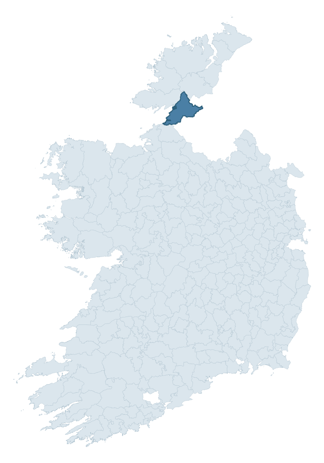
Where this barony sits in the Republic of Ireland
Geology and preservation
Bedrock geology shapes the landscape long before any settlement begins — controlling soil drainage, agricultural potential, the survival of upstanding monuments, and the preservation of buried archaeology. The figures below come from the Geological Survey Ireland 1:100,000 bedrock map.
The bedrock underlying Tirhugh is predominantly psammitic paragneisses (34% of the barony by area), with much of the rock dating to the Carboniferous period. A substantial secondary geology of limestone (30%) adds further variety to the underlying landscape. The single largest mapped unit is the Psammitic paragneiss (Slishwood Division) (34% of the barony's bedrock). With 10 distinct rock types mapped, the barony sits in the top third of ROI baronies for geological diversity (88th percentile) — typically a sign of complex tectonic history or coastal mosaics of differing rock units.
Rock type composition
Largest mapped unit: Psammitic paragneiss (Slishwood Division) (34% of the barony)
Placename evidence
Logainm records 28 heritage-diagnostic placenames for Tirhugh, drawn from townland and civil-parish names across the barony. The dominant stratum is Early Christian ecclesiastical — cill-, teampall-, and domhnach-prefixed names that record the dense network of early church foundations established between the fifth and tenth centuries. The leading diagnostic roots are cill- (9 — church), carn- (7 — cairn), and caiseal- (5 — stone ringfort). This is broadly in line with the ROI average of 30.7 heritage placenames per barony. The presence of multiple heritage strata side by side indicates layered occupation of the landscape across successive prehistoric and historic periods. A notable Norse signal is also visible: 5 placenames carry the gall- ('foreigner') element, marking areas of Hiberno-Norse contact or settlement. Logainm records 297 placenames for Tirhugh (predominantly townland names). Of these, 28 (9%) carry one of the diagnostic Gaelic roots tracked above; the remainder draw on more generic landscape vocabulary that does not encode a heritage period.
Pre-Christian / Early Medieval Defensive
| Root | Count | Meaning |
|---|---|---|
| caiseal- | 5 | stone ringfort |
| lios- | 2 | ringfort or enclosure |
| dún- | 1 | hilltop or promontory fort |
Early Christian Ecclesiastical
| Root | Count | Meaning |
|---|---|---|
| cill- | 9 | church (early) |
| teampall- | 2 | church (later medieval) |
| cillín- | 1 | unconsecrated burial ground |
Burial, Ritual, and Norse-Contact
| Root | Count | Meaning |
|---|---|---|
| carn- | 7 | cairn |
| gall- | 5 | foreigner — Norse settlement marker |
| leacht- | 1 | grave monument |
Other baronies in Donegal
About this profile
Click any section below to expand.
What is a barony?
A barony is a historic administrative unit in Ireland, broadly equivalent to an English hundred. The 280 baronies used here are from the OSi 2019 National Statutory Boundaries (generalised 20m), covering the 26 counties of the Republic of Ireland. Baronies derive from the Norman period, were formalised in the 17th century, and have not been redrawn for statistical purposes. They vary enormously in area, from compact urban baronies in Dublin to vast upland baronies in Connacht, and should not be compared by raw site count without accounting for area differences.
What counts as a site?
This profile combines three distinct heritage registers, each with its own definition of what constitutes a recordable site:
- Archaeological sites (NMS). The National Monuments Service Sites and Monuments Record (SMR) catalogues every known archaeological monument or site of archaeological interest in the Republic, from prehistoric burial mounds and ringforts to medieval churches and post-medieval defensive works. Inclusion does not require legal protection — only that the site has been identified, surveyed, and assessed as having archaeological value. A separate subset of these sites lies within a recorded protection zone, which gives them statutory protection under the National Monuments Acts.
- Listed buildings (NIAH). The National Inventory of Architectural Heritage records buildings of architectural, historical, archaeological, artistic, cultural, scientific, social, or technical interest. Each surveyed structure is appraised on a five-tier scale: International, National, Regional, Local, and Record-Only. The NIAH appraisal is informational rather than strictly statutory, but it underpins local-authority Record of Protected Structures (RPS) listings.
- Heritage placenames (Logainm). Logainm is the authoritative database of Irish placenames maintained by the Placenames Branch. This profile applies a heritage-diagnostic classifier to the Irish-language form of each townland name, flagging roots that signal defensive sites (ráth-, lios-, dún-, caiseal-, cathair-), ecclesiastical foundations (cill-, teampall-, domhnach-, mainistir-), prehistoric burial-ritual features (tuaim-, carn-, leaba-), or Norse-contact settlement (gall-). Townlands without one of these diagnostic roots are not flagged here — they may still carry historical significance, but that significance is not encoded in the name itself.
Editorial principles
The narrative sections of this profile follow several explicit principles:
- Evidential. Every claim about this barony’s heritage character is anchored in the underlying register data. Where a site count, a placename count, or a percentile rank is cited, it is computed from the source datasets at export time, not estimated.
- Comparative. Counts and metrics are reported alongside their percentile rank against the other 279 ROI baronies. A barony with 50 ringforts in absolute terms could be unusually high or unusually low depending on its size and regional context; percentile ranking removes that ambiguity.
- Transparent on limits. Where a register has known coverage gaps, survey biases, or data-quality issues that affect this barony’s figures, the profile flags them rather than presenting the numbers as definitive.
- No interpretation beyond what the data supports. The narrative does not speculate about historical events, social dynamics, or cultural meaning beyond what the recorded heritage and placename evidence directly attests.
Data caveats and limits
- NMS Sites and Monuments Record is the product of survey campaigns conducted at different intensities across different counties and decades. Some baronies have been surveyed more thoroughly than others, and absolute counts should be read in that light. Sites destroyed by development before survey are typically not represented; sites in heavily forested or upland terrain are sometimes under-recorded.
- NIAH coverage is broadly complete for the Republic of Ireland but the survey was conducted on a rolling county-by-county basis, and the most recent appraisal date varies. Buildings demolished or substantially altered after their original survey may still appear in the register; conversely, recent buildings of merit may not yet have been appraised.
- Logainm classification applies a deliberately conservative pattern-matching approach to the Irish-language townland forms. The classifier prioritises true positives over recall: a townland may carry a heritage signal that the classifier doesn’t recognise, particularly where the diagnostic root has been heavily anglicised or where the townland name draws on a less common term. The 60,000+ townland records and ~9,800 classified placenames give a substantial signal at barony scale, but individual townland names should be checked against Logainm directly for definitive interpretation.
- Period attribution. The chronological distribution reflects only those NMS sites that carry a recognised period attribution in the source data. Sites listed as “Unknown” period are excluded from the dated subset.
- Boundary changes. Some baronies have undergone minor boundary adjustments since their 19th-century definition; the OSi 2019 generalised boundaries used here are the current statutory definition and may differ slightly from historical maps in border areas.
- Bedrock geology is mapped at 1:100,000 scale, which means local variation within a barony — small pockets of different rock type, mineral veins, alluvium overlying bedrock — is generalised. The dominant-system and rocktype figures are area-weighted, so a barony reading “70% Carboniferous limestone” may still contain small but archaeologically important pockets of older or younger rock. Around 3% of GSI polygons do not match the lexicon and contribute no rocktype or system attribution.
Data sources
- National Monuments Service — Sites and Monuments Record (SMR) https://data.gov.ie/dataset/national-monuments-service-archaeological-survey-of-ireland
- National Inventory of Architectural Heritage (NIAH) https://data.gov.ie/dataset/national-inventory-of-architectural-heritage-niah-national-dataset
- Logainm — Placenames Database of Ireland https://www.logainm.ie/
- Ordnance Survey Ireland — National Statutory Barony Boundaries 2019 https://data-osi.opendata.arcgis.com/
- EURODEM — European Digital Elevation Model https://www.mapsforeurope.org/datasets/euro-dem
- ESA WorldCover https://esa-worldcover.org/en
- Geological Survey Ireland — 1:100,000 Bedrock Geology https://www.gsi.ie/en-ie/data-and-maps/Pages/Bedrock.aspx
Explore more: Search any of the 280 ROI baronies, browse by historical province, or read the methodology and data sources for the full Republic of Ireland Heritage Tool.