
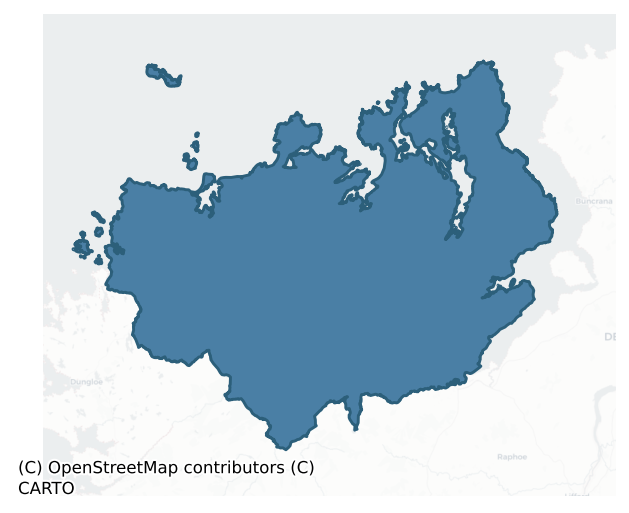
Kilmacrenan is a barony of County Donegal, in the historical province of Ulster (Irish: Cill Mhic Réanáin), covering 1262 km² of land. The barony records 776 NMS archaeological sites and 537 NIAH listed buildings, placing it at around the 3rd percentile among 280 ROI baronies for sites per km². This means it is in the bottom tenth of all baronies for sites per km². Dated archaeological evidence runs from the Mesolithic through to the Modern, spanning 9 of 9 archaeological periods, placing the barony in the 91st percentile among 280 ROI baronies for chronological depth. This means it is in the top tenth of all baronies for chronological depth. The largest dated subset of recorded sites dates to the Early Medieval. Logainm flags 97 placenames in the barony as carrying a recognised heritage root; the largest share — around 43% — are names associated with pre-christian defensive.
Heritage at a glance
Percentile rankings throughout this profile compare each barony only against the other 279 Republic of Ireland baronies.
The recorded heritage of Kilmacrenan
The National Monuments Service Sites and Monuments Record (SMR) is the statutory inventory of archaeological sites for the Republic of Ireland, maintained by the Department of Tourism, Culture, Arts, Gaeltacht, Sport and Media. Sites recorded here include earthworks, ringforts, megalithic tombs, ecclesiastical remains, and post-medieval features; not every record is legally protected, but each is registered as a monument of archaeological interest.
The National Monuments Service records 776 archaeological sites in Kilmacrenan, putting it at the 3rd percentile among 280 ROI baronies for sites per km². This means it is in the bottom tenth of all baronies for sites per km². A sparse recorded total of this kind in Ireland often reflects survey priority rather than genuine absence of past activity. Protection coverage is near-universal — 723 sites (93%) fall within a recorded monument protection zone, indicating an extensively surveyed landscape. The record is dominated by defensive sites — ringforts, enclosures, hillforts, and stone forts (247 sites, 32% of the total), with ecclesiastical sites forming a substantial secondary presence (143 sites, 18%). Ringfort – cashel is the most prevalent type, making up 11% of the barony's recorded sites (86 records) — well above the ROI average of 5% across all baronies where this type occurs. Ringfort – cashel is the stone-walled equivalent of the rath, found mainly in upland or western areas, broadly dated 500–1000 AD. Other significant types include Standing stone (50) and Enclosure (38). Standing stone is a deliberately set upright stone, used variously as a Bronze/Iron Age burial marker, route marker or commemorative monument; Enclosure is a banked or ditched feature of uncertain type, used as a catch-all where the original function cannot be determined from surface evidence. Across the barony's 1262 km², this gives a recorded density of 0.61 sites per km².
Most common monument types
Hover or tap a monument type to see its definition.
| Type | Count |
|---|---|
| Ringfort – cashel the stone-walled equivalent of the rath, found mainly in upland or western areas, broadly dated 500–1000 AD | 86 |
| Standing stone a deliberately set upright stone, used variously as a Bronze/Iron Age burial marker, route marker or commemorative monument | 50 |
| Enclosure a banked or ditched feature of uncertain type, used as a catch-all where the original function cannot be determined from surface evidence | 38 |
| Ringfort – rath an earthen ringfort enclosed by a bank and external ditch — the most common Early Medieval farmstead, broadly dated 500–1000 AD | 38 |
| Burial ground an area set apart for burial that is not associated with a church, in use from the medieval period onwards | 32 |
| Ringfort – unclassified a circular Early Medieval settlement enclosure where surviving evidence does not allow distinction between earthen and stone forms | 32 |
| Church a building used for public Christian worship, of any date from c. 500 AD onwards | 31 |
| Souterrain an underground stone-built passage and chamber, generally Early Medieval and often associated with ringforts as a defensive or storage feature | 29 |
Chronological distribution
The dated archaeological record for Kilmacrenan spans from the Mesolithic through to the Modern, with activity attested across 9 of 9 archaeological periods. This places Kilmacrenan in the top 9% of ROI baronies for chronological depth — few baronies record evidence across as many distinct archaeological periods. Every period from earliest to latest is represented in the record — an unbroken sequence of dated activity across the full chronological span. Activity concentrates most heavily in the Early Medieval (276 sites, 46% of dated material), with the Iron Age forming a secondary peak (108 sites, 18%). A further 172 recorded sites (22% of the overall NMS register for the barony) carry no period attribution — appearing as 'Unknown' in the bar chart below. This typically reflects either records that pre-date the standardised period vocabulary or sites awaiting specialist dating review, rather than a genuine absence of chronological evidence.
Sample of recorded monuments
Show 25 sample monuments (of 776 total)
A representative sample of 25 recorded monuments drawn from the barony’s 776 total NMS entries. Sites within a recorded monument protection zone and rarer site types are prioritised so the list shows a meaningful cross-section rather than only the most common type. Each entry shows the official Sites and Monuments Record reference number and the description published by the National Monuments Service.
Cross – Tau cross
At about the mid point on the S side of Tory Island is a settlement called West Town clustered around a small bay. This settlement includes within it and close to it the remains of the early ecclesiastical complex on…
At about the mid point on the S side of Tory Island is a settlement called West Town clustered around a small bay. This settlement includes within it and close to it the remains of the early ecclesiastical complex on the island (National Monument number 24). The available literature seems to refer to several structures and monuments no longer visible. In particular the Civil Survey of 1654-56 (Simington 1937, 114) refers to 'five churches almost ruined' only one of which seems to survive. Literary references to Tory appear to begin in the 7th century and continue throughout the early and later medieval period indicating its ecclesiastical nature (Gwynn and Hadcock 1970, 46).
At the head of the pier at West Town is a T-shaped or Tau cross carved from a single block of stone. It is 1.9m high, the shaft is .4m wide, the cross is .15m thick. The head of the cross is 1.1m wide and 0.35m deep.
The above description was derived from the 'Archaeological Survey of County Donegal. A description of the field antiquities of the County from the Mesolithic Period to the 17th century.' Compiled by: Brian Lacey with Eamon Cody, Claire Cotter, Judy Cuppage, Noel Dunne, Vincent Hurley, Celie O'Rahilly, Paul Walsh and Seán Ó Nualláin (Lifford: Donegal County Council, 1983). In this instance the entry has been revised and updated.
Revised by: Paul Walsh
Date of upload: 13 March 2013
Round tower
At about the mid point on the S side of Tory Island is a settlement called West Town clustered around a small bay. This settlement includes within it and close to it the remains of the early ecclesiastical complex on…
At about the mid point on the S side of Tory Island is a settlement called West Town clustered around a small bay. This settlement includes within it and close to it the remains of the early ecclesiastical complex on the island (National Monument number 24). The available literature seems to refer to several structures and monuments no longer visible. In particular the Civil Survey of 1654-56 (Simington 1937, 114) refers to 'five churches almost ruined' only one of which seems to survive. Literary references to Tory appear to begin in the 7th century and continue throughout the early and later medieval period indicating its ecclesiastical nature (Gwynn and Hadcock 1970, 46).
This tower is 15.7m in circumference and 12.8m in height. It is built of pinkish granite beach stones mortared with a shell lime. It is partially breached on the W side but is intact on the E to a cornice line, above which a small part of the cap rises. A doorway faces ESE 2.64m above the ground. It has a rounded head. Its maximum height is 1.65m and is 0.61m wide externally. There is a mortice for a door-fastening on the N jamb. Only one window survives below the cornice line, above the door. The tower had three floors, the top one formed by stone vaulting (Barrow 1979, 73-7). The tower was repaired by the Office of Public Works in the 1970s.
The above description was derived from the 'Archaeological Survey of County Donegal. A description of the field antiquities of the County from the Mesolith…
Leacht
At about the mid point on the S side of Tory Island is a settlement called West Town clustered around a small bay. This settlement includes within it and close to it the remains of the early ecclesiastical complex on…
At about the mid point on the S side of Tory Island is a settlement called West Town clustered around a small bay. This settlement includes within it and close to it the remains of the early ecclesiastical complex on the island (National Monument number 24). The available literature seems to refer to several structures and monuments no longer visible. In particular the Civil Survey of 1654-56 (Simington 1937, 114) refers to 'five churches almost ruined' only one of which seems to survive. Literary references to Tory appear to begin in the 7th century and continue throughout the early and later medieval period indicating its ecclesiastical nature (Gwynn and Hadcock 1970, 46).
This is named 'Altar' on the 3rd ed. OS 6-inch map. It appears to have been dedicated to St. John (Getty 1853) but may have been moved a bit to the E when it was, rebuilt some time in the 20th century. The altar consists of a collection of stone fragments and stray pieces gathered together on a slight platform. There are 13 pieces cemented in position and 3 other loose pieces resting on them.
1. A granite block 1m x 0.5m x 0.3m. On one face is a simple cross in relief (DG006-002006-).
2. A circular cross-base (DG006-002007-) with a socket, diameter 0.8m x 0.4m in height. At the centre of its flat top is a cross-shaped socket 0.4m x 0.3m x 0.1m wide. Wedged in this is a flat shaft of stone 0.6m high x 0.35m wide. The top is broken. On one face is part of a cross in slight relief. Resting on the so…
Ritual site – holy/saint's stone
Mevagh Church: It was described in 1622 as 'the ancient parish church now ruinated' (Royal Commission, 216). Built of rubble with pinnings, the surviving church remains, 13.15m by 5.5m internally, consist of the E gable…
Mevagh Church: It was described in 1622 as 'the ancient parish church now ruinated' (Royal Commission, 216). Built of rubble with pinnings, the surviving church remains, 13.15m by 5.5m internally, consist of the E gable with attached N return, the S wall and a small section of the W gable. The NE quoin is of rough ashlar construction with small pinnings; the SE corner has fallen away. The interior is littered with collapse and graveyard debris. The E gable, c. 5m at the highest N section is lit by a central deeply splayed window built of small horizontally laid stones; the head and most of the rear-arch are missing. The ope, .21m wide, has an estimated height of 1.88m. Immediately S of this window is the splayed ingoing of a smaller window. Part of its head survives giving an ope height of .87m and, though its exact width cannot be determined, it was probably similar to that of the present E window. The position of this window in the E gable supports the suggestion that it was one of a pair. Although no evidence for a corresponding N window survives, it may have been completely removed when the larger E window was built. The S wall, 3.6m high, preserves the ingoing of a deeply splayed window at its E end; it is of similar construction to the central E window. A relieving arch survives above the bond holes of a wooden lintelled doorway in this wall; the splayed ingoings remain but the jambs have fallen away. A small section of the W gable survives to an interior height of 1…
Barrow – ring-barrow
An area, circular in plan and c. 17m across, consists of a low mound, surrounded by an earthen bank with an intervening level area. There is a possible cause-way across the level area on the E. The bank is 4m to 5m wide…
An area, circular in plan and c. 17m across, consists of a low mound, surrounded by an earthen bank with an intervening level area. There is a possible cause-way across the level area on the E. The bank is 4m to 5m wide and reaches a maximum height of .7m at the outer edge on the W. It has been removed on the E where there is now a ruined stone wall. A pole has been set in the outer edge of the bank on the W. At a distance of c. 1m to 1.5m inside the line of the bank is a low mound, c. 0.2m in height which is approximately rectangular in plan and 3 to 4m across on top. On the E a slightly raised area about 3m wide joins the mound to a ruined field wall and appears to have formed a causeway between the mound and the bank. The removal of the bank here prevents confirmation that this was an entrance to the site. The causeway might just be spill from the bank removal. The site is at the Wedge of a N-S running ridge. There is a steady fall to the shore of Mulroy Bay c. 200m to the W. There is good grazing available.
The above description was derived from the 'Archaeological Survey of County Donegal. A description of the field antiquities of the County from the Mesolithic Period to the 17th century.' Compiled by: Brian Lacey with Eamon Cody, Claire Cotter, Judy Cuppage, Noel Dunne, Vincent Hurley, Celie O'Rahilly, Paul Walsh and Seán Ó Nualláin (Lifford: Donegal County Council, 1983). In certain instances the entries have been revised and updated.
Date of upload: 22 Septem…
Castle – tower house
Doe Castle is a National Monument (No. 319) in State care. It is first mentioned in 1544 in connection with an internecine struggle between the sons of MacSweeny Doe. Some survivors of the Spanish Armada were granted…
Doe Castle is a National Monument (No. 319) in State care. It is first mentioned in 1544 in connection with an internecine struggle between the sons of MacSweeny Doe. Some survivors of the Spanish Armada were granted refuge here in 1588. Between 1600 and 1614 the castle figured prominently in the local wars between the English and Irish. In 1614 it came into the possession of Capt. John Sandford and in 1623 it was described as 'an ancient strong castle, three storeys high, and a bawn of lime and stone . . . . with good flankers . . . . The castle and bawn (DG026-023003-) are well repaired by Captain Samford who hath made in it some additions of buildings, and hath covered the house and slated it, and is now building a stone house within the bawn' (Treadwell 1953-5, 43). Shortly after the outbreak of rebellion in 1641, Doe Castle fell into Irish hands and it was here, in 1642, that Owen Roe O'Neill landed with a hundred Irish veterans. It was captured by English forces under Sir Charles Coote in 1650 and continued as a military garrison during the second half of the 17th century. In the Williamite Wars it was taken by Donogh Og MacSweeny after the occupants had withdrawn for safety to Derry. It was subsequently abandoned and fell into ruins. Towards the end of the 18th century the lands came into the possession of George Vaughan Harte and c. 1800 he began to restore Doe Castle. 'All except the keep or tower was a complete ruin nearly level to this ground, even the court wal…
Graveslab (present location)
At Doe castle. located on the exterior N face of the tower adjoining the SW corner of the keep (DG026-023001-).
This 16th century trapezoidal tomb slab was brought here from the nearby graveyard (DG026-024003-) in…
At Doe castle. located on the exterior N face of the tower adjoining the SW corner of the keep (DG026-023001-).
This 16th century trapezoidal tomb slab was brought here from the nearby graveyard (DG026-024003-) in 1968. It is carved with an elaborate cross; the head comprises an interlace centre-piece with seven radiating spear-shaped terminals. The shaft is decorated with a double band interlace pattern and rises from a Calvary of five steps which encloses the sacred monogram I.H.C. On the left of the shaft are carved, a bird and three animal figures (including a bull?) and, on the right, three interlace designs, a vine-leaf pattern and (now broken) an animal figure. The slab is damaged and the date and inscriptions on the right-hand edge and 'the date may be 1544 [M] CCCCCXXXXIIII, . . . and the name of the sculptor MADONIUF ORAVAITY [ME] FECIT' (1903, 139). The name of the person for whom it was carved is indecipherable but it was assuredly for one of the McSweenys of Doe.
The above description was derived from the 'Archaeological Survey of County Donegal. A description of the field antiquities of the County from the Mesolithic Period to the 17th century.' Compiled by: Brian Lacey with Eamon Cody, Claire Cotter, Judy Cuppage, Noel Dunne, Vincent Hurley, Celie O'Rahilly, Paul Walsh and Seán Ó Nualláin (Lifford: Donegal County Council, 1983). In certain instances the entries have been revised and updated.
Date of upload: 22 September 2008
Cross-inscribed pillar
Marked as a standing stone on the 2nd and 3rd editions of the OS 6-inch maps, this slab (DG028-012001-) has now been removed to the grounds of St. Joseph's Church in Rathmullen (DG037-023). It consists of a regularly…
Marked as a standing stone on the 2nd and 3rd editions of the OS 6-inch maps, this slab (DG028-012001-) has now been removed to the grounds of St. Joseph's Church in Rathmullen (DG037-023). It consists of a regularly shaped slab 1.6m high x 0.36m wide by 0.2m thick. On one face a Maltese cross inside a circle has been incised, but only faint traces of the upper portions can be seen. It was originally located at the position outlined above, allegedly beside the entrance to a souterrain (DG028-012002-) (NMI) but no trace of this is visible now. The site is in gently rising pasture.
The above description was derived from the 'Archaeological Survey of County Donegal. A description of the field antiquities of the County from the Mesolithic Period to the 17th century.' Compiled by: Brian Lacey with Eamon Cody, Claire Cotter, Judy Cuppage, Noel Dunne, Vincent Hurley, Celie O'Rahilly, Paul Walsh and Seán Ó Nualláin (Lifford: Donegal County Council, 1983). In certain instances the entries have been revised and updated.
Date of upload: 22 September 2008
Standing stone – pair
This site consists of two standing stones set 3m apart. Both faces of each stone bear petroglyphs. The S stone is 2.2m high × 2.4m wide × c. 0.75m thick; NW-SE approximately. S stone E face: heavily ornamented with at…
This site consists of two standing stones set 3m apart. Both faces of each stone bear petroglyphs. The S stone is 2.2m high × 2.4m wide × c. 0.75m thick; NW-SE approximately. S stone E face: heavily ornamented with at least 48 isolated cup-marks as well as more complex motifs. Kinahan noted a cup-and-three gapped circles on the lower part of the S end of this face. Spalling has removed one half of this motif; the remainder survives as a cup-mark surrounded by a shallow recessed band and 2 concentric circles. This motif also includes 2 satellite cup-marks and a satellite cup-and-circle. The discrepancy between Kinahan's drawing of this motif and the present one may be, as in other instances, due to erosion. The upper portion of this face is dominated by a forked design incorporating 4 cup-marks, one of which is surrounded by a recessed band, and another by a partially defaced band. Close to this is an incomplete cup-and-two circles with satellite cup-mark; an incomplete cup-and-circle; 2 cup-marks surrounded by recessed bands and 1 cup-and-radial line. N stone W face: a cross and 8 cup-marks. N stone E face: 7 cup-marks. The stones are situated on wettish pasture land and Kinahan noted a 21/2 feet depth of peat around them.
(Kinahan 1887, 432-7).
The above description was derived from the 'Archaeological Survey of County Donegal. A description of the field antiquities of the County from the Mesolithic Period to the 17th century.' Compiled by: Brian Lacey with Eamon Cody…
Religious house – Carmelite friars
Rathmullan Priory: Founded in 1516 for the Carmelite Order by Owen Roe MacSweeney and dedicated to the Blessed Virgin Mary, the priory survived intact until 1595 when it was plundered by Bingham; the friars returned and…
Rathmullan Priory: Founded in 1516 for the Carmelite Order by Owen Roe MacSweeney and dedicated to the Blessed Virgin Mary, the priory survived intact until 1595 when it was plundered by Bingham; the friars returned and repaired the place. In 1601, the buildings consisted of a church and steeple, cloister, hall and three chambers. Andrew Knox, Bishop of Raphoe, having obtained possession of the site, converted the nave and transept into a private dwelling, preserving the tower and chancel as his chapel (Gwynn and Hadcock 1970, 291). His initials and the date 1618 over the hall doorway indicate when these alterations took place. In 1706, the chancel was consecrated by Bishop Pooley as the parish church in place of that at Killygarvan, which had fallen into ruin (Batt 1889, 42). Services were discontinued there when a new parish church, St. Columb's, was built in 1814 (Leslie 1940, 94). The house probably fell into ruins in the later 18th century after the Knox family moved to Prehen near Derry (Batt 1889, 43; Anonymous 1892, 22, 27, 31; Rowan 1979, 406). The ruins testify to at least two major building phases. The original 16th century priory consisted of a church, comprising chancel, central tower, nave and transept and the N and E domestic ranges. Much of the former survives but only the N, E and a section of the W walls of the latter remain. The early 17th century alterations included the conversion of the nave and transept into a three storey, L-shaped, fortified house…
Cross-inscribed pillar (present location)
Marked as a standing stone on the 2nd and 3rd editions of the OS 6-inch maps, this slab (DG028-012001-) has now been removed to the grounds of St. Joseph's Church in Rathmullen (DG037-023). It consists of a regularly…
Marked as a standing stone on the 2nd and 3rd editions of the OS 6-inch maps, this slab (DG028-012001-) has now been removed to the grounds of St. Joseph's Church in Rathmullen (DG037-023). It consists of a regularly shaped slab 1.6m x .36m. On one face a Maltese cross inside a circle has been incised, but only faint traces of the upper portions can be seen. It was originally located at the position outlined above, allegedly beside the entrance to a souterrain (DG028-012002-) (NMI) but no trace of this is visible now. The site is in gently rising pasture.
The above description was derived from the 'Archaeological Survey of County Donegal. A description of the field antiquities of the County from the Mesolithic Period to the 17th century.' Compiled by: Brian Lacey with Eamon Cody, Claire Cotter, Judy Cuppage, Noel Dunne, Vincent Hurley, Celie O'Rahilly, Paul Walsh and Seán Ó Nualláin (Lifford: Donegal County Council, 1983). In certain instances the entries have been revised and updated.
Date of upload: 22 September 2008
Inauguration site
Doon Rock is traditionally believed to be the inauguration site of the O'Donnells. In some respects, it can be said to resemble an inland promontory fort. It consists of a natural mound of rock somewhat oval in plan c.…
Doon Rock is traditionally believed to be the inauguration site of the O'Donnells. In some respects, it can be said to resemble an inland promontory fort. It consists of a natural mound of rock somewhat oval in plan c. 150m N-S and c. 75m E-W. It rises dramatically from the surrounding wet land and is naturally defensive. The sides are steep but an approach is possible with difficulty from the S. Near the S side of the rock, there is a 2m change in level. On the N or upper side of this step and surviving for about 17m in length c. 3m wide and 0.3m in height is the remains of a collapsed and overgrown stone wall. About 5m from the W end of the wall, there is a gap 2m wide. The rock is much overgrown and uneven. (Kinahan 1889, 284). In 2006 the area on top of the rock was landscaped and a path constructed to facilitate access (SMR file).
The above description was published in the 'Archaeological Survey of County Donegal. A description of the field antiquities of the County from the Mesolithic Period to the 17th century.' Compiled by: Brian Lacey with Eamon Cody, Claire Cotter, Judy Cuppage, Noel Dunne, Vincent Hurley, Celie O'Rahilly, Paul Walsh and Seán Ó Nualláin (Lifford: Donegal County Council, 1983). In this instance the entry has been revised and updated.
Revised by: Paul Walsh
Date of upload: 04 November 2013
Chapel
The early ecclesiastical site at Gartan is the reputed birthplace of Colmcille, the greatest of the Donegal saints (Gwynn and Hadcock 1970, 385)*. It presently consists of a complex of sites in and around a graveyard…
The early ecclesiastical site at Gartan is the reputed birthplace of Colmcille, the greatest of the Donegal saints (Gwynn and Hadcock 1970, 385)*. It presently consists of a complex of sites in and around a graveyard (DG044-017008-) enclosed by a modern stone wall. Within the graveyard are a number of grave markers and the remains of a structure known as the 'Abbey' (DG044-017001-). This is c. 11.8m E-W and c. 5.2m N-S externally. The walls are .7m wide and survive for the most part .3m in height occasionally reaching .6m. The surviving walls have been much interfered with and in places are obscured. An ashlar quoin occurs in the SW corner. The walls are composed of mortared outer blocks with a core of smaller stones. There are a number of gaps in the S wall. There are two modern graves in the interior. 20m NW of the graveyard on a mound of rock, is the badly preserved remains of a cross (DG044-017002-). This now survives 1.22m in height and is c. .4m in width. The arms are barely perceptible. The remains of a second badly-preserved cross (DG044-017003-) stands about 20m S of the graveyard. This is 1.4m in height and 0.55m wide. The arms of this cross are also only barely perceptible. A heap of loose stones lie against the S base of the cross. The stones are connected with a turas or pilgrimage performed at the site. To the SE of this cross is a holy well (DG044-017004-) (Ó Muirgheasa No. 61) surrounded by a modern concrete wall. Just SW of the graveyard is St. Columbkille…
Barrow – unclassified
A 'barrow' levelled here in 1854 is said to have contained an 'urn and kistvaen' (Kinahan 1889, 286). The site today consists of a flat-topped rise, approximately circular, c. 22m across. It is c. 1m high. A slab 1.51m…
A 'barrow' levelled here in 1854 is said to have contained an 'urn and kistvaen' (Kinahan 1889, 286). The site today consists of a flat-topped rise, approximately circular, c. 22m across. It is c. 1m high. A slab 1.51m × 1.05m on top is thought to be part of the 'kistvaen'.
The above description was derived from the 'Archaeological Survey of County Donegal. A description of the field antiquities of the County from the Mesolithic Period to the 17th century.' Compiled by: Brian Lacey with Eamon Cody, Claire Cotter, Judy Cuppage, Noel Dunne, Vincent Hurley, Celie O'Rahilly, Paul Walsh and Seán Ó Nualláin (Lifford: Donegal County Council, 1983). In certain instances the entries have been revised and updated.
Date of upload: 22 September 2008
Architectural feature
The church (DG037-021001-) on Augnish Isle was replaced by another in Ramelton town in the early 17th century. A small, carved, window-head is said to have been removed there from the island (Kinahan 1885-6, 424). The…
The church (DG037-021001-) on Augnish Isle was replaced by another in Ramelton town in the early 17th century. A small, carved, window-head is said to have been removed there from the island (Kinahan 1885-6, 424). The site which was located on a small tidal island in Lough Swilly probably dates from at least the 12th/13th century.
Meeting-house
The excavation of the meetinghouse took place between August and October, 1988. The now disused building is to be restored by the Ramelton Heritage and Development Association. It is of historical importance, being one…
The excavation of the meetinghouse took place between August and October, 1988. The now disused building is to be restored by the Ramelton Heritage and Development Association. It is of historical importance, being one of the earliest Presbyterian meetinghouses in the country, while the town of Ramelton was the birthplace and home of Francis Makemie, a founding father of the Presbyterian Church in America. The purpose of the excavation was to establish the original shape of the building and the date of its construction. The meetinghouse is twin-roofed, the central junction of the roofs being supported by a small portion of wall at either end (each of these contained about one-third part of an arch which was cut short, then blocked-in) and in the centre by two heavy wooden pillars, once the masts of the 1811 shipwreck 'The Saldanha'. These had been inserted during the early 19th-century renovations to the meetinghouse. The removal of plaster from the walls revealed features predating the renovations of c. 181 1. These consisted of blocked-in windows at each gable end of the north bay, but not the south, and the arches. Because there were no gable windows in the south bay, it was first thought that the structure was either a single roofed building or a classic 17th- or 18th-century 'T'-shaped meetinghouse, the arches being the windows or doors on either side and the south bay being an early 19th-century extension. The meetinghouse had been built on a slope and the excavation…
House – indeterminate date
A sub-pentagonal graveyard(DG052-019007-) containing Templedouglas Abbey, an altar and the Abbot's House (DG052-019002-).
Abbot's House: N of Templedouglas Abbey are the grass-covered lower courses of a rectangular…
A sub-pentagonal graveyard(DG052-019007-) containing Templedouglas Abbey, an altar and the Abbot's House (DG052-019002-).
Abbot's House: N of Templedouglas Abbey are the grass-covered lower courses of a rectangular structure 12.2m by 2.6m internally. The low grass-covered cairns of stones in the interior were made by 'pilgrims performing religious stations' (DG052-019004-) (Fagan Bk. No.7, 2). There is a modern tombstone set in the E wall. Tradition identifies this building as the abbot's house.
The above description was derived from the 'Archaeological Survey of County Donegal. A description of the field antiquities of the County from the Mesolithic Period to the 17th century.' Compiled by: Brian Lacey with Eamon Cody, Claire Cotter, Judy Cuppage, Noel Dunne, Vincent Hurley, Celie O'Rahilly, Paul Walsh and Seán Ó Nualláin (Lifford: Donegal County Council, 1983). In certain instances the entries have been revised and updated.
Date of upload: 22 September 2008
Water mill – unclassified
During the seventeenth century plantation of Donegal, 1000 acres in Letterkenny was granted to Captain Crawford. Near to his house Sir George Merbury 'hath erected a market town (DG053-042) called Letterkenny,…
During the seventeenth century plantation of Donegal, 1000 acres in Letterkenny was granted to Captain Crawford. Near to his house Sir George Merbury 'hath erected a market town (DG053-042) called Letterkenny, consisting of 50 thatched houses whereof 13 have clay and stone walls, and one watermill (DG053-044)' (Treadwell 1954-5, 41). The historic town of Letterkenny had a constable and stocks (Hunter 1981, 67). It is possible that the Corn Mill and Mill Ponds marked on the latest ed. of the OS 6-inch map to the W of the Main Street may have been located on the site of the earlier watermill mentioned in the 17th century.
Bibliography
Treadwell, V. W. (1954-5), 'The Plantation of Donegal – A Survey', Donegal Annual, 41.
Hunter, R. J. (1981), 'Ulster Plantation Towns, 1609-41' pp. 55-80, in The Town in Ireland (eds.) D. Harkness and M. O'Dowd.
Compiled by: Caimin O'Brien
Date of upload/revision: : 19 July 2010
Stone circle – embanked
Situated on flat pasture on a headland with panoramic views of the Atlantic Ocean and Tory Island to W and N with upland area to E and overlooked by rock outcrop immediately to S. Site consists of a slightly sunken…
Situated on flat pasture on a headland with panoramic views of the Atlantic Ocean and Tory Island to W and N with upland area to E and overlooked by rock outcrop immediately to S. Site consists of a slightly sunken circular shaped interior (diam 28.1m N-S ; 32m E-W) enclosed by a mixture of low upright stones and rock outcrop which has been quarried to form a revetment or kerbing defining a roughly circular shaped interior. The best preserved upright orthostats can be seen on the SE side where the tallest stone measures 0.85m H by 0.6m by 0.67m. This stone appears to be set into a socket with packing stones around its base. On the outer face of these stones on the SE side there is the slightest suggestion of a low denuded bank which may have been built up against the outer face of these upright stones. There is no enclosing element from ENE through E to ESE as this appears to have been levelled when the interior was used for tillage. There is evidence of cultivation ridges running across the interior of the enclosure. The interior of the enclosure rises slightly from what appears to be a low mound, although this rise may be due to later disturbance.
This circle or enclosure is situated amongst a field system (DG015-031002-) of unknown date. A field bank runs off the N side of the enclosure and runs down to the cliff edge while a second low field bank intersects the ENE side of the enclosure and runs off to the E of the monument. The extensive remains of a field system (DG…
Hearth
-'Labra Lark's Castle' is a large double-walled cashel (DG044-022001-). An area of rock outcrop is enclosed by a ruined stone wall originally up to 2.4m in width. The inner face is up to 1m in height but appears to have…
-'Labra Lark's Castle' is a large double-walled cashel (DG044-022001-). An area of rock outcrop is enclosed by a ruined stone wall originally up to 2.4m in width. The inner face is up to 1m in height but appears to have been rebuilt in modern times. There is an entrance to the N from 1m to 2m in width. The central area of the cashel is built on a core of rock from 2m to 3m high on the E but up to 8m high on the W. A second wall is built at a distance of 19m on the N, 12m on the S and c. 12m on the E and W, from the inner wall. It encloses an area c. 42m N-S and c. 35m E-W. This outer wall varies in width and appears to have been rebuilt in places. A number of field walls run from the outer wall, one each from the NW, W and SW and two from the S. It is not clear whether any of these is associated with the cashel. Radial walls connect the enclosing walls on the NE, N and W. The interior of the cashel is rough and heather-covered. The E half is raised c. 1m above the W half. The site is located on a NE-SW ridge in an area of rock outcrop and much overgrowth. There is higher ground to the N but good pasture is available nearby. A previous report (Fagan Bk. 9, 7) reports that 'Paved causeways, two fire hearths and cinders, also graves and a human skeleton (DG044-022002-)' were discovered inside the site.
The above description was derived from the 'Archaeological Survey of County Donegal. A description of the field antiquities of the County from the Mesolithic Period to the 1…
Monumental structure
This feature, listed by Borlase (1897) as a possible 'dolmen', is a small barrel-vaulted structure built between 1840 and 1850 (Lacy 1983). It stands in the graveyard of a ruined 16th-century church.
OS Revision Name…
This feature, listed by Borlase (1897) as a possible 'dolmen', is a small barrel-vaulted structure built between 1840 and 1850 (Lacy 1983). It stands in the graveyard of a ruined 16th-century church.
OS Revision Name Book, sheet 52 (1845-7), 8; Borlase 1897, 234, Kilmacrenan no. 28; Lacy 1983, 294, no. 1615.
The above description was published in the 'Survey of the Megalithic Tombs of Ireland. Volume VI, County Donegal.' Compiled by: Eamon Cody (Dublin: Stationery Office, 2002).
Date of upload: 22 September 2008
Altar
Depicted on current edition of the OS 6-inch map as 'Altar' but not marked on first ed. OS 6-inch map. The altar is associated with a holy well known as Toberenny (DG035-009-) and a Turas Station or penitential station…
Depicted on current edition of the OS 6-inch map as 'Altar' but not marked on first ed. OS 6-inch map. The altar is associated with a holy well known as Toberenny (DG035-009-) and a Turas Station or penitential station known as Turasanree (DG035-009002-). Based on its association with the Turas the altar may be the remains of a leacht.
Anomalous stone group
Depicted on the current edition of the Ordnance Survey 6-inch map in gothic script as 'Friar's Seat' and partially hachured as a cliff-face. The potential monument has not been visited and it is possible that this…
Depicted on the current edition of the Ordnance Survey 6-inch map in gothic script as 'Friar's Seat' and partially hachured as a cliff-face. The potential monument has not been visited and it is possible that this could be a geological feature rather than a natural feature. Described in 1886 as 'on a crag, a little to the N. W. of the abbey, is a flat stone called the "Friar's Seat" ' (Kinahan 1886, 424).
Compiled by: Caimin O'Brien
Date of upload/revision: : 17 November 2011
Memorial stone
This church (DG026-027), incorrectly identified by Bigger (1909, 180-1) as the site of the Third Order Regular foundation of Ballymacswiney, was probably a chapel of ease to Clondahorky. The site was probably abandoned…
This church (DG026-027), incorrectly identified by Bigger (1909, 180-1) as the site of the Third Order Regular foundation of Ballymacswiney, was probably a chapel of ease to Clondahorky. The site was probably abandoned soon after the present church was built at Ballymore in 1752 (Fagan Bk. 2, 1-3; Rowan 1979, 123).
The ivy-covered remains, 12.05m by 4.15m internally, are built of rubble. Only the lower courses of the E wall and E section of the S wall survive. The remainder of the latter wall, with splayed window having a segment-headed rear-arch, is 2.5m high. The E splayed ingoing, retaining indications for a timber door frame, survives at its W end. The W wall, 1.5m high, is featureless. The N wall, 2.5m high, has a similar window opposite that in the S wall and the splayed ingoing of a second survives to the E. The graveyard (DG026-027001-) wall overlies the remaining stretch of N wall and supercedes it at the NE corner. A memorial dated 1679 recorded by Fagan as adjoining the inner face of the S wall would indicate that the church was in use at that period; the plan and window forms confirm a 17th century date for the building. An overgrown graveyard adjoins the church.
The above description was derived from the 'Archaeological Survey of County Donegal. A description of the field antiquities of the County from the Mesolithic Period to the 17th century.' Compiled by: Brian Lacey with Eamon Cody, Claire Cotter, Judy Cuppage, Noel Dunne, Vincent Hurley, Celie O'Rahil…
Ringfort – cashel
In lowlying coastal pasture, encompassing a small bedrock platform located within a few hundred meters of the SW coastline of Sheep Haven Bay.
This enclosure is not indicated on the 1838 OS 6-inch map, but is shown as…
In lowlying coastal pasture, encompassing a small bedrock platform located within a few hundred meters of the SW coastline of Sheep Haven Bay.
This enclosure is not indicated on the 1838 OS 6-inch map, but is shown as a roughly circular enclosure, marked as ‘Cashel’, on the 1905 edition. It was recorded as a cashel in the Archaeological Survey of Donegal (Lacy et al. 1983, 151, no. 904) where it is described as follows: ‘Internal diam. c. 20m-25m. A 7m arc of massive stones on edge to the NW is all that survives of the 'Cashel' marked on the 2nd and 3rd editions of the OS 6-inch maps. On the NW interior is the remains of an oval (6m NW-SE and 5m NE-SW) grass-covered stone foundation. The wall is up to 2m wide and 0.5m high. The site is located on a subcircular, flat-topped, grassed-over rock platform surrounded by pasture and close to the coast.’
The site was excavated by Professor Tom Fanning, NUIG over five seasons (1987-90; 1992) as part of a programme of training and research (https://excavations.ie: Fanning 1988; 1989; 1990; 1992). Following the untimely death of the excavator, the post excavation analysis was completed under the direction of Michelle Comber (Comber et al. 2006, 67-124).
The enclosure encompasses the level top of a natural rock platform (diam. c. 25m), with a steep fall of ground at W–NW, and a more gradual slope at E. The excavation uncovered low remnants of the original enclosing wall which had been built around the perimeter of the rock platform…
Listed buildings
The National Inventory of Architectural Heritage (NIAH) is a state survey appraising buildings of architectural, historical, archaeological, artistic, cultural, scientific, social, or technical interest. Each surveyed structure receives a rating from International (the highest, for buildings of European importance) through National, Regional, Local, and Record-Only.
The National Inventory of Architectural Heritage records 537 listed buildings in Kilmacrenan, placing it in the top 4% of ROI baronies for listed-building density. Among these, 5 are graded National — buildings of interest to the whole of Ireland rather than only its region. The Republic holds 937 National-graded buildings in total, so this barony accounts for around 1% of the national total. Construction dates concentrate most heavily in the Victorian (1830-1900) period. The most-recorded building type is house (180 examples, 34% of the listed stock).
Terrain and environment
Mean elevation across the barony is 128m — the 77th percentile among 280 ROI baronies for elevation. This means it is in the top third of all baronies for elevation. This is a relatively elevated landscape by ROI standards. Elevation matters for heritage because higher-altitude baronies typically favour defensive monuments — ringforts and hilltop forts placed on prominent ground — while lowland baronies are more likely to carry the dense settlement and church networks of intensive agricultural landscapes. The barony reaches 731m at its highest point — a vertical span of more than 603m within its boundary, indicating significant topographic diversity. Mean slope is 7.4° — the 92nd percentile among 280 ROI baronies for slope. This means it is in the top tenth of all baronies for slope. This is consistently steep terrain by ROI standards, the kind of landscape that tends to preserve upstanding archaeological features well. Slope is a key control on both land use and archaeological preservation: steep ground resists ploughing and tends to preserve earthworks intact, while gentle slopes favour intensive cultivation that damages or destroys surface archaeology over time. Localised maximum slopes reach 21°, typical of stream-cut valleys, escarpments, or coastal bluffs within the wider landscape. The Topographic Wetness Index averages 9.4, the 8th percentile among 280 ROI baronies for wetness. This means it is in the bottom tenth of all baronies for wetness. This is well-drained ground by ROI standards — typical of upland or steeply-sloping country that sheds water rapidly. Drainage matters for heritage because poorly-drained ground preserves organic archaeology (wooden trackways, leather, textiles, and on rare occasions human remains) far better than free-draining soil; well-drained ground favours arable use but destroys organic material rapidly. The land cover is dominated by improved grassland (82%) and woodland (14%). In overall character, this is an upland landscape of steep, elevated terrain, with land use dominated by improved grassland.
Terrain measurements
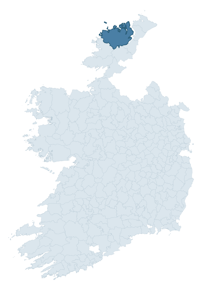
Where this barony sits in the Republic of Ireland
Geology and preservation
Bedrock geology shapes the landscape long before any settlement begins — controlling soil drainage, agricultural potential, the survival of upstanding monuments, and the preservation of buried archaeology. The figures below come from the Geological Survey Ireland 1:100,000 bedrock map.
The bedrock underlying Kilmacrenan is predominantly schist (34% of the barony by area), laid down during the Precambrian period (70% by area, over 540 million years ago). Schist forms upland, often steep terrain with thin soils that limited agriculture but favoured the construction of stone-built monuments and field walls. Schist landscapes commonly carry megalithic monuments and prehistoric ritual sites. A substantial secondary geology of granite (24%) and quartzite (19%) adds further variety to the underlying landscape. With 7 distinct rock types mapped, the barony sits in the top third of ROI baronies for geological diversity (70th percentile) — typically a sign of complex tectonic history or coastal mosaics of differing rock units.
Rock type composition
Largest mapped unit: Termon Formation (18% of the barony)
Placename evidence
Logainm records 97 heritage-diagnostic placenames for Kilmacrenan, drawn from townland and civil-parish names across the barony. The dominant stratum is pre-Christian and Early Medieval defensive — ráth-, lios-, dún-, and caiseal-prefixed names that mark Iron Age and early historic settlement. The leading diagnostic roots are cill- (34 — church), dún- (16 — hilltop fort or promontory fort), and caiseal- (14 — stone ringfort). This is well above the ROI average of 30.7 heritage placenames per barony — around 3.2× the typical figure. The presence of multiple heritage strata side by side indicates layered occupation of the landscape across successive prehistoric and historic periods. Logainm records 749 placenames for Kilmacrenan (predominantly townland names). Of these, 97 (13%) carry one of the diagnostic Gaelic roots tracked above; the remainder draw on more generic landscape vocabulary that does not encode a heritage period.
Pre-Christian / Early Medieval Defensive
| Root | Count | Meaning |
|---|---|---|
| dún- | 16 | hilltop or promontory fort |
| caiseal- | 14 | stone ringfort |
| ráth- | 7 | earthen ringfort |
| lios- | 4 | ringfort or enclosure |
| cathair- | 1 | stone fort |
Early Christian Ecclesiastical
| Root | Count | Meaning |
|---|---|---|
| cill- | 34 | church (early) |
| teampall- | 1 | church (later medieval) |
Burial, Ritual, and Norse-Contact
| Root | Count | Meaning |
|---|---|---|
| carn- | 13 | cairn |
| dumha- | 4 | mound |
| tuaim- | 2 | burial mound |
| gall- | 2 | foreigner — Norse settlement marker |
| leacht- | 1 | grave monument |
Other baronies in Donegal
About this profile
Click any section below to expand.
What is a barony?
A barony is a historic administrative unit in Ireland, broadly equivalent to an English hundred. The 280 baronies used here are from the OSi 2019 National Statutory Boundaries (generalised 20m), covering the 26 counties of the Republic of Ireland. Baronies derive from the Norman period, were formalised in the 17th century, and have not been redrawn for statistical purposes. They vary enormously in area, from compact urban baronies in Dublin to vast upland baronies in Connacht, and should not be compared by raw site count without accounting for area differences.
What counts as a site?
This profile combines three distinct heritage registers, each with its own definition of what constitutes a recordable site:
- Archaeological sites (NMS). The National Monuments Service Sites and Monuments Record (SMR) catalogues every known archaeological monument or site of archaeological interest in the Republic, from prehistoric burial mounds and ringforts to medieval churches and post-medieval defensive works. Inclusion does not require legal protection — only that the site has been identified, surveyed, and assessed as having archaeological value. A separate subset of these sites lies within a recorded protection zone, which gives them statutory protection under the National Monuments Acts.
- Listed buildings (NIAH). The National Inventory of Architectural Heritage records buildings of architectural, historical, archaeological, artistic, cultural, scientific, social, or technical interest. Each surveyed structure is appraised on a five-tier scale: International, National, Regional, Local, and Record-Only. The NIAH appraisal is informational rather than strictly statutory, but it underpins local-authority Record of Protected Structures (RPS) listings.
- Heritage placenames (Logainm). Logainm is the authoritative database of Irish placenames maintained by the Placenames Branch. This profile applies a heritage-diagnostic classifier to the Irish-language form of each townland name, flagging roots that signal defensive sites (ráth-, lios-, dún-, caiseal-, cathair-), ecclesiastical foundations (cill-, teampall-, domhnach-, mainistir-), prehistoric burial-ritual features (tuaim-, carn-, leaba-), or Norse-contact settlement (gall-). Townlands without one of these diagnostic roots are not flagged here — they may still carry historical significance, but that significance is not encoded in the name itself.
Editorial principles
The narrative sections of this profile follow several explicit principles:
- Evidential. Every claim about this barony’s heritage character is anchored in the underlying register data. Where a site count, a placename count, or a percentile rank is cited, it is computed from the source datasets at export time, not estimated.
- Comparative. Counts and metrics are reported alongside their percentile rank against the other 279 ROI baronies. A barony with 50 ringforts in absolute terms could be unusually high or unusually low depending on its size and regional context; percentile ranking removes that ambiguity.
- Transparent on limits. Where a register has known coverage gaps, survey biases, or data-quality issues that affect this barony’s figures, the profile flags them rather than presenting the numbers as definitive.
- No interpretation beyond what the data supports. The narrative does not speculate about historical events, social dynamics, or cultural meaning beyond what the recorded heritage and placename evidence directly attests.
Data caveats and limits
- NMS Sites and Monuments Record is the product of survey campaigns conducted at different intensities across different counties and decades. Some baronies have been surveyed more thoroughly than others, and absolute counts should be read in that light. Sites destroyed by development before survey are typically not represented; sites in heavily forested or upland terrain are sometimes under-recorded.
- NIAH coverage is broadly complete for the Republic of Ireland but the survey was conducted on a rolling county-by-county basis, and the most recent appraisal date varies. Buildings demolished or substantially altered after their original survey may still appear in the register; conversely, recent buildings of merit may not yet have been appraised.
- Logainm classification applies a deliberately conservative pattern-matching approach to the Irish-language townland forms. The classifier prioritises true positives over recall: a townland may carry a heritage signal that the classifier doesn’t recognise, particularly where the diagnostic root has been heavily anglicised or where the townland name draws on a less common term. The 60,000+ townland records and ~9,800 classified placenames give a substantial signal at barony scale, but individual townland names should be checked against Logainm directly for definitive interpretation.
- Period attribution. The chronological distribution reflects only those NMS sites that carry a recognised period attribution in the source data. Sites listed as “Unknown” period are excluded from the dated subset.
- Boundary changes. Some baronies have undergone minor boundary adjustments since their 19th-century definition; the OSi 2019 generalised boundaries used here are the current statutory definition and may differ slightly from historical maps in border areas.
- Bedrock geology is mapped at 1:100,000 scale, which means local variation within a barony — small pockets of different rock type, mineral veins, alluvium overlying bedrock — is generalised. The dominant-system and rocktype figures are area-weighted, so a barony reading “70% Carboniferous limestone” may still contain small but archaeologically important pockets of older or younger rock. Around 3% of GSI polygons do not match the lexicon and contribute no rocktype or system attribution.
Data sources
- National Monuments Service — Sites and Monuments Record (SMR) https://data.gov.ie/dataset/national-monuments-service-archaeological-survey-of-ireland
- National Inventory of Architectural Heritage (NIAH) https://data.gov.ie/dataset/national-inventory-of-architectural-heritage-niah-national-dataset
- Logainm — Placenames Database of Ireland https://www.logainm.ie/
- Ordnance Survey Ireland — National Statutory Barony Boundaries 2019 https://data-osi.opendata.arcgis.com/
- EURODEM — European Digital Elevation Model https://www.mapsforeurope.org/datasets/euro-dem
- ESA WorldCover https://esa-worldcover.org/en
- Geological Survey Ireland — 1:100,000 Bedrock Geology https://www.gsi.ie/en-ie/data-and-maps/Pages/Bedrock.aspx
Explore more: Search any of the 280 ROI baronies, browse by historical province, or read the methodology and data sources for the full Republic of Ireland Heritage Tool.