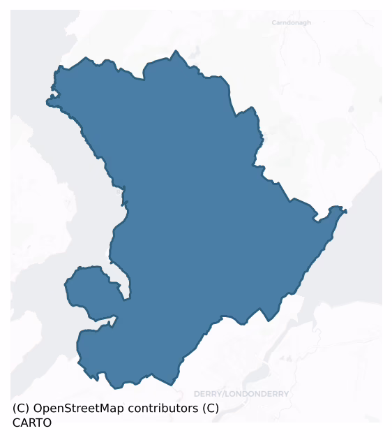
Inishowen West is a barony of County Donegal, in the historical province of Ulster (Irish: Inis Eoghain Thiar), covering 312 km² of land. The barony records 277 NMS archaeological sites and 207 NIAH listed buildings, placing it at around the 8th percentile among 280 ROI baronies for sites per km². This means it is in the bottom tenth of all baronies for sites per km². Dated archaeological evidence runs from the Mesolithic through to the Modern, spanning 9 of 9 archaeological periods, placing the barony in the 96th percentile among 280 ROI baronies for chronological depth. This means it is in the top tenth of all baronies for chronological depth. The largest dated subset of recorded sites dates to the Early Medieval. Logainm flags 15 placenames in the barony as carrying a recognised heritage root; the largest share — around 40% — are names associated with pre-christian defensive.

Heritage at a glance
Percentile rankings throughout this profile compare each barony only against the other 279 Republic of Ireland baronies.
The recorded heritage of Inishowen West
The National Monuments Service Sites and Monuments Record (SMR) is the statutory inventory of archaeological sites for the Republic of Ireland, maintained by the Department of Tourism, Culture, Arts, Gaeltacht, Sport and Media. Sites recorded here include earthworks, ringforts, megalithic tombs, ecclesiastical remains, and post-medieval features; not every record is legally protected, but each is registered as a monument of archaeological interest.
The National Monuments Service records 277 archaeological sites in Inishowen West, putting it at the 8th percentile among 280 ROI baronies for sites per km². This means it is in the bottom tenth of all baronies for sites per km². A sparse recorded total of this kind in Ireland often reflects survey priority rather than genuine absence of past activity. Protection coverage is near-universal — 257 sites (93%) fall within a recorded monument protection zone, indicating an extensively surveyed landscape. The record is dominated by defensive sites — ringforts, enclosures, hillforts, and stone forts (73 sites, 26% of the total), with prehistoric ritual monuments forming a substantial secondary presence (57 sites, 21%). Standing stone is the most prevalent type, making up 16% of the barony's recorded sites (45 records) — well above the ROI average of 4% across all baronies where this type occurs. Standing stone is a deliberately set upright stone, used variously as a Bronze/Iron Age burial marker, route marker or commemorative monument. Other significant types include Souterrain (19) and Ringfort – unclassified (15). Souterrain is an underground stone-built passage and chamber, generally Early Medieval and often associated with ringforts as a defensive or storage feature; Ringfort – unclassified is a circular Early Medieval settlement enclosure where surviving evidence does not allow distinction between earthen and stone forms. Across the barony's 312 km², this gives a recorded density of 0.89 sites per km².
Most common monument types
Hover or tap a monument type to see its definition.
| Type | Count |
|---|---|
| Standing stone a deliberately set upright stone, used variously as a Bronze/Iron Age burial marker, route marker or commemorative monument | 45 |
| Souterrain an underground stone-built passage and chamber, generally Early Medieval and often associated with ringforts as a defensive or storage feature | 19 |
| Ringfort – unclassified a circular Early Medieval settlement enclosure where surviving evidence does not allow distinction between earthen and stone forms | 15 |
| Ringfort – cashel the stone-walled equivalent of the rath, found mainly in upland or western areas, broadly dated 500–1000 AD | 13 |
| Rock art geometric and other motifs carved on earthfast boulders or rock outcrops, mainly Bronze Age but with possible Neolithic origins | 12 |
| Hut site a low stone or earthen foundation enclosing a small circular or oval area, generally interpreted as a former dwelling, of any date from prehistory to the medieval period | 12 |
Chronological distribution
The dated archaeological record for Inishowen West spans from the Mesolithic through to the Modern, with activity attested across 9 of 9 archaeological periods. This places Inishowen West in the top 4% of ROI baronies for chronological depth — few baronies record evidence across as many distinct archaeological periods. Every period from earliest to latest is represented in the record — an unbroken sequence of dated activity across the full chronological span. Activity concentrates most heavily in the Early Medieval (78 sites, 35% of dated material), with the Early Bronze Age forming a secondary peak (75 sites, 33%). A further 53 recorded sites (19% of the overall NMS register for the barony) carry no period attribution — appearing as 'Unknown' in the bar chart below. This typically reflects either records that pre-date the standardised period vocabulary or sites awaiting specialist dating review, rather than a genuine absence of chronological evidence.
Sample of recorded monuments
Show 25 sample monuments (of 277 total)
A representative sample of 25 recorded monuments drawn from the barony’s 277 total NMS entries. Sites within a recorded monument protection zone and rarer site types are prioritised so the list shows a meaningful cross-section rather than only the most common type. Each entry shows the official Sites and Monuments Record reference number and the description published by the National Monuments Service.
Burial mound
A small sand-covered hillock in a level area E of Portbane Strand. It is said that not less than 4 inhumations in cists were uncovered in this hillock. At least one of them was a small cist. A decorated pot was also…
A small sand-covered hillock in a level area E of Portbane Strand. It is said that not less than 4 inhumations in cists were uncovered in this hillock. At least one of them was a small cist. A decorated pot was also found but does not survive (local information). The hillock is in an area subject to considerable sand-shifting.
The above description was derived from the 'Archaeological Survey of County Donegal. A description of the field antiquities of the County from the Mesolithic Period to the 17th century.' Compiled by: Brian Lacey with Eamon Cody, Claire Cotter, Judy Cuppage, Noel Dunne, Vincent Hurley, Celie O'Rahilly, Paul Walsh and Seán Ó Nualláin (Lifford: Donegal County Council, 1983). In certain instances the entries have been revised and updated.
Date of upload: 22 September 2008
Castle – unclassified
Castleross (site of): Though the castle was demolished more than 150 years ago, the foundations were still visible when Davies and Swan wrote in 1939 (1939, 198). No visible trace of this castle survives.
The above…
Castleross (site of): Though the castle was demolished more than 150 years ago, the foundations were still visible when Davies and Swan wrote in 1939 (1939, 198). No visible trace of this castle survives.
The above description was derived from the 'Archaeological Survey of County Donegal. A description of the field antiquities of the County from the Mesolithic Period to the 17th century.' Compiled by: Brian Lacey with Eamon Cody, Claire Cotter, Judy Cuppage, Noel Dunne, Vincent Hurley, Celie O'Rahilly, Paul Walsh and Seán Ó Nualláin (Lifford: Donegal County Council, 1983). In certain instances the entries have been revised and updated.
Date of upload: 22 September 2008
Anomalous stone group
Marked 'Laght' on the map, all that was located was a possible foundation. It consists of approximately 12 large stones set in a circular formation, with a gap .5m wide, possibly constituting an entrance in the NE…
Marked 'Laght' on the map, all that was located was a possible foundation. It consists of approximately 12 large stones set in a circular formation, with a gap .5m wide, possibly constituting an entrance in the NE quadrant. The internal diameter is 1.9m. It is situated at the foot of Ballintlieve Hill which rises sharply on the SE side in very rough rocky terrain.
The above description was derived from the 'Archaeological Survey of County Donegal. A description of the field antiquities of the County from the Mesolithic Period to the 17th century.' Compiled by: Brian Lacey with Eamon Cody, Claire Cotter, Judy Cuppage, Noel Dunne, Vincent Hurley, Celie O'Rahilly, Paul Walsh and Seán Ó Nualláin (Lifford: Donegal County Council, 1983). In certain instances the entries have been revised and updated.
Date of upload: 22 September 2008
Clochan
The Archaeological Survey of Ireland (ASI) is in the process of providing information on all monuments on The Historic Environment Viewer (HEV). Currently the information for this record has not been uploaded. To…
The Archaeological Survey of Ireland (ASI) is in the process of providing information on all monuments on The Historic Environment Viewer (HEV). Currently the information for this record has not been uploaded. To access available information for research purposes please make an appointment in advance with the Archive Unit (open Fridays 10.00 am – 5.00 pm), Department of Culture, Heritage and the Gaeltacht, The Custom House, Dublin 1 D01W6XO or email nmarchive@chg.gov.ie.
House – 18th/19th century
Buncrana Castle (DG029-025001-) is a tower house described in 1601 as a small castle inhabited by Connor McGarrett O'Doherty, it was repaired early in 1602 by Hugh Boy O'Doherty. After Sir Cahir O'Doherty's revolt in…
Buncrana Castle (DG029-025001-) is a tower house described in 1601 as a small castle inhabited by Connor McGarrett O'Doherty, it was repaired early in 1602 by Hugh Boy O'Doherty. After Sir Cahir O'Doherty's revolt in 1608 it was burnt by English forces and may have been repaired soon after. It was granted to Chichester at the time of the Plantation and he leased it to Henry Vaughan who is described in 1611 as having 'buylte at Buncrannagh viz. The castle stronglie rebuylded w'th a parapitt on the topp of it, after the English fashion; . . . lyme burnte and other pr'parations made ready for a bawne aboute the castle' (Hunter 1975, 81). The Vaughan family resided there until the present house (DG029-025002-) was built c. 70m W of the tower house in 1718 (Davies and Swan 1939, 183-5).
Built in 1718 for Sir John Vaughan, large seven-bay two-storey over basement house with flanking single-bay pavilion wings, approached by an 18th-century six-arched stone-built bridge over the Crana River. There is a range of stone-built outbuildings to W of the house, and walls to the S of the house represent remains of a once fine terraced walled garden.
Compiled by: Caimin O'Brien
Date of revised upload: : 13 April 2016
Burial
This site, described by Killanin and Duignan (1962; 1967) as a possible 'prehistoric chamber tomb', is the supposed burial place of a priest killed during the era of the Penal laws (OS Revision Name Book, 1848). A…
This site, described by Killanin and Duignan (1962; 1967) as a possible 'prehistoric chamber tomb', is the supposed burial place of a priest killed during the era of the Penal laws (OS Revision Name Book, 1848). A modern memorial slab marks the spot.
OS Revision Name Book, sheet 29 (1848), 29; Anon. 1951, 350; Killanin and Duignan 1962, 113; Killanin and Duignan 1967, 127; Colhoun 1995, 68, no. 29/12; RMP 1995, 29:47.
The above description was published in the 'Survey of the Megalithic Tombs of Ireland. Volume VI, County Donegal.' Compiled by: Eamon Cody (Dublin: Stationery Office, 2002).
Date of upload: 22 September 2008
Cross-slab
The early ecclesiastical site of Fahan consists of a modern graveyard, at a bend in the road. It is possible that this bend may reflect something of an earlier enclosure. Inside the graveyard (DG038-013004-) is part of…
The early ecclesiastical site of Fahan consists of a modern graveyard, at a bend in the road. It is possible that this bend may reflect something of an earlier enclosure. Inside the graveyard (DG038-013004-) is part of a ruined church. Fahan old Church (DG038-013001-): In 1622, the parish church was 'well and sufficiently repaired' (Royal Commission, 191) and it continued in use until the new church was built in 1820 (Rowan 1979, 289). SE of the church is St. Mura's cross-slab (DG038-013002-). On the outside wall of the graveyard on the S side of the entrance is a small slab (DG038-013003-) .41mx .32m. On this is a carved wheeled cross. This stone is very similar to another found near Clonca (DG012-002009-). On the other side of the entrance is a stone (DG038-013007-) .66m × 0.5m built into the wall. Through this is bored a hole 14.5 cms in diameter. The site of Fahan is situated in a valley at the foot of Collan Hill and Carrick Hill close to the shore of Lough Swilly. About 350m NW of the churchyard and close to the shore is a holy well (DG038-012-) dedicated to St. Mura (Ó Muirgheasa No. 89).
(Crawford 1980, 29; Gwynn and Hadcock 1970, 36; Macalister 1949, 118 20, No. 951; Spence 1910-11, 17-31) (see also DG004-005001-)
(Crawford 1980, 29; Gwynn and Hadcock 1970, 36; Macalister 1949, 118 20, No. 951; Spence 1910-11, 17-31) (see also DG004-005001-)
The above description was derived from the 'Archaeological Survey of County Donegal. A description of the field antiqui…
Structure
In 1939 Davies and Swan suggested that the site of Fahan Castle may have been located in a field close to Castletown Cottage. During the course of their survey they identified the site of a levelled structure, which…
In 1939 Davies and Swan suggested that the site of Fahan Castle may have been located in a field close to Castletown Cottage. During the course of their survey they identified the site of a levelled structure, which they described as, 'the foundations are visible in growing corn' (Davies and Swan 1939, 204). The Donegal Survey recorded that there was no visible trace of any features which would indicate the former presence of a castle though some stones and bricks were unearthed by the landowner when cultivating a corner of the N field adjacent to the farmyard. Castletown House which is 400m S of Castletown Cottage is the more liklely location for the siting of the medieval castle (DG038-023—-) and bawn (DG028-023001-).
The above description was derived from the 'Archaeological Survey of County Donegal. A description of the field antiquities of the County from the Mesolithic Period to the 17th century.' Compiled by: Brian Lacey with Eamon Cody, Claire Cotter, Judy Cuppage, Noel Dunne, Vincent Hurley, Celie O'Rahilly, Paul Walsh and Seán Ó Nualláin (Lifford: Donegal County Council, 1983). In this instance the entry has been been revised and updated.
Compiled by Caimin O'Brien
Date of upload/revision: 18 November 2011
Cairn – burial cairn
Located at Grianán of Aileach, to SE of the cashel (DG047-012001-) and within the enclosing banks of the hillfort (DG047-012005-).
This cairn (DG047-012002-) was intact in the early 19th century. It is recorded on the…
Located at Grianán of Aileach, to SE of the cashel (DG047-012001-) and within the enclosing banks of the hillfort (DG047-012005-).
This cairn (DG047-012002-) was intact in the early 19th century. It is recorded on the 1837 OS 6-inch map as a small circular double-ringed feature (diam. c. 15m); however, it is not shown on later map editions, and it seems that it was destroyed sometime in the late 19th or early 20th centuries. In 19th-century accounts it is referred to as a ‘tumulus’ (Colby 1837); it may have been a cairn or mound, possibly a prehistoric burial mound, but this is not certain. During field survey in the 1980’s, a hint of a curving bank and a low mound of broken stones, possibly vestigial remains of the cairn, were noted SE of the cashel entrance, midway between the inner and middle enclosing banks, more or less at the location shown on the 1837 map. This area is now largely heather covered and no remains are visible.
Compiled by: Jane O'Shaughnessy
Date of upload: 6 March 2019
Hearth
Quantities of Mesolithic and Neolithic flints etc. have been identified by Dr. Woodman and B. McNaught in the fields surrounding the one within which this monument is located. Fragmentary remains of a levelled monument.…
Quantities of Mesolithic and Neolithic flints etc. have been identified by Dr. Woodman and B. McNaught in the fields surrounding the one within which this monument is located. Fragmentary remains of a levelled monument. It is situated on a steep SSE-facing slope and was uncovered during groundworks at a development site. It is extremely disturbed and now comprises a tiny, roughly horseshoe-shaped area (dims. c. 1.6m NNW-SSE; c. 1.2m ENE-WSW) with the SSE side open, comprising a series of burnt stones within a matrix of burnt soil. No shells were identified. The visible remains range between 5cm and 15cm above the 'new' ground level. They lie between c. 0.2m and c. 0.45m beneath the pre-existing ground level. There is no evidence to suggest that what is now visible corresponds to the original plan of the monument. This, together with the size and locational profile fo the monument, render it extremely unlikely that this marks the remains of a fulacht fia or burnt mound. It is more likely to have been a hearth.
Font
A short right-angled stretch of masonry in the graveyard (DG004-005003-) adjacent to the modern church seems to be all that survives of a pre-17th century church (DG004-005001-) here. Just outside the door of the modern…
A short right-angled stretch of masonry in the graveyard (DG004-005003-) adjacent to the modern church seems to be all that survives of a pre-17th century church (DG004-005001-) here. Just outside the door of the modern church is a painted stone font (DG004-007-), hexagonal in shape, c. 0.5m across with a hollow .3m in diameter and 0.2m deep. It is believed to have originally come from Fahan (DG038-013001-).
Date of revision : 17 May 2009
Caimin O'Brien
Hillfort
Located in rough terrain on the summit of a hill looking N across the former marshy area which separates Inishowen from the rest of Donegal. It commands extensive views along Lough Swilly and Lough Foyle and much of the…
Located in rough terrain on the summit of a hill looking N across the former marshy area which separates Inishowen from the rest of Donegal. It commands extensive views along Lough Swilly and Lough Foyle and much of the surrounding area in Counties Derry, Donegal and Tyrone.
The site known as the 'Grianán of Aileach' (National Monument number 140) consists of a restored cashel (DG047-012001-) centrally placed within a series of three enclosing earthen banks (DG047-012005-), a cairn (DG047-012002-), an approaching routeway or 'ancient road' (DG047-012004-) and a holy well (DG047-012003-).
The three outer enclosing banks of the cashel may represent the remains of a hillfort which predated the cashel. The innermost external bank is at a distance of c. 25m from the cashel wall. It is very low, worn and heather-covered but traceable for almost its entire circuit. A gap to the ENE gave onto the 'ancient road' (DG047-012004-) which approached the summit of the hill between two natural ledges of rock outcrop. Petrie's plan of the site shows the distance between this gap and the cashel entrance lined by settings of stones (Colby 1837, 217-232). There are possible indications of a fosse on the external side of the bank. The middle and outer banks exploit the contours of the top of the hill at varying distances from each other and from the cashel. The middle bank encloses an area of 4 acres (1.6 hectares). Like the inner bank, the middle and outer banks are much worn away and heat…
Holed stone
The early ecclesiastical site of Fahan consists of a modern graveyard, at a bend in the road. It is possible that this bend may reflect something of an earlier enclosure. Inside the graveyard (DG038-013004-) is part of…
The early ecclesiastical site of Fahan consists of a modern graveyard, at a bend in the road. It is possible that this bend may reflect something of an earlier enclosure. Inside the graveyard (DG038-013004-) is part of a ruined church. Fahan old Church (DG038-013001-): In 1622, the parish church was 'well and sufficiently repaired' (Royal Commission, 191) and it continued in use until the new church was built in 1820 (Rowan 1979, 289). On the outside wall of the graveyard on the S side of the entrance is a small slab (DG038-013003-) .41mx .32m. On this is a carved wheeled cross. This stone is very similar to another found near. Clonca (DG012-002001-). On the other side of the entrance is a stone (DG038-013007-) .66m × 0.5m built into the wall. Through this is bored a hole 14.5 cms in diameter. The site of Fahan is situated in a valley at the foot of Collan Hill and Carrick Hill close to the shore of Lough Swilly. About 350m NW of the churchyard and close to the shore is a holy well (DG038-012-) dedicated to St. Mura (Ó Muirgheasa No. 89).
(Crawford 1980, 29; Gwynn and Hadcock 1970, 36; Macalister 1949, 118 20, No. 951; Spence 1910-11, 17-31) (see also DG004-005001-)
The above description was derived from the 'Archaeological Survey of County Donegal. A description of the field antiquities of the County from the Mesolithic Period to the 17th century.' Compiled by: Brian Lacey with Eamon Cody, Claire Cotter, Judy Cuppage, Noel Dunne, Vincent Hurley, Celie O'Rahilly, Paul…
Penal Mass station
The site generally referred to as the 'Grianán of Aileach' (National Monument number 140) consists of a restored cashel centrally placed within a series of three enclosing earthen banks, the site of a 'tumu-lus', the…
The site generally referred to as the 'Grianán of Aileach' (National Monument number 140) consists of a restored cashel centrally placed within a series of three enclosing earthen banks, the site of a 'tumu-lus', the site of an approaching 'ancient road' and a holy well. (1) The cashel was surveyed and described by Petrie in 1835 (Colby 1837, 217-232). It subsequently fell into a state of considerable disarray but was rebuilt and restored between 1874 and 1878 by Dr. Walter Bernard of Derry (Bernard 1870-9, 415–23). The interior of the cashel (DG047-012001-) is fairly level but Petrie recorded traces of a rectangular stone structure at the centre, which he believed to be the remains of a 'chapel' dating to the Penal period (18th century).
Compiled by: Caimin O'Brien
Date of upload: 20 May 2009
Megalithic structure
Described by Ciara McManus as 'Concealed almost entirely by a thick garden hedge 1m W of the roadside, two large stones stand next to each other both aligned with their long axis in an E-W direction. The stone to the N…
Described by Ciara McManus as 'Concealed almost entirely by a thick garden hedge 1m W of the roadside, two large stones stand next to each other both aligned with their long axis in an E-W direction. The stone to the N is the larger of the two, though approximately 0.1m less in height than its S partner (exact measurements are impossible due to the thickness of the hedge). It is a large lichen-covered block standing stone 1.2m in height and measures 1.1m long and about 0.4m in breadth. The full height of both stones is lessened on the E side by build-up on the verge of the road, though to the W, in the base of the hedge, their full height can be seen as the garden is about 0.4m lower. The S stone stands 1.3m high and is a fine slab, approximately 0.3m thick and 1m in length. It is leaning slightly from its original position and and now rests against the top of the other though originally, if upright, as measured at the base of the stones, it would have been no more than 0.2m from the other. On present evidence, the stones do not appear to be the remains of any larger monument, such as a megalithic tomb and can only be classfieid at this time as a pair of standing stones' (Unpublished excavation report no. 00E646).
Excavation licence number 00E0646
A one-day site assessment was carried out in the area of a proposed house site at Liafin, Linsfort, Co. Donegal, in order to fulfil the requirements of an outline planning application to erect a dwelling and septic tank. The…
Burnt mound
On a gently SW-facing slope. This monument is located in the SE corner of a field which has recently been re-seeded. It comprises a large, irregularly-shaped area (dims. c.16m NE-SW; c.15m NW-SE) of dark soil with a…
On a gently SW-facing slope. This monument is located in the SE corner of a field which has recently been re-seeded. It comprises a large, irregularly-shaped area (dims. c.16m NE-SW; c.15m NW-SE) of dark soil with a small number of reddish, heat-shattered stones visible. The remainder of the soil in the field is generally light brown in colour.
At the NE side of this area is a newly-dug narrow, shallow drain (Wth. 0.45m; D 0.2m) with an adjacent newly-constructed access laneway. On the floor of the drain the soil is much darker and there are at least six concentrations of heat-shattered stones. Immediately beyond the laneway is a field boundary aligned NW-SE. In its SW face is a length of darker soil interspersed with numerous heat-shattered stones (L c.8.5m; H c.0.5m). This is not visible in the NE face.
No other features or artifacts were identified. The landowner, Mr. Ferguson, told me that the extent of the monument, the remains in the drain and the section in the field boundary were much clearer when the field was wet following rainfall.
Mr. Ferguson said that this monument had been known about by his family for generations. He also told me of a local tradition that this is the location of a battle between inhabitants of Scalp Mountain and Mouldy Hill, both of which are located a short distance from the monument.
This is almost certainly the remains of a burnt mound or fulacht fia.
Compiled by: Patrick F. O'Donovan
Date of upload: 04 October 2013
Mound
A low subrectangular mound, defined by a stone wall some 2-3 courses high, with a depression in the centre, where there is a small upright stone. The mound is 4.5m N-S × 2.5m E-W. The site is locally known as the…
A low subrectangular mound, defined by a stone wall some 2-3 courses high, with a depression in the centre, where there is a small upright stone. The mound is 4.5m N-S × 2.5m E-W. The site is locally known as the 'Priest's Grave'. It is situated on the lower SW slopes of Ballintlieve Hill, in rough uncultivated grazing land.
The above description was derived from the 'Archaeological Survey of County Donegal. A description of the field antiquities of the County from the Mesolithic Period to the 17th century.' Compiled by: Brian Lacey with Eamon Cody, Claire Cotter, Judy Cuppage, Noel Dunne, Vincent Hurley, Celie O'Rahilly, Paul Walsh and Seán Ó Nualláin (Lifford: Donegal County Council, 1983). In certain instances the entries have been revised and updated.
Date of upload: 22 September 2008
Cross-inscribed stone
Greenhill disused graveyard is believed to be the site of Desertegny early ecclesiastical foundation (Gwynn and Hadcock 1970, 379). It contains the remains of a R.C. Church of 18th or 19th century date, aligned NW-SE.…
Greenhill disused graveyard is believed to be the site of Desertegny early ecclesiastical foundation (Gwynn and Hadcock 1970, 379). It contains the remains of a R.C. Church of 18th or 19th century date, aligned NW-SE. It is possible that the curved wall of the graveyard from E to S represents part of the line of an earlier enclosure (DG019-005006-). The graveyard contains a number of crude stone crosses (DG019-005002-) and cross-inscribed stones (DG019-005003-). One cross-shaped stone (DG019-005004-) NW of the church has a cupmark on each face (DG019-005005-).
The above description was derived from the 'Archaeological Survey of County Donegal. A description of the field antiquities of the County from the Mesolithic Period to the 17th century.' Compiled by: Brian Lacey with Eamon Cody, Claire Cotter, Judy Cuppage, Noel Dunne, Vincent Hurley, Celie O'Rahilly, Paul Walsh and Seán Ó Nualláin (Lifford: Donegal County Council, 1983). In certain instances the entries have been revised and updated.
Date of upload: 22 September 2008
Megalithic tomb – court tomb
The monument is on the W side of the Inishowen peninsula, c. 1km from the shore of Lough Swilly on a low flat-topped ridge, and is aligned NE-SW. The land in the vicinity, poorly drained and bog grown, provides rough…
The monument is on the W side of the Inishowen peninsula, c. 1km from the shore of Lough Swilly on a low flat-topped ridge, and is aligned NE-SW. The land in the vicinity, poorly drained and bog grown, provides rough grazing. There are good views from the site, particularly to the SW across Lough Swilly, though limited to the NE by Aghaweel Hill c. 1.2km away and to the E by the less imposing Liafin Hill.
The monument consists of, at the NE, the remains of a gallery c. 6m long, now divided into two chambers. Approximately 26m to the SW there is a ruined subsidiary chamber, and a further 12m to the SW is another, both opening to the SE. These three elements seem to have stood in a long narrow mound that is now only intermittently traceable in the uneven, boggy surface. Reliable survey of its outline is not possible, but it seems to have been c. 15m broad. There appears to have been considerable clearance of cairn material from the site since the middle of the 19th century, when, it is reported, there was 'a vast quantity of loose stones of various dimensions lying in a confused mass' between the main gallery and the south-western subsidiary chambers (OS Revision Name Book, 1846-7). Today there is only a light scatter of loose stones in this area.
The main gallery opens to the NE. The front chamber is represented by a single orthostat at its southern side. This is a split stone set with its flat face to the interior. It is 0.8m high. It does not seem to be deeply set in th…
Megalithic tomb – court tomb
This monument lies c. 4km NW of Buncrana and stands on level arable land c. 450m from Stragill Strand on the E side of Lough Swilly. There is an extensive outlook westward across the lough, but rising ground to the E…
This monument lies c. 4km NW of Buncrana and stands on level arable land c. 450m from Stragill Strand on the E side of Lough Swilly. There is an extensive outlook westward across the lough, but rising ground to the E restricts the view inland.
Little of the structure now survives. At the E are four courtstones, two representing the inner end of its northern arm and the other two the inner end of the southern arm. Approximately 2m W of these there are two opposed orthostats, the last remains of the gallery. Beyond these is a large displaced slab. The surviving stones rise above the surface of a grass-grown, flat-topped, round mound that measures 9.5m E-W by 9.3m N-S. It is 0.7m high and has a well-defined, steep-faced perimeter. Stones gathered from the field have been dumped on it.
The inner ends of the court are 1.2m apart. The inner one of the two stones of the northern arm is 0.95m high. It rises 0.6m above the top of the adjoining courtstone. The inner courtstone at the S is pitched outward and would stand 0.45m high if upright. It may also have served as an entrance jamb. The adjoining courtstone is 0.6m high.
The surviving stone at the N side of the gallery is 0.35m high. The stone on the S side is 0.15m high. The displaced slab W of these is partly concealed. It measures 1.2m by at least 0.8m and is 0.25m thick. It may have served as backstone to the gallery. If so, a gallery length of c. 4m is indicated.
Colhoun 1949, 116 ('Ballinarry'); de Valera 1960, 104…
Field boundary
Drain digging in 1981 exposed evidence of field walls apparently 'barely under the turf' and above the present cultivation level. They were situated on the N slopes of Sheeragh in boggy, heather-covered terrain.
The…
Drain digging in 1981 exposed evidence of field walls apparently 'barely under the turf' and above the present cultivation level. They were situated on the N slopes of Sheeragh in boggy, heather-covered terrain.
The above description was derived from the 'Archaeological Survey of County Donegal. A description of the field antiquities of the County from the Mesolithic Period to the 17th century.' Compiled by: Brian Lacey with Eamon Cody, Claire Cotter, Judy Cuppage, Noel Dunne, Vincent Hurley, Celie O'Rahilly, Paul Walsh and Seán Ó Nualláin (Lifford: Donegal County Council, 1983). In certain instances the entries have been revised and updated.
Date of upload: 22 September 2008
Ecclesiastical enclosure
Internal Diam c. 20m N-S. The 'Graveyard' (DG030-014002-) marked on the OS 6-inch maps consists of a subcircular area enclosed by the remains of an earthen bank up to 1.25m in height on the E side, the W portion is cut…
Internal Diam c. 20m N-S. The 'Graveyard' (DG030-014002-) marked on the OS 6-inch maps consists of a subcircular area enclosed by the remains of an earthen bank up to 1.25m in height on the E side, the W portion is cut off by a road. Rich growth on the exterior may indicate a silted-up fosse. There is a small circular mound in the NW section of the interior and a hollow area on the E along the bank. There is a holy well (DG030-015-) dedicated to St. Patrick c. 100m to the W (Ó Muirgheasa No. 99). The site is located in cultivated land sloping E to Lough Foyle.
The above description was derived from the 'Archaeological Survey of County Donegal. A description of the field antiquities of the County from the Mesolithic Period to the 17th century.' Compiled by: Brian Lacey with Eamon Cody, Claire Cotter, Judy Cuppage, Noel Dunne, Vincent Hurley, Celie O'Rahilly, Paul Walsh and Seán Ó Nualláin (Lifford: Donegal County Council, 1983). In certain instances the entries have been revised and updated.
Date of upload: 22 September 2008
Hilltop enclosure
Indicated on the 1836 OS 6-inch map as a circular enclosure, named 'Fort'; not shown on the 1905 edition. Internal diam. c. 70m N-S × c. 30m E-W. Caiseal Na Bearnan (Caiseal of the gaps) an irregular-shaped area…
Indicated on the 1836 OS 6-inch map as a circular enclosure, named 'Fort'; not shown on the 1905 edition. Internal diam. c. 70m N-S × c. 30m E-W. Caiseal Na Bearnan (Caiseal of the gaps) an irregular-shaped area enclosed on all except its E side, where it is unnecessary due to a cliff edge, by a collapsed stone wall. At the SE end of the enclosure several subcircular structures (DG038-001002-) have been reported (Boyle-Somerville 1929, 164) but these were not observed on this occasion. Two large orthostats at the S end might indicate the entrance. The suggestion of an entrance by Boyle-Somerville at the N end does not seem likely. It is situated on a precipitous N-S ridge in mountainous terrain. There is a holy well (DG038-002—-) and a cairn (DG038-002001-) in the gap between the ridges immediately to NE.
The above description was derived from the 'Archaeological Survey of County Donegal. A description of the field antiquities of the County from the Mesolithic Period to the 17th century.' Compiled by: Brian Lacey with Eamon Cody, Claire Cotter, Judy Cuppage, Noel Dunne, Vincent Hurley, Celie O'Rahilly, Paul Walsh and Seán Ó Nualláin (Lifford: Donegal County Council, 1983). In certain instances the entries have been revised and updated.
Date of upload: 22 September 2008
Cross-inscribed stone
The Archaeological Survey of Ireland (ASI) is in the process of providing information on all monuments on The Historic Environment Viewer (HEV). Currently the information for this record has not been uploaded. To…
The Archaeological Survey of Ireland (ASI) is in the process of providing information on all monuments on The Historic Environment Viewer (HEV). Currently the information for this record has not been uploaded. To access available information for research purposes please make an appointment in advance with the Archive Unit (open Fridays 10.00 am – 5.00 pm), Department of Culture, Heritage and the Gaeltacht, The Custom House, Dublin 1 D01W6XO or email nmarchive@chg.gov.ie.
Standing stone
A standing stone 3.08m high × 1.13m wide × 0.38m thick; N-S. Situated on pasture land overlooking Lough Swilly.
The above description was derived from the 'Archaeological Survey of County Donegal. A description of…
A standing stone 3.08m high × 1.13m wide × 0.38m thick; N-S. Situated on pasture land overlooking Lough Swilly.
The above description was derived from the 'Archaeological Survey of County Donegal. A description of the field antiquities of the County from the Mesolithic Period to the 17th century.' Compiled by: Brian Lacey with Eamon Cody, Claire Cotter, Judy Cuppage, Noel Dunne, Vincent Hurley, Celie O'Rahilly, Paul Walsh and Seán Ó Nualláin (Lifford: Donegal County Council, 1983). In certain instances the entries have been revised and updated.
Date of upload: 22 September 2008
Listed buildings
The National Inventory of Architectural Heritage (NIAH) is a state survey appraising buildings of architectural, historical, archaeological, artistic, cultural, scientific, social, or technical interest. Each surveyed structure receives a rating from International (the highest, for buildings of European importance) through National, Regional, Local, and Record-Only.
The NIAH records 207 listed buildings in Inishowen West, the 80th percentile across ROI baronies for listed-building density. The highest-graded structure include 1 of National significance. The Republic holds 937 National-graded buildings in total, so this barony accounts for around 0% of the national total. Construction dates concentrate most heavily in the Victorian (1830-1900) period. The most-recorded building type is house (76 examples, 37% of the listed stock).
Terrain and environment
Mean elevation across the barony is 132m — the 80th percentile among 280 ROI baronies for elevation. This means it is in the top fifth of all baronies for elevation. This is a relatively elevated landscape by ROI standards. Elevation matters for heritage because higher-altitude baronies typically favour defensive monuments — ringforts and hilltop forts placed on prominent ground — while lowland baronies are more likely to carry the dense settlement and church networks of intensive agricultural landscapes. The barony reaches 612m at its highest point — a vertical span of more than 479m within its boundary, indicating significant topographic diversity. Mean slope is 6.6° — the 88th percentile among 280 ROI baronies for slope. This means it is in the top fifth of all baronies for slope. This is consistently steep terrain by ROI standards, the kind of landscape that tends to preserve upstanding archaeological features well. Slope is a key control on both land use and archaeological preservation: steep ground resists ploughing and tends to preserve earthworks intact, while gentle slopes favour intensive cultivation that damages or destroys surface archaeology over time. The Topographic Wetness Index averages 9.6, the 9th percentile among 280 ROI baronies for wetness. This means it is in the bottom tenth of all baronies for wetness. This is well-drained ground by ROI standards — typical of upland or steeply-sloping country that sheds water rapidly. Drainage matters for heritage because poorly-drained ground preserves organic archaeology (wooden trackways, leather, textiles, and on rare occasions human remains) far better than free-draining soil; well-drained ground favours arable use but destroys organic material rapidly. The land cover is dominated by improved grassland (75%) and woodland (19%). In overall character, this is an upland landscape of steep, elevated terrain, with land use dominated by improved grassland.
Terrain measurements
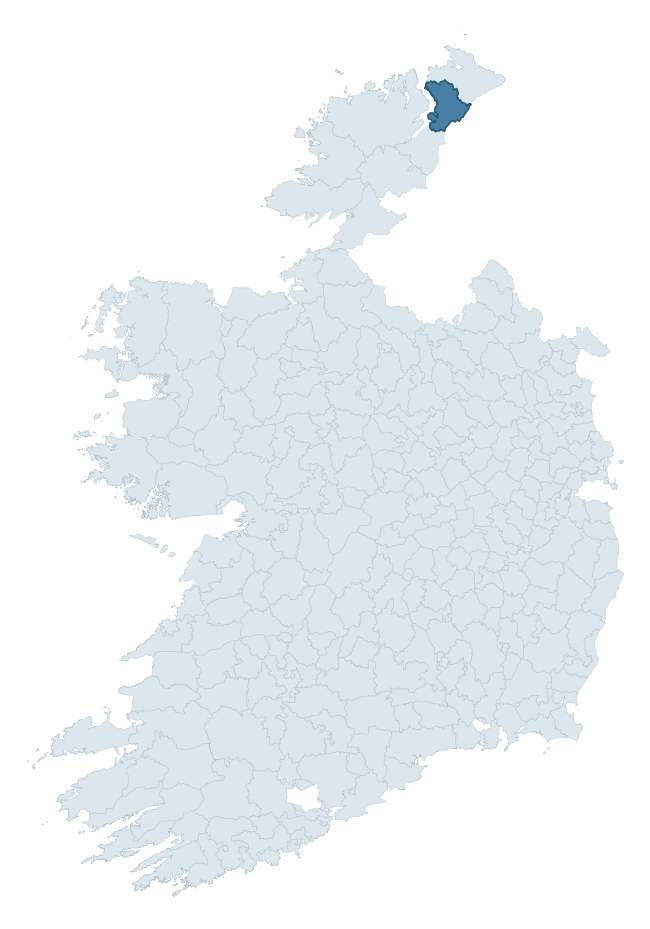
Where this barony sits in the Republic of Ireland
Geology and preservation
Bedrock geology shapes the landscape long before any settlement begins — controlling soil drainage, agricultural potential, the survival of upstanding monuments, and the preservation of buried archaeology. The figures below come from the Geological Survey Ireland 1:100,000 bedrock map.
The bedrock underlying Inishowen West is predominantly schist (77% of the barony by area), laid down during the Precambrian period (97% by area, over 540 million years ago). Schist forms upland, often steep terrain with thin soils that limited agriculture but favoured the construction of stone-built monuments and field walls. Schist landscapes commonly carry megalithic monuments and prehistoric ritual sites. The single largest mapped unit is the Lough Foyle Succession undifferentiated (29% of the barony's bedrock).
Rock type composition
Largest mapped unit: Lough Foyle Succession undifferentiated (29% of the barony)
Placename evidence
Logainm records 15 heritage-diagnostic placenames for Inishowen West, drawn from townland and civil-parish names across the barony. The dominant stratum is pre-Christian and Early Medieval defensive — ráth-, lios-, dún-, and caiseal-prefixed names that mark Iron Age and early historic settlement. The leading diagnostic roots are lios- (3 — ringfort or enclosure), cill- (3 — church), and carn- (3 — cairn). This is below the ROI average of 30.7 heritage placenames per barony, suggesting either lighter survey coverage or a townland-naming tradition that draws more on generic landscape vocabulary. The presence of multiple heritage strata side by side indicates layered occupation of the landscape across successive prehistoric and historic periods. Logainm records 119 placenames for Inishowen West (predominantly townland names). Of these, 15 (13%) carry one of the diagnostic Gaelic roots tracked above; the remainder draw on more generic landscape vocabulary that does not encode a heritage period.
Pre-Christian / Early Medieval Defensive
| Root | Count | Meaning |
|---|---|---|
| lios- | 3 | ringfort or enclosure |
| dún- | 2 | hilltop or promontory fort |
| caiseal- | 1 | stone ringfort |
Early Christian Ecclesiastical
| Root | Count | Meaning |
|---|---|---|
| cill- | 3 | church (early) |
| gráinseach- | 2 | monastic farm / grange |
| díseart- | 1 | hermitage |
Burial, Ritual, and Norse-Contact
| Root | Count | Meaning |
|---|---|---|
| carn- | 3 | cairn |
Other baronies in Donegal

Explore further
Grounding History: 10 Maps of Northern Ireland’s Past
If you’re interested in Irish heritage more widely, the companion report for Northern Ireland brings together the analysis of all 462 NI wards into one place through 10 high-quality maps — covering monument density, archaeological periods, placename heritage, terrain, wetland, and the historic landscape at first survey. Take a look.
About this profile
Click any section below to expand.
What is a barony?
A barony is a historic administrative unit in Ireland, broadly equivalent to an English hundred. The 280 baronies used here are from the OSi 2019 National Statutory Boundaries (generalised 20m), covering the 26 counties of the Republic of Ireland. Baronies derive from the Norman period, were formalised in the 17th century, and have not been redrawn for statistical purposes. They vary enormously in area, from compact urban baronies in Dublin to vast upland baronies in Connacht, and should not be compared by raw site count without accounting for area differences.
What counts as a site?
This profile combines three distinct heritage registers, each with its own definition of what constitutes a recordable site:
- Archaeological sites (NMS). The National Monuments Service Sites and Monuments Record (SMR) catalogues every known archaeological monument or site of archaeological interest in the Republic, from prehistoric burial mounds and ringforts to medieval churches and post-medieval defensive works. Inclusion does not require legal protection — only that the site has been identified, surveyed, and assessed as having archaeological value. A separate subset of these sites lies within a recorded protection zone, which gives them statutory protection under the National Monuments Acts.
- Listed buildings (NIAH). The National Inventory of Architectural Heritage records buildings of architectural, historical, archaeological, artistic, cultural, scientific, social, or technical interest. Each surveyed structure is appraised on a five-tier scale: International, National, Regional, Local, and Record-Only. The NIAH appraisal is informational rather than strictly statutory, but it underpins local-authority Record of Protected Structures (RPS) listings.
- Heritage placenames (Logainm). Logainm is the authoritative database of Irish placenames maintained by the Placenames Branch. This profile applies a heritage-diagnostic classifier to the Irish-language form of each townland name, flagging roots that signal defensive sites (ráth-, lios-, dún-, caiseal-, cathair-), ecclesiastical foundations (cill-, teampall-, domhnach-, mainistir-), prehistoric burial-ritual features (tuaim-, carn-, leaba-), or Norse-contact settlement (gall-). Townlands without one of these diagnostic roots are not flagged here — they may still carry historical significance, but that significance is not encoded in the name itself.
Editorial principles
The narrative sections of this profile follow several explicit principles:
- Evidential. Every claim about this barony’s heritage character is anchored in the underlying register data. Where a site count, a placename count, or a percentile rank is cited, it is computed from the source datasets at export time, not estimated.
- Comparative. Counts and metrics are reported alongside their percentile rank against the other 279 ROI baronies. A barony with 50 ringforts in absolute terms could be unusually high or unusually low depending on its size and regional context; percentile ranking removes that ambiguity.
- Transparent on limits. Where a register has known coverage gaps, survey biases, or data-quality issues that affect this barony’s figures, the profile flags them rather than presenting the numbers as definitive.
- No interpretation beyond what the data supports. The narrative does not speculate about historical events, social dynamics, or cultural meaning beyond what the recorded heritage and placename evidence directly attests.
Data caveats and limits
- NMS Sites and Monuments Record is the product of survey campaigns conducted at different intensities across different counties and decades. Some baronies have been surveyed more thoroughly than others, and absolute counts should be read in that light. Sites destroyed by development before survey are typically not represented; sites in heavily forested or upland terrain are sometimes under-recorded.
- NIAH coverage is broadly complete for the Republic of Ireland but the survey was conducted on a rolling county-by-county basis, and the most recent appraisal date varies. Buildings demolished or substantially altered after their original survey may still appear in the register; conversely, recent buildings of merit may not yet have been appraised.
- Logainm classification applies a deliberately conservative pattern-matching approach to the Irish-language townland forms. The classifier prioritises true positives over recall: a townland may carry a heritage signal that the classifier doesn’t recognise, particularly where the diagnostic root has been heavily anglicised or where the townland name draws on a less common term. The 60,000+ townland records and ~9,800 classified placenames give a substantial signal at barony scale, but individual townland names should be checked against Logainm directly for definitive interpretation.
- Period attribution. The chronological distribution reflects only those NMS sites that carry a recognised period attribution in the source data. Sites listed as “Unknown” period are excluded from the dated subset.
- Boundary changes. Some baronies have undergone minor boundary adjustments since their 19th-century definition; the OSi 2019 generalised boundaries used here are the current statutory definition and may differ slightly from historical maps in border areas.
- Bedrock geology is mapped at 1:100,000 scale, which means local variation within a barony — small pockets of different rock type, mineral veins, alluvium overlying bedrock — is generalised. The dominant-system and rocktype figures are area-weighted, so a barony reading “70% Carboniferous limestone” may still contain small but archaeologically important pockets of older or younger rock. Around 3% of GSI polygons do not match the lexicon and contribute no rocktype or system attribution.
Data sources
- National Monuments Service — Sites and Monuments Record (SMR) https://data.gov.ie/dataset/national-monuments-service-archaeological-survey-of-ireland
- National Inventory of Architectural Heritage (NIAH) https://data.gov.ie/dataset/national-inventory-of-architectural-heritage-niah-national-dataset
- Logainm — Placenames Database of Ireland https://www.logainm.ie/
- Ordnance Survey Ireland — National Statutory Barony Boundaries 2019 https://data-osi.opendata.arcgis.com/
- EURODEM — European Digital Elevation Model https://www.mapsforeurope.org/datasets/euro-dem
- ESA WorldCover https://esa-worldcover.org/en
- Geological Survey Ireland — 1:100,000 Bedrock Geology https://www.gsi.ie/en-ie/data-and-maps/Pages/Bedrock.aspx
Explore more: Search any of the 280 ROI baronies, browse by historical province, or read the methodology and data sources for the full Republic of Ireland Heritage Tool.