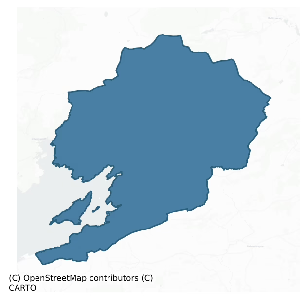
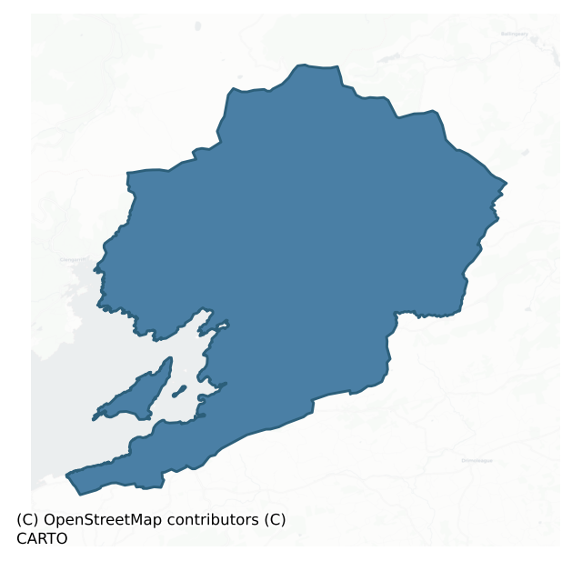
Bantry is a barony of County Cork, in the historical province of Munster (Irish: Beanntraí), covering 240 km² of land. The barony records 463 NMS archaeological sites and 116 NIAH listed buildings, placing it at around the 52nd percentile among 280 ROI baronies for sites per km². This means it is in the upper half of all baronies for sites per km². Dated archaeological evidence runs from the Neolithic through to the Post Medieval, spanning 7 of 9 archaeological periods, placing the barony in the 44th percentile among 280 ROI baronies for chronological depth. This means it is in the lower half of all baronies for chronological depth. The largest dated subset of recorded sites dates to the Early Bronze Age. Logainm flags 21 placenames in the barony as carrying a recognised heritage root; the largest share — around 67% — are names associated with pre-christian defensive.
Heritage at a glance
Percentile rankings throughout this profile compare each barony only against the other 279 Republic of Ireland baronies.
The recorded heritage of Bantry
The National Monuments Service Sites and Monuments Record (SMR) is the statutory inventory of archaeological sites for the Republic of Ireland, maintained by the Department of Tourism, Culture, Arts, Gaeltacht, Sport and Media. Sites recorded here include earthworks, ringforts, megalithic tombs, ecclesiastical remains, and post-medieval features; not every record is legally protected, but each is registered as a monument of archaeological interest.
The National Monuments Service records 463 archaeological sites in Bantry, putting it at the 52nd percentile among 280 ROI baronies for sites per km². This means it is in the upper half of all baronies for sites per km². Protection coverage is near-universal — 455 sites (98%) fall within a recorded monument protection zone, indicating an extensively surveyed landscape. The record is dominated by defensive sites — ringforts, enclosures, hillforts, and stone forts (144 sites, 31% of the total), with prehistoric ritual monuments forming a substantial secondary presence (67 sites, 14%). Standing stone is the most prevalent type, making up 14% of the barony's recorded sites (66 records) — well above the ROI average of 4% across all baronies where this type occurs. Standing stone is a deliberately set upright stone, used variously as a Bronze/Iron Age burial marker, route marker or commemorative monument. Other significant types include Ringfort – rath (53) and Hut site (52). Ringfort – rath is an earthen ringfort enclosed by a bank and external ditch — the most common Early Medieval farmstead, broadly dated 500–1000 AD; Hut site is a low stone or earthen foundation enclosing a small circular or oval area, generally interpreted as a former dwelling, of any date from prehistory to the medieval period. Across the barony's 240 km², this gives a recorded density of 1.93 sites per km².
Most common monument types
Hover or tap a monument type to see its definition.
| Type | Count |
|---|---|
| Standing stone a deliberately set upright stone, used variously as a Bronze/Iron Age burial marker, route marker or commemorative monument | 66 |
| Ringfort – rath an earthen ringfort enclosed by a bank and external ditch — the most common Early Medieval farmstead, broadly dated 500–1000 AD | 53 |
| Hut site a low stone or earthen foundation enclosing a small circular or oval area, generally interpreted as a former dwelling, of any date from prehistory to the medieval period | 52 |
| Enclosure a banked or ditched feature of uncertain type, used as a catch-all where the original function cannot be determined from surface evidence | 48 |
| Souterrain an underground stone-built passage and chamber, generally Early Medieval and often associated with ringforts as a defensive or storage feature | 27 |
| Fulacht fia a horseshoe-shaped Bronze Age burnt mound built around a sunken trough beside a water source, traditionally interpreted as a cooking site | 23 |
| Field boundary a continuous bank, wall or drain marking the limit of a field, of any date from the Neolithic onwards | 21 |
| Burial ground an area set apart for burial that is not associated with a church, in use from the medieval period onwards | 17 |
Chronological distribution
The dated archaeological record for Bantry spans from the Neolithic through to the Post Medieval, with activity attested across 7 of 9 archaeological periods. Every period from earliest to latest is represented in the record — an unbroken sequence of dated activity across the full chronological span. Activity concentrates most heavily in the Early Bronze Age (121 sites, 35% of dated material), with the Early Medieval forming a secondary peak (94 sites, 27%). A further 120 recorded sites (26% of the overall NMS register for the barony) carry no period attribution — appearing as 'Unknown' in the bar chart below. This typically reflects either records that pre-date the standardised period vocabulary or sites awaiting specialist dating review, rather than a genuine absence of chronological evidence.
Sample of recorded monuments
Show 25 sample monuments (of 463 total)
A representative sample of 25 recorded monuments drawn from the barony’s 463 total NMS entries. Sites within a recorded monument protection zone and rarer site types are prioritised so the list shows a meaningful cross-section rather than only the most common type. Each entry shows the official Sites and Monuments Record reference number and the description published by the National Monuments Service.
Field system
In mountain pasture on ENE-facing slope overlooking Coomhola river valley; covering an area of c. 7000 sq.m. with ancient field boundaries, hut site, stone settings and pre-bog wall. Collapsed dry-stone walls in three…
In mountain pasture on ENE-facing slope overlooking Coomhola river valley; covering an area of c. 7000 sq.m. with ancient field boundaries, hut site, stone settings and pre-bog wall. Collapsed dry-stone walls in three groups. To SW, wall runs E-W, c. 60m up E-facing slope; part of crossing wall runs out to N (10m) and S (4m). In middle of complex, two parallel walls, gently curving, run N-S c. 190m (20m apart); remains of two cross walls link these, forming sub-rectangular fields (20m x 40m); walls composed of upright stones (H c.0.7m), at intervals of 2.5m-3m with stone filling in between. To N, series of walls set at right angles to one another covering area 112m N-S; 70m E-W. Immediately N, at base of cut-away bog (D 0.6m) collapsed wall running E-W for 52m.
On top of a hillock at S end of complex is cist-like structure (1.6m NE-SW; 0.92m NW-SE) (CO091-009004-), defined on 3 sides by slabs and by series of small stones (some fallen) on NW side; number small stones set along inside of slabs. In middle of complex, rough stones arranged in a rough rectangle (4m E-W; 2m N-S) defined on 3 sides by prostrate stones (CO091-009002-); according to local informationa flagstone covering site was removed for road works. On N side of complex, attached to ancient field system, arc of embedded stones (H 0.3m) forms W wall (Wth 1m) of circular hut (diam. 4m) (CO091-009003-).
The above description is derived from the published 'Archaeological Inventory of County Cork. Volume 1: Wes…
Earthwork
On steep W-facing slope, overlooking Owvane River to N and W. Low oval earthwork (H 0.4m; E-W 9m; N-S 6.5m) with three stones (H 0.3m-0.57m) built into it; well defined on E. Standing stone (CO092-05302) to SE.
The…
On steep W-facing slope, overlooking Owvane River to N and W. Low oval earthwork (H 0.4m; E-W 9m; N-S 6.5m) with three stones (H 0.3m-0.57m) built into it; well defined on E. Standing stone (CO092-05302) to SE.
The above description is derived from the published 'Archaeological Inventory of County Cork. Volume 1: West Cork' (Dublin: Stationery Office, 1992). In certain instances the entries have been revised and updated in the light of recent research.
Date of upload/revision: 14 January 2009
House – fortified house
Two-storey house with attic and basement on slight prominence overlooking inlet in NE corner of Bantry Bay. Building of T-plan; E arm (20.6m N-S;7.5m E-W) with right-angle projection (14.4m E-W; 8.1m N-S) to W set just…
Two-storey house with attic and basement on slight prominence overlooking inlet in NE corner of Bantry Bay. Building of T-plan; E arm (20.6m N-S;7.5m E-W) with right-angle projection (14.4m E-W; 8.1m N-S) to W set just N of centre. Eastern arm converted into country house (CO105-02002-) but now derelict; W arm converted to farm buildings, now also derelict. Original window and door opes adopted to take wooden frames or blocked up. E arm now entered by first floor door in centre of E wall with approaching stairway. Interior divided into three units by inserted partition walls with wooden stairway in central part (now fallen). Basement under central and eastern units; steps down at N end from front doorway to semi-basement kitchen. Access not gained to floors above. N and S gables missing original stacks. S basement has pair of gun loops. Bartizans, much obscured by ivy, at first floor level in SE and NE corners. W arm had series of lean-to structures built inside it, partition walls of which survive. Ground floor fireplace in N wall with stack projecting on outside wall; rising full height of building to gable, flanked by second gable on S wall. Both these and main gable on W wall have original shaped masonry stacks with stepped, projecting caps. Bartizan on SW corner at first floor level; built in two units so that corner of building not obscured, each side held by two corbels, stone caps on top. House built in early decades of 17th century; described by Lewis as "the stro…
Moated site
In pasture overlooking Bantry Bay to N. Rectangular area enclosed by earthen bank (H 1.6m) with external fosse (D 1.15m). Interior inaccessible due to overgrowth.
The above description is derived from the published…
In pasture overlooking Bantry Bay to N. Rectangular area enclosed by earthen bank (H 1.6m) with external fosse (D 1.15m). Interior inaccessible due to overgrowth.
The above description is derived from the published 'Archaeological Inventory of County Cork. Volume 1: West Cork' (Dublin: Stationery Office, 1992). In certain instances the entries have been revised and updated in the light of recent research.
Date of upload/revision: 14 January 2009
Fish palace
The Archaeological Survey of Ireland (ASI) is in the process of providing information on all monuments on The Historic Environment Viewer (HEV). Currently the information for this record has not been uploaded. To…
The Archaeological Survey of Ireland (ASI) is in the process of providing information on all monuments on The Historic Environment Viewer (HEV). Currently the information for this record has not been uploaded. To access available information for research purposes please make an appointment in advance with the Archive Unit (open Fridays 10.00 am – 5.00 pm), Department of Culture, Heritage and the Gaeltacht, The Custom House, Dublin 1 D01W6XO or email nmarchive@chg.gov.ie.
Inscribed stone
In low-lying flat valley at foot of Cobduff mountain. Finlay (1973, 95) describes an area (l 1.3m; Wth 1m) on rock outcrop containing incised decorations, randomly arranged and including 'straight-lines, four 'x's, four…
In low-lying flat valley at foot of Cobduff mountain. Finlay (1973, 95) describes an area (l 1.3m; Wth 1m) on rock outcrop containing incised decorations, randomly arranged and including 'straight-lines, four 'x's, four 'chi' or windmill-figures, one of which is enclosed by a U and several sets of initials'.
The above description is derived from the published 'Archaeological Inventory of County Cork. Volume 1: West Cork' (Dublin: Stationery Office, 1992). In certain instances the entries have been revised and updated in the light of recent research.
Date of upload/revision: 14 January 2009
Megalithic tomb – unclassified
On a flat-topped knoll with fine views overlooking Glengarriff Harbour, c. 2m SW of a townland boundary fence. The remains consist of a chamber (L 1.15m; Wth 0.75m), aligned NNW-SSE, comprising two roughly parallel…
On a flat-topped knoll with fine views overlooking Glengarriff Harbour, c. 2m SW of a townland boundary fence. The remains consist of a chamber (L 1.15m; Wth 0.75m), aligned NNW-SSE, comprising two roughly parallel uprights which support the roofstone – a rounded boulder (1.6m N-S; 1.8m E-W; T 0.5m); no closing stones are visible. The cross-section of the roofstone is shaped like an inverted triangle with the rounded apex pointing downwards into the chamber, at which point it is 0.6m above the ground surface. The roofstone is similar in many respects to those used to cover boulder-burials but the support-stones are more typical of a megalithic tomb. The local name for the tomb is 'altar'. A megalithic structure (CO105-076—-) is located 2m to the N.
The above description is derived from 'The Archaeological Inventory of County Cork. Volume 5' (Dublin: Stationery Office, 2009).
Date of upload: 22 December 2009
Ogham stone
In pasture, on a gentle S-facing slope on the N side of the valley of the Mealagh River. Macalister (1945, vol. 1, 59) recorded an ogham inscription on the dexter edge of the E face of the upright SW stone (H 2m; Wth…
In pasture, on a gentle S-facing slope on the N side of the valley of the Mealagh River. Macalister (1945, vol. 1, 59) recorded an ogham inscription on the dexter edge of the E face of the upright SW stone (H 2m; Wth 1.1m; T 0.6m) of a pair of standing stones (CO106-035—-). He read the ogham inscription as ANM SAINA MAG OGALA MUCOI TEMOCA (ibid.). Only faint traces of this inscription, which was damaged some time after 1845, are now visible. Macalister also recorded that there may have been a third stone here up to 1870 (Macalister 1945, 59, no. 55; Macalister 1907, 31-7). The ogham stone was probably part of a prehistoric stone alignment and the inscription added at a later date to emphasise a land ownership or territorial claim. It is in an area with a concentration of such prehistoric monuments. The long axis of the stone is NE/SW (F. Moore field notes) which would support the suggestion that it is prehistoric in origin. When examined by F. Moore in the early 1980s only traces of the final four letters of the inscription could be discerned and while these were quite vague they were undoubtedly ogham scores, knife cut in the style of many Cork oghams. (Ronan et al. 2009, no. 16165)
Compiled by: Nora White
Date of upload: 18 April 2016
Castle – unclassified
On E shore of Bantry Bay. Shown on OS 6-inch map (1842) as dotted rectangle. Ó Murchadha (1985, 13) notes reference to castle at Dunnamark built in 1214 by Robert Carew. No visible surface trace.
The above…
On E shore of Bantry Bay. Shown on OS 6-inch map (1842) as dotted rectangle. Ó Murchadha (1985, 13) notes reference to castle at Dunnamark built in 1214 by Robert Carew. No visible surface trace.
The above description is derived from the published 'Archaeological Inventory of County Cork. Volume 1: West Cork' (Dublin: Stationery Office, 1992). In certain instances the entries have been revised and updated in the light of recent research.
Date of upload/revision: 14 January 2009
Mill – corn
Close to shore where Mealagh River enters Bantry Bay; 2km N of Bantry. Three mills remain, all in ruins; marked 'Tuck and Corn Mills' on OS 6-inch map (1842). Gabled 5-bay, 4-storey mill; additions to rear making…
Close to shore where Mealagh River enters Bantry Bay; 2km N of Bantry. Three mills remain, all in ruins; marked 'Tuck and Corn Mills' on OS 6-inch map (1842). Gabled 5-bay, 4-storey mill; additions to rear making L-shaped plan; wheel pit (Wth 2.1m) along SW elevation taking water from river to S. Second mill to S, shares the latters mill race; only S gable survives with external wheel pit (Wth 1.5m). Third building to W is overgrown; 8 bay, 3 storey, 6 bay deep; U-shaped in plan; wheel pit (Wth 2.25m) along SW elevation; functioned as barytes mill in 19th century.
The above description is derived from the published 'Archaeological Inventory of County Cork. Volume 1: West Cork' (Dublin: Stationery Office, 1992). In certain instances the entries have been revised and updated in the light of recent research.
Date of upload/revision: 14 January 2009
Clapper bridge
The Archaeological Survey of Ireland (ASI) is in the process of providing information on all monuments on The Historic Environment Viewer (HEV). Currently the information for this record has not been uploaded. To…
The Archaeological Survey of Ireland (ASI) is in the process of providing information on all monuments on The Historic Environment Viewer (HEV). Currently the information for this record has not been uploaded. To access available information for research purposes please make an appointment in advance with the Archive Unit (open Fridays 10.00 am – 5.00 pm), Department of Culture, Heritage and the Gaeltacht, The Custom House, Dublin 1 D01W6XO or email nmarchive@chg.gov.ie.
Religious house – Franciscan friars
Site now occupied by graveyard (CO118-030001-); only visible remains are collection of sixteen late-medieval carved fragments in graveyard; mostly from door and indoor surround and parts of cloister arcading. Franciscan…
Site now occupied by graveyard (CO118-030001-); only visible remains are collection of sixteen late-medieval carved fragments in graveyard; mostly from door and indoor surround and parts of cloister arcading. Franciscan Friary in existence in 1466 and supressed in 1542 (Gwynn and Hadcock 1988, 243); greatly damaged by English in 1568 and remains taken down by Domhnal O'Sullivan Bere in 1602 (O'Mahony 1967, 147).
The above description is derived from the published 'Archaeological Inventory of County Cork. Volume 1: West Cork' (Dublin: Stationery Office, 1992). In certain instances the entries have been revised and updated in the light of recent research.
Date of upload/revision: 14 January 2009
Cross
Upright stone (H 2.05m; 0.26m x 0.15m), long axis NE-SW, in burial ground (CO118-031002-) in early ecclesiastical enclosure (CO118-031001-). SW face divided into four panels: uppermost, two pieces of ribbon interlace;…
Upright stone (H 2.05m; 0.26m x 0.15m), long axis NE-SW, in burial ground (CO118-031002-) in early ecclesiastical enclosure (CO118-031001-). SW face divided into four panels: uppermost, two pieces of ribbon interlace; second panel, praying figure; third, Greek cross; lowest, St Paul and St Anthony seated at pedestal table holding bread. NE face divided into three panels: topmost, remains of spiral interlace; second, two pairs four legged animals; third, boat with four oarsmen and fifth figure steering in stern, rowing through sea of crosses. Two incisions (L 0.06; Wth 0.03; D 0.04) on top pillar indicate attachment of an original further element. Adjacent are four deeply grooved boulders which may have functioned as hinge/cornerstones in structure. (Hourihane and Hourihane 1979, 65-73).
The above description is derived from the published 'Archaeological Inventory of County Cork. Volume 1: West Cork' (Dublin: Stationery Office, 1992). In certain instances the entries have been revised and updated in the light of recent research.
Date of upload/revision: 14 January 2009
Architectural fragment
Adjacent to the Kilnaruane Pillar Stone (CO118-031003-) are four deeply grooved boulders which may have functioned as hinge/corner-stones in a structure.
The above description is derived from the published…
Adjacent to the Kilnaruane Pillar Stone (CO118-031003-) are four deeply grooved boulders which may have functioned as hinge/corner-stones in a structure.
The above description is derived from the published 'Archaeological Inventory of County Cork. Volume 1: West Cork' (Dublin: Stationery Office, 1992). In certain instances the entries have been revised and updated in the light of recent research.
Date of upload/revision: 14 January 2009
Cross-inscribed stone
On the N side of a road in the valley of the Mealagh River. Two small Greek crosses with expanded terminals are visible on an exposed section of smooth bedrock (4.6m E-W; 1.15m N-S) at the base of a roadside boundary.…
On the N side of a road in the valley of the Mealagh River. Two small Greek crosses with expanded terminals are visible on an exposed section of smooth bedrock (4.6m E-W; 1.15m N-S) at the base of a roadside boundary. Much of the remainder of the exposed bedrock is covered with shallow, mainly linear, grooves and small rounded depressions forming no discernible pattern.
The above description is derived from 'The Archaeological Inventory of County Cork. Volume 5' (Dublin: Stationery Office, 2009).
Date of upload: 22 December 2009
Bawn
On N bank of Owvane river commanding view in all directions; overlooked from N. Remains of tower-house stand in SW quadrant of rectangular bawn. W wall of tower (Wth 10.3m), most of N wall (L 12m) and short return of S…
On N bank of Owvane river commanding view in all directions; overlooked from N. Remains of tower-house stand in SW quadrant of rectangular bawn. W wall of tower (Wth 10.3m), most of N wall (L 12m) and short return of S wall (L 2m) stand to four storey. 'Ghost' of segmental vaults over 1st and 3rd floors visible on inside of W face (axis E-W). Central window opes in W wall at all levels; first floor embrasure has mural passage on either side; single ogee-headed light at 3rd floor. Small mural chamber in N wall at 1st floor level; mural passage visible in broken face of S wall at 3rd floor level. Similar bartizans atop NW and SW corners: supported by a corbel on each wall with a straight face set across corner.
Bawn roughly rectangular in plan (26m N-S; 48m E-W) projecting towers at each corner; S face overlooks rock-cut gorge. Appears late in date, probably 17th century. Eastern half altered to accomodate modern farm buildings (now disused). W wall and original W end of N wall pierced by many gun loops. Outward facing corners NE and SE corner towers acutely angled, similar to bastions on star-shaped forts; NW tower more bluntly pointed; SW tower roughly rectangular. SW tower has 4 tiers of nesting boxes on each face at 1st floor level. Castle of the O'Sullivan clan reputedly built by Dermot O'Sullivan about 1540 (Healy 1988, 170); surrendered after the fall of Dunboy in 1602 (O'Murchadha 1985, 308).
The above description is derived from the published 'Archaeological Inv…
Metalworking site
The Archaeological Survey of Ireland (ASI) is in the process of providing information on all monuments on The Historic Environment Viewer (HEV). Currently the information for this record has not been uploaded. To…
The Archaeological Survey of Ireland (ASI) is in the process of providing information on all monuments on The Historic Environment Viewer (HEV). Currently the information for this record has not been uploaded. To access available information for research purposes please make an appointment in advance with the Archive Unit (open Fridays 10.00 am – 5.00 pm), Department of Culture, Heritage and the Gaeltacht, The Custom House, Dublin 1 D01W6XO or email nmarchive@chg.gov.ie.
Chapel
A sixteenth-century map of Bantry and Beara (Breen 2005, frontispiece) shows a small chapel at the north-eastern end of Chapel Island (little). This may be the church of Iniscuingi that was listed in a decretal letter…
A sixteenth-century map of Bantry and Beara (Breen 2005, frontispiece) shows a small chapel at the north-eastern end of Chapel Island (little). This may be the church of Iniscuingi that was listed in a decretal letter of 1199 and a possession of Gill Abbey (CO074-036—-) in the late medieval period (ibid., 175-7).
Breen, C. (2005) The Gaelic Lordship of the O’Sullivan Beare, Four Courts Press.
The following description of the site was submitted to ASI by the archaeologist Tony Miller on 25th June 2012.
“I visited Chapel Island on the 28th April 2012 and found that the two halves of the island are now just about separated at high tide. There is no land between them, only a shingle beach. At the eastern tip of the western half of the island (Chapel Island Little) is a ruined house standing on a level terrace of land. It has the beach immediately to the east of it and the steep slope of the island to the west. The terrace is large and rectangular in shape, revetted by a well built dry-stone wall for c. 40m along the northwest side (the two corner returns are visible) and by another section c. 0.8m in height, 0.75m in width and c. 7m in length, on the north-east side. This last section of walling is fragmentary and there is no sign of an eastern corner and similarly there is no evidence for a south-eastern wall which has probably been eroded away by the sea. Of further note, there is a simple boundary wall, or possibly a breakwater, running out into the sea from the…
Rock art
On flat surface of exposed bedrock in flat rough ground. A single compass drawn circle (diam. c. 25cm).
Compiled by: Matt Kelleher based om information supplied by David Myler
Date of upload/revision: 21 March…
On flat surface of exposed bedrock in flat rough ground. A single compass drawn circle (diam. c. 25cm).
Compiled by: Matt Kelleher based om information supplied by David Myler
Date of upload/revision: 21 March 20222
Mine – copper
The Archaeological Survey of Ireland (ASI) is in the process of providing information on all monuments on The Historic Environment Viewer (HEV). Currently the information for this record has not been uploaded. To…
The Archaeological Survey of Ireland (ASI) is in the process of providing information on all monuments on The Historic Environment Viewer (HEV). Currently the information for this record has not been uploaded. To access available information for research purposes please make an appointment in advance with the Archive Unit (open Fridays 10.00 am – 5.00 pm), Department of Culture, Heritage and the Gaeltacht, The Custom House, Dublin 1 D01W6XO or email nmarchive@chg.gov.ie.
Radial-stone enclosure
On elevated moorland on NW side of valley of Owvane river. Eleven stones, most set radially and averaging H 0.5m, enclose circular area (diam. 6.8m). Others may remain concealed by bog. Standing stone (CO092-00902-)…
On elevated moorland on NW side of valley of Owvane river. Eleven stones, most set radially and averaging H 0.5m, enclose circular area (diam. 6.8m). Others may remain concealed by bog. Standing stone (CO092-00902-) protrudes from field fence 2.7m to N. (Ó Nualláin 1984, 78, no. 19)
The above description is derived from the published 'Archaeological Inventory of County Cork. Volume 1: West Cork' (Dublin: Stationery Office, 1992). In certain instances the entries have been revised and updated in the light of recent research.
Date of upload/revision: 14 January 2009
Castle – tower house
Built on rock outcrop at NE end of Whiddy Island. SW side of tower house (10.7m NW-SE; 8.6m NE-SW) remains. SW wall survives to 2nd floor level; short return (0.6m) of SE wall at ground level; NW wall survives to…
Built on rock outcrop at NE end of Whiddy Island. SW side of tower house (10.7m NW-SE; 8.6m NE-SW) remains. SW wall survives to 2nd floor level; short return (0.6m) of SE wall at ground level; NW wall survives to ground-floor level. Remains of lintelled window ope and one side of doorway in NW wall. Three horizontal rows of joist holes, c. 1m above the other, on inner SW face; stone-lined guardrobe chute exposed at first-floor level. Base batter around external walls removed. Castle of O Sullivan Bear; much of it collapsed during gales of 1920. (O Murchadha 1985, 304).
The above description is derived from the published 'Archaeological Inventory of County Cork. Volume 1: West Cork' (Dublin: Stationery Office, 1992). In certain instances the entries have been revised and updated in the light of recent research.
Date of upload/revision: 14 January 2009
Images provided by and copyright of Amanda Clarke 2016-2022 https://holywellscorkandkerry.com/
Cliff-edge fort
In tillage, on edge of steep incline dropping down to Mealagh river. D-shaped area (41m NE-SW; 22m NW-SE), enclosed by earthen bank (H 2.2m) SSW->N; scarp (H 2.55m) NNW-NE; steep drop NE-SSW. Interior slopes down to SW.…
In tillage, on edge of steep incline dropping down to Mealagh river. D-shaped area (41m NE-SW; 22m NW-SE), enclosed by earthen bank (H 2.2m) SSW->N; scarp (H 2.55m) NNW-NE; steep drop NE-SSW. Interior slopes down to SW. Myler (1998, 14) records that the 'earthen bank is disturbed by roots and erosion' and he also records 'a possible entrance at the eastern corner of the fort'.
The above description is derived from the published 'Archaeological Inventory of County Cork. Volume 1: West Cork' (Dublin: Stationery Office, 1992). In certain instances the entries have been revised and updated in the light of recent research.
Date of upload/revision: 24 January 2013
Standing stone
Inside N bank of ringfort (CO106-02001-). Irregular stone aligned N-S (H 1.2m; 0.9m x 0.3m).
Myler (1998, 42) recorded 'two standing stones of 4ft. in height' beside the NW bank and two corresponding stones on the…
Inside N bank of ringfort (CO106-02001-). Irregular stone aligned N-S (H 1.2m; 0.9m x 0.3m).
Myler (1998, 42) recorded 'two standing stones of 4ft. in height' beside the NW bank and two corresponding stones on the outside of the bank.
The above description is derived from the published 'Archaeological Inventory of County Cork. Volume 1: West Cork' (Dublin: Stationery Office, 1992). In certain instances the entries have been revised and updated in the light of recent research.
Date of upload/revision: 24 January 2013
Listed buildings
The National Inventory of Architectural Heritage (NIAH) is a state survey appraising buildings of architectural, historical, archaeological, artistic, cultural, scientific, social, or technical interest. Each surveyed structure receives a rating from International (the highest, for buildings of European importance) through National, Regional, Local, and Record-Only.
The NIAH records 116 listed buildings in Bantry (57th percentile across ROI baronies). The highest-graded structures include 3 of National significance. The Republic holds 937 National-graded buildings in total, so this barony accounts for around 0% of the national total. Construction dates concentrate most heavily in the Victorian (1830-1900) period. The most-recorded building type is house (72 examples, 62% of the listed stock).
Terrain and environment
Mean elevation across the barony is 176m — the 94th percentile among 280 ROI baronies for elevation. This means it is in the top tenth of all baronies for elevation. This is a relatively elevated landscape by ROI standards. Elevation matters for heritage because higher-altitude baronies typically favour defensive monuments — ringforts and hilltop forts placed on prominent ground — while lowland baronies are more likely to carry the dense settlement and church networks of intensive agricultural landscapes. The barony reaches 702m at its highest point — a vertical span of more than 526m within its boundary, indicating significant topographic diversity. Mean slope is 9.6° — the 97th percentile among 280 ROI baronies for slope. This means it is in the top tenth of all baronies for slope. This is consistently steep terrain by ROI standards, the kind of landscape that tends to preserve upstanding archaeological features well. Slope is a key control on both land use and archaeological preservation: steep ground resists ploughing and tends to preserve earthworks intact, while gentle slopes favour intensive cultivation that damages or destroys surface archaeology over time. The Topographic Wetness Index averages 8.7, the 2nd percentile among 280 ROI baronies for wetness. This means it is in the bottom tenth of all baronies for wetness. This is well-drained ground by ROI standards — typical of upland or steeply-sloping country that sheds water rapidly. Drainage matters for heritage because poorly-drained ground preserves organic archaeology (wooden trackways, leather, textiles, and on rare occasions human remains) far better than free-draining soil; well-drained ground favours arable use but destroys organic material rapidly. The land cover is dominated by improved grassland (74%) and woodland (25%). In overall character, this is an upland landscape of steep, elevated terrain, with land use dominated by improved grassland.
Terrain measurements
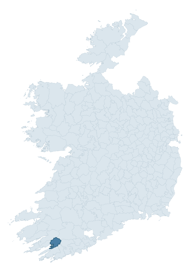
Where this barony sits in the Republic of Ireland
Geology and preservation
Bedrock geology shapes the landscape long before any settlement begins — controlling soil drainage, agricultural potential, the survival of upstanding monuments, and the preservation of buried archaeology. The figures below come from the Geological Survey Ireland 1:100,000 bedrock map.
The bedrock underlying Bantry is predominantly sandstone (72% of the barony by area), laid down during the Devonian period (59% by area, around 419 to 359 million years ago). Sandstone weathers to free-draining, moderately fertile soils that supported Early Medieval ringfort agriculture and later manorial estates. The rock itself is a major source of building stone — visible in churches, tower houses, and farm buildings across the barony's historic landscape. A substantial secondary geology of mudstone (24%) adds further variety to the underlying landscape.
Rock type composition
Largest mapped unit: Caha Mountain Formation (23% of the barony)
Placename evidence
Logainm records 21 heritage-diagnostic placenames for Bantry, drawn from townland and civil-parish names across the barony. The dominant stratum is pre-Christian and Early Medieval defensive — ráth-, lios-, dún-, and caiseal-prefixed names that mark Iron Age and early historic settlement. The leading diagnostic roots are cathair- (5 — stone fort), cill- (5 — church), and dún- (4 — hilltop fort or promontory fort). This is below the ROI average of 30.7 heritage placenames per barony, suggesting either lighter survey coverage or a townland-naming tradition that draws more on generic landscape vocabulary. The presence of multiple heritage strata side by side indicates layered occupation of the landscape across successive prehistoric and historic periods. Logainm records 190 placenames for Bantry (predominantly townland names). Of these, 21 (11%) carry one of the diagnostic Gaelic roots tracked above; the remainder draw on more generic landscape vocabulary that does not encode a heritage period.
Pre-Christian / Early Medieval Defensive
| Root | Count | Meaning |
|---|---|---|
| cathair- | 5 | stone fort |
| dún- | 4 | hilltop or promontory fort |
| ráth- | 2 | earthen ringfort |
| caiseal- | 2 | stone ringfort |
| lios- | 1 | ringfort or enclosure |
Early Christian Ecclesiastical
| Root | Count | Meaning |
|---|---|---|
| cill- | 5 | church (early) |
| díseart- | 1 | hermitage |
Burial, Ritual, and Norse-Contact
| Root | Count | Meaning |
|---|---|---|
| carn- | 1 | cairn |
Other baronies in Cork
- Barrymore
- Carbery West (east Division)
- Kinsale
- Courceys
- Carbery East (west Division)
- Bear
- Carbery East (east Division)
- Iraghticonnor — Kerry
- Owneybeg — Limerick
- Kenry — Limerick
See all 280 baronies in the Republic of Ireland Heritage Tool.

Explore further
Grounding History: 10 Maps of Northern Ireland’s Past
If you’re interested in Irish heritage more widely, the companion report for Northern Ireland brings together the analysis of all 462 NI wards into one place through 10 high-quality maps — covering monument density, archaeological periods, placename heritage, terrain, wetland, and the historic landscape at first survey. Take a look.
About this profile
Click any section below to expand.
What is a barony?
A barony is a historic administrative unit in Ireland, broadly equivalent to an English hundred. The 280 baronies used here are from the OSi 2019 National Statutory Boundaries (generalised 20m), covering the 26 counties of the Republic of Ireland. Baronies derive from the Norman period, were formalised in the 17th century, and have not been redrawn for statistical purposes. They vary enormously in area, from compact urban baronies in Dublin to vast upland baronies in Connacht, and should not be compared by raw site count without accounting for area differences.
What counts as a site?
This profile combines three distinct heritage registers, each with its own definition of what constitutes a recordable site:
- Archaeological sites (NMS). The National Monuments Service Sites and Monuments Record (SMR) catalogues every known archaeological monument or site of archaeological interest in the Republic, from prehistoric burial mounds and ringforts to medieval churches and post-medieval defensive works. Inclusion does not require legal protection — only that the site has been identified, surveyed, and assessed as having archaeological value. A separate subset of these sites lies within a recorded protection zone, which gives them statutory protection under the National Monuments Acts.
- Listed buildings (NIAH). The National Inventory of Architectural Heritage records buildings of architectural, historical, archaeological, artistic, cultural, scientific, social, or technical interest. Each surveyed structure is appraised on a five-tier scale: International, National, Regional, Local, and Record-Only. The NIAH appraisal is informational rather than strictly statutory, but it underpins local-authority Record of Protected Structures (RPS) listings.
- Heritage placenames (Logainm). Logainm is the authoritative database of Irish placenames maintained by the Placenames Branch. This profile applies a heritage-diagnostic classifier to the Irish-language form of each townland name, flagging roots that signal defensive sites (ráth-, lios-, dún-, caiseal-, cathair-), ecclesiastical foundations (cill-, teampall-, domhnach-, mainistir-), prehistoric burial-ritual features (tuaim-, carn-, leaba-), or Norse-contact settlement (gall-). Townlands without one of these diagnostic roots are not flagged here — they may still carry historical significance, but that significance is not encoded in the name itself.
Editorial principles
The narrative sections of this profile follow several explicit principles:
- Evidential. Every claim about this barony’s heritage character is anchored in the underlying register data. Where a site count, a placename count, or a percentile rank is cited, it is computed from the source datasets at export time, not estimated.
- Comparative. Counts and metrics are reported alongside their percentile rank against the other 279 ROI baronies. A barony with 50 ringforts in absolute terms could be unusually high or unusually low depending on its size and regional context; percentile ranking removes that ambiguity.
- Transparent on limits. Where a register has known coverage gaps, survey biases, or data-quality issues that affect this barony’s figures, the profile flags them rather than presenting the numbers as definitive.
- No interpretation beyond what the data supports. The narrative does not speculate about historical events, social dynamics, or cultural meaning beyond what the recorded heritage and placename evidence directly attests.
Data caveats and limits
- NMS Sites and Monuments Record is the product of survey campaigns conducted at different intensities across different counties and decades. Some baronies have been surveyed more thoroughly than others, and absolute counts should be read in that light. Sites destroyed by development before survey are typically not represented; sites in heavily forested or upland terrain are sometimes under-recorded.
- NIAH coverage is broadly complete for the Republic of Ireland but the survey was conducted on a rolling county-by-county basis, and the most recent appraisal date varies. Buildings demolished or substantially altered after their original survey may still appear in the register; conversely, recent buildings of merit may not yet have been appraised.
- Logainm classification applies a deliberately conservative pattern-matching approach to the Irish-language townland forms. The classifier prioritises true positives over recall: a townland may carry a heritage signal that the classifier doesn’t recognise, particularly where the diagnostic root has been heavily anglicised or where the townland name draws on a less common term. The 60,000+ townland records and ~9,800 classified placenames give a substantial signal at barony scale, but individual townland names should be checked against Logainm directly for definitive interpretation.
- Period attribution. The chronological distribution reflects only those NMS sites that carry a recognised period attribution in the source data. Sites listed as “Unknown” period are excluded from the dated subset.
- Boundary changes. Some baronies have undergone minor boundary adjustments since their 19th-century definition; the OSi 2019 generalised boundaries used here are the current statutory definition and may differ slightly from historical maps in border areas.
- Bedrock geology is mapped at 1:100,000 scale, which means local variation within a barony — small pockets of different rock type, mineral veins, alluvium overlying bedrock — is generalised. The dominant-system and rocktype figures are area-weighted, so a barony reading “70% Carboniferous limestone” may still contain small but archaeologically important pockets of older or younger rock. Around 3% of GSI polygons do not match the lexicon and contribute no rocktype or system attribution.
Data sources
- National Monuments Service — Sites and Monuments Record (SMR) https://data.gov.ie/dataset/national-monuments-service-archaeological-survey-of-ireland
- National Inventory of Architectural Heritage (NIAH) https://data.gov.ie/dataset/national-inventory-of-architectural-heritage-niah-national-dataset
- Logainm — Placenames Database of Ireland https://www.logainm.ie/
- Ordnance Survey Ireland — National Statutory Barony Boundaries 2019 https://data-osi.opendata.arcgis.com/
- EURODEM — European Digital Elevation Model https://www.mapsforeurope.org/datasets/euro-dem
- ESA WorldCover https://esa-worldcover.org/en
- Geological Survey Ireland — 1:100,000 Bedrock Geology https://www.gsi.ie/en-ie/data-and-maps/Pages/Bedrock.aspx
Explore more: Search any of the 280 ROI baronies, browse by historical province, or read the methodology and data sources for the full Republic of Ireland Heritage Tool.