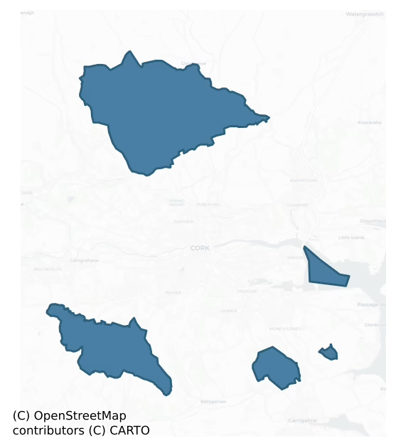
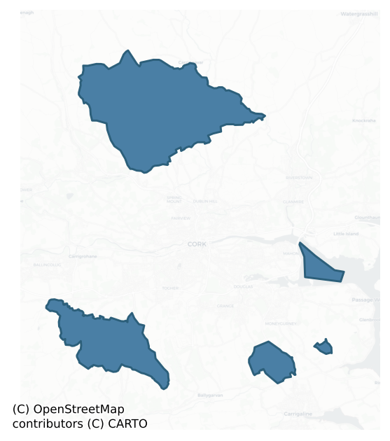
Cork is a barony of County Cork, in the historical province of Munster (Irish: Corcaigh), covering 56 km² of land. The barony records 152 NMS archaeological sites and 2,964 NIAH listed buildings, placing it at around the 75th percentile among 280 ROI baronies for sites per km². This means it is in the top third of all baronies for sites per km². Dated archaeological evidence runs from the Early Bronze Age through to the Modern, spanning 6 of 9 archaeological periods, placing the barony in the 22nd percentile among 280 ROI baronies for chronological depth. This means it is in the bottom third of all baronies for chronological depth. The largest dated subset of recorded sites dates to the Middle-Late Bronze Age. Logainm flags 28 placenames in the barony as carrying a recognised heritage root; the largest share — around 61% — are names associated with early Christian church and monastic foundations.
Heritage at a glance
Percentile rankings throughout this profile compare each barony only against the other 279 Republic of Ireland baronies.
The recorded heritage of Cork
The National Monuments Service Sites and Monuments Record (SMR) is the statutory inventory of archaeological sites for the Republic of Ireland, maintained by the Department of Tourism, Culture, Arts, Gaeltacht, Sport and Media. Sites recorded here include earthworks, ringforts, megalithic tombs, ecclesiastical remains, and post-medieval features; not every record is legally protected, but each is registered as a monument of archaeological interest.
The National Monuments Service records 152 archaeological sites in Cork, putting it at the 75th percentile among 280 ROI baronies for sites per km². This means it is in the top third of all baronies for sites per km². Protection coverage is near-universal — 148 sites (97%) fall within a recorded monument protection zone, indicating an extensively surveyed landscape. The record is dominated by defensive sites — ringforts, enclosures, hillforts, and stone forts (59 sites, 39% of the total), with agricultural and prehistoric industrial sites forming a substantial secondary presence (49 sites, 32%). Fulacht fia is the most prevalent type, making up 31% of the barony's recorded sites (47 records) — well above the ROI average of 6% across all baronies where this type occurs. Fulacht fia is a horseshoe-shaped Bronze Age burnt mound built around a sunken trough beside a water source, traditionally interpreted as a cooking site. Other significant types include Ringfort – rath (40) and Standing stone (20). Ringfort – rath is an earthen ringfort enclosed by a bank and external ditch — the most common Early Medieval farmstead, broadly dated 500–1000 AD; Standing stone is a deliberately set upright stone, used variously as a Bronze/Iron Age burial marker, route marker or commemorative monument. Across the barony's 56 km², this gives a recorded density of 2.70 sites per km².
Most common monument types
Hover or tap a monument type to see its definition.
| Type | Count |
|---|---|
| Fulacht fia a horseshoe-shaped Bronze Age burnt mound built around a sunken trough beside a water source, traditionally interpreted as a cooking site | 47 |
| Ringfort – rath an earthen ringfort enclosed by a bank and external ditch — the most common Early Medieval farmstead, broadly dated 500–1000 AD | 40 |
| Standing stone a deliberately set upright stone, used variously as a Bronze/Iron Age burial marker, route marker or commemorative monument | 20 |
| Enclosure a banked or ditched feature of uncertain type, used as a catch-all where the original function cannot be determined from surface evidence | 12 |
| Church a building used for public Christian worship, of any date from c. 500 AD onwards | 6 |
| Graveyard a burial area associated with a church, in use from the medieval period onwards | 4 |
| Moated site | 3 |
| Castle – unclassified a castle whose form cannot be precisely classified, dating somewhere between the late 12th and 16th centuries | 3 |
Chronological distribution
The dated archaeological record for Cork spans from the Early Bronze Age through to the Modern, with activity attested across 6 of 9 archaeological periods. This is the 22nd percentile across ROI baronies — a relatively narrow chronological band, with much of Irish prehistory not represented in the dated record. The record is near-continuous, with only the Post Medieval period falling inside the span without any recorded sites. Activity concentrates most heavily in the Middle Late Bronze Age (49 sites, 37% of dated material), with the Iron Age forming a secondary peak (32 sites, 24%). A further 18 recorded sites (12% of the overall NMS register for the barony) carry no period attribution — appearing as 'Unknown' in the bar chart below. This typically reflects either records that pre-date the standardised period vocabulary or sites awaiting specialist dating review, rather than a genuine absence of chronological evidence.
Sample of recorded monuments
Show 25 sample monuments (of 152 total)
A representative sample of 25 recorded monuments drawn from the barony’s 152 total NMS entries. Sites within a recorded monument protection zone and rarer site types are prioritised so the list shows a meaningful cross-section rather than only the most common type. Each entry shows the official Sites and Monuments Record reference number and the description published by the National Monuments Service.
Kiln – corn-drying
At S end of ringfort (CO063-046003-), in NE corner of church (CO063-046004-); heavily overgrown. Square structure (c. 2.6m N-S; c. 2.5m E-W; H c. 1.5m), open to S where passage (L 0.9m) leads into circular roofless…
At S end of ringfort (CO063-046003-), in NE corner of church (CO063-046004-); heavily overgrown. Square structure (c. 2.6m N-S; c. 2.5m E-W; H c. 1.5m), open to S where passage (L 0.9m) leads into circular roofless chamber (0.65m N-S; 0.6m E-W; H 1.4m). Passage (Wth 0.6m; max. H 0.3m) roofed by lintels; walls of passage and chamber of drystone construction. Exact function unknown. Present condition of structure probably resulting from investigation in 1865 when Pitt-Rivers 'dug in a cavity at the top of asmall mound' (Twohig 1987, 44). (UCC)
The above description is derived from the published 'Archaeological Inventory of County Cork. Volume 2: East and South Cork' (Dublin: Stationery Office, 1994). In certain instances the entries have been revised and updated in the light of recent research.
Date of upload/revision: 14 January 2009
Designed landscape – belvedere
Shown on 1842 OS 6-inch map as circular structure on W side of R.C. chapel; named 'Belfry' on 1904 OS 6-inch map. Tall stone-built circular tower built in 1832 by Fr. Matthew Horgan (Mulcahy 1989, 23). Door opes on…
Shown on 1842 OS 6-inch map as circular structure on W side of R.C. chapel; named 'Belfry' on 1904 OS 6-inch map. Tall stone-built circular tower built in 1832 by Fr. Matthew Horgan (Mulcahy 1989, 23). Door opes on ground and first floors; several pointed window opes; embattled parapet supported by corbels; bell still in situ. Similar tower at Waterloo (Ballygibbon) near Blarney.
The above description is derived from the published 'Archaeological Inventory of County Cork. Volume 2: East and South Cork' (Dublin: Stationery Office, 1994). In certain instances the entries have been revised and updated in the light of recent research.
Date of upload/revision: 14 January 2009
Milestone
The Archaeological Survey of Ireland (ASI) is in the process of providing information on all monuments on The Historic Environment Viewer (HEV). Currently the information for this record has not been uploaded. To…
The Archaeological Survey of Ireland (ASI) is in the process of providing information on all monuments on The Historic Environment Viewer (HEV). Currently the information for this record has not been uploaded. To access available information for research purposes please make an appointment in advance with the Archive Unit (open Fridays 10.00 am – 5.00 pm), Department of Culture, Heritage and the Gaeltacht, The Custom House, Dublin 1 D01W6XO or email nmarchive@chg.gov.ie.
Souterrain
In SW quadrant of ringfort (CO085-03601-). Coleman (1947, 70) records rectangular, earth-cut chamber (L 2.13m; Wth 1.35m; H 1.21m); barrel-vaulted ceiling. Long axis NE-SW; NE end collapsed preventing further…
In SW quadrant of ringfort (CO085-03601-). Coleman (1947, 70) records rectangular, earth-cut chamber (L 2.13m; Wth 1.35m; H 1.21m); barrel-vaulted ceiling. Long axis NE-SW; NE end collapsed preventing further investigation. Vent (or burrow?) at SW end extends for 0.74m. SW quadrant of ringfort heavily overgrown; no visible surface trace of souterrain.
The above description is derived from the published 'Archaeological Inventory of County Cork. Volume 2: East and South Cork' (Dublin: Stationery Office, 1994). In certain instances the entries have been revised and updated in the light of recent research.
Date of upload/revision: 14 January 2009
Ecclesiastical enclosure
In pasture, on N-facing slope. Aerial photograph (Dr. D.D.C. Pochin Mould) shows large subcircular enclosure (diam. c. 100m) with St. John's church and graveyard (CO085-04101-; CO085-04102-) in SE quadrant. Enclosure…
In pasture, on N-facing slope. Aerial photograph (Dr. D.D.C. Pochin Mould) shows large subcircular enclosure (diam. c. 100m) with St. John's church and graveyard (CO085-04101-; CO085-04102-) in SE quadrant. Enclosure defined by earthen bank of townland boundary (int. H 1.25m) N->E; arc of low bank (H 0.3m) E->SE; stone wall of graveyard SE->SW; levelled field fence W->NW and natural scarp NW->N. The decretal letter of 1199 appears to identify Inishkenny as 'Dissertanaeda' (Bolster 1972, 88); 'disert' is a name associated with pre-Norman church sites (Hurley 1979, 74).
The above description is derived from the published 'Archaeological Inventory of County Cork. Volume 2: East and South Cork' (Dublin: Stationery Office, 1994). In certain instances the entries have been revised and updated in the light of recent research.
Date of upload/revision: 14 January 2009
Mass-rock
In forestry, on outcropping rock, overlooking a river to the W. This mass-rock comprises outcropping rock (L 2.6m; T 0.3m; H 1m) which is orientated SW-NE. A metal cross and plaque records (in Irish) that mass was…
In forestry, on outcropping rock, overlooking a river to the W. This mass-rock comprises outcropping rock (L 2.6m; T 0.3m; H 1m) which is orientated SW-NE. A metal cross and plaque records (in Irish) that mass was celebrated at the rock during penal times.
The above description is derived from 'The Archaeological Inventory of County Cork. Volume 5' (Dublin: Stationery Office, 2009).
Date of upload: 22 December 2009
Armorial plaque (present location)
On the wall of a stable, c. 85m SE of the site od a castle (CO085-052—-). A stone plaque (CO086-001—-) with the coat of arms of Sir Robert Travers, impaled with the arms of his wife Elizabeth Boyle (Cremin 1910,…
On the wall of a stable, c. 85m SE of the site od a castle (CO085-052—-). A stone plaque (CO086-001—-) with the coat of arms of Sir Robert Travers, impaled with the arms of his wife Elizabeth Boyle (Cremin 1910, 143-146; Fitzgerald 1910, 196-8), and bearing the date 1630. The stable is part of the farm buildings of Castlewhite House, and probably dates to the 19th century.
The above description is derived from the published 'Archaeological Inventory of County Cork. Volume 2: East and South Cork' (Dublin: Stationery Office, 1994). In certain instances the entries have been revised and updated in the light of recent research.
Date of upload/revision: 14 January 2009
Cross-inscribed stone (present location)
An irregularly shaped stone (H 0.6m; Wth 0.74m; T 0.44m) currently in the garden of a house. Carved close to the top of the stone is a small single-lined circle (diam. 0.14m) within which is a plain single-lined Greek…
An irregularly shaped stone (H 0.6m; Wth 0.74m; T 0.44m) currently in the garden of a house. Carved close to the top of the stone is a small single-lined circle (diam. 0.14m) within which is a plain single-lined Greek cross. The stone was found in a load of landfill material during roadworks and its provenance is unknown (CO000-001—-).
The above description is derived from 'The Archaeological Inventory of County Cork. Volume 5' (Dublin: Stationery Office, 2009).
Date of upload: 22 December 2009
Burnt spread
The Archaeological Survey of Ireland (ASI) is in the process of providing information on all monuments on The Historic Environment Viewer (HEV). Currently the information for this record has not been uploaded. To…
The Archaeological Survey of Ireland (ASI) is in the process of providing information on all monuments on The Historic Environment Viewer (HEV). Currently the information for this record has not been uploaded. To access available information for research purposes please make an appointment in advance with the Archive Unit (open Fridays 10.00 am – 5.00 pm), Department of Culture, Heritage and the Gaeltacht, The Custom House, Dublin 1 D01W6XO or email nmarchive@chg.gov.ie.
Burnt mound
In pasture, on the NW bank of a stream. A spread (17m NE-SW; 12m NW-SE) of heat-shattered stones and charcoal-enriched soil.
The above description is derived from 'The Archaeological Inventory of County Cork. Volume…
In pasture, on the NW bank of a stream. A spread (17m NE-SW; 12m NW-SE) of heat-shattered stones and charcoal-enriched soil.
The above description is derived from 'The Archaeological Inventory of County Cork. Volume 5' (Dublin: Stationery Office, 2009).
Date of upload: 22 December 2009
Standing stone – pair
In thicket on E side of Blarney river. Stones, aligned NE-SW, stand 0.8m apart; overall length 1.9m. NE stone is 0.5m L, 0.4m T and 1.7m H. SW stone is 0.5m L; 0.45m T and 0.95m H. (O Nualláin 1988, 244, No. 101)
The…
In thicket on E side of Blarney river. Stones, aligned NE-SW, stand 0.8m apart; overall length 1.9m. NE stone is 0.5m L, 0.4m T and 1.7m H. SW stone is 0.5m L; 0.45m T and 0.95m H. (O Nualláin 1988, 244, No. 101)
The above description is derived from the published 'Archaeological Inventory of County Cork. Volume 2: East and South Cork' (Dublin: Stationery Office, 1994). In certain instances the entries have been revised and updated in the light of recent research.
Date of upload/revision: 14 January 2009
Standing stone – pair
On ridge on E side of Glashaboy river valley. One stone lies prostrate. Conlon (1916) recorded both stones as then erect and the former presence of a third stone. Erect stone, aligned ENE-WSW, is 1.55m L, 0.55m T and…
On ridge on E side of Glashaboy river valley. One stone lies prostrate. Conlon (1916) recorded both stones as then erect and the former presence of a third stone. Erect stone, aligned ENE-WSW, is 1.55m L, 0.55m T and 2.7m H. Prostrate slab stood 1.9m to W. It is 1.25m L, 0.3m T and stood 2.85m H. (Conlon 1916, 59-60; O Nualláin 1988, 244, No. 100)
The above description is derived from the published 'Archaeological Inventory of County Cork. Volume 2: East and South Cork' (Dublin: Stationery Office, 1994). In certain instances the entries have been revised and updated in the light of recent research.
Date of upload/revision: 14 January 2009
Burnt mound
In pasture, near the base of an ESE-facing slope and just above waterlogged ground. A large grass-covered spread (c. 32m NE-SW; c. 20m NW-SE) of heat-shattered stones and charcoal-enriched soil. The shape of the spread…
In pasture, near the base of an ESE-facing slope and just above waterlogged ground. A large grass-covered spread (c. 32m NE-SW; c. 20m NW-SE) of heat-shattered stones and charcoal-enriched soil. The shape of the spread could not be determined due to the grass cover. Burnt material was also visible in the V-shaped drain dug along the N side of the field boundary. Another possible burnt mound (CO063-110—-) lies c. 250m to the SW.
The above description is derived from 'The Archaeological Inventory of County Cork. Volume 5' (Dublin: Stationery Office, 2009).
Date of upload: 22 December 2009
Moated site
In pasture. Sub-rectangular area (51m E-W; 41m N-S) enclosed by earthen bank (H 1.7m). (Walsh 1985, 93, 103, no. 27)
The above description is derived from the published 'Archaeological Inventory of County Cork.…
In pasture. Sub-rectangular area (51m E-W; 41m N-S) enclosed by earthen bank (H 1.7m). (Walsh 1985, 93, 103, no. 27)
The above description is derived from the published 'Archaeological Inventory of County Cork. Volume 2: East and South Cork' (Dublin: Stationery Office, 1994). In certain instances the entries have been revised and updated in the light of recent research.
Date of upload/revision: 14 January 2009
Moated site
In pasture. Square area (35m E-W; 35m N-S) defined by earth and stone bank (max. int. H 1.5m). Fosse (D 0.5m) to N, S and E. Entrance (Wth 4m) and causeway to E. W bank incorporated into field fence. Interior…
In pasture. Square area (35m E-W; 35m N-S) defined by earth and stone bank (max. int. H 1.5m). Fosse (D 0.5m) to N, S and E. Entrance (Wth 4m) and causeway to E. W bank incorporated into field fence. Interior level.
The above description is derived from the published 'Archaeological Inventory of County Cork. Volume 2: East and South Cork' (Dublin: Stationery Office, 1994). In certain instances the entries have been revised and updated in the light of recent research.
Date of upload/revision: 14 January 2009
Moated site
Rectangular enclosure (c. 45.5m E-W; c. 50.6m N-S) defined by two earthen banks (max. int. H 1.6m; max. ext. H 2.3m); separated by intervening fosse; waterlogged to N, E and W. Parts of banks removed to N, E and SW.…
Rectangular enclosure (c. 45.5m E-W; c. 50.6m N-S) defined by two earthen banks (max. int. H 1.6m; max. ext. H 2.3m); separated by intervening fosse; waterlogged to N, E and W. Parts of banks removed to N, E and SW. Interior level; overgrown.
The above description is derived from the published 'Archaeological Inventory of County Cork. Volume 2: East and South Cork' (Dublin: Stationery Office, 1994). In certain instances the entries have been revised and updated in the light of recent research.
Date of upload/revision: 14 January 2009
Castle – unclassified
No visible surface remains of castle marked as 'in ruins' on map of 1777 (Healy 1988, 64) but shown as 'site of' on 1842 OS 6-inch map. Site now partially occupied by slurry pit; slight rise to W and slope down on S and…
No visible surface remains of castle marked as 'in ruins' on map of 1777 (Healy 1988, 64) but shown as 'site of' on 1842 OS 6-inch map. Site now partially occupied by slurry pit; slight rise to W and slope down on S and W sides to stream. Nearby farm buildings built with stone from castle according to local information. Barry castle, held by branch of family descended from David fitz David Barry Roe (O Murchadha 1985, 30).
The above description is derived from the published 'Archaeological Inventory of County Cork. Volume 2: East and South Cork' (Dublin: Stationery Office, 1994). In certain instances the entries have been revised and updated in the light of recent research.
Date of upload/revision: 14 January 2009
Castle – unclassified
In farmyard; no visible surface trace of site known as Rochfordstown Castle, some fragments of cut stone lying about may have come from it. On wall of nearby stable is stone plaque (CO086-001—-) with coat of arms of…
In farmyard; no visible surface trace of site known as Rochfordstown Castle, some fragments of cut stone lying about may have come from it. On wall of nearby stable is stone plaque (CO086-001—-) with coat of arms of Sir Robert Travers, impaled with the arms of his wife Elizabeth Boyle (Cremin 1910, 143-146; Fitzgerald 1910, 196-8), and bearing the date 1630. The stable is part of the farmbuildings of Castlewhite House, and probably dates to the 19th century. Healy (1988, 66) considers the plaque to mark the rebuilding of the old castle of the Rochfords. Cremin (ibid., 144) also mentions a lintel cut with the initials R.T. and E.T. (T for Travers) 'recently used in the building of a drain'.
The above description is derived from the published 'Archaeological Inventory of County Cork. Volume 2: East and South Cork' (Dublin: Stationery Office, 1994). In certain instances the entries have been revised and updated in the light of recent research.
Date of upload/revision: 14 January 2009
Castle – unclassified
Overlooking valley to W; no visible surface trace of castle marked 'site of' on 1842 OS 6-inch map. Nothing seems to be known of its history (Healy 1988,59).
The above description is derived from the published…
Overlooking valley to W; no visible surface trace of castle marked 'site of' on 1842 OS 6-inch map. Nothing seems to be known of its history (Healy 1988,59).
The above description is derived from the published 'Archaeological Inventory of County Cork. Volume 2: East and South Cork' (Dublin: Stationery Office, 1994). In certain instances the entries have been revised and updated in the light of recent research.
Date of upload/revision: 14 January 2009
Graveyard
On E side of Whitechurch village; rectangular graveyard (c. 80m E-W; c. 70m N-S), in occasional use. Enclosed by stone wall, entrance on N side with 'a noble pair of piers, on which hangs a large high double gate'…
On E side of Whitechurch village; rectangular graveyard (c. 80m E-W; c. 70m N-S), in occasional use. Enclosed by stone wall, entrance on N side with 'a noble pair of piers, on which hangs a large high double gate' (Buckley 1910-12). Earliest inscribed headstone dated 1752 (Buckley ibid.). In NW quadrant remains of C of I church; earlier church (CO063-014002-) reported in ruins 1615 and 1694 but rebuilt by 1774 and rebuilt again 1801 (Brady 1863, vol. 2, 405-7). Lewis (1837, vol. 2, 712) describes latter church as 'a spacious structure in the early English style, with a square tower surmounted by a low spire'; the church is shown as T-shaped on 1842 OS 6-inch map. By 1902 marked as 'in ruins' on OS 6-inch map; according to Buckley (ibid.) 'taken down' about 1890. Section of wall survives (15.4m E-W; max. H 0.7m) with return to S (L 6.2m) at E end, possibly remains of church. Site of ancient parish church of Whitechurch.
The above description is derived from the published 'Archaeological Inventory of County Cork. Volume 2: East and South Cork' (Dublin: Stationery Office, 1994). In certain instances the entries have been revised and updated in the light of recent research.
Date of upload/revision: 14 January 2009
Graveyard
This modern graveyard is referred to in the 'Archaeological Inventory of County Cork – vol. 2 East and South Cork' (1994, 302) under the entry (no. 5915) for a R.C. Church (CO085-038002-). The reference in the entry…
This modern graveyard is referred to in the 'Archaeological Inventory of County Cork – vol. 2 East and South Cork' (1994, 302) under the entry (no. 5915) for a R.C. Church (CO085-038002-). The reference in the entry reads as follows: 'Modern rectangular graveyard on W side.'
The above description is derived from the published 'Archaeological Inventory of County Cork. Volume 2: East and South Cork' (Dublin: Stationery Office, 1994). In certain instances the entries have been revised and updated in the light of recent research.
Date of upload/revision: 14 January 2009
Graveyard
On S side of road; within bounds of possible early ecclesiastical enclosure (5167). Roughly rectangular graveyard (c. 50m N-S; c. 40m E-W) with narrow extension on W side; in occasional use, overgrown but earliest…
On S side of road; within bounds of possible early ecclesiastical enclosure (5167). Roughly rectangular graveyard (c. 50m N-S; c. 40m E-W) with narrow extension on W side; in occasional use, overgrown but earliest inscribed headstones appear to date from late 18th century. Site of ancient parish church (CO085-041002-) of Inishkenny; church here in ruins in 1615, in 1702 described as roofless ruin 'of no use' (Brady 1863, vol 1, 128-9). C of I church build on site in 1809, described by Lewis (1837, vol. 2, 23) as 'a small plain edifice with a low tower and spire'; very little survives except parts of N, E and W walls of rectangular structure (c. 15m E-W; c. 10m N-S) standing c. 1m high and heavily overgrown; named 'St. John's Church' on OS 6-inch map.
The above description is derived from the published 'Archaeological Inventory of County Cork. Volume 2: East and South Cork' (Dublin: Stationery Office, 1994). In certain instances the entries have been revised and updated in the light of recent research.
Date of upload/revision: 14 January 2009
Graveyard
According to local information, this is the site of a graveyard. There are no visible remains of the graveyard or its associated church (CO085-136—-) and a bungalow has been built in the immediate vicinity. Also…
According to local information, this is the site of a graveyard. There are no visible remains of the graveyard or its associated church (CO085-136—-) and a bungalow has been built in the immediate vicinity. Also according to local information, famine victims were buried here during the 19th century.
The above description is derived from 'The Archaeological Inventory of County Cork. Volume 5' (Dublin: Stationery Office, 2009).
Date of upload: 22 December 2009
Church
In ringfort (4475). Rectangular structure, aligned approx. E-W (9.9m E-W; 6.3m N-S); W wall incorporated into bank. N, S and E walls appear as narrow earthen banks (max. H 1.6m); no opes apparent. Drystone 'altar' (1.6m…
In ringfort (4475). Rectangular structure, aligned approx. E-W (9.9m E-W; 6.3m N-S); W wall incorporated into bank. N, S and E walls appear as narrow earthen banks (max. H 1.6m); no opes apparent. Drystone 'altar' (1.6m N-S; 0.75m E-W; H 0.9m) against internal E wall. Marked 'R.C. Chapel (in ruins)' on 1842 OS 6-inch map.
The above description is derived from the published 'Archaeological Inventory of County Cork. Volume 2: East and South Cork' (Dublin: Stationery Office, 1994). In certain instances the entries have been revised and updated in the light of recent research.
Date of upload/revision: 14 January 2009
Fulacht fia
Partially overgrown horseshoe-shaped mound (L 12m; Wth 10m; H 0.5m) in rough grazing. Spring close by. (Walsh 1985, 67, 98)
The above description is derived from the published 'Archaeological Inventory of County…
Partially overgrown horseshoe-shaped mound (L 12m; Wth 10m; H 0.5m) in rough grazing. Spring close by. (Walsh 1985, 67, 98)
The above description is derived from the published 'Archaeological Inventory of County Cork. Volume 2: East and South Cork' (Dublin: Stationery Office, 1994). In certain instances the entries have been revised and updated in the light of recent research.
Date of upload/revision: 14 January 2009
Listed buildings
The National Inventory of Architectural Heritage (NIAH) is a state survey appraising buildings of architectural, historical, archaeological, artistic, cultural, scientific, social, or technical interest. Each surveyed structure receives a rating from International (the highest, for buildings of European importance) through National, Regional, Local, and Record-Only.
The National Inventory of Architectural Heritage records 2,964 listed buildings in Cork, placing it in the top 0% of ROI baronies for listed-building density. This includes 1 structure of International significance and 43 of National significance — buildings of the highest architectural and historic interest. The Republic holds 13 International-graded and 937 National-graded buildings in total, so this barony accounts for around 5% of the highest-tier national stock. Construction dates concentrate most heavily in the Victorian (1830-1900) period. The most-recorded building type is house (1,871 examples, 63% of the listed stock).
Terrain and environment
Mean elevation across the barony is 114m — the 69th percentile among 280 ROI baronies for elevation. This means it is in the top third of all baronies for elevation. Elevation matters for heritage because higher-altitude baronies typically favour defensive monuments — ringforts and hilltop forts placed on prominent ground — while lowland baronies are more likely to carry the dense settlement and church networks of intensive agricultural landscapes. Mean slope is 3.8° — the 54th percentile among 280 ROI baronies for slope. This means it is in the upper half of all baronies for slope. Slope is a key control on both land use and archaeological preservation: steep ground resists ploughing and tends to preserve earthworks intact, while gentle slopes favour intensive cultivation that damages or destroys surface archaeology over time. The Topographic Wetness Index averages 10.6, the 41st percentile among 280 ROI baronies for wetness. This means it is in the lower half of all baronies for wetness. Drainage matters for heritage because poorly-drained ground preserves organic archaeology (wooden trackways, leather, textiles, and on rare occasions human remains) far better than free-draining soil; well-drained ground favours arable use but destroys organic material rapidly. The land-cover mosaic combines improved grassland (74%), woodland (10%), and arable farmland (10%), giving a mixed agricultural and semi-natural landscape.
Terrain measurements
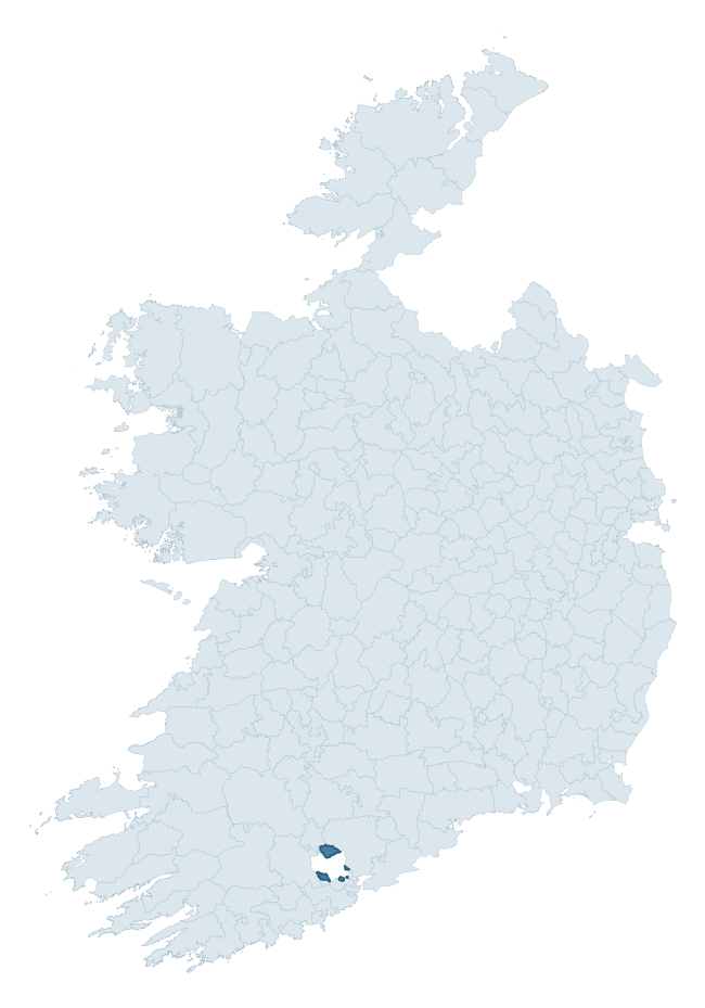
Where this barony sits in the Republic of Ireland
Geology and preservation
Bedrock geology shapes the landscape long before any settlement begins — controlling soil drainage, agricultural potential, the survival of upstanding monuments, and the preservation of buried archaeology. The figures below come from the Geological Survey Ireland 1:100,000 bedrock map.
The bedrock underlying Cork is predominantly mudstone (78% of the barony by area), laid down during the Devonian period (95% by area, around 419 to 359 million years ago). Mudstone breaks down into heavy, often poorly-drained clay soils that historically limited intensive arable use. The lower density of ploughing tends to preserve subsurface archaeology better than in sandstone or limestone terrain, though waterlogging can be a factor for site survival. The single largest mapped unit is the Ballytrasna Formation (78% of the barony's bedrock).
Rock type composition
Largest mapped unit: Ballytrasna Formation (79% of the barony)
Placename evidence
Logainm records 28 heritage-diagnostic placenames for Cork, drawn from townland and civil-parish names across the barony. The dominant stratum is Early Christian ecclesiastical — cill-, teampall-, and domhnach-prefixed names that record the dense network of early church foundations established between the fifth and tenth centuries. The leading diagnostic roots are cill- (9 — church), ráth- (8 — earthen ringfort), and cillín- (3 — killeen). This is broadly in line with the ROI average of 30.7 heritage placenames per barony. Logainm records 160 placenames for Cork (predominantly townland names). Of these, 28 (18%) carry one of the diagnostic Gaelic roots tracked above; the remainder draw on more generic landscape vocabulary that does not encode a heritage period.
Pre-Christian / Early Medieval Defensive
| Root | Count | Meaning |
|---|---|---|
| ráth- | 8 | earthen ringfort |
| lios- | 1 | ringfort or enclosure |
| dún- | 1 | hilltop or promontory fort |
Early Christian Ecclesiastical
| Root | Count | Meaning |
|---|---|---|
| cill- | 9 | church (early) |
| cillín- | 3 | unconsecrated burial ground |
| teampall- | 2 | church (later medieval) |
| gráinseach- | 2 | monastic farm / grange |
| mainistir- | 1 | monastery |
Other baronies in Cork
- Muskerry West
- Condons And Clangibbon
- Kinalmeaky
- Carbery East (east Division)
- Barrymore
- Muskerry East
- Kinsale
- Clonderalaw — Clare
- Middlethird — Tipperary
- Corkaguiny — Kerry
See all 280 baronies in the Republic of Ireland Heritage Tool.

Explore further
Grounding History: 10 Maps of Northern Ireland’s Past
If you’re interested in Irish heritage more widely, the companion report for Northern Ireland brings together the analysis of all 462 NI wards into one place through 10 high-quality maps — covering monument density, archaeological periods, placename heritage, terrain, wetland, and the historic landscape at first survey. Take a look.
About this profile
Click any section below to expand.
What is a barony?
A barony is a historic administrative unit in Ireland, broadly equivalent to an English hundred. The 280 baronies used here are from the OSi 2019 National Statutory Boundaries (generalised 20m), covering the 26 counties of the Republic of Ireland. Baronies derive from the Norman period, were formalised in the 17th century, and have not been redrawn for statistical purposes. They vary enormously in area, from compact urban baronies in Dublin to vast upland baronies in Connacht, and should not be compared by raw site count without accounting for area differences.
What counts as a site?
This profile combines three distinct heritage registers, each with its own definition of what constitutes a recordable site:
- Archaeological sites (NMS). The National Monuments Service Sites and Monuments Record (SMR) catalogues every known archaeological monument or site of archaeological interest in the Republic, from prehistoric burial mounds and ringforts to medieval churches and post-medieval defensive works. Inclusion does not require legal protection — only that the site has been identified, surveyed, and assessed as having archaeological value. A separate subset of these sites lies within a recorded protection zone, which gives them statutory protection under the National Monuments Acts.
- Listed buildings (NIAH). The National Inventory of Architectural Heritage records buildings of architectural, historical, archaeological, artistic, cultural, scientific, social, or technical interest. Each surveyed structure is appraised on a five-tier scale: International, National, Regional, Local, and Record-Only. The NIAH appraisal is informational rather than strictly statutory, but it underpins local-authority Record of Protected Structures (RPS) listings.
- Heritage placenames (Logainm). Logainm is the authoritative database of Irish placenames maintained by the Placenames Branch. This profile applies a heritage-diagnostic classifier to the Irish-language form of each townland name, flagging roots that signal defensive sites (ráth-, lios-, dún-, caiseal-, cathair-), ecclesiastical foundations (cill-, teampall-, domhnach-, mainistir-), prehistoric burial-ritual features (tuaim-, carn-, leaba-), or Norse-contact settlement (gall-). Townlands without one of these diagnostic roots are not flagged here — they may still carry historical significance, but that significance is not encoded in the name itself.
Editorial principles
The narrative sections of this profile follow several explicit principles:
- Evidential. Every claim about this barony’s heritage character is anchored in the underlying register data. Where a site count, a placename count, or a percentile rank is cited, it is computed from the source datasets at export time, not estimated.
- Comparative. Counts and metrics are reported alongside their percentile rank against the other 279 ROI baronies. A barony with 50 ringforts in absolute terms could be unusually high or unusually low depending on its size and regional context; percentile ranking removes that ambiguity.
- Transparent on limits. Where a register has known coverage gaps, survey biases, or data-quality issues that affect this barony’s figures, the profile flags them rather than presenting the numbers as definitive.
- No interpretation beyond what the data supports. The narrative does not speculate about historical events, social dynamics, or cultural meaning beyond what the recorded heritage and placename evidence directly attests.
Data caveats and limits
- NMS Sites and Monuments Record is the product of survey campaigns conducted at different intensities across different counties and decades. Some baronies have been surveyed more thoroughly than others, and absolute counts should be read in that light. Sites destroyed by development before survey are typically not represented; sites in heavily forested or upland terrain are sometimes under-recorded.
- NIAH coverage is broadly complete for the Republic of Ireland but the survey was conducted on a rolling county-by-county basis, and the most recent appraisal date varies. Buildings demolished or substantially altered after their original survey may still appear in the register; conversely, recent buildings of merit may not yet have been appraised.
- Logainm classification applies a deliberately conservative pattern-matching approach to the Irish-language townland forms. The classifier prioritises true positives over recall: a townland may carry a heritage signal that the classifier doesn’t recognise, particularly where the diagnostic root has been heavily anglicised or where the townland name draws on a less common term. The 60,000+ townland records and ~9,800 classified placenames give a substantial signal at barony scale, but individual townland names should be checked against Logainm directly for definitive interpretation.
- Period attribution. The chronological distribution reflects only those NMS sites that carry a recognised period attribution in the source data. Sites listed as “Unknown” period are excluded from the dated subset.
- Boundary changes. Some baronies have undergone minor boundary adjustments since their 19th-century definition; the OSi 2019 generalised boundaries used here are the current statutory definition and may differ slightly from historical maps in border areas.
- Bedrock geology is mapped at 1:100,000 scale, which means local variation within a barony — small pockets of different rock type, mineral veins, alluvium overlying bedrock — is generalised. The dominant-system and rocktype figures are area-weighted, so a barony reading “70% Carboniferous limestone” may still contain small but archaeologically important pockets of older or younger rock. Around 3% of GSI polygons do not match the lexicon and contribute no rocktype or system attribution.
Data sources
- National Monuments Service — Sites and Monuments Record (SMR) https://data.gov.ie/dataset/national-monuments-service-archaeological-survey-of-ireland
- National Inventory of Architectural Heritage (NIAH) https://data.gov.ie/dataset/national-inventory-of-architectural-heritage-niah-national-dataset
- Logainm — Placenames Database of Ireland https://www.logainm.ie/
- Ordnance Survey Ireland — National Statutory Barony Boundaries 2019 https://data-osi.opendata.arcgis.com/
- EURODEM — European Digital Elevation Model https://www.mapsforeurope.org/datasets/euro-dem
- ESA WorldCover https://esa-worldcover.org/en
- Geological Survey Ireland — 1:100,000 Bedrock Geology https://www.gsi.ie/en-ie/data-and-maps/Pages/Bedrock.aspx
Explore more: Search any of the 280 ROI baronies, browse by historical province, or read the methodology and data sources for the full Republic of Ireland Heritage Tool.