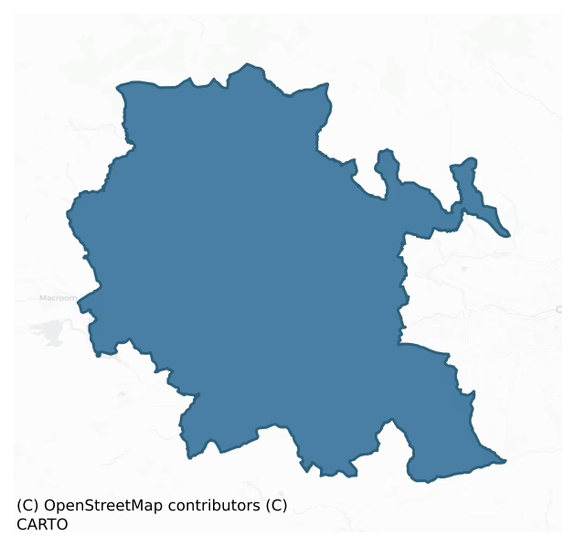
Muskerry East is a barony of County Cork, in the historical province of Munster (Irish: Múscraí Thoir), covering 460 km² of land. The barony records 1,455 NMS archaeological sites and 166 NIAH listed buildings, placing it at around the 84th percentile among 280 ROI baronies for sites per km². This means it is in the top fifth of all baronies for sites per km². Dated archaeological evidence runs from the Neolithic through to the Modern, spanning 8 of 9 archaeological periods, placing the barony in the 78th percentile among 280 ROI baronies for chronological depth. This means it is in the top third of all baronies for chronological depth. The largest dated subset of recorded sites dates to the Middle-Late Bronze Age. Logainm flags 56 placenames in the barony as carrying a recognised heritage root; the largest share — around 55% — are names associated with early Christian church and monastic foundations.
Heritage at a glance
Percentile rankings throughout this profile compare each barony only against the other 279 Republic of Ireland baronies.
The recorded heritage of Muskerry East
The National Monuments Service Sites and Monuments Record (SMR) is the statutory inventory of archaeological sites for the Republic of Ireland, maintained by the Department of Tourism, Culture, Arts, Gaeltacht, Sport and Media. Sites recorded here include earthworks, ringforts, megalithic tombs, ecclesiastical remains, and post-medieval features; not every record is legally protected, but each is registered as a monument of archaeological interest.
The National Monuments Service records 1,455 archaeological sites in Muskerry East, putting it at the 84th percentile among 280 ROI baronies for sites per km². This means it is in the top fifth of all baronies for sites per km². Protection coverage is near-universal — 1,424 sites (98%) fall within a recorded monument protection zone, indicating an extensively surveyed landscape. The record is dominated by defensive sites — ringforts, enclosures, hillforts, and stone forts (482 sites, 33% of the total), with agricultural and prehistoric industrial sites forming a substantial secondary presence (431 sites, 30%). Fulacht fia is the most prevalent type, making up 29% of the barony's recorded sites (421 records) — well above the ROI average of 6% across all baronies where this type occurs. Fulacht fia is a horseshoe-shaped Bronze Age burnt mound built around a sunken trough beside a water source, traditionally interpreted as a cooking site. Other significant types include Ringfort – rath (288) and Standing stone (157). Ringfort – rath is an earthen ringfort enclosed by a bank and external ditch — the most common Early Medieval farmstead, broadly dated 500–1000 AD; Standing stone is a deliberately set upright stone, used variously as a Bronze/Iron Age burial marker, route marker or commemorative monument. Across the barony's 460 km², this gives a recorded density of 3.16 sites per km².
Most common monument types
Hover or tap a monument type to see its definition.
| Type | Count |
|---|---|
| Fulacht fia a horseshoe-shaped Bronze Age burnt mound built around a sunken trough beside a water source, traditionally interpreted as a cooking site | 421 |
| Ringfort – rath an earthen ringfort enclosed by a bank and external ditch — the most common Early Medieval farmstead, broadly dated 500–1000 AD | 288 |
| Standing stone a deliberately set upright stone, used variously as a Bronze/Iron Age burial marker, route marker or commemorative monument | 157 |
| Souterrain an underground stone-built passage and chamber, generally Early Medieval and often associated with ringforts as a defensive or storage feature | 127 |
| Church a building used for public Christian worship, of any date from c. 500 AD onwards | 38 |
| Ogham stone a stone bearing an inscription in Ogham script, used as a memorial or boundary marker between the late 4th and early 8th centuries AD | 31 |
| Enclosure a banked or ditched feature of uncertain type, used as a catch-all where the original function cannot be determined from surface evidence | 30 |
Chronological distribution
The dated archaeological record for Muskerry East spans from the Neolithic through to the Modern, with activity attested across 8 of 9 archaeological periods. This is the 78th percentile across ROI baronies for chronological depth — an above-average span. Every period from earliest to latest is represented in the record — an unbroken sequence of dated activity across the full chronological span. Activity concentrates most heavily in the Middle Late Bronze Age (444 sites, 35% of dated material), with the Early Medieval forming a secondary peak (326 sites, 26%). A further 184 recorded sites (13% of the overall NMS register for the barony) carry no period attribution — appearing as 'Unknown' in the bar chart below. This typically reflects either records that pre-date the standardised period vocabulary or sites awaiting specialist dating review, rather than a genuine absence of chronological evidence.
Sample of recorded monuments
Show 25 sample monuments (of 1,455 total)
A representative sample of 25 recorded monuments drawn from the barony’s 1,455 total NMS entries. Sites within a recorded monument protection zone and rarer site types are prioritised so the list shows a meaningful cross-section rather than only the most common type. Each entry shows the official Sites and Monuments Record reference number and the description published by the National Monuments Service.
Cliff-edge fort
Shown as hachured subcircular enclosure on 1842 OS 6-inch map; D-shaped on 1904 and 1940 OS 6-inch maps. On cliff edge, on E side of Dripsey River. D-shaped area (straight side c. 30m N-S; projecting c. 18m to E)…
Shown as hachured subcircular enclosure on 1842 OS 6-inch map; D-shaped on 1904 and 1940 OS 6-inch maps. On cliff edge, on E side of Dripsey River. D-shaped area (straight side c. 30m N-S; projecting c. 18m to E) enclosed by pair of earthen banks with intervening and external fosses N->S; cliff edge to W. Outer bank (H 4m) is more substantial than inner bank (H 1.5m). External fosse measures 3.5m D. Entrance to SE with causeway across both fosses. Souterrain (CO049-006002-) visible in cliff face running underneath inner fosse to S.
The above description is derived from the published 'Archaeological Inventory of County Cork. Volume 3: Mid Cork' (Dublin: Stationery Office, 1997). In certain instances the entries have been revised and updated in the light of recent research.
Date of upload/revision: 14 January 2009
Cist
In pasture, no visible surface trace of 'stone-lined cist' (Hartnett 1939, 197), discovered by landowner c. 1920; it contained 'some human bones' and was closed up immediately.
The above description is derived from…
In pasture, no visible surface trace of 'stone-lined cist' (Hartnett 1939, 197), discovered by landowner c. 1920; it contained 'some human bones' and was closed up immediately.
The above description is derived from the published 'Archaeological Inventory of County Cork. Volume 3: Mid Cork' (Dublin: Stationery Office, 1997). In certain instances the entries have been revised and updated in the light of recent research.
Date of upload/revision: 14 January 2009
Megalithic tomb – unclassified
On level patch of ground, commanding view to S along Dripsey River valley.Tomb and many of surrounding field fences removed; capstone and orthostats piled atop nearest remaining field boundary. De Valera and O Nualláin…
On level patch of ground, commanding view to S along Dripsey River valley.Tomb and many of surrounding field fences removed; capstone and orthostats piled atop nearest remaining field boundary. De Valera and O Nualláin (1982, 8, no. 10) recorded ruined chamber covered by single roofstone (2.4m x 2.2m; 0.3m T) supported by single stone to W (H 0.7m; 1.1m x 0.15m) and SE (H 0.75m; 0.5m x 0.25m); N end rests on ground. Stone (H 0.1m) protrudes from ground at N end; W of SE support stone are two stones (H 1m: H 0.45m) side by side; two stones (H 0.75m: H 0.55m) stand beyond E edge of roofstone (ibid.). O Nualláin (ibid.) described tomb as unclassified but says, 'the possibility that the monument may be a large cist cannot be excluded.
The above description is derived from the published 'Archaeological Inventory of County Cork. Volume 3: Mid Cork' (Dublin: Stationery Office, 1997). In certain instances the entries have been revised and updated in the light of recent research.
Date of upload/revision: 14 January 2009
See linked document with details from Ruaidhrí de Valera and Seán Ó Nualláin, Survey of the Megalithic Tombs of Ireland. Volume IV. Counties Cork, Kerry, Limerick, Tipperary. (Dublin: Stationery Office, 1982)
Pit
Located c. 10m SE of ringfort (8314). Hachured as roughly oval-shaped raised area on 1938 OS 6-inch map, with a well indicated at S end. Remains consist of subcircular slightly raised area (diam. c. 10m) consisting of…
Located c. 10m SE of ringfort (8314). Hachured as roughly oval-shaped raised area on 1938 OS 6-inch map, with a well indicated at S end. Remains consist of subcircular slightly raised area (diam. c. 10m) consisting of earth and stones which appear much disturbed within mound; at S side is stone-lined pit (diam. 1.1m; D c. 1m), the bottom of which is choked by briars.
The above description is derived from the published 'Archaeological Inventory of County Cork. Volume 3: Mid Cork' (Dublin: Stationery Office, 1997). In certain instances the entries have been revised and updated in the light of recent research.
Date of upload/revision: 14 January 2009
Kerb circle
In pasture, on a slight NNW-facing slope. The remains of a small circular enclosure (diam. 3.5m), defined by an arc of low slabs (H c. 0.2m) set on edge SE-NW, sit on top of a low earthen mound (diam. 8m; H 0.4m). The…
In pasture, on a slight NNW-facing slope. The remains of a small circular enclosure (diam. 3.5m), defined by an arc of low slabs (H c. 0.2m) set on edge SE-NW, sit on top of a low earthen mound (diam. 8m; H 0.4m). The enclosing element is missing NW-SE where the mound has been disturbed. Large stones have been dumped on the E half of the mound. There is a spread (diam. 1m) of small stones in the centre of the enclosure. A single upright stone (H 1.07m), diamond-shaped in plan, roughly rectangular in section and orientated E-W, stands on the mound, immediately outside the enclosing element at W. Packing-stones are visible at the base and a slab is used as packing on its N side. According to local information, there is a tradition that this monument is associated with Hugh O'Neill who is said to have camped here on his way to the Battle of Kinsale (1601).
The above description is derived from 'The Archaeological Inventory of County Cork. Volume 5' (Dublin: Stationery Office, 2009).
Date of upload: 22 December 2009
Ogham stone (present location)
This is the present location of CO061-079003-. Discovered c. 1840 when flour mill demolished on site of possible ringfort (CO061-079001-); a second ogham stone apparently found with it (CO061-079004-). This stone (H…
This is the present location of CO061-079003-. Discovered c. 1840 when flour mill demolished on site of possible ringfort (CO061-079001-); a second ogham stone apparently found with it (CO061-079004-). This stone (H 2.4m x 0.8m x 0.15m) was used as a foot bridge over Delehinagh river (Hartnett 1939, 74) until 1851, when erected nearby beside St. Olan's holy well (CO61-089002-), where it remains today (Macalister 1945, 120,no. 122). Inscription worn and damaged but read by Macalister (ibid.) as MADORA MAQI DEGO. (Power et al. 1997, no. 7962)
Compiled by: Nora White
Date of upload: 5 March 2016
Images provided by and copyright of Amanda Clarke 2016-2022 https://holywellscorkandkerry.com/
Water mill – unclassified
In reclaimed land which had originally been poorly drained and marshy, c. 6m to the S of the Delehinagh River. Three well-preserved oak timber beams were discovered in this area during reclamation in the late 1990s…
In reclaimed land which had originally been poorly drained and marshy, c. 6m to the S of the Delehinagh River. Three well-preserved oak timber beams were discovered in this area during reclamation in the late 1990s (Cleary 1999a). The largest of the beams (L 4.4m; Wth 0.35m; T 0.25m) had two mortises (Wth 0.13m; D 0.1m) cut into either end of the beam. The smallest beam (L 2.3m; Wth 0.35m; T 0.2m) was rectangular in cross-section and was well preserved. One end of this beam was slightly splayed while the other was straight-edged. The third beam (L 2.85m; W 0.3m; T 0.2m) was weathered and irregular in shape. According to Cleary (ibid.), the first two beams were obviously structural timbers and, though more weathered and featureless, the third beam probably also came from a structure. Cleary (ibid.) suggests that they may have been part of a water mill, given their structural nature and their location adjacent to a stream.
The above description is derived from 'The Archaeological Inventory of County Cork. Volume 5' (Dublin: Stationery Office, 2009).
Date of upload: 22 December 2009
Mound
Heavily overgrown mound (H c. 2m) on grounds of Stone View house, c. 15m N of fulacht fiadh (CO062-185002-). Known locally as "the mound". According to local information, slab, said to be entrance to mound, discovered…
Heavily overgrown mound (H c. 2m) on grounds of Stone View house, c. 15m N of fulacht fiadh (CO062-185002-). Known locally as "the mound". According to local information, slab, said to be entrance to mound, discovered when stream was re-routed.
The above description is derived from the published 'Archaeological Inventory of County Cork. Volume 3: Mid Cork' (Dublin: Stationery Office, 1997). In certain instances the entries have been revised and updated in the light of recent research.
Date of upload/revision: 14 January 2009
Metalworking site
The Archaeological Survey of Ireland (ASI) is in the process of providing information on all monuments on The Historic Environment Viewer (HEV). Currently the information for this record has not been uploaded. To…
The Archaeological Survey of Ireland (ASI) is in the process of providing information on all monuments on The Historic Environment Viewer (HEV). Currently the information for this record has not been uploaded. To access available information for research purposes please make an appointment in advance with the Archive Unit (open Fridays 10.00 am – 5.00 pm), Department of Culture, Heritage and the Gaeltacht, The Custom House, Dublin 1 D01W6XO or email nmarchive@chg.gov.ie.
Well
A well, immediately to the NW of Mashanaglass castle (CO071-096002-), named 'Castle Well' on the 1938 OS 6-inch map. It is now covered over and used as pump house.
The above description is derived from the published…
A well, immediately to the NW of Mashanaglass castle (CO071-096002-), named 'Castle Well' on the 1938 OS 6-inch map. It is now covered over and used as pump house.
The above description is derived from the published 'Archaeological Inventory of County Cork. Volume 3: Mid Cork' (Dublin: Stationery Office, 1997). In certain instances the entries have been revised and updated in the light of recent research.
Date of upload/revision: 14 January 2009
Kiln – corn-drying
Excavated in 1955 by E.M Fahy (1956a, 34-5), in conjunction with horizontal-wheeled mill (CO071-090002-) which lies c. 45m to NW. Site occupies artificially levelled platform on S side of steep-sided glen; an artificial…
Excavated in 1955 by E.M Fahy (1956a, 34-5), in conjunction with horizontal-wheeled mill (CO071-090002-) which lies c. 45m to NW. Site occupies artificially levelled platform on S side of steep-sided glen; an artificial causeway links this area to the mill site. Excavation revealed an hourglass-shaped 'elongated shallow pit lying almost north-south across the platform….the pit was 22ft 6in long, 3ft 9in wide at its northern end, 2 ft wide about midway along its length, and 5ft 9in wide at its southern end. It was 1ft 6in deep at its northern end, and 2ft deep at its southern end, and 19in deep in its central area' (ibid., 35). Fahy found that 'a 2in thick layer of charcoal covered its floor at the northern end and spread rather thinly over the remainder of the pit floor' (ibid.); some large stones were found scattered on its southern half. Fahy concluded that pit 'may have been the ruins of the flue of a grain drying kiln, the northen end of the pit accommodating the fire' (ibid.); it appeared that kiln was deliberately dismantled. Area now overgrown; no obvious indication of kiln.
The above description is derived from the published 'Archaeological Inventory of County Cork. Volume 3: Mid Cork' (Dublin: Stationery Office, 1997). In certain instances the entries have been revised and updated in the light of recent research.
Date of upload/revision: 14 January 2009
Dovecote
In prominent position, overlooking Cronodymore house (CO072-041—-) to N and River Lee to S. Named 'Old Pigeon Ho.' on 1842 OS 6-inch map. Circular (int. diam. 5.5m; H c. 6m), roofless stone-built structure.…
In prominent position, overlooking Cronodymore house (CO072-041—-) to N and River Lee to S. Named 'Old Pigeon Ho.' on 1842 OS 6-inch map. Circular (int. diam. 5.5m; H c. 6m), roofless stone-built structure. Round-headed door ope on S side. Interior walls lined with 15 rows of nesting boxes; according to Gillman (1895, 225), 'each row holds thirty holes, making 450 nests in all. These nests are in the shape of an L, the entrance being large enough to admit one's arm, and the bend afforded good shelter for the nest'; the nests were 'visited twice a month for the young birds, and pigeon pies must have formed some of the dishes provided by the hospitality of Cronody for its guests' (ibid.). According to Gillman (ibid.), erected about same time as house, c. 1716.
The above description is derived from the published 'Archaeological Inventory of County Cork. Volume 3: Mid Cork' (Dublin: Stationery Office, 1997). In certain instances the entries have been revised and updated in the light of recent research.
Date of upload/revision: 14 January 2009
Castle – Anglo-Norman masonry castle
Described by Gillman (1893, 178) as 'a fortified manor-house built by the head of an important branch of the Muskerry MacCarthys, Teige of Aglish…now a bare patch of meadow'. Area now flooded due to Lee Valley…
Described by Gillman (1893, 178) as 'a fortified manor-house built by the head of an important branch of the Muskerry MacCarthys, Teige of Aglish…now a bare patch of meadow'. Area now flooded due to Lee Valley Hydro-electric Scheme. Healy (1988, 14) is doubtful that Mac Carthys ever built here and suggests it was house built by Kingstons in 18th century.
The above description is derived from the published 'Archaeological Inventory of County Cork. Volume 3: Mid Cork' (Dublin: Stationery Office, 1997). In certain instances the entries have been revised and updated in the light of recent research.
Date of upload/revision: 14 January 2009
Cave
Located c. 4km W of Ballincollig; entrance on S side of limestone quarry. Investigated by Caulfield (1866, 295) who found bones of wolf, boar and 'some human remains' embedded in stalactite floor of passage. In main…
Located c. 4km W of Ballincollig; entrance on S side of limestone quarry. Investigated by Caulfield (1866, 295) who found bones of wolf, boar and 'some human remains' embedded in stalactite floor of passage. In main chamber, at a depth of one foot under the surface, he found 'bones mixed with charcoal and lime deposits'; above these, at ground level, was square mound of stones (H c. 1.2m), resting on a flagstone (ibid.). Surveyed by Coleman (1940, 47-52), who recorded '670 yards' of passages, including one known as the Mass Rock chamber where, according to tradition, Mass was celebrated 'during the Penal days'; portion of antler and one vertebra of red deer found. Trial excavation by Coleman (1944, 58-9) did not uncover any evidence for human habitation and 'all the recovered bone material represented a recent fauna (Twohig 1975, 109).
The above description is derived from the published 'Archaeological Inventory of County Cork. Volume 3: Mid Cork' (Dublin: Stationery Office, 1997). In certain instances the entries have been revised and updated in the light of recent research.
Date of upload/revision: 14 January 2009
Rock scribing
On the N side of a road, embedded into an earth and stone field boundary. The SW face of a rectangular stone (H 0.6m; Wth 0.72m; T 0.26m) has numerous faint narrow horizontal grooves (L 0.05-0.2m), c. 0.01m apart,…
On the N side of a road, embedded into an earth and stone field boundary. The SW face of a rectangular stone (H 0.6m; Wth 0.72m; T 0.26m) has numerous faint narrow horizontal grooves (L 0.05-0.2m), c. 0.01m apart, across it. There are also three grooves (L 0.07-0.09m), 0.01m apart, on the upper surface of the stone.
The above description is derived from 'The Archaeological Inventory of County Cork. Volume 5' (Dublin: Stationery Office, 2009).
Date of upload: 22 December 2009
Religious house – Franciscan friars
In tillage, c. 80m S of the River Bride. Kilcrea castle (CO084-022001-) is visible c. 500m to the W, and the friary gate is aligned to the castle entrance. This friary was founded in 1465 for Observant Franciscans by…
In tillage, c. 80m S of the River Bride. Kilcrea castle (CO084-022001-) is visible c. 500m to the W, and the friary gate is aligned to the castle entrance. This friary was founded in 1465 for Observant Franciscans by Cormac Láidir MacCarthy, 6th Lord of Muskerry (Gwynn and Hadcock 1988, 251), on land that Cormac had recovered from the Anglo-Norman Barret family c.1420. Before the arrival of the Anglo-Norman, Muskerry had formed part of his ancestors’ original lordship, the medieval kingdom of Desmond (Lafaye 2018, 133). Cormac was killed in 1495 by his own brother, Eoghan, and by Eoghan’s sons (O’Donovan 1848-51, vol. 4, 1213), and he was buried in the friary wearing a Franciscan habit. Though Kilcrea friary was officially supressed in 1542, the friars remained at Kilcrea until the Cromwellian period, under the patronage of the MacCarthys; in the meantime the friary was sacked in 1584 and c. 1590, but repaired in 1603 and again in the 1620s (Gwynn and Hadcock ibid.). While the friary now stands in the middle of an empty field, 16th and 17th-century sources refer to grist mills, water mills and eel weirs on the River Bride, all located within the precinct of the friary, as well as gardens and houses (Lafaye ibid., 134-6). However, a geophysical survey of areas around the friary and the tower house carried out by the Discovery Programme in 2015 revealed little evidence for archaeological remains – though it is likely that the structures mentioned would have been made of tim…
Religious house – unclassified
On S-facing slope, near top of hill; immediately S of modern farm buildings, skirted to S by recent coniferous plantation. Roughly rectangular area (18.3m E-W; 6.8m N-S) defined by mound of rubble to W and SW (H c. 2m;…
On S-facing slope, near top of hill; immediately S of modern farm buildings, skirted to S by recent coniferous plantation. Roughly rectangular area (18.3m E-W; 6.8m N-S) defined by mound of rubble to W and SW (H c. 2m; 5m E-W), with traces of wall showing to W; and rectangular mound to E (H c. 2m), retained by stone wall (max. ext. H 2m; T 0.75m) to N (L 6.8m), E and S (L 5m); blocked ope at W end of N wall. To W of blocked ope, wall line interrupted by S end of second wall extending to N at right angles (L 2.9m); beyond this wall, line of N wall continues towards W end but is different in character, lower and narrower (H 1m; T 0.5m). E section probably that described by Hartnett (1939, 300) as 'the eastern gable', where he identified 'slight traces of a window opening'. Smith (1750, vol. 1, 198) mentions site as 'an abbey of regular canons, foundedby St. Aedus, in the eighth century'; no such foundation listed by Gwynn and Hadcock (1988); exact nature of site unclear.
The above description is derived from the published 'Archaeological Inventory of County Cork. Volume 3: Mid Cork' (Dublin: Stationery Office, 1997). In certain instances the entries have been revised and updated in the light of recent research.
Date of upload/revision: 14 January 2009
Mass-rock (present location)
In farmyard; formerly in nearby field. According to local information, this stone was a mass rock.
The above description is derived from the published 'Archaeological Inventory of County Cork. Volume 3: Mid Cork'…
In farmyard; formerly in nearby field. According to local information, this stone was a mass rock.
The above description is derived from the published 'Archaeological Inventory of County Cork. Volume 3: Mid Cork' (Dublin: Stationery Office, 1997). In certain instances the entries have been revised and updated in the light of recent research.
Date of upload/revision: 14 January 2009
Religious house – Augustinian nuns
In level part of large pasture field; fragmentary remains of rectangular church (int: 26m E-W; 5.9m N-S); walls in poor structural condition and ivy-clad. Central part of S wall, most of W gable and W third of N wall…
In level part of large pasture field; fragmentary remains of rectangular church (int: 26m E-W; 5.9m N-S); walls in poor structural condition and ivy-clad. Central part of S wall, most of W gable and W third of N wall entirely fallen; upper part of E gable also fallen. Two doors survive: near E end of N wall and slightly E of centre in same wall. Former has cut-stone surround with pointed arch and faces into church, suggesting former presence of structure outside church on this side; latter door had similar surround, now much damaged, and faces out from church in usual manner. Just inside latter door, fragments of two walls (Wth 1.3m; c. 2m apart) butt joint against N wall; may be remains of slim tower. Central E window poorly preserved; part of E side of window evident where N wall breaks off to W; better preserved window ope near E end of S wall with lower part of double lights surviving. Just E of latter window, at lower level, piscina with pointed-arch surround; damaged on E side, ornate stop chamfer on W side. Small plain wall press near S end of E wall.
According to Smith (1750, vol. 1, 171), founded by Cormac Mac Carthy in 1450 for Augustinian nuns, though Hayes (1894, 141) gives 1472. Later occupied by Franciscans but at exactly what time unclear (Gwynn and Hadcock 1988, 313).
No visible surface trace of graveyard around ruin; it apparently adjoined abbey on S side but was 'dug out' by landowner in 18th century and 'its mould used to manure the rest of the field'…
Slab-lined burial
Found in gravel pit on Mr. Reid's land in December 1923 and recorded by Lee (1924, 74-5). Rectangular cist (long axis E-W) measured '5 feet in length and 2 feet in width' and was formed of 'surface stones', three at…
Found in gravel pit on Mr. Reid's land in December 1923 and recorded by Lee (1924, 74-5). Rectangular cist (long axis E-W) measured '5 feet in length and 2 feet in width' and was formed of 'surface stones', three at each side and one at each end (ibid.). Within, in extended position, were remains of an 'adult man, of tall stature' consisting of 'two femurs, two fibulae, two tibiae, part of pelvis, sacrum, some ribs, one humerus, all in a good state of preservation' (ibid., 75). The body had been placed upon 'smaller stones loosely spread upon the gravel bed, then covered by flags' (ibid.). Exact location not known; Lee was also informed by Mr. Reid of two other cists in the immediate vicinity, which also remain unlocated.
The above description is derived from the published 'Archaeological Inventory of County Cork. Volume 3: Mid Cork' (Dublin: Stationery Office, 1997). In certain instances the entries have been revised and updated in the light of recent research.
Date of upload/revision: 14 January 2009
Fish-pond
Fish pond, indicated on 1842 OS 6-inch map, overgrown, to NE of Oldtown House (CO072-121—-).
The above description is derived from the published 'Archaeological Inventory of County Cork. Volume 3: Mid Cork'…
Fish pond, indicated on 1842 OS 6-inch map, overgrown, to NE of Oldtown House (CO072-121—-).
The above description is derived from the published 'Archaeological Inventory of County Cork. Volume 3: Mid Cork' (Dublin: Stationery Office, 1997). In certain instances the entries have been revised and updated in the light of recent research.
Date of upload/revision: 14 January 2009
Cross-slab
Not marked on 1842 and 1904 OS 6-inch maps. In field beside farmhouse and to SE of possible early ecclesiastical enclosure (CO060-075001-). Thin slab (H c. 1m; 0.35m x0.15m) with simple Greek cross enclosed by two…
Not marked on 1842 and 1904 OS 6-inch maps. In field beside farmhouse and to SE of possible early ecclesiastical enclosure (CO060-075001-). Thin slab (H c. 1m; 0.35m x0.15m) with simple Greek cross enclosed by two circles (diam. 0.19m) incised on SW face. Arms are formed of triple incised lines, centre lines of which terminate at circumference of outer enclosing circle, whilst other lines terminate at inner circle. Part of slab has flaked away above the circle. Bullaun stone (CO060-075006-) at base of slab. Locally believed to mark grave of priest killed in Penal times (Hartnett 1939, 44).
The above description is derived from the published 'Archaeological Inventory of County Cork. Volume 3: Mid Cork' (Dublin: Stationery Office, 1997). In certain instances the entries have been revised and updated in the light of recent research.
Date of upload/revision: 14 January 2009
Water mill – horizontal-wheeled
Remains of lidded penstock and plank-lined headrace discovered in 1927 by J.P. O'Conlon (Rynne 1988, 331). No visible surface trace remains.
The above description is derived from the published 'Archaeological…
Remains of lidded penstock and plank-lined headrace discovered in 1927 by J.P. O'Conlon (Rynne 1988, 331). No visible surface trace remains.
The above description is derived from the published 'Archaeological Inventory of County Cork. Volume 3: Mid Cork' (Dublin: Stationery Office, 1997). In certain instances the entries have been revised and updated in the light of recent research.
Date of upload/revision: 14 January 2009
Mill – unclassified
The Archaeological Survey of Ireland (ASI) is in the process of providing information on all monuments on The Historic Environment Viewer (HEV). Currently the information for this record has not been uploaded. To…
The Archaeological Survey of Ireland (ASI) is in the process of providing information on all monuments on The Historic Environment Viewer (HEV). Currently the information for this record has not been uploaded. To access available information for research purposes please make an appointment in advance with the Archive Unit (open Fridays 10.00 am – 5.00 pm), Department of Culture, Heritage and the Gaeltacht, The Custom House, Dublin 1 D01W6XO or email nmarchive@chg.gov.ie.
Fulacht fia
In rough grazing. Circular mound of burnt material (diam. 14m; H c. 2m) immediately NW of site of standing stone (CO049-016002-).
The above description is derived from the published 'Archaeological Inventory of…
In rough grazing. Circular mound of burnt material (diam. 14m; H c. 2m) immediately NW of site of standing stone (CO049-016002-).
The above description is derived from the published 'Archaeological Inventory of County Cork. Volume 3: Mid Cork' (Dublin: Stationery Office, 1997). In certain instances the entries have been revised and updated in the light of recent research.
Date of upload/revision: 14 January 2009
Listed buildings
The National Inventory of Architectural Heritage (NIAH) is a state survey appraising buildings of architectural, historical, archaeological, artistic, cultural, scientific, social, or technical interest. Each surveyed structure receives a rating from International (the highest, for buildings of European importance) through National, Regional, Local, and Record-Only.
The NIAH records 166 listed buildings in Muskerry East, the 71st percentile across ROI baronies for listed-building density. The highest-graded structures include 2 of National significance. The Republic holds 937 National-graded buildings in total, so this barony accounts for around 0% of the national total. Construction dates concentrate most heavily in the Victorian (1830-1900) period. The most-recorded building type is house (42 examples, 25% of the listed stock).
Terrain and environment
Mean elevation across the barony is 141m — the 83rd percentile among 280 ROI baronies for elevation. This means it is in the top fifth of all baronies for elevation. This is a relatively elevated landscape by ROI standards. Elevation matters for heritage because higher-altitude baronies typically favour defensive monuments — ringforts and hilltop forts placed on prominent ground — while lowland baronies are more likely to carry the dense settlement and church networks of intensive agricultural landscapes. The barony reaches 443m at its highest point — a vertical span of more than 302m within its boundary, indicating significant topographic diversity. Mean slope is 4.9° — the 72nd percentile among 280 ROI baronies for slope. This means it is in the top third of all baronies for slope. Slope is a key control on both land use and archaeological preservation: steep ground resists ploughing and tends to preserve earthworks intact, while gentle slopes favour intensive cultivation that damages or destroys surface archaeology over time. The Topographic Wetness Index averages 10.1, the 26th percentile among 280 ROI baronies for wetness. This means it is in the bottom third of all baronies for wetness. Drainage matters for heritage because poorly-drained ground preserves organic archaeology (wooden trackways, leather, textiles, and on rare occasions human remains) far better than free-draining soil; well-drained ground favours arable use but destroys organic material rapidly. The land-cover mosaic combines improved grassland (74%), woodland (17%), and arable farmland (6%), giving a mixed agricultural and semi-natural landscape. In overall character, this is elevated but relatively gentle terrain — typical of plateau country, with land use dominated by improved grassland.
Terrain measurements
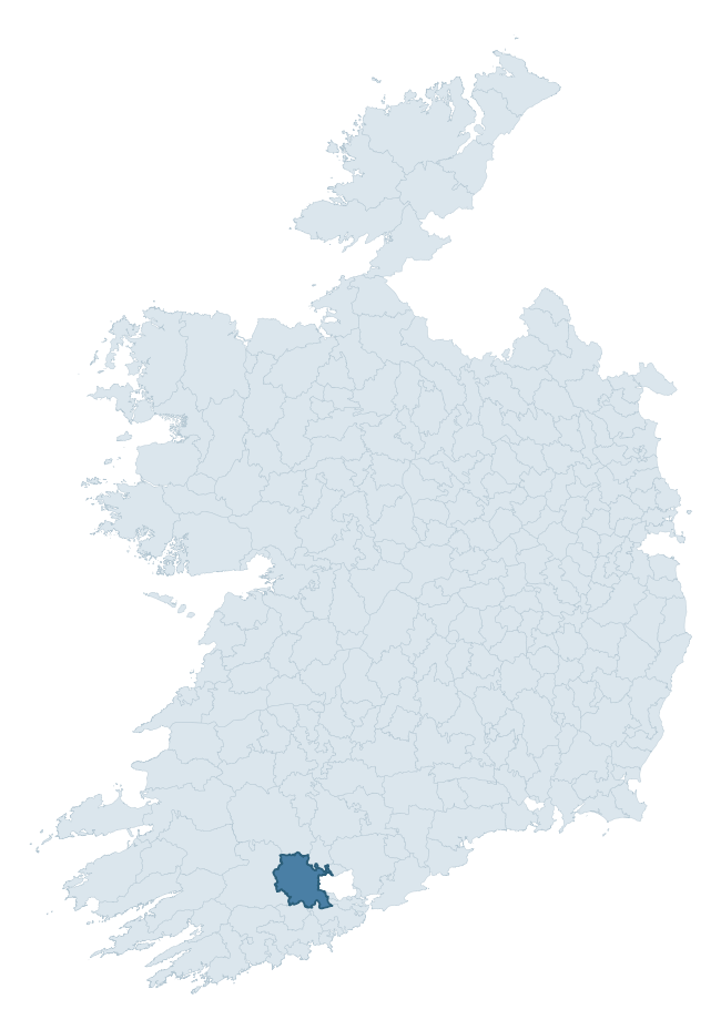
Where this barony sits in the Republic of Ireland
Geology and preservation
Bedrock geology shapes the landscape long before any settlement begins — controlling soil drainage, agricultural potential, the survival of upstanding monuments, and the preservation of buried archaeology. The figures below come from the Geological Survey Ireland 1:100,000 bedrock map.
The bedrock underlying Muskerry East is predominantly mudstone (74% of the barony by area), laid down during the Devonian period (93% by area, around 419 to 359 million years ago). Mudstone breaks down into heavy, often poorly-drained clay soils that historically limited intensive arable use. The lower density of ploughing tends to preserve subsurface archaeology better than in sandstone or limestone terrain, though waterlogging can be a factor for site survival. The single largest mapped unit is the Ballytrasna Formation (74% of the barony's bedrock).
Rock type composition
Largest mapped unit: Ballytrasna Formation (74% of the barony)
Placename evidence
Logainm records 56 heritage-diagnostic placenames for Muskerry East, drawn from townland and civil-parish names across the barony. The dominant stratum is Early Christian ecclesiastical — cill-, teampall-, and domhnach-prefixed names that record the dense network of early church foundations established between the fifth and tenth centuries. The leading diagnostic roots are cill- (24 — church), ráth- (9 — earthen ringfort), and lios- (4 — ringfort or enclosure). This is above the ROI average of 30.7 heritage placenames per barony. The presence of multiple heritage strata side by side indicates layered occupation of the landscape across successive prehistoric and historic periods. Logainm records 302 placenames for Muskerry East (predominantly townland names). Of these, 56 (19%) carry one of the diagnostic Gaelic roots tracked above; the remainder draw on more generic landscape vocabulary that does not encode a heritage period.
Pre-Christian / Early Medieval Defensive
| Root | Count | Meaning |
|---|---|---|
| ráth- | 9 | earthen ringfort |
| lios- | 4 | ringfort or enclosure |
| dún- | 4 | hilltop or promontory fort |
| cathair- | 1 | stone fort |
Early Christian Ecclesiastical
| Root | Count | Meaning |
|---|---|---|
| cill- | 24 | church (early) |
| díseart- | 2 | hermitage |
| cillín- | 2 | unconsecrated burial ground |
| teampall- | 1 | church (later medieval) |
| domhnach- | 1 | pre-Patrician or earliest Patrician church |
| gráinseach- | 1 | monastic farm / grange |
Burial, Ritual, and Norse-Contact
| Root | Count | Meaning |
|---|---|---|
| sián- | 2 | fairy mound |
| carn- | 1 | cairn |
| leacht- | 1 | grave monument |
| uaimh- | 1 | cave / souterrain |
| gall- | 1 | foreigner — Norse settlement marker |
Other baronies in Cork
- Bantry
- Duhallow
- Carbery West (east Division)
- Bear
- Fermoy
- Carbery East (west Division)
- Orrery And Kilmore
- Dunkerron North — Kerry
- Cork
- Connello Lower — Limerick
See all 280 baronies in the Republic of Ireland Heritage Tool.

Explore further
Grounding History: 10 Maps of Northern Ireland’s Past
If you’re interested in Irish heritage more widely, the companion report for Northern Ireland brings together the analysis of all 462 NI wards into one place through 10 high-quality maps — covering monument density, archaeological periods, placename heritage, terrain, wetland, and the historic landscape at first survey. Take a look.
About this profile
Click any section below to expand.
What is a barony?
A barony is a historic administrative unit in Ireland, broadly equivalent to an English hundred. The 280 baronies used here are from the OSi 2019 National Statutory Boundaries (generalised 20m), covering the 26 counties of the Republic of Ireland. Baronies derive from the Norman period, were formalised in the 17th century, and have not been redrawn for statistical purposes. They vary enormously in area, from compact urban baronies in Dublin to vast upland baronies in Connacht, and should not be compared by raw site count without accounting for area differences.
What counts as a site?
This profile combines three distinct heritage registers, each with its own definition of what constitutes a recordable site:
- Archaeological sites (NMS). The National Monuments Service Sites and Monuments Record (SMR) catalogues every known archaeological monument or site of archaeological interest in the Republic, from prehistoric burial mounds and ringforts to medieval churches and post-medieval defensive works. Inclusion does not require legal protection — only that the site has been identified, surveyed, and assessed as having archaeological value. A separate subset of these sites lies within a recorded protection zone, which gives them statutory protection under the National Monuments Acts.
- Listed buildings (NIAH). The National Inventory of Architectural Heritage records buildings of architectural, historical, archaeological, artistic, cultural, scientific, social, or technical interest. Each surveyed structure is appraised on a five-tier scale: International, National, Regional, Local, and Record-Only. The NIAH appraisal is informational rather than strictly statutory, but it underpins local-authority Record of Protected Structures (RPS) listings.
- Heritage placenames (Logainm). Logainm is the authoritative database of Irish placenames maintained by the Placenames Branch. This profile applies a heritage-diagnostic classifier to the Irish-language form of each townland name, flagging roots that signal defensive sites (ráth-, lios-, dún-, caiseal-, cathair-), ecclesiastical foundations (cill-, teampall-, domhnach-, mainistir-), prehistoric burial-ritual features (tuaim-, carn-, leaba-), or Norse-contact settlement (gall-). Townlands without one of these diagnostic roots are not flagged here — they may still carry historical significance, but that significance is not encoded in the name itself.
Editorial principles
The narrative sections of this profile follow several explicit principles:
- Evidential. Every claim about this barony’s heritage character is anchored in the underlying register data. Where a site count, a placename count, or a percentile rank is cited, it is computed from the source datasets at export time, not estimated.
- Comparative. Counts and metrics are reported alongside their percentile rank against the other 279 ROI baronies. A barony with 50 ringforts in absolute terms could be unusually high or unusually low depending on its size and regional context; percentile ranking removes that ambiguity.
- Transparent on limits. Where a register has known coverage gaps, survey biases, or data-quality issues that affect this barony’s figures, the profile flags them rather than presenting the numbers as definitive.
- No interpretation beyond what the data supports. The narrative does not speculate about historical events, social dynamics, or cultural meaning beyond what the recorded heritage and placename evidence directly attests.
Data caveats and limits
- NMS Sites and Monuments Record is the product of survey campaigns conducted at different intensities across different counties and decades. Some baronies have been surveyed more thoroughly than others, and absolute counts should be read in that light. Sites destroyed by development before survey are typically not represented; sites in heavily forested or upland terrain are sometimes under-recorded.
- NIAH coverage is broadly complete for the Republic of Ireland but the survey was conducted on a rolling county-by-county basis, and the most recent appraisal date varies. Buildings demolished or substantially altered after their original survey may still appear in the register; conversely, recent buildings of merit may not yet have been appraised.
- Logainm classification applies a deliberately conservative pattern-matching approach to the Irish-language townland forms. The classifier prioritises true positives over recall: a townland may carry a heritage signal that the classifier doesn’t recognise, particularly where the diagnostic root has been heavily anglicised or where the townland name draws on a less common term. The 60,000+ townland records and ~9,800 classified placenames give a substantial signal at barony scale, but individual townland names should be checked against Logainm directly for definitive interpretation.
- Period attribution. The chronological distribution reflects only those NMS sites that carry a recognised period attribution in the source data. Sites listed as “Unknown” period are excluded from the dated subset.
- Boundary changes. Some baronies have undergone minor boundary adjustments since their 19th-century definition; the OSi 2019 generalised boundaries used here are the current statutory definition and may differ slightly from historical maps in border areas.
- Bedrock geology is mapped at 1:100,000 scale, which means local variation within a barony — small pockets of different rock type, mineral veins, alluvium overlying bedrock — is generalised. The dominant-system and rocktype figures are area-weighted, so a barony reading “70% Carboniferous limestone” may still contain small but archaeologically important pockets of older or younger rock. Around 3% of GSI polygons do not match the lexicon and contribute no rocktype or system attribution.
Data sources
- National Monuments Service — Sites and Monuments Record (SMR) https://data.gov.ie/dataset/national-monuments-service-archaeological-survey-of-ireland
- National Inventory of Architectural Heritage (NIAH) https://data.gov.ie/dataset/national-inventory-of-architectural-heritage-niah-national-dataset
- Logainm — Placenames Database of Ireland https://www.logainm.ie/
- Ordnance Survey Ireland — National Statutory Barony Boundaries 2019 https://data-osi.opendata.arcgis.com/
- EURODEM — European Digital Elevation Model https://www.mapsforeurope.org/datasets/euro-dem
- ESA WorldCover https://esa-worldcover.org/en
- Geological Survey Ireland — 1:100,000 Bedrock Geology https://www.gsi.ie/en-ie/data-and-maps/Pages/Bedrock.aspx
Explore more: Search any of the 280 ROI baronies, browse by historical province, or read the methodology and data sources for the full Republic of Ireland Heritage Tool.