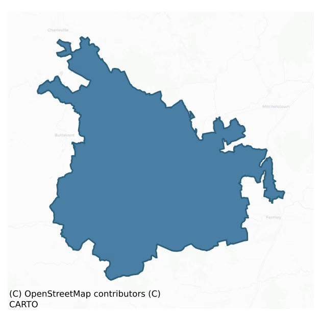
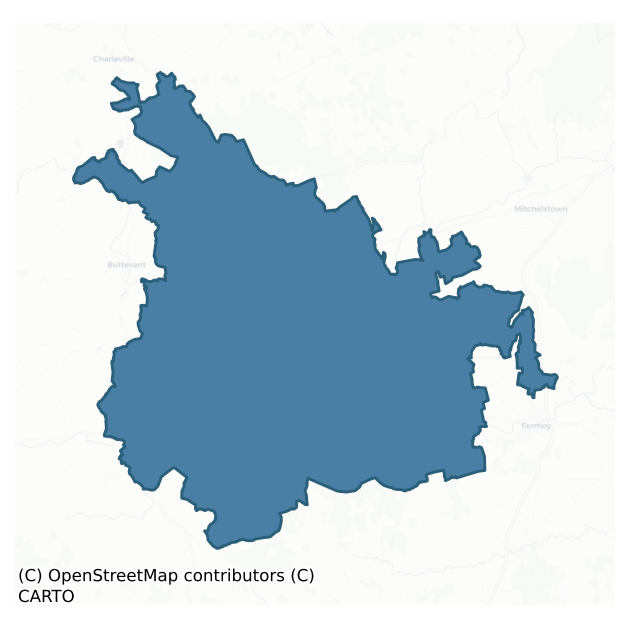
Fermoy is a barony of County Cork, in the historical province of Munster (Irish: Mainistir Fhear Maí), covering 492 km² of land. The barony records 1,326 NMS archaeological sites and 413 NIAH listed buildings, placing it at around the 74th percentile among 280 ROI baronies for sites per km². This means it is in the top third of all baronies for sites per km². Dated archaeological evidence runs from the Mesolithic through to the Modern, spanning 9 of 9 archaeological periods, placing the barony in the 90th percentile among 280 ROI baronies for chronological depth. This means it is in the top tenth of all baronies for chronological depth. The largest dated subset of recorded sites dates to the Iron Age. Logainm flags 54 placenames in the barony as carrying a recognised heritage root; the largest share — around 57% — are names associated with early Christian church and monastic foundations.
Heritage at a glance
Percentile rankings throughout this profile compare each barony only against the other 279 Republic of Ireland baronies.
The recorded heritage of Fermoy
The National Monuments Service Sites and Monuments Record (SMR) is the statutory inventory of archaeological sites for the Republic of Ireland, maintained by the Department of Tourism, Culture, Arts, Gaeltacht, Sport and Media. Sites recorded here include earthworks, ringforts, megalithic tombs, ecclesiastical remains, and post-medieval features; not every record is legally protected, but each is registered as a monument of archaeological interest.
The National Monuments Service records 1,326 archaeological sites in Fermoy, putting it at the 74th percentile among 280 ROI baronies for sites per km². This means it is in the top third of all baronies for sites per km². Protection coverage is near-universal — 1,264 sites (95%) fall within a recorded monument protection zone, indicating an extensively surveyed landscape. The record is dominated by defensive sites — ringforts, enclosures, hillforts, and stone forts (580 sites, 44% of the total), with agricultural and prehistoric industrial sites forming a substantial secondary presence (241 sites, 18%). Ringfort – rath is the most prevalent type, making up 21% of the barony's recorded sites (283 records), broadly in line with the ROI average of 20% across all baronies where this type occurs. Ringfort – rath is an earthen ringfort enclosed by a bank and external ditch — the most common Early Medieval farmstead, broadly dated 500–1000 AD. Other significant types include Fulacht fia (206) and Enclosure (202). Fulacht fia is a horseshoe-shaped Bronze Age burnt mound built around a sunken trough beside a water source, traditionally interpreted as a cooking site; Enclosure is a banked or ditched feature of uncertain type, used as a catch-all where the original function cannot be determined from surface evidence. Across the barony's 492 km², this gives a recorded density of 2.70 sites per km².
Most common monument types
Hover or tap a monument type to see its definition.
| Type | Count |
|---|---|
| Ringfort – rath an earthen ringfort enclosed by a bank and external ditch — the most common Early Medieval farmstead, broadly dated 500–1000 AD | 283 |
| Fulacht fia a horseshoe-shaped Bronze Age burnt mound built around a sunken trough beside a water source, traditionally interpreted as a cooking site | 206 |
| Enclosure a banked or ditched feature of uncertain type, used as a catch-all where the original function cannot be determined from surface evidence | 202 |
| Church a building used for public Christian worship, of any date from c. 500 AD onwards | 51 |
| Graveyard a burial area associated with a church, in use from the medieval period onwards | 37 |
| Souterrain an underground stone-built passage and chamber, generally Early Medieval and often associated with ringforts as a defensive or storage feature | 34 |
Chronological distribution
The dated archaeological record for Fermoy spans from the Mesolithic through to the Modern, with activity attested across 9 of 9 archaeological periods. This is the 90th percentile across ROI baronies for chronological depth — an above-average span. Every period from earliest to latest is represented in the record — an unbroken sequence of dated activity across the full chronological span. Activity concentrates most heavily in the Iron Age (398 sites, 38% of dated material), with the Middle Late Bronze Age forming a secondary peak (265 sites, 25%). A further 283 recorded sites (21% of the overall NMS register for the barony) carry no period attribution — appearing as 'Unknown' in the bar chart below. This typically reflects either records that pre-date the standardised period vocabulary or sites awaiting specialist dating review, rather than a genuine absence of chronological evidence.
Sample of recorded monuments
Show 25 sample monuments (of 1,326 total)
A representative sample of 25 recorded monuments drawn from the barony’s 1,326 total NMS entries. Sites within a recorded monument protection zone and rarer site types are prioritised so the list shows a meaningful cross-section rather than only the most common type. Each entry shows the official Sites and Monuments Record reference number and the description published by the National Monuments Service.
Tomb – effigial (present location)
Cemented to inner face of E gable of Ballyhay Church (14393). Tapering chamfered slab (H 1.14m; Wth 0.42m at top, 0.32m at base; T 0.2m) carved in high relief with civilian figure in kirtle and short shoulder cape. Feet…
Cemented to inner face of E gable of Ballyhay Church (14393). Tapering chamfered slab (H 1.14m; Wth 0.42m at top, 0.32m at base; T 0.2m) carved in high relief with civilian figure in kirtle and short shoulder cape. Feet in shoes resting on dog. Head resting on cushion with angels on either side. Early-14th-century in date (Hunt 1974, vol. 1, 129).
The above description is derived from the published 'Archaeological Inventory of County Cork. Volume 4: North Cork' (Dublin: Stationery Office, 2000). In certain instances the entries have been revised and updated in the light of recent research.
Date of upload/revision: 14 January 2009
Castle – motte
In undulating pasture, c. 200m N of Garrane River and c. 80m E of bivallate ringfort (12056). Steep-sided, circular, earthen mound (H 8.2m) surrounded by waterfilled fosse (Wth 4.4m) with substantial external earthen…
In undulating pasture, c. 200m N of Garrane River and c. 80m E of bivallate ringfort (12056). Steep-sided, circular, earthen mound (H 8.2m) surrounded by waterfilled fosse (Wth 4.4m) with substantial external earthen bank (ext. H 1.3m). Mound planted with trees; flat topped (21.5m E-W; 18.4m N-S), with central depression (10.75m E-W; 9.5m N-S). Bank widest to W where it is heavily planted with trees; short section to S very narrow, with field boundary extending S from it. Access to mound across muddy causeway to NNW. Ardskeagh Church (14388) c. 500m to NNW.
The above description is derived from the published 'Archaeological Inventory of County Cork. Volume 4: North Cork' (Dublin: Stationery Office, 2000). In certain instances the entries have been revised and updated in the light of recent research.
Date of upload/revision: 14 January 2009
Booley hut
Immediately N of highest point of Knockafutera, in Ballyhoura Mountains. Indicated as rectangular structure on 1905 and 1937 OS 6-inch maps. Ruined rectangular drystone-walled structure (int. 1.6m N-S; 2m E-W; wall…
Immediately N of highest point of Knockafutera, in Ballyhoura Mountains. Indicated as rectangular structure on 1905 and 1937 OS 6-inch maps. Ruined rectangular drystone-walled structure (int. 1.6m N-S; 2m E-W; wall thickness 1m; H 0.9m); door ope (Wth 0.7m) in E wall.
The above description is derived from the published 'Archaeological Inventory of County Cork. Volume 4: North Cork' (Dublin: Stationery Office, 2000). In certain instances the entries have been revised and updated in the light of recent research.
Date of upload/revision: 14 January 2009
Decoy pond
In wet woodland, on W bank of Awbeg River, in demesne of Doneraile Court (14887). Described by Fox (1984, 114-115) as roughly-square pond (L c. 100 yds), with four semicircular promontories (c. 7-8 yds sq.) protruding…
In wet woodland, on W bank of Awbeg River, in demesne of Doneraile Court (14887). Described by Fox (1984, 114-115) as roughly-square pond (L c. 100 yds), with four semicircular promontories (c. 7-8 yds sq.) protruding from centre of each side, and circular island in centre. Possible decoy pipe extends at E corner. Fox notes similarity to Beaulieu decoy in Drogheda which was made c. 1730 (Fox, ibid.); Smith in 1750 (vol. 1, 330) refers to a 'fine decoy' at Doneraile. However, this area is shown as heavily wooded on 1842 OS 6-inch map (decoy not shown) and there was no memory of its use in late 19th century (Fox ibid.). Outline of decoy pond, now dry, still evident in densely wooded area, known locally as 'The Decoy Wood'.
The above description is derived from the published 'Archaeological Inventory of County Cork. Volume 4: North Cork' (Dublin: Stationery Office, 2000). In certain instances the entries have been revised and updated in the light of recent research.
Date of upload/revision: 14 January 2009
Building
Adjacent to lake, at NE end of Kilcolman Bog. Indicated on 1842 OS 6-inch map as complex of structures around yard, named 'Dairy': long ranges on NE and SE sides, with shorter structure on NW side. Similar layout on…
Adjacent to lake, at NE end of Kilcolman Bog. Indicated on 1842 OS 6-inch map as complex of structures around yard, named 'Dairy': long ranges on NE and SE sides, with shorter structure on NW side. Similar layout on 1906 OS 6-inch map but buildings marker 'in ruins' except NE range. NE range survives as 1-storey, 5-bay, gable-ended residential house. Ruined 1-storey SE range (int: 31m NE-SW; 3.08m NW-SE) has a series of stone arched doors and one wide arch in NW wall. Known locally as 'Hill's Dairy' after the family that once owned the estate. 'Old Dairy', indicated on 1842 OS 6-inch map c. 900m to W, no longer survives.
The above description is derived from the published 'Archaeological Inventory of County Cork. Volume 4: North Cork' (Dublin: Stationery Office, 2000). In certain instances the entries have been revised and updated in the light of recent research.
Date of upload/revision: 14 January 2009
Mound
In pasture on N-facing slope. D-shaped mound (straight side c. 20m N-S; projecting c. 10m to E) abutting E side of N-S field fence; heavily overgrown making interpretation difficult.
The above description is derived…
In pasture on N-facing slope. D-shaped mound (straight side c. 20m N-S; projecting c. 10m to E) abutting E side of N-S field fence; heavily overgrown making interpretation difficult.
The above description is derived from the published 'Archaeological Inventory of County Cork. Volume 4: North Cork' (Dublin: Stationery Office, 2000). In certain instances the entries have been revised and updated in the light of recent research.
Date of upload/revision: 14 January 2009
Weir – regulating
The Archaeological Survey of Ireland (ASI) is in the process of providing information on all monuments on The Historic Environment Viewer (HEV). Currently the information for this record has not been uploaded. To…
The Archaeological Survey of Ireland (ASI) is in the process of providing information on all monuments on The Historic Environment Viewer (HEV). Currently the information for this record has not been uploaded. To access available information for research purposes please make an appointment in advance with the Archive Unit (open Fridays 10.00 am – 5.00 pm), Department of Culture, Heritage and the Gaeltacht, The Custom House, Dublin 1 D01W6XO or email nmarchive@chg.gov.ie.
Well
The only evidence that the chalybeate spring known as the Spa Well may have been a holy well is from Jones in Grove White (1905-25, vol. 1, 106) who says it was venerated from pre patrician times and that druids had a…
The only evidence that the chalybeate spring known as the Spa Well may have been a holy well is from Jones in Grove White (1905-25, vol. 1, 106) who says it was venerated from pre patrician times and that druids had a sanctuary there. O'Reilly (1987, 131) says it was not known as a holy well although visited by many people. A stone which was erected over the well had the following inscription: 'Dr. John Creagh 1780' (ibid.).
Compiled by: Archaeological Survey Unit, UCC.
Date of upload: 12 January 2010
Gateway
The Archaeological Survey of Ireland (ASI) is in the process of providing information on all monuments on The Historic Environment Viewer (HEV). Currently the information for this record has not been uploaded. To…
The Archaeological Survey of Ireland (ASI) is in the process of providing information on all monuments on The Historic Environment Viewer (HEV). Currently the information for this record has not been uploaded. To access available information for research purposes please make an appointment in advance with the Archive Unit (open Fridays 10.00 am – 5.00 pm), Department of Culture, Heritage and the Gaeltacht, The Custom House, Dublin 1 D01W6XO or email nmarchive@chg.gov.ie.
Gate lodge
The Archaeological Survey of Ireland (ASI) is in the process of providing information on all monuments on The Historic Environment Viewer (HEV). Currently the information for this record has not been uploaded. To…
The Archaeological Survey of Ireland (ASI) is in the process of providing information on all monuments on The Historic Environment Viewer (HEV). Currently the information for this record has not been uploaded. To access available information for research purposes please make an appointment in advance with the Archive Unit (open Fridays 10.00 am – 5.00 pm), Department of Culture, Heritage and the Gaeltacht, The Custom House, Dublin 1 D01W6XO or email nmarchive@chg.gov.ie.
Architectural fragment
This architectural fragment consists of a carved stone head and was referred to in the 'Archaeological Inventory of County Cork – vol. 4 North Cork' (2000, 14297) under the entry (no. 14297) for an unclassified castle…
This architectural fragment consists of a carved stone head and was referred to in the 'Archaeological Inventory of County Cork – vol. 4 North Cork' (2000, 14297) under the entry (no. 14297) for an unclassified castle (CO025-093002-). The reference to the carved head in the entry reads: 'Human head carved in stone and now set in enclosing wall near house may have come from castle.'
The above description is derived from the published 'Archaeological Inventory of County Cork. Volume 4: North Cork' (Dublin: Stationery Office, 2000). In certain instances the entries have been revised and updated in the light of recent research.
Date of upload/revision: 14 January 2009
Pit-burial
On W-facing slope, overlooking Awbeg river. In 1974 machine clearance in advance of reclamation work uncovered pit; investigated by Shee (O' Kelly and Shee 1974, 80). Pit (diam. 0.6m; D 0.3m) contained small heap of…
On W-facing slope, overlooking Awbeg river. In 1974 machine clearance in advance of reclamation work uncovered pit; investigated by Shee (O' Kelly and Shee 1974, 80). Pit (diam. 0.6m; D 0.3m) contained small heap of cremated bone (diam. c. 0.22m) at base; bone comprised remains of foetus, infant and adult; canine tusk of boar, perforated for use as a pendant, accompanied cremation. Pit covered by capstone (c.1.2m x c. 1.05m x c. 0.1m). Ploygonal cist (CO026-06101-) c. 1.3-1.5m to SE.
The above description is derived from the published 'Archaeological Inventory of County Cork. Volume 4: North Cork' (Dublin: Stationery Office, 2000). In certain instances the entries have been revised and updated in the light of recent research.
Date of upload/revision: 14 January 2009
Battery
This record was listed in the RMP (1998) as 'Potential site – cartographic'. The source for this record is Smith's, The ancient and present state of the county of Cork (1892, vol. 1), p. 388, which states that opposite…
This record was listed in the RMP (1998) as 'Potential site – cartographic'. The source for this record is Smith's, The ancient and present state of the county of Cork (1892, vol. 1), p. 388, which states that opposite the Castle 'is a field, which they call the Camp-field; from whence, a battery was erected by a party of the parliament forces, anno 1649, against the castle, which was then defended by the lady of lord Roche, for several days, in a gallant manner …' The name 'Camp Field' appears on the 1st ed. of the OS 6-inch map (not in antiquarian font) was repeated on the 1905 ed. As a 'battery' is specifically mentioned by Smith, this record has been reclassified as 'Battery (possible)'.
The above description is derived from the published 'Archaeological Inventory of County Cork. Volume 4: North Cork' (Dublin: Stationery Office, 2000). In certain instances the entries have been revised and updated in the light of recent research.
Date of upload/revision: 14 January 2009
Designed landscape – tea house
In woodland, atop steep E side of Awbeg River; immediately E of holy well (CO026-189—) and c. 400m S of Rockvale house and Tower (CO026-112—). Remains of stone-built rectangular structure (6m E-W; 6.6m N-S) with…
In woodland, atop steep E side of Awbeg River; immediately E of holy well (CO026-189—) and c. 400m S of Rockvale house and Tower (CO026-112—). Remains of stone-built rectangular structure (6m E-W; 6.6m N-S) with rectangular projection on E end of N side; walls (T c. 0.75m) stand to c. 3.5m high. External wall faced with irregular and unusual stones; internal walls smooth with some plaster fragments; some brick visible in E wall. Remains of possible door ope (Wth. 1.2m) in E wall. Described by Grove White (1905-25, vol. 4, 183) as 'a ruin built of very rude natural undressed stones, the walls being unusually thick. The doorway has a pointed arch…used as a summer house in 1841…erected as a teahouse by a Mrs Nagle. It was then thatched.' According to local information, there was a church site here.
The above description is derived from the published 'Archaeological Inventory of County Cork. Volume 4: North Cork' (Dublin: Stationery Office, 2000). In certain instances the entries have been revised and updated in the light of recent research.
Date of upload/revision: 14 January 2009
Mass-house
In farmyard, on S side of road. One-storey gable-ended farm building with slated roof; interior empty. According to local tradition, used as 'Mass House' in Penal times. Across small yard to N is vacant 2-storey…
In farmyard, on S side of road. One-storey gable-ended farm building with slated roof; interior empty. According to local tradition, used as 'Mass House' in Penal times. Across small yard to N is vacant 2-storey gable-ended farmhouse with slated roof. Both structures of late-18th/early 19th-century appearance.
The above description is derived from the published 'Archaeological Inventory of County Cork. Volume 4: North Cork' (Dublin: Stationery Office, 2000). In certain instances the entries have been revised and updated in the light of recent research.
Date of upload/revision: 14 January 2009
Religious house – Dominican friars
On the W side of road leading N from Glanworth village. The remains of the Dominican Priory of the Holy Cross consist in a rectangular church comprised of a nave and chancel divided by a tower; there are no standing…
On the W side of road leading N from Glanworth village. The remains of the Dominican Priory of the Holy Cross consist in a rectangular church comprised of a nave and chancel divided by a tower; there are no standing remains of the claustral ranges, which stood N of the church (Leask 1960, 182). While the Roche family has been given as the main founders c. 1475 (Gwynn and Hadcock 1988, 225), a document in the Calendar of Papal Letters dating to April 1475 states that the bishop of Cork and Cloyne and a Dominican friar petitioned the pope to allow ‘John de Geraldinis, knight of Kerry’ to give the friars an ‘abandoned stone wall and certain lands adjacent thereto in the town of Gleannwyr’, which is the Irish form of Glanworth (Twemlow 1955, 433). This may have been the 6th Knight of Kerry, John Caoch fitz Nicholas (Mosley 2003). The Fitzgeralds were great benefactors of the Dominican order (Lafaye 2012, 106). Smith (1750, vol. 1, 344) says it was founded in 1227 but there appears to be no other evidence for this date. The surviving remains are late 15th/16th-century in appearance; though the chancel is earlier than the nave and tower, there was probably only a short period between their construction.
The chancel (int. 14.17m E-W; 6.82m N-S) has a door, facing inwards, E of centre in the N wall; the surround has a pointed arch and a wicker-centred vault covers the doorway to the rear. The central window in the E gable has four round-headed lights surmounted by switchline tr…
Mill – woollen
On W bank of River Funshion; built against rock face to W, and overlooked by Glanworth Castle (14328). Rectangular 2-storey mill (18.5m E-W; 14m N-S), 6 bays wide; double-gable-ended to E; random rubble limestone…
On W bank of River Funshion; built against rock face to W, and overlooked by Glanworth Castle (14328). Rectangular 2-storey mill (18.5m E-W; 14m N-S), 6 bays wide; double-gable-ended to E; random rubble limestone construction with brick-dressed opes. In appearance mid-/late-19th-century- E wall rebuilt using masonry of earlier structure. Millrace taken from river by weir c. 150m to N, tail race flows under Glanworth Bridge (14817) immediately to S. Wheel-pit (Wth 3m) alongside E wall contains cast-iron poncelot waterwheel (diam. c. 4.5m; Wth 2.45m) with curved wooden paddles. Modern buildings to S contain 20th-century carding machine and bags of wool. Indicated on 1842 OS 6-inch map as L-shaped 'flour mill'; second 'flour mill' indicated on E bank of river to S of Glanworth Bridge, no longer survives. Excavations at Glanworth Castle discovered a paved area made with millstones (Mould 1991, 152) which are likely to have come from these mills. Lewis (1837, vol. 1, 655) refers to mill as property of Messrs. Murphy and Kelleher. Grove White (1905-25, vol. 3, 138) describes it as woollen mill belonging to John F. Quinlan & Co., which was 'burned many years ago'.
Subsequent to site inspection mill building restored and in 1998 converted to restaurant.
The above description is derived from the published 'Archaeological Inventory of County Cork. Volume 4: North Cork' (Dublin: Stationery Office, 2000). In certain instances the entries have been revised and updated in the light…
Cairn – burial cairn
In pasture, in SW corner of field; low circular mound (diam. c. 13.7m) defined by stone kerb; capstone of cist visible in centre of mound. Excavated by O'Kelly (1952, 121-158) who described four rectangular cists,…
In pasture, in SW corner of field; low circular mound (diam. c. 13.7m) defined by stone kerb; capstone of cist visible in centre of mound. Excavated by O'Kelly (1952, 121-158) who described four rectangular cists, covered by cairn enclosed by 'megalithic' kerbstones laid on edge; this multiple-cist cairn was built on a grey 'old turf' layer. Gap in kerb to N (Wth 13ft; sockets for two missing stones at W end of gap suggest original Wth c. 5ft.); W side defined by largest kerbstone (9ft x 3ft 9in x 1ft 3in), E side by radially set stone. Cairn material (max. H 4ft 6in) contained fragments of Food Vessel pottery with Beaker-type ornament, broken saddle-querns and rubbers, axe hammer, bone point and antler pendant. Central cist (4ft 6in x 4ft 3in; H 2ft; long axis NW-SE), 'of megalithic character' (ibid., 157), has three double-slabbed sidewalls; fourth sidewall has single thick slab; outer slabs do not support capstone (8ft 6in x 6ft; Th 2ft); floor paved in 'crazy-paving' fashion. Primary inhumation of male and female was disturbed by insertion of cremation of young person into cist. Cist no. 2 (3ft x 1ft; H 1ft 6in; capstone 4ft x 3ft) parallel to above, just inside kerb to SW, contained fragmentary adult inhumation. Cist no. 3 (1ft 8in x 1ft 3in; H 6in; long axis E-W), just inside kerb to NW, floored by slab; single boulder outside E and W ends; no trace of burial (ibid., 126). Cist no. 4 (1ft 9in x 3ft; H 1ft 10in; long axis E-W) contained fragmentary inhumations of male…
Water mill – horizontal-wheeled
In glen, on N side of Glencorra Stream, c. 120m NE of confluence with River Funshion. Discovered in 1948 during building work and report sent to Cork Public Museum by G. Pennefather. No mill structure was uncovered but…
In glen, on N side of Glencorra Stream, c. 120m NE of confluence with River Funshion. Discovered in 1948 during building work and report sent to Cork Public Museum by G. Pennefather. No mill structure was uncovered but 'what appears to be an ancient headrace extended for some distance up the glen' and fragments of six millstones were found which were similar to those at Mashanaglass (9309) (Fahy 1956, 57). Disused electricity-generating station now on site; according to local information, the millstones still lie in the stream bed.
The above description is derived from the published 'Archaeological Inventory of County Cork. Volume 4: North Cork' (Dublin: Stationery Office, 2000). In certain instances the entries have been revised and updated in the light of recent research.
Date of upload/revision: 14 January 2009
Urn burial
On SW side of ring barrow (CO027-159—) and multiple cist cairn (CO027-069—). Excavated by O'Kelly (1952, 121-58) who describes pit just large enough to contain an Encrusted Urn inverted over cremated bones of adult,…
On SW side of ring barrow (CO027-159—) and multiple cist cairn (CO027-069—). Excavated by O'Kelly (1952, 121-58) who describes pit just large enough to contain an Encrusted Urn inverted over cremated bones of adult, possibly male; urn packed around with black ashes; parts of second Encrusted Urn on edge of pit. Burial enclosed by short arc of fosse which joins with fosse of ringbarrow (CO027-159—) at either end; cutting of this extension fosse disturbed Food Vessel burial (CO027-160—). (Brindley et al. 1987/8, 15, fig. 2)
The above description is derived from the published 'Archaeological Inventory of County Cork. Volume 4: North Cork' (Dublin: Stationery Office, 2000). In certain instances the entries have been revised and updated in the light of recent research.
Date of upload/revision: 14 January 2009
Market-house
In Mallow, on S side of Davis Street; C of I Church (14719) adjacent to SW. Two-storey rectangular structure (long axis NW-SE) forms part of street line; rendered with exposed chamfered limestone quoins. Front elevation…
In Mallow, on S side of Davis Street; C of I Church (14719) adjacent to SW. Two-storey rectangular structure (long axis NW-SE) forms part of street line; rendered with exposed chamfered limestone quoins. Front elevation (NE) of 4-bay arcade with semicircular arches; 3 bays at SE end obscured by added projecting shopfronts; SE bay not visible; central two bays visible within shop; NW bay open for passage through building to rear. Area to rear known locally as 'the shambles'. Round-headed window opes on 1st floor, central ope blocked, two smaller sash windows replace ope at SE end. Gable-ended with chimney atop gables, third chimney off-centre. Modern addition to rear.
The above description is derived from the published 'Archaeological Inventory of County Cork. Volume 4: North Cork' (Dublin: Stationery Office, 2000). In certain instances the entries have been revised and updated in the light of recent research.
Date of upload/revision: 14 January 2009
Spa works/bath
In Mallow, c. 40m S of Lady's Well (14038) and built over Spa Well (14039). Indicated on 1842 OS 6-inch map, named 'Spa House' at end of 'Spa Walk', which ran parallel to canalised stream. Two-storey ornate L-shaped…
In Mallow, c. 40m S of Lady's Well (14038) and built over Spa Well (14039). Indicated on 1842 OS 6-inch map, named 'Spa House' at end of 'Spa Walk', which ran parallel to canalised stream. Two-storey ornate L-shaped structure: steeply pitched gable-ended roof with two modern chimney stacks; 1-storey gabled porch with dormer in angle of L; gables infilled with half timbering, variety of windows used throughout including bay, oriel, and tripartite windows. Recently modernised with stone-work exposed and windows replaced- formerly had decorative barge boards, latticed windows and numerous individual chimney stacks (photograph, Myers 1984, 13). Stone-lined well accommodated within (14039).
Mallow Spa became popular resort in 1720s (Smith 1750, vol. 1, 327). Spa House built in 1828; designed by George Pain in neo-Tudor style. Described by Lewis (1837, vol. 2, 339) as containing 'a small pump-room, an apartment for medical consultation, a reading-room and baths; the whole fitted up…for supplying…salt-water, vapour, and medicated baths'. According to Myers (ibid. 14) Spa well dedicated to St Patrick as holy well before its medicinal qualities were discovered, although Lewis (ibid.) refers to a dedication to St Peter. In 1857 Sir Denhem Jephson Norreys piped Spa water to specially-constructed watering place on W side of Spa walk, for general use; this survives as sunken rectangular area enclosed by ashlar limestone wall- steps lead down from street to paved area with sunken…
House – fortified house
On a slight limestone eminence, overlooking bridge on the Blackwater River c. 150m to the S. These remains of a fortified house are comprised of a rectangular 3-storey house (int. 25m N-S; 8.3m E-W) with 4-storey towers…
On a slight limestone eminence, overlooking bridge on the Blackwater River c. 150m to the S. These remains of a fortified house are comprised of a rectangular 3-storey house (int. 25m N-S; 8.3m E-W) with 4-storey towers projecting from the NW and SW corners and from the centre of the E and W walls; the former is polygonal in plan, while the latter have straight sides and pointed front (see plan in Leask 1944, plate 1). The plan by Leask also shows wall foundations within the fortified house but not associated with it, which may be part of the earlier castle of the Fitzgerald earls of Desmond (CO033-009004-) (ibid., 23). The house was built by Sir Thomas Norris, a senior English administrator in charge of the management of Munster, who was granted the Manor of Mallow during the Munster plantation; he first repaired and lived in the Fitzgerald castle before building the fortified house (Heritage Castles of County Cork 2017, 133). Thomas died in 1599 (Leask ibid., 24). The house was assaulted and ruined by the Confederate forces in 1645, and burned down in 1689 (Grove White 1905-25 vol. 4, 85). The country house (CO033-009002-) c. 70m to the N is said to incorporate stables associated with the fortified house (Bence-Jones 1978, 200). It is believed to be the earliest fortified house in County Cork, representing a new departure in Irish architecture: primarily designed for domestic comfort, rather than protection or defense (Heritage Castles, ibid.).
The house is entered t…
Hospital
Abandoned rectangular 3-storey structure in Mallow, adjoining W end of farm buildings of Mallow Castle Demesne (14872). Indicated as L-shaped structure named 'County Infirmary' on 1842 OS 6-inch map. Entrance front (S)…
Abandoned rectangular 3-storey structure in Mallow, adjoining W end of farm buildings of Mallow Castle Demesne (14872). Indicated as L-shaped structure named 'County Infirmary' on 1842 OS 6-inch map. Entrance front (S) of 5 bays; random-rubble limestone construction; central flat brick-arched door ope; flat brick-arched window opes (frames removed), 2nd floor window has moulded 18th century sill; brick cornice under eaves. Shallow hipped slate roof, in very poor repair. West elevation of 2 bays with blind windows. West elevation prolonged to N by addition of 2-bays of similar construction, making overall plan L-shaped. Lewis (1837, vol. 2, 341) described it as 'a neat plain building … at present, accommodating 14 patients, but is capable of containing 30'. Structure demolished by 1997, apart from E gable which adjoins farm buildings.
The above description is derived from the published 'Archaeological Inventory of County Cork. Volume 4: North Cork' (Dublin: Stationery Office, 2000). In certain instances the entries have been revised and updated in the light of recent research.
Date of upload/revision: 14 January 2009
Ringfort – rath
In level pasture. Depicted as hachured circular enclosure (diam. c. 35m) on 1842 OS 6-inch map; as hachured oval enclosure (c. 50m NNW-SSE; c. 30m ENE-WSW) on 1904 and 1935 OS 6-inch maps. Circular area (43.6m E-W; 43m…
In level pasture. Depicted as hachured circular enclosure (diam. c. 35m) on 1842 OS 6-inch map; as hachured oval enclosure (c. 50m NNW-SSE; c. 30m ENE-WSW) on 1904 and 1935 OS 6-inch maps. Circular area (43.6m E-W; 43m N-S) enclosed by earthen bank (int. H 1m; ext. H 1.6m); external fosse (D 0.2m). Break in bank (Wth 10.5m) to WSW. Interior slopes gently down to N; appears to be raised above level of surrounding field. Depicted on 1842 OS 6-inch map as hachured circular enclosure (diam. c. 35m); on 1904 and 1935 OS 6-inch maps as hachured oval enclosure (c. 50m NNW-SSE; c. 30m ENE-WSW).
The above description is derived from the published 'Archaeological Inventory of County Cork. Volume 4: North Cork' (Dublin: Stationery Office, 2000). In certain instances the entries have been revised and updated in the light of recent research.
Date of upload/revision: 14 January 2009
Listed buildings
The National Inventory of Architectural Heritage (NIAH) is a state survey appraising buildings of architectural, historical, archaeological, artistic, cultural, scientific, social, or technical interest. Each surveyed structure receives a rating from International (the highest, for buildings of European importance) through National, Regional, Local, and Record-Only.
The National Inventory of Architectural Heritage records 413 listed buildings in Fermoy, placing it in the top 8% of ROI baronies for listed-building density. The highest-graded structures include 3 of National significance. The Republic holds 937 National-graded buildings in total, so this barony accounts for around 0% of the national total. Construction dates concentrate most heavily in the Victorian (1830-1900) period. The most-recorded building type is house (181 examples, 44% of the listed stock).
Terrain and environment
Mean elevation across the barony is 118m — the 72nd percentile among 280 ROI baronies for elevation. This means it is in the top third of all baronies for elevation. This is a relatively elevated landscape by ROI standards. Elevation matters for heritage because higher-altitude baronies typically favour defensive monuments — ringforts and hilltop forts placed on prominent ground — while lowland baronies are more likely to carry the dense settlement and church networks of intensive agricultural landscapes. The barony reaches 443m at its highest point — a vertical span of more than 325m within its boundary, indicating significant topographic diversity. Mean slope is 4.2° — the 62nd percentile among 280 ROI baronies for slope. This means it is in the upper half of all baronies for slope. Slope is a key control on both land use and archaeological preservation: steep ground resists ploughing and tends to preserve earthworks intact, while gentle slopes favour intensive cultivation that damages or destroys surface archaeology over time. The Topographic Wetness Index averages 10.5, the 37th percentile among 280 ROI baronies for wetness. This means it is in the lower half of all baronies for wetness. Drainage matters for heritage because poorly-drained ground preserves organic archaeology (wooden trackways, leather, textiles, and on rare occasions human remains) far better than free-draining soil; well-drained ground favours arable use but destroys organic material rapidly. The land-cover mosaic combines improved grassland (59%), woodland (25%), and arable farmland (14%), giving a mixed agricultural and semi-natural landscape.
Terrain measurements
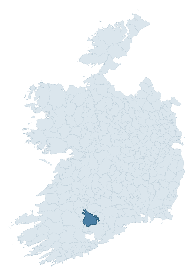
Where this barony sits in the Republic of Ireland
Geology and preservation
Bedrock geology shapes the landscape long before any settlement begins — controlling soil drainage, agricultural potential, the survival of upstanding monuments, and the preservation of buried archaeology. The figures below come from the Geological Survey Ireland 1:100,000 bedrock map.
The bedrock underlying Fermoy is predominantly limestone (55% of the barony by area), laid down during the Carboniferous period (65% by area, around 359 to 299 million years ago). Limestone is the most heritage-rich bedrock in Ireland. It supports fertile, well-drained soils that favoured dense Early Medieval settlement and Norman manorial agriculture, and it weathers into karst features — sinkholes, caves, swallow holes, and souterrains — that frequently carry archaeology. Where peat overlies limestone, organic preservation can be exceptional. A substantial secondary geology of mudstone (24%) and sandstone (15%) adds further variety to the underlying landscape.
Rock type composition
Largest mapped unit: Ballytrasna Formation (20% of the barony)
Placename evidence
Logainm records 54 heritage-diagnostic placenames for Fermoy, drawn from townland and civil-parish names across the barony. The dominant stratum is Early Christian ecclesiastical — cill-, teampall-, and domhnach-prefixed names that record the dense network of early church foundations established between the fifth and tenth centuries. The leading diagnostic roots are cill- (26 — church), ráth- (8 — earthen ringfort), and lios- (5 — ringfort or enclosure). This is above the ROI average of 30.7 heritage placenames per barony. The presence of multiple heritage strata side by side indicates layered occupation of the landscape across successive prehistoric and historic periods. Logainm records 357 placenames for Fermoy (predominantly townland names). Of these, 54 (15%) carry one of the diagnostic Gaelic roots tracked above; the remainder draw on more generic landscape vocabulary that does not encode a heritage period.
Pre-Christian / Early Medieval Defensive
| Root | Count | Meaning |
|---|---|---|
| ráth- | 8 | earthen ringfort |
| lios- | 5 | ringfort or enclosure |
| cathair- | 5 | stone fort |
| dún- | 4 | hilltop or promontory fort |
Early Christian Ecclesiastical
| Root | Count | Meaning |
|---|---|---|
| cill- | 26 | church (early) |
| teampall- | 2 | church (later medieval) |
| mainistir- | 1 | monastery |
| cillín- | 1 | unconsecrated burial ground |
| gráinseach- | 1 | monastic farm / grange |
Burial, Ritual, and Norse-Contact
| Root | Count | Meaning |
|---|---|---|
| gall- | 2 | foreigner — Norse settlement marker |
| leacht- | 1 | grave monument |
Other baronies in Cork
- Carbery West (east Division)
- Carbery East (east Division)
- Courceys
- Kinalmeaky
- Imokilly
- Kinalea
- Carbery West (west Division)
- Inchiquin — Clare
- Kinalmeaky
- Burren — Clare
See all 280 baronies in the Republic of Ireland Heritage Tool.

Explore further
Grounding History: 10 Maps of Northern Ireland’s Past
If you’re interested in Irish heritage more widely, the companion report for Northern Ireland brings together the analysis of all 462 NI wards into one place through 10 high-quality maps — covering monument density, archaeological periods, placename heritage, terrain, wetland, and the historic landscape at first survey. Take a look.
About this profile
Click any section below to expand.
What is a barony?
A barony is a historic administrative unit in Ireland, broadly equivalent to an English hundred. The 280 baronies used here are from the OSi 2019 National Statutory Boundaries (generalised 20m), covering the 26 counties of the Republic of Ireland. Baronies derive from the Norman period, were formalised in the 17th century, and have not been redrawn for statistical purposes. They vary enormously in area, from compact urban baronies in Dublin to vast upland baronies in Connacht, and should not be compared by raw site count without accounting for area differences.
What counts as a site?
This profile combines three distinct heritage registers, each with its own definition of what constitutes a recordable site:
- Archaeological sites (NMS). The National Monuments Service Sites and Monuments Record (SMR) catalogues every known archaeological monument or site of archaeological interest in the Republic, from prehistoric burial mounds and ringforts to medieval churches and post-medieval defensive works. Inclusion does not require legal protection — only that the site has been identified, surveyed, and assessed as having archaeological value. A separate subset of these sites lies within a recorded protection zone, which gives them statutory protection under the National Monuments Acts.
- Listed buildings (NIAH). The National Inventory of Architectural Heritage records buildings of architectural, historical, archaeological, artistic, cultural, scientific, social, or technical interest. Each surveyed structure is appraised on a five-tier scale: International, National, Regional, Local, and Record-Only. The NIAH appraisal is informational rather than strictly statutory, but it underpins local-authority Record of Protected Structures (RPS) listings.
- Heritage placenames (Logainm). Logainm is the authoritative database of Irish placenames maintained by the Placenames Branch. This profile applies a heritage-diagnostic classifier to the Irish-language form of each townland name, flagging roots that signal defensive sites (ráth-, lios-, dún-, caiseal-, cathair-), ecclesiastical foundations (cill-, teampall-, domhnach-, mainistir-), prehistoric burial-ritual features (tuaim-, carn-, leaba-), or Norse-contact settlement (gall-). Townlands without one of these diagnostic roots are not flagged here — they may still carry historical significance, but that significance is not encoded in the name itself.
Editorial principles
The narrative sections of this profile follow several explicit principles:
- Evidential. Every claim about this barony’s heritage character is anchored in the underlying register data. Where a site count, a placename count, or a percentile rank is cited, it is computed from the source datasets at export time, not estimated.
- Comparative. Counts and metrics are reported alongside their percentile rank against the other 279 ROI baronies. A barony with 50 ringforts in absolute terms could be unusually high or unusually low depending on its size and regional context; percentile ranking removes that ambiguity.
- Transparent on limits. Where a register has known coverage gaps, survey biases, or data-quality issues that affect this barony’s figures, the profile flags them rather than presenting the numbers as definitive.
- No interpretation beyond what the data supports. The narrative does not speculate about historical events, social dynamics, or cultural meaning beyond what the recorded heritage and placename evidence directly attests.
Data caveats and limits
- NMS Sites and Monuments Record is the product of survey campaigns conducted at different intensities across different counties and decades. Some baronies have been surveyed more thoroughly than others, and absolute counts should be read in that light. Sites destroyed by development before survey are typically not represented; sites in heavily forested or upland terrain are sometimes under-recorded.
- NIAH coverage is broadly complete for the Republic of Ireland but the survey was conducted on a rolling county-by-county basis, and the most recent appraisal date varies. Buildings demolished or substantially altered after their original survey may still appear in the register; conversely, recent buildings of merit may not yet have been appraised.
- Logainm classification applies a deliberately conservative pattern-matching approach to the Irish-language townland forms. The classifier prioritises true positives over recall: a townland may carry a heritage signal that the classifier doesn’t recognise, particularly where the diagnostic root has been heavily anglicised or where the townland name draws on a less common term. The 60,000+ townland records and ~9,800 classified placenames give a substantial signal at barony scale, but individual townland names should be checked against Logainm directly for definitive interpretation.
- Period attribution. The chronological distribution reflects only those NMS sites that carry a recognised period attribution in the source data. Sites listed as “Unknown” period are excluded from the dated subset.
- Boundary changes. Some baronies have undergone minor boundary adjustments since their 19th-century definition; the OSi 2019 generalised boundaries used here are the current statutory definition and may differ slightly from historical maps in border areas.
- Bedrock geology is mapped at 1:100,000 scale, which means local variation within a barony — small pockets of different rock type, mineral veins, alluvium overlying bedrock — is generalised. The dominant-system and rocktype figures are area-weighted, so a barony reading “70% Carboniferous limestone” may still contain small but archaeologically important pockets of older or younger rock. Around 3% of GSI polygons do not match the lexicon and contribute no rocktype or system attribution.
Data sources
- National Monuments Service — Sites and Monuments Record (SMR) https://data.gov.ie/dataset/national-monuments-service-archaeological-survey-of-ireland
- National Inventory of Architectural Heritage (NIAH) https://data.gov.ie/dataset/national-inventory-of-architectural-heritage-niah-national-dataset
- Logainm — Placenames Database of Ireland https://www.logainm.ie/
- Ordnance Survey Ireland — National Statutory Barony Boundaries 2019 https://data-osi.opendata.arcgis.com/
- EURODEM — European Digital Elevation Model https://www.mapsforeurope.org/datasets/euro-dem
- ESA WorldCover https://esa-worldcover.org/en
- Geological Survey Ireland — 1:100,000 Bedrock Geology https://www.gsi.ie/en-ie/data-and-maps/Pages/Bedrock.aspx
Explore more: Search any of the 280 ROI baronies, browse by historical province, or read the methodology and data sources for the full Republic of Ireland Heritage Tool.