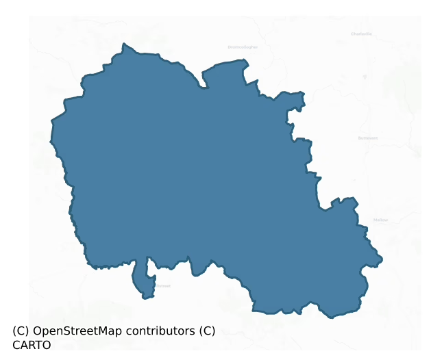
Duhallow is a barony of County Cork, in the historical province of Munster (Irish: Dúiche Ealla), covering 940 km² of land. The barony records 2,304 NMS archaeological sites and 215 NIAH listed buildings, placing it at around the 70th percentile among 280 ROI baronies for sites per km². This means it is in the top third of all baronies for sites per km². Dated archaeological evidence runs from the Neolithic through to the Modern, spanning 8 of 9 archaeological periods, placing the barony in the 85th percentile among 280 ROI baronies for chronological depth. This means it is in the top fifth of all baronies for chronological depth. The largest dated subset of recorded sites dates to the Middle-Late Bronze Age. Logainm flags 80 placenames in the barony as carrying a recognised heritage root; the largest share — around 52% — are names associated with early Christian church and monastic foundations.

Heritage at a glance
Percentile rankings throughout this profile compare each barony only against the other 279 Republic of Ireland baronies.
The recorded heritage of Duhallow
The National Monuments Service Sites and Monuments Record (SMR) is the statutory inventory of archaeological sites for the Republic of Ireland, maintained by the Department of Tourism, Culture, Arts, Gaeltacht, Sport and Media. Sites recorded here include earthworks, ringforts, megalithic tombs, ecclesiastical remains, and post-medieval features; not every record is legally protected, but each is registered as a monument of archaeological interest.
The National Monuments Service records 2,304 archaeological sites in Duhallow, putting it at the 70th percentile among 280 ROI baronies for sites per km². This means it is in the top third of all baronies for sites per km². Protection coverage is near-universal — 2,256 sites (98%) fall within a recorded monument protection zone, indicating an extensively surveyed landscape. The record is dominated by agricultural and prehistoric industrial sites — fulachta fiadh and field systems (789 sites, 34% of the total), with defensive sites forming a substantial secondary presence (789 sites, 34%). Fulacht fia is the most prevalent type, making up 33% of the barony's recorded sites (763 records) — well above the ROI average of 6% across all baronies where this type occurs. Fulacht fia is a horseshoe-shaped Bronze Age burnt mound built around a sunken trough beside a water source, traditionally interpreted as a cooking site. Other significant types include Ringfort – rath (485) and Souterrain (134). Ringfort – rath is an earthen ringfort enclosed by a bank and external ditch — the most common Early Medieval farmstead, broadly dated 500–1000 AD; Souterrain is an underground stone-built passage and chamber, generally Early Medieval and often associated with ringforts as a defensive or storage feature. Across the barony's 940 km², this gives a recorded density of 2.45 sites per km².
Most common monument types
Hover or tap a monument type to see its definition.
| Type | Count |
|---|---|
| Fulacht fia a horseshoe-shaped Bronze Age burnt mound built around a sunken trough beside a water source, traditionally interpreted as a cooking site | 763 |
| Ringfort – rath an earthen ringfort enclosed by a bank and external ditch — the most common Early Medieval farmstead, broadly dated 500–1000 AD | 485 |
| Souterrain an underground stone-built passage and chamber, generally Early Medieval and often associated with ringforts as a defensive or storage feature | 134 |
| Enclosure a banked or ditched feature of uncertain type, used as a catch-all where the original function cannot be determined from surface evidence | 126 |
| Standing stone a deliberately set upright stone, used variously as a Bronze/Iron Age burial marker, route marker or commemorative monument | 92 |
| Church a building used for public Christian worship, of any date from c. 500 AD onwards | 82 |
| Burial ground an area set apart for burial that is not associated with a church, in use from the medieval period onwards | 65 |
Chronological distribution
The dated archaeological record for Duhallow spans from the Neolithic through to the Modern, with activity attested across 8 of 9 archaeological periods. This is the 85th percentile across ROI baronies for chronological depth — an above-average span. Every period from earliest to latest is represented in the record — an unbroken sequence of dated activity across the full chronological span. Activity concentrates most heavily in the Middle Late Bronze Age (810 sites, 42% of dated material), with the Iron Age forming a secondary peak (450 sites, 23%). A further 376 recorded sites (16% of the overall NMS register for the barony) carry no period attribution — appearing as 'Unknown' in the bar chart below. This typically reflects either records that pre-date the standardised period vocabulary or sites awaiting specialist dating review, rather than a genuine absence of chronological evidence.
Sample of recorded monuments
Show 25 sample monuments (of 2,304 total)
A representative sample of 25 recorded monuments drawn from the barony’s 2,304 total NMS entries. Sites within a recorded monument protection zone and rarer site types are prioritised so the list shows a meaningful cross-section rather than only the most common type. Each entry shows the official Sites and Monuments Record reference number and the description published by the National Monuments Service.
Barrow – bowl-barrow
In pasture, on N-facing slope. Circular flat-topped mound (diam. c. 8m; H 0.9m from base of fosse) enclosed by fosse (Wth 4.2m; D 0.45m). External low rise (max. H 0.25m) evident NE->SE and SSW->SW. Top of mound (diam.…
In pasture, on N-facing slope. Circular flat-topped mound (diam. c. 8m; H 0.9m from base of fosse) enclosed by fosse (Wth 4.2m; D 0.45m). External low rise (max. H 0.25m) evident NE->SE and SSW->SW. Top of mound (diam. 4m) defined by narrow earthen rim (H 0.3m). According to landowner, top of mound dug into by his great grandfather in an attempt to level it. During digging large stone slab with bones underneath recovered at depth of 3ft (Bowman 1934, 85). Locally known as 'fort', field called 'fort field'.
The above description is derived from the published 'Archaeological Inventory of County Cork. Volume 4: North Cork' (Dublin: Stationery Office, 2000). In certain instances the entries have been revised and updated in the light of recent research.
Date of upload/revision: 14 January 2009
Penitential station
In fosse of ringbarrow (11873). Irregular stone (0.63m x 0.81m; T 0.17m) with oval depression (0.15m x 0.8m; D 0.7m) on one end. Bowman (1934, 99) noted that rounds paid at stone. Locally remembered as 'stone with…
In fosse of ringbarrow (11873). Irregular stone (0.63m x 0.81m; T 0.17m) with oval depression (0.15m x 0.8m; D 0.7m) on one end. Bowman (1934, 99) noted that rounds paid at stone. Locally remembered as 'stone with certain healing powers.' According to local information, no longer visited by pilgrims.
The above description is derived from the published 'Archaeological Inventory of County Cork. Volume 4: North Cork' (Dublin: Stationery Office, 2000). In certain instances the entries have been revised and updated in the light of recent research.
Date of upload/revision: 14 January 2009
House – early medieval
Within early ecclesiastical enclosure of Tullylease (13892), on slope leading down to stream to N. Depicted as rectangular structure named 'Prionte' on 1842 OS 6-inch map; as 'Prionte (Site of)' on 1905 OS 6-inch map.…
Within early ecclesiastical enclosure of Tullylease (13892), on slope leading down to stream to N. Depicted as rectangular structure named 'Prionte' on 1842 OS 6-inch map; as 'Prionte (Site of)' on 1905 OS 6-inch map. Known locally as St Berehert's house (Larkin 1978-79, 51). Rectangular structure (8.25m E-W; 5.95m N-S); walls (H c. 1m) appear to have been recently rebuilt. Entrances on E side and at W end of N wall. According to Reeves (1858, 270), stones from wall 'possess the virtue of securing the bearer against fire and storm; and as a natural consequence, the little structure has nearly disappeared.' In 1906 'only the trace of the building' remained (Lynch 1911, 67). Abutting N wall is St. Benjamin's Well (13994); Bowman (1934, 698) recorded that 'about, 15 years ago', stones were removed from this structure, locally known as 'The Hut', to build present wall around St. Benjamin's Well. Smooth, roughly circular stone (diam. 0.9m; T 0.18m), leaning against inner face of S wall, roughly incised with pilgrims cross. 'Prionte', said to derive from 'prionnteach' or refectory (Lynch ibid., 81).
The above description is derived from the published 'Archaeological Inventory of County Cork. Volume 4: North Cork' (Dublin: Stationery Office, 2000). In certain instances the entries have been revised and updated in the light of recent research.
Date of upload/revision: 14 January 2009
Hospital
In pasture, atop hill. No visible surface trace of site. Depicted only on 1936 OS 6-inch map as roofless rectangular structure, open-ended to N. Described by OS Field Memoranda (1933) as 'a small enclosure…measuring…
In pasture, atop hill. No visible surface trace of site. Depicted only on 1936 OS 6-inch map as roofless rectangular structure, open-ended to N. Described by OS Field Memoranda (1933) as 'a small enclosure…measuring eleven yards long and 4 yards wide, 1 foot high and 2 foot wide and is composed of earth and stone'. Bowman (1934, 437-8) recorded that 'An Sean-Oisbedeal – The Old Hospital, in P. Lane's… had accommodation for 6 persons', which, according to local tradition, was use during The Famine. Church (14513) immediately to E; burial ground (11993) c. 130m to E.
The above description is derived from the published 'Archaeological Inventory of County Cork. Volume 4: North Cork' (Dublin: Stationery Office, 2000). In certain instances the entries have been revised and updated in the light of recent research.
Date of upload/revision: 14 January 2009
Burial
Not marked on 1842 and 1904 OS 6-inch maps; shown as standing stone named Dallán on 1936 OS 6-inch map. In bogland, on hilltop, c. 10m to WSW of stone row (CO013-01104-). Removed; no visible surface trace. Described by…
Not marked on 1842 and 1904 OS 6-inch maps; shown as standing stone named Dallán on 1936 OS 6-inch map. In bogland, on hilltop, c. 10m to WSW of stone row (CO013-01104-). Removed; no visible surface trace. Described by OS Field Momoranda (1933) as stone (L c. 5ft) 'covered with heather and earth', exposed at one end (6in T) where it is 'raised about 6in off the ground', with each side resting on smaller stones; an 'old resident when referring to this particular spot called it Sean Uaig or Old Grave'.
The above description is derived from the published 'Archaeological Inventory of County Cork. Volume 4: North Cork' (Dublin: Stationery Office, 2000). In certain instances the entries have been revised and updated in the light of recent research.
Date of upload/revision: 14 January 2009
Headstone
The Archaeological Survey of Ireland (ASI) is in the process of providing information on all monuments on The Historic Environment Viewer (HEV). Currently the information for this record has not been uploaded. To…
The Archaeological Survey of Ireland (ASI) is in the process of providing information on all monuments on The Historic Environment Viewer (HEV). Currently the information for this record has not been uploaded. To access available information for research purposes please make an appointment in advance with the Archive Unit (open Fridays 10.00 am – 5.00 pm), Department of Culture, Heritage and the Gaeltacht, The Custom House, Dublin 1 D01W6XO or email nmarchive@chg.gov.ie.
Fish-pond
The Archaeological Survey of Ireland (ASI) is in the process of providing information on all monuments on The Historic Environment Viewer (HEV). Currently the information for this record has not been uploaded. To…
The Archaeological Survey of Ireland (ASI) is in the process of providing information on all monuments on The Historic Environment Viewer (HEV). Currently the information for this record has not been uploaded. To access available information for research purposes please make an appointment in advance with the Archive Unit (open Fridays 10.00 am – 5.00 pm), Department of Culture, Heritage and the Gaeltacht, The Custom House, Dublin 1 D01W6XO or email nmarchive@chg.gov.ie.
Stone circle – five-stone
On top of low ridge in rolling pasture. Circle comprised five stones, one of which had fallen; internal diameter 3.5m. Neither entrance stones nor axial stone could be identified with certainty. Stones measured 0.8m to…
On top of low ridge in rolling pasture. Circle comprised five stones, one of which had fallen; internal diameter 3.5m. Neither entrance stones nor axial stone could be identified with certainty. Stones measured 0.8m to 1.3m L, 0.5m to 0.8m T and 0.5m to 0.9m H. Prostrate slab, possibly fallen standing stone, lay 2m S of circle. Monument was destroyed in 1970s and stones thrown into abandoned quarry in SW corner of field. (Ó Nualláin 1984a, 30, no. 49)
The above description is derived from the published 'Archaeological Inventory of County Cork. Volume 4: North Cork' (Dublin: Stationery Office, 2000). In certain instances the entries have been revised and updated in the light of recent research.
Date of upload/revision: 14 January 2009
Megalithic tomb – unclassified
In flat pasture on shoulder of SE-facing slope; possible stone row (9845) in same townland. Ó Ríordáin (1989, 16, 18) records a 'collapsed Dolmen' known as the 'big stones'. Stones removed many years ago. No visible…
In flat pasture on shoulder of SE-facing slope; possible stone row (9845) in same townland. Ó Ríordáin (1989, 16, 18) records a 'collapsed Dolmen' known as the 'big stones'. Stones removed many years ago. No visible surface trace. Exact nature of site uncertain.
The above description is derived from the published 'Archaeological Inventory of County Cork. Volume 4: North Cork' (Dublin: Stationery Office, 2000). In certain instances the entries have been revised and updated in the light of recent research.
Date of upload/revision: 14 January 2009
Historic town
Immediately N of demesne of Newmarket House (14888), c. 1km E of Dalua River. Town established by Sir Richard Aldworth who obtained market licence in 1620 and built market house in 1622 (MacCarthy-Morrogh 1986, 165);…
Immediately N of demesne of Newmarket House (14888), c. 1km E of Dalua River. Town established by Sir Richard Aldworth who obtained market licence in 1620 and built market house in 1622 (MacCarthy-Morrogh 1986, 165); the 1641 depositions list 25 households (ibid.). In 1750 contained 'one regular street' with 'some well looking houses' (Smith 1750, vol. 1, 293); by 1837 contained 'about 246 houses, of which several are well built' (Lewis 1837, vol. 2, 428). Former parish church (14722) on S side of Church Street. (Allen 1973; Ó Cróinín 1989)
The above description is derived from the published 'Archaeological Inventory of County Cork. Volume 4: North Cork' (Dublin: Stationery Office, 2000). In certain instances the entries have been revised and updated in the light of recent research.
Date of upload/revision: 14 January 2009
Linkardstown burial
Found during preparation of cliff face for quarry blasting in May 1946. Skeletal remains of two adults were recovered with three sherds of a Drimnagh Style bowl; a fourth undecorated sherd may have come from a second…
Found during preparation of cliff face for quarry blasting in May 1946. Skeletal remains of two adults were recovered with three sherds of a Drimnagh Style bowl; a fourth undecorated sherd may have come from a second pot (pers. comm. M. Cahill). Although details of the burial are poorly documented, Brindley and Lanting (1989-90, 3) suggest that this may be an 'orthodox burial of Linkardstown Type.' Radiocarbon determination of 4585±80BP (OxA-2681) obtained for skeletal remains (ibid., 2).
The above description is derived from the published 'Archaeological Inventory of County Cork. Volume 4: North Cork' (Dublin: Stationery Office, 2000). In certain instances the entries have been revised and updated in the light of recent research.
An account of this monument has been published in: Cahill, M. & Sikora, M. (2011) Breaking ground, finding graves- reports on the excavations of burials by the National Museum of Ireland, 1927-2006. vol. 1, 12-17.
Compiled by: Denis Power
Date of upload: 15 August 2012
Market-house
In Kanturk. Indicated on 1842 OS 6-inch map as part of small island complex at junction of three roads; area called 'Market Sq' on 1905 OS 6-inch map. Market house referred to in 1657 (O'Sullivan 1997, 6), replaced by…
In Kanturk. Indicated on 1842 OS 6-inch map as part of small island complex at junction of three roads; area called 'Market Sq' on 1905 OS 6-inch map. Market house referred to in 1657 (O'Sullivan 1997, 6), replaced by two subsequent market houses on same site; second built in 1747 and illustrated (ibid., 8) as 2-storey gable-ended structure, 3-bay arcade on ground floor, four rectangular window opes on 1st floor, central floating pediment with oculus, details of cut stone. Also functioned as place of worship in mid-18th century, and as manorial courthouse and barracks (ibid., 9). Replaced in 1839 by present market house in Strand Street; 18th-century market house probably removed when area redeveloped after 1847 and present 3-storey 19th-century structure built on site. Strand Street market house known locally as 'clock-house'; narrow rectangular 2-storey structure of random-rubble construction with ashlar detail. Front elevation (S) of 5 bays, with central pedimented 3-bay breakfront; central wide segmental-arched door ope with sidelight incorporated into frame, 3 round-headed windows overhead. Large rectangular sash windows on ground and 1st floors on either side of breakfront; ground floor windows are pedimented. Small ornate rectangular niches over all 1st floor windows. Projecting cornice with low parapet. Cupola with clock in wooden louvres atop roof; clock made by Mangans of Cork bears date 1838. The shambles to rear was fitted out to accommodate nine of town's butc…
Icehouse
In limestone quarry, c. 35m N of Ballygiblin House (14853) on NW side of demesne. Inaccessible due to overgrowth; according to owner, icehouse (c. 2m deep; c. 2m square) cut into rock face of quarry and enclosed by wall…
In limestone quarry, c. 35m N of Ballygiblin House (14853) on NW side of demesne. Inaccessible due to overgrowth; according to owner, icehouse (c. 2m deep; c. 2m square) cut into rock face of quarry and enclosed by wall (H c. 2m).
The above description is derived from the published 'Archaeological Inventory of County Cork. Volume 4: North Cork' (Dublin: Stationery Office, 2000). In certain instances the entries have been revised and updated in the light of recent research.
Date of upload/revision: 14 January 2009
Pump-house
On E bank of Ketragh River, adjacent to tall single-arched Ketragh Bridge (Wth 7.88m). Small rectangular one storey structure (3.3m E-W; c. 4.37m N-S) of random-rubble limestone construction: brick-vaulted roof; door…
On E bank of Ketragh River, adjacent to tall single-arched Ketragh Bridge (Wth 7.88m). Small rectangular one storey structure (3.3m E-W; c. 4.37m N-S) of random-rubble limestone construction: brick-vaulted roof; door ope in S wall; window in N wall. Interior houses low breastshot cast-iron water-wheel (diam. c. 2.4m; Wth 0.55m) which powered adjacent water pump (no longer in use). Not shown on 1842 OS 6-inch map; named 'pump ho.' on 1905 OS 6-inch map, which shows impounded river to N controlled by weir and sluice gates.
The above description is derived from the published 'Archaeological Inventory of County Cork. Volume 4: North Cork' (Dublin: Stationery Office, 2000). In certain instances the entries have been revised and updated in the light of recent research.
Date of upload/revision: 14 January 2009
Cupmarked stone (present location)
One of a pair of standing stones (9868), removed from its position c. 1981. According to local information, cupmarks on one side. Stone subsequently dumped against field fence; no cupmarks evident on exposed surface of…
One of a pair of standing stones (9868), removed from its position c. 1981. According to local information, cupmarks on one side. Stone subsequently dumped against field fence; no cupmarks evident on exposed surface of stone. Original location record CO029-206—-.
The above description is derived from the published 'Archaeological Inventory of County Cork. Volume 4: North Cork' (Dublin: Stationery Office, 2000). In certain instances the entries have been revised and updated in the light of recent research.
Date of revision: 15 December 2009
Urn burial
In pasture, c. 30m ESE of ringfort (CO031-02301-). Discovered in 1975 during mechanical excavation of drainage channel, revealing circular pit (diam. c. 0.85m; D. c. 0.95m) containing an inverted Encrusted Urn;…
In pasture, c. 30m ESE of ringfort (CO031-02301-). Discovered in 1975 during mechanical excavation of drainage channel, revealing circular pit (diam. c. 0.85m; D. c. 0.95m) containing an inverted Encrusted Urn; investigated by O'Kelly and Shee (1974, 71-83). Pit described as having near vertical sides and a flat base; central area beneath urn was roughly paved and there was backfill of loose soil and rounded stones around urn (ibid., 73). Urn divided into two parts by applied horizontal rib; area between rib and rim decorated with a 'zig-zag band or fillet' and between shoulder and base by 'roughly scored lines forming a very loose chevron pattern which runs to a slightly splayed foot' (O'Kelly and Shee 1974, 74-5). Cremated remains of single adult and three fragments of a bone pin contained within urn (ibid. 76). (Doody 1986, Cork No. 25; Waddell 1990, 60-1)
The above description is derived from the published 'Archaeological Inventory of County Cork. Volume 4: North Cork' (Dublin: Stationery Office, 2000). In certain instances the entries have been revised and updated in the light of recent research.
Date of upload/revision: 14 January 2009
Religious house – Augustinian friars
Although isolated W gable in graveyard marked on map as 'monastery', evidence fairly ambiguous, whereas Clonmeen definitely parish church from 15th C; W gable included in the inventory with the Church…
Although isolated W gable in graveyard marked on map as 'monastery', evidence fairly ambiguous, whereas Clonmeen definitely parish church from 15th C; W gable included in the inventory with the Church (CO031-053003-).
The above description is derived from the published 'Archaeological Inventory of County Cork. Volume 4: North Cork' (Dublin: Stationery Office, 2000). In certain instances the entries have been revised and updated in the light of recent research.
Date of upload/revision: 14 January 2009
Crannog
Indicated as small island at NW side of Lough Lea on 1842, 1904 and 1938 OS 6-inch maps. Roughly circular raised area (34m E-W; 30m N-S) separated on N side from mainland by dry fosse (Wth 3.8m; D 2.9m). Interior raised…
Indicated as small island at NW side of Lough Lea on 1842, 1904 and 1938 OS 6-inch maps. Roughly circular raised area (34m E-W; 30m N-S) separated on N side from mainland by dry fosse (Wth 3.8m; D 2.9m). Interior raised 1.1m (S) and 1.4m (N) above water level and base of fosse respectively; large concentration of small stones visible around edge of site. Area heavily overgrown with trees. According to local information, lake dries-up in summer.
The above description is derived from the published 'Archaeological Inventory of County Cork. Volume 4: North Cork' (Dublin: Stationery Office, 2000). In certain instances the entries have been revised and updated in the light of recent research.
Date of upload/revision: 14 January 2009
Lock
This lock is referred to in the 'Archaeological Inventory of County Cork – vol. 4 North Cork' (2000, 714) under the entry (no. 15257) for a canal (CO032-021001-). The lock is referred to in the entry as follows: Canal…
This lock is referred to in the 'Archaeological Inventory of County Cork – vol. 4 North Cork' (2000, 714) under the entry (no. 15257) for a canal (CO032-021001-). The lock is referred to in the entry as follows: Canal taken from River Blackwater at W end, by Pallas lock which no longer survives (Jackson 1987, 22). Second lock (CO032-021003-) at Longueville: now shortened at E end from length of 47m to 23.5m; retaining side walls (Wth 6.62m; H c. 4m) built of coursed ashlar limestone, with vertical niche for lock gate at E end. W end destroyed when turned into underpass for farm animals during road widening in 1985/6.
The above description is derived from the published 'Archaeological Inventory of County Cork. Volume 4: North Cork' (Dublin: Stationery Office, 2000). In certain instances the entries have been revised and updated in the light of recent research.
Date of upload/revision: 14 January 2009
Graveslab
Built into W wall of Kilshannig graveyard (CO032-107002-) is a 16th-century graveslab said to have come from Mourne Abbey (see 9550) but has been here since at least 1860 (Brady ibid., 290); design consists of…
Built into W wall of Kilshannig graveyard (CO032-107002-) is a 16th-century graveslab said to have come from Mourne Abbey (see 9550) but has been here since at least 1860 (Brady ibid., 290); design consists of seven-armed ringed cross with fleur-de-lis terminals; shaft, banded at base of cross-head, flanked by two plain square raised panels, probably intended for heraldic shields; below this, leafy frond springs from sinister side of cross shaft; raised border occurs along three surviving edges of slab (see Maher 1994).
The above description is derived from the published 'Archaeological Inventory of County Cork. Volume 4: North Cork' (Dublin: Stationery Office, 2000). In certain instances the entries have been revised and updated in the light of recent research.
Date of upload/revision: 14 January 2009
Creamery
In Lombardstown, on W bank of River Douglas. Indicated on 1905 OS 6-inch map as 'creamery', with millrace taken from Douglas River by weir c. 800m to S. Originally powered by large waterwheel which was replaced by steam…
In Lombardstown, on W bank of River Douglas. Indicated on 1905 OS 6-inch map as 'creamery', with millrace taken from Douglas River by weir c. 800m to S. Originally powered by large waterwheel which was replaced by steam engine. Turbines (10h.p. and 30h.p.) installed as fire-fighting unit and to drive machinery respectively; both survive but no longer in use. In 1920s, National Gas Engine (No. 38937) installed, 90 h.p. engine still used as a standby engine. (FFIAS, 11)
The above description is derived from the published 'Archaeological Inventory of County Cork. Volume 4: North Cork' (Dublin: Stationery Office, 2000). In certain instances the entries have been revised and updated in the light of recent research.
Date of upload/revision: 14 January 2009
Round tower
On S-facing slope, above sharp fall in ground to S, within possible early ecclesiastical site (13905). Described by Smith (1750, vol. 1, 294) as 'stump of a round tower'. OS archives for 1844 (Walsh 1987a, 145) describe…
On S-facing slope, above sharp fall in ground to S, within possible early ecclesiastical site (13905). Described by Smith (1750, vol. 1, 294) as 'stump of a round tower'. OS archives for 1844 (Walsh 1987a, 145) describe 'semi-circular foundation about 2 feet above the general surface of the ground'; solid line of foundations extends on sketch plan SE->NW, rest of circle (diam. c. 7.5m) marked by broken line (ibid.). No visible surface trace of tower remains. (Barrow 1979, 211)
The above description is derived from the published 'Archaeological Inventory of County Cork. Volume 4: North Cork' (Dublin: Stationery Office, 2000). In certain instances the entries have been revised and updated in the light of recent research.
Date of upload/revision: 14 January 2009
Hillfort
At summit of Claragh Mountain, with extensive view in all directions. Subcircular area (122m E-W; 122m N-S) defined by rubble stone bank (int. H 0.6m; ext. H 1.4m), best preserved NNE->SW; low SW->W; slight traces…
At summit of Claragh Mountain, with extensive view in all directions. Subcircular area (122m E-W; 122m N-S) defined by rubble stone bank (int. H 0.6m; ext. H 1.4m), best preserved NNE->SW; low SW->W; slight traces W->NNE. Possible gap (Wth 8m) to WNW. Close to centre of interior, subrectangular enclosure (19m ENE-WSW; 14m NNW-SSE) defined by band of rubble stone (Wth 1.5m); cairn (diam. 8m; H 0.5m) (CO039-052001-) overlies W corner of enclosure. According to local tradition, priest buried here (Broker 1937, 45) 'c. 300 years ago' (Bowman 1934, 318). In 2014, in the process of erecting a cross at the summit, sections of the enclosing bank were removed at NE and SW. Other recent damage within the interior of the monument appears to have been caused during the installation of a telecom station, OS trigonometrical station and ESB poles.
The above description is derived from the published 'Archaeological Inventory of County Cork. Volume 4: North Cork' (Dublin: Stationery Office, 2000). In certain instances the entries have been revised and updated in the light of recent research.
Updated by: Matt Kelleher
Date of upload: 13 October 2014
Ringfort – cashel
In coniferous plantation, atop hill. Depicted as hachured circular enclosure (diam. c. 38m) on 1842, 1904 and 1937 OS 6-inch maps. According to local information, fort ploughed out c. 1970 and area planted; no visible…
In coniferous plantation, atop hill. Depicted as hachured circular enclosure (diam. c. 38m) on 1842, 1904 and 1937 OS 6-inch maps. According to local information, fort ploughed out c. 1970 and area planted; no visible surface trace. Recorded by Bowman (1934, 237) as single-ramparted fort (diam. c. 29m) with rampart (H c. 0.6m) of dry stone construction 'having an over-layer of earth.' ; some of rampart levelled and stones used in construction of trigonometrical station. Mound (c. 6.4m x c. 4.5m; H c. 0.6m) at S side of enclosure (ibid.).
The above description is derived from the published 'Archaeological Inventory of County Cork. Volume 4: North Cork' (Dublin: Stationery Office, 2000). In certain instances the entries have been revised and updated in the light of recent research.
Date of upload/revision: 14 January 2009
Fulacht fia
In pasture, on N side of drain and field fence. Roughly oval mound of burnt material (14.8m NW-SE; 12m NE-SW; H 1.3m); central depression (6.2m NW-SE; 5m NE-SW; D 1.5m), possibly due to removal of mound material. Bowman…
In pasture, on N side of drain and field fence. Roughly oval mound of burnt material (14.8m NW-SE; 12m NE-SW; H 1.3m); central depression (6.2m NW-SE; 5m NE-SW; D 1.5m), possibly due to removal of mound material. Bowman (1934, 81) recorded that 'a great part of the burned stones have been removed from the surface'.
The above description is derived from the published 'Archaeological Inventory of County Cork. Volume 4: North Cork' (Dublin: Stationery Office, 2000). In certain instances the entries have been revised and updated in the light of recent research.
Date of upload/revision: 14 January 2009
Listed buildings
The National Inventory of Architectural Heritage (NIAH) is a state survey appraising buildings of architectural, historical, archaeological, artistic, cultural, scientific, social, or technical interest. Each surveyed structure receives a rating from International (the highest, for buildings of European importance) through National, Regional, Local, and Record-Only.
The NIAH records 215 listed buildings in Duhallow, the 81st percentile across ROI baronies for listed-building density. All recorded buildings carry Regional or lower grading; the barony does not contain any structures appraised as being of National or International architectural importance. Construction dates concentrate most heavily in the Late Georgian (1800-1830) period. The most-recorded building type is house (85 examples, 40% of the listed stock).
Terrain and environment
Mean elevation across the barony is 190m — the 95th percentile among 280 ROI baronies for elevation. This means it is in the top tenth of all baronies for elevation. This is a relatively elevated landscape by ROI standards. Elevation matters for heritage because higher-altitude baronies typically favour defensive monuments — ringforts and hilltop forts placed on prominent ground — while lowland baronies are more likely to carry the dense settlement and church networks of intensive agricultural landscapes. The barony reaches 448m at its highest point — a vertical span of more than 258m within its boundary, indicating significant topographic diversity. Mean slope is 4.6° — the 71st percentile among 280 ROI baronies for slope. This means it is in the top third of all baronies for slope. Slope is a key control on both land use and archaeological preservation: steep ground resists ploughing and tends to preserve earthworks intact, while gentle slopes favour intensive cultivation that damages or destroys surface archaeology over time. The Topographic Wetness Index averages 10.2, the 27th percentile among 280 ROI baronies for wetness. This means it is in the bottom third of all baronies for wetness. Drainage matters for heritage because poorly-drained ground preserves organic archaeology (wooden trackways, leather, textiles, and on rare occasions human remains) far better than free-draining soil; well-drained ground favours arable use but destroys organic material rapidly. The land cover is dominated by improved grassland (72%) and woodland (24%). In overall character, this is elevated but relatively gentle terrain — typical of plateau country, with land use dominated by improved grassland.
Terrain measurements
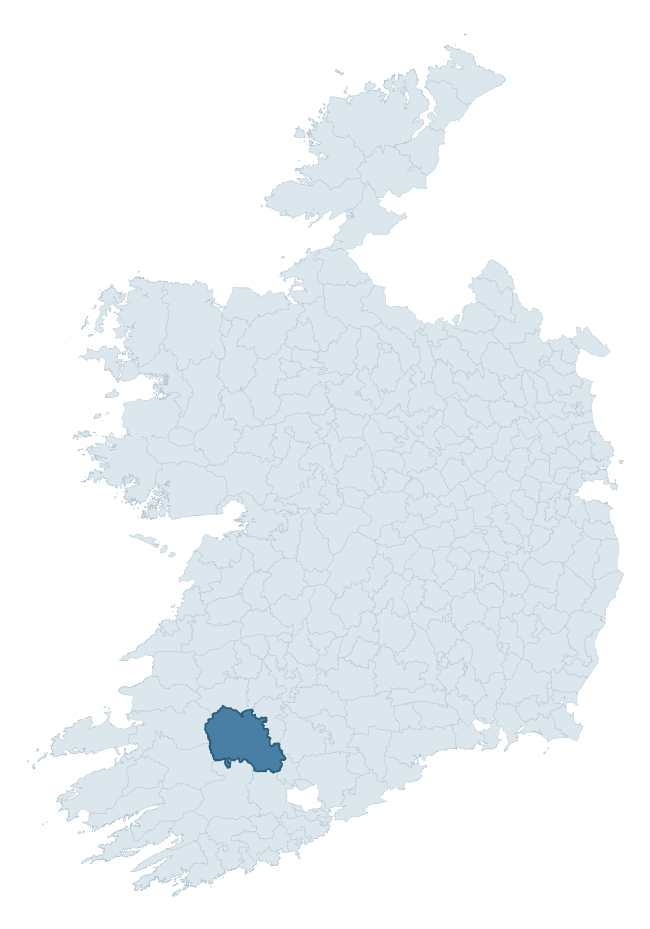
Where this barony sits in the Republic of Ireland
Geology and preservation
Bedrock geology shapes the landscape long before any settlement begins — controlling soil drainage, agricultural potential, the survival of upstanding monuments, and the preservation of buried archaeology. The figures below come from the Geological Survey Ireland 1:100,000 bedrock map.
The bedrock underlying Duhallow is predominantly sandstone (42% of the barony by area), laid down during the Carboniferous period (80% by area, around 359 to 299 million years ago). Sandstone weathers to free-draining, moderately fertile soils that supported Early Medieval ringfort agriculture and later manorial estates. The rock itself is a major source of building stone — visible in churches, tower houses, and farm buildings across the barony's historic landscape. A substantial secondary geology of mudstone (18%) and greywacke, siltstone and silty shale (11%) adds further variety to the underlying landscape. The single largest mapped unit is the Namurian (undifferentiated) (42% of the barony's bedrock). With 8 distinct rock types mapped, the barony sits in the top third of ROI baronies for geological diversity (85th percentile) — typically a sign of complex tectonic history or coastal mosaics of differing rock units.
Rock type composition
Largest mapped unit: Namurian (undifferentiated) (42% of the barony)
Placename evidence
Logainm records 80 heritage-diagnostic placenames for Duhallow, drawn from townland and civil-parish names across the barony. The dominant stratum is Early Christian ecclesiastical — cill-, teampall-, and domhnach-prefixed names that record the dense network of early church foundations established between the fifth and tenth centuries. The leading diagnostic roots are cill- (38 — church), lios- (14 — ringfort or enclosure), and ráth- (9 — earthen ringfort). This is well above the ROI average of 30.7 heritage placenames per barony — around 2.6× the typical figure. The presence of multiple heritage strata side by side indicates layered occupation of the landscape across successive prehistoric and historic periods. Logainm records 576 placenames for Duhallow (predominantly townland names). Of these, 80 (14%) carry one of the diagnostic Gaelic roots tracked above; the remainder draw on more generic landscape vocabulary that does not encode a heritage period.
Pre-Christian / Early Medieval Defensive
| Root | Count | Meaning |
|---|---|---|
| lios- | 14 | ringfort or enclosure |
| ráth- | 9 | earthen ringfort |
| caiseal- | 4 | stone ringfort |
| dún- | 3 | hilltop or promontory fort |
| cathair- | 1 | stone fort |
Early Christian Ecclesiastical
| Root | Count | Meaning |
|---|---|---|
| cill- | 38 | church (early) |
| cillín- | 2 | unconsecrated burial ground |
| teampall- | 1 | church (later medieval) |
| díseart- | 1 | hermitage |
Burial, Ritual, and Norse-Contact
| Root | Count | Meaning |
|---|---|---|
| leacht- | 3 | grave monument |
| feart- | 2 | grave mound |
| gall- | 2 | foreigner — Norse settlement marker |
| carn- | 1 | cairn |
Other baronies in Cork
- Carbery East (east Division)
- Muskerry West
- Cork
- Ibane And Barryroe
- Carbery East (west Division)
- Kinatalloon
- Muskerry East
- Dunkerron North — Kerry
- Iveragh — Kerry
- Bantry
See all 280 baronies in the Republic of Ireland Heritage Tool.

Explore further
Grounding History: 10 Maps of Northern Ireland’s Past
If you’re interested in Irish heritage more widely, the companion report for Northern Ireland brings together the analysis of all 462 NI wards into one place through 10 high-quality maps — covering monument density, archaeological periods, placename heritage, terrain, wetland, and the historic landscape at first survey. Take a look.
About this profile
Click any section below to expand.
What is a barony?
A barony is a historic administrative unit in Ireland, broadly equivalent to an English hundred. The 280 baronies used here are from the OSi 2019 National Statutory Boundaries (generalised 20m), covering the 26 counties of the Republic of Ireland. Baronies derive from the Norman period, were formalised in the 17th century, and have not been redrawn for statistical purposes. They vary enormously in area, from compact urban baronies in Dublin to vast upland baronies in Connacht, and should not be compared by raw site count without accounting for area differences.
What counts as a site?
This profile combines three distinct heritage registers, each with its own definition of what constitutes a recordable site:
- Archaeological sites (NMS). The National Monuments Service Sites and Monuments Record (SMR) catalogues every known archaeological monument or site of archaeological interest in the Republic, from prehistoric burial mounds and ringforts to medieval churches and post-medieval defensive works. Inclusion does not require legal protection — only that the site has been identified, surveyed, and assessed as having archaeological value. A separate subset of these sites lies within a recorded protection zone, which gives them statutory protection under the National Monuments Acts.
- Listed buildings (NIAH). The National Inventory of Architectural Heritage records buildings of architectural, historical, archaeological, artistic, cultural, scientific, social, or technical interest. Each surveyed structure is appraised on a five-tier scale: International, National, Regional, Local, and Record-Only. The NIAH appraisal is informational rather than strictly statutory, but it underpins local-authority Record of Protected Structures (RPS) listings.
- Heritage placenames (Logainm). Logainm is the authoritative database of Irish placenames maintained by the Placenames Branch. This profile applies a heritage-diagnostic classifier to the Irish-language form of each townland name, flagging roots that signal defensive sites (ráth-, lios-, dún-, caiseal-, cathair-), ecclesiastical foundations (cill-, teampall-, domhnach-, mainistir-), prehistoric burial-ritual features (tuaim-, carn-, leaba-), or Norse-contact settlement (gall-). Townlands without one of these diagnostic roots are not flagged here — they may still carry historical significance, but that significance is not encoded in the name itself.
Editorial principles
The narrative sections of this profile follow several explicit principles:
- Evidential. Every claim about this barony’s heritage character is anchored in the underlying register data. Where a site count, a placename count, or a percentile rank is cited, it is computed from the source datasets at export time, not estimated.
- Comparative. Counts and metrics are reported alongside their percentile rank against the other 279 ROI baronies. A barony with 50 ringforts in absolute terms could be unusually high or unusually low depending on its size and regional context; percentile ranking removes that ambiguity.
- Transparent on limits. Where a register has known coverage gaps, survey biases, or data-quality issues that affect this barony’s figures, the profile flags them rather than presenting the numbers as definitive.
- No interpretation beyond what the data supports. The narrative does not speculate about historical events, social dynamics, or cultural meaning beyond what the recorded heritage and placename evidence directly attests.
Data caveats and limits
- NMS Sites and Monuments Record is the product of survey campaigns conducted at different intensities across different counties and decades. Some baronies have been surveyed more thoroughly than others, and absolute counts should be read in that light. Sites destroyed by development before survey are typically not represented; sites in heavily forested or upland terrain are sometimes under-recorded.
- NIAH coverage is broadly complete for the Republic of Ireland but the survey was conducted on a rolling county-by-county basis, and the most recent appraisal date varies. Buildings demolished or substantially altered after their original survey may still appear in the register; conversely, recent buildings of merit may not yet have been appraised.
- Logainm classification applies a deliberately conservative pattern-matching approach to the Irish-language townland forms. The classifier prioritises true positives over recall: a townland may carry a heritage signal that the classifier doesn’t recognise, particularly where the diagnostic root has been heavily anglicised or where the townland name draws on a less common term. The 60,000+ townland records and ~9,800 classified placenames give a substantial signal at barony scale, but individual townland names should be checked against Logainm directly for definitive interpretation.
- Period attribution. The chronological distribution reflects only those NMS sites that carry a recognised period attribution in the source data. Sites listed as “Unknown” period are excluded from the dated subset.
- Boundary changes. Some baronies have undergone minor boundary adjustments since their 19th-century definition; the OSi 2019 generalised boundaries used here are the current statutory definition and may differ slightly from historical maps in border areas.
- Bedrock geology is mapped at 1:100,000 scale, which means local variation within a barony — small pockets of different rock type, mineral veins, alluvium overlying bedrock — is generalised. The dominant-system and rocktype figures are area-weighted, so a barony reading “70% Carboniferous limestone” may still contain small but archaeologically important pockets of older or younger rock. Around 3% of GSI polygons do not match the lexicon and contribute no rocktype or system attribution.
Data sources
- National Monuments Service — Sites and Monuments Record (SMR) https://data.gov.ie/dataset/national-monuments-service-archaeological-survey-of-ireland
- National Inventory of Architectural Heritage (NIAH) https://data.gov.ie/dataset/national-inventory-of-architectural-heritage-niah-national-dataset
- Logainm — Placenames Database of Ireland https://www.logainm.ie/
- Ordnance Survey Ireland — National Statutory Barony Boundaries 2019 https://data-osi.opendata.arcgis.com/
- EURODEM — European Digital Elevation Model https://www.mapsforeurope.org/datasets/euro-dem
- ESA WorldCover https://esa-worldcover.org/en
- Geological Survey Ireland — 1:100,000 Bedrock Geology https://www.gsi.ie/en-ie/data-and-maps/Pages/Bedrock.aspx
Explore more: Search any of the 280 ROI baronies, browse by historical province, or read the methodology and data sources for the full Republic of Ireland Heritage Tool.