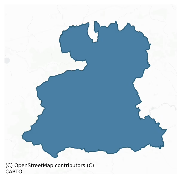
Muskerry West is a barony of County Cork, in the historical province of Munster (Irish: Múscraí Thiar), covering 763 km² of land. The barony records 1,711 NMS archaeological sites and 194 NIAH listed buildings, placing it at around the 64th percentile among 280 ROI baronies for sites per km². This means it is in the upper half of all baronies for sites per km². Dated archaeological evidence runs from the Neolithic through to the Modern, spanning 8 of 9 archaeological periods, placing the barony in the 52nd percentile among 280 ROI baronies for chronological depth. This means it is in the upper half of all baronies for chronological depth. The largest dated subset of recorded sites dates to the Early Medieval. Logainm flags 80 placenames in the barony as carrying a recognised heritage root; the largest share — around 55% — are names associated with pre-christian defensive.
Heritage at a glance
Percentile rankings throughout this profile compare each barony only against the other 279 Republic of Ireland baronies.
The recorded heritage of Muskerry West
The National Monuments Service Sites and Monuments Record (SMR) is the statutory inventory of archaeological sites for the Republic of Ireland, maintained by the Department of Tourism, Culture, Arts, Gaeltacht, Sport and Media. Sites recorded here include earthworks, ringforts, megalithic tombs, ecclesiastical remains, and post-medieval features; not every record is legally protected, but each is registered as a monument of archaeological interest.
The National Monuments Service records 1,711 archaeological sites in Muskerry West, putting it at the 64th percentile among 280 ROI baronies for sites per km². This means it is in the upper half of all baronies for sites per km². Protection coverage is near-universal — 1,688 sites (99%) fall within a recorded monument protection zone, indicating an extensively surveyed landscape. The record is dominated by defensive sites — ringforts, enclosures, hillforts, and stone forts (606 sites, 35% of the total), with agricultural and prehistoric industrial sites forming a substantial secondary presence (357 sites, 21%). Ringfort – rath is the most prevalent type, making up 20% of the barony's recorded sites (350 records), broadly in line with the ROI average of 20% across all baronies where this type occurs. Ringfort – rath is an earthen ringfort enclosed by a bank and external ditch — the most common Early Medieval farmstead, broadly dated 500–1000 AD. Other significant types include Fulacht fia (281) and Standing stone (214). Fulacht fia is a horseshoe-shaped Bronze Age burnt mound built around a sunken trough beside a water source, traditionally interpreted as a cooking site; Standing stone is a deliberately set upright stone, used variously as a Bronze/Iron Age burial marker, route marker or commemorative monument. Across the barony's 763 km², this gives a recorded density of 2.24 sites per km².
Most common monument types
Hover or tap a monument type to see its definition.
| Type | Count |
|---|---|
| Ringfort – rath an earthen ringfort enclosed by a bank and external ditch — the most common Early Medieval farmstead, broadly dated 500–1000 AD | 350 |
| Fulacht fia a horseshoe-shaped Bronze Age burnt mound built around a sunken trough beside a water source, traditionally interpreted as a cooking site | 281 |
| Standing stone a deliberately set upright stone, used variously as a Bronze/Iron Age burial marker, route marker or commemorative monument | 214 |
| Souterrain an underground stone-built passage and chamber, generally Early Medieval and often associated with ringforts as a defensive or storage feature | 150 |
| Field boundary a continuous bank, wall or drain marking the limit of a field, of any date from the Neolithic onwards | 65 |
| Enclosure a banked or ditched feature of uncertain type, used as a catch-all where the original function cannot be determined from surface evidence | 49 |
| Burial ground an area set apart for burial that is not associated with a church, in use from the medieval period onwards | 37 |
Chronological distribution
The dated archaeological record for Muskerry West spans from the Neolithic through to the Modern, with activity attested across 8 of 9 archaeological periods. Every period from earliest to latest is represented in the record — an unbroken sequence of dated activity across the full chronological span. Activity concentrates most heavily in the Early Medieval (515 sites, 36% of dated material), with the Early Bronze Age forming a secondary peak (367 sites, 26%). A further 293 recorded sites (17% of the overall NMS register for the barony) carry no period attribution — appearing as 'Unknown' in the bar chart below. This typically reflects either records that pre-date the standardised period vocabulary or sites awaiting specialist dating review, rather than a genuine absence of chronological evidence.
Sample of recorded monuments
Show 25 sample monuments (of 1,711 total)
A representative sample of 25 recorded monuments drawn from the barony’s 1,711 total NMS entries. Sites within a recorded monument protection zone and rarer site types are prioritised so the list shows a meaningful cross-section rather than only the most common type. Each entry shows the official Sites and Monuments Record reference number and the description published by the National Monuments Service.
Chapel
The Archaeological Survey of Ireland (ASI) is in the process of providing information on all monuments on The Historic Environment Viewer (HEV). Currently the information for this record has not been uploaded. To…
The Archaeological Survey of Ireland (ASI) is in the process of providing information on all monuments on The Historic Environment Viewer (HEV). Currently the information for this record has not been uploaded. To access available information for research purposes please make an appointment in advance with the Archive Unit (open Fridays 10.00 am – 5.00 pm), Department of Culture, Heritage and the Gaeltacht, The Custom House, Dublin 1 D01W6XO or email nmarchive@chg.gov.ie.
Mausoleum
The Archaeological Survey of Ireland (ASI) is in the process of providing information on all monuments on The Historic Environment Viewer (HEV). Currently the information for this record has not been uploaded. To…
The Archaeological Survey of Ireland (ASI) is in the process of providing information on all monuments on The Historic Environment Viewer (HEV). Currently the information for this record has not been uploaded. To access available information for research purposes please make an appointment in advance with the Archive Unit (open Fridays 10.00 am – 5.00 pm), Department of Culture, Heritage and the Gaeltacht, The Custom House, Dublin 1 D01W6XO or email nmarchive@chg.gov.ie.
Cross-slab (present location)
In pasture, on SW-facing slope, c. 18m S of the site of a holy well (CO058-013001-). The cross-slab originally stood c. 60m to WSW (CO058-013003-); according to Kelly (1897, 104), Windele noted on its removal 'many…
In pasture, on SW-facing slope, c. 18m S of the site of a holy well (CO058-013001-). The cross-slab originally stood c. 60m to WSW (CO058-013003-); according to Kelly (1897, 104), Windele noted on its removal 'many bones' under the mound where it stood. Now set in concrete and protected by circular stone wall. Thin slab (H 1.04m; 0.36m x 0.08m) with both N and S faces are decorated with a Greek cross of arcs, enclosed by two incised concentric rings. Treble cross, decorating top arm of crosson S face is thought by Henry (1952, 41) to be 'a fairly recent addition'. Above circle on N face walks an incised figure in side profile. Figure is simply depicted, with facial features, wearing a bell-shaped garment and carrying a crozier. Henry (ibid.) dates stone to second half of 7th century. Hurley and O'Flaherty (1981, 57-8) noted similarities between St Gobnait's Stone and stone from Bawnatemple (CO071-108005-) c. 19km to E.
The above description is derived from the published 'Archaeological Inventory of County Cork. Volume 3: Mid Cork' (Dublin: Stationery Office, 1997). In certain instances the entries have been revised and updated in the light of recent research.
Date of revision: 14 December 2009
This monument is subject to a preservation order made under the National Monuments Acts 1930 to 2014 (PO no. 29/1976).
Images provided by and copyright of Amanda Clarke 28 Nov 2016 https://holywellscorkandkerry.com/
Megalithic tomb – unclassified
Marked 'Cromlech' on 1842 OS 6-inch map. Not shown on 1903 or 1940 OS 6-inch maps. Removed. Sports field now occupies site. According to de Valera and O Nualláin (1982, 45, no. 13), 'The 1842 Memoranda describe the…
Marked 'Cromlech' on 1842 OS 6-inch map. Not shown on 1903 or 1940 OS 6-inch maps. Removed. Sports field now occupies site. According to de Valera and O Nualláin (1982, 45, no. 13), 'The 1842 Memoranda describe the object as…."a very perfect Cromlech or Druid's Altar". The original nature of the feature is uncertain.
The above description is derived from the published 'Archaeological Inventory of County Cork. Volume 3: Mid Cork' (Dublin: Stationery Office, 1997). In certain instances the entries have been revised and updated in the light of recent research.
Date of upload/revision: 14 January 2009
Sheela-na-gig
In S wall of nave at Ballyvourney church (CO058-034007-); lintel, forming head of window light, has carving on outside face. The figure (c. 0.3m x 0.2m) cut in false relief immediately above chamfer of window light;…
In S wall of nave at Ballyvourney church (CO058-034007-); lintel, forming head of window light, has carving on outside face. The figure (c. 0.3m x 0.2m) cut in false relief immediately above chamfer of window light; figure portrayed with torso, head and arms. The hands may be crossed at the navel rather than pointed downwards as suggested by Andersen (1977, 145). Guest (1936, 110) described it as 'female figure….cut into an ovoid depression'; she considered that it showed 'no definite features of a sheela-na-gig except the pose of the arms'. No. 38 in Cherry's catalogue (1992, 6).
The above description is derived from the published 'Archaeological Inventory of County Cork. Volume 3: Mid Cork' (Dublin: Stationery Office, 1997). In certain instances the entries have been revised and updated in the light of recent research.
Date of upload/revision: 14 January 2009
Image provided by and copyright of Amanda Clarke 2016-2022 https://holywellscorkandkerry.com/
House – vernacular house
Roadside. Ruined overgrown remains of house (long axis N-S); front inaccessible. Half-hipped roof collapsed; single off-centre chimney; traces of thatch visible. Central window in S side wall.
The above description…
Roadside. Ruined overgrown remains of house (long axis N-S); front inaccessible. Half-hipped roof collapsed; single off-centre chimney; traces of thatch visible. Central window in S side wall.
The above description is derived from the published 'Archaeological Inventory of County Cork. Volume 3: Mid Cork' (Dublin: Stationery Office, 1997). In certain instances the entries have been revised and updated in the light of recent research.
Date of upload/revision: 14 January 2009
Cairn – ring-cairn
In rough grazing, on S-facing slope, c. 11m SE of cairn (7858). Dump-constructed ring of stones (diam. 7.7m N-S, 7.2m E-W; H 0.4m; Wth c. 3m) surrounding central flat area.
The above description is derived from the…
In rough grazing, on S-facing slope, c. 11m SE of cairn (7858). Dump-constructed ring of stones (diam. 7.7m N-S, 7.2m E-W; H 0.4m; Wth c. 3m) surrounding central flat area.
The above description is derived from the published 'Archaeological Inventory of County Cork. Volume 3: Mid Cork' (Dublin: Stationery Office, 1997). In certain instances the entries have been revised and updated in the light of recent research.
Date of upload/revision: 14 January 2009
Burial
Not shown on 1842 and 1903 OS 6-inch maps. In rough grazing, on steep SSE-facing slope. Rectangular slab-lined hollow (L 0.9m; Wth 0.34m; D 0.35m) closed by flat sandstone slab. Human bone fragments noted inside. Area…
Not shown on 1842 and 1903 OS 6-inch maps. In rough grazing, on steep SSE-facing slope. Rectangular slab-lined hollow (L 0.9m; Wth 0.34m; D 0.35m) closed by flat sandstone slab. Human bone fragments noted inside. Area around burial strewn with loose stones; heap of white quartzite pebbles to E. Two upright slabs (H c. 0.45m; long axes E-W) adjacent to NE.
The above description is derived from the published 'Archaeological Inventory of County Cork. Volume 3: Mid Cork' (Dublin: Stationery Office, 1997). In certain instances the entries have been revised and updated in the light of recent research.
Date of upload/revision: 14 January 2009
Altar
Built into stone wall behind St. Abina's Catholic church, Garrane. D-shaped slab (0.9m x 0.6m) with inscription 'Altar Stone'; inscribed Greek cross with straight terminals positioned between the two words. Church…
Built into stone wall behind St. Abina's Catholic church, Garrane. D-shaped slab (0.9m x 0.6m) with inscription 'Altar Stone'; inscribed Greek cross with straight terminals positioned between the two words. Church itself in use; rectangular gable-ended church with bellcote on NW gable; entrance porch in NE wall with inscription 'AD 1877' in plaster medallion.
The above description is derived from the published 'Archaeological Inventory of County Cork. Volume 3: Mid Cork' (Dublin: Stationery Office, 1997). In certain instances the entries have been revised and updated in the light of recent research.
Date of upload/revision: 14 January 2009
Cliff-edge fort
In pasture, on slight promontory above River Laney. D-shaped area (straight side 20m; projecting 18m to W), defined by two earthen banks SSE->W, with ntervening fosse; single earthen bank (H 0.6m) W->NNE; cliff edge to…
In pasture, on slight promontory above River Laney. D-shaped area (straight side 20m; projecting 18m to W), defined by two earthen banks SSE->W, with ntervening fosse; single earthen bank (H 0.6m) W->NNE; cliff edge to E. Gap (Wth 1m) in bank to N. Outside enclosure land slopes down to S; banks more defensive on this side as incorporated into slope. Interior level except along cliff edge where it slopes down to E.
The above description is derived from the published 'Archaeological Inventory of County Cork. Volume 3: Mid Cork' (Dublin: Stationery Office, 1997). In certain instances the entries have been revised and updated in the light of recent research.
Date of upload/revision: 14 January 2009
Water mill – horizontal-wheeled
On SE-facing slope, c. 40m W of fast flowing stream. Discovered during land drainage in April 1981 when penstock and two other timbers were disturbed from their original position. Subsequently investigated by C. Rynne…
On SE-facing slope, c. 40m W of fast flowing stream. Discovered during land drainage in April 1981 when penstock and two other timbers were disturbed from their original position. Subsequently investigated by C. Rynne (1988, 298-323). Penstock (L 2.3m; Wth 0.15m) was incomplete, though probably not much longer than its present measurement; its face at fore-end was cut to slope downwards at an angle of 25°; two rebates were cut along upper edges to accommodate lid; investigator suggested that one of the other timbers found with it may have been used as a makeshift lid. Investigation revealed headrace to W of mill, exposed for a length of 4m, stepped at E end by three neatly-cut rock ledges to facilitate water flow and support penstock. Ledges led downwards to rectangular rock-cut platform (c. 3.8m E-W; c. 2.5m N-S) on which lay wooden foundations of partially-sunken rectangular wheel-house. Two sole-plates (L 4.03m; 0.23m X 0.3m: L 3.7m; 0.2m X 0.32m) defined N and S walls of wheel-house. Each sole-plate rested on ledge just above rock cut platform. A short run of rudimentary dry-stone walling (H 0.43m; L 1.98m) lay on top of N sole-plate at its E end. Rynne (ibid., 323) suggested that this was used to 'position a wallplate and to revet the sides of the excavation [of the rock-cut platform]'. Support beam for fore-end of penstock (L 2.5m; 0.3m x 0.15m) was tenoned into W end of N and S sole-plates. Remains of two flooring planks were found in the wheel-house with the remain…
Mill – unclassified
The Archaeological Survey of Ireland (ASI) is in the process of providing information on all monuments on The Historic Environment Viewer (HEV). Currently the information for this record has not been uploaded. To…
The Archaeological Survey of Ireland (ASI) is in the process of providing information on all monuments on The Historic Environment Viewer (HEV). Currently the information for this record has not been uploaded. To access available information for research purposes please make an appointment in advance with the Archive Unit (open Fridays 10.00 am – 5.00 pm), Department of Culture, Heritage and the Gaeltacht, The Custom House, Dublin 1 D01W6XO or email nmarchive@chg.gov.ie.
Ritual site – holy/saint's stone
Stone, associated with St Gobnait, shown only on 1842 OS 6-inch map c. 350m SW of Codrum Ho. Unlocated; no local information about it. Appears to be in roughly same location as inscribed stone (CO070-123—-).
The…
Stone, associated with St Gobnait, shown only on 1842 OS 6-inch map c. 350m SW of Codrum Ho. Unlocated; no local information about it. Appears to be in roughly same location as inscribed stone (CO070-123—-).
The above description is derived from the published 'Archaeological Inventory of County Cork. Volume 3: Mid Cork' (Dublin: Stationery Office, 1997). In certain instances the entries have been revised and updated in the light of recent research.
Date of upload/revision: 14 January 2009
Metalworking site
The Archaeological Survey of Ireland (ASI) is in the process of providing information on all monuments on The Historic Environment Viewer (HEV). Currently the information for this record has not been uploaded. To…
The Archaeological Survey of Ireland (ASI) is in the process of providing information on all monuments on The Historic Environment Viewer (HEV). Currently the information for this record has not been uploaded. To access available information for research purposes please make an appointment in advance with the Archive Unit (open Fridays 10.00 am – 5.00 pm), Department of Culture, Heritage and the Gaeltacht, The Custom House, Dublin 1 D01W6XO or email nmarchive@chg.gov.ie.
Building
The exact nature of a building named 'turret' on the 1842 OS 5-foot plan of Macroom Town is not clear. Macroom is not listed by Thomas (1992) as a walled town so it is unlikely to be a mural tower. The function of this…
The exact nature of a building named 'turret' on the 1842 OS 5-foot plan of Macroom Town is not clear. Macroom is not listed by Thomas (1992) as a walled town so it is unlikely to be a mural tower. The function of this structure is not known. It is no longer evident on the ground (Zajac et al. 1995, 69).
The above description is derived from 'The Archaeological Inventory of County Cork. Volume 5' (Dublin: Stationery Office, 2009).
Date of upload: 22 December 2009
Hermitage
Site occupies oval island (c. 60m E-W; c. 70m N-S), joined to S shore of Gouganebarra Lake by causeway (L c. 20m) which incorporates holy well (CO080-012002-). At NW corner of island is square enclosure (21m N-S; 20.6m…
Site occupies oval island (c. 60m E-W; c. 70m N-S), joined to S shore of Gouganebarra Lake by causeway (L c. 20m) which incorporates holy well (CO080-012002-). At NW corner of island is square enclosure (21m N-S; 20.6m E-W),with central open court (L 13.4m); immediately E of enclosure are fragmentary ruins covering area c. 24m E-W and c. 16.5m N-S; in SE corner of island is neo-Romanesque chapel, erected c. 1890. The former two features are remains of hermitage established here in late 17th century by Carmelite priest Denis O'Mahony (Smith 1750, vol. 1, 192-3; Croker 1824, 275-84; Windele 1844, 288-94; MacCarthy 1935, 85-9).
Square enclosure stands on stone-faced platform (H c. 1.5m; extends c. 3m out from enclosure on all sides). Enclosing wall (Wth c. 4.2m; H c. 2.6m) has level sod-covered top with traces of parapet wall (Wth c. 0.85m; H c. 0.9m) along outside edge. Central court entered through roofless passage (Wth c. 2.3m) in centre of S wall. At centre of court low stepped pyramid, supporting tall wooden cross (see photograph JCHAS 1892, p. 195). Each sidewall of court contains two arched recesses (Wth c. 2m; D c. 2.8m; H c.1.5m); each recess has shallow shelf on back wall. Enclosure repaired c.1890, at same time plaques marking stations of the cross erected on inside walls.
Immediately E of enclosure are remains of long narrow structure (c. 14m N-S; c. 5m E-W) missing most of its N and W walls; door ope in centre of S wall (identified as remains of chapel on plan…
Crannog
In Lough Allua, on the River Lee c. 2.9km W of Inchigeelagh. Named 'Illaunyweahagane' on 1842 and 1904 OS 6-inch maps; translated by O'Donoghue (1986, 244) as 'Oilean Uí Mhaothagain (Meighan's island) from a Cineal…
In Lough Allua, on the River Lee c. 2.9km W of Inchigeelagh. Named 'Illaunyweahagane' on 1842 and 1904 OS 6-inch maps; translated by O'Donoghue (1986, 244) as 'Oilean Uí Mhaothagain (Meighan's island) from a Cineal Laoghaire chieftain'. Lunham (1909, 22) noted 'many of the wooden piles forming the substructure of the crannoge are still visible and a passage raised above the level of the lake's bed leads to a rath in the vicinity of the shore' (CO081-011—-). Briefly inspected by Tony Balfe in January 1994 under licence from the OPW. He described a roughly circular artificial island (circumference 65-70m) composed of boulders. Remains of perimeter palisade visible NNE->SW; 73 wooden posts (diam. c. 0.1- 0.12m) ranging in height from just level with the lake bed to 1m on the S side. At W side spread of boulders covers palisade. Centre inaccessible due to overgrowth. Raised passage mentioned above was not found.
The above description is derived from the published 'Archaeological Inventory of County Cork. Volume 3: Mid Cork' (Dublin: Stationery Office, 1997). In certain instances the entries have been revised and updated in the light of recent research.
Date of upload/revision: 14 January 2009
Barracks
The Archaeological Survey of Ireland (ASI) is in the process of providing information on all monuments on The Historic Environment Viewer (HEV). Currently the information for this record has not been uploaded. To…
The Archaeological Survey of Ireland (ASI) is in the process of providing information on all monuments on The Historic Environment Viewer (HEV). Currently the information for this record has not been uploaded. To access available information for research purposes please make an appointment in advance with the Archive Unit (open Fridays 10.00 am – 5.00 pm), Department of Culture, Heritage and the Gaeltacht, The Custom House, Dublin 1 D01W6XO or email nmarchive@chg.gov.ie.
Slab-lined burial
Discovered in 1947 during ploughing in higher portion of sloping field; excavated by M.J. O'Kelly (1947, 36-40). Excavation revealed 'coffin-like' cist (long axis ENE-WSW), covered and lined with sandstone slabs,…
Discovered in 1947 during ploughing in higher portion of sloping field; excavated by M.J. O'Kelly (1947, 36-40). Excavation revealed 'coffin-like' cist (long axis ENE-WSW), covered and lined with sandstone slabs, measuring 6ft 6ins long, 2ft wide at centre and 1ft 4ins to 1ft 6ins deep; floor was unpaved. Skeletal remains were found 'jumbled together at the east end and were obviously much disturbed' (ibid.). All bones belonged to adult female except one which was the lower half of a right femur of a male. Pit (D 9ins) at E end of floor contained fragments of charcoal identified as Scots Pine. No visible surface trace.
The above description is derived from the published 'Archaeological Inventory of County Cork. Volume 3: Mid Cork' (Dublin: Stationery Office, 1997). In certain instances the entries have been revised and updated in the light of recent research.
Date of upload/revision: 14 January 2009
Cupmarked stone
Not shown on 1842 OS 6-inch map. Marked 'Altar' on 1904 OS 6-inch map. Large flat stone (L 1.8m; 1.4m x 0.5m) leaning aginst field fence on N side of road. According to local information, cup marks on concealed side.…
Not shown on 1842 OS 6-inch map. Marked 'Altar' on 1904 OS 6-inch map. Large flat stone (L 1.8m; 1.4m x 0.5m) leaning aginst field fence on N side of road. According to local information, cup marks on concealed side. Stone originally lay flat on roadside.
The above description is derived from the published 'Archaeological Inventory of County Cork. Volume 3: Mid Cork' (Dublin: Stationery Office, 1997). In certain instances the entries have been revised and updated in the light of recent research.
Date of upload/revision: 14 January 2009
Designed landscape – folly
On top of a hillock, with commanding view in all directions; 4-storey tower built in graveyard and on site of former parish church of Dunisky (CO083-013001-). Square tower (int.: 3.75m N-S; 3.75m E-W) with prominent…
On top of a hillock, with commanding view in all directions; 4-storey tower built in graveyard and on site of former parish church of Dunisky (CO083-013001-). Square tower (int.: 3.75m N-S; 3.75m E-W) with prominent clasped buttress on each corner (see photograph Fitzgerald 1930, opp. 87). Ground floor ope in W wall gives access to interior; no trace of burials on earthen floor inside nor are any memorials evident. No internal floors or stairs survive. Floors above ground floor have central window in each wall and small corner fireplace. Roof survives: flat slabs resting on metal framework. Built by Charles Beamish, who lived in nearby Delacour Villa and died in 1867 (Beamish 1950, 11); McCarthy (1977, 227) notes local legend that Beamish built tower as mausoleum 'for his three wives', but he had only one wife and she outlived him (Beamish ibid., 119). Likely therefore that Charles Beamish, a noted 'eccentric' (ibid., 11), built tower as a folly beside his house. Tower not mentioned by Lewis (1837, vol. 1, 582), but shown on 1842 OS 6-inch map and termed 'mausoleum'; therefore probably erected c. 1840.
The above description is derived from the published 'Archaeological Inventory of County Cork. Volume 3: Mid Cork' (Dublin: Stationery Office, 1997). In certain instances the entries have been revised and updated in the light of recent research.
Date of upload/revision: 14 January 2009
Designed landscape – ornamental lake
The Archaeological Survey of Ireland (ASI) is in the process of providing information on all monuments on The Historic Environment Viewer (HEV). Currently the information for this record has not been uploaded. To…
The Archaeological Survey of Ireland (ASI) is in the process of providing information on all monuments on The Historic Environment Viewer (HEV). Currently the information for this record has not been uploaded. To access available information for research purposes please make an appointment in advance with the Archive Unit (open Fridays 10.00 am – 5.00 pm), Department of Culture, Heritage and the Gaeltacht, The Custom House, Dublin 1 D01W6XO or email nmarchive@chg.gov.ie.
Hilltop enclosure
In pasture, on hilltop. Subrectangular area (66m N-S; 85.4m E-W) enclosed by partially stone-faced earthen bank (H 2.5m), with infilled external fosse (D 0.2m) to NNE. Gaps in bank to SE (Wth 3.4m) and NE (Wth 4m).…
In pasture, on hilltop. Subrectangular area (66m N-S; 85.4m E-W) enclosed by partially stone-faced earthen bank (H 2.5m), with infilled external fosse (D 0.2m) to NNE. Gaps in bank to SE (Wth 3.4m) and NE (Wth 4m). Silage pit against outer bank face to NNW; concrete wall and floor to E; roadway to S. Interior level to W; sloping downhill in E half. Possible souterrain (CO083-036002-) inside bank to S.
The above description is derived from the published 'Archaeological Inventory of County Cork. Volume 3: Mid Cork' (Dublin: Stationery Office, 1997). In certain instances the entries have been revised and updated in the light of recent research.
Date of upload/revision: 14 January 2009
Rock art
In pasture, on N-facing slope; table-like outcrop (Shee 1968, 145) of stone (L 2.65m; H 0.3m; Wth 1.55m). Decoration, revealed c. 1953 when landowner removed field fence, covers entire upper surface, except SW corner…
In pasture, on N-facing slope; table-like outcrop (Shee 1968, 145) of stone (L 2.65m; H 0.3m; Wth 1.55m). Decoration, revealed c. 1953 when landowner removed field fence, covers entire upper surface, except SW corner where surface is uneven; decoration divided into two sections by 'change in the level of the surface of the stone' (ibid.). Decoration picked but shallow, indistinct and 'difficult to describe' (ibid., see fig. 1). Northern half' framed by a broad well-picked line' parallel with the change in level but not continuous elsewhere; motifs include '5 cup-and-circle, each with a single circle' and 'seven other cupmarks each partly enclosed by a single arc' (ibid.). Decoration on southern half, itself divided by a natural crack, includes '3 cup and circle' and '5 cup-and-arc' motifs. According to Shee (ibid., 146), the decoration 'is quite untypical of Irish rock-art'.
The above description is derived from the published 'Archaeological Inventory of County Cork. Volume 3: Mid Cork' (Dublin: Stationery Office, 1997). In certain instances the entries have been revised and updated in the light of recent research.
Date of upload/revision: 14 January 2009
In improved, lush pasture (226m OD), on a small plateau of a NNW-facing slope. Good views of Lee and Bride River valleys to N and NE respectively and The Paps Mountains to NW. A slightly rough and unfractured sandstone boulder (dims. 3.20m N-S; 2.20m E-W; H 0.75m at NW; H 0.90m at S) having a flat, sub-oval dec…
Ringfort – rath
In pasture, atop E-W ridge, overlooking River Blackwater to N. Depicted on 1938 OS 6-inch map as circular area (diam. c. 40m) enclosed by bank, with second bank surviving SSE->NW. Levelled apart from double earthen bank…
In pasture, atop E-W ridge, overlooking River Blackwater to N. Depicted on 1938 OS 6-inch map as circular area (diam. c. 40m) enclosed by bank, with second bank surviving SSE->NW. Levelled apart from double earthen bank SSW->NW with intervening fosse. Inner bank (int. H 1m) and outer bank (ext. H 1.15m) are planted with mature deciduous trees. Interior encroached on by farmyard of Rathduane House; large shed built in SW quadrant. According to local information, souterrain (9103) in interior.
The above description is derived from the published 'Archaeological Inventory of County Cork. Volume 3: Mid Cork' (Dublin: Stationery Office, 1997). In certain instances the entries have been revised and updated in the light of recent research.
Date of upload/revision: 14 January 2009
Listed buildings
The National Inventory of Architectural Heritage (NIAH) is a state survey appraising buildings of architectural, historical, archaeological, artistic, cultural, scientific, social, or technical interest. Each surveyed structure receives a rating from International (the highest, for buildings of European importance) through National, Regional, Local, and Record-Only.
The NIAH records 194 listed buildings in Muskerry West, the 77th percentile across ROI baronies for listed-building density. The highest-graded structure include 1 of National significance. The Republic holds 937 National-graded buildings in total, so this barony accounts for around 0% of the national total. Construction dates concentrate most heavily in the Victorian (1830-1900) period. The most-recorded building type is house (80 examples, 41% of the listed stock).
Terrain and environment
Mean elevation across the barony is 208m — the 96th percentile among 280 ROI baronies for elevation. This means it is in the top tenth of all baronies for elevation. This is a relatively elevated landscape by ROI standards. Elevation matters for heritage because higher-altitude baronies typically favour defensive monuments — ringforts and hilltop forts placed on prominent ground — while lowland baronies are more likely to carry the dense settlement and church networks of intensive agricultural landscapes. The barony reaches 679m at its highest point — a vertical span of more than 471m within its boundary, indicating significant topographic diversity. Mean slope is 6.9° — the 91st percentile among 280 ROI baronies for slope. This means it is in the top tenth of all baronies for slope. This is consistently steep terrain by ROI standards, the kind of landscape that tends to preserve upstanding archaeological features well. Slope is a key control on both land use and archaeological preservation: steep ground resists ploughing and tends to preserve earthworks intact, while gentle slopes favour intensive cultivation that damages or destroys surface archaeology over time. The Topographic Wetness Index averages 9.4, the 8th percentile among 280 ROI baronies for wetness. This means it is in the bottom tenth of all baronies for wetness. This is well-drained ground by ROI standards — typical of upland or steeply-sloping country that sheds water rapidly. Drainage matters for heritage because poorly-drained ground preserves organic archaeology (wooden trackways, leather, textiles, and on rare occasions human remains) far better than free-draining soil; well-drained ground favours arable use but destroys organic material rapidly. The land cover is dominated by improved grassland (71%) and woodland (27%). In overall character, this is an upland landscape of steep, elevated terrain, with land use dominated by improved grassland.
Terrain measurements
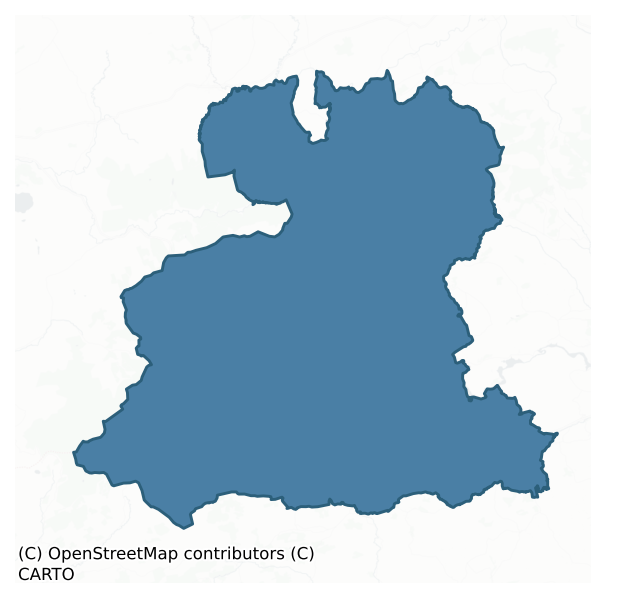
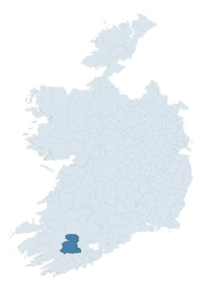
Where this barony sits in the Republic of Ireland
Geology and preservation
Bedrock geology shapes the landscape long before any settlement begins — controlling soil drainage, agricultural potential, the survival of upstanding monuments, and the preservation of buried archaeology. The figures below come from the Geological Survey Ireland 1:100,000 bedrock map.
The bedrock underlying Muskerry West is predominantly sandstone (75% of the barony by area), laid down during the Devonian period (89% by area, around 419 to 359 million years ago). Sandstone weathers to free-draining, moderately fertile soils that supported Early Medieval ringfort agriculture and later manorial estates. The rock itself is a major source of building stone — visible in churches, tower houses, and farm buildings across the barony's historic landscape. The single largest mapped unit is the Gun Point Formation (27% of the barony's bedrock).
Rock type composition
Largest mapped unit: Gun Point Formation (27% of the barony)
Placename evidence
Logainm records 80 heritage-diagnostic placenames for Muskerry West, drawn from townland and civil-parish names across the barony. The dominant stratum is pre-Christian and Early Medieval defensive — ráth-, lios-, dún-, and caiseal-prefixed names that mark Iron Age and early historic settlement. The leading diagnostic roots are cill- (26 — church), ráth- (12 — earthen ringfort), and dún- (10 — hilltop fort or promontory fort). This is well above the ROI average of 30.7 heritage placenames per barony — around 2.6× the typical figure. The presence of multiple heritage strata side by side indicates layered occupation of the landscape across successive prehistoric and historic periods. Logainm records 430 placenames for Muskerry West (predominantly townland names). Of these, 80 (19%) carry one of the diagnostic Gaelic roots tracked above; the remainder draw on more generic landscape vocabulary that does not encode a heritage period.
Pre-Christian / Early Medieval Defensive
| Root | Count | Meaning |
|---|---|---|
| ráth- | 12 | earthen ringfort |
| dún- | 10 | hilltop or promontory fort |
| lios- | 9 | ringfort or enclosure |
| cathair- | 8 | stone fort |
| caiseal- | 4 | stone ringfort |
Early Christian Ecclesiastical
| Root | Count | Meaning |
|---|---|---|
| cill- | 26 | church (early) |
| cillín- | 2 | unconsecrated burial ground |
| tobar- | 1 | holy well |
Burial, Ritual, and Norse-Contact
| Root | Count | Meaning |
|---|---|---|
| tuaim- | 3 | burial mound |
| leacht- | 2 | grave monument |
| carn- | 1 | cairn |
| leaba- | 1 | megalithic tomb |
| gall- | 1 | foreigner — Norse settlement marker |
Other baronies in Cork
- Fermoy
- Courceys
- Bear
- Kerrycurrihy
- Kinsale
- Carbery East (west Division)
- Barrymore
- Iffa And Offa East — Tipperary
- Owney And Arra — Tipperary
- Kinatalloon
See all 280 baronies in the Republic of Ireland Heritage Tool.

Explore further
Grounding History: 10 Maps of Northern Ireland’s Past
If you’re interested in Irish heritage more widely, the companion report for Northern Ireland brings together the analysis of all 462 NI wards into one place through 10 high-quality maps — covering monument density, archaeological periods, placename heritage, terrain, wetland, and the historic landscape at first survey. Take a look.
About this profile
Click any section below to expand.
What is a barony?
A barony is a historic administrative unit in Ireland, broadly equivalent to an English hundred. The 280 baronies used here are from the OSi 2019 National Statutory Boundaries (generalised 20m), covering the 26 counties of the Republic of Ireland. Baronies derive from the Norman period, were formalised in the 17th century, and have not been redrawn for statistical purposes. They vary enormously in area, from compact urban baronies in Dublin to vast upland baronies in Connacht, and should not be compared by raw site count without accounting for area differences.
What counts as a site?
This profile combines three distinct heritage registers, each with its own definition of what constitutes a recordable site:
- Archaeological sites (NMS). The National Monuments Service Sites and Monuments Record (SMR) catalogues every known archaeological monument or site of archaeological interest in the Republic, from prehistoric burial mounds and ringforts to medieval churches and post-medieval defensive works. Inclusion does not require legal protection — only that the site has been identified, surveyed, and assessed as having archaeological value. A separate subset of these sites lies within a recorded protection zone, which gives them statutory protection under the National Monuments Acts.
- Listed buildings (NIAH). The National Inventory of Architectural Heritage records buildings of architectural, historical, archaeological, artistic, cultural, scientific, social, or technical interest. Each surveyed structure is appraised on a five-tier scale: International, National, Regional, Local, and Record-Only. The NIAH appraisal is informational rather than strictly statutory, but it underpins local-authority Record of Protected Structures (RPS) listings.
- Heritage placenames (Logainm). Logainm is the authoritative database of Irish placenames maintained by the Placenames Branch. This profile applies a heritage-diagnostic classifier to the Irish-language form of each townland name, flagging roots that signal defensive sites (ráth-, lios-, dún-, caiseal-, cathair-), ecclesiastical foundations (cill-, teampall-, domhnach-, mainistir-), prehistoric burial-ritual features (tuaim-, carn-, leaba-), or Norse-contact settlement (gall-). Townlands without one of these diagnostic roots are not flagged here — they may still carry historical significance, but that significance is not encoded in the name itself.
Editorial principles
The narrative sections of this profile follow several explicit principles:
- Evidential. Every claim about this barony’s heritage character is anchored in the underlying register data. Where a site count, a placename count, or a percentile rank is cited, it is computed from the source datasets at export time, not estimated.
- Comparative. Counts and metrics are reported alongside their percentile rank against the other 279 ROI baronies. A barony with 50 ringforts in absolute terms could be unusually high or unusually low depending on its size and regional context; percentile ranking removes that ambiguity.
- Transparent on limits. Where a register has known coverage gaps, survey biases, or data-quality issues that affect this barony’s figures, the profile flags them rather than presenting the numbers as definitive.
- No interpretation beyond what the data supports. The narrative does not speculate about historical events, social dynamics, or cultural meaning beyond what the recorded heritage and placename evidence directly attests.
Data caveats and limits
- NMS Sites and Monuments Record is the product of survey campaigns conducted at different intensities across different counties and decades. Some baronies have been surveyed more thoroughly than others, and absolute counts should be read in that light. Sites destroyed by development before survey are typically not represented; sites in heavily forested or upland terrain are sometimes under-recorded.
- NIAH coverage is broadly complete for the Republic of Ireland but the survey was conducted on a rolling county-by-county basis, and the most recent appraisal date varies. Buildings demolished or substantially altered after their original survey may still appear in the register; conversely, recent buildings of merit may not yet have been appraised.
- Logainm classification applies a deliberately conservative pattern-matching approach to the Irish-language townland forms. The classifier prioritises true positives over recall: a townland may carry a heritage signal that the classifier doesn’t recognise, particularly where the diagnostic root has been heavily anglicised or where the townland name draws on a less common term. The 60,000+ townland records and ~9,800 classified placenames give a substantial signal at barony scale, but individual townland names should be checked against Logainm directly for definitive interpretation.
- Period attribution. The chronological distribution reflects only those NMS sites that carry a recognised period attribution in the source data. Sites listed as “Unknown” period are excluded from the dated subset.
- Boundary changes. Some baronies have undergone minor boundary adjustments since their 19th-century definition; the OSi 2019 generalised boundaries used here are the current statutory definition and may differ slightly from historical maps in border areas.
- Bedrock geology is mapped at 1:100,000 scale, which means local variation within a barony — small pockets of different rock type, mineral veins, alluvium overlying bedrock — is generalised. The dominant-system and rocktype figures are area-weighted, so a barony reading “70% Carboniferous limestone” may still contain small but archaeologically important pockets of older or younger rock. Around 3% of GSI polygons do not match the lexicon and contribute no rocktype or system attribution.
Data sources
- National Monuments Service — Sites and Monuments Record (SMR) https://data.gov.ie/dataset/national-monuments-service-archaeological-survey-of-ireland
- National Inventory of Architectural Heritage (NIAH) https://data.gov.ie/dataset/national-inventory-of-architectural-heritage-niah-national-dataset
- Logainm — Placenames Database of Ireland https://www.logainm.ie/
- Ordnance Survey Ireland — National Statutory Barony Boundaries 2019 https://data-osi.opendata.arcgis.com/
- EURODEM — European Digital Elevation Model https://www.mapsforeurope.org/datasets/euro-dem
- ESA WorldCover https://esa-worldcover.org/en
- Geological Survey Ireland — 1:100,000 Bedrock Geology https://www.gsi.ie/en-ie/data-and-maps/Pages/Bedrock.aspx
Explore more: Search any of the 280 ROI baronies, browse by historical province, or read the methodology and data sources for the full Republic of Ireland Heritage Tool.