Bear is a barony of County Cork, in the historical province of Munster (Irish: Béarra), covering 367 km² of land. The barony records 1,115 NMS archaeological sites and 136 NIAH listed buildings, placing it at around the 82nd percentile among 280 ROI baronies for sites per km². This means it is in the top fifth of all baronies for sites per km². Dated archaeological evidence runs from the Neolithic through to the Modern, spanning 8 of 9 archaeological periods, placing the barony in the 60th percentile among 280 ROI baronies for chronological depth. This means it is in the upper half of all baronies for chronological depth. The largest dated subset of recorded sites dates to the Early Bronze Age. Logainm flags 31 placenames in the barony as carrying a recognised heritage root; the largest share — around 65% — are names associated with early Christian church and monastic foundations.

Heritage at a glance
Percentile rankings throughout this profile compare each barony only against the other 279 Republic of Ireland baronies.
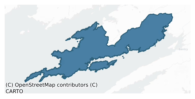
The recorded heritage of Bear
The National Monuments Service Sites and Monuments Record (SMR) is the statutory inventory of archaeological sites for the Republic of Ireland, maintained by the Department of Tourism, Culture, Arts, Gaeltacht, Sport and Media. Sites recorded here include earthworks, ringforts, megalithic tombs, ecclesiastical remains, and post-medieval features; not every record is legally protected, but each is registered as a monument of archaeological interest.
The National Monuments Service records 1,115 archaeological sites in Bear, putting it at the 82nd percentile among 280 ROI baronies for sites per km². This means it is in the top fifth of all baronies for sites per km². Protection coverage is near-universal — 1,068 sites (96%) fall within a recorded monument protection zone, indicating an extensively surveyed landscape. The record is dominated by domestic structures — house sites and settlement remains (260 sites, 23% of the total), with defensive sites forming a substantial secondary presence (219 sites, 20%). Hut site is the most prevalent type, making up 23% of the barony's recorded sites (258 records) — well above the ROI average of 5% across all baronies where this type occurs. Hut site is a low stone or earthen foundation enclosing a small circular or oval area, generally interpreted as a former dwelling, of any date from prehistory to the medieval period. Other significant types include Standing stone (113) and Enclosure (89). Standing stone is a deliberately set upright stone, used variously as a Bronze/Iron Age burial marker, route marker or commemorative monument; Enclosure is a banked or ditched feature of uncertain type, used as a catch-all where the original function cannot be determined from surface evidence. Across the barony's 367 km², this gives a recorded density of 3.04 sites per km².
Most common monument types
Hover or tap a monument type to see its definition.
| Type | Count |
|---|---|
| Hut site a low stone or earthen foundation enclosing a small circular or oval area, generally interpreted as a former dwelling, of any date from prehistory to the medieval period | 258 |
| Standing stone a deliberately set upright stone, used variously as a Bronze/Iron Age burial marker, route marker or commemorative monument | 113 |
| Enclosure a banked or ditched feature of uncertain type, used as a catch-all where the original function cannot be determined from surface evidence | 89 |
| Field boundary a continuous bank, wall or drain marking the limit of a field, of any date from the Neolithic onwards | 70 |
| Ringfort – rath an earthen ringfort enclosed by a bank and external ditch — the most common Early Medieval farmstead, broadly dated 500–1000 AD | 57 |
| Fulacht fia a horseshoe-shaped Bronze Age burnt mound built around a sunken trough beside a water source, traditionally interpreted as a cooking site | 57 |
| Souterrain an underground stone-built passage and chamber, generally Early Medieval and often associated with ringforts as a defensive or storage feature | 53 |
| Cairn – unclassified a stone mound that cannot be assigned to a specific cairn type | 38 |
Chronological distribution
The dated archaeological record for Bear spans from the Neolithic through to the Modern, with activity attested across 8 of 9 archaeological periods. Every period from earliest to latest is represented in the record — an unbroken sequence of dated activity across the full chronological span. Activity concentrates most heavily in the Early Bronze Age (215 sites, 33% of dated material), with the Early Medieval forming a secondary peak (154 sites, 24%). A further 470 recorded sites (42% of the overall NMS register for the barony) carry no period attribution — appearing as 'Unknown' in the bar chart below. This typically reflects either records that pre-date the standardised period vocabulary or sites awaiting specialist dating review, rather than a genuine absence of chronological evidence.
Sample of recorded monuments
Show 25 sample monuments (of 1,115 total)
A representative sample of 25 recorded monuments drawn from the barony’s 1,115 total NMS entries. Sites within a recorded monument protection zone and rarer site types are prioritised so the list shows a meaningful cross-section rather than only the most common type. Each entry shows the official Sites and Monuments Record reference number and the description published by the National Monuments Service.
Cairn – radial-stone cairn
Near end of boggy plateau on S side of Barraboy mountain. Six radially-set stones (H 0.2m – 0.6m) indicate ring c. 7m in diameter. Stone (H 0.9m; 1.2m x 0.4m) stands within ring at N. Precise nature of this structure is…
Near end of boggy plateau on S side of Barraboy mountain. Six radially-set stones (H 0.2m – 0.6m) indicate ring c. 7m in diameter. Stone (H 0.9m; 1.2m x 0.4m) stands within ring at N. Precise nature of this structure is unclear but more likely to be cairn than enclosure. Standing stone (CO090-00801-) 3m to N. (Ó Nualláin 1984b, 77, no. 16)
The above description is derived from the published 'Archaeological Inventory of County Cork. Volume 1: West Cork' (Dublin: Stationery Office, 1992). In certain instances the entries have been revised and updated in the light of recent research.
Date of upload/revision: 14 January 2009
Stone sculpture – iconic
On dry area in generally marshy ground. Subrectangular stone (H 1.15m; 0.3m x 0.46m) long axis N-S; False-relief human figure (H 0.43m) carved on lower surface of N face; damage to upper portion of figure. Small hole…
On dry area in generally marshy ground. Subrectangular stone (H 1.15m; 0.3m x 0.46m) long axis N-S; False-relief human figure (H 0.43m) carved on lower surface of N face; damage to upper portion of figure. Small hole (Wth 0.07m; D 0.05m) on top of stone. (O'Shea and Crowley 1972, 61).
The above description is derived from the published 'Archaeological Inventory of County Cork. Volume 1: West Cork' (Dublin: Stationery Office, 1992). In certain instances the entries have been revised and updated in the light of recent research.
Date of upload/revision: 14 January 2009
Booley hut
On W-facing hillside on N side of Bearhaven Peninsula. Remains of rectangular structure (int. L 5.2m; int. Wth 3.4m; H 1m; wall thickness c. 0.5m). Dry-stone construction.
The above description is derived from the…
On W-facing hillside on N side of Bearhaven Peninsula. Remains of rectangular structure (int. L 5.2m; int. Wth 3.4m; H 1m; wall thickness c. 0.5m). Dry-stone construction.
The above description is derived from the published 'Archaeological Inventory of County Cork. Volume 1: West Cork' (Dublin: Stationery Office, 1992). In certain instances the entries have been revised and updated in the light of recent research.
Date of upload/revision: 14 January 2009
Decorated stone
Located in a children's burial ground (CO102-024004-), within Cahervart early ecclesiastical enclosure (CO102-024002-). A circular flat-topped pile of stones (diam. 4m), with two depressions. O'Brien (1970, 65) suggests…
Located in a children's burial ground (CO102-024004-), within Cahervart early ecclesiastical enclosure (CO102-024002-). A circular flat-topped pile of stones (diam. 4m), with two depressions. O'Brien (1970, 65) suggests that this is a collapsed beehive hut.
The above description is derived from the published 'Archaeological Inventory of County Cork. Volume 1: West Cork' (Dublin: Stationery Office, 1992). In certain instances the entries have been revised and updated in the light of recent research.
Date of upload/revision: 14 January 2009
House – Bronze Age
A roughly circular (diam. c. 6m N-S; c. 7m E-W) mound of earth and stone with a depression (diam. c. 2m) off-centre to E. Walling is visible internally at SE. This may be the remains of a hut site.
Subsequent to being…
A roughly circular (diam. c. 6m N-S; c. 7m E-W) mound of earth and stone with a depression (diam. c. 2m) off-centre to E. Walling is visible internally at SE. This may be the remains of a hut site.
Subsequent to being published in vol. 1 of the Cork Inventory (Power et al. 1992) this hut site was excavated by W. O'Brien in 2003 (O'Brien 2006, 39). Excavation revealed it to be a substantial house with an entrance at E leading into a circular room (2.35m by 2.15m). A horseshoe shaped annexe to this room was on its W side and contained a hearth. Charcoal from the hearth was radiocarbon dated to 2465±20BP (GrN-28302) placing the house in the Late Bronze Age. Conservation work was carried out after excavation.
The above description is derived from the published 'Archaeological Inventory of County Cork. Volume 1: West Cork' (Dublin: Stationery Office, 1992). In certain instances the entries have been revised and updated in the light of recent research.
Date of upload/revision: 14 January 2009
Road – unclassified togher
In rough pasture, on bog on the lower S-facing slopes of Canshanavoe Mountain overlooking the valley of Adrigole River to the S. In the course of turf-cutting over several years, preserved pieces of cut wooden planks…
In rough pasture, on bog on the lower S-facing slopes of Canshanavoe Mountain overlooking the valley of Adrigole River to the S. In the course of turf-cutting over several years, preserved pieces of cut wooden planks were encountered on the face of the cut bog (D c. 0.5-0.7m below the surface). These may be the remains of a togher running through the bog (present depth 1-1.8m deep). One piece of wood (L 1.1m; Wth 0.15m; T 0.07m) was identified as oak (Archaeology Dept., UCC).
The above description is derived from 'The Archaeological Inventory of County Cork. Volume 5' (Dublin: Stationery Office, 2009).
Date of upload: 22 December 2009
Industrial chimney
The Archaeological Survey of Ireland (ASI) is in the process of providing information on all monuments on The Historic Environment Viewer (HEV). Currently the information for this record has not been uploaded. To…
The Archaeological Survey of Ireland (ASI) is in the process of providing information on all monuments on The Historic Environment Viewer (HEV). Currently the information for this record has not been uploaded. To access available information for research purposes please make an appointment in advance with the Archive Unit (open Fridays 10.00 am – 5.00 pm), Department of Culture, Heritage and the Gaeltacht, The Custom House, Dublin 1 D01W6XO or email nmarchive@chg.gov.ie.
Magazine
The Archaeological Survey of Ireland (ASI) is in the process of providing information on all monuments on The Historic Environment Viewer (HEV). Currently the information for this record has not been uploaded. To…
The Archaeological Survey of Ireland (ASI) is in the process of providing information on all monuments on The Historic Environment Viewer (HEV). Currently the information for this record has not been uploaded. To access available information for research purposes please make an appointment in advance with the Archive Unit (open Fridays 10.00 am – 5.00 pm), Department of Culture, Heritage and the Gaeltacht, The Custom House, Dublin 1 D01W6XO or email nmarchive@chg.gov.ie.
Burnt spread
In rough grazing, 30m to SW of stone circle (CO115-01102-). Raised subcircular area (diam. 2m) of rough ground; recent rectangular depression (2m x 1.50; D 0.6) near W limit.
The above description is derived from the…
In rough grazing, 30m to SW of stone circle (CO115-01102-). Raised subcircular area (diam. 2m) of rough ground; recent rectangular depression (2m x 1.50; D 0.6) near W limit.
The above description is derived from the published 'Archaeological Inventory of County Cork. Volume 1: West Cork' (Dublin: Stationery Office, 1992). In certain instances the entries have been revised and updated in the light of recent research.
Date of upload/revision: 14 January 2009
Kiln – lime
Built into cliff face on E shore of Millcove. Front wall collapsed, exposing barrel-shaped, stone-lined funnel (diam. 2.3m; H c.4m); few voussoirs of recess arch survive.
The above description is derived from the…
Built into cliff face on E shore of Millcove. Front wall collapsed, exposing barrel-shaped, stone-lined funnel (diam. 2.3m; H c.4m); few voussoirs of recess arch survive.
The above description is derived from the published 'Archaeological Inventory of County Cork. Volume 1: West Cork' (Dublin: Stationery Office, 1992). In certain instances the entries have been revised and updated in the light of recent research.
Date of upload/revision: 14 January 2009
Mass-house
Beneath rock face, along slight terrace of S-facing slope, in rocky mountain pasture. Rectangular structure (9.9m N-S; c. 2.4m E-W) with N end built up against rock face; S end open; side wall (max. H 1.2m; Wth 1.4m) of…
Beneath rock face, along slight terrace of S-facing slope, in rocky mountain pasture. Rectangular structure (9.9m N-S; c. 2.4m E-W) with N end built up against rock face; S end open; side wall (max. H 1.2m; Wth 1.4m) of dry stone construction. Cross wall across N end probably to make animal shelter. Locally known as "penal church", field known as "pairc an tseipéil", nearby boulder burial (CO115-066—) known as "mass rock".
The above description is derived from the published 'Archaeological Inventory of County Cork. Volume 1: West Cork' (Dublin: Stationery Office, 1992). In certain instances the entries have been revised and updated in the light of recent research.
Date of upload/revision: 14 January 2009
Cist
In a disused gravel-pit in an area of rough pasture, on a S-facing slope overlooking Berehaven Harbour and Bear Island. According to local information 'a box-like structure of stone slabs, which contained some bones',…
In a disused gravel-pit in an area of rough pasture, on a S-facing slope overlooking Berehaven Harbour and Bear Island. According to local information 'a box-like structure of stone slabs, which contained some bones', was discovered by County Council workers in the 1940s in the course of removing gravel from this pit for road repairs. This structure is no longer visible.
The above description is derived from 'The Archaeological Inventory of County Cork. Volume 5' (Dublin: Stationery Office, 2009).
Date of upload: 22 December 2009
Naust
Cut into the gravel seashore on the NE side of Lonehort Harbour, on the SE side of Bere Island. In addition to being subjected to natural erosion, further damage is known to have occurred to this naust during the…
Cut into the gravel seashore on the NE side of Lonehort Harbour, on the SE side of Bere Island. In addition to being subjected to natural erosion, further damage is known to have occurred to this naust during the clean-up operations following the Whiddy Oil Terminal disaster in 1979 (pers. comm. J. Sheehan). Subsequent excavations at this site in 1995 (Breen 1996, 5-6) revealed a naust or artificial boat shelter used for the repair or storage of Viking boats. A low drystone facing of three courses was found at the rear of the naust. The facing stones were block-like and quite large (pers. comm. J. Sheehan). Behind this facing, and resting on the cut of the naust, a quantity of rubble was found set in loosely packed soil. The size of the structure indicated that it would have originally accommodated an average-sized coastal boat, probably with a beam of just over 3m. A regular area of beach clearance led SW to a jetty (CO116-041001-) near the low-water mark. (Breen 1996, 5-6; Sheehan, Stummann Hansen and Ó Corráin 2001)
The above description is derived from 'The Archaeological Inventory of County Cork. Volume 5' (Dublin: Stationery Office, 2009).
Date of upload: 22 December 2009
Earthwork
In rough grazing, on a SW-facing slope, overlooking Lonehort Harbour on the SE side of Bere Island. The intermittent remains of a possible earthwork (L c. 170m; Wth 2-2.5m) extends upslope to the NE from the shore of…
In rough grazing, on a SW-facing slope, overlooking Lonehort Harbour on the SE side of Bere Island. The intermittent remains of a possible earthwork (L c. 170m; Wth 2-2.5m) extends upslope to the NE from the shore of Lonehort Harbour and then curves gently to the SE. It is defined by a stone field boundary (T 0.6m; H 1-1.4m) on its SE side and by traces of an eroded bank (Wth 1-1.5m; H 0.6m), with several large boulders occurring at intervals, on its NW side. This possible earthwork may be associated with the adjacent jetty (CO116-041001-) and Viking naust (CO116-041002-).
The above description is derived from 'The Archaeological Inventory of County Cork. Volume 5' (Dublin: Stationery Office, 2009).
Date of upload: 22 December 2009
Tomb – unclassified
Partially overlying W wall of church (CO126-012005-) stone-built vault bearing inscription "THIS TOMB WAS ERECTED FOR DAN O'SULLIVAN WHO DEPARTED THIS LIFE JAN ? 1787".
Compiled by: Archaeological Survey Unit,…
Partially overlying W wall of church (CO126-012005-) stone-built vault bearing inscription "THIS TOMB WAS ERECTED FOR DAN O'SULLIVAN WHO DEPARTED THIS LIFE JAN ? 1787".
Compiled by: Archaeological Survey Unit, UCC.
Date of upload: 20 December 2011
Ritual site – holy/saint's stone
The stone (H 0.4m; 0.25m x 0.15m) is cemented onto a stone wall. It has a lip around its base and a rounded head, underneath which is a hollowed angle. It narrows towards the top but there is a slight ridge around its…
The stone (H 0.4m; 0.25m x 0.15m) is cemented onto a stone wall. It has a lip around its base and a rounded head, underneath which is a hollowed angle. It narrows towards the top but there is a slight ridge around its midpoint. Locally it is considered to represent the human form and it is known as 'the holy stone' or 'the godstone'. A coffin-resting stone (CO126-031001-) lies c. 70m to the E. (O'Shea and Crowley 1972, 91)
The above description is derived from 'The Archaeological Inventory of County Cork. Volume 5' (Dublin: Stationery Office, 2009).
Date of upload: 22 December 2009
Barrow – embanked barrow
In the middle of a level pasture field with restricted views. A circular area (diam. 7m) is enclosed by a bank of earth and stone (Wth 2.2m; H 0.45m) which is partially obscured by overgrowth. Some field clearance…
In the middle of a level pasture field with restricted views. A circular area (diam. 7m) is enclosed by a bank of earth and stone (Wth 2.2m; H 0.45m) which is partially obscured by overgrowth. Some field clearance debris has been placed on and against the bank and in the uneven interior. There is a ring-barrow (CO127-047—-) c. 3km to the NW.
The above description is derived from 'The Archaeological Inventory of County Cork. Volume 5' (Dublin: Stationery Office, 2009).
Date of upload: 22 December 2009
Barrow – ring-barrow
In rough pasture, on a N-facing slope overlooking Ballydonegan Bay. An uneven and disturbed circular area (diam. 8m) enclosed by the remains of a fosse (Wth 1-1.2m; D 0.2-0.5m) with a damaged external bank (Wth…
In rough pasture, on a N-facing slope overlooking Ballydonegan Bay. An uneven and disturbed circular area (diam. 8m) enclosed by the remains of a fosse (Wth 1-1.2m; D 0.2-0.5m) with a damaged external bank (Wth 2.5-3.5m; ext. H 0.1-0.5m). There are breaks in the bank at E and W. A number of small mounds appear along the edge of the interior, giving the impression of the remains of an inner bank. However it is likely that they may have resulted from site disturbance. There are some field-clearance stones on the ring-barrow and it is partially covered by long grass and overgrowth. There is an embanked barrow (CO127-036—-) c. 3km to the SE.
The above description is derived from 'The Archaeological Inventory of County Cork. Volume 5' (Dublin: Stationery Office, 2009).
Date of upload: 22 December 2009
Bastioned fort
Built on ruins of Dunboy Castle (CO128-001002-) about 1650-56 (Gowen 1978, 1-49). Irregular star in plan, covering an area 32m x 35m. Six salient angles; entrance to E completely destroyed; bank roughly 5m thick. Walls…
Built on ruins of Dunboy Castle (CO128-001002-) about 1650-56 (Gowen 1978, 1-49). Irregular star in plan, covering an area 32m x 35m. Six salient angles; entrance to E completely destroyed; bank roughly 5m thick. Walls of earlier tower trimmed to height 10-11 feet, re-roofed and internal partition wall built; annex built abutting W wall of tower. Site now as revealed by Fahy's excavation.
The above description is derived from the published 'Archaeological Inventory of County Cork. Volume 1: West Cork' (Dublin: Stationery Office, 1992). In certain instances the entries have been revised and updated in the light of recent research.
Date of upload/revision: 14 January 2009
Castle – tower house
Close to shore on small rocky promontory, overlooking Bear Island sound. Dunboy Castle, excavated by Fahy 1967-73 (Gowen 1978, 1-49). Rectangular tower (16.8m E-W; 12.8m N-S); only ground floor survives (max. H 4m).…
Close to shore on small rocky promontory, overlooking Bear Island sound. Dunboy Castle, excavated by Fahy 1967-73 (Gowen 1978, 1-49). Rectangular tower (16.8m E-W; 12.8m N-S); only ground floor survives (max. H 4m). Entered by door at N end E wall, straight mural stairs rises from doorway towards SE corner. Central window opes in N, S and W walls, embrasures covered by segmental vaults. Garderobe shafts in N and W walls. Bawn wall runs E, from S of tower, for 75m where it turns N for 55m. A secondary bawn, with salient angles, built close-in to tower in 1602 when site was besieged and castle reduced to 'a very ruined state' (see CO128-001003-). Star-shaped fort (CO128-001001-) built on site in mid-17th century. Castle of O'Sullivan Beare clan, probably built in 15th century. Site now as revealed by Fahy's excavation.
The above description is derived from the published 'Archaeological Inventory of County Cork. Volume 1: West Cork' (Dublin: Stationery Office, 1992). In certain instances the entries have been revised and updated in the light of recent research.
Date of upload/revision: 14 January 2009
Barracks
The Archaeological Survey of Ireland (ASI) is in the process of providing information on all monuments on The Historic Environment Viewer (HEV). Currently the information for this record has not been uploaded. To…
The Archaeological Survey of Ireland (ASI) is in the process of providing information on all monuments on The Historic Environment Viewer (HEV). Currently the information for this record has not been uploaded. To access available information for research purposes please make an appointment in advance with the Archive Unit (open Fridays 10.00 am – 5.00 pm), Department of Culture, Heritage and the Gaeltacht, The Custom House, Dublin 1 D01W6XO or email nmarchive@chg.gov.ie.
Sea wall
On a shingle strand beside a car park, to the W of the O'Sullivan Bere's castle (CO128-001002-) at Dunboy. The remains of a stone wall (T 0.9m; H 0.05-0.2m), which curves slightly to the S, extend (L 19m) E-W across the…
On a shingle strand beside a car park, to the W of the O'Sullivan Bere's castle (CO128-001002-) at Dunboy. The remains of a stone wall (T 0.9m; H 0.05-0.2m), which curves slightly to the S, extend (L 19m) E-W across the strand. The remaining stones are smooth-faced and are carefully laid along the line of the wall. Numerous stones and slabs are scattered on the strand near the stone wall. Along with the extant wall, the quantity of stones nearby suggests a substantial well-constructed wall which was probably built as a barrier to protect the bank. The bank itself is now in an eroded state at the head of the strand, 4m to S. Traces of bog were noted under some of the base stones. A shell midden (CO128-024001-) is 4m to the S.
The above description is derived from 'The Archaeological Inventory of County Cork. Volume 5' (Dublin: Stationery Office, 2009).
Date of upload: 22 December 2009
Coffin-resting stone
On the S side of a road which leads to Dursey Sound. A flat-topped boulder (2m N-S; 1.2m E-W; H 0.7m) on which coffins were temporarily rested during funeral processions to the now closed burial ground (CO126-013—-)…
On the S side of a road which leads to Dursey Sound. A flat-topped boulder (2m N-S; 1.2m E-W; H 0.7m) on which coffins were temporarily rested during funeral processions to the now closed burial ground (CO126-013—-) c. 300m to the SW in Ballaghboy. A holy stone (CO126-031—-) lies c. 70m to the W.
The above description is derived from 'The Archaeological Inventory of County Cork. Volume 5' (Dublin: Stationery Office, 2009).
Date of upload: 22 December 2009
Ecclesiastical site
In Kilnamanagh graveyard (vol. 1, no. 3118). According to local tradition, this was the site of an early Christian monastery 'Cill na Manach' (The Church of the Monks) from which the parish of Kilnamanagh derived its…
In Kilnamanagh graveyard (vol. 1, no. 3118). According to local tradition, this was the site of an early Christian monastery 'Cill na Manach' (The Church of the Monks) from which the parish of Kilnamanagh derived its name. Also, according to local tradition, the ruined church (vol. 1, no. 3118), which is in the S sector of the graveyard, is on the site of the monastic settlement. As part of this tradition, funerals to the graveyard proceed around the church ruins before the coffin is placed in the grave.
The above description is derived from 'The Archaeological Inventory of County Cork. Volume 5' (Dublin: Stationery Office, 2009).
Date of upload: 22 December 2009
Hut site
On rugged W-facing hillside. Remains of 3-sided structure built against natural rock face; rectangular in plan (5m E-W; 3m N-S). Stone-built walls (H 2.2m, thickness 0.7m); ope on S side. Possibly associated with nearby…
On rugged W-facing hillside. Remains of 3-sided structure built against natural rock face; rectangular in plan (5m E-W; 3m N-S). Stone-built walls (H 2.2m, thickness 0.7m); ope on S side. Possibly associated with nearby mass rock (local information); not located.
The above description is derived from the published 'Archaeological Inventory of County Cork. Volume 1: West Cork' (Dublin: Stationery Office, 1992). In certain instances the entries have been revised and updated in the light of recent research.
Date of upload/revision: 14 January 2009
Listed buildings
The National Inventory of Architectural Heritage (NIAH) is a state survey appraising buildings of architectural, historical, archaeological, artistic, cultural, scientific, social, or technical interest. Each surveyed structure receives a rating from International (the highest, for buildings of European importance) through National, Regional, Local, and Record-Only.
The NIAH records 136 listed buildings in Bear (62nd percentile across ROI baronies). All recorded buildings carry Regional or lower grading; the barony does not contain any structures appraised as being of National or International architectural importance. Construction dates concentrate most heavily in the Modern (post-1900) period. The most-recorded building type is house (60 examples, 44% of the listed stock).
Terrain and environment
Mean elevation across the barony is 152m — the 86th percentile among 280 ROI baronies for elevation. This means it is in the top fifth of all baronies for elevation. This is a relatively elevated landscape by ROI standards. Elevation matters for heritage because higher-altitude baronies typically favour defensive monuments — ringforts and hilltop forts placed on prominent ground — while lowland baronies are more likely to carry the dense settlement and church networks of intensive agricultural landscapes. The barony reaches 682m at its highest point — a vertical span of more than 530m within its boundary, indicating significant topographic diversity. Mean slope is 11.4° — the 99th percentile among 280 ROI baronies for slope. This means it is in the top tenth of all baronies for slope. This is consistently steep terrain by ROI standards, the kind of landscape that tends to preserve upstanding archaeological features well. Slope is a key control on both land use and archaeological preservation: steep ground resists ploughing and tends to preserve earthworks intact, while gentle slopes favour intensive cultivation that damages or destroys surface archaeology over time. The Topographic Wetness Index averages 8.4, the 0th percentile among 280 ROI baronies for wetness. This means it is in the bottom tenth of all baronies for wetness. This is well-drained ground by ROI standards — typical of upland or steeply-sloping country that sheds water rapidly. Drainage matters for heritage because poorly-drained ground preserves organic archaeology (wooden trackways, leather, textiles, and on rare occasions human remains) far better than free-draining soil; well-drained ground favours arable use but destroys organic material rapidly. The land cover is dominated by improved grassland (84%) and woodland (15%). In overall character, this is an upland landscape of steep, elevated terrain, with land use dominated by improved grassland.
Terrain measurements
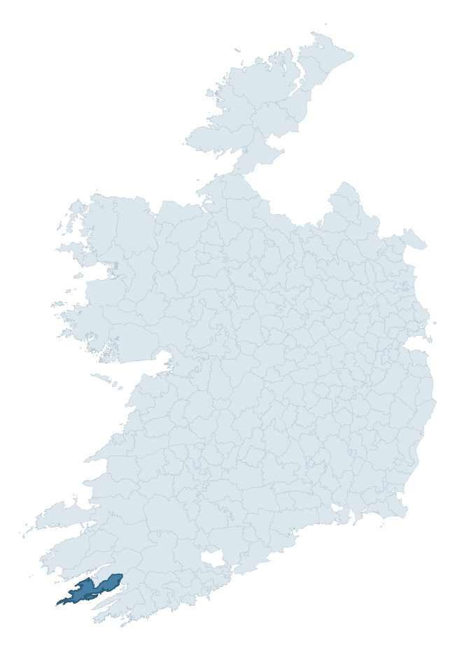
Where this barony sits in the Republic of Ireland
Geology and preservation
Bedrock geology shapes the landscape long before any settlement begins — controlling soil drainage, agricultural potential, the survival of upstanding monuments, and the preservation of buried archaeology. The figures below come from the Geological Survey Ireland 1:100,000 bedrock map.
The bedrock underlying Bear is predominantly sandstone (96% of the barony by area), laid down during the Devonian period (96% by area, around 419 to 359 million years ago). Sandstone weathers to free-draining, moderately fertile soils that supported Early Medieval ringfort agriculture and later manorial estates. The rock itself is a major source of building stone — visible in churches, tower houses, and farm buildings across the barony's historic landscape. The single largest mapped unit is the Caha Mountain Formation (70% of the barony's bedrock).
Rock type composition
Largest mapped unit: Caha Mountain Formation (70% of the barony)
Placename evidence
Logainm records 31 heritage-diagnostic placenames for Bear, drawn from townland and civil-parish names across the barony. The dominant stratum is Early Christian ecclesiastical — cill-, teampall-, and domhnach-prefixed names that record the dense network of early church foundations established between the fifth and tenth centuries. The leading diagnostic roots are cill- (19 — church), ráth- (4 — earthen ringfort), and cathair- (3 — stone fort). This is broadly in line with the ROI average of 30.7 heritage placenames per barony. The presence of multiple heritage strata side by side indicates layered occupation of the landscape across successive prehistoric and historic periods. Logainm records 250 placenames for Bear (predominantly townland names). Of these, 31 (12%) carry one of the diagnostic Gaelic roots tracked above; the remainder draw on more generic landscape vocabulary that does not encode a heritage period.
Pre-Christian / Early Medieval Defensive
| Root | Count | Meaning |
|---|---|---|
| ráth- | 4 | earthen ringfort |
| cathair- | 3 | stone fort |
| caiseal- | 2 | stone ringfort |
| dún- | 1 | hilltop or promontory fort |
Early Christian Ecclesiastical
| Root | Count | Meaning |
|---|---|---|
| cill- | 19 | church (early) |
| díseart- | 1 | hermitage |
Burial, Ritual, and Norse-Contact
| Root | Count | Meaning |
|---|---|---|
| carn- | 1 | cairn |
Other baronies in Cork
- Condons And Clangibbon
- Carbery West (west Division)
- Barretts
- Duhallow
- Fermoy
- Kerrycurrihy
- Kinalea
- Carbery East (west Division)
- Burren — Clare
- Fermoy
See all 280 baronies in the Republic of Ireland Heritage Tool.

Explore further
Grounding History: 10 Maps of Northern Ireland’s Past
If you’re interested in Irish heritage more widely, the companion report for Northern Ireland brings together the analysis of all 462 NI wards into one place through 10 high-quality maps — covering monument density, archaeological periods, placename heritage, terrain, wetland, and the historic landscape at first survey. Take a look.
About this profile
Click any section below to expand.
What is a barony?
A barony is a historic administrative unit in Ireland, broadly equivalent to an English hundred. The 280 baronies used here are from the OSi 2019 National Statutory Boundaries (generalised 20m), covering the 26 counties of the Republic of Ireland. Baronies derive from the Norman period, were formalised in the 17th century, and have not been redrawn for statistical purposes. They vary enormously in area, from compact urban baronies in Dublin to vast upland baronies in Connacht, and should not be compared by raw site count without accounting for area differences.
What counts as a site?
This profile combines three distinct heritage registers, each with its own definition of what constitutes a recordable site:
- Archaeological sites (NMS). The National Monuments Service Sites and Monuments Record (SMR) catalogues every known archaeological monument or site of archaeological interest in the Republic, from prehistoric burial mounds and ringforts to medieval churches and post-medieval defensive works. Inclusion does not require legal protection — only that the site has been identified, surveyed, and assessed as having archaeological value. A separate subset of these sites lies within a recorded protection zone, which gives them statutory protection under the National Monuments Acts.
- Listed buildings (NIAH). The National Inventory of Architectural Heritage records buildings of architectural, historical, archaeological, artistic, cultural, scientific, social, or technical interest. Each surveyed structure is appraised on a five-tier scale: International, National, Regional, Local, and Record-Only. The NIAH appraisal is informational rather than strictly statutory, but it underpins local-authority Record of Protected Structures (RPS) listings.
- Heritage placenames (Logainm). Logainm is the authoritative database of Irish placenames maintained by the Placenames Branch. This profile applies a heritage-diagnostic classifier to the Irish-language form of each townland name, flagging roots that signal defensive sites (ráth-, lios-, dún-, caiseal-, cathair-), ecclesiastical foundations (cill-, teampall-, domhnach-, mainistir-), prehistoric burial-ritual features (tuaim-, carn-, leaba-), or Norse-contact settlement (gall-). Townlands without one of these diagnostic roots are not flagged here — they may still carry historical significance, but that significance is not encoded in the name itself.
Editorial principles
The narrative sections of this profile follow several explicit principles:
- Evidential. Every claim about this barony’s heritage character is anchored in the underlying register data. Where a site count, a placename count, or a percentile rank is cited, it is computed from the source datasets at export time, not estimated.
- Comparative. Counts and metrics are reported alongside their percentile rank against the other 279 ROI baronies. A barony with 50 ringforts in absolute terms could be unusually high or unusually low depending on its size and regional context; percentile ranking removes that ambiguity.
- Transparent on limits. Where a register has known coverage gaps, survey biases, or data-quality issues that affect this barony’s figures, the profile flags them rather than presenting the numbers as definitive.
- No interpretation beyond what the data supports. The narrative does not speculate about historical events, social dynamics, or cultural meaning beyond what the recorded heritage and placename evidence directly attests.
Data caveats and limits
- NMS Sites and Monuments Record is the product of survey campaigns conducted at different intensities across different counties and decades. Some baronies have been surveyed more thoroughly than others, and absolute counts should be read in that light. Sites destroyed by development before survey are typically not represented; sites in heavily forested or upland terrain are sometimes under-recorded.
- NIAH coverage is broadly complete for the Republic of Ireland but the survey was conducted on a rolling county-by-county basis, and the most recent appraisal date varies. Buildings demolished or substantially altered after their original survey may still appear in the register; conversely, recent buildings of merit may not yet have been appraised.
- Logainm classification applies a deliberately conservative pattern-matching approach to the Irish-language townland forms. The classifier prioritises true positives over recall: a townland may carry a heritage signal that the classifier doesn’t recognise, particularly where the diagnostic root has been heavily anglicised or where the townland name draws on a less common term. The 60,000+ townland records and ~9,800 classified placenames give a substantial signal at barony scale, but individual townland names should be checked against Logainm directly for definitive interpretation.
- Period attribution. The chronological distribution reflects only those NMS sites that carry a recognised period attribution in the source data. Sites listed as “Unknown” period are excluded from the dated subset.
- Boundary changes. Some baronies have undergone minor boundary adjustments since their 19th-century definition; the OSi 2019 generalised boundaries used here are the current statutory definition and may differ slightly from historical maps in border areas.
- Bedrock geology is mapped at 1:100,000 scale, which means local variation within a barony — small pockets of different rock type, mineral veins, alluvium overlying bedrock — is generalised. The dominant-system and rocktype figures are area-weighted, so a barony reading “70% Carboniferous limestone” may still contain small but archaeologically important pockets of older or younger rock. Around 3% of GSI polygons do not match the lexicon and contribute no rocktype or system attribution.
Data sources
- National Monuments Service — Sites and Monuments Record (SMR) https://data.gov.ie/dataset/national-monuments-service-archaeological-survey-of-ireland
- National Inventory of Architectural Heritage (NIAH) https://data.gov.ie/dataset/national-inventory-of-architectural-heritage-niah-national-dataset
- Logainm — Placenames Database of Ireland https://www.logainm.ie/
- Ordnance Survey Ireland — National Statutory Barony Boundaries 2019 https://data-osi.opendata.arcgis.com/
- EURODEM — European Digital Elevation Model https://www.mapsforeurope.org/datasets/euro-dem
- ESA WorldCover https://esa-worldcover.org/en
- Geological Survey Ireland — 1:100,000 Bedrock Geology https://www.gsi.ie/en-ie/data-and-maps/Pages/Bedrock.aspx
Explore more: Search any of the 280 ROI baronies, browse by historical province, or read the methodology and data sources for the full Republic of Ireland Heritage Tool.