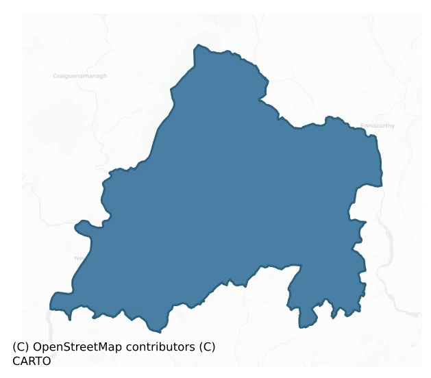
Bantry is a barony of County Wexford, in the historical province of Leinster (Irish: Beanntraí), covering 413 km² of land. The barony records 631 NMS archaeological sites and 479 NIAH listed buildings, placing it at around the 34th percentile among 280 ROI baronies for sites per km². This means it is in the lower half of all baronies for sites per km². Dated archaeological evidence runs from the Neolithic through to the Post Medieval, spanning 7 of 9 archaeological periods, placing the barony in the 42nd percentile among 280 ROI baronies for chronological depth. This means it is in the lower half of all baronies for chronological depth. The largest dated subset of recorded sites dates to the Early Bronze Age. Logainm flags 43 placenames in the barony as carrying a recognised heritage root; the largest share — around 44% — are names associated with early Christian church and monastic foundations.
Heritage at a glance
Percentile rankings throughout this profile compare each barony only against the other 279 Republic of Ireland baronies.
The recorded heritage of Bantry
The National Monuments Service Sites and Monuments Record (SMR) is the statutory inventory of archaeological sites for the Republic of Ireland, maintained by the Department of Tourism, Culture, Arts, Gaeltacht, Sport and Media. Sites recorded here include earthworks, ringforts, megalithic tombs, ecclesiastical remains, and post-medieval features; not every record is legally protected, but each is registered as a monument of archaeological interest.
The National Monuments Service records 631 archaeological sites in Bantry, putting it at the 34th percentile among 280 ROI baronies for sites per km². This means it is in the lower half of all baronies for sites per km². Of these, 555 (88%) fall within a recorded monument protection zone. The record is dominated by defensive sites — ringforts, enclosures, hillforts, and stone forts (294 sites, 47% of the total), with ecclesiastical sites forming a substantial secondary presence (140 sites, 22%). Ringfort – rath is the most prevalent type, making up 19% of the barony's recorded sites (118 records), broadly in line with the ROI average of 20% across all baronies where this type occurs. Ringfort – rath is an earthen ringfort enclosed by a bank and external ditch — the most common Early Medieval farmstead, broadly dated 500–1000 AD. Other significant types include Ringfort – unclassified (64) and Moated site (61). Ringfort – unclassified is a circular Early Medieval settlement enclosure where surviving evidence does not allow distinction between earthen and stone forms. Across the barony's 413 km², this gives a recorded density of 1.53 sites per km².
Most common monument types
Hover or tap a monument type to see its definition.
| Type | Count |
|---|---|
| Ringfort – rath an earthen ringfort enclosed by a bank and external ditch — the most common Early Medieval farmstead, broadly dated 500–1000 AD | 118 |
| Ringfort – unclassified a circular Early Medieval settlement enclosure where surviving evidence does not allow distinction between earthen and stone forms | 64 |
| Moated site | 61 |
| Church a building used for public Christian worship, of any date from c. 500 AD onwards | 40 |
| Ritual site – holy well a well or spring traditionally associated with a saint, often credited with healing properties; many trace earlier ritual origins but devotion is documented from the medieval period onwards | 34 |
| Enclosure a banked or ditched feature of uncertain type, used as a catch-all where the original function cannot be determined from surface evidence | 27 |
| Graveyard a burial area associated with a church, in use from the medieval period onwards | 26 |
| Graveslab a recumbent grave-marking slab, dated 1200–1700 AD | 26 |
Chronological distribution
The dated archaeological record for Bantry spans from the Neolithic through to the Post Medieval, with activity attested across 7 of 9 archaeological periods. Every period from earliest to latest is represented in the record — an unbroken sequence of dated activity across the full chronological span. Activity concentrates most heavily in the Early Bronze Age (121 sites, 35% of dated material), with the Early Medieval forming a secondary peak (94 sites, 27%). A further 120 recorded sites (26% of the overall NMS register for the barony) carry no period attribution — appearing as 'Unknown' in the bar chart below. This typically reflects either records that pre-date the standardised period vocabulary or sites awaiting specialist dating review, rather than a genuine absence of chronological evidence.
Sample of recorded monuments
Show 25 sample monuments (of 631 total)
A representative sample of 25 recorded monuments drawn from the barony’s 631 total NMS entries. Sites within a recorded monument protection zone and rarer site types are prioritised so the list shows a meaningful cross-section rather than only the most common type. Each entry shows the official Sites and Monuments Record reference number and the description published by the National Monuments Service.
Concentric enclosure
Situated towards the top of a gentle S-facing slope. The cropmark of a circular enclosure (diam. c. 30m) defined by a fosse feature is within a larger penannular enclosure (diam. c. 100m) also defined by a fosse feature…
Situated towards the top of a gentle S-facing slope. The cropmark of a circular enclosure (diam. c. 30m) defined by a fosse feature is within a larger penannular enclosure (diam. c. 100m) also defined by a fosse feature that is open W-NE. The features are visible on aerial photographs (MM (2) 34-6; (51) 28, 29, 34). The rath (WX025-048—-) is c. 100m to the SE.
The above description is derived from the published 'Archaeological Inventory of County Wexford' (Dublin: Stationery Office, 1996). In certain instances the entries have been revised and updated in the light of recent research.
Compiled by: Michael Moore
Date of upload/revision: 3 July, 2012
Amended: 25 April, 2014
Religious house – Augustinian canons
A monastery of the Order of St. Victor was founded by Gerald de Prendergast in 1230 and subsequently attached to St Thomas' in Dublin at which time it became Augustinian (Lewis 1837, vol. 1, 604). Nothing is known of…
A monastery of the Order of St. Victor was founded by Gerald de Prendergast in 1230 and subsequently attached to St Thomas' in Dublin at which time it became Augustinian (Lewis 1837, vol. 1, 604). Nothing is known of its subsequent history except that it was still owned by St. Thomas’ at the Suppression in 1541-2 (White 1943, 44-5). In the later 16th century it was owned by various people, including Sir Henry Wallop after 1595 (Gwynn and Hadcock 1970, 175). In 1641 Sir Gerard Lowther, a Protestant, owned a thousand acres and a ‘fair stone house’ in St. Johns (Simington 1953, 255). The location is not absolutely known, but John O’Donovan writing about 1840 (O’Flanagan 1933, vol, 2, 255) thought that it was on the site of St. John’s House, an early 19th century mansion, where there is a 17th century house (WX026-004002-). This is in the N-S Slaney valley, with the river c. 100m to the E. Nothing of the medieval structure is visible at ground level. Archaeological testing (17E0279) by A. McCarthy c. 150m to the N at the closest point produced no related material (excavations.ie 2017:532).
The above description is derived from the published 'Archaeological Inventory of County Wexford' (Dublin: Stationery Office, 1996). In certain instances the entries have been revised and updated in the light of recent research.
Compiled by: Michael Moore
Date of upload/revision: 12 July 2012
Amended: 4 February 2022
Town defences
The town of New Ross is situated on a steep W-facing slope which runs down to the River Barrow/Nore. The walls enclosed c. 105 acres and they were commenced c. 1265 according to a poem which describes the different…
The town of New Ross is situated on a steep W-facing slope which runs down to the River Barrow/Nore. The walls enclosed c. 105 acres and they were commenced c. 1265 according to a poem which describes the different trades working in digging the fosse on different days, with the ladies working on Sunday (Hore 1900-10, vol. 1, 58-60). However, according to a charter of 1374, New Ross appears to be still unwalled (ibid, 202 4). Murage was collected down to 1830 but the most intense period was 1374-1420 (Thomas 1992, vol. 2, 176).
The town wall ran from the river at the N, up Goat Lane to the Maiden Gate, the only survivor of four original gates. Only one side of the entrance passage with a portcullis niche and evidence of groin vaulting survives. The gate was conserved in 2012 when extraneous fabric was removed and the original structure secured with a lime mortar. The work was archaeologically monitored (E004449) by N. Gregory but no medieval material was encountered in any ground works (excavations.ie 2012:631). From there the wall ran along the back of properties to the W of Haughton Place, and along Nunnery Lane to a mural tower. This is a semicircular tower of mortared shale surviving to two storeys (H c. 5m). Each storey had three windows and the first storey had four smaller slot windows while the ground floor has one. Archaeological testing (95E00086) connected with a drainage scheme identified part of the fosse outside the town wall close to the tower (McCutcheon…
Religious house – Fratres Cruciferi
A priory of Fratres Cruciferi was founded c. 1195, probably by William Marshall. They were expelled during the 13the century after one of the brothers murdered a townsman. As a result of the expulsion the town was…
A priory of Fratres Cruciferi was founded c. 1195, probably by William Marshall. They were expelled during the 13the century after one of the brothers murdered a townsman. As a result of the expulsion the town was placed under a papal interdict that was not lifted until 1435 (Hore 1900-11, vol. 1, 94-7). By 1295 their property had passed to the Franciscans who had been in the town from c. 1256. The Franciscan house was known as the priory of St. Saviour’s, and some of the duty paid by ships in the port were awarded to it. The friars ensured that their house was enclosed within the walls. At the Suppression in 1541 the church and kitchens were ruinous but there was a cemetery and two small gardens. The friars were finally driven out in 1558 and the last of the buildings removed in 1732. The Franciscan priory was located in the Priory Lane/ Priory St. area and some grave covers, now at St Mary's (WX029-013002-), were recovered from the site. Archaeological testing (07E0968) produced no archaeological material, but did identify part of the town wall (Scully 2010). (Hore, 1900, vol. 1, 94-9; Gwynn and Hadcock 1970, 215, 257)
The above description is derived from the published 'Archaeological Inventory of County Wexford' (Dublin: Stationery Office, 1996). In certain instances the entries have been revised and updated in the light of recent research.
Compiled by: Michael Moore
Date of upload/revision: 2 August, 2012
Religious house – Augustinian friars
Augustinian Friars were established in New Ross in the late 13th or early 14th century. Traditionally, it is thought to have been founded by William de la Roche in 1320, but they were in the town before that date (Hore…
Augustinian Friars were established in New Ross in the late 13th or early 14th century. Traditionally, it is thought to have been founded by William de la Roche in 1320, but they were in the town before that date (Hore 1900, vol. 1, 100), and it is suggested that Gilbert de Clare may have been the founder (Butler 1976, 81-2). In 1484 the New Ross house adopted the Observant reforms. It was suppressed in 1540 when the priory consisted of a church, belfry, hall and other buildings, and a cemetery. The exact location is uncertain but it is thought to have been on South St., where St Michael's Theatre now stands. Some dressed stonework from it was in an entry to a yard on South St. but it cannot be traced now. The Augustinians returned to New Ross in the early 18th century, and from 1725 began to establish themselves on High Hill where they built a church in 1836 (Butler 1976, 94-8). (Gwynn and Hadcock 1970, 301; Butler 1976, 80-90; 94-101)
The above description is derived from the published 'Archaeological Inventory of County Wexford' (Dublin: Stationery Office, 1996). In certain instances the entries have been revised and updated in the light of recent research.
Compiled by: Michael Moore
Date of upload/revision: 2 August, 2012
Hospital
St Saviour's church (WX029-013074-) was close to the site where Thomas Gregory founded a Hospital of the Holy Trinity probably in the middle of the 16th century, although the first charter is dated 1587 when it is…
St Saviour's church (WX029-013074-) was close to the site where Thomas Gregory founded a Hospital of the Holy Trinity probably in the middle of the 16th century, although the first charter is dated 1587 when it is granted the chapels of St. Michael’s and St. Saviour’s. The hospital is on the site now occupied by the Trinity Houses on South St. These were built in 1772 as part of the charity which continued down to the present. Archaeological testing (97E0250) in the vicinity failed to reveal anything other than a pit (WX029-013013-) (Sullivan 1998). (Hore 1900, vol. 1, 80 84, 267-8; Gwynn and Hadcock 1970, 355)
The above description is derived from the published 'Archaeological Inventory of County Wexford' (Dublin: Stationery Office, 1996). In certain instances the entries have been revised and updated in the light of recent research.
Compiled by: Michael Moore
Date of upload/revision: 2 August, 2012
Fortification
Marked faintly as a D-shaped enclosure (dims. c. 70m E-W; c. 60m N-S) curtailed by an E-W lane at S and described as the site of Fort Garrett on the 1839 ed. of the OS 6-inch map. It is situated on a slight W-facing…
Marked faintly as a D-shaped enclosure (dims. c. 70m E-W; c. 60m N-S) curtailed by an E-W lane at S and described as the site of Fort Garrett on the 1839 ed. of the OS 6-inch map. It is situated on a slight W-facing slope but it is not visible at ground level in pasture. The castle (WX030-013001-) is at the same location.
The above description is derived from the published 'Archaeological Inventory of County Wexford' (Dublin: Stationery Office, 1996). In certain instances the entries have been revised and updated in the light of recent research.
Compiled by; Michael Moore
Date of upload/revision: 16 August, 2012
Four poster
Located on top of a broad low hill. Four orthostats enclose an area of c. 4.25-4.9m x 3.4-3.7m with an outlier (dims. 0.85m x 0.4m; H 0.8m) 4.15m to the SW and a quartz block (dims. 1.7m x 1.25m) lying prone between the…
Located on top of a broad low hill. Four orthostats enclose an area of c. 4.25-4.9m x 3.4-3.7m with an outlier (dims. 0.85m x 0.4m; H 0.8m) 4.15m to the SW and a quartz block (dims. 1.7m x 1.25m) lying prone between the quadrangle and the outlier. The NW stone (dims. 0.75m x 0.6m; H 1.6m) in the quadrangle is the tallest. The other stones are: at NE (dims. 0.95mx 0.35m; H 0.85m); at SE (dims. 0.9m x 0.2m; H 0.7m); at SW (dims. 0.9m x 0.6m; H 1.4m) (O’Nualláin 1984b, 71). (Grattan Flood 1912, 15-16; Browne 2002-03)
The above description is derived from the published 'Archaeological Inventory of County Wexford' (Dublin: Stationery Office, 1996). In certain instances the entries have been revised and updated in the light of recent research.
Compiled by: Michael Moore
Date of upload/revision: 16 August, 2012
Slab-lined burial
Located towards the bottom a an E-facing slope on a low NW-SE spur with a small N-S stream c. 130m to the E and a small NW-SE stream c. 240m to the S. A stone-lined cist (dims. c. 1.8m x 0.6m; D 0.6m) but apparently…
Located towards the bottom a an E-facing slope on a low NW-SE spur with a small N-S stream c. 130m to the E and a small NW-SE stream c. 240m to the S. A stone-lined cist (dims. c. 1.8m x 0.6m; D 0.6m) but apparently without any human remains or pottery was discovered in ploughing and reported to the National Museum of Ireland in 1934. A sherd of late Medieval pottery was recovered nearby, but the discovery was not investigated further. (SMR file; Cahill and Sikora, 2011, vol. 2, 457-8)
Compiled by: Michael Moore
Date of upload: 15 August, 2012
Castle – motte and bailey
Situated just off the E edge of a plateau and on the W side of a small N-S valley with a stream c. 20m to the E. The castle of Old Ross is first mentioned in 1233 (Hore 1900-11, vol. 1, 2) and repairs to the palisade…
Situated just off the E edge of a plateau and on the W side of a small N-S valley with a stream c. 20m to the E. The castle of Old Ross is first mentioned in 1233 (Hore 1900-11, vol. 1, 2) and repairs to the palisade were carried out in 1281 (ibid. 15). The motte is a flat topped earthen mound (diam. of top 8-9m; diam. of base 35m E-W; H 5.8m at W to 7.7m at E) with some mature deciduous trees and scrub. It has no clearly visible fosse, but soil removal and slippage in the 1970s showed construction layers within the core of the mound (Culleton and Colfer 1974-5). A bailey may have existed to the S (dims. c. 50m N-S; c. 30m E-W) and an enclosure (diam. c. 30m) described as the ‘Site of Castle’ is marked on the 1839 ed. of the OS 6-inch map in this location. The church site (WX030-053001-) is c. 450m to the SE.
The above description is derived from the published 'Archaeological Inventory of County Wexford' (Dublin: Stationery Office, 1996). In certain instances the entries have been revised and updated in the light of recent research.
Compiled by: Michael Moore
Date of upload/revision: 16 August, 2012
This monument is subject to a preservation order made under the National Monuments Acts 1930 to 2014 (PO no. 2/1974).
Enclosure – large enclosure
Marked as a large enclosure described as 'Rathlyhar' on the 1839 and 1925 eds of the OS 6-inch map and situated just E of the top of a broad, low hill. This is a circular area (diam. c. 110m) planted in a cereal crop…
Marked as a large enclosure described as 'Rathlyhar' on the 1839 and 1925 eds of the OS 6-inch map and situated just E of the top of a broad, low hill. This is a circular area (diam. c. 110m) planted in a cereal crop and defined by an earthen bank (Wth 3.5-5m; int. H 1.3m; ext. H 1.6- 1.8m) and hedge. There are slight traces of an outer fosse (Wth c. 6-8m) visible as a slight dip down towards the base of the bank externally. There is an entrance (Wth of top 5.2m; Wth of base 2m), perhaps modern, at the W point.
The above description is derived from the published 'Archaeological Inventory of County Wexford' (Dublin: Stationery Office, 1996). In certain instances the entries have been revised and updated in the light of recent research.
Compiled by: Michael Moore
Date of upload/revision: 15 August, 2012
Megalithic tomb – portal tomb
Situated on a slight rise on a S-facing slope at the S foot of Bree Hill. This is a complete portal tomb facing E and consists of two portal stones (H 2.1m; 1.85m), two sidestones, a backstone, sillstone and a large…
Situated on a slight rise on a S-facing slope at the S foot of Bree Hill. This is a complete portal tomb facing E and consists of two portal stones (H 2.1m; 1.85m), two sidestones, a backstone, sillstone and a large roofstone (dims. 3.8m x 3.6m; T 0.75m). (Borlase 1897, vol. 2, 416 17; Grattan Flood 1912, 13 14; Ó Nualláin 1983, 103)
The above description is derived from the published 'Archaeological Inventory of County Wexford' (Dublin: Stationery Office, 1996). In certain instances the entries have been revised and updated in the light of recent research.
Compiled by: Michael Moore
Date of upload/revision: 27 August, 2012
Memorial stone
A memorial stone (dims. c. 1.17m x 0.41-0.56m), now built into a wall of Adamstown House (WX031-056—-) c. 500m to the SE, was originally over the gateway of the bawn (WX031-019003-) at Adamstown tower house…
A memorial stone (dims. c. 1.17m x 0.41-0.56m), now built into a wall of Adamstown House (WX031-056—-) c. 500m to the SE, was originally over the gateway of the bawn (WX031-019003-) at Adamstown tower house (WX031-019001-). It has the Devereux crest surrounded by a ribbon with the raised Latin inscription ‘S. Nicolai Devereux Militis’ (Sir Nicholas Devereux, knight) on it at its broader end. The rest of the stone has the Latin inscription in raised gothic lettering ‘Orate pro animabus Nicholai Devereux, Militis, et Dominae Katrinae Power ejus uxoris qui hoc manerium condiderunt. A. Dni – 1556’ (Pray for the souls of Nicholas Devereux, Knight, and Lady Katherine Power, his wife, who built this manor – AD 1556) (Ffrench 1889a). The inscription is said to continue in lombardic lettering on the reverse side, which is now hidden in a wall, as: ‘IOC: cujus anime propitetur Deus’ (on whose souls may God have mercy) (Redmond 1887-8). Katherine was the daughter of Sir Richard Power of Curraghmore (WA008-005—-), Co. Waterford.
Compiled by: Michael Moore
Date of upload: 27 August, 2012
Cross – High cross
Situated on a rise in a low-lying landscape. St Abban's cross, a Latin cross in green stone (H c. 3.8m; Wth 0.58m; T 0.2m), is set in a rectangular base (dims of top 0.8m x 0.8m) buried in the ground (Harbison 1992,…
Situated on a rise in a low-lying landscape. St Abban's cross, a Latin cross in green stone (H c. 3.8m; Wth 0.58m; T 0.2m), is set in a rectangular base (dims of top 0.8m x 0.8m) buried in the ground (Harbison 1992, vol. 1, 9) and a decorated Romanesque fragment recorded from the graveyard (Leask 1955, vol. 1, 163) but no longer traceable are the only indications of the early church of St. Abán (WX031-023001-).
Compiled by: Michael Moore
Date of upload: 27 August, 2012
Standing stone – pair
Located towards the top of the SE-facing slope of a small NE-SW ridge. A pair of quartz bearing granite standing stones are placed 4.2m apart in a line running NNE SSW. The N stone (dims. 0.8m x 0.45m; H 1m) is roughly…
Located towards the top of the SE-facing slope of a small NE-SW ridge. A pair of quartz bearing granite standing stones are placed 4.2m apart in a line running NNE SSW. The N stone (dims. 0.8m x 0.45m; H 1m) is roughly aligned NNE-SSW and flat-topped while the S stone has a rectangular cross-section (dims. 0.55 0.7m x 0.7m; H 1.35m) at the base but narrows to a point on a N-S ridge.
The above description is derived from the published 'Archaeological Inventory of County Wexford' (Dublin: Stationery Office, 1996). In certain instances the entries have been revised and updated in the light of recent research.
Compiled by: Michael Moore
Date of upload/revision: 27 August, 2012
Memorial stone (present location)
A memorial stone (dims. c. 1.17m x 0.41-0.56m), now built into an internal wall of Adamstown House (WX031-056—-), was originally over the gateway of the bawn (WX031-019003-) at Adamstown tower house (WX031-019001-),…
A memorial stone (dims. c. 1.17m x 0.41-0.56m), now built into an internal wall of Adamstown House (WX031-056—-), was originally over the gateway of the bawn (WX031-019003-) at Adamstown tower house (WX031-019001-), which is c. 500m to the NW. It has the Devereux crest surrounded by a ribbon with the raised Latin inscription ‘S. Nicolai Devereux Militis’ (Sir Nicholas Devereux, knight) on it at its broader end. The rest of the stone has the Latin inscription in raised gothic lettering ‘Orate pro animabus Nicholai Devereux, Militis, et Dominae Katrinae Power ejus uxoris qui hoc manerium condiderunt. A. Dni – 1556’ (Pray for the souls of Nicholas Devereux, Knight, and Lady Katherine Power, his wife, who built this manor – AD 1556) (Ffrench 1889). The inscription is said to continue in lombardic lettering on the reverse side, which is now hidden in a wall, as: ‘IOC: cujus anime propitetur Deus’ (on whose souls may God have mercy) (Redmond 1887-8). Katherine was the daughter of Sir Richard Power of Curraghmore (WA008-005—-), Co. Waterford.
Compiled by: Michael Moore
Date of upload: 27 August, 2012
Children's burial ground
Located on the NE-facing slope of a NE-SW ridge overlooking a slight col c. 200m to the NE with slightly higher ground further to the NE. A small grass-covered cairn of stones including quartz stones (dims 6m x 4m; H…
Located on the NE-facing slope of a NE-SW ridge overlooking a slight col c. 200m to the NE with slightly higher ground further to the NE. A small grass-covered cairn of stones including quartz stones (dims 6m x 4m; H 1m) was used as a children's burial ground according to a local tradition. It is known locally as Chrishavale – Chrish being derived from the Irish for cross, but the rest is obscure.
The above description is derived from the published 'Archaeological Inventory of County Wexford' (Dublin: Stationery Office, 1996). In certain instances the entries have been revised and updated in the light of recent research.
Compiled by: Michael Moore
Date of upload/revision: 31 August, 2012
Habitation site
Situated on a low ESE-WNW spur, c. 75m W of Ballyanne parish church (WX029-002001-). Archaeological testing (98E0137) recorded a drip gully and some post-holes representing a house, together with 12th -14th century…
Situated on a low ESE-WNW spur, c. 75m W of Ballyanne parish church (WX029-002001-). Archaeological testing (98E0137) recorded a drip gully and some post-holes representing a house, together with 12th -14th century pottery. (Moran 2000)
Compiled by: Michael Moore
Date of upload: 1 August, 2012
Cross-inscribed pillar
Located on a gentle W-facing slope. There is a cross-inscribed pillar (dims. 0.34m x 0.22m; H 0.9m) in the NE part of the graveyard (WX030-053002-) at Old Ross. On its SE face is a cross of single incised lines (H…
Located on a gentle W-facing slope. There is a cross-inscribed pillar (dims. 0.34m x 0.22m; H 0.9m) in the NE part of the graveyard (WX030-053002-) at Old Ross. On its SE face is a cross of single incised lines (H 0.45m; Wth 0.25m) with cross-bars on the terminals.
Compiled by: Michael Moore
Date of upload: 15 August, 2012
Cross – Churchyard cross (present location)
Two portions of an eight-sided cross from Moneyhore church site (WX025-043001-) are at a nearby farmyard. One piece (L c. 0.75m) has 8 facets (Wth 12-13cm; L 52-54cm) but is probably unfinished with a roughly square…
Two portions of an eight-sided cross from Moneyhore church site (WX025-043001-) are at a nearby farmyard. One piece (L c. 0.75m) has 8 facets (Wth 12-13cm; L 52-54cm) but is probably unfinished with a roughly square base (38cm x 35cm; H 15-20cm). Another portion built into the wall of an outhouse (L 67cm) has a pyramid stop. Both fragments are probably from the same late medieval cross.
Compiled by: Michael Moore
Date of upload; 3 July, 2012
Cross – Churchyard cross
Two portions of an eight-sided cross from Moneyhore church site are at a nearby farmyard (WX025-058—-). One piece (L c. 0.75m) has 8 facets (Wth 12-13cm; L 52-54cm) but is probably unfinished with a roughly square…
Two portions of an eight-sided cross from Moneyhore church site are at a nearby farmyard (WX025-058—-). One piece (L c. 0.75m) has 8 facets (Wth 12-13cm; L 52-54cm) but is probably unfinished with a roughly square base (38cm x 35cm; H 15-20cm). Another portion built into the wall of an outhouse (L 67cm) has a pyramid stop. Both fragments are probably from the same late medieval cross.
Compiled by: Michael Moore
Date of upload: 3 July, 2012
Cross-inscribed stone
A small cross inscribed slab (dims 0.4m x 0.33m; T 5cm) was found on the site of Killell church (WX036-012001-) and graveyard (WX036-012002-), and it is now in the Wexford County Museum in Enniscorthy (WX020-031016-)…
A small cross inscribed slab (dims 0.4m x 0.33m; T 5cm) was found on the site of Killell church (WX036-012001-) and graveyard (WX036-012002-), and it is now in the Wexford County Museum in Enniscorthy (WX020-031016-) (Kelly 1988, 96, fig. 31d).
Compiled by: Michael Moore
Date of upload: 7 November, 2012
Bridge
The first bridge was a wooden structure built shortly before 1210. Stanihurst, writing in 1586, states that 'diverse of the poales, logs and stakes with which the bridge was underpropt, sticke to this daie in the water'…
The first bridge was a wooden structure built shortly before 1210. Stanihurst, writing in 1586, states that 'diverse of the poales, logs and stakes with which the bridge was underpropt, sticke to this daie in the water' (Hore 1900-11, vol. 1, 52). In 1313 the town received a grant of pontage in order to build a new bridge between Ross and Rosbercon (ibid. 178). The bridge was destroyed in the siege of the town in 1643 and it was not rebuilt until 1796 (ibid. 112). (Bradley and King 1990, 106)
Compiled by: Michael Moore
Date of upload: 7 August, 2012
Burial
In October 1951 human remains were discovered during the construction of a new Garda Station at Cross Lane, New Ross. According to the Garda report the remains were found in quicklime in a shallow grave. The remains…
In October 1951 human remains were discovered during the construction of a new Garda Station at Cross Lane, New Ross. According to the Garda report the remains were found in quicklime in a shallow grave. The remains were found on the site of the old Bridewell or gaol of New Ross. As the disposition of the burial suggested that it was modern, it was not investigated the NMI. The remains were not acquired. (Cahill and Sikora 2011, vol. 2, 523)
Compiled by: M. Cahill and M. Sikora
Date of upload: 7 August, 2012
Ringfort – rath
Situated on a NE-facing slope in the foothills of White Mountain. This is a circular area (diam. 43.5m NW-SE; 41.5m NE-SW) defined by a low earthen bank (Wth 3.5-4.5m; int. H 0.2-0.8m; ext. H 0.7-1.4m), with external…
Situated on a NE-facing slope in the foothills of White Mountain. This is a circular area (diam. 43.5m NW-SE; 41.5m NE-SW) defined by a low earthen bank (Wth 3.5-4.5m; int. H 0.2-0.8m; ext. H 0.7-1.4m), with external stone cladding E-S. There are some gaps in the perimeter at W but the original entrance cannot be identified, and there is no visible fosse. It is overlain by a NE-SW field wall that zig-zags across the site; it is planted with coniferous trees to the SE and is covered in scrub to the NW of this feature. Archaeological testing (07E0075) immediately to the N uncovered linear stone features that may be elements of a field system (Tierney and Rooney 2007).
The above description is derived from the published 'Archaeological Inventory of County Wexford' (Dublin: Stationery Office, 1996). In certain instances the entries have been revised and updated in the light of recent research.
Compiled by: Michael Moore
Date of upload/revision: 25 June, 2012
Listed buildings
The National Inventory of Architectural Heritage (NIAH) is a state survey appraising buildings of architectural, historical, archaeological, artistic, cultural, scientific, social, or technical interest. Each surveyed structure receives a rating from International (the highest, for buildings of European importance) through National, Regional, Local, and Record-Only.
The National Inventory of Architectural Heritage records 479 listed buildings in Bantry, placing it in the top 5% of ROI baronies for listed-building density. The highest-graded structures include 4 of National significance. The Republic holds 937 National-graded buildings in total, so this barony accounts for around 0% of the national total. Construction dates concentrate most heavily in the Victorian (1830-1900) period. The most-recorded building type is house (172 examples, 36% of the listed stock).
Terrain and environment
Mean elevation across the barony is 176m — the 94th percentile among 280 ROI baronies for elevation. This means it is in the top tenth of all baronies for elevation. This is a relatively elevated landscape by ROI standards. Elevation matters for heritage because higher-altitude baronies typically favour defensive monuments — ringforts and hilltop forts placed on prominent ground — while lowland baronies are more likely to carry the dense settlement and church networks of intensive agricultural landscapes. The barony reaches 702m at its highest point — a vertical span of more than 526m within its boundary, indicating significant topographic diversity. Mean slope is 9.6° — the 97th percentile among 280 ROI baronies for slope. This means it is in the top tenth of all baronies for slope. This is consistently steep terrain by ROI standards, the kind of landscape that tends to preserve upstanding archaeological features well. Slope is a key control on both land use and archaeological preservation: steep ground resists ploughing and tends to preserve earthworks intact, while gentle slopes favour intensive cultivation that damages or destroys surface archaeology over time. The Topographic Wetness Index averages 8.7, the 2nd percentile among 280 ROI baronies for wetness. This means it is in the bottom tenth of all baronies for wetness. This is well-drained ground by ROI standards — typical of upland or steeply-sloping country that sheds water rapidly. Drainage matters for heritage because poorly-drained ground preserves organic archaeology (wooden trackways, leather, textiles, and on rare occasions human remains) far better than free-draining soil; well-drained ground favours arable use but destroys organic material rapidly. The land cover is dominated by improved grassland (74%) and woodland (25%). In overall character, this is an upland landscape of steep, elevated terrain, with land use dominated by improved grassland.
Terrain measurements
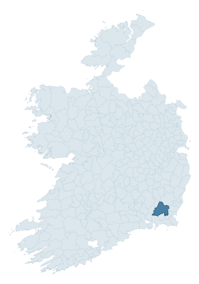
Where this barony sits in the Republic of Ireland
Geology and preservation
Bedrock geology shapes the landscape long before any settlement begins — controlling soil drainage, agricultural potential, the survival of upstanding monuments, and the preservation of buried archaeology. The figures below come from the Geological Survey Ireland 1:100,000 bedrock map.
The bedrock underlying Bantry is predominantly slate (35% of the barony by area), laid down during the Ordovician period (96% by area, around 485 to 444 million years ago). Slate weathers to thin upland soils but provides high-value building and roofing stone, which often shows in surviving 19th-century rural and ecclesiastical architecture. A substantial secondary geology of rhyolite (28%) and slates (21%) adds further variety to the underlying landscape. The single largest mapped unit is the Campile Formation (28% of the barony's bedrock). With 8 distinct rock types mapped, the barony sits in the top third of ROI baronies for geological diversity (83rd percentile) — typically a sign of complex tectonic history or coastal mosaics of differing rock units.
Rock type composition
Largest mapped unit: Campile Formation (28% of the barony)
Placename evidence
Logainm records 43 heritage-diagnostic placenames for Bantry, drawn from townland and civil-parish names across the barony. The dominant stratum is Early Christian ecclesiastical — cill-, teampall-, and domhnach-prefixed names that record the dense network of early church foundations established between the fifth and tenth centuries. The leading diagnostic roots are ráth- (9 — earthen ringfort), cill- (9 — church), and dún- (6 — hilltop fort or promontory fort). This is above the ROI average of 30.7 heritage placenames per barony. The presence of multiple heritage strata side by side indicates layered occupation of the landscape across successive prehistoric and historic periods. Logainm records 262 placenames for Bantry (predominantly townland names). Of these, 43 (16%) carry one of the diagnostic Gaelic roots tracked above; the remainder draw on more generic landscape vocabulary that does not encode a heritage period.
Pre-Christian / Early Medieval Defensive
| Root | Count | Meaning |
|---|---|---|
| ráth- | 9 | earthen ringfort |
| dún- | 6 | hilltop or promontory fort |
Early Christian Ecclesiastical
| Root | Count | Meaning |
|---|---|---|
| cill- | 9 | church (early) |
| teampall- | 6 | church (later medieval) |
| gráinseach- | 3 | monastic farm / grange |
| tobar- | 1 | holy well |
Burial, Ritual, and Norse-Contact
| Root | Count | Meaning |
|---|---|---|
| tuaim- | 6 | burial mound |
| carn- | 2 | cairn |
| leacht- | 1 | grave monument |
| gall- | 1 | foreigner — Norse settlement marker |
Other baronies in Wexford
About this profile
Click any section below to expand.
What is a barony?
A barony is a historic administrative unit in Ireland, broadly equivalent to an English hundred. The 280 baronies used here are from the OSi 2019 National Statutory Boundaries (generalised 20m), covering the 26 counties of the Republic of Ireland. Baronies derive from the Norman period, were formalised in the 17th century, and have not been redrawn for statistical purposes. They vary enormously in area, from compact urban baronies in Dublin to vast upland baronies in Connacht, and should not be compared by raw site count without accounting for area differences.
What counts as a site?
This profile combines three distinct heritage registers, each with its own definition of what constitutes a recordable site:
- Archaeological sites (NMS). The National Monuments Service Sites and Monuments Record (SMR) catalogues every known archaeological monument or site of archaeological interest in the Republic, from prehistoric burial mounds and ringforts to medieval churches and post-medieval defensive works. Inclusion does not require legal protection — only that the site has been identified, surveyed, and assessed as having archaeological value. A separate subset of these sites lies within a recorded protection zone, which gives them statutory protection under the National Monuments Acts.
- Listed buildings (NIAH). The National Inventory of Architectural Heritage records buildings of architectural, historical, archaeological, artistic, cultural, scientific, social, or technical interest. Each surveyed structure is appraised on a five-tier scale: International, National, Regional, Local, and Record-Only. The NIAH appraisal is informational rather than strictly statutory, but it underpins local-authority Record of Protected Structures (RPS) listings.
- Heritage placenames (Logainm). Logainm is the authoritative database of Irish placenames maintained by the Placenames Branch. This profile applies a heritage-diagnostic classifier to the Irish-language form of each townland name, flagging roots that signal defensive sites (ráth-, lios-, dún-, caiseal-, cathair-), ecclesiastical foundations (cill-, teampall-, domhnach-, mainistir-), prehistoric burial-ritual features (tuaim-, carn-, leaba-), or Norse-contact settlement (gall-). Townlands without one of these diagnostic roots are not flagged here — they may still carry historical significance, but that significance is not encoded in the name itself.
Editorial principles
The narrative sections of this profile follow several explicit principles:
- Evidential. Every claim about this barony’s heritage character is anchored in the underlying register data. Where a site count, a placename count, or a percentile rank is cited, it is computed from the source datasets at export time, not estimated.
- Comparative. Counts and metrics are reported alongside their percentile rank against the other 279 ROI baronies. A barony with 50 ringforts in absolute terms could be unusually high or unusually low depending on its size and regional context; percentile ranking removes that ambiguity.
- Transparent on limits. Where a register has known coverage gaps, survey biases, or data-quality issues that affect this barony’s figures, the profile flags them rather than presenting the numbers as definitive.
- No interpretation beyond what the data supports. The narrative does not speculate about historical events, social dynamics, or cultural meaning beyond what the recorded heritage and placename evidence directly attests.
Data caveats and limits
- NMS Sites and Monuments Record is the product of survey campaigns conducted at different intensities across different counties and decades. Some baronies have been surveyed more thoroughly than others, and absolute counts should be read in that light. Sites destroyed by development before survey are typically not represented; sites in heavily forested or upland terrain are sometimes under-recorded.
- NIAH coverage is broadly complete for the Republic of Ireland but the survey was conducted on a rolling county-by-county basis, and the most recent appraisal date varies. Buildings demolished or substantially altered after their original survey may still appear in the register; conversely, recent buildings of merit may not yet have been appraised.
- Logainm classification applies a deliberately conservative pattern-matching approach to the Irish-language townland forms. The classifier prioritises true positives over recall: a townland may carry a heritage signal that the classifier doesn’t recognise, particularly where the diagnostic root has been heavily anglicised or where the townland name draws on a less common term. The 60,000+ townland records and ~9,800 classified placenames give a substantial signal at barony scale, but individual townland names should be checked against Logainm directly for definitive interpretation.
- Period attribution. The chronological distribution reflects only those NMS sites that carry a recognised period attribution in the source data. Sites listed as “Unknown” period are excluded from the dated subset.
- Boundary changes. Some baronies have undergone minor boundary adjustments since their 19th-century definition; the OSi 2019 generalised boundaries used here are the current statutory definition and may differ slightly from historical maps in border areas.
- Bedrock geology is mapped at 1:100,000 scale, which means local variation within a barony — small pockets of different rock type, mineral veins, alluvium overlying bedrock — is generalised. The dominant-system and rocktype figures are area-weighted, so a barony reading “70% Carboniferous limestone” may still contain small but archaeologically important pockets of older or younger rock. Around 3% of GSI polygons do not match the lexicon and contribute no rocktype or system attribution.
Data sources
- National Monuments Service — Sites and Monuments Record (SMR) https://data.gov.ie/dataset/national-monuments-service-archaeological-survey-of-ireland
- National Inventory of Architectural Heritage (NIAH) https://data.gov.ie/dataset/national-inventory-of-architectural-heritage-niah-national-dataset
- Logainm — Placenames Database of Ireland https://www.logainm.ie/
- Ordnance Survey Ireland — National Statutory Barony Boundaries 2019 https://data-osi.opendata.arcgis.com/
- EURODEM — European Digital Elevation Model https://www.mapsforeurope.org/datasets/euro-dem
- ESA WorldCover https://esa-worldcover.org/en
- Geological Survey Ireland — 1:100,000 Bedrock Geology https://www.gsi.ie/en-ie/data-and-maps/Pages/Bedrock.aspx
Explore more: Search any of the 280 ROI baronies, browse by historical province, or read the methodology and data sources for the full Republic of Ireland Heritage Tool.