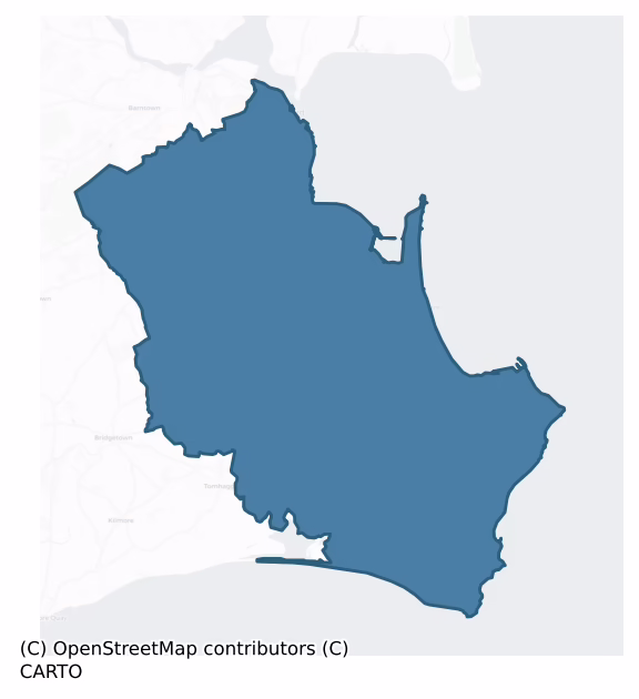
Forth is a barony of County Wexford, in the historical province of Leinster (Irish: Fotharta), covering 168 km² of land. The barony records 467 NMS archaeological sites and 789 NIAH listed buildings, placing it at around the 77th percentile among 280 ROI baronies for sites per km². This means it is in the top third of all baronies for sites per km². Dated archaeological evidence runs from the Neolithic through to the Modern, spanning 8 of 9 archaeological periods, placing the barony in the 66th percentile among 280 ROI baronies for chronological depth. This means it is in the upper half of all baronies for chronological depth. The largest dated subset of recorded sites dates to the Iron Age. Logainm flags 56 placenames in the barony as carrying a recognised heritage root; the largest share — around 57% — are names associated with early Christian church and monastic foundations.
Heritage at a glance
Percentile rankings throughout this profile compare each barony only against the other 279 Republic of Ireland baronies.
The recorded heritage of Forth
The National Monuments Service Sites and Monuments Record (SMR) is the statutory inventory of archaeological sites for the Republic of Ireland, maintained by the Department of Tourism, Culture, Arts, Gaeltacht, Sport and Media. Sites recorded here include earthworks, ringforts, megalithic tombs, ecclesiastical remains, and post-medieval features; not every record is legally protected, but each is registered as a monument of archaeological interest.
The National Monuments Service records 467 archaeological sites in Forth, putting it at the 77th percentile among 280 ROI baronies for sites per km². This means it is in the top third of all baronies for sites per km². Protection coverage is near-universal — 450 sites (96%) fall within a recorded monument protection zone, indicating an extensively surveyed landscape. The record is dominated by defensive sites — ringforts, enclosures, hillforts, and stone forts (180 sites, 39% of the total), with ecclesiastical sites forming a substantial secondary presence (109 sites, 23%). Ringfort – rath is the most prevalent type, making up 19% of the barony's recorded sites (91 records), broadly in line with the ROI average of 20% across all baronies where this type occurs. Ringfort – rath is an earthen ringfort enclosed by a bank and external ditch — the most common Early Medieval farmstead, broadly dated 500–1000 AD. Other significant types include Enclosure (48) and Church (41). Enclosure is a banked or ditched feature of uncertain type, used as a catch-all where the original function cannot be determined from surface evidence; Church is a building used for public Christian worship, of any date from c. 500 AD onwards. Across the barony's 168 km², this gives a recorded density of 2.77 sites per km².
Most common monument types
Hover or tap a monument type to see its definition.
| Type | Count |
|---|---|
| Ringfort – rath an earthen ringfort enclosed by a bank and external ditch — the most common Early Medieval farmstead, broadly dated 500–1000 AD | 91 |
| Enclosure a banked or ditched feature of uncertain type, used as a catch-all where the original function cannot be determined from surface evidence | 48 |
| Church a building used for public Christian worship, of any date from c. 500 AD onwards | 41 |
| Ring-ditch a circular ditch under 20m across, often the ploughed-out remains of a barrow, ring-barrow or roundhouse | 40 |
| Graveyard a burial area associated with a church, in use from the medieval period onwards | 33 |
| Ritual site – holy well a well or spring traditionally associated with a saint, often credited with healing properties; many trace earlier ritual origins but devotion is documented from the medieval period onwards | 25 |
| Castle – tower house a fortified residential tower of four or five storeys, mostly built by lords in the 15th and 16th centuries and often within a defended bawn | 18 |
Chronological distribution
The dated archaeological record for Forth spans from the Neolithic through to the Modern, with activity attested across 8 of 9 archaeological periods. Every period from earliest to latest is represented in the record — an unbroken sequence of dated activity across the full chronological span. Activity concentrates most heavily in the Iron Age (149 sites, 43% of dated material), with the Early Medieval forming a secondary peak (61 sites, 18%). A further 119 recorded sites (25% of the overall NMS register for the barony) carry no period attribution — appearing as 'Unknown' in the bar chart below. This typically reflects either records that pre-date the standardised period vocabulary or sites awaiting specialist dating review, rather than a genuine absence of chronological evidence.
Sample of recorded monuments
Show 25 sample monuments (of 467 total)
A representative sample of 25 recorded monuments drawn from the barony’s 467 total NMS entries. Sites within a recorded monument protection zone and rarer site types are prioritised so the list shows a meaningful cross-section rather than only the most common type. Each entry shows the official Sites and Monuments Record reference number and the description published by the National Monuments Service.
Historic town
Founded by the Vikings in the ninth century, Wexford town was built around the deep water Pool, now occupied by the Crescent. Archaeological excavations in the town indicate that the NNW-SSE line taken by Main St.…
Founded by the Vikings in the ninth century, Wexford town was built around the deep water Pool, now occupied by the Crescent. Archaeological excavations in the town indicate that the NNW-SSE line taken by Main St. probably represents the crest of the original shore created by high tides, with most deposits E of this being composed of silts and infill. However, only one section of quay has been identified (WX032-031027-) in this area with a section at a location further inland (WX037-032043-). The earliest occupation material will probably be found W of Main St. and close to the Pool. The defences of the Viking town have not been encountered in excavation yet, but they were probably an earthen rampart with an outer fosse. Their precise route cannot be described with certainty, but it is very likely that they followed much the same line as the later Anglo Norman wall, beginning at the S end of the town at the seashore near the site of the Anglo-Norman castle (WX037 032001 ), crossing the Bishops' Water river, Bride St., Peter St., the old Kysers Lane now Mary Street, and returning to the sea probably at Cornmarket and Common Quay St. (Colfer 1990-1, 9). St. Iberius’ church appears to have been at the N limit of the town but extra-mural suburbs were burnt when the Anglo-Normans captured the town in 1169 (Bradley and King 1990, 148). This encloses an area of c. 6 ha. Archaeological excavation at the junction of Bride St. and Main St. (WX037 032020 ) confirm that this area cont…
Castle – Anglo-Norman masonry castle
The castle at Wexford is located on a slight rise at the S end of the town, and it may have been built on the site of a Viking strongpoint (Hadden 1968, 13). It is traditionally thought to have been built by King John,…
The castle at Wexford is located on a slight rise at the S end of the town, and it may have been built on the site of a Viking strongpoint (Hadden 1968, 13). It is traditionally thought to have been built by King John, but it was certainly in existence by 1221, although a door-keeper of the castle is mentioned in 1185. A list of its constables from 1311 to 1590 survives (Hore 1900-11, vol. 5, 65). The castle was bombarded by Cromwell's forces in October 1649 and quickly surrendered, which led to the capture of the town (ibid. 293-304). The castle is described (ibid. 63-70) as having been a rectangular keep with four towers attached. It was converted to a military barracks in the 1720s (Colfer 1990-1, 18-21), and these buildings still occupy the site, but no features of a medieval castle are evident.
The above description is derived from the published 'Archaeological Inventory of County Wexford' (Dublin: Stationery Office, 1996). In certain instances the entries have been revised and updated in the light of recent research.
Compiled by: Michael Moore
Date of upload/revision: 19 December, 2012
Town defences
The Anglo-Norman walls of Wexford town followed the likely line of much of the earthen ramparts of the Vikings, but the Viking defences have not yet been recognised in any excavation. The defences began at the harbour…
The Anglo-Norman walls of Wexford town followed the likely line of much of the earthen ramparts of the Vikings, but the Viking defences have not yet been recognised in any excavation. The defences began at the harbour on the N side of the site of the castle (WX037-032001-), crossed Barrack St., King St. and Bride St. at the junction with Clifford St. From this point it progressed NNW to the top of Mary St., continued N to the W side of High St., Mallon St. and Abbey St., crossed Georges St. to the West Gate and turned NE back towards the harbour. Considerable portions survive.
The town wall at the SW corner of the town off Bride St. rises from flat ground around the valley of the Bishops Water River (ext. H c. 4m) but deposits against the interior reduce the height (int. H to c. 2m). The curved corner (total L c. 42m) is interrupted by inserted windows and is partly rebuilt. However, it has evidence of 5 gun loops and a benched wall walk. Archaeological testing (04E1118) at Ropewalk Yard/Stone Bridge Lane E of this and at a much lower level produced archaeological deposits and portion of a wall (Wth 1.6m) that is probably the town wall (McLoughlin 2004; excavations.ie 2004:1838). Archaeological testing (16E0051) at a development site on Clifford St. during November 2018 uncovered the base of the wall (Wth 1.4m; max. H 0.9m) which had a clay-bonded core and mortared facing stones on both sides as well as a slight external base-batter on the SW side. The inner face was…
Religious house – Franciscan friars
A Franciscan priory was established by 1260, on a church site dedicated to SS John and Bridget that might have been an earlier foundation of the Knights Hospitallers, who granted it to them. The Franciscan church was…
A Franciscan priory was established by 1260, on a church site dedicated to SS John and Bridget that might have been an earlier foundation of the Knights Hospitallers, who granted it to them. The Franciscan church was suppressed in 1541 when it is not described in any detail (White 1943, 371-2), but an inquisition in 1543 describes it as consisting of the remains of a house, chapterhouse, belfry, dormitory, hall and kitchen with other buildings (Hore 1900-11, vol. 5. 154; Gwynn and Hadcock 1980, 261). It was located outside the town walls at Mary St. and was largely destroyed in the 1640s to repair the town walls. The site was reoccupied by Franciscans from the late 17th century, whose present church is said to be partly built on walls of older church (Cullen 1895, 375). In particular there is an external base-batter on the E wall of the present church that might indicate re-use of an older wall. This church is often confused with the site of St John's church (WX037 032015 ). (Hore 1900-11, vol. 5, 82 3)
The above description is derived from the published 'Archaeological Inventory of County Wexford' (Dublin: Stationery Office, 1996). In certain instances the entries have been revised and updated in the light of recent research.
Compiled by: Michael Moore
Date of upload/revision: 19 December, 2012
Concentric enclosure
Situated on a level landscape. The cropmark of a circular enclosure defined by a wide fosse feature (ext. diam. c. 35m) within a larger enclosure (diam. c. 70m) defined by a narrower feature S-W-N is visible on aerial…
Situated on a level landscape. The cropmark of a circular enclosure defined by a wide fosse feature (ext. diam. c. 35m) within a larger enclosure (diam. c. 70m) defined by a narrower feature S-W-N is visible on aerial photographs (MM (10) 30 33). It is also visible on aerial photographs (ASIAP (267) 12-15), and on digital aerial photographs (WX042-019_1 to _4) taken in 2006. It is also visible on the OSI series of aerial photographs (2000).
The above description is derived from the published 'Archaeological Inventory of County Wexford' (Dublin: Stationery Office, 1996). In certain instances the entries have been revised and updated in the light of recent research.
Compiled by: Michael Moore
Date of upload/revision: 27 May, 2013
Mill – corn
A house and a water mill are depicted on the Down Survey map of Forth barony (1656-8) at Milltown (5) in Kilscoran parish. Rowland Scurlocke owned 70 acres at Milltown in 1640 (Simington 1953, 304). A corn mill is…
A house and a water mill are depicted on the Down Survey map of Forth barony (1656-8) at Milltown (5) in Kilscoran parish. Rowland Scurlocke owned 70 acres at Milltown in 1640 (Simington 1953, 304). A corn mill is marked on the 1839 and 1940 eds of the OS 6-inch map at Milltown but it might not be on the site of the earlier structure. The overgrown remains of a rectangular mill building that is probably 18th century in date survives. It has several floors (int. dims 8.9m E-W; 4.7m N-S) with the stone-faced mill-race (Wth 1.15m) immediately to the W. The mill-race widens (Wth c. 5-6m) further N as it returns to a S-N stream c. 130m N of the mill. The mill has a return (ext. dims 6.6m E-W; c. 4m N-S) at N divided into two rooms, one with two millstones. See this web-page for the Down Survey barony map accessed on 5 December, 2013: http://downsurvey.tcd.ie/down-survey-maps.php#bm=Forth&c=Wexford
Compiled by: Michael Moore
Date of upload: 8 January, 2014
House – 16th century
Located on a level landscape with a small N-S stream c. 130m to the W. The house was built in 1570 by Dionisius Stafford and his second wife Katherine Synnott of Ballygerry (WX048-017—-), according to the Latin…
Located on a level landscape with a small N-S stream c. 130m to the W. The house was built in 1570 by Dionisius Stafford and his second wife Katherine Synnott of Ballygerry (WX048-017—-), according to the Latin inscription of a memorial stone now lost. His first wife was Joan Browne of Mulrankin (WX047-031—-) (Hore 1925, 15-6; Browne 1937). The house was largely pulled down c. 1860 (Browne 1937), and is abutting the N side of the tower house (WX048-033001-). It is a rectangular building (int. dims 16.5m N-S; 6m E-W) now reduced to one storey, but only the W wall and the N gable survive, with a blocked chimney-breast (Wth 3.5m) in the gable. One window (Wth 1.47m; H 1.58m) of four ogee-headed lights with the mullions removed, a doorway (Wth 0.93m) and one musket-loop in the W wall are original. Together with the tower house (WX048-033001-) it could form the E side of a bawn (WX048-033005-).
Compiled by: Michael Moore
Date of upload: 2 January, 2014
Standing stone – pair
Situated on a gently rolling landscape. Two monoliths placed 0.9m apart form a line oriented N-S. The N stone with a rectangular cross-section (dims 0.6m x 0.5m; H 1.15m) has a possible ogham inscription on one angle…
Situated on a gently rolling landscape. Two monoliths placed 0.9m apart form a line oriented N-S. The N stone with a rectangular cross-section (dims 0.6m x 0.5m; H 1.15m) has a possible ogham inscription on one angle close to the flat top. It has been read as: IARNI (Macalister 1945, vol. 1, 48-9). The S stone has a rectangular cross-section (dims 0.68m x 0.44m; H 1.03m) with a rounded top. Both stones are of a conglomerate stone with quartz. The area around them was excavated by Macalister with no result (1921, 77).
The above description is derived from the published 'Archaeological Inventory of County Wexford' (Dublin: Stationery Office, 1996). In certain instances the entries have been revised and updated in the light of recent research.
Compiled by: Michael Moore
Date of upload/revision: 07 January 2014
Enclosure – large enclosure
Located at the E edge of a gently rolling landscape with the ground sloping down to clay cliffs (H c. 10m) overlooking the sea shore c. 300m to the SE. The monument is described as a rath with two banks attributed to…
Located at the E edge of a gently rolling landscape with the ground sloping down to clay cliffs (H c. 10m) overlooking the sea shore c. 300m to the SE. The monument is described as a rath with two banks attributed to the Danes by Sutton writing c. 1680 (Hore 1862 3, 63; 1921, 56). It is described in italic lettering on the 1839 ed. of the OS 6-inch map as Mulgrave Rath Observatory. According to John O’Donovan writing c. 1840 this name was applied to the monument by the proprietor after Lord Mulgrave, Lord Lieutenant of Ireland (1835-9). The proprietor had also installed an observatory in it and built the wall around it (O’Flanagan 1933, vol. 1, 275).
The monument is a slightly domed circular area (int. diam. 62m) defined by an earthen bank (at S: Wth 9m; int. and ext. H 3m) separated by berm (at S: Wth 6.5-8.5m) from an outer bank (at S: Wth 11-15.5m; int. H 4-4.5m; ext. H 5.5m). The centre is cultivated as an ornamental garden with tunnels through the banks and a masonry wall (H 1.5-2.5m) is retaining the outside of the outer bank (max. ext. diam. c. 120m). The banks are supporting mature deciduous trees. No original entrances or excavated fosses are visible. There was reputed to be an underground cave or souterrain at its centre that was discovered in 1908 (SMR file).
The exact classification of this enclosure is difficult to determine. Dalton (1921, 31-3) considered it a possible sub-Roman/Celtic cult-centre. Its large scale, and the scale and regularity of its ban…
House – fortified house
This house is located on a slight S-facing slope with a small NW-SE stream c. 100m to the N and the W shore of Lady’s Island Lough is c. 250m to the E. The earliest reference is from 1616 when Robert French was seized…
This house is located on a slight S-facing slope with a small NW-SE stream c. 100m to the N and the W shore of Lady’s Island Lough is c. 250m to the E. The earliest reference is from 1616 when Robert French was seized of the castle at Rathshillane (Jeffrey 1979, 35). He was probably descended from the French family of Ballytory (WX048-042—-), which is c. 850m to the N. According to the Book of Survey and Distribution (1660s) Robert Ellyott, an Irish Papist, owned 54 acres at Rathsheland c. 1640 (Simington 1953, 305), and Robert Elliott of Ratilane is listed for transplantation with eight dependents in 1653 (Hore 1900-11, vol. 6, 502). By the Act of Settlement (1666) 54 acres at Rashillan was bestowed on Constantine Neale together with about 600 acres elsewhere in Tacumshin parish (Hore 1921, 50).
This is a rectangular building of three storeys (ext. dims 13.1m N-S; 7.45m E-W) with granite quoins, stepped crenellations, and machicolations at the NE and SW angles. The entrance doorway (Wth 1.14m; H 1.92m) with a segmental arch in granite and a recess for a plaque (Wth 0.5m; H 0.4m) above it is towards the S end of the E wall. The doorframe has an outer rebate and may have had a yett, but it is protected by a machicolation on the parapet and inside there are two draw-bar sockets. The doorway opens directly into the ground floor, which has no masonry internal divisions. There are three rectangular windows in lintelled recesses on the W wall, while a fourth opening may have…
Causeway
Lady’s Island was once a triangular island (max. dims c. 700m N-S; c. 220m E-W at S) with the apex at the N end in Lady’s Island Lough (dims c. 3.5km NNE-SSW; c. 500m-1.5km E-W), a lake that was called Lough Togher in…
Lady’s Island was once a triangular island (max. dims c. 700m N-S; c. 220m E-W at S) with the apex at the N end in Lady’s Island Lough (dims c. 3.5km NNE-SSW; c. 500m-1.5km E-W), a lake that was called Lough Togher in the 17th century (Hore 1862, 62, 87). Salt water seeps through the bar separating the lake from the sea and the bar is sometimes breached, so the lake is a semi salt-water lagoon. The causeway connected the mainland with the island and was the only access for pilgrims and others. On the island side the tower house (WX053-014001-) and its attached gatehouse (WX053-014002-) control access to the church (WX053-013001-), but there must have been a gateway associated with the tower on the N side of the bawn (WX053-015—-), that is at the S end of the causeway from the lake-shore c. 100m to the N. The nature of the causeway is not known, but it was probably a natural shingle spit. Today it is hidden beneath a grass sward (Wth c. 100m NE-SW), and the shore has extended out to meet the island. When the water-level in the lake is high the causeway can be seen as a raised bank (Wth c. 10m; H c. 0.5-1m) beneath a gravel roadway.
Compiled by: Michael Moore
Date of upload: 25 March, 2014
Cist
Situated on a W-facing slope. A rectangular cist (int. dims 0.73m NE-SW; 0.61m NW-SE; D 0.4m) was apparently empty when it was discovered in 1961 and investigated by NMI (Waddell 1990, 155). It was composed of six slabs…
Situated on a W-facing slope. A rectangular cist (int. dims 0.73m NE-SW; 0.61m NW-SE; D 0.4m) was apparently empty when it was discovered in 1961 and investigated by NMI (Waddell 1990, 155). It was composed of six slabs (T 0.12-0.28), there being two on the long sides, and there were two capstones that were removed in ploughing. (Ó Ríordáin 2011)
The above description is derived from the published 'Archaeological Inventory of County Wexford' (Dublin: Stationery Office, 1996). In certain instances the entries have been revised and updated in the light of recent research.
Compiled by: Michael Moore
Date of upload/revision: 24 March, 2014
Ringfort – unclassified
A hachured feature (diam. c. 30m) is marked only on the 1940 ed. of the OS 6-inch map, and it is situated on a gentle N-facing slope. A rath was listed at Clougheast by Mac Leighim (1920, 136-7) and it was described in…
A hachured feature (diam. c. 30m) is marked only on the 1940 ed. of the OS 6-inch map, and it is situated on a gentle N-facing slope. A rath was listed at Clougheast by Mac Leighim (1920, 136-7) and it was described in 1940 as a slightly raised area (diam. c. 80 feet (c. 25m) that was known locally as a rath (OSFM). It was removed in the 1980s. An area of stunted growth (diam. c. 20m) is visible in a cereal crop at ground level, and it is visible as a similar feature on aerial photographs (MM (28) 11-14), but it cannot be distinguished on digital aerial photographs (WX053-091_1 to _3) from 2006. Rath (WX053-091—-) is c. 100m to the W, and rath (WX053-092—-) is c. 130m to the SE.
The above description is derived from the published 'Archaeological Inventory of County Wexford' (Dublin: Stationery Office, 1996). In certain instances the entries have been revised and updated in the light of recent research.
Compiled by: Michael Moore
Date of upload/revision: 21 March, 2014
Ecclesiastical enclosure
Situated at the crest of a NE-facing slope. St. Vogue’s church (WX053-035002-) is within a subcircular or D-shaped and grass-covered enclosure (dims 48m NE-SW; 42m NW-SE) defined by an earthen bank (Wth 2.5-3.5m; int. H…
Situated at the crest of a NE-facing slope. St. Vogue’s church (WX053-035002-) is within a subcircular or D-shaped and grass-covered enclosure (dims 48m NE-SW; 42m NW-SE) defined by an earthen bank (Wth 2.5-3.5m; int. H 0.8-1.2m; ext. H 1.2-1.5m) S-N-NE that is also the townland boundary with Nethertown S-W-N. The perimeter is curtailed by old farm buildings at SE and by a N-S farm track at E. As the original entrance to this enclosure is not identified, it may have been on the E side. Although the stratigraphic evidence is not conclusive, excavation (E000143) determined that the earliest internal features are probably associated with the use of the enclosure, the bank of which was accompanied by a shallow outer fosse (at W: Wth of top c. 2m; D 0.5m). The bank had an original external stone-facing at W, but that visible at N was more recent (O’Kelly et al. 1975, 23-4).
The enclosure was only used for burial after the abandonment of the church and a late medieval house (WX053-035007-), when it may have been reserved exclusively for drowned mariners. The names of ships that sank near Carnsore Point, such as the ‘William’ of Weymouth in 1818 which has the only headstone, the ‘Ceres’ in 1866, the ‘Langdale’ in 1879, and the ‘Sem’, a Hungarian ship wrecked in 1884, are known locally to have provided interments (Walsh 1921-5). Seventeen burials were excavated in the northern part of the enclosure, and a further ten, mostly infants, were recorded inside the church. Redeposited h…
Megalithic structure
Located at the bottom of a slight S and E-facing slope at Carnsore Point, and marked on the 1839 and 1940 eds of the OS 6-inch map where it is described in gothic lettering as a Giant's Grave and a Dolmen respectively.…
Located at the bottom of a slight S and E-facing slope at Carnsore Point, and marked on the 1839 and 1940 eds of the OS 6-inch map where it is described in gothic lettering as a Giant's Grave and a Dolmen respectively. The earliest reference is from the Dublin Magazine, of August 1764 where it is described as 23ft in length (L c. 7m), and Beranger the artist sketched it in 1780 (Wilde 1876-8, 129), although this has never been published. The area was excavated (E000142) in 1975 when a trench (dims 20m x 5m) produced no evidence of the structure and it can be concluded that erosion by the sea has removed all trace of it (Cahill and Lynch 1976 7, 59).
The above description is derived from the published 'Archaeological Inventory of County Wexford' (Dublin: Stationery Office, 1996). In certain instances the entries have been revised and updated in the light of recent research.
Compiled by: Michael Moore
Date of upload/revision: 27 March, 2014
House – 18th/19th century
Located on a low-lying landscape in the village of Mayglass. This is a four-bay thatched vernacular house of two storeys that is constructed of earthen walls over a stone base. It was constructed in a number of phases,…
Located on a low-lying landscape in the village of Mayglass. This is a four-bay thatched vernacular house of two storeys that is constructed of earthen walls over a stone base. It was constructed in a number of phases, dating from c. 1675 to the late 19th century, but it has remained unchanged since then. The house is a variant of the ’lobby entry’ house and retains a number of early features, including its fireplace with a wall oven and some of the windows, but the SW end of the house is thought to be an addition. Both the house and its farm buildings are undergoing a conservation programme since 1998 with support from the Heritage Council (Reeners 2003). Part of the works necessitated the erection of a shed over the structure to shelter it and archaeological excavation (98E0587) in connection with this identified some ground levels associated with the house (Sheehan 2000), but further work under the same licence uncovered original early walls extending outside the present house to the NE (Wren 2000). See this website accessed on 18 October, 2013:
http://www.mayglass-2000.ie/project.html
Compiled by: Michael Moore
Date of upload: 18 October, 2013
Pit
Located on a fairly level, low-lying landscape. The cropmark of a large pit or quarry (diam. c. 20m) is visible on digital aerial photographs (WX048-148_1, _2) taken in July, 2006. The pit pre-dates the NNE-SSW field…
Located on a fairly level, low-lying landscape. The cropmark of a large pit or quarry (diam. c. 20m) is visible on digital aerial photographs (WX048-148_1, _2) taken in July, 2006. The pit pre-dates the NNE-SSW field bank and drain that are marked on the 1839 ed. of the OS 6-inch map but which are now removed. It is also visible on the OSi series of aerial photographs (1995). Rath (WX048-148—-) is c. 80m to the ESE.
Compiled by: Michael Moore
Date of upload: 7 January, 2104
Quay
Archaeological testing (03E1729) on a site fronting onto Paul Quay and bordered by Oyster Lane on the NW and which is c. 50m S of the Crescent uncovered sections of a number of walls running NE-SW. One wall (Wth 1.6m),…
Archaeological testing (03E1729) on a site fronting onto Paul Quay and bordered by Oyster Lane on the NW and which is c. 50m S of the Crescent uncovered sections of a number of walls running NE-SW. One wall (Wth 1.6m), encountered at a depth of 1.3m had organic layers containing Leinster ware to its NW and is interpreted as a possible quay-wall with a lagoon on the NW and perhaps infill material to the SE. (McLoughlin 2004; 2006)
Compiled by: Michael Moore
Date of upload: 20 December, 2012
Font (present location)
The rectangular granite font (ext. dims 0.64m x 0.6m; H 0.41m; int. dims 0.43m x 0.42m; D c. 0.3m) from Kilmacree church (WX042-032001-), c. 600m to the S, is now at the remains of Ballykelly Roman Catholic church…
The rectangular granite font (ext. dims 0.64m x 0.6m; H 0.41m; int. dims 0.43m x 0.42m; D c. 0.3m) from Kilmacree church (WX042-032001-), c. 600m to the S, is now at the remains of Ballykelly Roman Catholic church (WX042-033001).
Compiled by: Michael Moore
Date of upload: 24 May, 2013
Gatehouse
The gatehouse (ext. dims 5.9m NW-SE; 3.2m NE-SW) is offset to the S and W of the W angle of the tower house (WX053-014001-). The entrance passage (Wth 2.45m), with a segmental arch at SW and a pointed arch at NE, is…
The gatehouse (ext. dims 5.9m NW-SE; 3.2m NE-SW) is offset to the S and W of the W angle of the tower house (WX053-014001-). The entrance passage (Wth 2.45m), with a segmental arch at SW and a pointed arch at NE, is protected by a murder-hole inside the NE arch. The gate is secured by a single draw-bar socket with the remains of a timber beam in place. The murder-hole is controlled from the first floor, which is a lintelled chamber (int. dims 4.1m NW-SE; 1.5m NE-SW; H 2.65m) accessed by a lintelled doorway (Wth 0.78m; H 2.45m) from the second floor of the tower house. The parapet is destroyed, but it was accessed by a lintelled doorway (Wth 0.65m; H 1.92m) at the third floor of the tower house.
Compiled by: Michael Moore
Date of upload; 25 March, 2014
Inscribed stone
There is an inscribed stone (dims 0.56m x 0.53m; T 0.3m) preserved at the site of Ballymacane castle (WX053-005001-) bearing the date 1612 and initials IS, DS and RS, which refer to John, Dionysius and Richard…
There is an inscribed stone (dims 0.56m x 0.53m; T 0.3m) preserved at the site of Ballymacane castle (WX053-005001-) bearing the date 1612 and initials IS, DS and RS, which refer to John, Dionysius and Richard Stafford.
Compiled by: Michael Moore
Date of upload: 21 March, 2014
House – Bronze Age
Archaeological testing (05E0028) identified a ring-ditch (Stafford 2008) that was subsequently partially excavated under the same licence while the unexcavated portion was preserved under undeveloped ground (McManus…
Archaeological testing (05E0028) identified a ring-ditch (Stafford 2008) that was subsequently partially excavated under the same licence while the unexcavated portion was preserved under undeveloped ground (McManus 2008). A circular area (diam. 10.2m) was defined by a slot-trench with a number of internal post-holes and stake-holes. An entrance was not identified in the excavated portion, but may survive SE-SW. A large pit outside the structure to the S may have been associated and functioned as a storage pit. The ditch-barrow (WX042-090—-) is c. 150m to the SW. (MacManus 2006, 2008)
Compiled by: Michael Moore
Date of upload: 28 May, 2013
Sea wall
Archaeological monitoring (04E0179) of cable-laying in Main Street North encountered a clay-bonded N-S wall (H 0.5m) in the W face of the trench (L 3m) resting on peaty silts that also preserved three stakes retaining…
Archaeological monitoring (04E0179) of cable-laying in Main Street North encountered a clay-bonded N-S wall (H 0.5m) in the W face of the trench (L 3m) resting on peaty silts that also preserved three stakes retaining planks (L 3.5m) in situ. This is interpreted as a possible temporary sea-wall (total L 10m) (Stafford 2007).
Compiled by: Michael Moore
Date of upload: 20 December, 2012
Armorial plaque
An armorial stone is attached to the W side of the tower at St. Selskar’s church (WX037-032009-). The fragmentary inscription beneath the shield is interpreted as referring to Richard Stafford of Rahale (WX032-039—-)…
An armorial stone is attached to the W side of the tower at St. Selskar’s church (WX037-032009-). The fragmentary inscription beneath the shield is interpreted as referring to Richard Stafford of Rahale (WX032-039—-) and his wife Anstance Sutton (W. B. V. 1898-1900; Hore 1900-11, vol. 5, 75). Richard Stafford was descended from a junior branch of the Staffords of Ballyconor (WX048-033001-). There is a view that the armorial stone was combined with the memorial stone (WX037-032031-) to form a single memorial (FitzGerald 1901-03).
Compiled by: Michael Moore
Date of upload: 20 December, 2012
Ringfort – rath
Located on a slight rise in a low-lying landscape. The cropmark of a circular enclosure (diam. c. 55m) defined by a continuous fosse feature is visible on aerial photographs (CUCAP: BDJ 18, BOD 71; MM (42) 24-27), with…
Located on a slight rise in a low-lying landscape. The cropmark of a circular enclosure (diam. c. 55m) defined by a continuous fosse feature is visible on aerial photographs (CUCAP: BDJ 18, BOD 71; MM (42) 24-27), with a ring-ditch (diam. c. 15m) within. A second fosse is visible outside the first SW-NE. It is not visible at ground level in pasture, although a NE-SW field bank has been removed since the 1970s. Achaeological testing (09E0033) c. 70m to the SW produced no archaeological material (Gregory 2012).
The above description is derived from the published 'Archaeological Inventory of County Wexford' (Dublin: Stationery Office, 1996). In certain instances the entries have been revised and updated in the light of recent research.
Compiled by: Michael Moore
Date of upload/revision: 21 October, 2013
Listed buildings
The National Inventory of Architectural Heritage (NIAH) is a state survey appraising buildings of architectural, historical, archaeological, artistic, cultural, scientific, social, or technical interest. Each surveyed structure receives a rating from International (the highest, for buildings of European importance) through National, Regional, Local, and Record-Only.
The National Inventory of Architectural Heritage records 789 listed buildings in Forth, placing it in the top 1% of ROI baronies for listed-building density. Among these, 20 are graded National — buildings of interest to the whole of Ireland rather than only its region. The Republic holds 937 National-graded buildings in total, so this barony accounts for around 2% of the national total. Construction dates concentrate most heavily in the Victorian (1830-1900) period. The most-recorded building type is house (334 examples, 42% of the listed stock).
Terrain and environment
Mean elevation across the barony is 27m — the 4th percentile among 280 ROI baronies for elevation. This means it is in the bottom tenth of all baronies for elevation. This is a relatively low-lying landscape by ROI standards. Elevation matters for heritage because higher-altitude baronies typically favour defensive monuments — ringforts and hilltop forts placed on prominent ground — while lowland baronies are more likely to carry the dense settlement and church networks of intensive agricultural landscapes. The barony reaches 229m at its highest point — a vertical span of more than 202m within its boundary, indicating significant topographic diversity. Mean slope is 2.2° — the 13th percentile among 280 ROI baronies for slope. This means it is in the bottom fifth of all baronies for slope. This is broadly flat terrain, the kind of landscape best suited to intensive agriculture. Slope is a key control on both land use and archaeological preservation: steep ground resists ploughing and tends to preserve earthworks intact, while gentle slopes favour intensive cultivation that damages or destroys surface archaeology over time. The Topographic Wetness Index averages 11.7, the 84th percentile among 280 ROI baronies for wetness. This means it is in the top fifth of all baronies for wetness. This is wet, slow-draining ground by ROI standards — the kind of landscape that may carry waterlogged archaeological sites of unusual preservation value. Drainage matters for heritage because poorly-drained ground preserves organic archaeology (wooden trackways, leather, textiles, and on rare occasions human remains) far better than free-draining soil; well-drained ground favours arable use but destroys organic material rapidly. The land-cover mosaic combines improved grassland (56%), arable farmland (21%), and woodland (16%), giving a mixed agricultural and semi-natural landscape. In overall character, this is low-lying, gently-sloping terrain — characteristic of Ireland's central plain and coastal lowlands, with land use dominated by improved grassland.
Terrain measurements
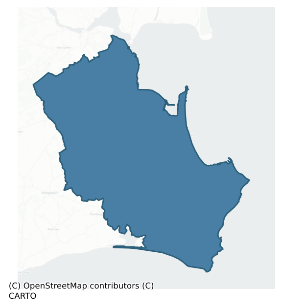
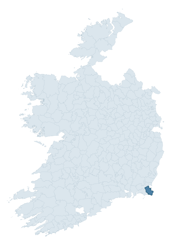
Where this barony sits in the Republic of Ireland
Geology and preservation
Bedrock geology shapes the landscape long before any settlement begins — controlling soil drainage, agricultural potential, the survival of upstanding monuments, and the preservation of buried archaeology. The figures below come from the Geological Survey Ireland 1:100,000 bedrock map.
The bedrock underlying Forth is predominantly amphibolite (21% of the barony by area), with much of the rock dating to the Precambrian period. A substantial secondary geology of sandstone (16%) and limestone (14%) adds further variety to the underlying landscape. With 11 distinct rock types mapped, the barony sits in the top third of ROI baronies for geological diversity (93rd percentile) — typically a sign of complex tectonic history or coastal mosaics of differing rock units.
Rock type composition
Largest mapped unit: Greenore Point Group (21% of the barony)
Placename evidence
Logainm records 56 heritage-diagnostic placenames for Forth, drawn from townland and civil-parish names across the barony. The dominant stratum is Early Christian ecclesiastical — cill-, teampall-, and domhnach-prefixed names that record the dense network of early church foundations established between the fifth and tenth centuries. The leading diagnostic roots are cill- (22 — church), ráth- (16 — earthen ringfort), and dún- (5 — hilltop fort or promontory fort). This is above the ROI average of 30.7 heritage placenames per barony. The presence of multiple heritage strata side by side indicates layered occupation of the landscape across successive prehistoric and historic periods. Logainm records 443 placenames for Forth (predominantly townland names). Of these, 56 (13%) carry one of the diagnostic Gaelic roots tracked above; the remainder draw on more generic landscape vocabulary that does not encode a heritage period.
Pre-Christian / Early Medieval Defensive
| Root | Count | Meaning |
|---|---|---|
| ráth- | 16 | earthen ringfort |
| dún- | 5 | hilltop or promontory fort |
Early Christian Ecclesiastical
| Root | Count | Meaning |
|---|---|---|
| cill- | 22 | church (early) |
| gráinseach- | 5 | monastic farm / grange |
| tobar- | 2 | holy well |
| teampall- | 1 | church (later medieval) |
| díseart- | 1 | hermitage |
| cillín- | 1 | unconsecrated burial ground |
Burial, Ritual, and Norse-Contact
| Root | Count | Meaning |
|---|---|---|
| carn- | 3 | cairn |
| gall- | 1 | foreigner — Norse settlement marker |
Other baronies in Wexford
About this profile
Click any section below to expand.
What is a barony?
A barony is a historic administrative unit in Ireland, broadly equivalent to an English hundred. The 280 baronies used here are from the OSi 2019 National Statutory Boundaries (generalised 20m), covering the 26 counties of the Republic of Ireland. Baronies derive from the Norman period, were formalised in the 17th century, and have not been redrawn for statistical purposes. They vary enormously in area, from compact urban baronies in Dublin to vast upland baronies in Connacht, and should not be compared by raw site count without accounting for area differences.
What counts as a site?
This profile combines three distinct heritage registers, each with its own definition of what constitutes a recordable site:
- Archaeological sites (NMS). The National Monuments Service Sites and Monuments Record (SMR) catalogues every known archaeological monument or site of archaeological interest in the Republic, from prehistoric burial mounds and ringforts to medieval churches and post-medieval defensive works. Inclusion does not require legal protection — only that the site has been identified, surveyed, and assessed as having archaeological value. A separate subset of these sites lies within a recorded protection zone, which gives them statutory protection under the National Monuments Acts.
- Listed buildings (NIAH). The National Inventory of Architectural Heritage records buildings of architectural, historical, archaeological, artistic, cultural, scientific, social, or technical interest. Each surveyed structure is appraised on a five-tier scale: International, National, Regional, Local, and Record-Only. The NIAH appraisal is informational rather than strictly statutory, but it underpins local-authority Record of Protected Structures (RPS) listings.
- Heritage placenames (Logainm). Logainm is the authoritative database of Irish placenames maintained by the Placenames Branch. This profile applies a heritage-diagnostic classifier to the Irish-language form of each townland name, flagging roots that signal defensive sites (ráth-, lios-, dún-, caiseal-, cathair-), ecclesiastical foundations (cill-, teampall-, domhnach-, mainistir-), prehistoric burial-ritual features (tuaim-, carn-, leaba-), or Norse-contact settlement (gall-). Townlands without one of these diagnostic roots are not flagged here — they may still carry historical significance, but that significance is not encoded in the name itself.
Editorial principles
The narrative sections of this profile follow several explicit principles:
- Evidential. Every claim about this barony’s heritage character is anchored in the underlying register data. Where a site count, a placename count, or a percentile rank is cited, it is computed from the source datasets at export time, not estimated.
- Comparative. Counts and metrics are reported alongside their percentile rank against the other 279 ROI baronies. A barony with 50 ringforts in absolute terms could be unusually high or unusually low depending on its size and regional context; percentile ranking removes that ambiguity.
- Transparent on limits. Where a register has known coverage gaps, survey biases, or data-quality issues that affect this barony’s figures, the profile flags them rather than presenting the numbers as definitive.
- No interpretation beyond what the data supports. The narrative does not speculate about historical events, social dynamics, or cultural meaning beyond what the recorded heritage and placename evidence directly attests.
Data caveats and limits
- NMS Sites and Monuments Record is the product of survey campaigns conducted at different intensities across different counties and decades. Some baronies have been surveyed more thoroughly than others, and absolute counts should be read in that light. Sites destroyed by development before survey are typically not represented; sites in heavily forested or upland terrain are sometimes under-recorded.
- NIAH coverage is broadly complete for the Republic of Ireland but the survey was conducted on a rolling county-by-county basis, and the most recent appraisal date varies. Buildings demolished or substantially altered after their original survey may still appear in the register; conversely, recent buildings of merit may not yet have been appraised.
- Logainm classification applies a deliberately conservative pattern-matching approach to the Irish-language townland forms. The classifier prioritises true positives over recall: a townland may carry a heritage signal that the classifier doesn’t recognise, particularly where the diagnostic root has been heavily anglicised or where the townland name draws on a less common term. The 60,000+ townland records and ~9,800 classified placenames give a substantial signal at barony scale, but individual townland names should be checked against Logainm directly for definitive interpretation.
- Period attribution. The chronological distribution reflects only those NMS sites that carry a recognised period attribution in the source data. Sites listed as “Unknown” period are excluded from the dated subset.
- Boundary changes. Some baronies have undergone minor boundary adjustments since their 19th-century definition; the OSi 2019 generalised boundaries used here are the current statutory definition and may differ slightly from historical maps in border areas.
- Bedrock geology is mapped at 1:100,000 scale, which means local variation within a barony — small pockets of different rock type, mineral veins, alluvium overlying bedrock — is generalised. The dominant-system and rocktype figures are area-weighted, so a barony reading “70% Carboniferous limestone” may still contain small but archaeologically important pockets of older or younger rock. Around 3% of GSI polygons do not match the lexicon and contribute no rocktype or system attribution.
Data sources
- National Monuments Service — Sites and Monuments Record (SMR) https://data.gov.ie/dataset/national-monuments-service-archaeological-survey-of-ireland
- National Inventory of Architectural Heritage (NIAH) https://data.gov.ie/dataset/national-inventory-of-architectural-heritage-niah-national-dataset
- Logainm — Placenames Database of Ireland https://www.logainm.ie/
- Ordnance Survey Ireland — National Statutory Barony Boundaries 2019 https://data-osi.opendata.arcgis.com/
- EURODEM — European Digital Elevation Model https://www.mapsforeurope.org/datasets/euro-dem
- ESA WorldCover https://esa-worldcover.org/en
- Geological Survey Ireland — 1:100,000 Bedrock Geology https://www.gsi.ie/en-ie/data-and-maps/Pages/Bedrock.aspx
Explore more: Search any of the 280 ROI baronies, browse by historical province, or read the methodology and data sources for the full Republic of Ireland Heritage Tool.