
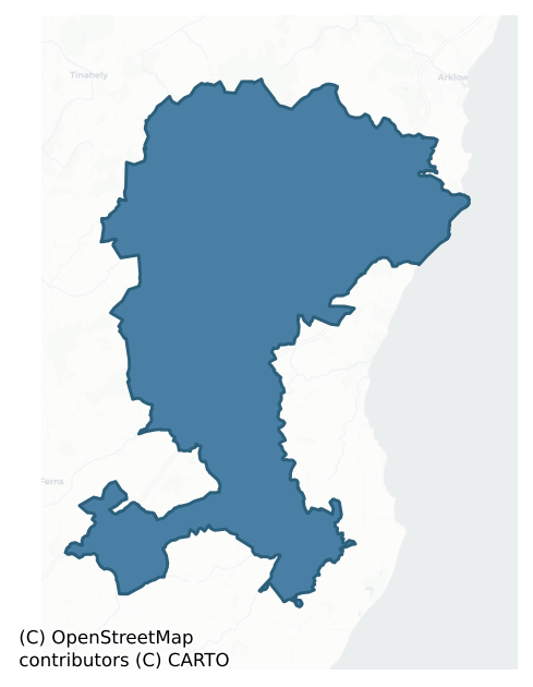
Gorey is a barony of County Wexford, in the historical province of Leinster (Irish: Guaire), covering 331 km² of land. The barony records 444 NMS archaeological sites and 229 NIAH listed buildings, placing it at around the 26th percentile among 280 ROI baronies for sites per km². This means it is in the bottom third of all baronies for sites per km². Dated archaeological evidence runs from the Neolithic through to the Post Medieval, spanning 7 of 9 archaeological periods, placing the barony in the 37th percentile among 280 ROI baronies for chronological depth. This means it is in the lower half of all baronies for chronological depth. The largest dated subset of recorded sites dates to the Iron Age. Logainm flags 48 placenames in the barony as carrying a recognised heritage root; the largest share — around 71% — are names associated with early Christian church and monastic foundations.
Heritage at a glance
Percentile rankings throughout this profile compare each barony only against the other 279 Republic of Ireland baronies.
The recorded heritage of Gorey
The National Monuments Service Sites and Monuments Record (SMR) is the statutory inventory of archaeological sites for the Republic of Ireland, maintained by the Department of Tourism, Culture, Arts, Gaeltacht, Sport and Media. Sites recorded here include earthworks, ringforts, megalithic tombs, ecclesiastical remains, and post-medieval features; not every record is legally protected, but each is registered as a monument of archaeological interest.
The National Monuments Service records 444 archaeological sites in Gorey, putting it at the 26th percentile among 280 ROI baronies for sites per km². This means it is in the bottom third of all baronies for sites per km². Of these, 353 (80%) fall within a recorded monument protection zone. The record is dominated by defensive sites — ringforts, enclosures, hillforts, and stone forts (134 sites, 30% of the total), with agricultural and prehistoric industrial sites forming a substantial secondary presence (66 sites, 15%). Ringfort – rath is the most prevalent type, making up 15% of the barony's recorded sites (66 records), broadly in line with the ROI average of 20% across all baronies where this type occurs. Ringfort – rath is an earthen ringfort enclosed by a bank and external ditch — the most common Early Medieval farmstead, broadly dated 500–1000 AD. Other significant types include Fulacht fia (44) and Standing stone (28). Fulacht fia is a horseshoe-shaped Bronze Age burnt mound built around a sunken trough beside a water source, traditionally interpreted as a cooking site; Standing stone is a deliberately set upright stone, used variously as a Bronze/Iron Age burial marker, route marker or commemorative monument. Across the barony's 331 km², this gives a recorded density of 1.34 sites per km².
Most common monument types
Hover or tap a monument type to see its definition.
| Type | Count |
|---|---|
| Ringfort – rath an earthen ringfort enclosed by a bank and external ditch — the most common Early Medieval farmstead, broadly dated 500–1000 AD | 66 |
| Fulacht fia a horseshoe-shaped Bronze Age burnt mound built around a sunken trough beside a water source, traditionally interpreted as a cooking site | 44 |
| Standing stone a deliberately set upright stone, used variously as a Bronze/Iron Age burial marker, route marker or commemorative monument | 28 |
| Enclosure a banked or ditched feature of uncertain type, used as a catch-all where the original function cannot be determined from surface evidence | 25 |
| Ringfort – unclassified a circular Early Medieval settlement enclosure where surviving evidence does not allow distinction between earthen and stone forms | 25 |
| Burnt mound a heap of fire-cracked stone, ash and charcoal, with no surviving trough, dated Bronze Age to early medieval | 18 |
| Excavation – miscellaneous | 18 |
| Church a building used for public Christian worship, of any date from c. 500 AD onwards | 17 |
Chronological distribution
The dated archaeological record for Gorey spans from the Neolithic through to the Post Medieval, with activity attested across 7 of 9 archaeological periods. Every period from earliest to latest is represented in the record — an unbroken sequence of dated activity across the full chronological span. Activity concentrates most heavily in the Iron Age (125 sites, 39% of dated material), with the Middle Late Bronze Age forming a secondary peak (69 sites, 21%). A further 123 recorded sites (28% of the overall NMS register for the barony) carry no period attribution — appearing as 'Unknown' in the bar chart below. This typically reflects either records that pre-date the standardised period vocabulary or sites awaiting specialist dating review, rather than a genuine absence of chronological evidence.
Sample of recorded monuments
Show 25 sample monuments (of 444 total)
A representative sample of 25 recorded monuments drawn from the barony’s 444 total NMS entries. Sites within a recorded monument protection zone and rarer site types are prioritised so the list shows a meaningful cross-section rather than only the most common type. Each entry shows the official Sites and Monuments Record reference number and the description published by the National Monuments Service.
Castle – motte and bailey
Situated on a rise on the floor of a closed valley with higher ground all around within 400m – 1.2 km, and overlooked by Kilcash church (WX002-001001-), c. 800m to the NNE. It is marked on the 1841 ed. of the OS 6-inch…
Situated on a rise on the floor of a closed valley with higher ground all around within 400m – 1.2 km, and overlooked by Kilcash church (WX002-001001-), c. 800m to the NNE. It is marked on the 1841 ed. of the OS 6-inch map as a mound (diam. of base c. 40m) with a subcircular enclosure (dims. c. 30m NW-SE; c. 20m NE-SW) just to the SW. It is described by Kinahan (1879-88, 154–5) and Westropp (1904, 321) as a motte and bailey, and Kinahan records a midden (WX002-052—-) in the fosse of the motte at SW. Orpen (1907, 136; 1911, 270–71) regarded it as the inauguration site of the Uí Cinsealaigh, and it is very likely that it was used in this manner with a prehistoric mound at its core (FitzPatrick 2004, 91-2, 104). However, it may have been adapted later as a motte and bailey, which would be its final manifestation. It is not visible at ground level as it has been removed by quarrying. Standing stone (WX002-004003-) and the cist and pit burials (WX002-004002-) are at the same location.
The above description is derived from the published 'Archaeological Inventory of County Wexford' (Dublin: Stationery Office, 1996). In certain instances the entries have been revised and updated in the light of recent research.
Compiled by: Michael Moore
Date of upload/revision: 27 January 2012
Hut site
According to Kinahan (1879-88, 157) there were three circles defined by collapsed stone walls on the S-facing slope of Connagh Hill, at a location indicated on a field map of the Geological Survey of Ireland. The area…
According to Kinahan (1879-88, 157) there were three circles defined by collapsed stone walls on the S-facing slope of Connagh Hill, at a location indicated on a field map of the Geological Survey of Ireland. The area is now forested and there is no indication of the hut-sites. A stone with rock art (WX002-041—-) was nearby to the S.
Compiled by: Michael Moore
Date of upload: 1 February, 2012
Cupmarked stone
According to Kinahan (1879-88, 157) there was a large flat rock with seven cup-marks on its surface just S of three hut-sites (WX002-040—-) on the S-facing slope of Connagh Hill, at a location indicated on a field map…
According to Kinahan (1879-88, 157) there was a large flat rock with seven cup-marks on its surface just S of three hut-sites (WX002-040—-) on the S-facing slope of Connagh Hill, at a location indicated on a field map of the Geological Survey of Ireland. The area is now forested and there is no indication of either the hut-sites or the rock art.
Compiled by: Michael Moore
Date of upload: 1 February, 2012
Cairn – ring-cairn
The precise location of this monument is unknown, but it was in an area occupied as a concentrated settlement in the late 19th century, and is now developed as a farmyard. It was situated towards the top of a S-facing…
The precise location of this monument is unknown, but it was in an area occupied as a concentrated settlement in the late 19th century, and is now developed as a farmyard. It was situated towards the top of a S-facing slope just down from a col between low hills c. 400m to the W and E and c. 40-50m higher than the col.
It was described by Kinahan (1879-88) as two concentric circles of stones (diams c. 3m and c. 4m), one within the other, enclosing and partly overlying four pits filled with ashes and burnt stone. There was burnt stones and ashes between the rings N-E and S-W, and both the stones and pits were covered with a clay mantle (ext. diam. c. 6-8m). The cairn was at the centre of a complex area where a cist (WX002-043—-) and a flat cemetery (WX002-0042—-) had been discovered on separate occasions, and there was a fulacht fia (WX002-039—-) nearby. The ring-cairn was listed as a possible Linkardstown-type cist (Ryan 1981, 146).
The above description is derived from the published 'Archaeological Inventory of County Wexford' (Dublin: Stationery Office, 1996). In certain instances the entries have been revised and updated in the light of recent research.
Compiled by: Michael Moore
Date of upload/revision: 1 February 2012
Midden
According to Kinahan (1879-88, 155) there was a midden in the fosse around the motte (WX002-004001-) at SW, or in the area immediately adjacent. It was disturbed when a field bank was made around the fosse, and a gold…
According to Kinahan (1879-88, 155) there was a midden in the fosse around the motte (WX002-004001-) at SW, or in the area immediately adjacent. It was disturbed when a field bank was made around the fosse, and a gold ring was reputedly discovered at the time. The ares is now quarried.
Compiled by: Michael Moore
Date of upload: 1 February, 2012
Cross – Wayside cross
Located in a slight col on a N-S spur, and on the W road bank of a NNW-SSE road. It was described as the stone cross of Ballie Lis in the Civil Survey (1654-56) where it was a marker for the boundary of Gorey Barony and…
Located in a slight col on a N-S spur, and on the W road bank of a NNW-SSE road. It was described as the stone cross of Ballie Lis in the Civil Survey (1654-56) where it was a marker for the boundary of Gorey Barony and Killinhugh parish (Simington 1953, 3, 5). This is the head of a square-cut (dims. 22cm x 21cm) granite cross of Latin type protruding through road fence (visible H 0.6m; spread of arms 0.7m).
The above description is derived from the published 'Archaeological Inventory of County Wexford' (Dublin: Stationery Office, 1996). In certain instances the entries have been revised and updated in the light of recent research.
Compiled by: Michael Moore
Date of upload/revision: 1 February 2012
Barrow – bowl-barrow
Described as a 'Moat' on the 1839 ed. of the OS 6-inch map and as a 'Tumulus' on the 1940 ed. Situated on a scarp immediately overlooking the N-S combined Clonough and Inch Rivers, with the stream immediately to the W.…
Described as a 'Moat' on the 1839 ed. of the OS 6-inch map and as a 'Tumulus' on the 1940 ed. Situated on a scarp immediately overlooking the N-S combined Clonough and Inch Rivers, with the stream immediately to the W. A record made in 1940 includes a fosse (Wth of top c. 7m at W to c. 10m at E; int. D 3-3.5m; ext. D 1.5m) that merges into a berm (Wth c. 10m) S-W, with an outer bank (Wth of base c. 9m; ext. H 3m) SW-NW (OSFM). In 1987 it is a large grass-covered earthen mound (diam. of top 16.5m; diam. of base c. 32m; H c. 3m generally to 5m at W) with some scrub. There is no visible fosse, kerb or outer bank, but it could be a motte.
The above description is derived from the published 'Archaeological Inventory of County Wexford' (Dublin: Stationery Office, 1996). In certain instances the entries have been revised and updated in the light of recent research.
Compiled by: Michael Moore
Date of upload/revision: 20 November 2012
Millstone quarry
Located towards the bottom of a S and SE-facing slope. An area of bedrock is split and a loose portion (dims. 4.8m NE-SW; 1.8m NW-SE; H 1.4-1.8m) is supported on a sidestone (dims. 2m NE-SW; 0.3-0.5m NW-SE; H 1m) at SE…
Located towards the bottom of a S and SE-facing slope. An area of bedrock is split and a loose portion (dims. 4.8m NE-SW; 1.8m NW-SE; H 1.4-1.8m) is supported on a sidestone (dims. 2m NE-SW; 0.3-0.5m NW-SE; H 1m) at SE and the bedrock itself at NW. It is possibly connected with the making of millstones.
The above description is derived from the published 'Archaeological Inventory of County Wexford' (Dublin: Stationery Office, 1996). In certain instances the entries have been revised and updated in the light of recent research.
Compiled by: Michael Moore
Date of upload/revision: 29 February 2012
Mass-rock
Marked only on the 1940 ed. of the OS 6-inch map, and situated in a scrub-covered fold on the steep N-facing slope of a deep W-E valley. There is a small arm-chair arrangement of stones and bedrock creating a shelf (Wth…
Marked only on the 1940 ed. of the OS 6-inch map, and situated in a scrub-covered fold on the steep N-facing slope of a deep W-E valley. There is a small arm-chair arrangement of stones and bedrock creating a shelf (Wth 0.8m; D 0.7m) which was known locally as a place where Mass was celebrated (OSFM 1940).
The above description is derived from the published 'Archaeological Inventory of County Wexford' (Dublin: Stationery Office, 1996). In certain instances the entries have been revised and updated in the light of recent research.
Compiled by: Michael Moore
Date of upload/revision: 21 November, 2012
Standing stone – pair
Two standing stones are marked close together only on the 1940 ed. of the OS 6-inch map. They are located towards the top of an E-facing slope, with a col c. 300m to the W. An earthfast stone (dims c. 1.5m x c. 0.35m; H…
Two standing stones are marked close together only on the 1940 ed. of the OS 6-inch map. They are located towards the top of an E-facing slope, with a col c. 300m to the W. An earthfast stone (dims c. 1.5m x c. 0.35m; H c. 1m) was described in 1939 with a second stone (dims c. 1.5m x c. 1.2m; max. H 0.9m at E), which might be bedrock, located c. 1.5m to the S (OSFM). Neither stone was visible at ground level in pasture in 1987.
The above description is derived from the published 'Archaeological Inventory of County Wexford' (Dublin: Stationery Office, 1996). In certain instances the entries have been revised and updated in the light of recent research.
Compiled by: Michael Moore
Date of upload/revision: 21 November 2012
Mill – unclassified
A mill at Monaseed was owned by Henry Masterson in 1640, but this was ruined by the time of the Civil Survey (1654-6) (Simington 1953, 7, 30). A mill is marked on the 1839 and 1924 eds of the OS 6-inch map at…
A mill at Monaseed was owned by Henry Masterson in 1640, but this was ruined by the time of the Civil Survey (1654-6) (Simington 1953, 7, 30). A mill is marked on the 1839 and 1924 eds of the OS 6-inch map at Millquarter on a W-facing slope in the valley of the N-S River Lask, c. 60m from the stream. The mill survives as a two-storey structure (ext. dims. 7.1m N-S; 6.1m E-W) with walls 0.6m thick. Two large beams support the first floor, but no milling equiptment survives. The head race (L c. 500m), still with a strong flow of water, runs parallel with the stream until it turns W along the N side of the mill. There is a later structure attached to the W of the mill. The date of the mill building is unknown but it is probably on the site of the original.
Compiled by; Michael Moore
Date of upload: 1 February, 2012
Barrow – ring-barrow
Situated in a shallow basin at the source of the W-E River Lask, with a slight hill c. 800m to the E and higher hills c. 2km to the NW in Co. Wicklow. This is a circular area (diam. 8.2m) surrounded by a wet fosse (Wth…
Situated in a shallow basin at the source of the W-E River Lask, with a slight hill c. 800m to the E and higher hills c. 2km to the NW in Co. Wicklow. This is a circular area (diam. 8.2m) surrounded by a wet fosse (Wth 4.5–5.8m; D 0.8m) and an outer earthen bank (Wth 1.5–2m). It is truncated by a NW-SE field bank at SW (max. ext. diam. 21.5m). Pond (WX006-083003-) is c. 30m to the SW. It is now in a coniferous wood.
The above description is derived from the published 'Archaeological Inventory of County Wexford' (Dublin: Stationery Office, 1996). In certain instances the entries have been revised and updated in the light of recent research.
Compiled by: Michael Moore
Date of upload/revision: 2 March, 2012
Graveslab
There is a wedge-shaped graveslab (dims. 2.05m x. 0.75-0.95m) with a ringed cross in relief (H 1.9m; Wth 0.8m) within the graveyard (WX007-015002-) of Kilgorman church (WX007-015001-).
Compiled by: Michael…
There is a wedge-shaped graveslab (dims. 2.05m x. 0.75-0.95m) with a ringed cross in relief (H 1.9m; Wth 0.8m) within the graveyard (WX007-015002-) of Kilgorman church (WX007-015001-).
Compiled by: Michael Moore
Date of upload: 15 March, 2012
Historic town
There may have been a settlement at Gorey in the thirteenth century as a payment of 13 shillings was made by 'the communityh of the town (ville) of Gorey' in 1296, but nothing further is known until the 17th century…
There may have been a settlement at Gorey in the thirteenth century as a payment of 13 shillings was made by 'the communityh of the town (ville) of Gorey' in 1296, but nothing further is known until the 17th century when Gorey emerges a planned town, part of the early 17-century plantation of north county Wexford. It received its first charter in 1619 as Newtown or Newborough. Bishop Ram, the Protestant bishop of Ferns lived at Gorey. The town was captured by Rebels in 1641.
The town was laid out on a grid pattern covering c. 14 acres (c. 5.5 ha), and it might never have been defended with a wall, although there are passing references to ramparts in the early 18th century. Main Street runs ENE-WSW through the centre of the original town area, which extends from Pearse St. at N to Church Lane at S, The Avenue at W to Church St. at E. The graveyard and church site (WX007-033001-) with the Ram tomb (WX007-03303-) are within the town. Archaeological testing within the town has yet to produce any related material. (Bradley and King 1990, 88-91; Hore 1900-11, vol. 6, 609-34)
The above description is derived from the published 'Archaeological Inventory of County Wexford' (Dublin: Stationery Office, 1996). In certain instances the entries have been revised and updated in the light of recent research.
Compiled by: Michael Moore
Date of upload/revision: 15 March 2012
Water mill – horizontal-wheeled
Discovered in land reclamation c. 1985. An oak flume (L 3.87m), two structural beams (L 3.2m; 1.7m) and a possible portion of unfinished paddle survive. A sample from one of the structural timbers produced a…
Discovered in land reclamation c. 1985. An oak flume (L 3.87m), two structural beams (L 3.2m; 1.7m) and a possible portion of unfinished paddle survive. A sample from one of the structural timbers produced a dendrochronological felling date of AD 1228±9 (M. Baillie, Palaeoecology Laboratory, Queen's University, Belfast).
The above description is derived from the published 'Archaeological Inventory of County Wexford' (Dublin: Stationery Office, 1996). In certain instances the entries have been revised and updated in the light of recent research.
Date of upload/revision: 16 March, 2012
Cairn – unclassified
Situated in a valley bottom, with a small N-S stream c. 130m to the W. There is a cairn (diam. 2.5m; H 0.2m) with quartz stones just N of the centre of the enclosure (WX011-001001-), but there is no evidence of a…
Situated in a valley bottom, with a small N-S stream c. 130m to the W. There is a cairn (diam. 2.5m; H 0.2m) with quartz stones just N of the centre of the enclosure (WX011-001001-), but there is no evidence of a structure.
Compiled by: Michael Moore
Date of upload: 11 April, 2012
Cross – High cross
Located on a gentle E-facing slope. The parish church of Rossminoge (WX011-002001) is within a rectangular graveyard (WX011-002002-) defined by an earthen bank, which has a fosse or ditch (Wth of top 5.5m; D 0.8m)…
Located on a gentle E-facing slope. The parish church of Rossminoge (WX011-002001) is within a rectangular graveyard (WX011-002002-) defined by an earthen bank, which has a fosse or ditch (Wth of top 5.5m; D 0.8m) inside it on the SE side. In the SW corner of graveyard is the ringed but unpierced and undecorated head of a large granite high cross (H 0.93m; Wth 0.84m; T c. 0.1m), but one of the arms is missing. It is standing upright in the socket of a granite base (dims 0.56m x 0.4m; H 0.25m plus).
Compiled by: Michael Moore
Date of upload: 11 April, 2012
Castle – ringwork
Located towards the top of a NE-facing slope. This is a circular scrub-covered area (diam. 26m) defined by an earthen bank (Wth 15m; H 1.8–2.3m) with an external silted fosse (Wth of top 5m; D 0.4m) beyond which is a…
Located towards the top of a NE-facing slope. This is a circular scrub-covered area (diam. 26m) defined by an earthen bank (Wth 15m; H 1.8–2.3m) with an external silted fosse (Wth of top 5m; D 0.4m) beyond which is a scarp (Wth 12m) sloping up to the surface of the surrounding field. There is no visible entrance. The church site (WX021-022001-) is c. 80m to the NW. An extensive geophysical survey conducted for Kilkenny Archaeology revealed that the visible ringwork is at the SE edge of a subcircular enclosure (int. diam. 72m E-W; 68m N-S) defined by a fosse (Wth c. 5m) that appears to be attached to the fosse defining the ecclesiastical enclosure (WX021-022002-) (Ó Drisceoil 2009, 12). (Barry 1987, 52–3).
The above description is derived from the published 'Archaeological Inventory of County Wexford' (Dublin: Stationery Office, 1996). In certain instances the entries have been revised and updated in the light of recent research.
Compiled by: Michael Moore
Date of upload/revision: 15 June, 2012
Tomb – chest tomb
The parish church of Gorey (WX007-033001-) was within a rectangular graveyard (WX007-033002-) defined by masonry walls. The tomb-chest of Archbishop Ram (D 1634) is within the graveyard. This is an oblong structure…
The parish church of Gorey (WX007-033001-) was within a rectangular graveyard (WX007-033002-) defined by masonry walls. The tomb-chest of Archbishop Ram (D 1634) is within the graveyard. This is an oblong structure (dims. 1.85m x 0.95m; H 0.75m) with an English and Latin inscription in relief on the W end-stone. It lies over a vault that was opened temporarily around 1909 and then sealed (Cantwell 1974-85, vol. 5, No. 189).
Compiled by: Michael Moore
Date of upload: 15 March, 2012
Architectural fragment
The Romanesque parish church of Kilmakilloge (WX007-034001-) is within a D-shaped graveyard (WX007-034002-). Twelve cut stones in the graveyard are from a Romanesque doorway which was in the W gable, and the church…
The Romanesque parish church of Kilmakilloge (WX007-034001-) is within a D-shaped graveyard (WX007-034002-). Twelve cut stones in the graveyard are from a Romanesque doorway which was in the W gable, and the church originally had a separate nave and chancel according to John O'Donovan writing c. 1840 (O'Flanagan 1933, vol. 1, 10).
Compiled by: Michael Moore
Date of upload: 15 March, 2012
Walled garden
Situated on a SE-facing slope in a broad col with hills c. 600m to the NW and c. 1.5km to the SE. Monaseed was granted to William Marwood in 1613 and by 1621 the house (WX006-071001-) had been built as well as a walled…
Situated on a SE-facing slope in a broad col with hills c. 600m to the NW and c. 1.5km to the SE. Monaseed was granted to William Marwood in 1613 and by 1621 the house (WX006-071001-) had been built as well as a walled orchard that is described as measuring 268 feet by 161 feet (loeber, Stouthamer-Loeber 1987, 193-4). The present farm complex c. 60m E of Monaseed House (WX006-071001-) has corresponding dimensions (dims. c. 86m NE-SW; c. 50m NW-SE) and its SW wall (Wth 0.6-0.8m; H c. 2.5m) is probably original as it is poorly bonded with clay mortar and has two adjacent flat-arched gateways (Wth c. 3m) with undressed vouosoirs.
Compiled by: Michael Moore
Date of upload: 1 March, 2012
House – medieval
Excavated (E3471) during 2005 by H. Schweitzer as a part of Site 6 at Moneycross Upper, which was one of the excavations undertaken in advance of the construction of the N11 Arklow-Gorey link-road. Situated in a…
Excavated (E3471) during 2005 by H. Schweitzer as a part of Site 6 at Moneycross Upper, which was one of the excavations undertaken in advance of the construction of the N11 Arklow-Gorey link-road. Situated in a low-lying landscape on a slight S-facing slope. A house (dims. 14.5m N-S; 6.6m E-W) defined by a slot-trench (Wth c. 0.3-0.8m; D 0.02-0.2m) that was complete apart from the N half of the W side had a doorway (Wth 1.2m) in the centre of the E wall. The doorway and adjacent walling had been repaired once. Iron artefacts and Leinster cooking ware can be associated with it. Disturbance of the interior ensured that no in situ features could be recorded, but a re-deposit of charcoal may indicate a hearth. Two small pits, located outside c. 5m to the SE and to the SW are probably contemporary. The house is associated with field system (WX011-054002-), part of which were excavated to the W. (Schweitzer 2008; 2009; Eogan and Kelly 2016, 222)
Compiled by: Michael Moore
Date of upload: 12 April, 2012
Pit alignment
This site was excavated (E3502) during 2005 as a part of a complex area know as Site 42-44 of the N11 Gorey to Arklow link. An extensive area (dims. 250m N-S 48-60m E-W) across the road-take was excavated, but…
This site was excavated (E3502) during 2005 as a part of a complex area know as Site 42-44 of the N11 Gorey to Arklow link. An extensive area (dims. 250m N-S 48-60m E-W) across the road-take was excavated, but geophysical survey indicates that activity extended outside this to the E, W and SW. Situated on the lower NW-facing slope of Ask Hill.
This is Structure J in area A, where three parallel lines of pits are roughly aligned WNW-ESE. The N line consists of eight large but shallow pits extending from N of ring-ditch (WX007-076004-) to beyond the excavated area at E (L 16m plus). The S row (L 6m plus) has smaller pits and had some associated lithics and pottery, while the central row was shorter and equidistant from the other two. The flat cemetery (WX007-076003-) is c. 8m to the N. (Stevens 2008a, 392; 2008, 17-19)
Compiled by: Michael Moore
Date of upload: 16 March, 2012
Timber circle
This site was excavated (E3502) during 2005 as a part of a complex area know as Site 42-44 of the N11 Gorey to Arklow link. An extensive area (dims. 250m N-S 48-60m E-W) across the road-take was excavated, but…
This site was excavated (E3502) during 2005 as a part of a complex area know as Site 42-44 of the N11 Gorey to Arklow link. An extensive area (dims. 250m N-S 48-60m E-W) across the road-take was excavated, but geophysical survey indicates that activity extended outside this to the E, W and SW. Situated on the lower NW-facing slope of Ask Hill.
This is structure K in area B, located just W and NW of ring-ditch (WX007-076010-). It consists of two interrupted arcs of post-holes surrounding two larger post-holes, but the W half of the structure survives unexcavated, so its classification is uncertain. The central post-holes (dims 2.6m x 1.95: 2.03m x 1.8m) had sloping sides (D 0.25m) at the top leading to straight post-pits (D 1.75m; 1.85m), one with a stone at its base. Some flints and slight amounts of cremated remains were recovered. (Stevens 2008, 27-31; 392, 2008a, 392)
Compiled by: Michael Moore
Date of upload: 16 March, 2012
Ringfort – rath
Marked as a subrectangular or D-shaped embanked enclosure (ext. dims c. 70m NE-SW; c. 50m NE-SW) on the 1839 ed. of the OS 6-inch map. It is not visible at ground level in pasture in a level, low-lying landscape, but it…
Marked as a subrectangular or D-shaped embanked enclosure (ext. dims c. 70m NE-SW; c. 50m NE-SW) on the 1839 ed. of the OS 6-inch map. It is not visible at ground level in pasture in a level, low-lying landscape, but it is visible as a cropmark of a sub-rectangular or pentagonal enclosure defined by the parch-mark of a wide earthen bank (Wth c. 5-10m) with inner and outer ditch features, on the OSI series of vertical aerial photographs (2000). It has been listed as a moated site (Barry 1977, 226, WX 101), but is more likely to have been a rath.
The above description is derived from the published 'Archaeological Inventory of County Wexford' (Dublin: Stationery Office, 1996). In certain instances the entries have been revised and updated in the light of recent research.
Compiled by: Michael Moore
Date of upload/revision: 14 February 2012
Amended: 15 May, 2014
Listed buildings
The National Inventory of Architectural Heritage (NIAH) is a state survey appraising buildings of architectural, historical, archaeological, artistic, cultural, scientific, social, or technical interest. Each surveyed structure receives a rating from International (the highest, for buildings of European importance) through National, Regional, Local, and Record-Only.
The NIAH records 229 listed buildings in Gorey, the 82nd percentile across ROI baronies for listed-building density. The highest-graded structure include 1 of National significance. The Republic holds 937 National-graded buildings in total, so this barony accounts for around 0% of the national total. Construction dates concentrate most heavily in the Victorian (1830-1900) period. The most-recorded building type is house (66 examples, 29% of the listed stock).
Terrain and environment
Mean elevation across the barony is 103m — the 61st percentile among 280 ROI baronies for elevation. This means it is in the upper half of all baronies for elevation. Elevation matters for heritage because higher-altitude baronies typically favour defensive monuments — ringforts and hilltop forts placed on prominent ground — while lowland baronies are more likely to carry the dense settlement and church networks of intensive agricultural landscapes. The barony reaches 601m at its highest point — a vertical span of more than 497m within its boundary, indicating significant topographic diversity. Mean slope is 4.5° — the 68th percentile among 280 ROI baronies for slope. This means it is in the top third of all baronies for slope. Slope is a key control on both land use and archaeological preservation: steep ground resists ploughing and tends to preserve earthworks intact, while gentle slopes favour intensive cultivation that damages or destroys surface archaeology over time. The Topographic Wetness Index averages 10.3, the 30th percentile among 280 ROI baronies for wetness. This means it is in the bottom third of all baronies for wetness. Drainage matters for heritage because poorly-drained ground preserves organic archaeology (wooden trackways, leather, textiles, and on rare occasions human remains) far better than free-draining soil; well-drained ground favours arable use but destroys organic material rapidly. The land-cover mosaic combines improved grassland (67%), woodland (17%), and arable farmland (14%), giving a mixed agricultural and semi-natural landscape.
Terrain measurements
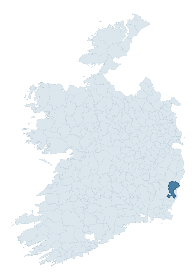
Where this barony sits in the Republic of Ireland
Geology and preservation
Bedrock geology shapes the landscape long before any settlement begins — controlling soil drainage, agricultural potential, the survival of upstanding monuments, and the preservation of buried archaeology. The figures below come from the Geological Survey Ireland 1:100,000 bedrock map.
The bedrock underlying Gorey is predominantly slate (36% of the barony by area), laid down during the Ordovician period (94% by area, around 485 to 444 million years ago). Slate weathers to thin upland soils but provides high-value building and roofing stone, which often shows in surviving 19th-century rural and ecclesiastical architecture. A substantial secondary geology of slates (20%) and rhyolite (15%) adds further variety to the underlying landscape. With 9 distinct rock types mapped, the barony sits in the top third of ROI baronies for geological diversity (87th percentile) — typically a sign of complex tectonic history or coastal mosaics of differing rock units.
Rock type composition
Largest mapped unit: Ballylane Shale Formation (22% of the barony)
Placename evidence
Logainm records 48 heritage-diagnostic placenames for Gorey, drawn from townland and civil-parish names across the barony. The dominant stratum is Early Christian ecclesiastical — cill-, teampall-, and domhnach-prefixed names that record the dense network of early church foundations established between the fifth and tenth centuries. The leading diagnostic roots are cill- (30 — church), ráth- (6 — earthen ringfort), and tobar- (4 — holy well). This is above the ROI average of 30.7 heritage placenames per barony. The presence of multiple heritage strata side by side indicates layered occupation of the landscape across successive prehistoric and historic periods. Logainm records 379 placenames for Gorey (predominantly townland names). Of these, 48 (13%) carry one of the diagnostic Gaelic roots tracked above; the remainder draw on more generic landscape vocabulary that does not encode a heritage period.
Pre-Christian / Early Medieval Defensive
| Root | Count | Meaning |
|---|---|---|
| ráth- | 6 | earthen ringfort |
| lios- | 2 | ringfort or enclosure |
| dún- | 2 | hilltop or promontory fort |
Early Christian Ecclesiastical
| Root | Count | Meaning |
|---|---|---|
| cill- | 30 | church (early) |
| tobar- | 4 | holy well |
Burial, Ritual, and Norse-Contact
| Root | Count | Meaning |
|---|---|---|
| tuaim- | 2 | burial mound |
| carn- | 2 | cairn |
Other baronies in Wexford
About this profile
Click any section below to expand.
What is a barony?
A barony is a historic administrative unit in Ireland, broadly equivalent to an English hundred. The 280 baronies used here are from the OSi 2019 National Statutory Boundaries (generalised 20m), covering the 26 counties of the Republic of Ireland. Baronies derive from the Norman period, were formalised in the 17th century, and have not been redrawn for statistical purposes. They vary enormously in area, from compact urban baronies in Dublin to vast upland baronies in Connacht, and should not be compared by raw site count without accounting for area differences.
What counts as a site?
This profile combines three distinct heritage registers, each with its own definition of what constitutes a recordable site:
- Archaeological sites (NMS). The National Monuments Service Sites and Monuments Record (SMR) catalogues every known archaeological monument or site of archaeological interest in the Republic, from prehistoric burial mounds and ringforts to medieval churches and post-medieval defensive works. Inclusion does not require legal protection — only that the site has been identified, surveyed, and assessed as having archaeological value. A separate subset of these sites lies within a recorded protection zone, which gives them statutory protection under the National Monuments Acts.
- Listed buildings (NIAH). The National Inventory of Architectural Heritage records buildings of architectural, historical, archaeological, artistic, cultural, scientific, social, or technical interest. Each surveyed structure is appraised on a five-tier scale: International, National, Regional, Local, and Record-Only. The NIAH appraisal is informational rather than strictly statutory, but it underpins local-authority Record of Protected Structures (RPS) listings.
- Heritage placenames (Logainm). Logainm is the authoritative database of Irish placenames maintained by the Placenames Branch. This profile applies a heritage-diagnostic classifier to the Irish-language form of each townland name, flagging roots that signal defensive sites (ráth-, lios-, dún-, caiseal-, cathair-), ecclesiastical foundations (cill-, teampall-, domhnach-, mainistir-), prehistoric burial-ritual features (tuaim-, carn-, leaba-), or Norse-contact settlement (gall-). Townlands without one of these diagnostic roots are not flagged here — they may still carry historical significance, but that significance is not encoded in the name itself.
Editorial principles
The narrative sections of this profile follow several explicit principles:
- Evidential. Every claim about this barony’s heritage character is anchored in the underlying register data. Where a site count, a placename count, or a percentile rank is cited, it is computed from the source datasets at export time, not estimated.
- Comparative. Counts and metrics are reported alongside their percentile rank against the other 279 ROI baronies. A barony with 50 ringforts in absolute terms could be unusually high or unusually low depending on its size and regional context; percentile ranking removes that ambiguity.
- Transparent on limits. Where a register has known coverage gaps, survey biases, or data-quality issues that affect this barony’s figures, the profile flags them rather than presenting the numbers as definitive.
- No interpretation beyond what the data supports. The narrative does not speculate about historical events, social dynamics, or cultural meaning beyond what the recorded heritage and placename evidence directly attests.
Data caveats and limits
- NMS Sites and Monuments Record is the product of survey campaigns conducted at different intensities across different counties and decades. Some baronies have been surveyed more thoroughly than others, and absolute counts should be read in that light. Sites destroyed by development before survey are typically not represented; sites in heavily forested or upland terrain are sometimes under-recorded.
- NIAH coverage is broadly complete for the Republic of Ireland but the survey was conducted on a rolling county-by-county basis, and the most recent appraisal date varies. Buildings demolished or substantially altered after their original survey may still appear in the register; conversely, recent buildings of merit may not yet have been appraised.
- Logainm classification applies a deliberately conservative pattern-matching approach to the Irish-language townland forms. The classifier prioritises true positives over recall: a townland may carry a heritage signal that the classifier doesn’t recognise, particularly where the diagnostic root has been heavily anglicised or where the townland name draws on a less common term. The 60,000+ townland records and ~9,800 classified placenames give a substantial signal at barony scale, but individual townland names should be checked against Logainm directly for definitive interpretation.
- Period attribution. The chronological distribution reflects only those NMS sites that carry a recognised period attribution in the source data. Sites listed as “Unknown” period are excluded from the dated subset.
- Boundary changes. Some baronies have undergone minor boundary adjustments since their 19th-century definition; the OSi 2019 generalised boundaries used here are the current statutory definition and may differ slightly from historical maps in border areas.
- Bedrock geology is mapped at 1:100,000 scale, which means local variation within a barony — small pockets of different rock type, mineral veins, alluvium overlying bedrock — is generalised. The dominant-system and rocktype figures are area-weighted, so a barony reading “70% Carboniferous limestone” may still contain small but archaeologically important pockets of older or younger rock. Around 3% of GSI polygons do not match the lexicon and contribute no rocktype or system attribution.
Data sources
- National Monuments Service — Sites and Monuments Record (SMR) https://data.gov.ie/dataset/national-monuments-service-archaeological-survey-of-ireland
- National Inventory of Architectural Heritage (NIAH) https://data.gov.ie/dataset/national-inventory-of-architectural-heritage-niah-national-dataset
- Logainm — Placenames Database of Ireland https://www.logainm.ie/
- Ordnance Survey Ireland — National Statutory Barony Boundaries 2019 https://data-osi.opendata.arcgis.com/
- EURODEM — European Digital Elevation Model https://www.mapsforeurope.org/datasets/euro-dem
- ESA WorldCover https://esa-worldcover.org/en
- Geological Survey Ireland — 1:100,000 Bedrock Geology https://www.gsi.ie/en-ie/data-and-maps/Pages/Bedrock.aspx
Explore more: Search any of the 280 ROI baronies, browse by historical province, or read the methodology and data sources for the full Republic of Ireland Heritage Tool.