
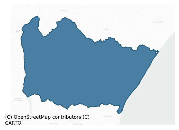
Ballaghkeen South is a barony of County Wexford, in the historical province of Leinster (Irish: An Bealach Caoin Theas), covering 166 km² of land. The barony records 248 NMS archaeological sites and 160 NIAH listed buildings, placing it at around the 33rd percentile among 280 ROI baronies for sites per km². This means it is in the lower half of all baronies for sites per km². Dated archaeological evidence runs from the Early Bronze Age through to the Post Medieval, spanning 6 of 9 archaeological periods, placing the barony in the 16th percentile among 280 ROI baronies for chronological depth. This means it is in the bottom fifth of all baronies for chronological depth. The largest dated subset of recorded sites dates to the Iron Age. Logainm flags 22 placenames in the barony as carrying a recognised heritage root; the largest share — around 73% — are names associated with early Christian church and monastic foundations.
Heritage at a glance
Percentile rankings throughout this profile compare each barony only against the other 279 Republic of Ireland baronies.
The recorded heritage of Ballaghkeen South
The National Monuments Service Sites and Monuments Record (SMR) is the statutory inventory of archaeological sites for the Republic of Ireland, maintained by the Department of Tourism, Culture, Arts, Gaeltacht, Sport and Media. Sites recorded here include earthworks, ringforts, megalithic tombs, ecclesiastical remains, and post-medieval features; not every record is legally protected, but each is registered as a monument of archaeological interest.
The National Monuments Service records 248 archaeological sites in Ballaghkeen South, putting it at the 33rd percentile among 280 ROI baronies for sites per km². This means it is in the lower half of all baronies for sites per km². Of these, 223 (90%) fall within a recorded monument protection zone. The record is dominated by defensive sites — ringforts, enclosures, hillforts, and stone forts (97 sites, 39% of the total), with ecclesiastical sites forming a substantial secondary presence (45 sites, 18%). The most diagnostically specific type is Ring-ditch (33 records, 13% of the barony's NMS total) — compared to an ROI average of 6% across all baronies where this type occurs. Ring-ditch is a circular ditch under 20m across, often the ploughed-out remains of a barrow, ring-barrow or roundhouse. The broader 'Enclosure' classification — which catches unclassified ringforts and field enclosures — accounts for a further 35 records (14%) and reflects the difficulty of sub-classifying degraded earthworks from surface evidence alone. Across the barony's 166 km², this gives a recorded density of 1.49 sites per km².
Most common monument types
Hover or tap a monument type to see its definition.
| Type | Count |
|---|---|
| Enclosure a banked or ditched feature of uncertain type, used as a catch-all where the original function cannot be determined from surface evidence | 35 |
| Ring-ditch a circular ditch under 20m across, often the ploughed-out remains of a barrow, ring-barrow or roundhouse | 33 |
| Ringfort – rath an earthen ringfort enclosed by a bank and external ditch — the most common Early Medieval farmstead, broadly dated 500–1000 AD | 28 |
| Moated site | 22 |
| Church a building used for public Christian worship, of any date from c. 500 AD onwards | 15 |
| Ritual site – holy well a well or spring traditionally associated with a saint, often credited with healing properties; many trace earlier ritual origins but devotion is documented from the medieval period onwards | 13 |
| Fulacht fia a horseshoe-shaped Bronze Age burnt mound built around a sunken trough beside a water source, traditionally interpreted as a cooking site | 13 |
| Graveyard a burial area associated with a church, in use from the medieval period onwards | 13 |
Chronological distribution
The dated archaeological record for Ballaghkeen South spans from the Early Bronze Age through to the Post Medieval, with activity attested across 6 of 9 archaeological periods. This is the 16th percentile across ROI baronies — a relatively narrow chronological band, with much of Irish prehistory not represented in the dated record. Every period from earliest to latest is represented in the record — an unbroken sequence of dated activity across the full chronological span. Activity concentrates most heavily in the Iron Age (85 sites, 51% of dated material), with the Middle Late Bronze Age forming a secondary peak (27 sites, 16%). A further 81 recorded sites (33% of the overall NMS register for the barony) carry no period attribution — appearing as 'Unknown' in the bar chart below. This typically reflects either records that pre-date the standardised period vocabulary or sites awaiting specialist dating review, rather than a genuine absence of chronological evidence.
Sample of recorded monuments
Show 25 sample monuments (of 248 total)
A representative sample of 25 recorded monuments drawn from the barony’s 248 total NMS entries. Sites within a recorded monument protection zone and rarer site types are prioritised so the list shows a meaningful cross-section rather than only the most common type. Each entry shows the official Sites and Monuments Record reference number and the description published by the National Monuments Service.
Windmill
Marked 'Windmill (in ruins)' on the 1839 and 1940 eds. of the OS 6-inch map. It is situated on the summit of Vinegar Hill overlooking the N-S River Slaney c. 700m to the W and Enniscorthy town. This is a cylindrical…
Marked 'Windmill (in ruins)' on the 1839 and 1940 eds. of the OS 6-inch map. It is situated on the summit of Vinegar Hill overlooking the N-S River Slaney c. 700m to the W and Enniscorthy town. This is a cylindrical tower (ext. diam 4.6m; int. diam. 3.4m) surviving to the first floor (H c. 4.5m). There is one doorway, rebuilt in brick, on the W side and there are three slit windows at the first floor.
The above description is derived from the published 'Archaeological Inventory of County Wexford' (Dublin: Stationery Office, 1996). In certain instances the entries have been revised and updated in the light of recent research.
See the attached view from SW
Compiled by: Michael Moore
Date of upload/revision: 6 June, 2012
This monument is subject to a preservation order made under the National Monuments Acts 1930 to 2014 (PO no. 72/1939) and it is a National Monument in state guardianship, No. 392.
Boulder-burial
Situated on a shelf on the steep S-facing slope with rock outcrop that is on the N side of a ravine, with the NE-SW stream c. 15m to the S. A roofstone (dims 2.1m x 1.7m x 0.7m) is supported on three boulders (dims c.…
Situated on a shelf on the steep S-facing slope with rock outcrop that is on the N side of a ravine, with the NE-SW stream c. 15m to the S. A roofstone (dims 2.1m x 1.7m x 0.7m) is supported on three boulders (dims c. 1m x 0.6m x 0.6m) while the SE corner of the stone is supported on cement blocks. Archaeological testing (98E0326) c. 70m to the NE produced no related material (Bennett 2000).
The above description is derived from the published 'Archaeological Inventory of County Wexford' (Dublin: Stationery Office, 1996). In certain instances the entries have been revised and updated in the light of recent research.
Compiled by: Michael Moore
Date of upload/revision: 20 May 2013
Castle – tower house
Situated on the E bank of the N-S River Slaney with the stream c. 20m to the W. It is thought to have been built by the Brownes of Mulrankin (WX047 031—-) and it is described as 'in ruins' and the property of William…
Situated on the E bank of the N-S River Slaney with the stream c. 20m to the W. It is thought to have been built by the Brownes of Mulrankin (WX047 031—-) and it is described as 'in ruins' and the property of William Browne in 1641, together with 500 acres in Brownswood and Crefoge (Simington 1953, 72).
The remains consist of parts of the E (L 12.1m; T 2.35m) and S (L 6.5m) walls surviving to the second storey. The vaulted ground floor has a lintelled alcove for three gun-loops at the SE angle and a damaged embrasure in the E wall has two gun-loops. At the first floor there is a destroyed light in the E wall and an oubliette is contained in the masonry of the vault at the SE angle with a single gun-loop in the wall above. Two corbels to support the ceiling of the first floor survive in the E wall, and there are fragments of window embrasures at the second floor in the E and S walls.
See the attached section from the Down Survey (1656-8) parish map (N at right) reproduced courtesy of the National Library of Ireland (Ms 725)
The above description is derived from the published 'Archaeological Inventory of County Wexford' (Dublin: Stationery Office, 1996). In certain instances the entries have been revised and updated in the light of recent research.
Compiled by: Michael Moore
Date of upload/revision: 11 July 2012
Historic town
Edermine was given by Richard Marshall to Alianore, Countess of Pembroke and the widow of his brother William in 1232, and by 1301 it seems to have acquired the status of a town as in that year the town of Edirdrim was…
Edermine was given by Richard Marshall to Alianore, Countess of Pembroke and the widow of his brother William in 1232, and by 1301 it seems to have acquired the status of a town as in that year the town of Edirdrim was held by Reginald de Dene of Joan de Valence. In 1234 the burgesses paid 60 shillings in rent, but this is the last reference to burgesses (Hore 1906, vol. 6, 581-3; Bradley and King 1990, 30-1). The location is not certain, but it was probably in the vicinity of the church (WX026-033001-), and evidence of archaeological features (WX026-073—-) has been recorded S of the graveyard, but testing (01E0158) further S on the other side of the stream in Edermine produced no archaeological material (Tierney 2003).
The above description is derived from the published 'Archaeological Inventory of County Wexford' (Dublin: Stationery Office, 1996). In certain instances the entries have been revised and updated in the light of recent research.
Compiled by: Michael Moore
Date of upload/revision: 12 July 2012
Castle – unclassified
Marked as a structure described as Ballinkeel Castle in the 1839 and 1940 eds. of the OS 6-inch map and situated on a rise in a low-lying landscape. John O’Donovan writing c. 1840 says there was an old castle of the…
Marked as a structure described as Ballinkeel Castle in the 1839 and 1940 eds. of the OS 6-inch map and situated on a rise in a low-lying landscape. John O’Donovan writing c. 1840 says there was an old castle of the Hays family at Ballinkeel (O’Flanagan 1933, vol. 1, 356), and he is probably the origin of the mis-classification of what is a folly or gazebo on the grounds of Ballinkeel House, which was adapted later as a dove-cote. According to the Civil Survey (1654-6) William Kennay, a Protestant, owned 300 acres in Ballinkeile in 1641, but there is no record of a castle (Simington 1953, 65). The Hays family acquired the land in the18th century but there are no other references to a castle (Hore 1990-11, vol. 6, 590; Jeffrey 1979, 180-1).
The structure is a square tower (ext. dims. 5.35m x 5.35m; H c. 7m) with mortared shale walls (T 0.85m). There is a lintelled doorway (Wth 1.2m; H 2m) in the S wall but the inner face of the walls is occupied by niches for doves. Externally at the first floor there are large pointed windows (Wth c. 1m; H c. 2m), now blocked up, in each wall.
Compiled by: Michael Moore
Date of upload: 11 July, 2012
Water mill – horizontal-wheeled
Situated on a slight SE-facing slope. Some large worked oak timbers became visible at bottom of land drain at a depth of c. 2m. Three timbers (Wth 0.5m; 0.2m; 0.4m) crossed the bottom of the drain while other timbers…
Situated on a slight SE-facing slope. Some large worked oak timbers became visible at bottom of land drain at a depth of c. 2m. Three timbers (Wth 0.5m; 0.2m; 0.4m) crossed the bottom of the drain while other timbers protruded from the SW face of the drain over a distance of 1.5m and c. 0.2m above the bottom of the drain. A combined dendrochronological felling date of AD 900±9 was derived from two samples from the drain section (M. Baillie, Palaeoecology Laboratory, Queen's University, Belfast).
The above description is derived from the published 'Archaeological Inventory of County Wexford' (Dublin: Stationery Office, 1996). In certain instances the entries have been revised and updated in the light of recent research.
Compiled by: Michael Moore
Date of upload/revision: 11 July 2012
Burial ground
Marked faintly as a rectangular feature (dims. c. 25m E-W; c. 15m N-S) described as 'Moneyboy Burial Ground' in italic lettering on the 1839 ed. of the OS-6 inch map and situated on the N-facing slope of a low rise. It…
Marked faintly as a rectangular feature (dims. c. 25m E-W; c. 15m N-S) described as 'Moneyboy Burial Ground' in italic lettering on the 1839 ed. of the OS-6 inch map and situated on the N-facing slope of a low rise. It was visible in 1978 as a slightly raised trapezoidal area (dims. 24m E-W; 2-8m N-S) with no evidence of burial (SMR file). It is not visible now at around level in a root crop.
The above description is derived from the published 'Archaeological Inventory of County Wexford' (Dublin: Stationery Office, 1996). In certain instances the entries have been revised and updated in the light of recent research.
Compiled by: Michael Moore
Date of upload/revision: 17 July 2012
Pit-burial
Located on a NE-facing slope. An inverted cordoned urn containing the cremation of an adult, a stone battle axe and a flint flake was found in a pit (diam. of top c. 07m; D 0.8) capped with a stone in 1974 (Ryan 1975).…
Located on a NE-facing slope. An inverted cordoned urn containing the cremation of an adult, a stone battle axe and a flint flake was found in a pit (diam. of top c. 07m; D 0.8) capped with a stone in 1974 (Ryan 1975). (Culleton 1984, 37-9; Waddell 1990, 154)
The above description is derived from the published 'Archaeological Inventory of County Wexford' (Dublin: Stationery Office, 1996). In certain instances the entries have been revised and updated in the light of recent research.
Compiled by: Michael Moore
Date of upload/revision: 18 July 2012
Field system
Located on a slight W-facing slope in the basin of the River Sow with the N-S stream at the W edge. An area of c. 8 ha contains an enclosure (WX032-052001-) and nine ring-ditches that are visible as cropmarks on aerial…
Located on a slight W-facing slope in the basin of the River Sow with the N-S stream at the W edge. An area of c. 8 ha contains an enclosure (WX032-052001-) and nine ring-ditches that are visible as cropmarks on aerial photographs (MM (51) 6-15). Also within the area are the cropmarks of a number of field banks from a rectangular field system, not all of which are recorded on OS maps and some of which terminate at the enclosure. The field banks are generally straight and identified as single ditch-features.
Compiled by: Michael Moore
Date of upload: 31 August, 2012
Font
Located at the W edge of a slight N-S ridge. The site of the parish church of Screen (WX033-008001-) is within a raised rectangular graveyard (WX032-008002-). An oval stone (dims. 0.52m x 0.35m; H 0.35m) with an oval…
Located at the W edge of a slight N-S ridge. The site of the parish church of Screen (WX033-008001-) is within a raised rectangular graveyard (WX032-008002-). An oval stone (dims. 0.52m x 0.35m; H 0.35m) with an oval socket, which is almost buried in the graveyard, is regarded as a font but may be a cross-base.
Compiled by: Michael Moore
Date of upload: 4 September, 2012
Souterrain
Situated towards the bottom of a SE-facing slope with the N-S River Sow c. 50m to the S at a point where it turns briefly W. In 1998 ploughing removed a lintel from a short section in the middle of a souterrain passage…
Situated towards the bottom of a SE-facing slope with the N-S River Sow c. 50m to the S at a point where it turns briefly W. In 1998 ploughing removed a lintel from a short section in the middle of a souterrain passage (L 3m; Wth 0.7m; H 0.65m) that was blocked at either end.
Compiled by: Michael Moore
Date of upload: 3 September, 2012
Tannery
Situated on the flood-plain of the NW-SE River Slaney, which is c. 130m to the SW. Archaeological testing (97E0374) recorded three rows of seven, evenly-spaced pits (dims. 1.4m x 1.1m; D 1.1m), each pit being lined with…
Situated on the flood-plain of the NW-SE River Slaney, which is c. 130m to the SW. Archaeological testing (97E0374) recorded three rows of seven, evenly-spaced pits (dims. 1.4m x 1.1m; D 1.1m), each pit being lined with wood and water-proofed with marl. The pits related to standing walls, and are interpreted as a post-medieval tannery. (Bennet 1998)
Compiled by: Michael Moore
Date of upload: 31 May, 2012
Habitation site
Identified in centre-line testing (E4110) in advance of the M11 Gorey to Enniscorthy road scheme and set aside for resolution as Ballycourcy More 2 (Hardy et al. 2010, 95-7). It is situated on a level landscape with a…
Identified in centre-line testing (E4110) in advance of the M11 Gorey to Enniscorthy road scheme and set aside for resolution as Ballycourcy More 2 (Hardy et al. 2010, 95-7). It is situated on a level landscape with a small S-N stream c. 120m to the E. The site was excavated (E4268) by D. Gallagher who uncovered the complex remains of a prehistoric settlement represented by numerous post and stake-holes, pits, two hearths and three slot-trenches in a confined area (dims c. 15m N-S; c. 15m E-W). There were possible outlying structures, and the features were cut by post-medieval furrows and drains. Two subcircular hut-sites (dims 5m x 3-4m: 5m x 4m) are identified in clusters of stake-holes, which may represent the repeated replacement of temporary structures and which could be middle Neolithic in date. There is a possible rectangular structure (dims 8m x 7m) with a central hearth nearby, and two other possible rectangular structures are in the vicinity. The fulacht fia (WX026-087—-) is c. 145m to the NNE and the rectangular enclosure (WX026-057—-) is c. 80m to the W. (Rajic and Hardy 2013; Gallagher 2013)
Compiled by: Michael Moore
Date of upload: 29 November, 2013
Enclosure – large enclosure
Situated on a slight E-facing slope and just S of a farm complex. The cropmark of a large subcircular enclosure (dims c. 82m NW-SE; c. 70m) defined by a single fosse is visible only on Google Earth (14/07/2018). It is…
Situated on a slight E-facing slope and just S of a farm complex. The cropmark of a large subcircular enclosure (dims c. 82m NW-SE; c. 70m) defined by a single fosse is visible only on Google Earth (14/07/2018). It is cut by a NNE-SSW field bank towards the edge at E, and it was first reported by Faith Bailey.
See the attached enhanced view from Google Earth (14/07/2018)
Compiled by: Michael Moore
Date of upload: 17 January 2022
Standing stone
Marked only on the 1940 ed. of the OS 6-inch map and located in woodland established before 1839 (OS 6-inch map) on a steep N-facing slope down from the site of Greenmount House and overlooking the NE-SW River Slaney…
Marked only on the 1940 ed. of the OS 6-inch map and located in woodland established before 1839 (OS 6-inch map) on a steep N-facing slope down from the site of Greenmount House and overlooking the NE-SW River Slaney which is c. 300m to the N. It is on the S side of the more northerly of two E-W lanes. This is a schist stone aligned E-W (dims. 0.5m x 0.4m; H 1.1m). It is associated with the enclosures in the wood, and may be part of an ornamental landscape.
The above description is derived from the published 'Archaeological Inventory of County Wexford' (Dublin: Stationery Office, 1996). In certain instances the entries have been revised and updated in the light of recent research.
Compiled by: Michael Moore
Date of upload/revision: 31 May, 2012
Cist
Located on a slight rise towards the E end of a small NW-SE ridge. There is local information on the discovery in 1973 of a red pottery vessel with ashes beneath a stone (dims. 1m x 0.75m) which is still visible at the…
Located on a slight rise towards the E end of a small NW-SE ridge. There is local information on the discovery in 1973 of a red pottery vessel with ashes beneath a stone (dims. 1m x 0.75m) which is still visible at the surface. The excavation was filled in again without being disturbed. (Cahill and Sikora 2011, vol. 2, 451-2)
Compiled by: Michael Moore
Date of upload: 7 August, 2012
Cist
Located on a fairly level low-lying landscape. A pit (diam. 0.5m; D 0.45m) was discovered in 1988. It contained the cremated remains of an adult with a fragment of a bronze pin within an upturned vase urn that had an…
Located on a fairly level low-lying landscape. A pit (diam. 0.5m; D 0.45m) was discovered in 1988. It contained the cremated remains of an adult with a fragment of a bronze pin within an upturned vase urn that had an inverted vase food vessel on top of it (Cahill 2011). Two samples of charcoal produced calibrated C14 dates of 2140-1786 BC. (Cahill 2011)
The above description is derived from the published 'Archaeological Inventory of County Wexford' (Dublin: Stationery Office, 1996). In certain instances the entries have been revised and updated in the light of recent research.
Compiled by: Michael Moore
Date of upload/revision: 31 August, 2012
House – 17th century
Land at Ballynaclash was granted to John Langhorne, a son-in-law of Lord Deputy Chichtester, in 1613, and a small castle of two and a half storeys and a court or bawn had been built by 1621 (Loeber and Stouthamer Loeber…
Land at Ballynaclash was granted to John Langhorne, a son-in-law of Lord Deputy Chichtester, in 1613, and a small castle of two and a half storeys and a court or bawn had been built by 1621 (Loeber and Stouthamer Loeber 1987, 189). By this time it was owned by Sir Adam Loftus, who also owned an estate at Rahale (WX032-039—-), c. 11 km to the W. By 1641 Loftus had let or transferred Ballynaclash to George Cheevers, a Catholic, who, according to the Civil Survey (1654-6) owned 605 acres and a ruined stone house in Ballyvollowe (Ballyvaldon) parish in Ballyvaldon, Ballyconnigar, Balina and Ballineclassy townlands (Simington 1953, 57). The house is said to have been burnt by Patrick Longe c. 1651, supposedly to prevent it falling into the hands of Catholic rebels, but the circumstances are equivocal (Hore 1900-11, vol. 6, 497-500). The remains of a circular tower survived until c. 1980, but there are no visible remains of any structure now at ground level.
See the attached section from the Down Survey (1656-8) parish map (N at right) reproduced courtesy of the National Library of Ireland (Ms 725)
The above description is derived from the published 'Archaeological Inventory of County Wexford' (Dublin: Stationery Office, 1996). In certain instances the entries have been revised and updated in the light of recent research.
Compiled by: Michael Moore
Date of upload/revision: 5 September, 2012
House – 17th century
According to the terrier or commentary to the Down Survey (1656-8) parish map of Ballyvaloo and St. Margaret’s parishes George Cheever owned 77 acres at Ballinesker togheter with what is described as a stone house and …
According to the terrier or commentary to the Down Survey (1656-8) parish map of Ballyvaloo and St. Margaret’s parishes George Cheever owned 77 acres at Ballinesker togheter with what is described as a stone house and a windmill (WX033-017—-).
According to the Civil Survey Cheevers owned a total of 605 acres in Ballyvalloo parish, the rest being in Ballyvaloo, Ballina, Ballinaclash, and the Black Connigers, which is now Ballinrooaun (Simington 1953, 57). A structure is marked faintly as a rectangular feature (dims. c. 15m NW-SE; c. 10m NE-SW) and described as the site of Ballinsker Castle on the 1839 ed. of the OS 6-inch map. It is situated at the highest point of an esker ridge with the sea-shore c. 200m to the SE. John O'Donovan writing c. 1840 records that a castle stood here until about 1825 (O'Flanagan 1933a, vol. 1, 305). There are no other references to it, and there are no visible remains of a structure at ground level in pasture, but this is probably the site of George Cheever's house.
The above description is derived from the published 'Archaeological Inventory of County Wexford' (Dublin: Stationery Office, 1996). In certain instances the entries have been revised and updated in the light of recent research.
Compiled by: Michael Moore
Date of upload/revision: 4 September, 2012
Amended: 14 February, 2014
Well
Marked on the 1839 and 1924 eds of the OS 6-inch map, and described as ‘Castle Well’ in both. It is situated at the bottom of the E-facing slope of an esker and c. 120m from the sea-shore to the SE. It is not visible at…
Marked on the 1839 and 1924 eds of the OS 6-inch map, and described as ‘Castle Well’ in both. It is situated at the bottom of the E-facing slope of an esker and c. 120m from the sea-shore to the SE. It is not visible at ground level in reclaimed pasture.
Compiled by: Michael Moore
Date of upload: 4 September, 2012
Well
Located on the flood-plain of the NW-SE River Slaney at Enniscorthy, with the river c. 100m to the SW. Archaeological testing (97E0202) recorded a stone-lined well (diam. 0.92m) to a depth of c. 18m. The date of…
Located on the flood-plain of the NW-SE River Slaney at Enniscorthy, with the river c. 100m to the SW. Archaeological testing (97E0202) recorded a stone-lined well (diam. 0.92m) to a depth of c. 18m. The date of construction is not certain but it has been preserved in situ beneath a modern structure. St. Senan's church (WX020-031001-) is c. 140m to the N. (Henry 1998)
Compilded by: Michael Moore
Date of upload: 31 May, 2012
Standing stone
Situated in the SW corner of the graveyard (WX026-033002-) at Edermine. This is a granite stone with a rectangular cross section (dims. 0.7m E-W; 0.5m N-S; H 0.7m).
Compiled by: Michael Moore
Date of upload: 12…
Situated in the SW corner of the graveyard (WX026-033002-) at Edermine. This is a granite stone with a rectangular cross section (dims. 0.7m E-W; 0.5m N-S; H 0.7m).
Compiled by: Michael Moore
Date of upload: 12 July, 2012
Mound
Marked only on the 1924 ed. of the OS 6-inch map as a small mound with a pit or quarry immediately to its W. This is a flat topped and scrub-covered, subcircular earthen mound (dims. of top 5.5m N-S; 4m E-W; dims. of…
Marked only on the 1924 ed. of the OS 6-inch map as a small mound with a pit or quarry immediately to its W. This is a flat topped and scrub-covered, subcircular earthen mound (dims. of top 5.5m N-S; 4m E-W; dims. of base 21m N-S; 18m E-W; H 2 5m). There is a quarry immediately to the W, and the church site (WX027-012001-) is c. 180m to the WSW while the holy well (WX027-013—-) is 30m to the NE. It is probably a quarry spoil heap.
The above description is derived from the published 'Archaeological Inventory of County Wexford' (Dublin: Stationery Office, 1996). In certain instances the entries have been revised and updated in the light of recent research.
Compiled by: Michael Moore
Date of upload/revision: 25 July 2012
Mound
Marked only on the 1924 ed. of the OS 6-inch map and situated on the S bank of a small W-E stream c. 900m from the sea-shore. This is a flat-topped, grass and scrub-covered earthen mound (dims of base 16.5m E-W; 14.5m…
Marked only on the 1924 ed. of the OS 6-inch map and situated on the S bank of a small W-E stream c. 900m from the sea-shore. This is a flat-topped, grass and scrub-covered earthen mound (dims of base 16.5m E-W; 14.5m N-S; dims of top 7m E-W; 4m N-S; H 2.2-2.5m). There is no visible fosse. The church (WX027-036001-) is c. 75m to the W, on the other side of the stream.
The above description is derived from the published 'Archaeological Inventory of County Wexford' (Dublin: Stationery Office, 1996). In certain instances the entries have been revised and updated in the light of recent research.
Compiled by: Michael Moore
Date of upload/revision: 17 July 2012
Enclosure
Marked as a rectangular feature (dims. c. 65m WNW-ESE; c. 50m NNE-SSW) on the 1839 ed. of the OS 6-inch map, and as a rectangular field (dims c. 70m WNW-ESE; c. 55m NNE-SSW) on the 1940 ed. It is situated in a level…
Marked as a rectangular feature (dims. c. 65m WNW-ESE; c. 50m NNE-SSW) on the 1839 ed. of the OS 6-inch map, and as a rectangular field (dims c. 70m WNW-ESE; c. 55m NNE-SSW) on the 1940 ed. It is situated in a level landscape in the basin of the NE-SW River Sow with the stream c. 430m to the S. No antiquity is visible at ground level in pasture and it may be a field, but it is listed as a moated site (Barry 1977, 216, WX 24). Enclosure (WX026-029—-) is c. 100m to the E.
The above description is derived from the published 'Archaeological Inventory of County Wexford' (Dublin: Stationery Office, 1996). In certain instances the entries have been revised and updated in the light of recent research.
Date of upload/revision: 11 July 2012
Listed buildings
The National Inventory of Architectural Heritage (NIAH) is a state survey appraising buildings of architectural, historical, archaeological, artistic, cultural, scientific, social, or technical interest. Each surveyed structure receives a rating from International (the highest, for buildings of European importance) through National, Regional, Local, and Record-Only.
The NIAH records 160 listed buildings in Ballaghkeen South (70th percentile across ROI baronies). The highest-graded structures include 4 of National significance. The Republic holds 937 National-graded buildings in total, so this barony accounts for around 0% of the national total. Construction dates concentrate most heavily in the Victorian (1830-1900) period. The most-recorded building type is house (40 examples, 25% of the listed stock).
Terrain and environment
Mean elevation across the barony is 53m — the 17th percentile among 280 ROI baronies for elevation. This means it is in the bottom fifth of all baronies for elevation. This is a relatively low-lying landscape by ROI standards. Elevation matters for heritage because higher-altitude baronies typically favour defensive monuments — ringforts and hilltop forts placed on prominent ground — while lowland baronies are more likely to carry the dense settlement and church networks of intensive agricultural landscapes. A maximum elevation of 156m gives the barony meaningful vertical relief. Mean slope is 3.4° — the 46th percentile among 280 ROI baronies for slope. This means it is in the lower half of all baronies for slope. Slope is a key control on both land use and archaeological preservation: steep ground resists ploughing and tends to preserve earthworks intact, while gentle slopes favour intensive cultivation that damages or destroys surface archaeology over time. The Topographic Wetness Index averages 10.8, the 48th percentile among 280 ROI baronies for wetness. This means it is in the lower half of all baronies for wetness. Drainage matters for heritage because poorly-drained ground preserves organic archaeology (wooden trackways, leather, textiles, and on rare occasions human remains) far better than free-draining soil; well-drained ground favours arable use but destroys organic material rapidly. The land-cover mosaic combines improved grassland (55%), arable farmland (27%), and woodland (16%), giving a mixed agricultural and semi-natural landscape.
Terrain measurements
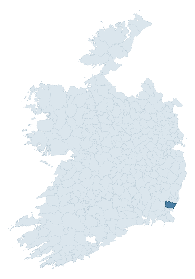
Where this barony sits in the Republic of Ireland
Geology and preservation
Bedrock geology shapes the landscape long before any settlement begins — controlling soil drainage, agricultural potential, the survival of upstanding monuments, and the preservation of buried archaeology. The figures below come from the Geological Survey Ireland 1:100,000 bedrock map.
The bedrock underlying Ballaghkeen South is predominantly slate (49% of the barony by area), laid down during the Ordovician period (61% by area, around 485 to 444 million years ago). Slate weathers to thin upland soils but provides high-value building and roofing stone, which often shows in surviving 19th-century rural and ecclesiastical architecture. A substantial secondary geology of sandstone (35%) adds further variety to the underlying landscape. The single largest mapped unit is the Ballyhoge Formation (49% of the barony's bedrock).
Rock type composition
Largest mapped unit: Ballyhoge Formation (49% of the barony)
Placename evidence
Logainm records 22 heritage-diagnostic placenames for Ballaghkeen South, drawn from townland and civil-parish names across the barony. The dominant stratum is Early Christian ecclesiastical — cill-, teampall-, and domhnach-prefixed names that record the dense network of early church foundations established between the fifth and tenth centuries. The leading diagnostic roots are cill- (14 — church), ráth- (6 — earthen ringfort), and teampall- (1 — church). This is below the ROI average of 30.7 heritage placenames per barony, suggesting either lighter survey coverage or a townland-naming tradition that draws more on generic landscape vocabulary. The presence of multiple heritage strata side by side indicates layered occupation of the landscape across successive prehistoric and historic periods. Logainm records 183 placenames for Ballaghkeen South (predominantly townland names). Of these, 22 (12%) carry one of the diagnostic Gaelic roots tracked above; the remainder draw on more generic landscape vocabulary that does not encode a heritage period.
Pre-Christian / Early Medieval Defensive
| Root | Count | Meaning |
|---|---|---|
| ráth- | 6 | earthen ringfort |
Early Christian Ecclesiastical
| Root | Count | Meaning |
|---|---|---|
| cill- | 14 | church (early) |
| teampall- | 1 | church (later medieval) |
| tobar- | 1 | holy well |
Burial, Ritual, and Norse-Contact
| Root | Count | Meaning |
|---|---|---|
| gall- | 1 | foreigner — Norse settlement marker |
Other baronies in Wexford

Explore further
Grounding History: 10 Maps of Northern Ireland’s Past
If you’re interested in Irish heritage more widely, the companion report for Northern Ireland brings together the analysis of all 462 NI wards into one place through 10 high-quality maps — covering monument density, archaeological periods, placename heritage, terrain, wetland, and the historic landscape at first survey. Take a look.
About this profile
Click any section below to expand.
What is a barony?
A barony is a historic administrative unit in Ireland, broadly equivalent to an English hundred. The 280 baronies used here are from the OSi 2019 National Statutory Boundaries (generalised 20m), covering the 26 counties of the Republic of Ireland. Baronies derive from the Norman period, were formalised in the 17th century, and have not been redrawn for statistical purposes. They vary enormously in area, from compact urban baronies in Dublin to vast upland baronies in Connacht, and should not be compared by raw site count without accounting for area differences.
What counts as a site?
This profile combines three distinct heritage registers, each with its own definition of what constitutes a recordable site:
- Archaeological sites (NMS). The National Monuments Service Sites and Monuments Record (SMR) catalogues every known archaeological monument or site of archaeological interest in the Republic, from prehistoric burial mounds and ringforts to medieval churches and post-medieval defensive works. Inclusion does not require legal protection — only that the site has been identified, surveyed, and assessed as having archaeological value. A separate subset of these sites lies within a recorded protection zone, which gives them statutory protection under the National Monuments Acts.
- Listed buildings (NIAH). The National Inventory of Architectural Heritage records buildings of architectural, historical, archaeological, artistic, cultural, scientific, social, or technical interest. Each surveyed structure is appraised on a five-tier scale: International, National, Regional, Local, and Record-Only. The NIAH appraisal is informational rather than strictly statutory, but it underpins local-authority Record of Protected Structures (RPS) listings.
- Heritage placenames (Logainm). Logainm is the authoritative database of Irish placenames maintained by the Placenames Branch. This profile applies a heritage-diagnostic classifier to the Irish-language form of each townland name, flagging roots that signal defensive sites (ráth-, lios-, dún-, caiseal-, cathair-), ecclesiastical foundations (cill-, teampall-, domhnach-, mainistir-), prehistoric burial-ritual features (tuaim-, carn-, leaba-), or Norse-contact settlement (gall-). Townlands without one of these diagnostic roots are not flagged here — they may still carry historical significance, but that significance is not encoded in the name itself.
Editorial principles
The narrative sections of this profile follow several explicit principles:
- Evidential. Every claim about this barony’s heritage character is anchored in the underlying register data. Where a site count, a placename count, or a percentile rank is cited, it is computed from the source datasets at export time, not estimated.
- Comparative. Counts and metrics are reported alongside their percentile rank against the other 279 ROI baronies. A barony with 50 ringforts in absolute terms could be unusually high or unusually low depending on its size and regional context; percentile ranking removes that ambiguity.
- Transparent on limits. Where a register has known coverage gaps, survey biases, or data-quality issues that affect this barony’s figures, the profile flags them rather than presenting the numbers as definitive.
- No interpretation beyond what the data supports. The narrative does not speculate about historical events, social dynamics, or cultural meaning beyond what the recorded heritage and placename evidence directly attests.
Data caveats and limits
- NMS Sites and Monuments Record is the product of survey campaigns conducted at different intensities across different counties and decades. Some baronies have been surveyed more thoroughly than others, and absolute counts should be read in that light. Sites destroyed by development before survey are typically not represented; sites in heavily forested or upland terrain are sometimes under-recorded.
- NIAH coverage is broadly complete for the Republic of Ireland but the survey was conducted on a rolling county-by-county basis, and the most recent appraisal date varies. Buildings demolished or substantially altered after their original survey may still appear in the register; conversely, recent buildings of merit may not yet have been appraised.
- Logainm classification applies a deliberately conservative pattern-matching approach to the Irish-language townland forms. The classifier prioritises true positives over recall: a townland may carry a heritage signal that the classifier doesn’t recognise, particularly where the diagnostic root has been heavily anglicised or where the townland name draws on a less common term. The 60,000+ townland records and ~9,800 classified placenames give a substantial signal at barony scale, but individual townland names should be checked against Logainm directly for definitive interpretation.
- Period attribution. The chronological distribution reflects only those NMS sites that carry a recognised period attribution in the source data. Sites listed as “Unknown” period are excluded from the dated subset.
- Boundary changes. Some baronies have undergone minor boundary adjustments since their 19th-century definition; the OSi 2019 generalised boundaries used here are the current statutory definition and may differ slightly from historical maps in border areas.
- Bedrock geology is mapped at 1:100,000 scale, which means local variation within a barony — small pockets of different rock type, mineral veins, alluvium overlying bedrock — is generalised. The dominant-system and rocktype figures are area-weighted, so a barony reading “70% Carboniferous limestone” may still contain small but archaeologically important pockets of older or younger rock. Around 3% of GSI polygons do not match the lexicon and contribute no rocktype or system attribution.
Data sources
- National Monuments Service — Sites and Monuments Record (SMR) https://data.gov.ie/dataset/national-monuments-service-archaeological-survey-of-ireland
- National Inventory of Architectural Heritage (NIAH) https://data.gov.ie/dataset/national-inventory-of-architectural-heritage-niah-national-dataset
- Logainm — Placenames Database of Ireland https://www.logainm.ie/
- Ordnance Survey Ireland — National Statutory Barony Boundaries 2019 https://data-osi.opendata.arcgis.com/
- EURODEM — European Digital Elevation Model https://www.mapsforeurope.org/datasets/euro-dem
- ESA WorldCover https://esa-worldcover.org/en
- Geological Survey Ireland — 1:100,000 Bedrock Geology https://www.gsi.ie/en-ie/data-and-maps/Pages/Bedrock.aspx
Explore more: Search any of the 280 ROI baronies, browse by historical province, or read the methodology and data sources for the full Republic of Ireland Heritage Tool.