
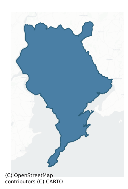
Shelburne is a barony of County Wexford, in the historical province of Leinster (Irish: Síol Bhroin), covering 216 km² of land. The barony records 408 NMS archaeological sites and 183 NIAH listed buildings, placing it at around the 50th percentile among 280 ROI baronies for sites per km². This means it is in the upper half of all baronies for sites per km². Dated archaeological evidence runs from the Early Bronze Age through to the Modern, spanning 7 of 9 archaeological periods, placing the barony in the 25th percentile among 280 ROI baronies for chronological depth. This means it is in the bottom third of all baronies for chronological depth. The largest dated subset of recorded sites dates to the Iron Age. Logainm flags 27 placenames in the barony as carrying a recognised heritage root; the largest share — around 63% — are names associated with early Christian church and monastic foundations.
Heritage at a glance
Percentile rankings throughout this profile compare each barony only against the other 279 Republic of Ireland baronies.
The recorded heritage of Shelburne
The National Monuments Service Sites and Monuments Record (SMR) is the statutory inventory of archaeological sites for the Republic of Ireland, maintained by the Department of Tourism, Culture, Arts, Gaeltacht, Sport and Media. Sites recorded here include earthworks, ringforts, megalithic tombs, ecclesiastical remains, and post-medieval features; not every record is legally protected, but each is registered as a monument of archaeological interest.
The National Monuments Service records 408 archaeological sites in Shelburne, putting it at the 50th percentile among 280 ROI baronies for sites per km². This means it is in the upper half of all baronies for sites per km². Protection coverage is near-universal — 395 sites (97%) fall within a recorded monument protection zone, indicating an extensively surveyed landscape. The record is dominated by defensive sites — ringforts, enclosures, hillforts, and stone forts (172 sites, 42% of the total), with ecclesiastical sites forming a substantial secondary presence (102 sites, 25%). Ringfort – rath is the most prevalent type, making up 23% of the barony's recorded sites (95 records), broadly in line with the ROI average of 20% across all baronies where this type occurs. Ringfort – rath is an earthen ringfort enclosed by a bank and external ditch — the most common Early Medieval farmstead, broadly dated 500–1000 AD. Other significant types include Church (36) and Enclosure (27). Church is a building used for public Christian worship, of any date from c. 500 AD onwards; Enclosure is a banked or ditched feature of uncertain type, used as a catch-all where the original function cannot be determined from surface evidence. Across the barony's 216 km², this gives a recorded density of 1.89 sites per km².
Most common monument types
Hover or tap a monument type to see its definition.
| Type | Count |
|---|---|
| Ringfort – rath an earthen ringfort enclosed by a bank and external ditch — the most common Early Medieval farmstead, broadly dated 500–1000 AD | 95 |
| Church a building used for public Christian worship, of any date from c. 500 AD onwards | 36 |
| Enclosure a banked or ditched feature of uncertain type, used as a catch-all where the original function cannot be determined from surface evidence | 27 |
| Ritual site – holy well a well or spring traditionally associated with a saint, often credited with healing properties; many trace earlier ritual origins but devotion is documented from the medieval period onwards | 21 |
| Graveyard a burial area associated with a church, in use from the medieval period onwards | 20 |
| Castle – tower house a fortified residential tower of four or five storeys, mostly built by lords in the 15th and 16th centuries and often within a defended bawn | 13 |
| Burnt mound a heap of fire-cracked stone, ash and charcoal, with no surviving trough, dated Bronze Age to early medieval | 11 |
| Graveslab a recumbent grave-marking slab, dated 1200–1700 AD | 11 |
Chronological distribution
The dated archaeological record for Shelburne spans from the Early Bronze Age through to the Modern, with activity attested across 7 of 9 archaeological periods. This is the 25th percentile across ROI baronies — a relatively narrow chronological band, with much of Irish prehistory not represented in the dated record. Every period from earliest to latest is represented in the record — an unbroken sequence of dated activity across the full chronological span. Activity concentrates most heavily in the Iron Age (126 sites, 41% of dated material), with the Early Medieval forming a secondary peak (76 sites, 25%). A further 101 recorded sites (25% of the overall NMS register for the barony) carry no period attribution — appearing as 'Unknown' in the bar chart below. This typically reflects either records that pre-date the standardised period vocabulary or sites awaiting specialist dating review, rather than a genuine absence of chronological evidence.
Sample of recorded monuments
Show 25 sample monuments (of 408 total)
A representative sample of 25 recorded monuments drawn from the barony’s 408 total NMS entries. Sites within a recorded monument protection zone and rarer site types are prioritised so the list shows a meaningful cross-section rather than only the most common type. Each entry shows the official Sites and Monuments Record reference number and the description published by the National Monuments Service.
Stone row
Located in a slight NE-SW valley with the summit of Slievecoiltia Hill c. 2.5km to the NE. Three granite stones are aligned NE-SW (L of row 6.5m) increasing in H from 1.2m at NE to 1.4m in the centre and 1.8m at SW.…
Located in a slight NE-SW valley with the summit of Slievecoiltia Hill c. 2.5km to the NE. Three granite stones are aligned NE-SW (L of row 6.5m) increasing in H from 1.2m at NE to 1.4m in the centre and 1.8m at SW. Each stone has a roughly pointed top and from the NE the stones are diamond-shaped (dims 1m x 0.35-0.5m; H 1.2m), subrectangular (dims 1.05-1.22m x 0.68-0.82m; H 1.4m) and rectangular (dims 1-1.05m x 0.45-0.5m; H 1.8m). From the NE they are placed 1.4m and 1.87m apart.. (Westropp 1918, 13-14; Ó Nualláin 1988, 241, No. 75)
The above description is derived from the published 'Archaeological Inventory of County Wexford' (Dublin: Stationery Office, 1996). In certain instances the entries have been revised and updated in the light of recent research.
Compiled by: Michael Moore
Date of upload/revision: 29 January, 2013
Cross – High cross
What is probably the smallest high cross in Ireland (H 0.55m; Wth at crux 0.31m; T 0.14m) is within the graveyard (WX039-018006-) of Kilmokea church site (WX039-018002-). The cross is of sandstone and the head is solid.…
What is probably the smallest high cross in Ireland (H 0.55m; Wth at crux 0.31m; T 0.14m) is within the graveyard (WX039-018006-) of Kilmokea church site (WX039-018002-). The cross is of sandstone and the head is solid. There is rope-moulding around the edges of both large faces, each with its own cross, and rope-moulding surrounds individual panels that are filled with knot interlace. An inscription, possibly reading NDMNA, is at the top of one large side (Harbison 1992, vol. 1, 131, 363).
Compiled by: Michael Moore
Date of upload: 28 January, 2013
Mass-rock
Marked only on the 1940 ed. of the OS 6-inch map, and situated on an E-facing slope. A granite erratic (dims. c. 1m x 1.5m; H 1m) is sitting on a small exposure of rock outcrop. It has a flat upper surface with a…
Marked only on the 1940 ed. of the OS 6-inch map, and situated on an E-facing slope. A granite erratic (dims. c. 1m x 1.5m; H 1m) is sitting on a small exposure of rock outcrop. It has a flat upper surface with a recessed shelf at one corner on which is incised a cross (H 0.32m; Wth 0.21m) of triple lines with splayed terminals. Local tradition holds that it was thrown into the stream below by the military (OSFM), but it was restored to its original position in 1973, and Mass is celebrated at it annually on the Monday closest to the feast of St. James (July 25th). See this web-page accessed on 29 October, 2013. http://homepage.eircom.net/~horeswoodns/killesk_massrock.htm
The above description is derived from the published 'Archaeological Inventory of County Wexford' (Dublin: Stationery Office, 1996). In certain instances the entries have been revised and updated in the light of recent research.
Compiled by: Michael Moore
Date of upload/revision: 28 January, 2013
Amended: 29 October, 2013.
Castle – Anglo-Norman masonry castle
There are references to the repair of a stone castle requiring lead, slate and timber in 1286, which also required the digging of a moat (Hore 1901-11, vol. 3, 202-3). According to the Civil Survey (1654-6) 120 acres…
There are references to the repair of a stone castle requiring lead, slate and timber in 1286, which also required the digging of a moat (Hore 1901-11, vol. 3, 202-3). According to the Civil Survey (1654-6) 120 acres and a large castle at Great Island was the property of the Earl of Ormond in 1640 (Simington 1953, 181). There is no reason other than the 1839 and 1940 eds of the OS 6 inch map for believing a castle to have been located exactly here within the ringwork (WX039- 028001-) and adjacent to castle site (WX039-028003-). There are no visible remains of a structure at ground level.
The above description is derived from the published 'Archaeological Inventory of County Wexford' (Dublin: Stationery Office, 1996). In certain instances the entries have been revised and updated in the light of recent research.
Compiled by: Michael Moore
Date of upload/revision: 28 January, 2013
Leper hospital
There is one reference to a leper hospital in a partial survey of Great Island in 1607-08 (Hore 1910-11, vol. 3, 229), with the 1940 ed. of the OS 6 inch map providing the only evidence of the location towards the top…
There is one reference to a leper hospital in a partial survey of Great Island in 1607-08 (Hore 1910-11, vol. 3, 229), with the 1940 ed. of the OS 6 inch map providing the only evidence of the location towards the top of a steep slope down the N-S River Barrow/Nore. Shaw Mason (1816, vol. 3, 542) records that a large collection of human bones was found at Greatisland, perhaps at this location within the ringwork (WX039-028001-). The burial of two adults in a stone compartment (WX039-028006-) was investigated in 1979 close to this location (Cahill 2011).
The above description is derived from the published 'Archaeological Inventory of County Wexford' (Dublin: Stationery Office, 1996). In certain instances the entries have been revised and updated in the light of recent research.
Compiled by: Michael Moore
Date of upload/revision: 28 January, 2013
Tide mill – unclassified
Situated at the bottom of a gentle N-facing slope at the point where a small SE-NW stream emerges into the tidal reaches of the E-W Campile stream. References to the salt mill of Dunbrody date from 1540 (Hore 1901-11,…
Situated at the bottom of a gentle N-facing slope at the point where a small SE-NW stream emerges into the tidal reaches of the E-W Campile stream. References to the salt mill of Dunbrody date from 1540 (Hore 1901-11, vol. 3. 124) when it was listed as part of the possessions of the suppressed abbey of Dunbrody (WX039-030001-), and John Itchingham, the grandson of Sir Osborne Etchingham who acquired the abbey’s lands in 1545, owned it when he died in 1616 (ibid. 177). The mill is marked on a manuscript map of 1803 in NLI (21 F 20 (1) (Colfer 2004, 64, Figl 58). This was a tidal mill, whose dam exists as a causeway (L c. 180m) extending NE from the site of the millhouse to the church (WX039-029002-) and gatehouse (WX039-029001-) where the land begins to rise to the abbey, but the pond to the E is now reclaimed. There is local knowledge of a large mill wheel that was found in drainage operations c. 1970 and reburied.
The above description is derived from the published 'Archaeological Inventory of County Wexford' (Dublin: Stationery Office, 1996). In certain instances the entries have been revised and updated in the light of recent research.
Compiled by: Michael Moore
Date of upload/revision: 25 January, 2013
Souterrain
Located towards the bottom of a NE-facing slope with the head of a SE-NW inlet of the tidal River Nore/Barrow c. 100m to the NE. The souterrain is on the line of the bank of rath (WX039-087001-) at W, and was discovered…
Located towards the bottom of a NE-facing slope with the head of a SE-NW inlet of the tidal River Nore/Barrow c. 100m to the NE. The souterrain is on the line of the bank of rath (WX039-087001-) at W, and was discovered when a lintel was removed in ploughing. It is an oval chamber (dims 3.2m NE-SW; 1.2-1.9m NW-SE) and the long walls corbel in to a line of lintels on the long axis. The SW end has collapsed and the maximum H (1.3m) is achieved at the NE end where the present entrance is. There is a lintelled but blocked entrance (Wth 0.5m; visible H 0.4m) at the NE end of the chamber, which is now closed.
Compiled by: Michael Moore
Date of upload: 25 January, 2013
Bastioned fort
Located on a NE-SW promontory (H c. 20m) jutting out into the estuary of the Barrow/Nore/Suir. Outside the ramparts the ground slopes down almost to sea-level over c. 50m. The original name of the promontory –…
Located on a NE-SW promontory (H c. 20m) jutting out into the estuary of the Barrow/Nore/Suir. Outside the ramparts the ground slopes down almost to sea-level over c. 50m. The original name of the promontory – Dunmechanan, the fort of the son of Canan – indicates that it may be an ancient promontory fort, but there is no confirmation of this (Sinnott 1970-1, 63). The name was first recorded in the foundation charter of Dunbrody Abbey (WX039-030001-) in 1172-77 (Hore 1900-11, vol. 3, 39). A castle, probably a tower house, with a wall cutting off the end of the promontory is depicted on what are probably late 16th century maps with the bastioned fort already established (Hore 1900-11, vol. 4, 2). John Inglysshe occupied Duncannon in 1541, and it was granted to Sir Osborne Itchingham in 1545 and Sir Nicholas White, the Master of the Rolls, in 1569 (ibid. vol. 4, 4), but the castle is first mentioned in 1580 when John Itchingham, who was involved with pirates there, resisted arrest by the sheriff (ibid. vol. 3, 148-9). A circular tower of this castle survived into the early 20th century (ibid. vol. 4, Pl., P5-6) and became known as King James’ tower, but it is no longer extant. (Sinnott 1970-1, 63-5)
The fortification of the promontory was first proposed in 1551-2 in order to provide a base for a permanent garrison that would suppress piracy and secure Waterford and Ross against invasion. However, it required the threat of a Spanish invasion in the 1580s to initiate constru…
Stone sculpture
Built into the top of the inner (E) face of the sea-wall at Arthurstown, which was built c. 1800. A rectangular stone (H 0.35m; Wth 0.33m) has a worn face in relief. A second stone (WX044-033002-) is c. 100m W along the…
Built into the top of the inner (E) face of the sea-wall at Arthurstown, which was built c. 1800. A rectangular stone (H 0.35m; Wth 0.33m) has a worn face in relief. A second stone (WX044-033002-) is c. 100m W along the sea-wall. Both stones may have come from Ballyhack church site (WX044-018001-) on the cliff-top c. 500m to the W.
The above description is derived from the published 'Archaeological Inventory of County Wexford' (Dublin: Stationery Office, 1996). In certain instances the entries have been revised and updated in the light of recent research.
Compiled by: Michael Moore
Date of upload/revision: 17 June, 2013
Well
Marked on the 1839 and 1925 eds of the OS 6-inch map and described as Toberernan on both, in italic lettering on the former and gothic on the latter. It is situated on a slight S-facing slope and in an alcove on the W…
Marked on the 1839 and 1925 eds of the OS 6-inch map and described as Toberernan on both, in italic lettering on the former and gothic on the latter. It is situated on a slight S-facing slope and in an alcove on the W side of a small N-S road. This is a circular stone-lined well (diam. c. 0.5m), now overgrown and disused. There is no evidence that it was ever venerated.
Compiled by: Michael Moore
Date of upload: 22 July, 2013
Religious house – Augustinian friars
This church is said to have been founded by the Kavanaghs for Augustinian Friars c. 1317 with a grant of land, but at the Suppression in 1540, the house, described erroneously as Dominican, had very little property…
This church is said to have been founded by the Kavanaghs for Augustinian Friars c. 1317 with a grant of land, but at the Suppression in 1540, the house, described erroneously as Dominican, had very little property outside some plots at Clonmines (White 1943, 365-6). The church was enlarged by Nicholas FitzNicholas in 1385 when fortifications might also have been added. The friars were expelled in 1544 (Gwynn and Hadcock 1970, 297) but they continued to serve in the locality, and in 1773 settled on a small farm at Grantstown in Barrystown townland c. 2.4km to the E. The small chapel at Grantstown was replaced by the present church and abbey in 1830 (Furlong 1968, 39-40).
The original church ruin survives in an almost complete state of preservation, except for the N and W walls of the nave. It consists of a nave (int. dims. 12.2m E-W; 7.2m N-S) with a S aisle (Wth 2.85m) separated from nave by three pointed arches. There is no evidence of a N aisle or of an entrance, and the S aisle is featureless apart from a destroyed E window and a blocked window towards the E end of the S wall. The W wall of the nave, which had a large decorated window (Grosse 1791 vol. 1, 44-5), is now destroyed. The chancel (int. dims 15.55m E-W; 7.2m N-S) has a destroyed E window, three damaged three-light ogee-headed windows in the S wall, and a destroyed window in the N wall. There is an aumbry and a destroyed triple-sedile in the S wall, and a possible tomb-niche in the N wall, which is the only…
Town defences
Situated at the crest of a slight N and E-facing slope down to the N-S Owenduff/Corock river, which is c. 300-350m to the E. There are no murage grants for Clonmines and it might not have been defended, but at the W…
Situated at the crest of a slight N and E-facing slope down to the N-S Owenduff/Corock river, which is c. 300-350m to the E. There are no murage grants for Clonmines and it might not have been defended, but at the W side of the town a N-S field bank (Wth c. 2m; H c. 2m) has a flat bottomed fosse or ditch (Wth c. 4m; int. D c. 1m) on its E side running N from the graveyard that has the fortified church (WX045-012006-) and St. Nicholas’ parish church (WX045-012007-) (L c. 200m). This would cut off the town on a bend of the E-W Owenduff river c. 500m N of the churches.
The above description is derived from the published 'Archaeological Inventory of County Wexford' (Dublin: Stationery Office, 1996). In certain instances the entries have been revised and updated in the light of recent research.
Compiled by: Michael Moore
Date of upload/revision: 22 July 2007
Burial ground
Situated on a gentle W-facing slope with a N-S stream c. 70m to the W. This is a slightly raised rectangular grass-covered area (dims. 22m N-S; 17m E-W; H 0.3-0.6m) with a local tradition of use as a graveyard. There is…
Situated on a gentle W-facing slope with a N-S stream c. 70m to the W. This is a slightly raised rectangular grass-covered area (dims. 22m N-S; 17m E-W; H 0.3-0.6m) with a local tradition of use as a graveyard. There is no visible evidence of burial. Dungulph castle (WX045-041—-) is c. 100m to the N.
The above description is derived from the published 'Archaeological Inventory of County Wexford' (Dublin: Stationery Office, 1996). In certain instances the entries have been revised and updated in the light of recent research.
Compiled by: Michael Moore
Date of upload/revision: 22 July 2013
Ring-ditch
Situated on the crest of a slight N-S ridge. The cropmark of a circular enclosure (ext. diam. c. 20m) defined by a single ditch feature (Wth c. 3m) is visible on aerial photographs (MM (48) 2-4).
Compiled by: Michael…
Situated on the crest of a slight N-S ridge. The cropmark of a circular enclosure (ext. diam. c. 20m) defined by a single ditch feature (Wth c. 3m) is visible on aerial photographs (MM (48) 2-4).
Compiled by: Michael Moore
Date of upload: 22 July, 2013
Castle – motte
Situated on a level landscape with a N-S valley (Wth of top c. 70m; D c. 5-10m) c. 20m to the E. Hervey de Montmorency granted the churches of Shelburne and Bargy baronies to Christchurch, Canterbury, who granted the…
Situated on a level landscape with a N-S valley (Wth of top c. 70m; D c. 5-10m) c. 20m to the E. Hervey de Montmorency granted the churches of Shelburne and Bargy baronies to Christchurch, Canterbury, who granted the town of Fethard to Richard de Londres c. 1200 (Hore 1900-11, vol. 4, 310-1) on condition that he build a castle, which may have been the motte, although this mound is rather low. This is a circular, grass-covered and flat-topped mound (diam. of base 25m; diam. of top 13m; H 1.4-2.2m). It is surrounded by a slightly sunken area (Wth 6-11m) N-S-W representing a fosse, with slight traces of an outer bank (Wth 3m; H 0.2m) at SE. The church site (WX050-011001-) is c. 40m to the S, and the castle (WX050-011003-) is c. 25m to the SW.
The above description is derived from the published 'Archaeological Inventory of County Wexford' (Dublin: Stationery Office, 1996). In certain instances the entries have been revised and updated in the light of recent research.
Compiled by: Michael Moore
Date of upload/revision: 11 February 2015
Military camp
Baginbun Head is a broad promontory (dims. c 400m ENE-WSW; c. 200m NNW-SSE; H c. 20m) with other promontories off it. Richard de Clare FitzGilber, also known as Strongbow, sent Raymond le Gros to Ireland with ten…
Baginbun Head is a broad promontory (dims. c 400m ENE-WSW; c. 200m NNW-SSE; H c. 20m) with other promontories off it. Richard de Clare FitzGilber, also known as Strongbow, sent Raymond le Gros to Ireland with ten knights and seventy archers to prepare for his own arrival. Raymond encamped from May to August 1170 at a place called Dundunnolf (Dún Domhnail), which was perhaps the name of the promontory fort (WX050-015001-) at the E end of the headland, and Orpen (1898) identified this as being at Baginbun Head. Raymond could then have erected the linear fortifications (WX050-015001-) which run ENE-WSW across the headland enclosing about 22 acres (c. 9 ha) in preparation for a large invading force. While waiting for Strongbow Raymond defeated a large force sent against him here from Waterford (Redmond 1900, 32-50; Orpen 1904, 430-1; 1904a) and afterwards 70 leading citizens of Waterford were held captive at the camp for a time before being thrown into the sea.
The linear fortification of two earthen banks encloses a large area and would have been a suitable camp for an invading force, but it was not used for this purpose. When Strongbow did arrive he had 200 knights and 1000 others with him and he landed at Crook in the estuary, from where he marched to Waterford and captured the city. A feature described in gothic lettering as ‘Strongbow’s Cap’ on the 1839 edition of the OS 6-inch map is within the headland, but this is probably an error for ‘Strongbow’s Camp’. A stone kno…
Ogham stone
Fragments of an ogham stone were found in 1845 on the shore below Brecaun Church (WX054-003002-) (Barry 1896, 127-8), and c. 1930 another fragment was found which enabled Macalister (1930, 54-5) to read the inscription…
Fragments of an ogham stone were found in 1845 on the shore below Brecaun Church (WX054-003002-) (Barry 1896, 127-8), and c. 1930 another fragment was found which enabled Macalister (1930, 54-5) to read the inscription as: SEDAN [1 MAQQI CAT]TABGBOTT AVVI DERCMASOC. He describes the stone as ‘3 ft. 10 ½ inches, by 1 ft. by 8 inches thick’ (c. 1.18m x c. 0.3m x c. 0.2m), and it is now in NMI (DU018-274—-). In the mythological history of early Ireland Derc Masoc was the son of Cathair Mór, who was said to have been one of the first kings to have ruled all of Ireland. Derc Masoc was the progenitor of Uí Deirc Mosaig, the ruling family of Ath Cliath Cualann, or the Dublin area. Archaeological excavation in 1987 found the final missing piece of the ogham stone (Breen 1988).
Compiled by: Michael Moore
Date of upload: 31 March, 2014
Lighthouse
Located on the level landscape at the S tip of the narrow part (L c. 4.5km NE-SW; Wth c. 600m-1.5km NW-SE) of Hook peninsula. A lighthouse tower was built early in the 13th century by the monks of St. Dubhán’s church…
Located on the level landscape at the S tip of the narrow part (L c. 4.5km NE-SW; Wth c. 600m-1.5km NW-SE) of Hook peninsula. A lighthouse tower was built early in the 13th century by the monks of St. Dubhán’s church (WX054-009001-), who by this time had adopted the Augustinian rule and the name of St. Saviour’s. The identification (Ffrench 1898) with St. Saviour’s church in New Ross (WX029-013074-) is erroneous. References date from 1245 when the monks were commanded to continue providing the light on the tower they had built. The tower might have been built c. 1210-1230 at the instigation of William Marshall the elder, who survived shipwreck off the Wexford coast. This prompted him to found the Cistercian abbey of Tintern (WX045-027001-). Marshall is also thought to have built a circular vaulted keep, similar to the lighthouse, at Pembroke castle in Wales c. 1200 (Colfer 1984-5, 71-2). Twelve acres were set aside for the equal maintenance of the monks and the custodian. After the Suppression of the Knights Templar in 1314 the lighthouse was vested in the Sovereign (mayor) and Corporation of New Ross, who walked the bounds ceremonially to demonstrate possession up to 1687 at least. The lighthouse was maintained without interruption until c. 1641, but it is described as a former lighthouse that used to be white-washed in 1657, in the terrier or commentary of Hook parish in the Down Survey (1656-8). (Hore 1900-11, vol. 4, 398-409; Colfer 1978, 29-32)
The tower was restor…
Salt works
Located on the S side of Slade Harbour and SE of the fortified house (WX054-008002-). In 1685 Henry Loftus rented the castles and land of Slade to William Mansel, who was a brother-in-law of his wife’s and who had been…
Located on the S side of Slade Harbour and SE of the fortified house (WX054-008002-). In 1685 Henry Loftus rented the castles and land of Slade to William Mansel, who was a brother-in-law of his wife’s and who had been implicated in the Monmouth rebellion in England against James II in 1685. Mansel developed the saltworks, which functioned by dissolving rock-salt, and evaporating the brine into a purer commodity to be used in the fishing industry. Rock-salt from Cheshire was imported using the pier (WX054-017—-) built by Henry Loftus in 1684. Coal for both the saltworks and the lighthouse (WX054-010—-) was also imported at Slade, The saltworks may have been in decline by the 1770s (Hore 1900-11, vol. 4, 425-6), and the works are described as 'disused' on the 1839 ed. of the OS 6-inch map. Much of the E end of the structure was destroyed in the later 19th century (ibid. vol. 4, 419-20).
The E end of the complex originally consisted of four E-W corridors, arranged four-square. Each corridor was divided into four chambers (int. dims c. 5m E-W; c. 3.5m N-S), and each chamber is corbelled separately. Only the SW corridor survives complete (int. dims 20m E-W; 3.5m N-S) but fragments of corbelling or piers from the NW and SE corridors are present. The contiguous W end of the complex consists of the remains of small corbelled chambers centred on a large square corbelled chamber (dims 7m x 7m), which was open at the top. The total length of the complex is c. 60m E-W. The corr…
House – indeterminate date
Situated on a fairly level landscape. The faint cropmark of a small rectangular structure (dims c. 10m E-W; c. 5m N-S) defined by drain features is visible on aerial photographs (WX045-084_1 to _4). The structue crosses…
Situated on a fairly level landscape. The faint cropmark of a small rectangular structure (dims c. 10m E-W; c. 5m N-S) defined by drain features is visible on aerial photographs (WX045-084_1 to _4). The structue crosses the drain feature that outlines the boundary of a wood on Tintern demesne land as marked on the 1839 and 1925 eds of the OS 6-inch map.
Compiled by: Michael Moore
Date of upload: 22 July, 2013
Cist
Situated at the E edge of a shelf overlooking a N-S valley (Wth of top c. 250m) with its stream c. 30m to the E. A polygonal cist (int. dims. 1.05m N-S; 0.95m E-W) defined by 6 or 7 side-stones (dims. c. 0.45-0.6m; H…
Situated at the E edge of a shelf overlooking a N-S valley (Wth of top c. 250m) with its stream c. 30m to the E. A polygonal cist (int. dims. 1.05m N-S; 0.95m E-W) defined by 6 or 7 side-stones (dims. c. 0.45-0.6m; H 0.4m; T 0.1-0.2m) is covered by a single roofstone (max. dims. 3.2m NW-SE; 1.3m NE-SW; T 0.1-0.25m) which has graffiti incised on it dating from 1932. It is within the mound of an amorphous grass and scrub-covered barrow (diam. 23m N-S; 23m E-W; H 0.5-1m).
Compiled by: Michael Moore
Date of upload: 13 September, 2012
Inscribed stone (present location)
A stone came to light on a cliff-top at Lady Betty’s Pool. c. 1880, which is c. 340m N of the linear earthwork at Baginbun (WX050-015002-). It had an inscription that resembled those on a stone at Fethard Castle…
A stone came to light on a cliff-top at Lady Betty’s Pool. c. 1880, which is c. 340m N of the linear earthwork at Baginbun (WX050-015002-). It had an inscription that resembled those on a stone at Fethard Castle (WX050-011009-) c. 1.8km to the NNW and on a cross at Carew, in Pembrokeshire in Wales. Many interpretations of the inscription were attempted but it was generally accepted that it was Latin and recorded the name ‘Margit’ (Vigors 1897). Doubt was cast on the antiquity of the inscriptions (Lynn 1904; 1905), but while Orpen (1904, 1905) regards the Fethard inscription as a 19th century copy of the Welsh stone he was inclined to accept the Baginbun stone as more ancient. Both stones are probably 19th century copies of the Welsh stone. The Baginbun stone is a sub-triangular stone (dims 1.58m x 1.08m; T 0.68m) that was moved c. 1980 for its own safety from its cliff-top position to a nearby house where it is displayed in the front garden. Only slight traces of the inscription remain.
Compiled by: Michael Moore
Date of upload; 12 February, 2014
Headstone
Now located in the National Museum of Ireland, Dublin (DU018-295—-). Figure was discovered in the gardens of Kilmokea House, Great Island, Campile, and presumed to have come from adjacent cemetery (WX039-018006-)…
Now located in the National Museum of Ireland, Dublin (DU018-295—-). Figure was discovered in the gardens of Kilmokea House, Great Island, Campile, and presumed to have come from adjacent cemetery (WX039-018006-) (Freitag 2004, 135). Described by Freitag as a 'wedge-shaped schistose slab (dims. H 0.84m; top Wth. 0.3m; bottom Wth. 0.25m) with headstone inscription (reading: 'MB.D. 12 March 1705.a 72') on one side and Sheela on the other. Figure crude and somewhat atypical; defined by grooves roughly describing figure of woman. Head shaped like an American football, without facial features, connected to torso by most remarkable big hole (c.4 cm deep). The only other Sheela with hole in that position is Seir Kieran. Angular shoulders; two neatly carved holes in chest area indicating breasts; straight arms reaching down to genital area; legs apart and straight, no feet. Traces of a horizontal and two vertical lines between legs' (Freitag 2004, 135).
A re-examination shows that this stone is a sliver of a headstone with a crude hourglass on the reverse as a memento mori that has been adapted into a human form but without arms or legs (Digital Heritage Age). The inscription reads: MB…d 12….ma….rch..1763…d 72. See the attached link: https://sketchfab.com/3d-models/nmi-1994-40-great-island-05e114a2c43b461ca24c7ae8de64cc4c
Compiled by: Caimin O'Brien.
Date of upload: 05 June 2012.
Amended: 12 April, 2021
Midden
Situated in Fethard-on-Sea village. Archaeological testing (96E0116) over an extensive area (dims c. 75m NNW-SSE; c. 60m ENE-WSW) immediately S of the church site (WX050-011001-) identified one pit (diam. 1m; D 0.8m)…
Situated in Fethard-on-Sea village. Archaeological testing (96E0116) over an extensive area (dims c. 75m NNW-SSE; c. 60m ENE-WSW) immediately S of the church site (WX050-011001-) identified one pit (diam. 1m; D 0.8m) with a large content of periwinkle shells, and a spread nearby (diam. 1.1m) consisting largely of cockle and limpet shells. Two sherds of what may be a cooking ware was recovered from the base of a cut or hollow (Wth 5m; D 1.05m) in the base of the same trench. (Scully 1996, 5; 1997)
Compiled by: Michael Moore
Date of upload; 12 February, 2014
Ringfort – rath
Located on a slight SE to W-facing slope. This is a dished oval, grass and scrub-covered area (dims. 47m WNW-ESE; 33m NNE-SSW) defined by a scarp (H 0.7m at NW to 1.6m at SE), with an external fosse best preserved…
Located on a slight SE to W-facing slope. This is a dished oval, grass and scrub-covered area (dims. 47m WNW-ESE; 33m NNE-SSW) defined by a scarp (H 0.7m at NW to 1.6m at SE), with an external fosse best preserved NE-S-W (Wth of top 4.7 6m; ext. D 0.5m at NW to 1m at SE). There is no visible entrance. It is listed as a possible ringwork (Barry 1987, Fig. 14, 52).
The above description is derived from the published 'Archaeological Inventory of County Wexford' (Dublin: Stationery Office, 1996). In certain instances the entries have been revised and updated in the light of recent research.
Compiled by: Michael Moore
Date of upload/revision: 16 October, 2012
Listed buildings
The National Inventory of Architectural Heritage (NIAH) is a state survey appraising buildings of architectural, historical, archaeological, artistic, cultural, scientific, social, or technical interest. Each surveyed structure receives a rating from International (the highest, for buildings of European importance) through National, Regional, Local, and Record-Only.
The NIAH records 183 listed buildings in Shelburne, the 75th percentile across ROI baronies for listed-building density. The highest-graded structures include 4 of National significance. The Republic holds 937 National-graded buildings in total, so this barony accounts for around 0% of the national total. Construction dates concentrate most heavily in the Victorian (1830-1900) period.
Terrain and environment
Mean elevation across the barony is 42m — the 12th percentile among 280 ROI baronies for elevation. This means it is in the bottom fifth of all baronies for elevation. This is a relatively low-lying landscape by ROI standards. Elevation matters for heritage because higher-altitude baronies typically favour defensive monuments — ringforts and hilltop forts placed on prominent ground — while lowland baronies are more likely to carry the dense settlement and church networks of intensive agricultural landscapes. The barony reaches 266m at its highest point — a vertical span of more than 224m within its boundary, indicating significant topographic diversity. Mean slope is 3.1° — the 38th percentile among 280 ROI baronies for slope. This means it is in the lower half of all baronies for slope. Slope is a key control on both land use and archaeological preservation: steep ground resists ploughing and tends to preserve earthworks intact, while gentle slopes favour intensive cultivation that damages or destroys surface archaeology over time. The Topographic Wetness Index averages 11.1, the 60th percentile among 280 ROI baronies for wetness. This means it is in the upper half of all baronies for wetness. Drainage matters for heritage because poorly-drained ground preserves organic archaeology (wooden trackways, leather, textiles, and on rare occasions human remains) far better than free-draining soil; well-drained ground favours arable use but destroys organic material rapidly. The land-cover mosaic combines improved grassland (60%), arable farmland (24%), and woodland (11%), giving a mixed agricultural and semi-natural landscape.
Terrain measurements
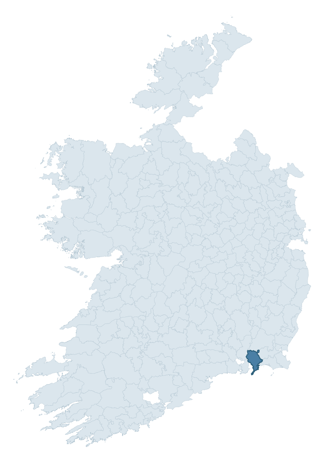
Where this barony sits in the Republic of Ireland
Geology and preservation
Bedrock geology shapes the landscape long before any settlement begins — controlling soil drainage, agricultural potential, the survival of upstanding monuments, and the preservation of buried archaeology. The figures below come from the Geological Survey Ireland 1:100,000 bedrock map.
The bedrock underlying Shelburne is predominantly mudstone (27% of the barony by area), laid down during the Ordovician period (67% by area, around 485 to 444 million years ago). Mudstone breaks down into heavy, often poorly-drained clay soils that historically limited intensive arable use. The lower density of ploughing tends to preserve subsurface archaeology better than in sandstone or limestone terrain, though waterlogging can be a factor for site survival. A substantial secondary geology of rhyolite (23%) and slate (23%) adds further variety to the underlying landscape. The single largest mapped unit is the Booley Bay Formation (27% of the barony's bedrock). With 10 distinct rock types mapped, the barony sits in the top third of ROI baronies for geological diversity (89th percentile) — typically a sign of complex tectonic history or coastal mosaics of differing rock units.
Rock type composition
Largest mapped unit: Booley Bay Formation (27% of the barony)
Placename evidence
Logainm records 27 heritage-diagnostic placenames for Shelburne, drawn from townland and civil-parish names across the barony. The dominant stratum is Early Christian ecclesiastical — cill-, teampall-, and domhnach-prefixed names that record the dense network of early church foundations established between the fifth and tenth centuries. The leading diagnostic roots are cill- (9 — church), dún- (6 — hilltop fort or promontory fort), and teampall- (5 — church). This is broadly in line with the ROI average of 30.7 heritage placenames per barony. Logainm records 140 placenames for Shelburne (predominantly townland names). Of these, 27 (19%) carry one of the diagnostic Gaelic roots tracked above; the remainder draw on more generic landscape vocabulary that does not encode a heritage period.
Pre-Christian / Early Medieval Defensive
| Root | Count | Meaning |
|---|---|---|
| dún- | 6 | hilltop or promontory fort |
| ráth- | 4 | earthen ringfort |
Early Christian Ecclesiastical
| Root | Count | Meaning |
|---|---|---|
| cill- | 9 | church (early) |
| teampall- | 5 | church (later medieval) |
| gráinseach- | 3 | monastic farm / grange |
Other baronies in Wexford

Explore further
Grounding History: 10 Maps of Northern Ireland’s Past
If you’re interested in Irish heritage more widely, the companion report for Northern Ireland brings together the analysis of all 462 NI wards into one place through 10 high-quality maps — covering monument density, archaeological periods, placename heritage, terrain, wetland, and the historic landscape at first survey. Take a look.
About this profile
Click any section below to expand.
What is a barony?
A barony is a historic administrative unit in Ireland, broadly equivalent to an English hundred. The 280 baronies used here are from the OSi 2019 National Statutory Boundaries (generalised 20m), covering the 26 counties of the Republic of Ireland. Baronies derive from the Norman period, were formalised in the 17th century, and have not been redrawn for statistical purposes. They vary enormously in area, from compact urban baronies in Dublin to vast upland baronies in Connacht, and should not be compared by raw site count without accounting for area differences.
What counts as a site?
This profile combines three distinct heritage registers, each with its own definition of what constitutes a recordable site:
- Archaeological sites (NMS). The National Monuments Service Sites and Monuments Record (SMR) catalogues every known archaeological monument or site of archaeological interest in the Republic, from prehistoric burial mounds and ringforts to medieval churches and post-medieval defensive works. Inclusion does not require legal protection — only that the site has been identified, surveyed, and assessed as having archaeological value. A separate subset of these sites lies within a recorded protection zone, which gives them statutory protection under the National Monuments Acts.
- Listed buildings (NIAH). The National Inventory of Architectural Heritage records buildings of architectural, historical, archaeological, artistic, cultural, scientific, social, or technical interest. Each surveyed structure is appraised on a five-tier scale: International, National, Regional, Local, and Record-Only. The NIAH appraisal is informational rather than strictly statutory, but it underpins local-authority Record of Protected Structures (RPS) listings.
- Heritage placenames (Logainm). Logainm is the authoritative database of Irish placenames maintained by the Placenames Branch. This profile applies a heritage-diagnostic classifier to the Irish-language form of each townland name, flagging roots that signal defensive sites (ráth-, lios-, dún-, caiseal-, cathair-), ecclesiastical foundations (cill-, teampall-, domhnach-, mainistir-), prehistoric burial-ritual features (tuaim-, carn-, leaba-), or Norse-contact settlement (gall-). Townlands without one of these diagnostic roots are not flagged here — they may still carry historical significance, but that significance is not encoded in the name itself.
Editorial principles
The narrative sections of this profile follow several explicit principles:
- Evidential. Every claim about this barony’s heritage character is anchored in the underlying register data. Where a site count, a placename count, or a percentile rank is cited, it is computed from the source datasets at export time, not estimated.
- Comparative. Counts and metrics are reported alongside their percentile rank against the other 279 ROI baronies. A barony with 50 ringforts in absolute terms could be unusually high or unusually low depending on its size and regional context; percentile ranking removes that ambiguity.
- Transparent on limits. Where a register has known coverage gaps, survey biases, or data-quality issues that affect this barony’s figures, the profile flags them rather than presenting the numbers as definitive.
- No interpretation beyond what the data supports. The narrative does not speculate about historical events, social dynamics, or cultural meaning beyond what the recorded heritage and placename evidence directly attests.
Data caveats and limits
- NMS Sites and Monuments Record is the product of survey campaigns conducted at different intensities across different counties and decades. Some baronies have been surveyed more thoroughly than others, and absolute counts should be read in that light. Sites destroyed by development before survey are typically not represented; sites in heavily forested or upland terrain are sometimes under-recorded.
- NIAH coverage is broadly complete for the Republic of Ireland but the survey was conducted on a rolling county-by-county basis, and the most recent appraisal date varies. Buildings demolished or substantially altered after their original survey may still appear in the register; conversely, recent buildings of merit may not yet have been appraised.
- Logainm classification applies a deliberately conservative pattern-matching approach to the Irish-language townland forms. The classifier prioritises true positives over recall: a townland may carry a heritage signal that the classifier doesn’t recognise, particularly where the diagnostic root has been heavily anglicised or where the townland name draws on a less common term. The 60,000+ townland records and ~9,800 classified placenames give a substantial signal at barony scale, but individual townland names should be checked against Logainm directly for definitive interpretation.
- Period attribution. The chronological distribution reflects only those NMS sites that carry a recognised period attribution in the source data. Sites listed as “Unknown” period are excluded from the dated subset.
- Boundary changes. Some baronies have undergone minor boundary adjustments since their 19th-century definition; the OSi 2019 generalised boundaries used here are the current statutory definition and may differ slightly from historical maps in border areas.
- Bedrock geology is mapped at 1:100,000 scale, which means local variation within a barony — small pockets of different rock type, mineral veins, alluvium overlying bedrock — is generalised. The dominant-system and rocktype figures are area-weighted, so a barony reading “70% Carboniferous limestone” may still contain small but archaeologically important pockets of older or younger rock. Around 3% of GSI polygons do not match the lexicon and contribute no rocktype or system attribution.
Data sources
- National Monuments Service — Sites and Monuments Record (SMR) https://data.gov.ie/dataset/national-monuments-service-archaeological-survey-of-ireland
- National Inventory of Architectural Heritage (NIAH) https://data.gov.ie/dataset/national-inventory-of-architectural-heritage-niah-national-dataset
- Logainm — Placenames Database of Ireland https://www.logainm.ie/
- Ordnance Survey Ireland — National Statutory Barony Boundaries 2019 https://data-osi.opendata.arcgis.com/
- EURODEM — European Digital Elevation Model https://www.mapsforeurope.org/datasets/euro-dem
- ESA WorldCover https://esa-worldcover.org/en
- Geological Survey Ireland — 1:100,000 Bedrock Geology https://www.gsi.ie/en-ie/data-and-maps/Pages/Bedrock.aspx
Explore more: Search any of the 280 ROI baronies, browse by historical province, or read the methodology and data sources for the full Republic of Ireland Heritage Tool.