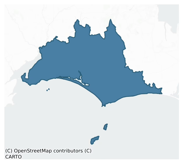
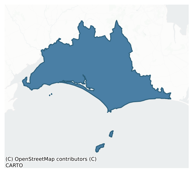
Bargy is a barony of County Wexford, in the historical province of Leinster (Irish: Uí Bhairrche), covering 174 km² of land. The barony records 317 NMS archaeological sites and 147 NIAH listed buildings, placing it at around the 47th percentile among 280 ROI baronies for sites per km². This means it is in the lower half of all baronies for sites per km². Dated archaeological evidence runs from the Early Bronze Age through to the Post Medieval, spanning 6 of 9 archaeological periods, placing the barony in the 18th percentile among 280 ROI baronies for chronological depth. This means it is in the bottom fifth of all baronies for chronological depth. The largest dated subset of recorded sites dates to the Iron Age. Logainm flags 35 placenames in the barony as carrying a recognised heritage root; the largest share — around 66% — are names associated with early Christian church and monastic foundations.
Heritage at a glance
Percentile rankings throughout this profile compare each barony only against the other 279 Republic of Ireland baronies.
The recorded heritage of Bargy
The National Monuments Service Sites and Monuments Record (SMR) is the statutory inventory of archaeological sites for the Republic of Ireland, maintained by the Department of Tourism, Culture, Arts, Gaeltacht, Sport and Media. Sites recorded here include earthworks, ringforts, megalithic tombs, ecclesiastical remains, and post-medieval features; not every record is legally protected, but each is registered as a monument of archaeological interest.
The National Monuments Service records 317 archaeological sites in Bargy, putting it at the 47th percentile among 280 ROI baronies for sites per km². This means it is in the lower half of all baronies for sites per km². Protection coverage is near-universal — 295 sites (93%) fall within a recorded monument protection zone, indicating an extensively surveyed landscape. The record is dominated by defensive sites — ringforts, enclosures, hillforts, and stone forts (139 sites, 44% of the total), with ecclesiastical sites forming a substantial secondary presence (71 sites, 22%). Ringfort – rath is the most prevalent type, making up 23% of the barony's recorded sites (72 records), broadly in line with the ROI average of 20% across all baronies where this type occurs. Ringfort – rath is an earthen ringfort enclosed by a bank and external ditch — the most common Early Medieval farmstead, broadly dated 500–1000 AD. Other significant types include Church (27) and Enclosure (21). Church is a building used for public Christian worship, of any date from c. 500 AD onwards; Enclosure is a banked or ditched feature of uncertain type, used as a catch-all where the original function cannot be determined from surface evidence. Across the barony's 174 km², this gives a recorded density of 1.82 sites per km².
Most common monument types
Hover or tap a monument type to see its definition.
| Type | Count |
|---|---|
| Ringfort – rath an earthen ringfort enclosed by a bank and external ditch — the most common Early Medieval farmstead, broadly dated 500–1000 AD | 72 |
| Church a building used for public Christian worship, of any date from c. 500 AD onwards | 27 |
| Enclosure a banked or ditched feature of uncertain type, used as a catch-all where the original function cannot be determined from surface evidence | 21 |
| Ritual site – holy well a well or spring traditionally associated with a saint, often credited with healing properties; many trace earlier ritual origins but devotion is documented from the medieval period onwards | 17 |
| Graveyard a burial area associated with a church, in use from the medieval period onwards | 15 |
| Castle – tower house a fortified residential tower of four or five storeys, mostly built by lords in the 15th and 16th centuries and often within a defended bawn | 13 |
| Castle – unclassified a castle whose form cannot be precisely classified, dating somewhere between the late 12th and 16th centuries | 11 |
Chronological distribution
The dated archaeological record for Bargy spans from the Early Bronze Age through to the Post Medieval, with activity attested across 6 of 9 archaeological periods. This is the 18th percentile across ROI baronies — a relatively narrow chronological band, with much of Irish prehistory not represented in the dated record. Every period from earliest to latest is represented in the record — an unbroken sequence of dated activity across the full chronological span. Activity concentrates most heavily in the Iron Age (92 sites, 39% of dated material), with the Early Medieval forming a secondary peak (64 sites, 27%). A further 84 recorded sites (26% of the overall NMS register for the barony) carry no period attribution — appearing as 'Unknown' in the bar chart below. This typically reflects either records that pre-date the standardised period vocabulary or sites awaiting specialist dating review, rather than a genuine absence of chronological evidence.
Sample of recorded monuments
Show 25 sample monuments (of 317 total)
A representative sample of 25 recorded monuments drawn from the barony’s 317 total NMS entries. Sites within a recorded monument protection zone and rarer site types are prioritised so the list shows a meaningful cross-section rather than only the most common type. Each entry shows the official Sites and Monuments Record reference number and the description published by the National Monuments Service.
Cairn – burial cairn
Located at the crest of the S-facing slope of the most south-western summit of Forth Mountain and close to Skeater Rock. A cairn of stones (diam. c. 30m) was removed in 1884 when a 'bowl food vessel' was discovered…
Located at the crest of the S-facing slope of the most south-western summit of Forth Mountain and close to Skeater Rock. A cairn of stones (diam. c. 30m) was removed in 1884 when a 'bowl food vessel' was discovered (Ffrench 1895). The cairn was completely removed and its precise location is not known (Culleton 1984, 33-4).
Archaeological testing (22E0169) by C. Moriarty c. 45m to the W produce no evidence of the cairn (excavations.ie 2022:024).
The above description is derived from the published 'Archaeological Inventory of County Wexford' (Dublin: Stationery Office, 1996). In certain instances the entries have been revised and updated in the light of recent research.
Compiled by: Michael Moore
Date of revision: 8 February 2016
Amended: 23 December 2022
Bullaun stone (present location)
A granite stone (dims. 1.36m x 0.57-1.24m; H 0.38m) with one rounded basin (diam. 0.5m; D 0.34m) was moved a short distance to its present location on the E side of an enlarged field c. 1982.
The above description is…
A granite stone (dims. 1.36m x 0.57-1.24m; H 0.38m) with one rounded basin (diam. 0.5m; D 0.34m) was moved a short distance to its present location on the E side of an enlarged field c. 1982.
The above description is derived from the published 'Archaeological Inventory of County Wexford' (Dublin: Stationery Office, 1996). In certain instances the entries have been revised and updated in the light of recent research.
Compiled by: Michael Moore
Date of upload/revision: 23 July 2013
Burial ground
Marked faintly as a rectangular feature (dims c. 25m E-W; c. 20m N-S) on the 1839 ed. and marked faintly as a circular feature (diam. c. 20m) on the 1925 ed. of the OS 6-inch map, and described as a graveyard on both.…
Marked faintly as a rectangular feature (dims c. 25m E-W; c. 20m N-S) on the 1839 ed. and marked faintly as a circular feature (diam. c. 20m) on the 1925 ed. of the OS 6-inch map, and described as a graveyard on both. It is located on a slight W-facing slope. This is a raised subcircular area (dims 18m NW-SE; 16m NE-SW) with some small trees defined by scarp (H 0.4 0.7m). There is no visible structure or evidence of burials at ground level.
The above description is derived from the published 'Archaeological Inventory of County Wexford' (Dublin: Stationery Office, 1996). In certain instances the entries have been revised and updated in the light of recent research.
Compiled by: Michael Moore
Date of upload/revision: 23 July 2013
Midden
Clare island is a rock outcrop island with soil cover (dims. c. 50m NW-SE; c. 30m NE-SW), situated between Bannow Island, which is c. 200m to the W, and the mainland, which is c. 140m to the SE. In 1864 animal bones and…
Clare island is a rock outcrop island with soil cover (dims. c. 50m NW-SE; c. 30m NE-SW), situated between Bannow Island, which is c. 200m to the W, and the mainland, which is c. 140m to the SE. In 1864 animal bones and oyster shells were noted over much of the island (Anon. 1864a). In the same year a trench was excavated (Anon. 1864b) and the bones were identified as largely deer with cattle and pig. The only artefacts recovered were fragments of an earthenware vessel. Within the 'A' horizon on the W side of island a lens of shells (L c. 20m; T c. 0.1m) mostly oyster, some animal bone and burnt stone can still be seen.
The above description is derived from the published 'Archaeological Inventory of County Wexford' (Dublin: Stationery Office, 1996). In certain instances the entries have been revised and updated in the light of recent research.
Compiled by: Michael Moore
Date of upload/revision: 22 July 2013
Historic town
Situated on a broad low peninsula (Wth c. 400-700m N-S; L c. 500m E-W) which is at the SW end of the broad peninsula of Bannow parish lying between Bannow Bay to the NW and the sea to the S. The site of the first…
Situated on a broad low peninsula (Wth c. 400-700m N-S; L c. 500m E-W) which is at the SW end of the broad peninsula of Bannow parish lying between Bannow Bay to the NW and the sea to the S. The site of the first Anglo-Norman landing in Ireland is on Bannow Island (WX045-042—-) across a channel (Wth c. 200m) to the W that has silted up since the Down Survey map (1654-8). Bargy had been granted to Hervey de Montmorency, but he had granted the church of Bannow to Christchurch in Cantebury, who later granted it to Tintern abbey (WX045-027001-), and 120 acres of the village of Bannow was amongst Tintern‘s possessions at the Suppression in 1540 (Hore 1900-11, vol. 2, 76). The town may have developed around a seigniorial manor as the manor of the Lordship of Bannow is recorded into the 15th century. Since it was not a Royal foundation no charters or grants of murage or other rights are known, but it is unlikely that it was ever fortified. However, the usual burger rights were granted.
A town was certainly in existence by the late the 13th century when Bannow is mentioned indirectly in a charter to New Ross dated 1283-6. By 1307 the burgage rent yielded almost £8, suggesting a burger population of about 160, but the town might already have been in decline. This was caused by the silting up of the bay and the channels to the open sea, but the rate at which this occurred is not known. A survey in the Book of Survey and Distribution (1655) mentions six streets, 19 proprietors or…
Mine
Silver and lead ore were mined at Barrystown from 1551-53, and probably before that date. Dutch miners under their Captain, Joachim Gundelfinger, had been brought in to operate the mines in two shifts per day of…
Silver and lead ore were mined at Barrystown from 1551-53, and probably before that date. Dutch miners under their Captain, Joachim Gundelfinger, had been brought in to operate the mines in two shifts per day of fourteen men, but it was never profitable. Disagreements between the Dutch Captain and the King’s Surveyor, Robert Recorde, led to delays and mismanagement over a smelter that was needed to process the ore. A plan to connect the mines with Clonmines c. 850m to the NW by a bridge across the Owenduff/Corock river was not carried out, but the mines would have provided a boost for the town. Mining was possibly resumed in the 1560s under a concession leased by Walter Peppard (Hore 1901-11, vol. 2, 233-61). Robert Leigh writing in 1684 describes five or six large pits that produced more lead than silver, and says the mines were abandoned when they became flooded (Hore 1858-9, 455). The mines were also worked 1804-12 under George Ogle and again 1845-50 by the Barrystown Mining Company under the management of a Mr. Angove. Four mine-shafts are marked on the 1839 ed. of the OS 6-inch map at the bottom of a W-facing slope on the E shore at the inner end of Bannow Bay. The mineshafts are now back filled, but the hollows of some are still visible. An engine house (ext. dims 6.05m E-W; 5.75m N-S) with a chimney stack (ext. diam. of base c. 2.85m; surviving H c. 13m) at the NW angle that was built by the Mining Company is on the site. (Butler 1985, 173-6)
Archaeological monitor…
Tide mill – unclassified
A water mill at Bannow, which was first mentioned in 1307, is described as ruinous in 1324 (Hore vol. 4, 453-4). In 1634 it was part of the estate of John Cullen of Cullenstown castle (ibid. 457). It has recently been…
A water mill at Bannow, which was first mentioned in 1307, is described as ruinous in 1324 (Hore vol. 4, 453-4). In 1634 it was part of the estate of John Cullen of Cullenstown castle (ibid. 457). It has recently been identified as a tidal mill, the causeway of which survives across a small inlet and stream just N of Brandane church (WX045-047—-) (Magahy 2017, 317-20). The causeway (O’Broin 1921, 121) was known as the ‘Black Bridge’, from which large pieces of blackened oak, probably the remnants of the millhouse had been recovered c. 1800 (Tuomy 1850, 209). The causeway (L c. 150m) consists of a grass-covered bank of stones (Wth c. 1-2m; H c. 0.5m) with a break (L c. 15m) near its S end.
Compiled by: Michael Moore
Date of revised upload: 25 January, 2017
House – 16th/17th century
Located on a slight NW-SE spur with a NW-SE stream c. 350m to the NE that loops around to the S and W and is c. 500m to the SW flowing N. The Fitzhenrys were the principal landowners in Kilcavan from at least the…
Located on a slight NW-SE spur with a NW-SE stream c. 350m to the NE that loops around to the S and W and is c. 500m to the SW flowing N. The Fitzhenrys were the principal landowners in Kilcavan from at least the mid-13th century (Jeffrey 1979, 79-80). The flashing of a large building, probably of one storey and attic, is visible on the outer face of the E wall of the tower house (WX046-001001-), and the original S wall (T 0.7m) of this structure is present in a small one-storey house (ext. dims 18.95m E-W; 8.45m N-S) that is still occupied. There is a square hood moulding externally over one of its windows in the S wall. Internally, this is a blocked pointed doorway. Kilcavan parish church (WX046-002001-) is c. 400m to the SE.
Compiled by: Michael Moore
Date of upload: 20 August, 2013
Font (present location)
The highly decorated Romanesque font now in the Roman Catholic church at Carrick-on-Bannow originally came from Bannow church (WX045-045009-) (Tuomey 1850, 201). It is complete (H 0.87m) and was probably made from…
The highly decorated Romanesque font now in the Roman Catholic church at Carrick-on-Bannow originally came from Bannow church (WX045-045009-) (Tuomey 1850, 201). It is complete (H 0.87m) and was probably made from Dundry stone but is now painted white. It has a rectangular base (dims 0.6m x 0.61m; H 0.26m), a plain circular stem (diam. 0.48m), and the rectangular basin (dims 0.62m x 0.59m; H 0.4m) has banded decoration that is similar on two sides but different on the other two, and shows Anglo-Saxon influence. (Corlett 2012)
The above description is derived from the published 'Archaeological Inventory of County Wexford' (Dublin: Stationery Office, 1996). In certain instances the entries have been revised and updated in the light of recent research.
Compiled by: Michael Moore
Date of upload/revision: 19 August, 2013
Standing stone
Marked only on the 1925 ed. of the OS 6-inch map, and situated on a level landscape. This is a granite stone with veins of quartz and a rectangular cross-section (dims. 1.4m NNE-SSW; 1m WNW-ESE; H 3m). A description of…
Marked only on the 1925 ed. of the OS 6-inch map, and situated on a level landscape. This is a granite stone with veins of quartz and a rectangular cross-section (dims. 1.4m NNE-SSW; 1m WNW-ESE; H 3m). A description of cupmarks (Kinahan 1883-4a 234-5; 1883-4c) and of an ogham inscription (Macalister 1949, vol. 1, 47-8) cannot be endorsed.
The above description is derived from the published 'Archaeological Inventory of County Wexford' (Dublin: Stationery Office, 1996). In certain instances the entries have been revised and updated in the light of recent research.
Compiled by: Michael Moore
Date of upload/revision: 16 August, 2013
Mound
Marked as small circular embanked enclosure (diam. c. 15m) on the 1839 ed. of the OS 6-inch map. It is situated on a fairly level landscape at a point where two field banks now meet, and with a small NW-SE stream c.…
Marked as small circular embanked enclosure (diam. c. 15m) on the 1839 ed. of the OS 6-inch map. It is situated on a fairly level landscape at a point where two field banks now meet, and with a small NW-SE stream c. 100m to the S. No antiquity is visible at ground level.
The above description is derived from the published 'Archaeological Inventory of County Wexford' (Dublin: Stationery Office, 1996). In certain instances the entries have been revised and updated in the light of recent research.
Compiled by: Michael Moore
Date of upload/revision: 20 August, 2013
Promontory fort – inland
The site of Duncormick castle (WX046-034001-) is situated on a rock outcrop promontory (dims 51m E-W; c. 38m N-S; H 4-6.5m) on the W side of the valley of a N-S stream, and in the centre of Duncormick village. There is…
The site of Duncormick castle (WX046-034001-) is situated on a rock outcrop promontory (dims 51m E-W; c. 38m N-S; H 4-6.5m) on the W side of the valley of a N-S stream, and in the centre of Duncormick village. There is a wide trench or fosse (Wth of top 13-15m; D 6-6.5m) on the S side of the promontory, which may be natural. It extends west as far as a N-S public road (L c. 100m). There is no evidence of an earthwork bank or fosse cutting off the promontory, although the promontory is partly occupied by a house.
Compiled by: Michael Moore
Date of upload: 19 August, 2103
Castle – motte and bailey
The manors of Rosegarland and Duncormick were jointly held by Maurice de London by the service of three and a quarter knights in 1247, and by three knights in 1324, but thereafter the manors are separated and Duncormick…
The manors of Rosegarland and Duncormick were jointly held by Maurice de London by the service of three and a quarter knights in 1247, and by three knights in 1324, but thereafter the manors are separated and Duncormick is not recorded, although it seems to have been acquired by the Meiler family (Brooks 1950, 103). The motte would have been built as part of the initial settlement after 1170. It is located on a bluff on the E bank of a N-S stream that flows through Duncormick village, with the stream c. 50m to the E. The motte is a flat-topped and densely overgrown earthen mound (diam. top 17m; diam. of base 21m; H 2.9-.2m). There is no visible fosse or any visible sign of a bailey, but archaeological testing (06E0929) uncovered a substantial ditch (Wth of top 5.2m; max. D 1.35m) that could be interpreted as part of the perimeter of a bailey (Dehaene 2009).
An archaeological assessment and testing (02E0040) identified elements of a field system (WX046-035002-) to the NE that may be associated with it, and a kiln (WX046-035003-) and a house (WX046-035004-) were identified to the E, close to the present road through the village (Richardson 2002; excavations.ie 2002:1799). The church site (WX046-57001- is c. 120m to the E and the castle site (WX046-034001-) is c. 120m to the SW on the other side of the river.
The above description is derived from the published 'Archaeological Inventory of County Wexford' (Dublin: Stationery Office, 1996). In certain instances the entrie…
Courtyard
According to an inquisition held in New Ross on October 19th 1631 Arthur Keating, the son of Oliver Keating, possessed a court, which may have been a bawn of the castle (WX046-041001-) at Kilcowan (Jeffrey 1979, 78-9).…
According to an inquisition held in New Ross on October 19th 1631 Arthur Keating, the son of Oliver Keating, possessed a court, which may have been a bawn of the castle (WX046-041001-) at Kilcowan (Jeffrey 1979, 78-9). Its location is not known, but it would be close to the castle.
Compiled by: Michael Moore
Date of upload: 20 August, 2013
Chapel
Located on a fairly level landscape, and described as 'R.C. chapel (in ruins)' on the 1839 ed. of the OS 6-inch map. This could be an estate chapel, or private chapel, of Cullenstown tower house (WX046-046001-), which…
Located on a fairly level landscape, and described as 'R.C. chapel (in ruins)' on the 1839 ed. of the OS 6-inch map. This could be an estate chapel, or private chapel, of Cullenstown tower house (WX046-046001-), which lies c. 200m to the WNW. The foundations of a rectangular structure (ext. dims 7.85m E-W; 4.2m N-S) are within a rectangular grass-covered enclosure (ext. dims 35.5m N-S; 19m E-W; int. dims 33.8m N-S; 14.8m E-W) defined by a low bank or the remains of a wall (Wth 2.5m; H 0.4m). One headstone commemorating Hugh Monro Robertston, probably from a shipwreck and dated 1819, is visible.
The above description is derived from the published 'Archaeological Inventory of County Wexford' (Dublin: Stationery Office, 1996). In certain instances the entries have been revised and updated in the light of recent research.
Compiled by: Michael Moore
Date of upload/revision: 19 August, 2013
Walled garden
Oliver Keating was possessed of the manor of Kilcowan at the time of his death in March 1629 (Jeffrey 1979, 78-9). This consisted of a castle (WX046-042001-), a hall (WX046-042002-), an orchard, a messuage…
Oliver Keating was possessed of the manor of Kilcowan at the time of his death in March 1629 (Jeffrey 1979, 78-9). This consisted of a castle (WX046-042001-), a hall (WX046-042002-), an orchard, a messuage (WX046-068—-) or house and appurtenances, and at least two cottages (WX046-069—-; WX046-070—-). The site of the castle was at the W edge of a rectangular wooded area (dims c. 100m E-W; c. 25m N-S) as depicted on the 1839 ed. of the OS 6-inch map and this area is known locally to have been an orchard before it was removed. It cannot be certain that this is on the site of the original orchard, or that it was defined by a wall.
Compiled by: Michael Moore
Date of upload: 20 August, 2103
Habitation site
Situated on the flood-plain of a small N-S stream and close to the stream at a point where it curves to the W. A number of prehistoric flints and worked stones have been recovered on the land, largely from this area.…
Situated on the flood-plain of a small N-S stream and close to the stream at a point where it curves to the W. A number of prehistoric flints and worked stones have been recovered on the land, largely from this area. They include two stone axes, a hollow-based arrowhead, some flint cores, a crude loom-weight and a possible hone-stone. The soil is said to be black clay with lenses of shell and organic material.
Compiled by: Michael Moore
Date of upload: 19 August, 2013
Mass-house
Located on a bluff overlooking a small W-E valley. Tomhaggard is not listed in a survey of Catholic priests in Ferns diocese in 1731 (Anon. 1915, 166-9), but Jasper Devereux was registered as the pastor of Mayglass and…
Located on a bluff overlooking a small W-E valley. Tomhaggard is not listed in a survey of Catholic priests in Ferns diocese in 1731 (Anon. 1915, 166-9), but Jasper Devereux was registered as the pastor of Mayglass and Tomhaggard in 1703 (Grattan Flood 1915, 68). The structure is marked on the 1839 ed. of the OS 6-inch map but it is not named. This is a stone walled thatched structure (ext. dims. 7.1m NW-SE; 5.5m NE-SW; int. dims 5.9m NW-SE; 3.7m NE-SW) built against the inner face of the SE wall of the tower house (WX047-050002-), probably at the first floor level. A window embrasure has been blocked at the bottom creating an altar shelf (Wth 1.73m; H 1.14m; D 0.53m). There is no evidence of an enclosure or burial associated with it, but there is a D-shaped stone (dims 0.5m x 0.28m) over the doorway carved with four curves on its rounded edge and a T-shaped incision. St James' Well (WX047-049—-) is c. 35m to the W and St Anne's Well (WX047-051—-) is c. 10m to the N at the base of the bluff. A small excavation (03E0646) connected with the underpinning of a buttress on the N side of the mass-house failed to produce any related material (Hayden 2006).
The above description is derived from the published 'Archaeological Inventory of County Wexford' (Dublin: Stationery Office, 1996). In certain instances the entries have been revised and updated in the light of recent research.
Compiled by: Michael Moore
Date of upload/revision: 21 October, 2013
Concentric enclosure
Situated on a level landscape. The cropmark of a bivallate circular enclosure (int. diam. c. 45m; ext. diam. c. 80m) defined by a wider inner fosse feature (Wth c. 3m) and slighter outer fosse feature is visible on…
Situated on a level landscape. The cropmark of a bivallate circular enclosure (int. diam. c. 45m; ext. diam. c. 80m) defined by a wider inner fosse feature (Wth c. 3m) and slighter outer fosse feature is visible on aerial photographs (ASIAP (3) 33-37). There is a subrectangular enclosure (dims c. 30m NW-SE; c. 15m NE-SW) defined by a slight fosse feature inside the inner enclosure, No entrances can be detected, but a drain or narrow stream connects the defining features radially at NW and a similar feature connects them at SSE and extends further in this direction.
Compiled by: Michael Moore
Date of upload: 18 February, 2014
Churchyard
Located on a fairly level landscape. The church at Cullenstown could be an estate chapel, or private chapel, of Cullenstown tower house (WX046-046001-) which is c. 200m to the WNW. The church (WX046-047001-) is within a…
Located on a fairly level landscape. The church at Cullenstown could be an estate chapel, or private chapel, of Cullenstown tower house (WX046-046001-) which is c. 200m to the WNW. The church (WX046-047001-) is within a rectangular grass-covered enclosure (ext. dims 35.5m N-S; 19m E-W; int. dims 33.8m N-S; 14.8m E-W) defined by a low bank or the remains of a wall (Wth 2.5m; H 0.4m). One headstone commemorating Hugh Monro Robertston dated 1819, probably from a shipwreck, is visible.
Compiled by: Michael Moore
Date of upload: 19 August, 2013
Sarcophagus
Two graveslabs and a sarcophagus are at the SE angle of the nave of Bannow church (WX045-045001-). The sarcophagus (Wth 0.45-0.74m; H c. 0.35m; L 2.04m) has a single drain-hole. The nearby graveslab with no inscription…
Two graveslabs and a sarcophagus are at the SE angle of the nave of Bannow church (WX045-045001-). The sarcophagus (Wth 0.45-0.74m; H c. 0.35m; L 2.04m) has a single drain-hole. The nearby graveslab with no inscription (WX045-045006-) may have been the cover for this coffin. (Bradley 1988, 79)
Compiled by: Michael Moore
Date of upload: 22 July, 2013
House – indeterminate date
Situated on a level landscape. According to local reports stone foundations, probably of a house- site, were found in the interior of rath (WX047-023001-) through ploughing.
Compiled by: Michael Moore
Date of…
Situated on a level landscape. According to local reports stone foundations, probably of a house- site, were found in the interior of rath (WX047-023001-) through ploughing.
Compiled by: Michael Moore
Date of upload: 18 October, 2013
Architectural fragment
A fragment of a wall with no distinguishing features may be part of a tower house (WX042-023001-). Two dressed granite stones from a pointed doorway are present at the site.
Compiled by: Michael Moore
Date of…
A fragment of a wall with no distinguishing features may be part of a tower house (WX042-023001-). Two dressed granite stones from a pointed doorway are present at the site.
Compiled by: Michael Moore
Date of upload: 27 May, 2013
Hut site
Located at the NE point of the Great Saltee Island, on a low-lying, level, grass and fern-covered landscape. Part of the foundation course of a circular hut site (int. dims 7.9m E-W; 4.8m plus N-S) is within the…
Located at the NE point of the Great Saltee Island, on a low-lying, level, grass and fern-covered landscape. Part of the foundation course of a circular hut site (int. dims 7.9m E-W; 4.8m plus N-S) is within the promontory fort (WX051A002001-), but most of the perimeter SW-N-SE is missing.
Compiled by: Michael Moore
Date of upload; 17 February, 2014
Ringfort – rath
Marked as an oval quarry (dims c. 30m N-S; c. 20m E-W) on the 1839 Ed. of the OS 6 inch map. It is located towards the top of a slight E-facing slope and on the N side of a NE-SW road. It is marked on the 1925 Ed. as a…
Marked as an oval quarry (dims c. 30m N-S; c. 20m E-W) on the 1839 Ed. of the OS 6 inch map. It is located towards the top of a slight E-facing slope and on the N side of a NE-SW road. It is marked on the 1925 Ed. as a D-shaped area (dims c. 40m NW-SE; c. 30m NE-SW) extending to the S side of the road and defined by a wide fosse or quarry SW-N-NE on the 1925 Ed. of the map. It is known locally to have been a rath defined by earthen banks on the N side of the road. There is a quarry on the N side of the road but a slight scarp of a bank (H 0.2-0.4m) defines the perimeter of a ringfort SE-SW.
Archaeological testing (15E0339) of an extensive area (dims c. 90-120m NNW-SSE; c. 70-90m ENE-WSW) SE of the rath produced evidence of an outer bank or fosse of the rath at SE. There were also at least five gullies, some of which yielded sherds of medieval pottery, which related to the medieval management of the land. Some furrows relating to the gullies were also recorded and at one point a large deposit (dims c. 5m x c. 4m) containing a wealth of medieval ceramics, either the top of a pit or a fosse, was identified. All features will be preserved in situ, including a furnace bottom (WX041-069—-) and an adjacent pit, beneath a protective layer where necessary or fully excavated when the house development proceeds. (McLoughlin 2015)
The above description is derived from the published 'Archaeological Inventory of County Wexford' (Dublin: Stationery Office, 1996). In certain instan…
Listed buildings
The National Inventory of Architectural Heritage (NIAH) is a state survey appraising buildings of architectural, historical, archaeological, artistic, cultural, scientific, social, or technical interest. Each surveyed structure receives a rating from International (the highest, for buildings of European importance) through National, Regional, Local, and Record-Only.
The NIAH records 147 listed buildings in Bargy (67th percentile across ROI baronies). The highest-graded structure include 1 of National significance. The Republic holds 937 National-graded buildings in total, so this barony accounts for around 0% of the national total. Construction dates concentrate most heavily in the Victorian (1830-1900) period. The most-recorded building type is farm house (45 examples, 31% of the listed stock).
Terrain and environment
Mean elevation across the barony is 24m — the 2nd percentile among 280 ROI baronies for elevation. This means it is in the bottom tenth of all baronies for elevation. This is a relatively low-lying landscape by ROI standards. Elevation matters for heritage because higher-altitude baronies typically favour defensive monuments — ringforts and hilltop forts placed on prominent ground — while lowland baronies are more likely to carry the dense settlement and church networks of intensive agricultural landscapes. A maximum elevation of 218m gives the barony meaningful vertical relief. Mean slope is 2.0° — the 7th percentile among 280 ROI baronies for slope. This means it is in the bottom tenth of all baronies for slope. This is broadly flat terrain, the kind of landscape best suited to intensive agriculture. Slope is a key control on both land use and archaeological preservation: steep ground resists ploughing and tends to preserve earthworks intact, while gentle slopes favour intensive cultivation that damages or destroys surface archaeology over time. The Topographic Wetness Index averages 11.9, the 94th percentile among 280 ROI baronies for wetness. This means it is in the top tenth of all baronies for wetness. This is wet, slow-draining ground by ROI standards — the kind of landscape that may carry waterlogged archaeological sites of unusual preservation value. Drainage matters for heritage because poorly-drained ground preserves organic archaeology (wooden trackways, leather, textiles, and on rare occasions human remains) far better than free-draining soil; well-drained ground favours arable use but destroys organic material rapidly. The land-cover mosaic combines improved grassland (63%), arable farmland (23%), and woodland (10%), giving a mixed agricultural and semi-natural landscape. In overall character, this is low-lying, gently-sloping terrain — characteristic of Ireland's central plain and coastal lowlands, with land use dominated by improved grassland.
Terrain measurements
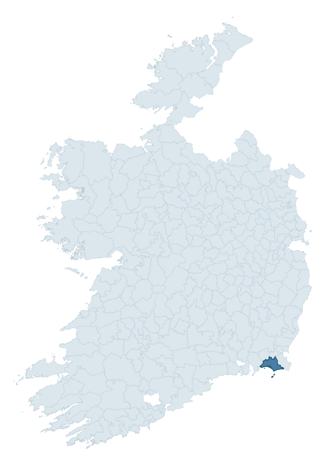
Where this barony sits in the Republic of Ireland
Geology and preservation
Bedrock geology shapes the landscape long before any settlement begins — controlling soil drainage, agricultural potential, the survival of upstanding monuments, and the preservation of buried archaeology. The figures below come from the Geological Survey Ireland 1:100,000 bedrock map.
The bedrock underlying Bargy is predominantly slate (23% of the barony by area), laid down during the Cambrian period (54% by area, around 540 to 485 million years ago). Slate weathers to thin upland soils but provides high-value building and roofing stone, which often shows in surviving 19th-century rural and ecclesiastical architecture. With 14 distinct rock types mapped, the barony sits in the top third of ROI baronies for geological diversity (97th percentile) — typically a sign of complex tectonic history or coastal mosaics of differing rock units.
Rock type composition
Largest mapped unit: Ardenagh Formation (22% of the barony)
Placename evidence
Logainm records 35 heritage-diagnostic placenames for Bargy, drawn from townland and civil-parish names across the barony. The dominant stratum is Early Christian ecclesiastical — cill-, teampall-, and domhnach-prefixed names that record the dense network of early church foundations established between the fifth and tenth centuries. The leading diagnostic roots are cill- (20 — church), ráth- (7 — earthen ringfort), and dún- (3 — hilltop fort or promontory fort). This is broadly in line with the ROI average of 30.7 heritage placenames per barony. The presence of multiple heritage strata side by side indicates layered occupation of the landscape across successive prehistoric and historic periods. Logainm records 248 placenames for Bargy (predominantly townland names). Of these, 35 (14%) carry one of the diagnostic Gaelic roots tracked above; the remainder draw on more generic landscape vocabulary that does not encode a heritage period.
Pre-Christian / Early Medieval Defensive
| Root | Count | Meaning |
|---|---|---|
| ráth- | 7 | earthen ringfort |
| dún- | 3 | hilltop or promontory fort |
Early Christian Ecclesiastical
| Root | Count | Meaning |
|---|---|---|
| cill- | 20 | church (early) |
| gráinseach- | 2 | monastic farm / grange |
| tobar- | 1 | holy well |
Burial, Ritual, and Norse-Contact
| Root | Count | Meaning |
|---|---|---|
| uaimh- | 1 | cave / souterrain |
| gall- | 1 | foreigner — Norse settlement marker |
Other baronies in Wexford
About this profile
Click any section below to expand.
What is a barony?
A barony is a historic administrative unit in Ireland, broadly equivalent to an English hundred. The 280 baronies used here are from the OSi 2019 National Statutory Boundaries (generalised 20m), covering the 26 counties of the Republic of Ireland. Baronies derive from the Norman period, were formalised in the 17th century, and have not been redrawn for statistical purposes. They vary enormously in area, from compact urban baronies in Dublin to vast upland baronies in Connacht, and should not be compared by raw site count without accounting for area differences.
What counts as a site?
This profile combines three distinct heritage registers, each with its own definition of what constitutes a recordable site:
- Archaeological sites (NMS). The National Monuments Service Sites and Monuments Record (SMR) catalogues every known archaeological monument or site of archaeological interest in the Republic, from prehistoric burial mounds and ringforts to medieval churches and post-medieval defensive works. Inclusion does not require legal protection — only that the site has been identified, surveyed, and assessed as having archaeological value. A separate subset of these sites lies within a recorded protection zone, which gives them statutory protection under the National Monuments Acts.
- Listed buildings (NIAH). The National Inventory of Architectural Heritage records buildings of architectural, historical, archaeological, artistic, cultural, scientific, social, or technical interest. Each surveyed structure is appraised on a five-tier scale: International, National, Regional, Local, and Record-Only. The NIAH appraisal is informational rather than strictly statutory, but it underpins local-authority Record of Protected Structures (RPS) listings.
- Heritage placenames (Logainm). Logainm is the authoritative database of Irish placenames maintained by the Placenames Branch. This profile applies a heritage-diagnostic classifier to the Irish-language form of each townland name, flagging roots that signal defensive sites (ráth-, lios-, dún-, caiseal-, cathair-), ecclesiastical foundations (cill-, teampall-, domhnach-, mainistir-), prehistoric burial-ritual features (tuaim-, carn-, leaba-), or Norse-contact settlement (gall-). Townlands without one of these diagnostic roots are not flagged here — they may still carry historical significance, but that significance is not encoded in the name itself.
Editorial principles
The narrative sections of this profile follow several explicit principles:
- Evidential. Every claim about this barony’s heritage character is anchored in the underlying register data. Where a site count, a placename count, or a percentile rank is cited, it is computed from the source datasets at export time, not estimated.
- Comparative. Counts and metrics are reported alongside their percentile rank against the other 279 ROI baronies. A barony with 50 ringforts in absolute terms could be unusually high or unusually low depending on its size and regional context; percentile ranking removes that ambiguity.
- Transparent on limits. Where a register has known coverage gaps, survey biases, or data-quality issues that affect this barony’s figures, the profile flags them rather than presenting the numbers as definitive.
- No interpretation beyond what the data supports. The narrative does not speculate about historical events, social dynamics, or cultural meaning beyond what the recorded heritage and placename evidence directly attests.
Data caveats and limits
- NMS Sites and Monuments Record is the product of survey campaigns conducted at different intensities across different counties and decades. Some baronies have been surveyed more thoroughly than others, and absolute counts should be read in that light. Sites destroyed by development before survey are typically not represented; sites in heavily forested or upland terrain are sometimes under-recorded.
- NIAH coverage is broadly complete for the Republic of Ireland but the survey was conducted on a rolling county-by-county basis, and the most recent appraisal date varies. Buildings demolished or substantially altered after their original survey may still appear in the register; conversely, recent buildings of merit may not yet have been appraised.
- Logainm classification applies a deliberately conservative pattern-matching approach to the Irish-language townland forms. The classifier prioritises true positives over recall: a townland may carry a heritage signal that the classifier doesn’t recognise, particularly where the diagnostic root has been heavily anglicised or where the townland name draws on a less common term. The 60,000+ townland records and ~9,800 classified placenames give a substantial signal at barony scale, but individual townland names should be checked against Logainm directly for definitive interpretation.
- Period attribution. The chronological distribution reflects only those NMS sites that carry a recognised period attribution in the source data. Sites listed as “Unknown” period are excluded from the dated subset.
- Boundary changes. Some baronies have undergone minor boundary adjustments since their 19th-century definition; the OSi 2019 generalised boundaries used here are the current statutory definition and may differ slightly from historical maps in border areas.
- Bedrock geology is mapped at 1:100,000 scale, which means local variation within a barony — small pockets of different rock type, mineral veins, alluvium overlying bedrock — is generalised. The dominant-system and rocktype figures are area-weighted, so a barony reading “70% Carboniferous limestone” may still contain small but archaeologically important pockets of older or younger rock. Around 3% of GSI polygons do not match the lexicon and contribute no rocktype or system attribution.
Data sources
- National Monuments Service — Sites and Monuments Record (SMR) https://data.gov.ie/dataset/national-monuments-service-archaeological-survey-of-ireland
- National Inventory of Architectural Heritage (NIAH) https://data.gov.ie/dataset/national-inventory-of-architectural-heritage-niah-national-dataset
- Logainm — Placenames Database of Ireland https://www.logainm.ie/
- Ordnance Survey Ireland — National Statutory Barony Boundaries 2019 https://data-osi.opendata.arcgis.com/
- EURODEM — European Digital Elevation Model https://www.mapsforeurope.org/datasets/euro-dem
- ESA WorldCover https://esa-worldcover.org/en
- Geological Survey Ireland — 1:100,000 Bedrock Geology https://www.gsi.ie/en-ie/data-and-maps/Pages/Bedrock.aspx
Explore more: Search any of the 280 ROI baronies, browse by historical province, or read the methodology and data sources for the full Republic of Ireland Heritage Tool.