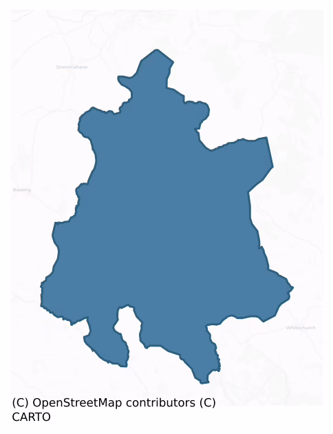
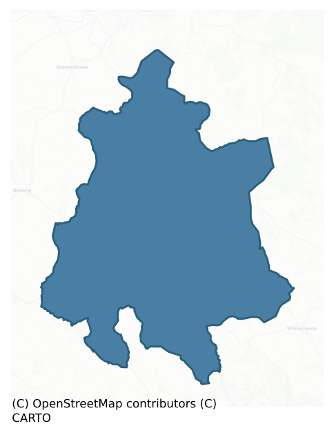
Barretts is a barony of County Cork, in the historical province of Munster (Irish: Baróidigh), covering 128 km² of land. The barony records 392 NMS archaeological sites and 19 NIAH listed buildings, placing it at around the 82nd percentile among 280 ROI baronies for sites per km². This means it is in the top fifth of all baronies for sites per km². Dated archaeological evidence runs from the Neolithic through to the Modern, spanning 8 of 9 archaeological periods, placing the barony in the 53rd percentile among 280 ROI baronies for chronological depth. This means it is in the upper half of all baronies for chronological depth. The largest dated subset of recorded sites dates to the Middle-Late Bronze Age.
Heritage at a glance
Percentile rankings throughout this profile compare each barony only against the other 279 Republic of Ireland baronies.
The recorded heritage of Barretts
The National Monuments Service Sites and Monuments Record (SMR) is the statutory inventory of archaeological sites for the Republic of Ireland, maintained by the Department of Tourism, Culture, Arts, Gaeltacht, Sport and Media. Sites recorded here include earthworks, ringforts, megalithic tombs, ecclesiastical remains, and post-medieval features; not every record is legally protected, but each is registered as a monument of archaeological interest.
The National Monuments Service records 392 archaeological sites in Barretts, putting it at the 82nd percentile among 280 ROI baronies for sites per km². This means it is in the top fifth of all baronies for sites per km². Protection coverage is near-universal — 390 sites (100%) fall within a recorded monument protection zone, indicating an extensively surveyed landscape. The record is dominated by defensive sites — ringforts, enclosures, hillforts, and stone forts (175 sites, 45% of the total), with agricultural and prehistoric industrial sites forming a substantial secondary presence (99 sites, 25%). Ringfort – rath is the most prevalent type, making up 35% of the barony's recorded sites (139 records) — well above the ROI average of 20% across all baronies where this type occurs. Ringfort – rath is an earthen ringfort enclosed by a bank and external ditch — the most common Early Medieval farmstead, broadly dated 500–1000 AD. Other significant types include Fulacht fia (98) and Standing stone (54). Fulacht fia is a horseshoe-shaped Bronze Age burnt mound built around a sunken trough beside a water source, traditionally interpreted as a cooking site; Standing stone is a deliberately set upright stone, used variously as a Bronze/Iron Age burial marker, route marker or commemorative monument. Across the barony's 128 km², this gives a recorded density of 3.05 sites per km².
Most common monument types
Hover or tap a monument type to see its definition.
| Type | Count |
|---|---|
| Ringfort – rath an earthen ringfort enclosed by a bank and external ditch — the most common Early Medieval farmstead, broadly dated 500–1000 AD | 139 |
| Fulacht fia a horseshoe-shaped Bronze Age burnt mound built around a sunken trough beside a water source, traditionally interpreted as a cooking site | 98 |
| Standing stone a deliberately set upright stone, used variously as a Bronze/Iron Age burial marker, route marker or commemorative monument | 54 |
| Souterrain an underground stone-built passage and chamber, generally Early Medieval and often associated with ringforts as a defensive or storage feature | 15 |
| Church a building used for public Christian worship, of any date from c. 500 AD onwards | 9 |
| Enclosure a banked or ditched feature of uncertain type, used as a catch-all where the original function cannot be determined from surface evidence | 8 |
| Graveyard a burial area associated with a church, in use from the medieval period onwards | 6 |
| Moated site | 6 |
Chronological distribution
The dated archaeological record for Barretts spans from the Neolithic through to the Modern, with activity attested across 8 of 9 archaeological periods. Every period from earliest to latest is represented in the record — an unbroken sequence of dated activity across the full chronological span. Activity concentrates most heavily in the Middle Late Bronze Age (100 sites, 28% of dated material), with the Iron Age forming a secondary peak (95 sites, 27%). A further 37 recorded sites (9% of the overall NMS register for the barony) carry no period attribution — appearing as 'Unknown' in the bar chart below. This typically reflects either records that pre-date the standardised period vocabulary or sites awaiting specialist dating review, rather than a genuine absence of chronological evidence.
Sample of recorded monuments
Show 25 sample monuments (of 392 total)
A representative sample of 25 recorded monuments drawn from the barony’s 392 total NMS entries. Sites within a recorded monument protection zone and rarer site types are prioritised so the list shows a meaningful cross-section rather than only the most common type. Each entry shows the official Sites and Monuments Record reference number and the description published by the National Monuments Service.
House – vernacular house
Roadside. Front (E) of 4 bays; off-centre doorway to S. Gable-ended with partially collapsed thatched roof; off-centre chimney to S. Formerly a public house; now in disrepair. According to local information, walls…
Roadside. Front (E) of 4 bays; off-centre doorway to S. Gable-ended with partially collapsed thatched roof; off-centre chimney to S. Formerly a public house; now in disrepair. According to local information, walls partially mud-built; cavity wall construction; cavity filled with dried beech leaves. Taller addition at S end built in early 20th century.
The above description is derived from the published 'Archaeological Inventory of County Cork. Volume 3: Mid Cork' (Dublin: Stationery Office, 1997). In certain instances the entries have been revised and updated in the light of recent research.
Date of upload/revision: 14 January 2009
Religious house – Knights Hospitallers
In marshy area, sloping gently down to SW, on E side of Abbey river and just N of its junction with Clyda river. Standing remains consist of ruined church (CO042-044002-) at centre of wedge-shaped graveyard (9550) which…
In marshy area, sloping gently down to SW, on E side of Abbey river and just N of its junction with Clyda river. Standing remains consist of ruined church (CO042-044002-) at centre of wedge-shaped graveyard (9550) which forms NE part of original enclosure of preceptory; graveyard divided from rest of enclosure to S and W by dry-stone wall which is not shown on 1842 OS 6-inch map. Enclosure roughly gable-shaped in plan (c. 90m NW-SE) with apex facing NW; much of W and SW sides defined by original enclosing wall with short lengths of wall surviving on N and SE sides; otherwise area now bounded by low roadside wall, which also forms outside boundary of graveyard.
Church: consists of nave (30.4m E-W; 10.5m N-S) with chancel (surviving L 13.5m E-W; 8.1m N-S) added at E end; W wall of nave broken down to foundation level, E wall of chancel entirely fallen, side walls of chancel much broken down, especially at E ends, otherwise walls stand to near full height but heavily ivy-clad. Nave walls penetrated by series of rectangular holes (H c. 0.2m; Wth c. 0.2m; H above present ground level c. 1.5m), probably putlog holes, though O'Regan (1901, 5) suggests they housed slides to ventilate church. East of centre in N wall of nave is door ope; of door surround only lowest jamb stone on E side survives; directly opposite on S wall is similar ruined door ope. Part of two window embrasures survive in S wall, on either side of door; both appear to have been double-splayed and lintelled emb…
Holed stone (present location)
In pasture, at base of S-facing slope, on N side of road, directly opposite ruin of Kilquane church (CO042-068004-); prostrate slab (L 1.9m; 0.7m x 0.3m) with smooth hole (diam. 0.1m) drilled through it. Known locally…
In pasture, at base of S-facing slope, on N side of road, directly opposite ruin of Kilquane church (CO042-068004-); prostrate slab (L 1.9m; 0.7m x 0.3m) with smooth hole (diam. 0.1m) drilled through it. Known locally as "Cloch na Peacaib" (the sinner's stone); according to Windele, writing in1848, 'women, nearing their confinement, used to draw clothes through the hole in order to ensure a favourable delivery' (Logan 1980, 106). According to Grove-White (1905-25, vol. 3, 323), the stone 'formerly stood a little higher up the ascent'. The road, which now separates the stone from the ruined church, was not constructed until the mid-19th century. Original location record CO042-113—-.
The above description is derived from the published 'Archaeological Inventory of County Cork. Volume 3: Mid Cork' (Dublin: Stationery Office, 1997). In certain instances the entries have been revised and updated in the light of recent research.
Date of revision: 17 December 2009
Revised by: Mary Tunney
This monument is subject to a preservation order made under the National Monuments Acts 1930 to 2014 (PO no. 1/1993).
Stone circle – multiple-stone
Site destroyed between 1963 and 1970. It stood on rolling pasture, 150m SE of Peastinagh River. Six stones of circle remained in 1963, with single internal stone (6817). Orthostats were 0.3m to 1.1m L, 0.1m to 0.25m T…
Site destroyed between 1963 and 1970. It stood on rolling pasture, 150m SE of Peastinagh River. Six stones of circle remained in 1963, with single internal stone (6817). Orthostats were 0.3m to 1.1m L, 0.1m to 0.25m T and 0.4m to 0.85m H. (O Nualláin 1984a, 11, no. 1)
The above description is derived from the published 'Archaeological Inventory of County Cork. Volume 3: Mid Cork' (Dublin: Stationery Office, 1997). In certain instances the entries have been revised and updated in the light of recent research.
Date of upload/revision: 14 January 2009
Burial
At summit of hill, now forested. Locally thought to be the burial place of highwayman. No visible surface trace of burial.
The above description is derived from the published 'Archaeological Inventory of County Cork.…
At summit of hill, now forested. Locally thought to be the burial place of highwayman. No visible surface trace of burial.
The above description is derived from the published 'Archaeological Inventory of County Cork. Volume 3: Mid Cork' (Dublin: Stationery Office, 1997). In certain instances the entries have been revised and updated in the light of recent research.
Date of upload/revision: 14 January 2009
Megalithic tomb – unclassified
In level pasture. Removed; no visible surface trace. Condon (1916, 68, no. 26) recorded….'dolmen partially embedded in an accumulation of stones, earth, grass etc. The top of the capstone is level with this…
In level pasture. Removed; no visible surface trace. Condon (1916, 68, no. 26) recorded….'dolmen partially embedded in an accumulation of stones, earth, grass etc. The top of the capstone is level with this accumulation, and, therefore, it is impossible without implements to uncover the upright stones. The interior of the monument is filled up with rubbish. The capstone is 84 inches in length, 33 inches in average breadth, and is 8 inches in thickness'. According to de Valera and O Nualláin (1982, 44, no. 9) 'The original nature of the feature is uncertain'.
The above description is derived from the published 'Archaeological Inventory of County Cork. Volume 3: Mid Cork' (Dublin: Stationery Office, 1997). In certain instances the entries have been revised and updated in the light of recent research.
Date of upload/revision: 14 January 2009
Ecclesiastical enclosure
In pasture, on gentle N-facing slope. A roughly circular enclosure (93m N-S; 80m E-W), defined by earthen bank NNE->NW (int. H 0.8m; ext. H 1.2m); possible entrance to SE (Wth 4.2m). Interior under pasture with no…
In pasture, on gentle N-facing slope. A roughly circular enclosure (93m N-S; 80m E-W), defined by earthen bank NNE->NW (int. H 0.8m; ext. H 1.2m); possible entrance to SE (Wth 4.2m). Interior under pasture with no visible surface trace of church and graveyard indicated on 1842 OS 6-inch map (the burial ground is still remembered in local tradition). According to O'Donoghue (1986, 206), Kilmona is 'Cill Mona – Church of St. Mona'.
The above description is derived from the published 'Archaeological Inventory of County Cork. Volume 3: Mid Cork' (Dublin: Stationery Office, 1997). In certain instances the entries have been revised and updated in the light of recent research.
Date of upload/revision: 14 January 2009
Castle – unclassified
In level tillage; no visible surface trace of site shown on 1842 OS 6-inch map as rectangular structure, bisected by field fence, and labelled 'site of Castle'; 1904 OS 6-inch map shows both field fence and structure…
In level tillage; no visible surface trace of site shown on 1842 OS 6-inch map as rectangular structure, bisected by field fence, and labelled 'site of Castle'; 1904 OS 6-inch map shows both field fence and structure removed. Sherds of 17th-century pottery, clay pipe fragments, ceramic wig curlers and gunflints found in vicinity of castle during ploughing; pottery includes Sgraffito and gravel-tempered wares from North Devon as well as German stoneware; clay pipes include examples from Bristol and Cork, with a date range 1650-1690 (pers. comm. Sheila Lane). Probably site of fortified house built by Galway family (Healy 1988, 62-3).
The above description is derived from the published 'Archaeological Inventory of County Cork. Volume 3: Mid Cork' (Dublin: Stationery Office, 1997). In certain instances the entries have been revised and updated in the light of recent research.
Date of upload/revision: 14 January 2009
Water mill – horizontal-wheeled
Remains of penstock (Wth 0.12m-0.7m) and frontal supporting beam (L 1.25m; H 0.5m; Wth 0.13m) investigated by M.J. O'Kelly in 1970 (Rynne 1988, 328). No visible surface trace remains.
The above description is derived…
Remains of penstock (Wth 0.12m-0.7m) and frontal supporting beam (L 1.25m; H 0.5m; Wth 0.13m) investigated by M.J. O'Kelly in 1970 (Rynne 1988, 328). No visible surface trace remains.
The above description is derived from the published 'Archaeological Inventory of County Cork. Volume 3: Mid Cork' (Dublin: Stationery Office, 1997). In certain instances the entries have been revised and updated in the light of recent research.
Date of upload/revision: 14 January 2009
Burnt mound
A burnt mound consisting of heat shattered stone and charcoal rich soil was discovered during test excavation c.8m from the western edge of a field of semi-improved pasture. A roughly circular mound c 0.1m in height…
A burnt mound consisting of heat shattered stone and charcoal rich soil was discovered during test excavation c.8m from the western edge of a field of semi-improved pasture. A roughly circular mound c 0.1m in height measured 15.5m E-W and 11.5m N-S survived beneath a thin layer of topsoil. It lies c 50m to the southwest of a previously recorded fulacht fiadh (CO051-083—-).
Compiled by: Tony Miller
Date of upload/revision: 3 March 2022
Enclosure – large enclosure
Licence 17E0306 and 20E0004. The ditches were discovered during monitoring and subsequently partially excavated, in 2017 and 2020. Consultation of aerial imagery led to discovery of cropmarked ditches surrounding…
Licence 17E0306 and 20E0004. The ditches were discovered during monitoring and subsequently partially excavated, in 2017 and 2020. Consultation of aerial imagery led to discovery of cropmarked ditches surrounding ringfort CO051-107. The ditches excavated are part of the western extent of the large cropmarked enclosure surrounding the 'ringfort'. The ditch was v-shaped in profile and measured 2.32-2.5m in width by 1.18 – 1.51m in depth. Sherds of medieval pottery (13th/14th century in date), hone stones and slag were recovered from the fills. A large crop-marked enclosure visible on 2015 aerial imagery (Google Earth pro) surrounding ringfort CO051-107. Three ditches were exposed on 2 adjacent development sites at the western side of the large cropmarked enclosure and were partially excavated in 2017 and 2020.
Compiled by: Annette Quinn (Tobar Archaeology)
Date of upload/revision: 11 March 2022
Pit
On slightly undulating arable land bounded by an area of recently felled woodland to the south and Dromgarriff Lane to the east. The pits have been fully excavated and preserved by record.
Compiled by: Jennifer…
On slightly undulating arable land bounded by an area of recently felled woodland to the south and Dromgarriff Lane to the east. The pits have been fully excavated and preserved by record.
Compiled by: Jennifer McCarthy
Date of upload/revision: 10 May 2023
Moloney, C. Hourihan, S. and Long, P. 2016. An Archaeological, Architectural and Cultural Heritage
Impact Assessment of lands at the Proposed Solar Farm Development at Dromgarriff South,
Whitechurch, Co. Cork. Unpublished Client Report.
O’Connor, J. and Gooney, D. 2021. Preliminary excavation report on archaeological works for a
proposed solar farm development Dromgarrif South, Co. Cork (21E0152) (Unpublished Client Report)
O’ Connor, J. & O’Flaherty, E. 2021. Report on the Results of Archaeological Test Trenching at a
proposed solar array development at Dromgarriff South, Whitechurch, Co. Cork (21E0152).
Unpublished report by Rubicon Heritage Services Ltd.
O’Flaherty, E. 2016. Geophysical (fluxgate magnetometry) survey at Dromgarriff South, Whitechurch,
Co. Cork (Unpublished Client Report)
Castle – tower house
In undulating pasture, on W shoulder of Clyda River valley; remains consist of oval earthwork (CO042-009001-), in NW corner of which stand fragmentary remains of rectangular structure, with partially-collapsed,…
In undulating pasture, on W shoulder of Clyda River valley; remains consist of oval earthwork (CO042-009001-), in NW corner of which stand fragmentary remains of rectangular structure, with partially-collapsed, four-storey tower (CO042-009003-) built against its N wall (both E walls are in line). Earthwork is flat-topped (c.46m E-W; c. 42m N-S); defined SW->NE by wide earth-cut fosse (Wth 17m; D 2.2m), and by scarped edge above steep natural slope NE->SW. Only three wall fragments (NW, NE and SE corners) of rectangular structure (c. 16m N-S; c. 10m E-W) now stand; a substantial clump of fallen masonry lies in fosse to W. Surviving fragments stand to two storeys and are missing much of their facing stones. NE corner has two much-ruined window opes, one above the other, near N end of E wall; where wall breaks off to S, skewbacks for arch and draw-bar socket indicate former doorway near centre of E wall. SE corner breaks off to W and N at sides of window embrasures, at both floor levels. NW fragment very poorly preserved and overgrown. Though little of it survives, this structure appears to be remains of late 12th/early-13th century hall.
W and S walls of attached tower have collapsed above 1st-floor level but N and E walls stand to near full height. Ground-floor chamber (5.5m N-S; 4m E-W) covered by rounded wicker-centred vault; double-splayed window in N wall; much of S wall gone; recess in E wall appears to be blocked stairs. Access to higher floors not gained. Windows i…
Bridge
Road bridge (Wth 5.8m) over the Clyda River. Three overgrown semicircular arches; low pointed breakwaters.
The above description is derived from the published 'Archaeological Inventory of County Cork. Volume 3: Mid…
Road bridge (Wth 5.8m) over the Clyda River. Three overgrown semicircular arches; low pointed breakwaters.
The above description is derived from the published 'Archaeological Inventory of County Cork. Volume 3: Mid Cork' (Dublin: Stationery Office, 1997). In certain instances the entries have been revised and updated in the light of recent research.
Date of upload/revision: 14 January 2009
Country house
Abandoned early 19th-century 2-storey house with half-hipped roof. Entrance front (S) of 3 bays, central rectangular door with rectangular light; double sash windows. Weather slated throughout from above top of…
Abandoned early 19th-century 2-storey house with half-hipped roof. Entrance front (S) of 3 bays, central rectangular door with rectangular light; double sash windows. Weather slated throughout from above top of groundfloor windows. Two slightly off-centre chimney stacks. Two-storey addition at W end. Central stairway projection to rear, with hipped roof; lean-tos on either side covered by continuation of main roof. Range of stone-builtfarm buildings to rear now roofless.
The above description is derived from the published 'Archaeological Inventory of County Cork. Volume 3: Mid Cork' (Dublin: Stationery Office, 1997). In certain instances the entries have been revised and updated in the light of recent research.
Date of upload/revision: 14 January 2009
Stone row
In level pasture, on W side of Fiddler's Brook. Row of three stones, aligned approximately NNE-SSW, c. 7.6m in overall length. NE stone alone survives in fence; it is 2.1m L, 0.4m T and 3.2m H; it fell in 1996. Second…
In level pasture, on W side of Fiddler's Brook. Row of three stones, aligned approximately NNE-SSW, c. 7.6m in overall length. NE stone alone survives in fence; it is 2.1m L, 0.4m T and 3.2m H; it fell in 1996. Second stone, standing in 1910, stood c. 2.4m to SW; it measured c. 1.1m L, c. 0.4m T and 2.4m H. Third stones stood c. 1.5m to SW; it measured c. 0.9m L and 1.2m H. OS records (1933) note that stones were removed twenty years previously to form gate pillars (CO051-043002-) to N; depicted on 1938 OS 6-inch map as pair of stones, next to or in fence, c. 30m to N; E gate pillar remains (H 1.2m; 0.75m x 0.25m). Five-stone circle (CO051-043001-) stood c. 75m to WSW. (RIA MS 12. W.2, no. 32; Condon 1916, 129, No. 105; Walsh 1998)
The above description is derived from the published 'Archaeological Inventory of County Cork. Volume 3: Mid Cork' (Dublin: Stationery Office, 1997). In certain instances the entries have been revised and updated in the light of recent research.
Updated by: Paul Walsh
Revised date of upload: 20 April 2015
Stone row
In pasture, on N-facing slope. Marked as 'Cromlech' on 1842, 1904 and 1938 OS 6-inch maps. Stones removed; no visible surface trace of sites. de Valera and O Nualláin (1982, 44, no. 6) recorded two stones standing in…
In pasture, on N-facing slope. Marked as 'Cromlech' on 1842, 1904 and 1938 OS 6-inch maps. Stones removed; no visible surface trace of sites. de Valera and O Nualláin (1982, 44, no. 6) recorded two stones standing in line N-S, 1m apart, and measuring 0.65m L by 0.25m T by 1m H and 0.7m L by 0.5m T by 1.1m H, respectively; third stone lies prostrate 1.45m to W of S stone.
The above description is derived from the published 'Archaeological Inventory of County Cork. Volume 3: Mid Cork' (Dublin: Stationery Office, 1997). In certain instances the entries have been revised and updated in the light of recent research.
Date of upload/revision: 14 January 2009
Bridge
Road bridge (Wth 13.47m) over tributary of River Martin, in causeway across ravine. Three tall semicircular arches, pointed breakwaters.
The above description is derived from the published 'Archaeological Inventory…
Road bridge (Wth 13.47m) over tributary of River Martin, in causeway across ravine. Three tall semicircular arches, pointed breakwaters.
The above description is derived from the published 'Archaeological Inventory of County Cork. Volume 3: Mid Cork' (Dublin: Stationery Office, 1997). In certain instances the entries have been revised and updated in the light of recent research.
Date of upload/revision: 14 January 2009
Country house
Two-storey double-gable-ended house of mid/late 18th-century appearance. Entrance front (SE) of 5 bays; central rectangular door approached by stone steps and flanked by one surviving side light; plate glass sash…
Two-storey double-gable-ended house of mid/late 18th-century appearance. Entrance front (SE) of 5 bays; central rectangular door approached by stone steps and flanked by one surviving side light; plate glass sash windows with shallow reveals. Brick cornice under eaves. Projecting chimney breast on all four gables. According to owner SE section built over cellar. House recently abandoned.
The above description is derived from the published 'Archaeological Inventory of County Cork. Volume 3: Mid Cork' (Dublin: Stationery Office, 1997). In certain instances the entries have been revised and updated in the light of recent research.
Date of upload/revision: 14 January 2009
Castle – tower house
In pasture, atop low rise; castle now reduced to sod-covered foundations (c. 12.5m N-S; c. 12m E-W; H c. 0.5m), about which some stones are littered. Lewis (1837, vol. 1, 650) described it as 'a lofty square tower,…
In pasture, atop low rise; castle now reduced to sod-covered foundations (c. 12.5m N-S; c. 12m E-W; H c. 0.5m), about which some stones are littered. Lewis (1837, vol. 1, 650) described it as 'a lofty square tower, built in 1535 by the Clancarthys'; photograph in Lee (1910, facing 131) shows heavily ivy-clad tower; in the 1940s it was still possible, according to Duggan (1989, 50), 'to climb to the battlements using the internal circular stairway'; the ruins were levelled 1948/49 'and all the stones were drawn away to build the boundary walls around a new housing scheme' (ibid.). Passed from Mac Carthys to Travers family in 17th century and in 19th century to Townsends (Healy 1988, 55). 1842 OS 6-inch map shows castle standing within demesne of Garrycloyne House; this house demolished in early 1940s but some demesne features survive including rusticated gate piers and ruined gate lodge, and ruined farm buildings.
The above description is derived from the published 'Archaeological Inventory of County Cork. Volume 3: Mid Cork' (Dublin: Stationery Office, 1997). In certain instances the entries have been revised and updated in the light of recent research.
Date of upload/revision: 14 January 2009
Castle – Anglo-Norman masonry castle
In undulating pasture, on W shoulder of Clyda River valley; remains consist of oval earthwork (CO042-009001-), in NW corner of which stand fragmentary remains of rectangular structure, with partially-collapsed,…
In undulating pasture, on W shoulder of Clyda River valley; remains consist of oval earthwork (CO042-009001-), in NW corner of which stand fragmentary remains of rectangular structure, with partially-collapsed, four-storey tower (CO042-009003-) built against its N wall (both E walls are in line). Earthwork is flat-topped (c. 46m E-W; c. 42m N-S); defined SW->NE by wide earth-cut fosse (Wth 17m; D 2.2m), and by scarped edge above steep natural slope NE->SW. Only three wall fragments (NW, NE and SE corners) of rectangular structure (c. 16m N-S; c. 10m E-W) now stand; a substantial clump of fallen masonry lies in fosse to W. Surviving fragments stand to two storeys and are missing much of their facing stones. NE corner has two much-ruined window opes, one above the other, near N end of E wall; where wall breaks off to S, skewbacks for arch and draw-bar socket indicate former doorway near centre of E wall. SE corner breaks off to W and N at sides of window embrasures, at both floor levels. NW fragment very poorly preserved and overgrown.Though little of it survives, this structure appears to be remains of late 12th/early-13th century hall.
W and S walls of attached tower have collapsed above 1st-floor level but N and E walls stand to near full height. Ground-floor chamber (5.5m N-S; 4m E-W) covered by rounded wicker-centred vault; double-splayed window in N wall; much of S wall gone; recess in E wall appears to be blocked stairs. Access to higher floors not gained. Windows i…
Mound
In level pasture, c. 30m W of Kilquane church and graveyard (CO042-06803;CO042-06804-). Circular earthen mound (H 1.35m; diam. c. 4.4m), heavily overgrown, with some stone facing. According to local tradition, a tree…
In level pasture, c. 30m W of Kilquane church and graveyard (CO042-06803;CO042-06804-). Circular earthen mound (H 1.35m; diam. c. 4.4m), heavily overgrown, with some stone facing. According to local tradition, a tree was removed from here by local man who became ill subsequently; he then replaced the tree and built the mound to protect it (Grove-White 1905-25,vol. 3, 324; see photo opp. 322). Grove-White (ibid.) considered that it 'looks like a mound over an ancient grave'. The mound was cleared of overgrowth in 1993.
The above description is derived from the published 'Archaeological Inventory of County Cork. Volume 3: Mid Cork' (Dublin: Stationery Office, 1997). In certain instances the entries have been revised and updated in the light of recent research.
Date of upload/revision: 14 January 2009
This monument is subject to a preservation order made under the National Monuments Acts 1930 to 2014 (PO no. 1/1993).
Ritual site – holy well
In wet boggy area. Site not located.
The above description is derived from the published 'Archaeological Inventory of County Cork. Volume 3: Mid Cork' (Dublin: Stationery Office, 1997). In certain instances the…
In wet boggy area. Site not located.
The above description is derived from the published 'Archaeological Inventory of County Cork. Volume 3: Mid Cork' (Dublin: Stationery Office, 1997). In certain instances the entries have been revised and updated in the light of recent research.
Date of upload/revision: 14 January 2009
Images provided by and copyright of Amanda Clarke 2016-2022 https://holywellscorkandkerry.com/
Standing stone – pair
In rolling pasture, on W side of Peastinagh River valley. Monument destroyed. Probable standing stone pair. Condon (1916, 69, no. 27, UCC) records two stones, aligned ENE-WSW. NE stone was c. 0.6m T and c. 1.9m H. SW…
In rolling pasture, on W side of Peastinagh River valley. Monument destroyed. Probable standing stone pair. Condon (1916, 69, no. 27, UCC) records two stones, aligned ENE-WSW. NE stone was c. 0.6m T and c. 1.9m H. SW stone was c. 0.65m L, c. 0.3m T and c. 0.9m H. (Grove-White 1905-25, vol.1, 328)
The above description is derived from the published 'Archaeological Inventory of County Cork. Volume 3: Mid Cork' (Dublin: Stationery Office, 1997). In certain instances the entries have been revised and updated in the light of recent research.
Date of upload/revision: 14 January 2009
Ringfort – rath
Shown on 1842 OS 6-inch map as hachured circular enclosure (diam. c. 33m). In pasture, on S-facing slope. Levelled; no visible surface trace.
The above description is derived from the published 'Archaeological…
Shown on 1842 OS 6-inch map as hachured circular enclosure (diam. c. 33m). In pasture, on S-facing slope. Levelled; no visible surface trace.
The above description is derived from the published 'Archaeological Inventory of County Cork. Volume 3: Mid Cork' (Dublin: Stationery Office, 1997). In certain instances the entries have been revised and updated in the light of recent research.
Date of upload/revision: 14 January 2009
Listed buildings
The National Inventory of Architectural Heritage (NIAH) is a state survey appraising buildings of architectural, historical, archaeological, artistic, cultural, scientific, social, or technical interest. Each surveyed structure receives a rating from International (the highest, for buildings of European importance) through National, Regional, Local, and Record-Only.
The NIAH records only 19 listed buildings in Barretts, the 6th percentile across ROI baronies — a relatively thin architectural record. All recorded buildings carry Regional or lower grading; the barony does not contain any structures appraised as being of National or International architectural importance. Construction dates concentrate most heavily in the Victorian (1830-1900) period. The most-recorded building type is bridge (5 examples, 26% of the listed stock).
Terrain and environment
Mean elevation across the barony is 160m — the 88th percentile among 280 ROI baronies for elevation. This means it is in the top fifth of all baronies for elevation. This is a relatively elevated landscape by ROI standards. Elevation matters for heritage because higher-altitude baronies typically favour defensive monuments — ringforts and hilltop forts placed on prominent ground — while lowland baronies are more likely to carry the dense settlement and church networks of intensive agricultural landscapes. A maximum elevation of 318m gives the barony meaningful vertical relief. Mean slope is 3.8° — the 53rd percentile among 280 ROI baronies for slope. This means it is in the upper half of all baronies for slope. Slope is a key control on both land use and archaeological preservation: steep ground resists ploughing and tends to preserve earthworks intact, while gentle slopes favour intensive cultivation that damages or destroys surface archaeology over time. The Topographic Wetness Index averages 10.5, the 35th percentile among 280 ROI baronies for wetness. This means it is in the lower half of all baronies for wetness. Drainage matters for heritage because poorly-drained ground preserves organic archaeology (wooden trackways, leather, textiles, and on rare occasions human remains) far better than free-draining soil; well-drained ground favours arable use but destroys organic material rapidly. The land cover is dominated by improved grassland (76%) and woodland (19%). In overall character, this is elevated but relatively gentle terrain — typical of plateau country, with land use dominated by improved grassland.
Terrain measurements
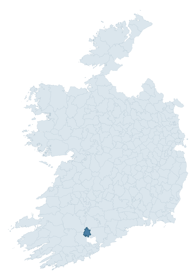
Where this barony sits in the Republic of Ireland
Geology and preservation
Bedrock geology shapes the landscape long before any settlement begins — controlling soil drainage, agricultural potential, the survival of upstanding monuments, and the preservation of buried archaeology. The figures below come from the Geological Survey Ireland 1:100,000 bedrock map.
The bedrock underlying Barretts is predominantly mudstone (66% of the barony by area), laid down during the Devonian period (100% by area, around 419 to 359 million years ago). Mudstone breaks down into heavy, often poorly-drained clay soils that historically limited intensive arable use. The lower density of ploughing tends to preserve subsurface archaeology better than in sandstone or limestone terrain, though waterlogging can be a factor for site survival. A substantial secondary geology of sandstone (34%) adds further variety to the underlying landscape. The single largest mapped unit is the Ballytrasna Formation (66% of the barony's bedrock). With only 2 distinct rock types mapped, the barony is geologically uniform compared to the rest of the Republic (7th percentile for diversity) — a single coherent bedrock landscape.
Rock type composition
Largest mapped unit: Ballytrasna Formation (66% of the barony)
Placename evidence
Logainm records 10 heritage-diagnostic placenames for Barretts, a modest sample drawn predominantly from the townland record. The dominant stratum is pre-christian defensive. The most frequent diagnostic roots are ráth- (3) and lios- (2). With a sample of this size the count should be treated as indicative rather than definitive.
Pre-Christian / Early Medieval Defensive
| Root | Count | Meaning |
|---|---|---|
| ráth- | 3 | earthen ringfort |
| lios- | 2 | ringfort or enclosure |
Early Christian Ecclesiastical
| Root | Count | Meaning |
|---|---|---|
| cill- | 2 | church (early) |
| teampall- | 1 | church (later medieval) |
| domhnach- | 1 | pre-Patrician or earliest Patrician church |
| mainistir- | 1 | monastery |
Other baronies in Cork
- Carbery West (west Division)
- Kerrycurrihy
- Courceys
- Kinsale
- Kinalea
- Carbery West (east Division)
- Carbery East (west Division)
- Ormond Upper — Tipperary
- Iraghticonnor — Kerry
- Glenahiry — Waterford
See all 280 baronies in the Republic of Ireland Heritage Tool.

Explore further
Grounding History: 10 Maps of Northern Ireland’s Past
If you’re interested in Irish heritage more widely, the companion report for Northern Ireland brings together the analysis of all 462 NI wards into one place through 10 high-quality maps — covering monument density, archaeological periods, placename heritage, terrain, wetland, and the historic landscape at first survey. Take a look.
About this profile
Click any section below to expand.
What is a barony?
A barony is a historic administrative unit in Ireland, broadly equivalent to an English hundred. The 280 baronies used here are from the OSi 2019 National Statutory Boundaries (generalised 20m), covering the 26 counties of the Republic of Ireland. Baronies derive from the Norman period, were formalised in the 17th century, and have not been redrawn for statistical purposes. They vary enormously in area, from compact urban baronies in Dublin to vast upland baronies in Connacht, and should not be compared by raw site count without accounting for area differences.
What counts as a site?
This profile combines three distinct heritage registers, each with its own definition of what constitutes a recordable site:
- Archaeological sites (NMS). The National Monuments Service Sites and Monuments Record (SMR) catalogues every known archaeological monument or site of archaeological interest in the Republic, from prehistoric burial mounds and ringforts to medieval churches and post-medieval defensive works. Inclusion does not require legal protection — only that the site has been identified, surveyed, and assessed as having archaeological value. A separate subset of these sites lies within a recorded protection zone, which gives them statutory protection under the National Monuments Acts.
- Listed buildings (NIAH). The National Inventory of Architectural Heritage records buildings of architectural, historical, archaeological, artistic, cultural, scientific, social, or technical interest. Each surveyed structure is appraised on a five-tier scale: International, National, Regional, Local, and Record-Only. The NIAH appraisal is informational rather than strictly statutory, but it underpins local-authority Record of Protected Structures (RPS) listings.
- Heritage placenames (Logainm). Logainm is the authoritative database of Irish placenames maintained by the Placenames Branch. This profile applies a heritage-diagnostic classifier to the Irish-language form of each townland name, flagging roots that signal defensive sites (ráth-, lios-, dún-, caiseal-, cathair-), ecclesiastical foundations (cill-, teampall-, domhnach-, mainistir-), prehistoric burial-ritual features (tuaim-, carn-, leaba-), or Norse-contact settlement (gall-). Townlands without one of these diagnostic roots are not flagged here — they may still carry historical significance, but that significance is not encoded in the name itself.
Editorial principles
The narrative sections of this profile follow several explicit principles:
- Evidential. Every claim about this barony’s heritage character is anchored in the underlying register data. Where a site count, a placename count, or a percentile rank is cited, it is computed from the source datasets at export time, not estimated.
- Comparative. Counts and metrics are reported alongside their percentile rank against the other 279 ROI baronies. A barony with 50 ringforts in absolute terms could be unusually high or unusually low depending on its size and regional context; percentile ranking removes that ambiguity.
- Transparent on limits. Where a register has known coverage gaps, survey biases, or data-quality issues that affect this barony’s figures, the profile flags them rather than presenting the numbers as definitive.
- No interpretation beyond what the data supports. The narrative does not speculate about historical events, social dynamics, or cultural meaning beyond what the recorded heritage and placename evidence directly attests.
Data caveats and limits
- NMS Sites and Monuments Record is the product of survey campaigns conducted at different intensities across different counties and decades. Some baronies have been surveyed more thoroughly than others, and absolute counts should be read in that light. Sites destroyed by development before survey are typically not represented; sites in heavily forested or upland terrain are sometimes under-recorded.
- NIAH coverage is broadly complete for the Republic of Ireland but the survey was conducted on a rolling county-by-county basis, and the most recent appraisal date varies. Buildings demolished or substantially altered after their original survey may still appear in the register; conversely, recent buildings of merit may not yet have been appraised.
- Logainm classification applies a deliberately conservative pattern-matching approach to the Irish-language townland forms. The classifier prioritises true positives over recall: a townland may carry a heritage signal that the classifier doesn’t recognise, particularly where the diagnostic root has been heavily anglicised or where the townland name draws on a less common term. The 60,000+ townland records and ~9,800 classified placenames give a substantial signal at barony scale, but individual townland names should be checked against Logainm directly for definitive interpretation.
- Period attribution. The chronological distribution reflects only those NMS sites that carry a recognised period attribution in the source data. Sites listed as “Unknown” period are excluded from the dated subset.
- Boundary changes. Some baronies have undergone minor boundary adjustments since their 19th-century definition; the OSi 2019 generalised boundaries used here are the current statutory definition and may differ slightly from historical maps in border areas.
- Bedrock geology is mapped at 1:100,000 scale, which means local variation within a barony — small pockets of different rock type, mineral veins, alluvium overlying bedrock — is generalised. The dominant-system and rocktype figures are area-weighted, so a barony reading “70% Carboniferous limestone” may still contain small but archaeologically important pockets of older or younger rock. Around 3% of GSI polygons do not match the lexicon and contribute no rocktype or system attribution.
Data sources
- National Monuments Service — Sites and Monuments Record (SMR) https://data.gov.ie/dataset/national-monuments-service-archaeological-survey-of-ireland
- National Inventory of Architectural Heritage (NIAH) https://data.gov.ie/dataset/national-inventory-of-architectural-heritage-niah-national-dataset
- Logainm — Placenames Database of Ireland https://www.logainm.ie/
- Ordnance Survey Ireland — National Statutory Barony Boundaries 2019 https://data-osi.opendata.arcgis.com/
- EURODEM — European Digital Elevation Model https://www.mapsforeurope.org/datasets/euro-dem
- ESA WorldCover https://esa-worldcover.org/en
- Geological Survey Ireland — 1:100,000 Bedrock Geology https://www.gsi.ie/en-ie/data-and-maps/Pages/Bedrock.aspx
Explore more: Search any of the 280 ROI baronies, browse by historical province, or read the methodology and data sources for the full Republic of Ireland Heritage Tool.