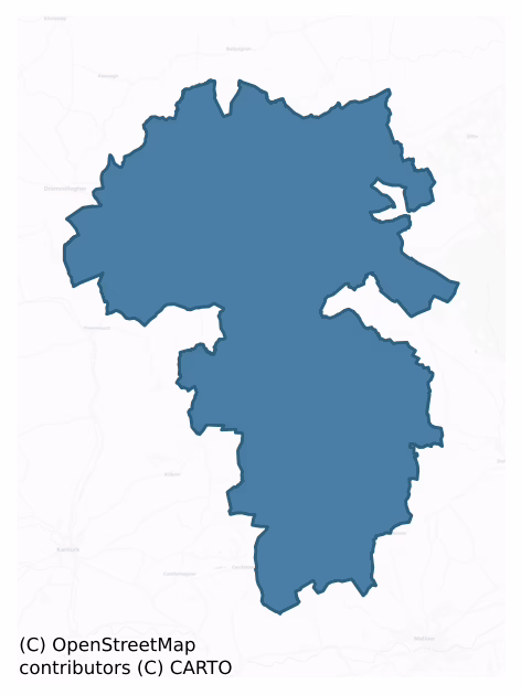
Orrery And Kilmore is a barony of County Cork, in the historical province of Munster (Irish: Orbhraí agus An Choill Mhór), covering 281 km² of land. The barony records 956 NMS archaeological sites and 202 NIAH listed buildings, placing it at around the 88th percentile among 280 ROI baronies for sites per km². This means it is in the top fifth of all baronies for sites per km². Dated archaeological evidence runs from the Neolithic through to the Modern, spanning 8 of 9 archaeological periods, placing the barony in the 76th percentile among 280 ROI baronies for chronological depth. This means it is in the top third of all baronies for chronological depth. The largest dated subset of recorded sites dates to the Iron Age. Logainm flags 45 placenames in the barony as carrying a recognised heritage root; the largest share — around 51% — are names associated with early Christian church and monastic foundations.
Heritage at a glance
Percentile rankings throughout this profile compare each barony only against the other 279 Republic of Ireland baronies.
The recorded heritage of Orrery And Kilmore
The National Monuments Service Sites and Monuments Record (SMR) is the statutory inventory of archaeological sites for the Republic of Ireland, maintained by the Department of Tourism, Culture, Arts, Gaeltacht, Sport and Media. Sites recorded here include earthworks, ringforts, megalithic tombs, ecclesiastical remains, and post-medieval features; not every record is legally protected, but each is registered as a monument of archaeological interest.
The National Monuments Service records 956 archaeological sites in Orrery And Kilmore, putting it at the 88th percentile among 280 ROI baronies for sites per km². This means it is in the top fifth of all baronies for sites per km². Protection coverage is near-universal — 926 sites (97%) fall within a recorded monument protection zone, indicating an extensively surveyed landscape. The dominant category is defensive sites — ringforts, enclosures, hillforts, and stone forts (478 sites, 50% of the record). Ringfort – rath is the most prevalent type, making up 27% of the barony's recorded sites (260 records) — well above the ROI average of 20% across all baronies where this type occurs. Ringfort – rath is an earthen ringfort enclosed by a bank and external ditch — the most common Early Medieval farmstead, broadly dated 500–1000 AD. Other significant types include Fulacht fia (162) and Enclosure (129). Fulacht fia is a horseshoe-shaped Bronze Age burnt mound built around a sunken trough beside a water source, traditionally interpreted as a cooking site; Enclosure is a banked or ditched feature of uncertain type, used as a catch-all where the original function cannot be determined from surface evidence. Across the barony's 281 km², this gives a recorded density of 3.41 sites per km².
Most common monument types
Hover or tap a monument type to see its definition.
| Type | Count |
|---|---|
| Ringfort – rath an earthen ringfort enclosed by a bank and external ditch — the most common Early Medieval farmstead, broadly dated 500–1000 AD | 260 |
| Fulacht fia a horseshoe-shaped Bronze Age burnt mound built around a sunken trough beside a water source, traditionally interpreted as a cooking site | 162 |
| Enclosure a banked or ditched feature of uncertain type, used as a catch-all where the original function cannot be determined from surface evidence | 129 |
| Moated site | 30 |
| Church a building used for public Christian worship, of any date from c. 500 AD onwards | 28 |
| Standing stone a deliberately set upright stone, used variously as a Bronze/Iron Age burial marker, route marker or commemorative monument | 24 |
Chronological distribution
The dated archaeological record for Orrery And Kilmore spans from the Neolithic through to the Modern, with activity attested across 8 of 9 archaeological periods. This is the 76th percentile across ROI baronies for chronological depth — an above-average span. Every period from earliest to latest is represented in the record — an unbroken sequence of dated activity across the full chronological span. Activity concentrates most heavily in the Iron Age (288 sites, 38% of dated material), with the Middle Late Bronze Age forming a secondary peak (196 sites, 26%). A further 190 recorded sites (20% of the overall NMS register for the barony) carry no period attribution — appearing as 'Unknown' in the bar chart below. This typically reflects either records that pre-date the standardised period vocabulary or sites awaiting specialist dating review, rather than a genuine absence of chronological evidence.
Sample of recorded monuments
Show 25 sample monuments (of 956 total)
A representative sample of 25 recorded monuments drawn from the barony’s 956 total NMS entries. Sites within a recorded monument protection zone and rarer site types are prioritised so the list shows a meaningful cross-section rather than only the most common type. Each entry shows the official Sites and Monuments Record reference number and the description published by the National Monuments Service.
Burial
Uncovered during quarrying in gravel pit in late 1950s/early 1960s. According to landowner, skeletons of 40 humans and a horse were found. Burials were extended and lying E-W, c. 11/2ft underground. Pit also found…
Uncovered during quarrying in gravel pit in late 1950s/early 1960s. According to landowner, skeletons of 40 humans and a horse were found. Burials were extended and lying E-W, c. 11/2ft underground. Pit also found contained furnace bottom (UCC). Bones reinterred in NW corner of field. Bones, since found occasionally by owner when ploughing adjacent field, buried under tree and in front lawn of house. Cist burial (CO002-122—) also found in gravel pit.
See also Excavations 2003, 36-7.
The above description is derived from the published 'Archaeological Inventory of County Cork. Volume 4: North Cork' (Dublin: Stationery Office, 2000). In certain instances the entries have been revised and updated in the light of recent research.
Date of upload/revision: 14 January 2009
Post office
In Charleville. Two-storey residential house, part of terrace set back from street line on old Limerick road. Indicated on 1842 OS 6-inch map and named 'Post Office'. Front elevation (E) of 3 bays; plate glass sash…
In Charleville. Two-storey residential house, part of terrace set back from street line on old Limerick road. Indicated on 1842 OS 6-inch map and named 'Post Office'. Front elevation (E) of 3 bays; plate glass sash windows. Central round-headed door ope with fanlight: Doric pillars support moulded surround of fanlight; prominent key stone inscribed 'J.B. 1825' with rosette over. Central coursed ashlar chimney stack with some brick. Stone wall, with limestone piers, encloses front garden. House to S, of similar dimensions with brick chimneys on gables.
The above description is derived from the published 'Archaeological Inventory of County Cork. Volume 4: North Cork' (Dublin: Stationery Office, 2000). In certain instances the entries have been revised and updated in the light of recent research.
Date of upload/revision: 14 January 2009
Cist
According to local information, 'compartmented cist' found in sandpit in mid-late 1920s. A pit was divided into two by a central slab and an 'inverted urn' was found in each of the pits. (pers comm. Margaret McCarthy,…
According to local information, 'compartmented cist' found in sandpit in mid-late 1920s. A pit was divided into two by a central slab and an 'inverted urn' was found in each of the pits. (pers comm. Margaret McCarthy, Dept of Archaeology, UCC)
The above description is derived from the published 'Archaeological Inventory of County Cork. Volume 4: North Cork' (Dublin: Stationery Office, 2000). In certain instances the entries have been revised and updated in the light of recent research.
Date of upload/revision: 14 January 2009
Designed landscape feature
The Archaeological Survey of Ireland (ASI) is in the process of providing information on all monuments on The Historic Environment Viewer (HEV). Currently the information for this record has not been uploaded. To…
The Archaeological Survey of Ireland (ASI) is in the process of providing information on all monuments on The Historic Environment Viewer (HEV). Currently the information for this record has not been uploaded. To access available information for research purposes please make an appointment in advance with the Archive Unit (open Fridays 10.00 am – 5.00 pm), Department of Culture, Heritage and the Gaeltacht, The Custom House, Dublin 1 D01W6XO or email nmarchive@chg.gov.ie.
Armorial plaque
A rectangular slab (0.8m x 0.6m) carved with the Fitzgerald coat of arms (Grove White 1905-25, vol. 2, 110) is built into the roadside wall beside the country house known as Castle Lishen (CO006-020002-). It was…
A rectangular slab (0.8m x 0.6m) carved with the Fitzgerald coat of arms (Grove White 1905-25, vol. 2, 110) is built into the roadside wall beside the country house known as Castle Lishen (CO006-020002-). It was formerly over the front door of the house but originally came from the adjacent tower house (CO006-020001-).
The above description is derived from the published 'Archaeological Inventory of County Cork. Volume 4: North Cork' (Dublin: Stationery Office, 2000). In certain instances the entries have been revised and updated in the light of recent research.
Date of upload/revision: 14 January 2009
Architectural fragment
This stone, with a spiral motif carved in relief, is set into a gate pier c. 200m to SW of tower house (CO006-020001-) and probably originally came from it.
The above description is derived from the published…
This stone, with a spiral motif carved in relief, is set into a gate pier c. 200m to SW of tower house (CO006-020001-) and probably originally came from it.
The above description is derived from the published 'Archaeological Inventory of County Cork. Volume 4: North Cork' (Dublin: Stationery Office, 2000). In certain instances the entries have been revised and updated in the light of recent research.
Date of upload/revision: 14 January 2009
Urn burial
Discovered in 1960 during gravel quarrying operations; extensive damage occured before investigation by O'Kelly and Murphy (1961). Pit (diam. c. 0.74m) contained inverted Encrusted Urn covering cremated bones of young…
Discovered in 1960 during gravel quarrying operations; extensive damage occured before investigation by O'Kelly and Murphy (1961). Pit (diam. c. 0.74m) contained inverted Encrusted Urn covering cremated bones of young adult; excavator suggests bones wrapped in organic material. Pit backfilled with loose sandy soil. Kavanagh 1973, 535) describes urn as having 'rim flattened, bevelled internally…decorated with finger-nail impressions; externally urn decorated…with closely set scored vertical lines; two perforations in…neck area; joint between neck and body carries applied discs; below neck are…two cordons…upper applied, other pinched up; grooves created by cordons ornamented with…obliquely set scores; below this are vertical grooves giving ribbed effect; next zone filled with…wide incised chevron pattern; lowerpart of urn carries long shallow grooves set obliquely; made of coarse…well-fired…bright orange ware'. (Kavanagh 1973, 535); Waddell 1990, 58; Doody 1986, Cork No. 4).
The above description is derived from the published 'Archaeological Inventory of County Cork. Volume 4: North Cork' (Dublin: Stationery Office, 2000). In certain instances the entries have been revised and updated in the light of recent research.
Date of upload/revision: 14 January 2009
Gate lodge
The Archaeological Survey of Ireland (ASI) is in the process of providing information on all monuments on The Historic Environment Viewer (HEV). Currently the information for this record has not been uploaded. To…
The Archaeological Survey of Ireland (ASI) is in the process of providing information on all monuments on The Historic Environment Viewer (HEV). Currently the information for this record has not been uploaded. To access available information for research purposes please make an appointment in advance with the Archive Unit (open Fridays 10.00 am – 5.00 pm), Department of Culture, Heritage and the Gaeltacht, The Custom House, Dublin 1 D01W6XO or email nmarchive@chg.gov.ie.
Canal
To the N of a castle site (CO007-039001-) is a shallow linear depression running NE-SW which was described in the late 19th century as a 'shallow rectangular ditch faced with stone'. This may be the remains of the…
To the N of a castle site (CO007-039001-) is a shallow linear depression running NE-SW which was described in the late 19th century as a 'shallow rectangular ditch faced with stone'. This may be the remains of the 'handsome canal' referred to by Smith (1750, vol. 1, 306).
The above description is derived from the published 'Archaeological Inventory of County Cork. Volume 4: North Cork' (Dublin: Stationery Office, 2000). In certain instances the entries have been revised and updated in the light of recent research.
Date of upload/revision: 14 January 2009
Cliff-edge fort
In pasture, on break in SE-facing slope, above stream which forms townland boundary. Almost circular area (30.6m NW-SE; 24.7m NNE-SSW) enclosed by straight sharp fall of ground, down to stream N->NE; low earthen bank…
In pasture, on break in SE-facing slope, above stream which forms townland boundary. Almost circular area (30.6m NW-SE; 24.7m NNE-SSW) enclosed by straight sharp fall of ground, down to stream N->NE; low earthen bank (int. H 0.3m; ext. H 0.9m) S->SSW and NW->N; scarp elsewhere; external fosse (D 0.65m) NE->N. Interior slightly raised above level of surrounding field.
The above description is derived from the published 'Archaeological Inventory of County Cork. Volume 4: North Cork' (Dublin: Stationery Office, 2000). In certain instances the entries have been revised and updated in the light of recent research.
Date of upload/revision: 14 January 2009
Windmill
On top of a Windmill Hill, in centre of ringfort (12827). In centre of shallow depression (diam. c. 13.35m; D 0.5m) is southern arc (C 4.39m) of circular 2-storey windmill (H 4.2m), built atop slight stone plinth (H…
On top of a Windmill Hill, in centre of ringfort (12827). In centre of shallow depression (diam. c. 13.35m; D 0.5m) is southern arc (C 4.39m) of circular 2-storey windmill (H 4.2m), built atop slight stone plinth (H 0.1m; D 0.2m). Surviving portion is plastered over coursed rubble limestone walling (wall thickness 1.22m); external wall tapers slightly inward with height. At regular intervals, c. 40m outside external wall and following the curve of the building, are five decomposing wooden posts inclining inwards (H c. 0.88m; diam. c. 0.25m). Remains of door opes in E and W walls. Two wooden posts incline and touch internal walls adjacent to door opes, similar to external posts. Three large joist holes (c. Wth 0.27m; H 0.35m; D 0.9m) in internal wall, with ledge directly overhead between ground and first floor. Small stone-framed window in S wall at 1st-floor level. Known locally as a castle. Shown as small circular structure on 1842 OS 6-inch map.
The above description is derived from the published 'Archaeological Inventory of County Cork. Volume 4: North Cork' (Dublin: Stationery Office, 2000). In certain instances the entries have been revised and updated in the light of recent research.
Date of upload/revision: 14 January 2009
Bullaun stone
Found on S edge of fulacht fiadh (10364). Roughly triangular-shaped stone (0.48m x 0.6m) with hollow in centre (diam. 0.21m; D 0.12m); shallow subcircular hollow (diam. 0.21m; D 0.03m) on reverse side. Quern stone found…
Found on S edge of fulacht fiadh (10364). Roughly triangular-shaped stone (0.48m x 0.6m) with hollow in centre (diam. 0.21m; D 0.12m); shallow subcircular hollow (diam. 0.21m; D 0.03m) on reverse side. Quern stone found in same field. Ringfort (12176) c. 20m to SSW.
The above description is derived from the published 'Archaeological Inventory of County Cork. Volume 4: North Cork' (Dublin: Stationery Office, 2000). In certain instances the entries have been revised and updated in the light of recent research.
Date of upload/revision: 14 January 2009
Ringfort – cashel
On top of a hill, with view of Liscarroll in valley to W. Indicated on 1937 OS 6-inch map as pair of concentric broken lines, enclosing a circular area (min. diam. c. 25m; max. diam. c. 35m). Roughly circular area (int.…
On top of a hill, with view of Liscarroll in valley to W. Indicated on 1937 OS 6-inch map as pair of concentric broken lines, enclosing a circular area (min. diam. c. 25m; max. diam. c. 35m). Roughly circular area (int. diam: 27.7m N-S; 20.3m E-W, ext. diam: 46m N-S; 40.7m E-W) enclosed by grass-covered collapsed stone bank (int. H 0.3m; ext. H 0.4m). Bank partially overgrown with bushes. No entrance noted; bank lower to N and S (Wth 2.6m) where used as entrance by machinery. Interior surface level; rough due to stones scattered across surface; W half overgrown with low bushes. Possible souterrain (CO016-287—) in NW quadrant.
The above description is derived from the published 'Archaeological Inventory of County Cork. Volume 4: North Cork' (Dublin: Stationery Office, 2000). In certain instances the entries have been revised and updated in the light of recent research.
Date of upload/revision: 14 January 2009
Bowling green
In level pasture, c. 200m S of Egmont House (14892) and c. 150m N of Egmont Barn (14946). Indicated on 1842 OS 6-inch map as hachured rectangular area (c. 35m E-W; c. 50m N-S) enclosed by fosse. Levelled; no visible…
In level pasture, c. 200m S of Egmont House (14892) and c. 150m N of Egmont Barn (14946). Indicated on 1842 OS 6-inch map as hachured rectangular area (c. 35m E-W; c. 50m N-S) enclosed by fosse. Levelled; no visible surface trace. Noted by Grove White (1905-25, vol. 3, 98) as 'a bowling-green with a surrounding ditch which was wet once.' Visible in aerial photograph (CAS) as rectangular cropmark.
The above description is derived from the published 'Archaeological Inventory of County Cork. Volume 4: North Cork' (Dublin: Stationery Office, 2000). In certain instances the entries have been revised and updated in the light of recent research.
Date of upload/revision: 14 January 2009
Barn
In pasture, on elevated rocky site with extensive views in all directions. Two-storey L-shaped structure of rubble masonry construction, roofed by high pointed vaults with plank centring. Main block (15.6m N-S; 5.5m…
In pasture, on elevated rocky site with extensive views in all directions. Two-storey L-shaped structure of rubble masonry construction, roofed by high pointed vaults with plank centring. Main block (15.6m N-S; 5.5m E-W) has central doorways (Wth. 2.4m) in E and W walls, latter framed by masonry abutments (Wth. 0.64m) projecting 0.95m from external wall face; both door arches collapsed, springings 2.2m above present ground level. Central doorway (Wth. 1.1m) in S wall with brick segmental-arched window ope over. Wide 1st-floor window with brick segmental arch directly overhead. North wall and N end of W wall now collapsed to foundation level but photograph taken in 1909 (Grove White 1905-25, vol. 3, opp. 96) shows this end intact with ground-floor doorway and 1st-floor window in N wall similar to that in S wall. Doorway (Wth. 1.45m), now partially blocked, at S end of E wall gave access to annexe (6.8m E-W; 4.5m N-S); door arch collapsed, some brick springings survive. Breach (Wth. c. 1.2m) at W end of N wall; rectangular ope (0.2m square) at E end of S wall near ground level may have been drain. First floor under high pointed vault lit by window with brick segmental arch in E wall. Underground vaulted cellars immediately to N, brick vaults almost entirely collapsed; twin cellars, each 4.5m N-S, 7.1m E-W; E end missing so original length uncertain. Purpose of structure uncertain but local tradition suggests it was barn and cider press built in 17th century by a colonel Tayl…
House – Neolithic
Discovered in 1986 during construction of Bruff-Mallow gas pipeline (Gowen 1988, 44-51; site 1/19/2). Excavated area (6.5m x 4m) revealed linear trench (long axis N-S), with several post-holes on W (inner) side, and two…
Discovered in 1986 during construction of Bruff-Mallow gas pipeline (Gowen 1988, 44-51; site 1/19/2). Excavated area (6.5m x 4m) revealed linear trench (long axis N-S), with several post-holes on W (inner) side, and two shallow pits/hollows on E side; along E edge of excavated area was 'a probably unrelated' (ibid., 44) linear fosse. Linear trench (L 3.4m N-S; Wth 0.3-0.5m; max. D 0.45m), with short possible continuation at right angles to W at N end, may have formed NE corner of rectangular structure; yellow clay fill with patches of oxidised clay and overlying dark fill with charcoal, indicated that structure was probably clay-daubed and destroyed by fire. Four substantial pits/post-holes to W of trench also appeared to have been associated. Finds from trench and post-holes included 22 sherds and 40 fragments of 'Western Neolithic round-bottomed shouldered bowls' (ibid., 50) from up to six pots, five struck blades and many other fragments of flint, charred hazelnut and grain fragments. Radiocarbon determination of 4860±70 BP obtained from house trench (pers. comm. M. Gowen).
The above description is derived from the published 'Archaeological Inventory of County Cork. Volume 4: North Cork' (Dublin: Stationery Office, 2000). In certain instances the entries have been revised and updated in the light of recent research.
Date of upload/revision: 14 January 2009
Religious house – Franciscan friars
In Buttevant town (CO017-053001-), on the W bank of the Awbeg River. Remains of a Franciscan friary founded c. 1251 by David de Barry (Gwynn and Hadcock 1988, 243), Lord of Buttevant. David I’s son, David de Barry II…
In Buttevant town (CO017-053001-), on the W bank of the Awbeg River. Remains of a Franciscan friary founded c. 1251 by David de Barry (Gwynn and Hadcock 1988, 243), Lord of Buttevant. David I’s son, David de Barry II (d. 1278) was buried in the chancel of the church. The remains consist in the ruin of a single-aisled church (int. 46m E-W; 7.5m N-S), divided by a collapsed belfry tower into a nave (int. 22.6m E-W; 7.50m N-S) and chancel (int. 17.5m E-W; 7.50m N-S); a transept (int. 11.7m N-S; 7.8m E-W) extends to the S from the E end of the nave, with a side chapel to the E (int. 4.4m E-W; 3.3m N-S). Of the claustral buildings remains only a small square room (c. 3.75m N-S; c. 4m E-W) abutting the E end of the church to the N, interpreted as the sacristy. A crypt on two levels under the E end of the chancel has been interpreted by O'Keeffe (2012) as a possible early castle or hall (see plans: Brash 1852a, opp. 88; Cochrane 1912, 67; Monastic Ireland: http://monastic.ie/tour/buttevant-franciscan-friary/; suggested reconstruction of the entire friary plan in Cotter 2013, 12). It later became an important burial place for the Barrys, and Buttevant remained the principal residence of the senior branch of the family throughout the Middle Ages. By the 16th century the conventual buildings were in ruins, but repaired in 1604 and subsequently re-inhabited by friars (Gwynn and Hadcock, ibid.). It was a ruin again by 1750, though some of the conventual buildings still stood at that t…
Religious house – unclassified
In SE corner of Buttevant town. Forming part of S boundary wall of Convent of Mercy graveyard is older wall (L 18m; max. H 2.8m; T 1m). In centre of older wall is blocked window ope, upper part missing; inside edge of…
In SE corner of Buttevant town. Forming part of S boundary wall of Convent of Mercy graveyard is older wall (L 18m; max. H 2.8m; T 1m). In centre of older wall is blocked window ope, upper part missing; inside edge of embrasure (Wth 1.3m; min. H 1.2m) formed of cut-limestone blocks. This may be all that remains of 'small trefoil-headed two-light window' noted by Brash (1852a, 87). This identified by Brash (1852a, 87) as probably remains of structure described by Smith (1750, vol. 1, 314) as 'part of another ruin' near the Franciscan friary (14382) and 'said to have been a nunnery, dedicated to St Owen; or, according to others, St John the Baptist' (ibid.); Gwynn and Hadcock (1988, 326) note Smith's reference but state that 'no supporting evidence for a nunnery at Buttevant has been found.' This wall might also be remains of RC chapel (14734).
The above description is derived from the published 'Archaeological Inventory of County Cork. Volume 4: North Cork' (Dublin: Stationery Office, 2000). In certain instances the entries have been revised and updated in the light of recent research.
Date of upload/revision: 14 January 2009
Fever hospital
At E side of Buttevant town; now part of Convent of Mercy school. Named 'Fever Hospital' on 1842 OS 6-inch map, 'School' on 1906 and 1937 OS 6-inch maps. Rendered, rectangular 2-storey structure (long axis N-S).…
At E side of Buttevant town; now part of Convent of Mercy school. Named 'Fever Hospital' on 1842 OS 6-inch map, 'School' on 1906 and 1937 OS 6-inch maps. Rendered, rectangular 2-storey structure (long axis N-S). Gable-ended with chimneys on gables, two other chimneys off-centre. Front elevation (E) of 3 bays; central rectangular door ope with modern door; slim double sash windows with glazing bars and limestone sills. Rear elevation similar to front with addition of central porch. Inserted windows in ground and 1st floor of N gable. South gable hidden behind modern addition.
The above description is derived from the published 'Archaeological Inventory of County Cork. Volume 4: North Cork' (Dublin: Stationery Office, 2000). In certain instances the entries have been revised and updated in the light of recent research.
Date of upload/revision: 14 January 2009
Town defences
The earliest reference to town walls in Buttevant is a murage grant of 1317 which allowed John de Barry to 'enclose it with walls' under his supervision (Barry 1899, 155; Thomas 1992, ii, 28); in 1375 mention is made of…
The earliest reference to town walls in Buttevant is a murage grant of 1317 which allowed John de Barry to 'enclose it with walls' under his supervision (Barry 1899, 155; Thomas 1992, ii, 28); in 1375 mention is made of the town's 'North Gate' (Thomas, ibid.). Nothing appears to survive of the town's walls nor is their exact course known (ibid.), but they had 'a rectangular circuit enclosing an area somewhere between 5 and 15 hectares…the possible line suggested by two boundaries, parallel and 25m apart…possibly suggesting an inner and outer wall' (Zajac et al. 1995, 10; see map in Thomas, ibid.). Smith (1750, vol. 1, 313) (and followed by later writers) noted 'remains of a wall that surrounded the town; and they also shew [sic] the traces of an outward wall, which enclosed the other, and took up a considerable circuit of ground'. The 1842 OS 6-inch map does not show town walls. In summary, whilst a number of suggestions have been made, notably by Thomas (1992, ii, 27-9) and Cotter (2010, 4-18) suggesting particular lines of town wall, as yet no extant wall or fragment of wall in Buttevant has been accepted as a definite surviving section of the town wall. Indeed, the exact line of the town wall(s) has yet to be established. (Thomas 1992; Power et al. 2000, 595, no. 14632; Cotter 2010)
Revised by: Denis Power
Date of upload: 12 March 2013
Clapper bridge
On NW bank of Awbeg River. Remains of foot bridge (L c. 35m; long axis NW-SE) survive, extending from E corner of Water House (14940). Bridge not marked on 1842 OS 6-inch map, river shown as being wider (Wth c. 35m)…
On NW bank of Awbeg River. Remains of foot bridge (L c. 35m; long axis NW-SE) survive, extending from E corner of Water House (14940). Bridge not marked on 1842 OS 6-inch map, river shown as being wider (Wth c. 35m) flowing along edge of Water House. According to local information, river dredged and narrowed (Wth c. 20m) in 1900s and SE section of bridge removed, leaving remainder on dry land – see photograph by Jones (1906, 200) and plan by O'Keeffe and Simington (1991, 309). Seven random-rubble limestone piers (H 0.7m-1m; Wth 0.96 to 1.37m ) remain; span increases from NW to SE. Piers bridged by long limestone slabs (L 1.1m to 2.5m). Thin strip of metal inserted into centre of three wider slabs. According to Grove White (1905-1925, vol. 4, 316), clapper bridge used by monks of Ballybeg Abbey (14379) which is located c. 450m to SE, to access grist mill somewhere in Waterhouse townland. May be associated with 'Monk's Pond' to rear of Springfield house (14849) on SE bank of river.
The above description is derived from the published 'Archaeological Inventory of County Cork. Volume 4: North Cork' (Dublin: Stationery Office, 2000). In certain instances the entries have been revised and updated in the light of recent research.
Date of upload/revision: 14 January 2009
Religious house – Augustinian canons
In flat pasture, c. 200m S of Awbeg River. This Augustinian Priory was founded by Philip de Barry in 1229 and dedicated to St Thomas Becket (Gwynn and Hadcock 1988, 159). It was dissolved in 1541, and possibly…
In flat pasture, c. 200m S of Awbeg River. This Augustinian Priory was founded by Philip de Barry in 1229 and dedicated to St Thomas Becket (Gwynn and Hadcock 1988, 159). It was dissolved in 1541, and possibly re-established for a time (ibid., 153). It was in ruins by 1750 (Smith 1750, vol.1, 316), and the centre and W end of the church were subsequently occupied by a farmhouse and out offices until the early 20th century (Grove White 1905-25 vol. 1, 121). The remains consist in a complex of ruined 13th-century monastic buildings comprising a church with a cloister on the S side (the W end of church is in line with the mid-point of the cloister) and claustral ranges to the S, W and E (see plan in Shine 1993, 108). The priory was renovated in the late-medieval period, when a 4-storey rectangular tower was built against the N end of the W claustral range and a tower was inserted into the W end of the church. A late-medieval rectangular tower (CO017-059002-), c. 70m to the N, and a columbarium (CO017-059003-), c. 25m to SE, are also part of the monastic complex.
The Church (int. 50.8m E-W; 8.25m N-S) is best preserved at the W and E ends. Between these all of the N wall is missing, and only fragments of the S wall stand, much of this recently rebuilt. The W end wall has a rebuilt ground-floor doorway, near the N end; the rear-arch of the embrasure is built of well-cut sandstone blocks, some with diagonal tooling. Overhead and in the centre of the wall is a pair of windows:…
Dovecote
In flat pasture, to the SE of Ballybeg Augustinian Priory church. This circular columbarium (CO017-059003-; int. diam. 4.6m) is entered via a ground-floor door on the W side. The Interior wall face has continuous rows…
In flat pasture, to the SE of Ballybeg Augustinian Priory church. This circular columbarium (CO017-059003-; int. diam. 4.6m) is entered via a ground-floor door on the W side. The Interior wall face has continuous rows of nesting boxes (Wth 0.22m; H 0.2m; 32 boxes in each circuit), in 11 tiers up to a height of c. 5m (see plan and section in Brash 1852b, 266-7). Above this, the wall inclines gently inward for a height of c. 2m, above which it is corbelled in steeply, leaving a circular opening at the top. High up on the exterior wall face on the N side is a lintelled door giving access to mural stairs leading to the top of the tower, possibly to a wall-walk. Section of projecting masonry to the E of the door indicates the wall extending N from the columbarium, probably with a wall-walk, from which the door was accessed.
This is a National Monument in State Guardianship (no. 301).
The above description is derived from the published 'Archaeological Inventory of County Cork. Volume 4: North Cork' (Dublin: Stationery Office, 2000). In certain instances the entries have been revised and updated in the light of recent research.
Photographs attached:
CO017-059003-_01: View of columbarium from NW.
CO017-059003-_02: Interior of columbarium, from W.
CO017-059003-_03: View of from W, with ground-floor door.
CO017-059003-_04: View from N, with lintelled door at top of tower.
CO017-059003-_05: View from SE, with priory in the background.
Date of upload/revision: 14 Jan…
Graveslab
Narrow, tapering graveslab, found originally at E end of graveyard (CO017-101001-), just above ground level (Grove White 1905-25, vol. 1, 348-50). Housed in church (CO017-101002-); access not gained. Eight-armed ringed…
Narrow, tapering graveslab, found originally at E end of graveyard (CO017-101001-), just above ground level (Grove White 1905-25, vol. 1, 348-50). Housed in church (CO017-101002-); access not gained. Eight-armed ringed cross with trefoil terminals on the trapezium-shaped stone bordered by black letter inscription, difficult to read but probably dating to 1508 (Zajac et al, 1995, 17; Fitzgerald 1904-6); lower end of slab (L 3ft; Wth 23in, narrowing to 18in; T 5in) has broken off.
The above description is derived from the published 'Archaeological Inventory of County Cork. Volume 4: North Cork' (Dublin: Stationery Office, 2000). In certain instances the entries have been revised and updated in the light of recent research.
Date of upload/revision: 14 January 2009
Ringfort – rath
In level rough grazing land. Circular area (diam. c. 30m) enclosed by earthen bank (H 1.2m) with external fosse (D 0.5m). Bank heavily overgrown; interior planted with coniferous trees. Townland boundary follows line of…
In level rough grazing land. Circular area (diam. c. 30m) enclosed by earthen bank (H 1.2m) with external fosse (D 0.5m). Bank heavily overgrown; interior planted with coniferous trees. Townland boundary follows line of bank to W and S.
The above description is derived from the published 'Archaeological Inventory of County Cork. Volume 4: North Cork' (Dublin: Stationery Office, 2000). In certain instances the entries have been revised and updated in the light of recent research.
Date of upload/revision: 14 January 2009
Listed buildings
The National Inventory of Architectural Heritage (NIAH) is a state survey appraising buildings of architectural, historical, archaeological, artistic, cultural, scientific, social, or technical interest. Each surveyed structure receives a rating from International (the highest, for buildings of European importance) through National, Regional, Local, and Record-Only.
The NIAH records 202 listed buildings in Orrery And Kilmore, the 80th percentile across ROI baronies for listed-building density. All recorded buildings carry Regional or lower grading; the barony does not contain any structures appraised as being of National or International architectural importance. Construction dates concentrate most heavily in the Victorian (1830-1900) period. The most-recorded building type is house (99 examples, 49% of the listed stock).
Terrain and environment
Mean elevation across the barony is 117m — the 70th percentile among 280 ROI baronies for elevation. This means it is in the top third of all baronies for elevation. Elevation matters for heritage because higher-altitude baronies typically favour defensive monuments — ringforts and hilltop forts placed on prominent ground — while lowland baronies are more likely to carry the dense settlement and church networks of intensive agricultural landscapes. A maximum elevation of 316m gives the barony meaningful vertical relief. Mean slope is 2.8° — the 34th percentile among 280 ROI baronies for slope. This means it is in the lower half of all baronies for slope. Slope is a key control on both land use and archaeological preservation: steep ground resists ploughing and tends to preserve earthworks intact, while gentle slopes favour intensive cultivation that damages or destroys surface archaeology over time. The Topographic Wetness Index averages 11.2, the 62nd percentile among 280 ROI baronies for wetness. This means it is in the upper half of all baronies for wetness. Drainage matters for heritage because poorly-drained ground preserves organic archaeology (wooden trackways, leather, textiles, and on rare occasions human remains) far better than free-draining soil; well-drained ground favours arable use but destroys organic material rapidly. The land-cover mosaic combines improved grassland (81%), woodland (12%), and arable farmland (6%), giving a mixed agricultural and semi-natural landscape.
Terrain measurements
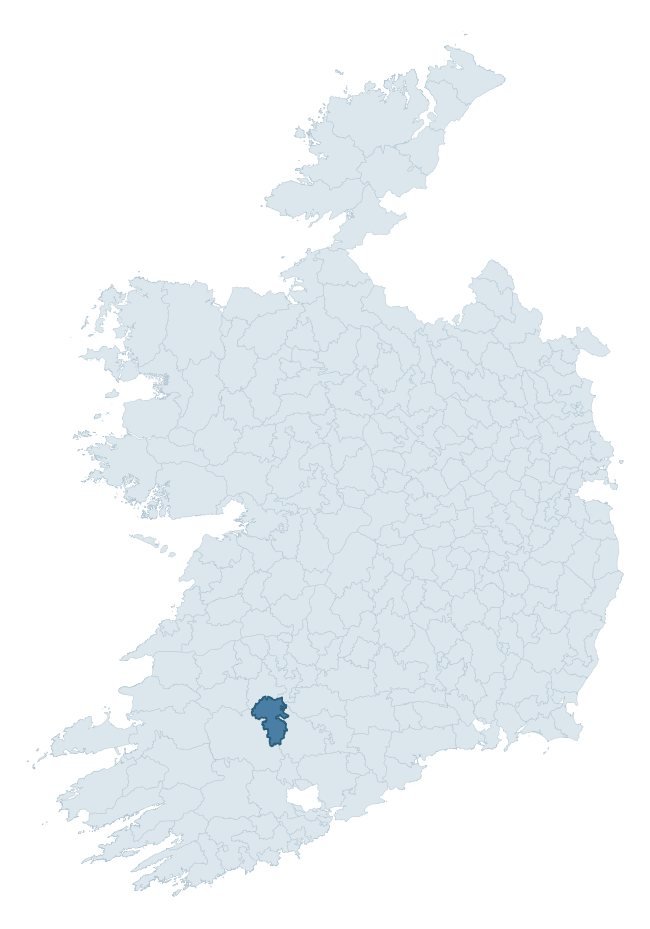
Where this barony sits in the Republic of Ireland
Geology and preservation
Bedrock geology shapes the landscape long before any settlement begins — controlling soil drainage, agricultural potential, the survival of upstanding monuments, and the preservation of buried archaeology. The figures below come from the Geological Survey Ireland 1:100,000 bedrock map.
The bedrock underlying Orrery And Kilmore is predominantly limestone (46% of the barony by area), laid down during the Carboniferous period (97% by area, around 359 to 299 million years ago). Limestone is the most heritage-rich bedrock in Ireland. It supports fertile, well-drained soils that favoured dense Early Medieval settlement and Norman manorial agriculture, and it weathers into karst features — sinkholes, caves, swallow holes, and souterrains — that frequently carry archaeology. Where peat overlies limestone, organic preservation can be exceptional. A substantial secondary geology of shale (16%) and greywacke, siltstone and silty shale (11%) adds further variety to the underlying landscape.
Rock type composition
Largest mapped unit: Clare Shale Formation (16% of the barony)
Placename evidence
Logainm records 45 heritage-diagnostic placenames for Orrery And Kilmore, drawn from townland and civil-parish names across the barony. The dominant stratum is Early Christian ecclesiastical — cill-, teampall-, and domhnach-prefixed names that record the dense network of early church foundations established between the fifth and tenth centuries. The leading diagnostic roots are cill- (19 — church), ráth- (11 — earthen ringfort), and lios- (9 — ringfort or enclosure). This is above the ROI average of 30.7 heritage placenames per barony. The presence of multiple heritage strata side by side indicates layered occupation of the landscape across successive prehistoric and historic periods. Logainm records 234 placenames for Orrery And Kilmore (predominantly townland names). Of these, 45 (19%) carry one of the diagnostic Gaelic roots tracked above; the remainder draw on more generic landscape vocabulary that does not encode a heritage period.
Pre-Christian / Early Medieval Defensive
| Root | Count | Meaning |
|---|---|---|
| ráth- | 11 | earthen ringfort |
| lios- | 9 | ringfort or enclosure |
| dún- | 2 | hilltop or promontory fort |
Early Christian Ecclesiastical
| Root | Count | Meaning |
|---|---|---|
| cill- | 19 | church (early) |
| teampall- | 2 | church (later medieval) |
| gráinseach- | 2 | monastic farm / grange |
Burial, Ritual, and Norse-Contact
| Root | Count | Meaning |
|---|---|---|
| gall- | 1 | foreigner — Norse settlement marker |
Other baronies in Cork
- Duhallow
- Muskerry West
- Carbery East (east Division)
- Muskerry East
- Ibane And Barryroe
- Cork
- Barretts
- Coshlea — Limerick
- Upperthird — Waterford
- Leitrim — Clare
See all 280 baronies in the Republic of Ireland Heritage Tool.

Explore further
Grounding History: 10 Maps of Northern Ireland’s Past
If you’re interested in Irish heritage more widely, the companion report for Northern Ireland brings together the analysis of all 462 NI wards into one place through 10 high-quality maps — covering monument density, archaeological periods, placename heritage, terrain, wetland, and the historic landscape at first survey. Take a look.
About this profile
Click any section below to expand.
What is a barony?
A barony is a historic administrative unit in Ireland, broadly equivalent to an English hundred. The 280 baronies used here are from the OSi 2019 National Statutory Boundaries (generalised 20m), covering the 26 counties of the Republic of Ireland. Baronies derive from the Norman period, were formalised in the 17th century, and have not been redrawn for statistical purposes. They vary enormously in area, from compact urban baronies in Dublin to vast upland baronies in Connacht, and should not be compared by raw site count without accounting for area differences.
What counts as a site?
This profile combines three distinct heritage registers, each with its own definition of what constitutes a recordable site:
- Archaeological sites (NMS). The National Monuments Service Sites and Monuments Record (SMR) catalogues every known archaeological monument or site of archaeological interest in the Republic, from prehistoric burial mounds and ringforts to medieval churches and post-medieval defensive works. Inclusion does not require legal protection — only that the site has been identified, surveyed, and assessed as having archaeological value. A separate subset of these sites lies within a recorded protection zone, which gives them statutory protection under the National Monuments Acts.
- Listed buildings (NIAH). The National Inventory of Architectural Heritage records buildings of architectural, historical, archaeological, artistic, cultural, scientific, social, or technical interest. Each surveyed structure is appraised on a five-tier scale: International, National, Regional, Local, and Record-Only. The NIAH appraisal is informational rather than strictly statutory, but it underpins local-authority Record of Protected Structures (RPS) listings.
- Heritage placenames (Logainm). Logainm is the authoritative database of Irish placenames maintained by the Placenames Branch. This profile applies a heritage-diagnostic classifier to the Irish-language form of each townland name, flagging roots that signal defensive sites (ráth-, lios-, dún-, caiseal-, cathair-), ecclesiastical foundations (cill-, teampall-, domhnach-, mainistir-), prehistoric burial-ritual features (tuaim-, carn-, leaba-), or Norse-contact settlement (gall-). Townlands without one of these diagnostic roots are not flagged here — they may still carry historical significance, but that significance is not encoded in the name itself.
Editorial principles
The narrative sections of this profile follow several explicit principles:
- Evidential. Every claim about this barony’s heritage character is anchored in the underlying register data. Where a site count, a placename count, or a percentile rank is cited, it is computed from the source datasets at export time, not estimated.
- Comparative. Counts and metrics are reported alongside their percentile rank against the other 279 ROI baronies. A barony with 50 ringforts in absolute terms could be unusually high or unusually low depending on its size and regional context; percentile ranking removes that ambiguity.
- Transparent on limits. Where a register has known coverage gaps, survey biases, or data-quality issues that affect this barony’s figures, the profile flags them rather than presenting the numbers as definitive.
- No interpretation beyond what the data supports. The narrative does not speculate about historical events, social dynamics, or cultural meaning beyond what the recorded heritage and placename evidence directly attests.
Data caveats and limits
- NMS Sites and Monuments Record is the product of survey campaigns conducted at different intensities across different counties and decades. Some baronies have been surveyed more thoroughly than others, and absolute counts should be read in that light. Sites destroyed by development before survey are typically not represented; sites in heavily forested or upland terrain are sometimes under-recorded.
- NIAH coverage is broadly complete for the Republic of Ireland but the survey was conducted on a rolling county-by-county basis, and the most recent appraisal date varies. Buildings demolished or substantially altered after their original survey may still appear in the register; conversely, recent buildings of merit may not yet have been appraised.
- Logainm classification applies a deliberately conservative pattern-matching approach to the Irish-language townland forms. The classifier prioritises true positives over recall: a townland may carry a heritage signal that the classifier doesn’t recognise, particularly where the diagnostic root has been heavily anglicised or where the townland name draws on a less common term. The 60,000+ townland records and ~9,800 classified placenames give a substantial signal at barony scale, but individual townland names should be checked against Logainm directly for definitive interpretation.
- Period attribution. The chronological distribution reflects only those NMS sites that carry a recognised period attribution in the source data. Sites listed as “Unknown” period are excluded from the dated subset.
- Boundary changes. Some baronies have undergone minor boundary adjustments since their 19th-century definition; the OSi 2019 generalised boundaries used here are the current statutory definition and may differ slightly from historical maps in border areas.
- Bedrock geology is mapped at 1:100,000 scale, which means local variation within a barony — small pockets of different rock type, mineral veins, alluvium overlying bedrock — is generalised. The dominant-system and rocktype figures are area-weighted, so a barony reading “70% Carboniferous limestone” may still contain small but archaeologically important pockets of older or younger rock. Around 3% of GSI polygons do not match the lexicon and contribute no rocktype or system attribution.
Data sources
- National Monuments Service — Sites and Monuments Record (SMR) https://data.gov.ie/dataset/national-monuments-service-archaeological-survey-of-ireland
- National Inventory of Architectural Heritage (NIAH) https://data.gov.ie/dataset/national-inventory-of-architectural-heritage-niah-national-dataset
- Logainm — Placenames Database of Ireland https://www.logainm.ie/
- Ordnance Survey Ireland — National Statutory Barony Boundaries 2019 https://data-osi.opendata.arcgis.com/
- EURODEM — European Digital Elevation Model https://www.mapsforeurope.org/datasets/euro-dem
- ESA WorldCover https://esa-worldcover.org/en
- Geological Survey Ireland — 1:100,000 Bedrock Geology https://www.gsi.ie/en-ie/data-and-maps/Pages/Bedrock.aspx
Explore more: Search any of the 280 ROI baronies, browse by historical province, or read the methodology and data sources for the full Republic of Ireland Heritage Tool.