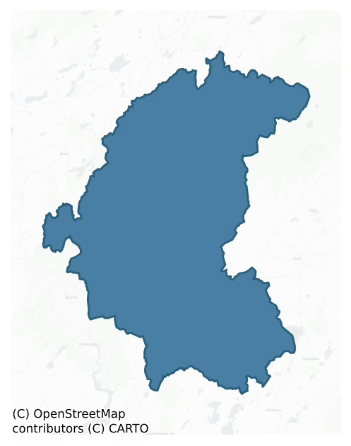
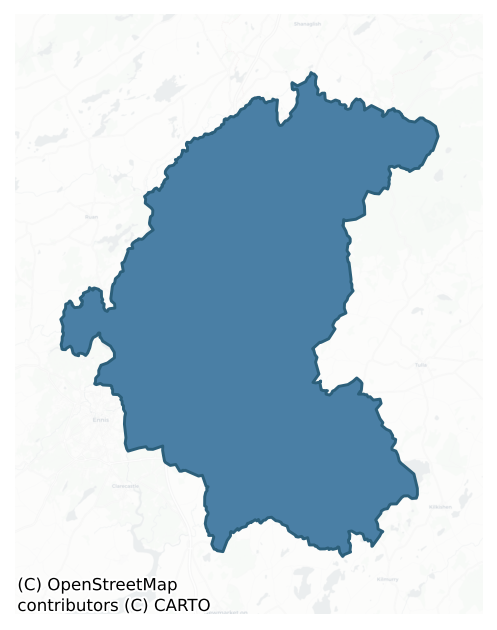
Bunratty Upper is a barony of County Clare, in the historical province of Munster (Irish: Bun Raite Uachtarach), covering 218 km² of land. The barony records 834 NMS archaeological sites and 21 NIAH listed buildings, placing it at around the 91st percentile among 280 ROI baronies for sites per km². This means it is in the top tenth of all baronies for sites per km². Dated archaeological evidence runs from the Neolithic through to the Modern, spanning 8 of 9 archaeological periods, placing the barony in the 57th percentile among 280 ROI baronies for chronological depth. This means it is in the upper half of all baronies for chronological depth. The largest dated subset of recorded sites dates to the Early Medieval. Logainm flags 29 placenames in the barony as carrying a recognised heritage root; the largest share — around 52% — are names associated with pre-christian defensive.
Heritage at a glance
Percentile rankings throughout this profile compare each barony only against the other 279 Republic of Ireland baronies.
The recorded heritage of Bunratty Upper
The National Monuments Service Sites and Monuments Record (SMR) is the statutory inventory of archaeological sites for the Republic of Ireland, maintained by the Department of Tourism, Culture, Arts, Gaeltacht, Sport and Media. Sites recorded here include earthworks, ringforts, megalithic tombs, ecclesiastical remains, and post-medieval features; not every record is legally protected, but each is registered as a monument of archaeological interest.
The National Monuments Service records 834 archaeological sites in Bunratty Upper, putting it at the 91st percentile among 280 ROI baronies for sites per km². This means it is in the top tenth of all baronies for sites per km². Protection coverage is near-universal — 772 sites (93%) fall within a recorded monument protection zone, indicating an extensively surveyed landscape. The dominant category is defensive sites — ringforts, enclosures, hillforts, and stone forts (450 sites, 54% of the record). Ringfort – cashel is the most prevalent type, making up 19% of the barony's recorded sites (156 records) — well above the ROI average of 5% across all baronies where this type occurs. Ringfort – cashel is the stone-walled equivalent of the rath, found mainly in upland or western areas, broadly dated 500–1000 AD. Other significant types include Enclosure (129) and Ringfort – rath (90). Enclosure is a banked or ditched feature of uncertain type, used as a catch-all where the original function cannot be determined from surface evidence; Ringfort – rath is an earthen ringfort enclosed by a bank and external ditch — the most common Early Medieval farmstead, broadly dated 500–1000 AD. Across the barony's 218 km², this gives a recorded density of 3.83 sites per km².
Most common monument types
Hover or tap a monument type to see its definition.
| Type | Count |
|---|---|
| Ringfort – cashel the stone-walled equivalent of the rath, found mainly in upland or western areas, broadly dated 500–1000 AD | 156 |
| Enclosure a banked or ditched feature of uncertain type, used as a catch-all where the original function cannot be determined from surface evidence | 129 |
| Ringfort – rath an earthen ringfort enclosed by a bank and external ditch — the most common Early Medieval farmstead, broadly dated 500–1000 AD | 90 |
| Fulacht fia a horseshoe-shaped Bronze Age burnt mound built around a sunken trough beside a water source, traditionally interpreted as a cooking site | 77 |
| Burnt mound a heap of fire-cracked stone, ash and charcoal, with no surviving trough, dated Bronze Age to early medieval | 37 |
| Earthwork an unclassified earthen structure with no diagnostic features that allow a more specific classification | 34 |
| Ritual site – holy well a well or spring traditionally associated with a saint, often credited with healing properties; many trace earlier ritual origins but devotion is documented from the medieval period onwards | 26 |
| Excavation – miscellaneous | 22 |
Chronological distribution
The dated archaeological record for Bunratty Upper spans from the Neolithic through to the Modern, with activity attested across 8 of 9 archaeological periods. Every period from earliest to latest is represented in the record — an unbroken sequence of dated activity across the full chronological span. Activity concentrates most heavily in the Early Medieval (283 sites, 42% of dated material), with the Iron Age forming a secondary peak (180 sites, 27%). A further 155 recorded sites (19% of the overall NMS register for the barony) carry no period attribution — appearing as 'Unknown' in the bar chart below. This typically reflects either records that pre-date the standardised period vocabulary or sites awaiting specialist dating review, rather than a genuine absence of chronological evidence.
Sample of recorded monuments
Show 25 sample monuments (of 834 total)
A representative sample of 25 recorded monuments drawn from the barony’s 834 total NMS entries. Sites within a recorded monument protection zone and rarer site types are prioritised so the list shows a meaningful cross-section rather than only the most common type. Each entry shows the official Sites and Monuments Record reference number and the description published by the National Monuments Service.
Bridge
The Archaeological Survey of Ireland (ASI) is in the process of providing information on all monuments on The Historic Environment Viewer (HEV). Currently the information for this record has not been uploaded. To…
The Archaeological Survey of Ireland (ASI) is in the process of providing information on all monuments on The Historic Environment Viewer (HEV). Currently the information for this record has not been uploaded. To access available information for research purposes please make an appointment in advance with the Archive Unit (open Fridays 10.00 am – 5.00 pm), Department of Culture, Heritage and the Gaeltacht, The Custom House, Dublin 1 D01W6XO or email nmarchive@chg.gov.ie.
Inscribed stone
The Archaeological Survey of Ireland (ASI) is in the process of providing information on all monuments on The Historic Environment Viewer (HEV). Currently the information for this record has not been uploaded. To…
The Archaeological Survey of Ireland (ASI) is in the process of providing information on all monuments on The Historic Environment Viewer (HEV). Currently the information for this record has not been uploaded. To access available information for research purposes please make an appointment in advance with the Archive Unit (open Fridays 10.00 am – 5.00 pm), Department of Culture, Heritage and the Gaeltacht, The Custom House, Dublin 1 D01W6XO or email nmarchive@chg.gov.ie.
Religious house – Augustinian canons
Traditionally an early site, a church had been built by the 12th century which was granted to Clare Abbey (CL033-120—-) by Donal Mor O'Brien in 1189. It is listed in the ecclesiastical taxation of 1302-06 and in 1421…
Traditionally an early site, a church had been built by the 12th century which was granted to Clare Abbey (CL033-120—-) by Donal Mor O'Brien in 1189. It is listed in the ecclesiastical taxation of 1302-06 and in 1421 is described as the conventual priory of St. Mary. It was suppressed c. 1543 but was still possessed by friars in 1584 and was repaired as a parish church in 1615 by Donagh, Earl of Thomond. It is situated on flat ground near the SW tip of a peninsula on Inchicronan Lough and has an associated graveyard (CL026-014002-).
The church (int. dims. 19.7m E-W; 5m N-S) is nearly complete (H 1.8-3m) with a round-headed E window (Wth 0.16m; H 1.2m), the head of which is decorated externally with carved foliage and spirals. At the centre of the S wall (T 0.7m) is an inserted doorway (Wth 0.84m; H 2m) with an external chamfer and a spud stone, but the top is missing. Towards the E end of the S wall are two inserted 14th-century pointed arches (Wth 2.35m; H 2.8m) leading to a transept (int. dims. 8m N-S; 5.3m E-W). There is a cornice and dressed drainage stones over the transept arches, and the S wall has a pointed window (Wth 0.8m; H 2.4m), originally of three lights. There is a blocked doorway or window in the E wall, outside of which is a mausoleum of the Butlers of Ballyline dating from the 18th century. The N wall of the church has an inserted and pointed chamfered doorway (Wth 0.7m; H 1.95m) with the small figure of a monk in prayer at the base of the E jamb. T…
Building
The Archaeological Survey of Ireland (ASI) is in the process of providing information on all monuments on The Historic Environment Viewer (HEV). Currently the information for this record has not been uploaded. To…
The Archaeological Survey of Ireland (ASI) is in the process of providing information on all monuments on The Historic Environment Viewer (HEV). Currently the information for this record has not been uploaded. To access available information for research purposes please make an appointment in advance with the Archive Unit (open Fridays 10.00 am – 5.00 pm), Department of Culture, Heritage and the Gaeltacht, The Custom House, Dublin 1 D01W6XO or email nmarchive@chg.gov.ie.
Concentric enclosure
The Archaeological Survey of Ireland (ASI) is in the process of providing information on all monuments on The Historic Environment Viewer (HEV). Currently the information for this record has not been uploaded. To…
The Archaeological Survey of Ireland (ASI) is in the process of providing information on all monuments on The Historic Environment Viewer (HEV). Currently the information for this record has not been uploaded. To access available information for research purposes please make an appointment in advance with the Archive Unit (open Fridays 10.00 am – 5.00 pm), Department of Culture, Heritage and the Gaeltacht, The Custom House, Dublin 1 D01W6XO or email nmarchive@chg.gov.ie.
Stone circle
The Archaeological Survey of Ireland (ASI) is in the process of providing information on all monuments on The Historic Environment Viewer (HEV). Currently the information for this record has not been uploaded. To…
The Archaeological Survey of Ireland (ASI) is in the process of providing information on all monuments on The Historic Environment Viewer (HEV). Currently the information for this record has not been uploaded. To access available information for research purposes please make an appointment in advance with the Archive Unit (open Fridays 10.00 am – 5.00 pm), Department of Culture, Heritage and the Gaeltacht, The Custom House, Dublin 1 D01W6XO or email nmarchive@chg.gov.ie.
Inauguration site
Situated in a natural amphitheatre bounded to N and E by a curving ridge with the Hell River immediately to the SW. A possible ring-barrow (CL034-095001-) reused as an inauguration site. According to FitzPatrick (2004,…
Situated in a natural amphitheatre bounded to N and E by a curving ridge with the Hell River immediately to the SW. A possible ring-barrow (CL034-095001-) reused as an inauguration site. According to FitzPatrick (2004, 52) it is clear that the appropriation of prehistoric ceremonial landscapes by early and later medieval dynasties for assembly and inauguration is a recurrent theme. The earlier monuments were sometimes used unaltered but sometimes were modified or had additions made. No scientific excavations of inauguration mounds have taken place. What we know has been gleaned from the landscape context, surface morphology and historical circumstances (ibid.). Some of the earliest documented associations of mounds with medieval royal assembly and inauguration occur in respect of Magh Adhair, the assembly site of Dál gCais. Westropp (1896, 59) citing the Annals of the Four Masters, notes that in AD 877 Flan Sunagh of Cashel invaded Thomond and thought fit to stop and play chess at Magh Adhair in bravado. In AD 982 the Annals tell us that Máel Sechnaill, king of Temair, overran Thomond, and cut down a probable sacred tree (CL034-095011-) at Magh Adhair (FitzPatrick 2004, 59). It is recorded that another sacred tree was cut down here by Aedh O Conor, King of Connacht, in 1051. FitzPatrick, outlining the later history states that by the thirteenth century, Magh Adhair was well established as the inauguration site of the Uí Bhriain descendants. Seven Uí Bhriain inaugurations a…
Designed landscape – tree-ring
Listed as 'Enclosure' in the RMP (1996). Indicated as an enclosure with trees on the 1842 and 1921 eds. of the OS 6-inch map, and situated on a gentle S and SW-facing slope. A subcircular area (int. dims. 33m N-S; 28m…
Listed as 'Enclosure' in the RMP (1996). Indicated as an enclosure with trees on the 1842 and 1921 eds. of the OS 6-inch map, and situated on a gentle S and SW-facing slope. A subcircular area (int. dims. 33m N-S; 28m E-W) defined by a narrow wall spread (Wth 1.2-2m; H 0.5-0.8m) which is partly collapsed. There is no visible entrance or internal features, but there are ash trees growing on the perimeter with hazel in the interior.
Compiled by: Michael Moore
Date of upload: 13 July 2016
Henge
The Archaeological Survey of Ireland (ASI) is in the process of providing information on all monuments on The Historic Environment Viewer (HEV). Currently the information for this record has not been uploaded. To…
The Archaeological Survey of Ireland (ASI) is in the process of providing information on all monuments on The Historic Environment Viewer (HEV). Currently the information for this record has not been uploaded. To access available information for research purposes please make an appointment in advance with the Archive Unit (open Fridays 10.00 am – 5.00 pm), Department of Culture, Heritage and the Gaeltacht, The Custom House, Dublin 1 D01W6XO or email nmarchive@chg.gov.ie.
Ceremonial enclosure
The Archaeological Survey of Ireland (ASI) is in the process of providing information on all monuments on The Historic Environment Viewer (HEV). Currently the information for this record has not been uploaded. To…
The Archaeological Survey of Ireland (ASI) is in the process of providing information on all monuments on The Historic Environment Viewer (HEV). Currently the information for this record has not been uploaded. To access available information for research purposes please make an appointment in advance with the Archive Unit (open Fridays 10.00 am – 5.00 pm), Department of Culture, Heritage and the Gaeltacht, The Custom House, Dublin 1 D01W6XO or email nmarchive@chg.gov.ie.
Settlement deserted – medieval
A number of grass-covered foundations of rectangular structures of different sizes as well as associated roadways are visible immediately S of Quin Friary (CL042-027002-). Quin is described by McInerney (2014, 84) as an…
A number of grass-covered foundations of rectangular structures of different sizes as well as associated roadways are visible immediately S of Quin Friary (CL042-027002-). Quin is described by McInerney (2014, 84) as an important medieval settlement that had grown up around a late 13th-century Anglo-Norman castle, the ruins of which were incorporated into the sub-structure of the friary (CL042-027002-). Lidar images show the low foundations with great clarity (see Hull and McCooey 2015, 38). The earliest documentary evidence for settlement at Quin is in the 14th century Caithréim Thoirdhealbhaigh where a date of 1277 is cited and further reference to a town is made less than 10 years later by reference to ‘…the round-towered stone-substantial town of Quin’ (Hayes O’Grady 1929, 30). Westropp (1888, 335), citing the Calendar of State Papers, notes that ‘Quin Friary was dissolved in 1541, and granted two years later to Conor, Baron Ibracken, who, like all his family, protected the monks. Five years later – 1548, September 18 – the abbey and its grounds were granted to Teig M'Conor Brien and Tirlagh O'Brien of Dough. It consisted of ‘The precincts of the late house of Franciscan Friars at Queyne in Thomond, conteyninge 1 acre in which is one great church now ruinose covered with sclate (CL042-027003-), & stepill greatlie dacied, a church & cloister (CL042-027002-), with an orchard and other edifices & also 1 water mill (CL042-027013-) ruinose & prostrate & ten cottages in Quey…
Castle – Anglo-Norman masonry castle
Situated on a bend of the River Rine at the NE edge of Quin village with some defense afforded by the river to the W and N. The ground falls away sharply towards the river to W and N. This Anglo-Norman castle was built…
Situated on a bend of the River Rine at the NE edge of Quin village with some defense afforded by the river to the W and N. The ground falls away sharply towards the river to W and N. This Anglo-Norman castle was built in 1280 by Sir Thomas de Clare (c. 1245-87) in an attempt to subdue the Macnamaras. It was captured and burned by Cumheadha MacNamara in 1285 and in the 14th century much of it was demolished and used to build the Franciscan Friary (CL042-027002-) on the same footprint. Many of the castle walls were reused and incorporated into the Friary. (See Ua Cróinín 1997, CL042-027001-_01.pdf (attached) for more on the history of the castle). A substantial square castle (c. 37m across) with round corner bastions (ext. diam. 12m), the lower parts of which still remain at NE, SE and SW. Including the bastions the front elevation measures 48m. There are no above ground remains of a bastion at NW but there may have been one originally. A deep wide flat-bottomed moat (dims. at SE: Wth at base 5.5m; Wth at top 15.3m; ext. D 1.24m; int. D 2.62m) is still evident from E to S. At S it is occupied by the present graveyard (CL042-027009-). Excavation (Hull 2017; Licence no. E004671) of the possible medieval school (CL042-027015-) to the E of the castle in 2017 revealed portion of the refilled moat at that location. Of the moat, Hull (2017, 15) states: ‘The excavation has established that the moat continued in a northward direction to the east of the monument although the full de…
Religious house – Franciscan friars
Situated on a W-facing slope on the E bank of the River Rine at the NE edge of Quin village, Quin Friary (known locally as Quin Abbey) is built on the burnt-out ruins of an Anglo-Norman de Clare castle (CL042-027001-).…
Situated on a W-facing slope on the E bank of the River Rine at the NE edge of Quin village, Quin Friary (known locally as Quin Abbey) is built on the burnt-out ruins of an Anglo-Norman de Clare castle (CL042-027001-). In 1280, the Anglo-Norman Sir Thomas de Clare commenced work on the castle at Quin. In c. 1285/7 Covea MacNamara stormed and burned the castle in revenge for the death of a chief named ‘O’Liddy “of the broad shield”’ and his brother. The remains of the earlier castle are still visible as they were incorporated into the friary, with the foundations of the rounded NE, SW and SE corner towers of the curtain wall surviving to varying degrees. The lower portions of the curtain wall adjacent to the NE tower also survive. No attempt was made to rebuild the fortress (Ua Cróinín 2014). Maccon Mac Conmara established a house at Quin for the Franciscan friars in 1433 having obtained a papal licence (McInerney 2014, 125). The friary was founded on an earlier house built by Síoda Cam Mac Conmara in 1402 (ibid.). Quin remained under the jurisdiction of the Conventuals until it was officially dissolved in 1541. The friars continued to live at Quin under the protection of the earls of Thomond. The abbey and lands were granted in 1543 to Conor O’Brien, Baron Ibracken, who, like all his family, protected the friars. Five years later – 1548, September 18 – it was granted to Teig M'Conor Brien and Tirlagh O'Brien of Dough. The friary became Observant when a community was recons…
Ringfort – unclassified
The Archaeological Survey of Ireland (ASI) is in the process of providing information on all monuments on The Historic Environment Viewer (HEV). Currently the information for this record has not been uploaded. To…
The Archaeological Survey of Ireland (ASI) is in the process of providing information on all monuments on The Historic Environment Viewer (HEV). Currently the information for this record has not been uploaded. To access available information for research purposes please make an appointment in advance with the Archive Unit (open Fridays 10.00 am – 5.00 pm), Department of Culture, Heritage and the Gaeltacht, The Custom House, Dublin 1 D01W6XO or email nmarchive@chg.gov.ie.
Barrow – embanked barrow
This site is located east of Knappogue Castle in a large field used for pasture immediately beside the Sixmilebridge-Ennis road. The surface of the field in which the site is located is uneven with long curvilinear…
This site is located east of Knappogue Castle in a large field used for pasture immediately beside the Sixmilebridge-Ennis road. The surface of the field in which the site is located is uneven with long curvilinear natural banks of earth distributed throughout. The site is depicted as a hachured plan on the OS 6-inch-sheets. The site which overlooks the gently sloping ground to the south consists of a broad ditchless bank defining a roughly level subcircular area 29m in diameter. The bank stands up to 0.5m above the interior of the site and measures on average 8.7m wide. A farm gate is located just south of the enclosure leading onto the road. The remains of a byre and some other small structures are built on the bank at the south. No features were discernible on the interior of the site and there were no indications of an original entrance.
Compiled by Geraldine Stout
Date of upload: 14/03/2012
Habitation site
The Archaeological Survey of Ireland (ASI) is in the process of providing information on all monuments on The Historic Environment Viewer (HEV). Currently the information for this record has not been uploaded. To…
The Archaeological Survey of Ireland (ASI) is in the process of providing information on all monuments on The Historic Environment Viewer (HEV). Currently the information for this record has not been uploaded. To access available information for research purposes please make an appointment in advance with the Archive Unit (open Fridays 10.00 am – 5.00 pm), Department of Culture, Heritage and the Gaeltacht, The Custom House, Dublin 1 D01W6XO or email nmarchive@chg.gov.ie.
Mound
The Archaeological Survey of Ireland (ASI) is in the process of providing information on all monuments on The Historic Environment Viewer (HEV). Currently the information for this record has not been uploaded. To…
The Archaeological Survey of Ireland (ASI) is in the process of providing information on all monuments on The Historic Environment Viewer (HEV). Currently the information for this record has not been uploaded. To access available information for research purposes please make an appointment in advance with the Archive Unit (open Fridays 10.00 am – 5.00 pm), Department of Culture, Heritage and the Gaeltacht, The Custom House, Dublin 1 D01W6XO or email nmarchive@chg.gov.ie.
Architectural fragment
The Archaeological Survey of Ireland (ASI) is in the process of providing information on all monuments on The Historic Environment Viewer (HEV). Currently the information for this record has not been uploaded. To…
The Archaeological Survey of Ireland (ASI) is in the process of providing information on all monuments on The Historic Environment Viewer (HEV). Currently the information for this record has not been uploaded. To access available information for research purposes please make an appointment in advance with the Archive Unit (open Fridays 10.00 am – 5.00 pm), Department of Culture, Heritage and the Gaeltacht, The Custom House, Dublin 1 D01W6XO or email nmarchive@chg.gov.ie.
Post row – peatland
The Archaeological Survey of Ireland (ASI) is in the process of providing information on all monuments on The Historic Environment Viewer (HEV). Currently the information for this record has not been uploaded. To…
The Archaeological Survey of Ireland (ASI) is in the process of providing information on all monuments on The Historic Environment Viewer (HEV). Currently the information for this record has not been uploaded. To access available information for research purposes please make an appointment in advance with the Archive Unit (open Fridays 10.00 am – 5.00 pm), Department of Culture, Heritage and the Gaeltacht, The Custom House, Dublin 1 D01W6XO or email nmarchive@chg.gov.ie.
Burnt spread
The Archaeological Survey of Ireland (ASI) is in the process of providing information on all monuments on The Historic Environment Viewer (HEV). Currently the information for this record has not been uploaded. To…
The Archaeological Survey of Ireland (ASI) is in the process of providing information on all monuments on The Historic Environment Viewer (HEV). Currently the information for this record has not been uploaded. To access available information for research purposes please make an appointment in advance with the Archive Unit (open Fridays 10.00 am – 5.00 pm), Department of Culture, Heritage and the Gaeltacht, The Custom House, Dublin 1 D01W6XO or email nmarchive@chg.gov.ie.
Castle – ringwork
The Archaeological Survey of Ireland (ASI) is in the process of providing information on all monuments on The Historic Environment Viewer (HEV). Currently the information for this record has not been uploaded. To…
The Archaeological Survey of Ireland (ASI) is in the process of providing information on all monuments on The Historic Environment Viewer (HEV). Currently the information for this record has not been uploaded. To access available information for research purposes please make an appointment in advance with the Archive Unit (open Fridays 10.00 am – 5.00 pm), Department of Culture, Heritage and the Gaeltacht, The Custom House, Dublin 1 D01W6XO or email nmarchive@chg.gov.ie.
Ring-ditch
The Archaeological Survey of Ireland (ASI) is in the process of providing information on all monuments on The Historic Environment Viewer (HEV). Currently the information for this record has not been uploaded. To…
The Archaeological Survey of Ireland (ASI) is in the process of providing information on all monuments on The Historic Environment Viewer (HEV). Currently the information for this record has not been uploaded. To access available information for research purposes please make an appointment in advance with the Archive Unit (open Fridays 10.00 am – 5.00 pm), Department of Culture, Heritage and the Gaeltacht, The Custom House, Dublin 1 D01W6XO or email nmarchive@chg.gov.ie.
Memorial stone
The Archaeological Survey of Ireland (ASI) is in the process of providing information on all monuments on The Historic Environment Viewer (HEV). Currently the information for this record has not been uploaded. To…
The Archaeological Survey of Ireland (ASI) is in the process of providing information on all monuments on The Historic Environment Viewer (HEV). Currently the information for this record has not been uploaded. To access available information for research purposes please make an appointment in advance with the Archive Unit (open Fridays 10.00 am – 5.00 pm), Department of Culture, Heritage and the Gaeltacht, The Custom House, Dublin 1 D01W6XO or email nmarchive@chg.gov.ie.
Wall monument
A slender wall monument (Wth 2.4m; D 0.8m) occupies the NE corner of the chancel of Quin Abbey (CL042-027002-). A large slab with a moulded plinth is surmounted by a three-arched canopy with a widely spreading cornice…
A slender wall monument (Wth 2.4m; D 0.8m) occupies the NE corner of the chancel of Quin Abbey (CL042-027002-). A large slab with a moulded plinth is surmounted by a three-arched canopy with a widely spreading cornice supporting the great arch over the E window for most of its width. The arches are cusped and the spandrels are filled with well carved leaves in low relief. The cavetto or surround beneath the arch columns bears an inscription in raised gothic letters and is cited by Westropp (1892-4, 453) as follows: ‘Hic jacent Oid fili Laurencii [Lorcan] fili Mathi [Mahon] M com Ara et Constina M N Mara uxor Ej Q me fieri fecerut.’ An inscription on the front of the plain slab beneath is in capital letters and reads ‘Macnamara of Ayle. Died 1402’. A MacNamara armorial plaque is placed on the back wall under the canopy and a slab beneath it reads ‘This monument was erected by Mahon Daul McNemara, and repaired by Captain Teige McNemara of Ranna. A.D. 1714.’ (Ua Briain 1908)
The following images have been uploaded:
CL042-027010-_01.jpg Wall monument from SW.
CL042-027010-_02.jpg Armorial plaque within wall monument.
Compiled by: Mary Tunney
Date of upload: 2 July 2018
Ringfort – cashel
The Archaeological Survey of Ireland (ASI) is in the process of providing information on all monuments on The Historic Environment Viewer (HEV). Currently the information for this record has not been uploaded. To…
The Archaeological Survey of Ireland (ASI) is in the process of providing information on all monuments on The Historic Environment Viewer (HEV). Currently the information for this record has not been uploaded. To access available information for research purposes please make an appointment in advance with the Archive Unit (open Fridays 10.00 am – 5.00 pm), Department of Culture, Heritage and the Gaeltacht, The Custom House, Dublin 1 D01W6XO or email nmarchive@chg.gov.ie.
Listed buildings
The National Inventory of Architectural Heritage (NIAH) is a state survey appraising buildings of architectural, historical, archaeological, artistic, cultural, scientific, social, or technical interest. Each surveyed structure receives a rating from International (the highest, for buildings of European importance) through National, Regional, Local, and Record-Only.
The NIAH records only 21 listed buildings in Bunratty Upper, the 8th percentile across ROI baronies — a relatively thin architectural record. The highest-graded structures include 3 of National significance. The Republic holds 937 National-graded buildings in total, so this barony accounts for around 0% of the national total. Construction dates concentrate most heavily in the Late Georgian (1800-1830) period. The most-recorded building type is church/chapel (5 examples, 24% of the listed stock).
Terrain and environment
Mean elevation across the barony is 49m — the 15th percentile among 280 ROI baronies for elevation. This means it is in the bottom fifth of all baronies for elevation. This is a relatively low-lying landscape by ROI standards. Elevation matters for heritage because higher-altitude baronies typically favour defensive monuments — ringforts and hilltop forts placed on prominent ground — while lowland baronies are more likely to carry the dense settlement and church networks of intensive agricultural landscapes. The barony reaches 305m at its highest point — a vertical span of more than 256m within its boundary, indicating significant topographic diversity. Mean slope is 4.0° — the 57th percentile among 280 ROI baronies for slope. This means it is in the upper half of all baronies for slope. Slope is a key control on both land use and archaeological preservation: steep ground resists ploughing and tends to preserve earthworks intact, while gentle slopes favour intensive cultivation that damages or destroys surface archaeology over time. The Topographic Wetness Index averages 10.6, the 42nd percentile among 280 ROI baronies for wetness. This means it is in the lower half of all baronies for wetness. Drainage matters for heritage because poorly-drained ground preserves organic archaeology (wooden trackways, leather, textiles, and on rare occasions human remains) far better than free-draining soil; well-drained ground favours arable use but destroys organic material rapidly. The land cover is dominated by improved grassland (69%) and woodland (28%).
Terrain measurements
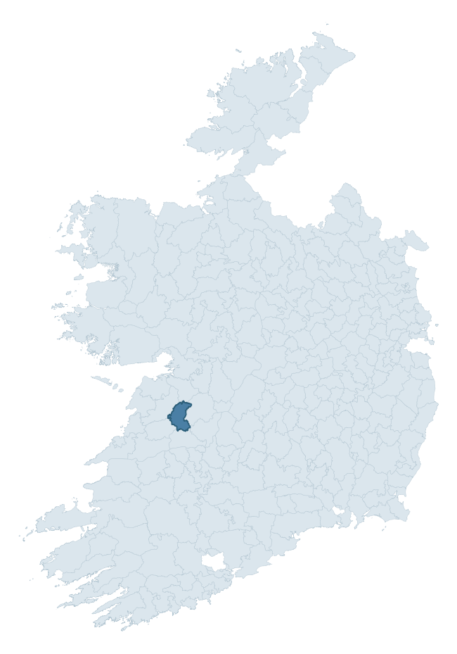
Where this barony sits in the Republic of Ireland
Geology and preservation
Bedrock geology shapes the landscape long before any settlement begins — controlling soil drainage, agricultural potential, the survival of upstanding monuments, and the preservation of buried archaeology. The figures below come from the Geological Survey Ireland 1:100,000 bedrock map.
The bedrock underlying Bunratty Upper is predominantly limestone (73% of the barony by area), laid down during the Carboniferous period (83% by area, around 359 to 299 million years ago). Limestone is the most heritage-rich bedrock in Ireland. It supports fertile, well-drained soils that favoured dense Early Medieval settlement and Norman manorial agriculture, and it weathers into karst features — sinkholes, caves, swallow holes, and souterrains — that frequently carry archaeology. Where peat overlies limestone, organic preservation can be exceptional. With 7 distinct rock types mapped, the barony sits in the top third of ROI baronies for geological diversity (69th percentile) — typically a sign of complex tectonic history or coastal mosaics of differing rock units.
Rock type composition
Largest mapped unit: Waulsortian Limestones (20% of the barony)
Placename evidence
Logainm records 29 heritage-diagnostic placenames for Bunratty Upper, drawn from townland and civil-parish names across the barony. The dominant stratum is pre-Christian and Early Medieval defensive — ráth-, lios-, dún-, and caiseal-prefixed names that mark Iron Age and early historic settlement. The leading diagnostic roots are cill- (11 — church), ráth- (4 — earthen ringfort), and cathair- (4 — stone fort). This is broadly in line with the ROI average of 30.7 heritage placenames per barony. The presence of multiple heritage strata side by side indicates layered occupation of the landscape across successive prehistoric and historic periods. Logainm records 208 placenames for Bunratty Upper (predominantly townland names). Of these, 29 (14%) carry one of the diagnostic Gaelic roots tracked above; the remainder draw on more generic landscape vocabulary that does not encode a heritage period.
Pre-Christian / Early Medieval Defensive
| Root | Count | Meaning |
|---|---|---|
| ráth- | 4 | earthen ringfort |
| cathair- | 4 | stone fort |
| dún- | 2 | hilltop or promontory fort |
| caiseal- | 2 | stone ringfort |
Early Christian Ecclesiastical
| Root | Count | Meaning |
|---|---|---|
| cill- | 11 | church (early) |
| teampall- | 1 | church (later medieval) |
Burial, Ritual, and Norse-Contact
| Root | Count | Meaning |
|---|---|---|
| carn- | 2 | cairn |
| gall- | 2 | foreigner — Norse settlement marker |
Other baronies in Clare
- Bunratty Lower
- Tulla Lower
- Inchiquin
- Islands
- Ibrickan
- Corcomroe
- Clonderalaw
- Kilnamanagh Upper — Tipperary
- Kilnamanagh Lower — Tipperary
- Corcomroe
See all 280 baronies in the Republic of Ireland Heritage Tool.

Explore further
Grounding History: 10 Maps of Northern Ireland’s Past
If you’re interested in Irish heritage more widely, the companion report for Northern Ireland brings together the analysis of all 462 NI wards into one place through 10 high-quality maps — covering monument density, archaeological periods, placename heritage, terrain, wetland, and the historic landscape at first survey. Take a look.
About this profile
Click any section below to expand.
What is a barony?
A barony is a historic administrative unit in Ireland, broadly equivalent to an English hundred. The 280 baronies used here are from the OSi 2019 National Statutory Boundaries (generalised 20m), covering the 26 counties of the Republic of Ireland. Baronies derive from the Norman period, were formalised in the 17th century, and have not been redrawn for statistical purposes. They vary enormously in area, from compact urban baronies in Dublin to vast upland baronies in Connacht, and should not be compared by raw site count without accounting for area differences.
What counts as a site?
This profile combines three distinct heritage registers, each with its own definition of what constitutes a recordable site:
- Archaeological sites (NMS). The National Monuments Service Sites and Monuments Record (SMR) catalogues every known archaeological monument or site of archaeological interest in the Republic, from prehistoric burial mounds and ringforts to medieval churches and post-medieval defensive works. Inclusion does not require legal protection — only that the site has been identified, surveyed, and assessed as having archaeological value. A separate subset of these sites lies within a recorded protection zone, which gives them statutory protection under the National Monuments Acts.
- Listed buildings (NIAH). The National Inventory of Architectural Heritage records buildings of architectural, historical, archaeological, artistic, cultural, scientific, social, or technical interest. Each surveyed structure is appraised on a five-tier scale: International, National, Regional, Local, and Record-Only. The NIAH appraisal is informational rather than strictly statutory, but it underpins local-authority Record of Protected Structures (RPS) listings.
- Heritage placenames (Logainm). Logainm is the authoritative database of Irish placenames maintained by the Placenames Branch. This profile applies a heritage-diagnostic classifier to the Irish-language form of each townland name, flagging roots that signal defensive sites (ráth-, lios-, dún-, caiseal-, cathair-), ecclesiastical foundations (cill-, teampall-, domhnach-, mainistir-), prehistoric burial-ritual features (tuaim-, carn-, leaba-), or Norse-contact settlement (gall-). Townlands without one of these diagnostic roots are not flagged here — they may still carry historical significance, but that significance is not encoded in the name itself.
Editorial principles
The narrative sections of this profile follow several explicit principles:
- Evidential. Every claim about this barony’s heritage character is anchored in the underlying register data. Where a site count, a placename count, or a percentile rank is cited, it is computed from the source datasets at export time, not estimated.
- Comparative. Counts and metrics are reported alongside their percentile rank against the other 279 ROI baronies. A barony with 50 ringforts in absolute terms could be unusually high or unusually low depending on its size and regional context; percentile ranking removes that ambiguity.
- Transparent on limits. Where a register has known coverage gaps, survey biases, or data-quality issues that affect this barony’s figures, the profile flags them rather than presenting the numbers as definitive.
- No interpretation beyond what the data supports. The narrative does not speculate about historical events, social dynamics, or cultural meaning beyond what the recorded heritage and placename evidence directly attests.
Data caveats and limits
- NMS Sites and Monuments Record is the product of survey campaigns conducted at different intensities across different counties and decades. Some baronies have been surveyed more thoroughly than others, and absolute counts should be read in that light. Sites destroyed by development before survey are typically not represented; sites in heavily forested or upland terrain are sometimes under-recorded.
- NIAH coverage is broadly complete for the Republic of Ireland but the survey was conducted on a rolling county-by-county basis, and the most recent appraisal date varies. Buildings demolished or substantially altered after their original survey may still appear in the register; conversely, recent buildings of merit may not yet have been appraised.
- Logainm classification applies a deliberately conservative pattern-matching approach to the Irish-language townland forms. The classifier prioritises true positives over recall: a townland may carry a heritage signal that the classifier doesn’t recognise, particularly where the diagnostic root has been heavily anglicised or where the townland name draws on a less common term. The 60,000+ townland records and ~9,800 classified placenames give a substantial signal at barony scale, but individual townland names should be checked against Logainm directly for definitive interpretation.
- Period attribution. The chronological distribution reflects only those NMS sites that carry a recognised period attribution in the source data. Sites listed as “Unknown” period are excluded from the dated subset.
- Boundary changes. Some baronies have undergone minor boundary adjustments since their 19th-century definition; the OSi 2019 generalised boundaries used here are the current statutory definition and may differ slightly from historical maps in border areas.
- Bedrock geology is mapped at 1:100,000 scale, which means local variation within a barony — small pockets of different rock type, mineral veins, alluvium overlying bedrock — is generalised. The dominant-system and rocktype figures are area-weighted, so a barony reading “70% Carboniferous limestone” may still contain small but archaeologically important pockets of older or younger rock. Around 3% of GSI polygons do not match the lexicon and contribute no rocktype or system attribution.
Data sources
- National Monuments Service — Sites and Monuments Record (SMR) https://data.gov.ie/dataset/national-monuments-service-archaeological-survey-of-ireland
- National Inventory of Architectural Heritage (NIAH) https://data.gov.ie/dataset/national-inventory-of-architectural-heritage-niah-national-dataset
- Logainm — Placenames Database of Ireland https://www.logainm.ie/
- Ordnance Survey Ireland — National Statutory Barony Boundaries 2019 https://data-osi.opendata.arcgis.com/
- EURODEM — European Digital Elevation Model https://www.mapsforeurope.org/datasets/euro-dem
- ESA WorldCover https://esa-worldcover.org/en
- Geological Survey Ireland — 1:100,000 Bedrock Geology https://www.gsi.ie/en-ie/data-and-maps/Pages/Bedrock.aspx
Explore more: Search any of the 280 ROI baronies, browse by historical province, or read the methodology and data sources for the full Republic of Ireland Heritage Tool.