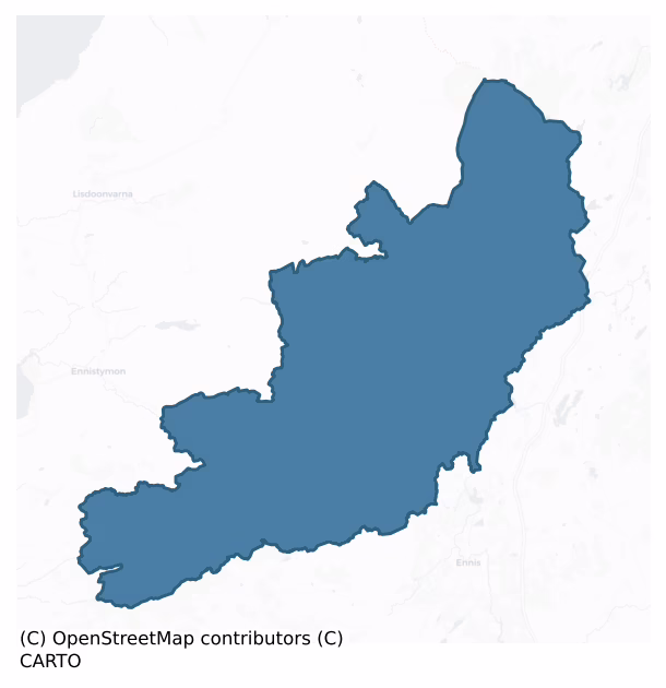
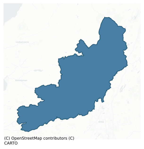
Inchiquin is a barony of County Clare, in the historical province of Munster (Irish: Inse Uí Chuinn), covering 358 km² of land. The barony records 1,133 NMS archaeological sites and 31 NIAH listed buildings, placing it at around the 85th percentile among 280 ROI baronies for sites per km². This means it is in the top fifth of all baronies for sites per km². Dated archaeological evidence runs from the Neolithic through to the Modern, spanning 8 of 9 archaeological periods, placing the barony in the 63rd percentile among 280 ROI baronies for chronological depth. This means it is in the upper half of all baronies for chronological depth. The largest dated subset of recorded sites dates to the Early Medieval. Logainm flags 52 placenames in the barony as carrying a recognised heritage root; the largest share — around 48% — are names associated with early Christian church and monastic foundations.
Heritage at a glance
Percentile rankings throughout this profile compare each barony only against the other 279 Republic of Ireland baronies.
The recorded heritage of Inchiquin
The National Monuments Service Sites and Monuments Record (SMR) is the statutory inventory of archaeological sites for the Republic of Ireland, maintained by the Department of Tourism, Culture, Arts, Gaeltacht, Sport and Media. Sites recorded here include earthworks, ringforts, megalithic tombs, ecclesiastical remains, and post-medieval features; not every record is legally protected, but each is registered as a monument of archaeological interest.
The National Monuments Service records 1,133 archaeological sites in Inchiquin, putting it at the 85th percentile among 280 ROI baronies for sites per km². This means it is in the top fifth of all baronies for sites per km². Protection coverage is near-universal — 1,107 sites (98%) fall within a recorded monument protection zone, indicating an extensively surveyed landscape. The dominant category is defensive sites — ringforts, enclosures, hillforts, and stone forts (565 sites, 50% of the record). Ringfort – cashel is the most prevalent type, making up 17% of the barony's recorded sites (198 records) — well above the ROI average of 5% across all baronies where this type occurs. Ringfort – cashel is the stone-walled equivalent of the rath, found mainly in upland or western areas, broadly dated 500–1000 AD. Other significant types include Enclosure (166) and Ringfort – rath (81). Enclosure is a banked or ditched feature of uncertain type, used as a catch-all where the original function cannot be determined from surface evidence; Ringfort – rath is an earthen ringfort enclosed by a bank and external ditch — the most common Early Medieval farmstead, broadly dated 500–1000 AD. Across the barony's 358 km², this gives a recorded density of 3.17 sites per km².
Most common monument types
Hover or tap a monument type to see its definition.
| Type | Count |
|---|---|
| Ringfort – cashel the stone-walled equivalent of the rath, found mainly in upland or western areas, broadly dated 500–1000 AD | 198 |
| Enclosure a banked or ditched feature of uncertain type, used as a catch-all where the original function cannot be determined from surface evidence | 166 |
| Ringfort – rath an earthen ringfort enclosed by a bank and external ditch — the most common Early Medieval farmstead, broadly dated 500–1000 AD | 81 |
| Fulacht fia a horseshoe-shaped Bronze Age burnt mound built around a sunken trough beside a water source, traditionally interpreted as a cooking site | 70 |
| Hut site a low stone or earthen foundation enclosing a small circular or oval area, generally interpreted as a former dwelling, of any date from prehistory to the medieval period | 48 |
| Cairn – unclassified a stone mound that cannot be assigned to a specific cairn type | 47 |
| Earthwork an unclassified earthen structure with no diagnostic features that allow a more specific classification | 38 |
Chronological distribution
The dated archaeological record for Inchiquin spans from the Neolithic through to the Modern, with activity attested across 8 of 9 archaeological periods. Every period from earliest to latest is represented in the record — an unbroken sequence of dated activity across the full chronological span. Activity concentrates most heavily in the Early Medieval (330 sites, 37% of dated material), with the Iron Age forming a secondary peak (236 sites, 26%). A further 231 recorded sites (20% of the overall NMS register for the barony) carry no period attribution — appearing as 'Unknown' in the bar chart below. This typically reflects either records that pre-date the standardised period vocabulary or sites awaiting specialist dating review, rather than a genuine absence of chronological evidence.
Sample of recorded monuments
Show 25 sample monuments (of 1,133 total)
A representative sample of 25 recorded monuments drawn from the barony’s 1,133 total NMS entries. Sites within a recorded monument protection zone and rarer site types are prioritised so the list shows a meaningful cross-section rather than only the most common type. Each entry shows the official Sites and Monuments Record reference number and the description published by the National Monuments Service.
Mass-rock
Along a cliff face in an area with much hazel scrub. A mass-rock was noted at this location on Tim Robinson's 1977 map of the Burren. It was not found during inspections in 1999 and 2007. Two enclosures (CL010-100001-…
Along a cliff face in an area with much hazel scrub. A mass-rock was noted at this location on Tim Robinson's 1977 map of the Burren. It was not found during inspections in 1999 and 2007. Two enclosures (CL010-100001- and CL010-100002-) lie c. 110m to the SW and c. 60m to the S respectively. A cave (CL010-100004-) is marked on Robinson's just to the N of the SW enclosure (CL010-100001-).
Compiled by: Mary Tunney
Date of upload: 30 May 2023
Religious house – unclassified
Indicated as a rectangular building and named ‘Friary (in ruins)’ on the 1842 OS 6-inch map. Drawn as a broken rectangle and named ‘Correen Friary (site of)’ on the 1897 OS 25-inch plan. Given the same name on the 1920…
Indicated as a rectangular building and named ‘Friary (in ruins)’ on the 1842 OS 6-inch map. Drawn as a broken rectangle and named ‘Correen Friary (site of)’ on the 1897 OS 25-inch plan. Given the same name on the 1920 ed. of the OS 6-inch map, but indicated only with a cross. Listed as ‘Friary’ in the RMP (1996). Swinfen (1992, 139-40) noted a speculative reference to a possible leper hospital in this vicinity, based on the townland name of Poulnalour—from Poll na Lobhar (‘Leper’s Pool/Hole’). However, there is a local belief that the name actually derives from a holy well (CL010-105—-) c. 345m to the W, the waters of which were believed to cure leprosy.
Compiled by: Mary Tunney and Conn Herriott
Date of upload: 28 June 2023
Holed stone
Situated within a graveyard (CL010-108003-) 3m from its SW edge. The tallest stone in the graveyard, this holed stone (H.48m) is a simple, undressed, upright limestone slab (H 0.48m) containing a natural hole (diam.…
Situated within a graveyard (CL010-108003-) 3m from its SW edge. The tallest stone in the graveyard, this holed stone (H.48m) is a simple, undressed, upright limestone slab (H 0.48m) containing a natural hole (diam. 8cm) near its top. Otherwise the stone is heavily moss-covered and appears featureless. Swinfen (1992, 139) described this stone as containing two holes, and she suggested such stones ‘were connected with ancient curative superstitions.’ Sheehan (1982, 36) noted that these sorts of stones are quite commonly found at early church sites. There is a church (CL010-108002-) just to the N, situated in the W side of the graveyard.
Compiled by: Mary Tunney and Conn Herriott
Date of upload: 28 June 2023
House – fortified house
Situated at the junction of the roads from Corofin, Ballyvaughan and Kilfenora with good views to S and SW. A 17th-century fortified house attached to the W side of a five-storey 15th-century tower house (CL016-032002-)…
Situated at the junction of the roads from Corofin, Ballyvaughan and Kilfenora with good views to S and SW. A 17th-century fortified house attached to the W side of a five-storey 15th-century tower house (CL016-032002-) with walled gardens (CL016-032001- and CL016-032011-) at E and W. Only the services wing of the tower house remains, the original halls were replaced by the fortified house in 1648. The doorways to W of the tower house are not at the correct floor height to permit access to the three floors and attic of the later four-bay house. Both the tower and the house have a base-batter and good quoins except the W wall of the tower indicating that it was rebuilt. A gateway (CL016-032007-)(now in Dromoland) stood in front of the house, possibly on the line of a bawn wall, and had an inscription that read ‘This was built in the year of our Lord 1648 by Conor O’Brien and by Mary Ni Mahone, wife of the said Conor’. This was the illustrious 'Maire Rua' and Conor was her second of three husbands. Her son Donough lived at Leamaneh until 1684 when he moved to Dromoland. The property then passed to his son Lucius who died in 1717, to his son Sir Edward who owned it in 1728 and to his son Captain Edward who held it in 1764. By 1773 it was held by Charles MacDonnell who was married to Catherine O’Brien. The MacDonnells lived at Newhall and let Leamaneh go to ruin whereupon it passed back to Edward. The castle was most likely lived in until about 1800. (See Ua Cróinín and Breen…
Cross – Tau cross
This record is for the original location of a Tau Cross listed as ‘Cross’ in the SMR (1992) and the RMP (1996). There is a replica on site. See CL017-116003- for the present location of the cross and details. The cross…
This record is for the original location of a Tau Cross listed as ‘Cross’ in the SMR (1992) and the RMP (1996). There is a replica on site. See CL017-116003- for the present location of the cross and details. The cross is a national monument in State care, No. 574.
Compiled by: Mary Tunney
Date of upload: 11 May 2015
Cairn – clearance cairn
Situated on level ground which slopes slightly to the S. Indicated as a hachured circular feature on the 1916 OS 6-inch map. This is a modern D-shaped clearance cairn (8.2m NE-SW; 9.6m NW-SE) with a straight E face,…
Situated on level ground which slopes slightly to the S. Indicated as a hachured circular feature on the 1916 OS 6-inch map. This is a modern D-shaped clearance cairn (8.2m NE-SW; 9.6m NW-SE) with a straight E face, comprising some large stones (diam. 0.8m) at the base. A large quantity of ‘fist-size’ stones have been thrown inside the straight side.
Compiled by: Mary Tunney
Date of upload: 8 June 2016
Ritual site – holy tree/bush
The Archaeological Survey of Ireland (ASI) is in the process of providing information on all monuments on The Historic Environment Viewer (HEV). Currently the information for this record has not been uploaded. To…
The Archaeological Survey of Ireland (ASI) is in the process of providing information on all monuments on The Historic Environment Viewer (HEV). Currently the information for this record has not been uploaded. To access available information for research purposes please make an appointment in advance with the Archive Unit (open Fridays 10.00 am – 5.00 pm), Department of Culture, Heritage and the Gaeltacht, The Custom House, Dublin 1 D01W6XO or email nmarchive@chg.gov.ie.
Megalithic tomb – passage tomb
The Archaeological Survey of Ireland (ASI) is in the process of providing information on all monuments on The Historic Environment Viewer (HEV). Currently the information for this record has not been uploaded. To…
The Archaeological Survey of Ireland (ASI) is in the process of providing information on all monuments on The Historic Environment Viewer (HEV). Currently the information for this record has not been uploaded. To access available information for research purposes please make an appointment in advance with the Archive Unit (open Fridays 10.00 am – 5.00 pm), Department of Culture, Heritage and the Gaeltacht, The Custom House, Dublin 1 D01W6XO or email nmarchive@chg.gov.ie.
Rock scribing – folk art
The Archaeological Survey of Ireland (ASI) is in the process of providing information on all monuments on The Historic Environment Viewer (HEV). Currently the information for this record has not been uploaded. To…
The Archaeological Survey of Ireland (ASI) is in the process of providing information on all monuments on The Historic Environment Viewer (HEV). Currently the information for this record has not been uploaded. To access available information for research purposes please make an appointment in advance with the Archive Unit (open Fridays 10.00 am – 5.00 pm), Department of Culture, Heritage and the Gaeltacht, The Custom House, Dublin 1 D01W6XO or email nmarchive@chg.gov.ie.
Enclosure – large enclosure
The Archaeological Survey of Ireland (ASI) is in the process of providing information on all monuments on The Historic Environment Viewer (HEV). Currently the information for this record has not been uploaded. To…
The Archaeological Survey of Ireland (ASI) is in the process of providing information on all monuments on The Historic Environment Viewer (HEV). Currently the information for this record has not been uploaded. To access available information for research purposes please make an appointment in advance with the Archive Unit (open Fridays 10.00 am – 5.00 pm), Department of Culture, Heritage and the Gaeltacht, The Custom House, Dublin 1 D01W6XO or email nmarchive@chg.gov.ie.
Cross – Wayside cross
The Archaeological Survey of Ireland (ASI) is in the process of providing information on all monuments on The Historic Environment Viewer (HEV). Currently the information for this record has not been uploaded. To…
The Archaeological Survey of Ireland (ASI) is in the process of providing information on all monuments on The Historic Environment Viewer (HEV). Currently the information for this record has not been uploaded. To access available information for research purposes please make an appointment in advance with the Archive Unit (open Fridays 10.00 am – 5.00 pm), Department of Culture, Heritage and the Gaeltacht, The Custom House, Dublin 1 D01W6XO or email nmarchive@chg.gov.ie.
Ritual site – holy/saint's stone
The Archaeological Survey of Ireland (ASI) is in the process of providing information on all monuments on The Historic Environment Viewer (HEV). Currently the information for this record has not been uploaded. To…
The Archaeological Survey of Ireland (ASI) is in the process of providing information on all monuments on The Historic Environment Viewer (HEV). Currently the information for this record has not been uploaded. To access available information for research purposes please make an appointment in advance with the Archive Unit (open Fridays 10.00 am – 5.00 pm), Department of Culture, Heritage and the Gaeltacht, The Custom House, Dublin 1 D01W6XO or email nmarchive@chg.gov.ie.
Mill – unclassified
The Archaeological Survey of Ireland (ASI) is in the process of providing information on all monuments on The Historic Environment Viewer (HEV). Currently the information for this record has not been uploaded. To…
The Archaeological Survey of Ireland (ASI) is in the process of providing information on all monuments on The Historic Environment Viewer (HEV). Currently the information for this record has not been uploaded. To access available information for research purposes please make an appointment in advance with the Archive Unit (open Fridays 10.00 am – 5.00 pm), Department of Culture, Heritage and the Gaeltacht, The Custom House, Dublin 1 D01W6XO or email nmarchive@chg.gov.ie.
Cross-slab
On the floor of an E-W valley, c. 150m S of Kilnamona church (CL033-006001-) and forming the W edge of a holy well (CL033-0070011). A limestone slab (dims. 0.48m x 0.46m; T 0.13m) with an incised ringed cross of double…
On the floor of an E-W valley, c. 150m S of Kilnamona church (CL033-006001-) and forming the W edge of a holy well (CL033-0070011). A limestone slab (dims. 0.48m x 0.46m; T 0.13m) with an incised ringed cross of double lines with hollowed angles.
Compiled by: Michael Moore
Date of upload: 18 May 2016
Barrow – unclassified
In a shallow depression in a gentle W-facing slope in pasture. This well-preserved barrow comprises a grass-covered circular platform (diam. of base 13.7m N-S; min. 12m E-W; diam. of top 10m N-S; 9.3m E-W) which is…
In a shallow depression in a gentle W-facing slope in pasture. This well-preserved barrow comprises a grass-covered circular platform (diam. of base 13.7m N-S; min. 12m E-W; diam. of top 10m N-S; 9.3m E-W) which is poorly defined NE-E-SSE, where the platform limits merge with the surrounding ground. However, a later N-S running field wall (and townland boundary) appears to follow the edge of the barrow on this eastern side. Several non-contiguous stones protruding through the sod at the edge of the platform may be kerbstones. At the centre of the platform is a low cairn (diam. c. 1.5m; H 0.1m). There is a graveyard (CL017-020002-) c. 69m to the S, enclosing Killinaboy medieval church (CL017-020001-). The site of a tower house (CL010-020004-) lies c. 93m to the SE.
See attached image: CL017-020008-_01 Monument viewed from the N.
Compiled by: Gearóid Conroy and Conn Herriott
Date of upload: 18 July 2023
Cross – Tau Cross (present location)
A T-shaped cross carved from a single piece of limestone. The cross is in the Clare Heritage Museum in Corofin but originally stood on Roughan Hill close to the road from Kilnaboy to Kilfenora and adjacent to a cashel…
A T-shaped cross carved from a single piece of limestone. The cross is in the Clare Heritage Museum in Corofin but originally stood on Roughan Hill close to the road from Kilnaboy to Kilfenora and adjacent to a cashel (CL016-052001-) and souterrain (CL016-052003-). A replica now stands in its place at its original location (CL016-052002-). The cross has been the subject of several theories as to its origin and was ‘removed’ and returned a number of times (Harbison 2009). It is named ‘Cross Inneenboy’ (the cross of the daughter of Baoth) on the OS 6-inch maps at its original location in Roughaun townland and may have been a termon cross or boundary marker for Kilnaboy. According to Harbison (2000, 57,59) it may have copied a T-shaped staff or crozier reliquary and he postulates that it was possibly part of an ancient pilgrimage route in North Clare. T-shaped croziers are depicted on a graveslab in Killinaboy (CL017-020014-), on the N side of the base of the Dysert O’Dea high cross (CL025-091004-) and on the E face of the Doorty Cross in Kilfenora (CL016-015006-). In 1937 Dr. Adolf Mahr asserted that the tau cross might be part of a La Tene tradition but Rynne (1967, 162) concluded that given the topographical association with the other representations of tau-croziers in conjuction with affinities of style with other adjacent monuments, it was in fact a Romanesque boundary marker.
The cross (H 0.43m; Wth across the arms 0.69m; D 0.18m) was aligned NE-SW in its original loc…
House – Bronze Age
The Archaeological Survey of Ireland (ASI) is in the process of providing information on all monuments on The Historic Environment Viewer (HEV). Currently the information for this record has not been uploaded. To…
The Archaeological Survey of Ireland (ASI) is in the process of providing information on all monuments on The Historic Environment Viewer (HEV). Currently the information for this record has not been uploaded. To access available information for research purposes please make an appointment in advance with the Archive Unit (open Fridays 10.00 am – 5.00 pm), Department of Culture, Heritage and the Gaeltacht, The Custom House, Dublin 1 D01W6XO or email nmarchive@chg.gov.ie.
Standing stone – pair
The Archaeological Survey of Ireland (ASI) is in the process of providing information on all monuments on The Historic Environment Viewer (HEV). Currently the information for this record has not been uploaded. To…
The Archaeological Survey of Ireland (ASI) is in the process of providing information on all monuments on The Historic Environment Viewer (HEV). Currently the information for this record has not been uploaded. To access available information for research purposes please make an appointment in advance with the Archive Unit (open Fridays 10.00 am – 5.00 pm), Department of Culture, Heritage and the Gaeltacht, The Custom House, Dublin 1 D01W6XO or email nmarchive@chg.gov.ie.
Sheepfold
Indicated as an oval enclosure on the 1916 ed. of the OS 6-inch map and described as a sheepfold on the OS 25-inch map. It is located on a NW-facing slope and c. 50m from a severe NW-facing slope or cliff. This is an…
Indicated as an oval enclosure on the 1916 ed. of the OS 6-inch map and described as a sheepfold on the OS 25-inch map. It is located on a NW-facing slope and c. 50m from a severe NW-facing slope or cliff. This is an oval enclosure (dims 24m N-S; 17m E-W) defined by a drystone wall.
Compiled by: Michael Moore
Date of upload: 13 January, 2014
Fish-pond
Situated just E of Leamaneh Castle (CL016-032002-/CL016-032003-) within a large walled garden (CL016-032001-). Two or possibly three long narrow fish ponds fed by water from a well (CL016-032004-) just outside the…
Situated just E of Leamaneh Castle (CL016-032002-/CL016-032003-) within a large walled garden (CL016-032001-). Two or possibly three long narrow fish ponds fed by water from a well (CL016-032004-) just outside the garden wall to W and separated from each other by low earthen banks or causeways. The most westerly pond (Wth at top 10m; Wth at base 8.4m; D 0.7-1.3m) is the most complete. The fish-ponds vary from c. 50m to c. 175m in length.
Compiled by: Mary Tunney
Date of upload: 7 November 2018
Stone sculpture (present location)
Not listed in the SMR (1992) or the RMP (1996). A curious carved jambstone found in the early 19th century among the ruins of Kilvoydan church (CL017-119002-). On one face is a fairly crude representation of the…
Not listed in the SMR (1992) or the RMP (1996). A curious carved jambstone found in the early 19th century among the ruins of Kilvoydan church (CL017-119002-). On one face is a fairly crude representation of the martyrdom of St. Sebastian. The face is much worn and the long wavy hair literally stands on end and reaches the very top of the stone. The hands are crossed and bound and the body is shot through with six arrows. The lower portion is carved with rich 15th-century foliage (Swinfen 1992, 89). The stone was removed to Corofin chapel and is now housed in the Heritage Centre in Corofin. Original location record CL017-119006-. (McNamara 1900, 29-30)
CL017-116004-_01.jpg attached.
Compiled by: Mary Tunney
Date of upload: 22 September 2014
Tomb – effigial
This record is for the original location of an effigial graveslab found according to Harbison (1971, 31) within the walls of Dysert O’Dea church (CL025-091001-) in the 1960s. It was hung on the external S wall of the…
This record is for the original location of an effigial graveslab found according to Harbison (1971, 31) within the walls of Dysert O’Dea church (CL025-091001-) in the 1960s. It was hung on the external S wall of the church (CL025-091001-) on the E side of the decorative doorway and is now housed in the OPW depot in Athenry (see GA084-151029-). Hunt (1974, vol. 1, 120) described this as ‘a fragment of a wedge-shaped slab bearing the lower part of a (presumably male) figure carved in very flat relief. The edge of the slab is bordered by a rope-moulding placed between two rolled mouldings. The figure is apparently portrayed in a surcoat, the lower part of which can be seen flaring outwards from the waist to a point above the knees. The outline of the legs appears below it, and these seem to be covered by the folds of a garment, but the details are very obscure because of the heavy exfoliation of the original surface. The bare feet splay outwards and downwards. The only remaining detail is that of the right foot which, oddly enough, is carved as a left foot.’
The following image has been uploaded:
CL026-091006-_01.jpg View of effigial slab in its present location.
Compiled by: Mary Tunney
Date of upload: 6 September 2017
Stone circle – multiple-stone
The Archaeological Survey of Ireland (ASI) is in the process of providing information on all monuments on The Historic Environment Viewer (HEV). Currently the information for this record has not been uploaded. To…
The Archaeological Survey of Ireland (ASI) is in the process of providing information on all monuments on The Historic Environment Viewer (HEV). Currently the information for this record has not been uploaded. To access available information for research purposes please make an appointment in advance with the Archive Unit (open Fridays 10.00 am – 5.00 pm), Department of Culture, Heritage and the Gaeltacht, The Custom House, Dublin 1 D01W6XO or email nmarchive@chg.gov.ie.
Inscribed stone (present location)
This record was created for the present location of an inscribed stone originally from Mill Street, Ennis (now Parnell Street). It was for a time in Edenvale (CL041-059—-) but it is presently in the restored tower…
This record was created for the present location of an inscribed stone originally from Mill Street, Ennis (now Parnell Street). It was for a time in Edenvale (CL041-059—-) but it is presently in the restored tower house at Dysert O’Dea (CL025-095002-) (Ó Murchadha 1991, 33-4). The inscription, in roman capitals, reads 'THIS HOUSE AND THE FRONT WAS BUILT AND FINISED BY GEOARGE STACPOLE MEARCHANT IN THE YEARE ANNO DOMINI 1687.' (Westropp 1895-7, 38)
CL025-095009_01.jpg and CL025-095009-_02.jpg attached.
Compiled by: Mary Tunney
Date of upload: 15 April 2014
Ringfort – cashel
Crowning a high rocky outcrop (H 10m at N) beside a sharp bend in the road in an area of hazel scrub with commanding views from SW-NE. A well-built oval cashel (int. diam. 0.44m N-S; 25m E-W), named 'Cashlaungarr' on…
Crowning a high rocky outcrop (H 10m at N) beside a sharp bend in the road in an area of hazel scrub with commanding views from SW-NE. A well-built oval cashel (int. diam. 0.44m N-S; 25m E-W), named 'Cashlaungarr' on the 1916 OS 6-inch map, defined by a wall of fairly regular blocks (H 2.5m at E to 4m at NE; T 2.8m at NNE). Grass and moss covers much of the wall. The original outer wall face survives in many areas. The only surviving inner wall face is at N (H 0.3-1m). There is an entrance at ENE (Wth 2m) lined with walls (H 1.2m) exiting on to a precipitous slope. The interior is uneven and according to a plan by Westropp (1896, 153) it contained four house sites (CL010-057002, CL010-057003-, CL010-057004-, CL010-057005-), one in the centre and three in the N quadrant. These cannot be clearly seen on the ground. Also in 1896, Westropp noted irregularities in the wall at SE constructed to follow the irregular line of the outcrop. A wall close to the S side of the entrance (Wth 0.8m; ext. H 1m) probably formed part of an enclosed area extending out 18.5m N and E of the cashel indicated on a later Westropp plan (1915, 270). It is not known if this contemporary and it is not visible on any available aerial photography. Glencurran Cave (CL010-054—-) is 96m to the W and Cahercommaun cashel (CL010-064003-) lies c. 550m to the E. Cashlaungarr is a national monument in State care, no. 270.
Compiled by: Mary Tunney
Date of upload: 27 May 2015
Listed buildings
The National Inventory of Architectural Heritage (NIAH) is a state survey appraising buildings of architectural, historical, archaeological, artistic, cultural, scientific, social, or technical interest. Each surveyed structure receives a rating from International (the highest, for buildings of European importance) through National, Regional, Local, and Record-Only.
The NIAH records only 31 listed buildings in Inchiquin, the 14th percentile across ROI baronies — a relatively thin architectural record. The highest-graded structure include 1 of National significance. The Republic holds 937 National-graded buildings in total, so this barony accounts for around 0% of the national total. Construction dates concentrate most heavily in the Victorian (1830-1900) period. The most-recorded building type is church/chapel (10 examples, 32% of the listed stock).
Terrain and environment
Mean elevation across the barony is 64m — the 26th percentile among 280 ROI baronies for elevation. This means it is in the bottom third of all baronies for elevation. This is a relatively low-lying landscape by ROI standards. Elevation matters for heritage because higher-altitude baronies typically favour defensive monuments — ringforts and hilltop forts placed on prominent ground — while lowland baronies are more likely to carry the dense settlement and church networks of intensive agricultural landscapes. The barony reaches 388m at its highest point — a vertical span of more than 323m within its boundary, indicating significant topographic diversity. Mean slope is 4.3° — the 65th percentile among 280 ROI baronies for slope. This means it is in the upper half of all baronies for slope. Slope is a key control on both land use and archaeological preservation: steep ground resists ploughing and tends to preserve earthworks intact, while gentle slopes favour intensive cultivation that damages or destroys surface archaeology over time. The Topographic Wetness Index averages 10.5, the 37th percentile among 280 ROI baronies for wetness. This means it is in the lower half of all baronies for wetness. Drainage matters for heritage because poorly-drained ground preserves organic archaeology (wooden trackways, leather, textiles, and on rare occasions human remains) far better than free-draining soil; well-drained ground favours arable use but destroys organic material rapidly. The land cover is dominated by improved grassland (71%) and woodland (25%).
Terrain measurements
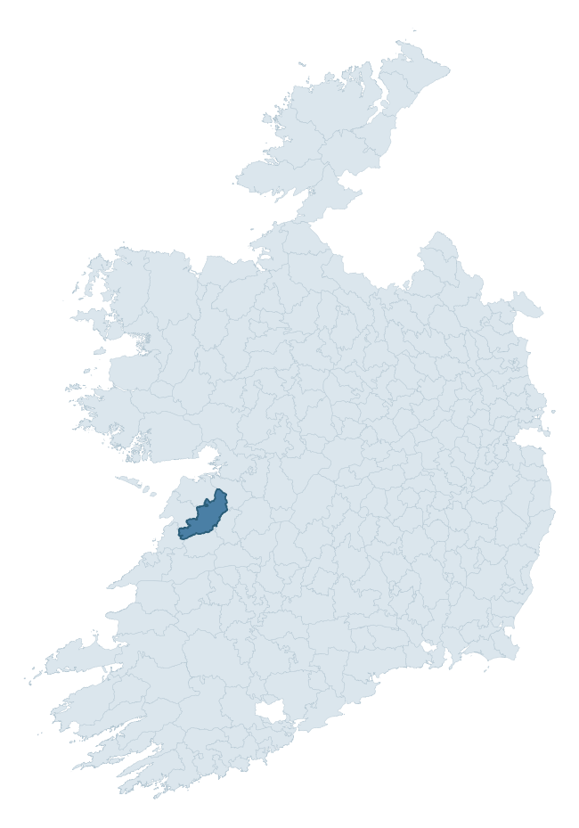
Where this barony sits in the Republic of Ireland
Geology and preservation
Bedrock geology shapes the landscape long before any settlement begins — controlling soil drainage, agricultural potential, the survival of upstanding monuments, and the preservation of buried archaeology. The figures below come from the Geological Survey Ireland 1:100,000 bedrock map.
The bedrock underlying Inchiquin is predominantly limestone (60% of the barony by area), laid down during the Carboniferous period (100% by area, around 359 to 299 million years ago). Limestone is the most heritage-rich bedrock in Ireland. It supports fertile, well-drained soils that favoured dense Early Medieval settlement and Norman manorial agriculture, and it weathers into karst features — sinkholes, caves, swallow holes, and souterrains — that frequently carry archaeology. Where peat overlies limestone, organic preservation can be exceptional. A substantial secondary geology of mudstone, siltstone, sandstone (26%) and siltstone (10%) adds further variety to the underlying landscape. The single largest mapped unit is the Central Clare Group (26% of the barony's bedrock).
Rock type composition
Largest mapped unit: Central Clare Group (26% of the barony)
Placename evidence
Logainm records 52 heritage-diagnostic placenames for Inchiquin, drawn from townland and civil-parish names across the barony. The dominant stratum is Early Christian ecclesiastical — cill-, teampall-, and domhnach-prefixed names that record the dense network of early church foundations established between the fifth and tenth centuries. The leading diagnostic roots are cill- (15 — church), caiseal- (11 — stone ringfort), and lios- (7 — ringfort or enclosure). This is above the ROI average of 30.7 heritage placenames per barony. The presence of multiple heritage strata side by side indicates layered occupation of the landscape across successive prehistoric and historic periods. Logainm records 304 placenames for Inchiquin (predominantly townland names). Of these, 52 (17%) carry one of the diagnostic Gaelic roots tracked above; the remainder draw on more generic landscape vocabulary that does not encode a heritage period.
Pre-Christian / Early Medieval Defensive
| Root | Count | Meaning |
|---|---|---|
| caiseal- | 11 | stone ringfort |
| lios- | 7 | ringfort or enclosure |
| ráth- | 4 | earthen ringfort |
| cathair- | 1 | stone fort |
Early Christian Ecclesiastical
| Root | Count | Meaning |
|---|---|---|
| cill- | 15 | church (early) |
| cillín- | 5 | unconsecrated burial ground |
| teampall- | 3 | church (later medieval) |
| díseart- | 2 | hermitage |
Burial, Ritual, and Norse-Contact
| Root | Count | Meaning |
|---|---|---|
| carn- | 2 | cairn |
| uaimh- | 1 | cave / souterrain |
Other baronies in Clare
- Leitrim
- Ibrickan
- Bunratty Lower
- Islands
- Tulla Upper
- Clonderalaw
- Tulla Lower
- Pubblebrien — Limerick
- Carbery West (west Division) — Cork
- Decies Without Drum — Waterford
See all 280 baronies in the Republic of Ireland Heritage Tool.

Explore further
Grounding History: 10 Maps of Northern Ireland’s Past
If you’re interested in Irish heritage more widely, the companion report for Northern Ireland brings together the analysis of all 462 NI wards into one place through 10 high-quality maps — covering monument density, archaeological periods, placename heritage, terrain, wetland, and the historic landscape at first survey. Take a look.
About this profile
Click any section below to expand.
What is a barony?
A barony is a historic administrative unit in Ireland, broadly equivalent to an English hundred. The 280 baronies used here are from the OSi 2019 National Statutory Boundaries (generalised 20m), covering the 26 counties of the Republic of Ireland. Baronies derive from the Norman period, were formalised in the 17th century, and have not been redrawn for statistical purposes. They vary enormously in area, from compact urban baronies in Dublin to vast upland baronies in Connacht, and should not be compared by raw site count without accounting for area differences.
What counts as a site?
This profile combines three distinct heritage registers, each with its own definition of what constitutes a recordable site:
- Archaeological sites (NMS). The National Monuments Service Sites and Monuments Record (SMR) catalogues every known archaeological monument or site of archaeological interest in the Republic, from prehistoric burial mounds and ringforts to medieval churches and post-medieval defensive works. Inclusion does not require legal protection — only that the site has been identified, surveyed, and assessed as having archaeological value. A separate subset of these sites lies within a recorded protection zone, which gives them statutory protection under the National Monuments Acts.
- Listed buildings (NIAH). The National Inventory of Architectural Heritage records buildings of architectural, historical, archaeological, artistic, cultural, scientific, social, or technical interest. Each surveyed structure is appraised on a five-tier scale: International, National, Regional, Local, and Record-Only. The NIAH appraisal is informational rather than strictly statutory, but it underpins local-authority Record of Protected Structures (RPS) listings.
- Heritage placenames (Logainm). Logainm is the authoritative database of Irish placenames maintained by the Placenames Branch. This profile applies a heritage-diagnostic classifier to the Irish-language form of each townland name, flagging roots that signal defensive sites (ráth-, lios-, dún-, caiseal-, cathair-), ecclesiastical foundations (cill-, teampall-, domhnach-, mainistir-), prehistoric burial-ritual features (tuaim-, carn-, leaba-), or Norse-contact settlement (gall-). Townlands without one of these diagnostic roots are not flagged here — they may still carry historical significance, but that significance is not encoded in the name itself.
Editorial principles
The narrative sections of this profile follow several explicit principles:
- Evidential. Every claim about this barony’s heritage character is anchored in the underlying register data. Where a site count, a placename count, or a percentile rank is cited, it is computed from the source datasets at export time, not estimated.
- Comparative. Counts and metrics are reported alongside their percentile rank against the other 279 ROI baronies. A barony with 50 ringforts in absolute terms could be unusually high or unusually low depending on its size and regional context; percentile ranking removes that ambiguity.
- Transparent on limits. Where a register has known coverage gaps, survey biases, or data-quality issues that affect this barony’s figures, the profile flags them rather than presenting the numbers as definitive.
- No interpretation beyond what the data supports. The narrative does not speculate about historical events, social dynamics, or cultural meaning beyond what the recorded heritage and placename evidence directly attests.
Data caveats and limits
- NMS Sites and Monuments Record is the product of survey campaigns conducted at different intensities across different counties and decades. Some baronies have been surveyed more thoroughly than others, and absolute counts should be read in that light. Sites destroyed by development before survey are typically not represented; sites in heavily forested or upland terrain are sometimes under-recorded.
- NIAH coverage is broadly complete for the Republic of Ireland but the survey was conducted on a rolling county-by-county basis, and the most recent appraisal date varies. Buildings demolished or substantially altered after their original survey may still appear in the register; conversely, recent buildings of merit may not yet have been appraised.
- Logainm classification applies a deliberately conservative pattern-matching approach to the Irish-language townland forms. The classifier prioritises true positives over recall: a townland may carry a heritage signal that the classifier doesn’t recognise, particularly where the diagnostic root has been heavily anglicised or where the townland name draws on a less common term. The 60,000+ townland records and ~9,800 classified placenames give a substantial signal at barony scale, but individual townland names should be checked against Logainm directly for definitive interpretation.
- Period attribution. The chronological distribution reflects only those NMS sites that carry a recognised period attribution in the source data. Sites listed as “Unknown” period are excluded from the dated subset.
- Boundary changes. Some baronies have undergone minor boundary adjustments since their 19th-century definition; the OSi 2019 generalised boundaries used here are the current statutory definition and may differ slightly from historical maps in border areas.
- Bedrock geology is mapped at 1:100,000 scale, which means local variation within a barony — small pockets of different rock type, mineral veins, alluvium overlying bedrock — is generalised. The dominant-system and rocktype figures are area-weighted, so a barony reading “70% Carboniferous limestone” may still contain small but archaeologically important pockets of older or younger rock. Around 3% of GSI polygons do not match the lexicon and contribute no rocktype or system attribution.
Data sources
- National Monuments Service — Sites and Monuments Record (SMR) https://data.gov.ie/dataset/national-monuments-service-archaeological-survey-of-ireland
- National Inventory of Architectural Heritage (NIAH) https://data.gov.ie/dataset/national-inventory-of-architectural-heritage-niah-national-dataset
- Logainm — Placenames Database of Ireland https://www.logainm.ie/
- Ordnance Survey Ireland — National Statutory Barony Boundaries 2019 https://data-osi.opendata.arcgis.com/
- EURODEM — European Digital Elevation Model https://www.mapsforeurope.org/datasets/euro-dem
- ESA WorldCover https://esa-worldcover.org/en
- Geological Survey Ireland — 1:100,000 Bedrock Geology https://www.gsi.ie/en-ie/data-and-maps/Pages/Bedrock.aspx
Explore more: Search any of the 280 ROI baronies, browse by historical province, or read the methodology and data sources for the full Republic of Ireland Heritage Tool.