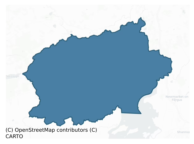
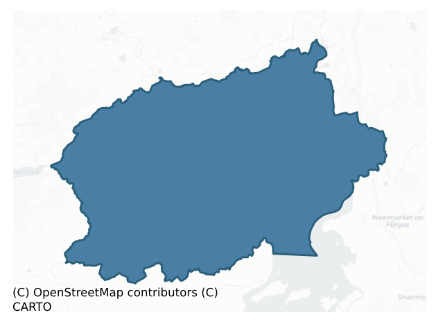
Islands is a barony of County Clare, in the historical province of Munster (Irish: Na hOileáin), covering 272 km² of land. The barony records 616 NMS archaeological sites and 94 NIAH listed buildings, placing it at around the 65th percentile among 280 ROI baronies for sites per km². This means it is in the upper half of all baronies for sites per km². Dated archaeological evidence runs from the Neolithic through to the Modern, spanning 8 of 9 archaeological periods, placing the barony in the 57th percentile among 280 ROI baronies for chronological depth. This means it is in the upper half of all baronies for chronological depth. The largest dated subset of recorded sites dates to the Early Medieval. Logainm flags 43 placenames in the barony as carrying a recognised heritage root; the largest share — around 44% — are names associated with pre-christian defensive.
Heritage at a glance
Percentile rankings throughout this profile compare each barony only against the other 279 Republic of Ireland baronies.
The recorded heritage of Islands
The National Monuments Service Sites and Monuments Record (SMR) is the statutory inventory of archaeological sites for the Republic of Ireland, maintained by the Department of Tourism, Culture, Arts, Gaeltacht, Sport and Media. Sites recorded here include earthworks, ringforts, megalithic tombs, ecclesiastical remains, and post-medieval features; not every record is legally protected, but each is registered as a monument of archaeological interest.
The National Monuments Service records 616 archaeological sites in Islands, putting it at the 65th percentile among 280 ROI baronies for sites per km². This means it is in the upper half of all baronies for sites per km². Protection coverage is near-universal — 562 sites (91%) fall within a recorded monument protection zone, indicating an extensively surveyed landscape. The dominant category is defensive sites — ringforts, enclosures, hillforts, and stone forts (340 sites, 55% of the record). Ringfort – rath is the most prevalent type, making up 34% of the barony's recorded sites (208 records) — well above the ROI average of 20% across all baronies where this type occurs. Ringfort – rath is an earthen ringfort enclosed by a bank and external ditch — the most common Early Medieval farmstead, broadly dated 500–1000 AD. Other significant types include Enclosure (59) and Earthwork (30). Enclosure is a banked or ditched feature of uncertain type, used as a catch-all where the original function cannot be determined from surface evidence; Earthwork is an unclassified earthen structure with no diagnostic features that allow a more specific classification. Across the barony's 272 km², this gives a recorded density of 2.27 sites per km².
Most common monument types
Hover or tap a monument type to see its definition.
| Type | Count |
|---|---|
| Ringfort – rath an earthen ringfort enclosed by a bank and external ditch — the most common Early Medieval farmstead, broadly dated 500–1000 AD | 208 |
| Enclosure a banked or ditched feature of uncertain type, used as a catch-all where the original function cannot be determined from surface evidence | 59 |
| Earthwork an unclassified earthen structure with no diagnostic features that allow a more specific classification | 30 |
| Fulacht fia a horseshoe-shaped Bronze Age burnt mound built around a sunken trough beside a water source, traditionally interpreted as a cooking site | 30 |
| Ringfort – cashel the stone-walled equivalent of the rath, found mainly in upland or western areas, broadly dated 500–1000 AD | 26 |
| Burnt mound a heap of fire-cracked stone, ash and charcoal, with no surviving trough, dated Bronze Age to early medieval | 24 |
| Children's burial ground an unconsecrated medieval and early-modern burial ground for unbaptised or stillborn children, often called a cillín or ceallúnach | 15 |
Chronological distribution
The dated archaeological record for Islands spans from the Neolithic through to the Modern, with activity attested across 8 of 9 archaeological periods. Every period from earliest to latest is represented in the record — an unbroken sequence of dated activity across the full chronological span. Activity concentrates most heavily in the Early Medieval (259 sites, 55% of dated material), with the Iron Age forming a secondary peak (94 sites, 20%). A further 146 recorded sites (24% of the overall NMS register for the barony) carry no period attribution — appearing as 'Unknown' in the bar chart below. This typically reflects either records that pre-date the standardised period vocabulary or sites awaiting specialist dating review, rather than a genuine absence of chronological evidence.
Sample of recorded monuments
Show 25 sample monuments (of 616 total)
A representative sample of 25 recorded monuments drawn from the barony’s 616 total NMS entries. Sites within a recorded monument protection zone and rarer site types are prioritised so the list shows a meaningful cross-section rather than only the most common type. Each entry shows the official Sites and Monuments Record reference number and the description published by the National Monuments Service.
Round tower
Situated near the top of a steep E-facing slope almost at the N perimeter of Drumcliff graveyard (CL033-033002-) c. 10m N of the church (CL033-033001-). A ruined circular tower (diam. at base 4.88m, int. diam. 2.44m)…
Situated near the top of a steep E-facing slope almost at the N perimeter of Drumcliff graveyard (CL033-033002-) c. 10m N of the church (CL033-033001-). A ruined circular tower (diam. at base 4.88m, int. diam. 2.44m) standing to 11m on the N side but only to 3m on the S (Wth of wall at S 1.14m), built of coursed roughly squared and dressed limestone interspersed with large irregular boulders and smaller stones. The courses are more regular above the first metre and the walls have a mortared rubble core. The interior is filled with earth to the level of the surviving S side. A first-floor doorway at a height of 6m was evident in 1808 and was described as having a moulding round it (Barrow 1979, 59). Three windows were also present, one of which faced W, 7.3m above the ground. This window appears to be square-headed in a 19th-century drawing in the Royal Irish Academy (ibid.). Offsets for the first, second and third floors are clearly visible in the interior. Two pairs of non-structural corbels can be seen, one at first and one at second floor level. The round tower and the church are national monuments in State care, no. 204. (Barrow 1979, 59; Lalor 1999, 109, 111)
The following images are attached:
CL033-033003-_01.jpg Round tower from SW
CL033-033003-_02.jpg View from S
Compiled by: Mary Tunney
Date of upload: 28 April 2015
Ecclesiastical enclosure
Situated on top of Ryan Hill. A large D-shaped area (c. 140m E-W; c. 100m N-S) with a straight N side, defined by an earthen bank (Wth 4.8m; int. H 0.3m; ext. H 0.6m) at NE and an earthen bank (Wth 5.2m; int. H 0.3m;…
Situated on top of Ryan Hill. A large D-shaped area (c. 140m E-W; c. 100m N-S) with a straight N side, defined by an earthen bank (Wth 4.8m; int. H 0.3m; ext. H 0.6m) at NE and an earthen bank (Wth 5.2m; int. H 0.3m; ext. H 1.5m) and outer fosse (Wth of base 3.5m; D 0.5m) at SW with traces of a scarp NE-SW. A NE-SW field wall bisects the enclosure and S of this is an inner scarp (H 0.5m) (diam. c. 70m NE-SW) that does not continue N of the field wall. Within that again is a rectangular area (32m NNE-SSW; 18m WNW-ESE) defined by a scarp (max. H 0.7m at E) and a slight bank (Wth 2.5m; int. H 0.1m; ext. H 0.4m) at S which is also cut by and extant only S of the field wall. A possible church (CL033-034002-) lay in the N portion of the rectangular area. Drumcliff church (CL033-033—-) lies c. 700m to the SW.
Compiled by: Mary Tunney
Date of upload: 24 May 2016
Historic town
Situated on the River Fergus, Ennis was founded in the early 13th century AD upon the arrival of the O’Briens, formerly the kings of Munster, when they were compelled to surrender Limerick to the Anglo-Normans and move…
Situated on the River Fergus, Ennis was founded in the early 13th century AD upon the arrival of the O’Briens, formerly the kings of Munster, when they were compelled to surrender Limerick to the Anglo-Normans and move westwards into the territory of Thomond. They initially built earthen strongholds or ringworks at Clonroad c. 1210 and c. 1267 (CL033-085005- and CL033-085006-) about 1km to the E at an existing fording point on the river with a tower house constructed there about 1470 (Ó Dálaigh 1987, 28) (CL033-085001-) and a large mansion attached by 1558 (CL033-085002-). Around 1240 the Franciscans were invited to establish a monastery close to Clonroad. The Friary (CL033-082001-) was built on high ground at ‘Inis’, meaning an island (in this case formed by a secondary channel of the river) in about 1270. The Friary and the castle were linked by a causeway as much of the surrounding area was liable to flooding. Over the following centuries Ennis grew with the Friary providing a focus for a market and the river providing a channel of communication. A period of prosperity in the 15th century saw the expansion of the town with a small castle (CL033-082007-) and gatehouse (CL033-082033-) built at the southern end. No defensive walls were built at Ennis, possibly because the natural island afforded enough protection or perhaps because there was an insufficient volume of trade. The O’Brien stronghold at Clonroad protected the eastern approach to the town. A small castle (CL033…
Settlement deserted – medieval
In the vicinity of Clonroad castle (CL033-085001-). The account of a raid on Clonroad castle in 1553 makes it clear that there was a substantial settlement associated with the castle and by 1703 Moland could still…
In the vicinity of Clonroad castle (CL033-085001-). The account of a raid on Clonroad castle in 1553 makes it clear that there was a substantial settlement associated with the castle and by 1703 Moland could still record ‘a few shops’ and the holding of two annual fairs there (Ó Dálaigh 1987, 16; Bradley, Halpin and King 1988, 80). The extent of the settlement is not known.
Compiled by: Mary Tunney
Date of upload: 23 April 2014
Rock scribing
On flat low-lying ground beside a high wall at the entrance to Cregaun housing estate, c. 50m W of the public road. A limestone glacial erratic (c. 4m x 3m, H 2.5-3m) with an inscribed face on the lower SE side. The top…
On flat low-lying ground beside a high wall at the entrance to Cregaun housing estate, c. 50m W of the public road. A limestone glacial erratic (c. 4m x 3m, H 2.5-3m) with an inscribed face on the lower SE side. The top half of the face is broken off. On inspection in 2000 the broken part lay on the ground nearby. The face had very large ears, a narrow straight nose and pointed eyes. Rynne (1985, 79) cites parallels with carvings dating to the Romanesque and Transitional periods. A small mound (CL033-177—-) was noted very close to the erratic in 1996 during clearance in advance of construction of Cregaun estate and a small hut site (CL033-176—-) was also noted nearby. (Rynne 1985, 78-80; Coffey 1996, 57-8)
CL033-118—_01.jpg attached. Photo: Etienne Rynne 1986.
Compiled by: Mary Tunney
Date of upload: 23 June 2014
Religious house – Augustinian canons
Situated at the N end of a slight N-S ridge on the W bank of the River Fergus with wide views all around. The Ennis-Limerick railway line runs N-S just 15m to the W. The abbey was founded by the Augustinians in 1189…
Situated at the N end of a slight N-S ridge on the W bank of the River Fergus with wide views all around. The Ennis-Limerick railway line runs N-S just 15m to the W. The abbey was founded by the Augustinians in 1189 under the patronage of Donal Mór O’Brien, king of Thomond, and was dedicated to Saints Peter and Paul. It was known as ‘de Forgio’ from the name of the river (Gwynn and Hadcock 1970, 162) and became an important ecclesiastical centre in the medieval diocese of Killaloe (McInerney 2014, 82). In 1278 the abbey was the scene of a great slaughter between various factions of the O’Brien family (named ‘Battle 1278’ on the OS 6-inch map). After the dissolution of the monasteries in 1541, it passed to various members of the O’Brien family, but the Canons seem to have lived on in the abbey until about 1650. Some parts of the single-aisled church date to the late 12th century but the majority of the existing buildings date to the 15th century when the Meic Craith lineage held the abbacy. It was probably in the reign of Teige Acomhad O’Brien, around 1461, that the church was repaired, the well-preserved E window inserted, the tower built, and the domestic buildings with their unusual floral window at the SE corner added (Harbison 1992, 58-9).
The church (int. dims. 37.38m E-W; 7.1m N-S; ext. dims. 39.18m E-W; 8.95m N-S) is built of coursed limestone and is aligned roughly WNW-ESE. A number of features exist in the N wall. 11m from the W end is a pointed doorway with a ho…
Burial
The Archaeological Survey of Ireland (ASI) is in the process of providing information on all monuments on The Historic Environment Viewer (HEV). Currently the information for this record has not been uploaded. To…
The Archaeological Survey of Ireland (ASI) is in the process of providing information on all monuments on The Historic Environment Viewer (HEV). Currently the information for this record has not been uploaded. To access available information for research purposes please make an appointment in advance with the Archive Unit (open Fridays 10.00 am – 5.00 pm), Department of Culture, Heritage and the Gaeltacht, The Custom House, Dublin 1 D01W6XO or email nmarchive@chg.gov.ie.
Megalithic tomb – wedge tomb
See linked document with details from Ruaidhrí de Valera and Seán Ó Nualláin, Survey of the Megalithic Tombs of Ireland. Volume I. County Clare. (Dublin: Stationery Office, 1961)
Date of upload: 30 December 2011
Religious house – Augustinian nuns
Situated on a steeply inclined shelf overlooking the N shore of Killone Lough within a graveyard (CL041-062002-). Accessible only by foot from gates c. 1km to N and S at the edge of Newhall estate. Listed as ‘Convent’…
Situated on a steeply inclined shelf overlooking the N shore of Killone Lough within a graveyard (CL041-062002-). Accessible only by foot from gates c. 1km to N and S at the edge of Newhall estate. Listed as ‘Convent’ in the RMP (1996), Collins (2007) gives the following history. ‘…established in the 1180s, probably by Donal Mor O’Brien, as a nunnery following the rule of St. Augustine. Killone nunnery first appears in the Annals of Inishfallen in 1260, when it is recorded that “Slaney, O’Bryan’s daughter, abbess of Kill Eoin, chief in devotion, alms-deeds and hospitality of all women in Munster, died.” Slaney is believed to have been the sister of the king of Thomond, Donchad Cairbreach, who founded the nearby Ennis Friary. The nunnery receives a possible mention in papal taxation records of 1302 (although it may perhaps have been confused with another monastic house) and is again noted in 1584, when it was dissolved by the Crown. A satirical poem on the tribes of Ireland, written in 1617, tells of Lady Honora O’Brien, who in her youth had followed the religious life at Killone but ran off with Sir Roger O’Shaughnessy, with whom she had two children before the pope gave dispensation for their marriage. The nunnery at Killone is rarely mentioned in the documentary sources of the 17th century and appears to have been left ruinous since then.’
The buildings are set around a small almost square cloister (13.5m N-S; 16.5m E-W). The church (int. dims. 26.17m E-W; 8.56m N-S;…
Altar
Situated in a grove on the N shore of Killone Lake, 125m NE of Killone Augustinian nunnery (CL041-062001-). A stone altar, c. 5m S of St John’s holy well (CL041-062003-). The altar originally consisted of two…
Situated in a grove on the N shore of Killone Lake, 125m NE of Killone Augustinian nunnery (CL041-062001-). A stone altar, c. 5m S of St John’s holy well (CL041-062003-). The altar originally consisted of two double-faced drystone walls placed 0.75m apart and aligned NW-SE. A cement slab is laid across the two walls supporting a grotto. Limestone slabs are placed at the ends of the walls and between the slabs at N is a slab bearing the following inscription: ‘This altar was built by Anthony Roch, merchant from Ennis 1731 + IHS’. Three small water-rolled stones or ‘cursing stones’ (CL041-062008-) lie on top of the altar and a large fourth one is at the base. A new stone altar table has been built immediately to the E. It’s inscription reads ‘Dedicated to the memory of Francis O’Neill, Ballyveskil. 25/10/1949 – 30/08/2009. 23 June 2010’. Mass continues to be celebrated here on June 23rd, the eve of St. John the Baptist. (Westropp 1900, 133)
The following image has been uploaded:
CL041-062004-_01.jpg View of altar from NE.
Compiled by: Mary Tunney
Date of upload: 7 November 2016
Castle – Anglo-Norman masonry castle
See attached document with details from Risteárd Ua Cróinín and Martin Breen, The Castles and Tower-houses of Co. Clare (unpublished report). Uploaded courtesy of R. Ua Cróinín and M. Breen.
Date of upload: 12…
See attached document with details from Risteárd Ua Cróinín and Martin Breen, The Castles and Tower-houses of Co. Clare (unpublished report). Uploaded courtesy of R. Ua Cróinín and M. Breen.
Date of upload: 12 December 2014
Pier/Jetty
On the N bank of the River Fergus adjacent to Manusmore townland. Described by O’Sullivan (2001, 296) as a possibly post-medieval ‘stone-built jetty at the saltmarsh edge, oriented NE-SW, 16m long, 2m wide, 50cm high.…
On the N bank of the River Fergus adjacent to Manusmore townland. Described by O’Sullivan (2001, 296) as a possibly post-medieval ‘stone-built jetty at the saltmarsh edge, oriented NE-SW, 16m long, 2m wide, 50cm high. Located c. 100m NW of Latoon Creek. Built of irregular limestone slabs laid as a double kerb with a rubble infill. May 1995.' (O'Sullivan 2001, 296, Fergus estuary east 6)
Compiled by: Mary Tunney
Date of upload: 27 August 2019
Penitential station
The Archaeological Survey of Ireland (ASI) is in the process of providing information on all monuments on The Historic Environment Viewer (HEV). Currently the information for this record has not been uploaded. To…
The Archaeological Survey of Ireland (ASI) is in the process of providing information on all monuments on The Historic Environment Viewer (HEV). Currently the information for this record has not been uploaded. To access available information for research purposes please make an appointment in advance with the Archive Unit (open Fridays 10.00 am – 5.00 pm), Department of Culture, Heritage and the Gaeltacht, The Custom House, Dublin 1 D01W6XO or email nmarchive@chg.gov.ie.
Hilltop enclosure
The Archaeological Survey of Ireland (ASI) is in the process of providing information on all monuments on The Historic Environment Viewer (HEV). Currently the information for this record has not been uploaded. To…
The Archaeological Survey of Ireland (ASI) is in the process of providing information on all monuments on The Historic Environment Viewer (HEV). Currently the information for this record has not been uploaded. To access available information for research purposes please make an appointment in advance with the Archive Unit (open Fridays 10.00 am – 5.00 pm), Department of Culture, Heritage and the Gaeltacht, The Custom House, Dublin 1 D01W6XO or email nmarchive@chg.gov.ie.
Building
The Archaeological Survey of Ireland (ASI) is in the process of providing information on all monuments on The Historic Environment Viewer (HEV). Currently the information for this record has not been uploaded. To…
The Archaeological Survey of Ireland (ASI) is in the process of providing information on all monuments on The Historic Environment Viewer (HEV). Currently the information for this record has not been uploaded. To access available information for research purposes please make an appointment in advance with the Archive Unit (open Fridays 10.00 am – 5.00 pm), Department of Culture, Heritage and the Gaeltacht, The Custom House, Dublin 1 D01W6XO or email nmarchive@chg.gov.ie.
Cairn – unclassified
The Archaeological Survey of Ireland (ASI) is in the process of providing information on all monuments on The Historic Environment Viewer (HEV). Currently the information for this record has not been uploaded. To…
The Archaeological Survey of Ireland (ASI) is in the process of providing information on all monuments on The Historic Environment Viewer (HEV). Currently the information for this record has not been uploaded. To access available information for research purposes please make an appointment in advance with the Archive Unit (open Fridays 10.00 am – 5.00 pm), Department of Culture, Heritage and the Gaeltacht, The Custom House, Dublin 1 D01W6XO or email nmarchive@chg.gov.ie.
Religious house – Franciscan friars
Situated in the centre of Ennis Historic Town (CL033-082—-) on what was formerly an island formed by the River Fergus. The Franciscans were invited to establish a monastery here c. AD 1240 c. 1km W of Clonroad Castle…
Situated in the centre of Ennis Historic Town (CL033-082—-) on what was formerly an island formed by the River Fergus. The Franciscans were invited to establish a monastery here c. AD 1240 c. 1km W of Clonroad Castle (CL033-085001-). While the earliest dwellings were most likely temporary, the defeat of the Anglo-Normans at Clare Castle (CL041-089—-) in 1270 allowed Toirrdelach Mór Ó Briain of Clonroad the opportunity to construct a more permanent building for the friars at Ennis. An ornate friary in the Gothic style was constructed consisting of a long nave and chancel with a window of five tall lancets in the E gable. Construction continued into the 14th century with the refectory and sacristy added by Matha Caoch MacNamara in 1349 (O'Neill 2009, 315). During a period of great prosperity in the 15th century the friary was substantially rebuilt including the addition of a cloister garth to the N, c. 1470, an ornate transept built onto the southern wall of the nave and a bell tower inserted between the nave and chancel. The friary was dissolved in 1543 but remained open until 1570. For a time it was used as a law court and prison. Following a royal visitation in 1615 it was decided that the friary church be renovated and used for Protestant worship. A secure gateway, known in the 18th century as ‘the great gate of the abbey of St Francis’ sealed off the friary from the rest of the urban settlement. This is visible on Hewett’s map of 1736 and is mentioned in the Registr…
Inn
Situated at O’Connell Square within Ennis historic town (CL033-082—-). A depiction by Thomas Dineley in 1681 shows Lenthall’s Inn as a large two-storey building of four bays with dormer windows in the roof and a…
Situated at O’Connell Square within Ennis historic town (CL033-082—-). A depiction by Thomas Dineley in 1681 shows Lenthall’s Inn as a large two-storey building of four bays with dormer windows in the roof and a chimney stack on the S gable and names it ‘Lenthall’s, the chief inn’ (Ó Dálaigh 2012, 4). John Lenthall, innkeeper, is mentioned in the Manor Court Rolls in 1674 (ibid., 20) and a John Lenthall, vintner, is named in a new charter issued for Ennis dated 1687 (ibid., 5). This is one of four recorded inns in Ennis in the 17th century and the only one with a known location although one was in an unknown location on the present Parnell Street.
Compiled by: Mary Tunney
Date of upload: 13 May 2014
Market-house
Situated at O’Connell Square, where the present O’Connell monument stands, within Ennis historic town (CL033-082—-). The earliest documented court sessions in Ennis were held in the vaulted chapterhouse or sacristy of…
Situated at O’Connell Square, where the present O’Connell monument stands, within Ennis historic town (CL033-082—-). The earliest documented court sessions in Ennis were held in the vaulted chapterhouse or sacristy of Franciscan Friary (CL033-082001-) from 1570 (Ó Dalaigh, 1986, 5). By 1641 a new market-house including courtrooms had been built in the centre of the town on the E side of what was then the market place. Dineley’s sketch of 1681 represents it as an L-shaped, gabled building of two or three floors. Moland’s map (1703) shows it with a cupola over the roof and an arched façade of three bays at the front. The ground floor of the building was arcaded for the use of market traders and the upper floor was where the law courts were held and where the county grand jury assembled. There is a reference in the Orrery letters (ii, 73-4) to its use as a playhouse in 1666 as cited in Ó Dálaigh (2012, 23). The market-house was replaced by a new building c. 1733 which was itself demolished in 1852. (Bradley, Halpin and King 1988, 52; Ó Dálaigh 2012, 4, 15)
Compiled by: Mary Tunney
Date of upload: 19 May 2014
Font (present location)
This record is for the present location of a font found during renovations to the floor of Kilballyowen church (CL065-071001-), near the village of Cross, Loop Head, Co. Clare (original location record CL065-071005-)…
This record is for the present location of a font found during renovations to the floor of Kilballyowen church (CL065-071001-), near the village of Cross, Loop Head, Co. Clare (original location record CL065-071005-) and dedicated to St. John the Baptist. This richly carved limestone font is in storage in Clare Museum, Ennis. The font was donated in the 1960’s to the de Valera Library and Museum and was subsequently moved to Clare Museum as a result of flooding. Described by Higgins (1995, 29) as consisting of three pieces, joined with modern cement and repaired with plaster, it is now in two pieces, the bowl and shaft remaining cemented together. Westropp (1915, 354) suggests a date of 1460-80 and likens the carving to that on the Royal tomb in Ennis Friary (CL033-082015-). Higgins (ibid.) draws parallels with the tracery canopy under the crossing tower of the Friary (CL033-082016-). The moulded base (H 0.28m) is octagonal in plan and it and the lower third of the rectangular shaft are of a single piece (H 0.41m; Wth 0.52m; each face L 0.21m). The remainder of the panelled and carved shaft (H 0.37m) and the shallow basin stone (D 0.11-0.13m; Wth 0.35-0.37m; diam. 0.18-0.19m) with drain-hole and moulded corners form the second piece. The shaft has spirally fluted columns at the angles and a decorated panel on each face. Two panels have well-preserved foliage or trees. One panel depicts St John the Baptist wearing a long pleated robe and a cloak fastened with a six-petalle…
Stone sculpture
On display under the canopy of the Royal/McMahon tomb in the nave of Ennis Friary (CL033-082001-). A fragment of a pieta (H 0.36m; Wth 0.48m; D 0.32m), or ‘Our Lady’s Pity’ as it was known in the 15th century, which may…
On display under the canopy of the Royal/McMahon tomb in the nave of Ennis Friary (CL033-082001-). A fragment of a pieta (H 0.36m; Wth 0.48m; D 0.32m), or ‘Our Lady’s Pity’ as it was known in the 15th century, which may have originally formed part of the Royal tomb (CL033-082015-). One of the few remaining fragments of 15th-century free-standing stone sculpture in the round in Ireland. Carved in limestone, the remaining fragment shows the body of Christ lying upon the knees of the Virgin, the arms crossed at the wrists and the right arm grasped at the elbow by Our Lady’s left hand. (Hunt 1975, 36-8; Pl. II, 2; Harbison 1984, 13-14; Bradley, Halpin and King 1988, 77)
CL033-082024-_01.jpg attached.
Compiled by: Mary Tunney
Date of upload: 15 April 2014
Inscribed stone
At no. 10 Abbey Street, Ennis within the historic town (CL033-082—-). An inscribed stone uncovered above and slightly to the right of the front door during the demolition of the remains of a 17th-century house…
At no. 10 Abbey Street, Ennis within the historic town (CL033-082—-). An inscribed stone uncovered above and slightly to the right of the front door during the demolition of the remains of a 17th-century house (CL033-082029-) in August 1990. The inscription, in Roman capitals, reads ‘JAMES MACNAMARA BUILT THIS HOUSE ANNO DOMINI 1661’. The stone is on display in a wooden frame inside the present building constructed on the same site. (Ó Murchadha 1991, 33-4)
CL033-082030-_01.jpg attached.
Compiled by: Mary Tunney
Date of upload: 14 April 2014
Castle – ringwork
On low-lying ground on the S bank of the River Fergus. This was the main residence of the O’Brien kings of Thomond from the 13th to the 16th centuries. An earthen stronghold built by Conchobhar Ó Briain c. AD 1267 and…
On low-lying ground on the S bank of the River Fergus. This was the main residence of the O’Brien kings of Thomond from the 13th to the 16th centuries. An earthen stronghold built by Conchobhar Ó Briain c. AD 1267 and burnt in AD 1311 is recorded in the Caithréim Thoirdhealbhaigh (cited in Ó Dálaigh 1987 and 2012). An earlier earthen stronghold (CL033-085005-) had existed on the N bank of the river built by Donnachad Cairprech Ó Briain c. 1210. A tower house (CL033-085001-) was built on this site S of the river c. 1470 and by 1558 a large mansion (CL033-085002-) had been attached. (Ó Dálaigh 1987, 20-22; 2012, 15)
Compiled by: Mary Tunney
Date of upload: 23 April 2014
Mound
A small mound was noted in 1996 during clearance by a bulldozer in advance of the construction of Cregaun housing estate in Ennis town. It was almost alongside a large glacial erratic with an inscribed face…
A small mound was noted in 1996 during clearance by a bulldozer in advance of the construction of Cregaun housing estate in Ennis town. It was almost alongside a large glacial erratic with an inscribed face (CL033-118—-). A small circular hut site (CL033-176—-) was also noted in the immediate vicinity. (Coffey 1996, 57)
Compiled by: Mary Tunney
Date of upload: 16 July 2014
Ringfort – rath
The Archaeological Survey of Ireland (ASI) is in the process of providing information on all monuments on The Historic Environment Viewer (HEV). Currently the information for this record has not been uploaded. To…
The Archaeological Survey of Ireland (ASI) is in the process of providing information on all monuments on The Historic Environment Viewer (HEV). Currently the information for this record has not been uploaded. To access available information for research purposes please make an appointment in advance with the Archive Unit (open Fridays 10.00 am – 5.00 pm), Department of Culture, Heritage and the Gaeltacht, The Custom House, Dublin 1 D01W6XO or email nmarchive@chg.gov.ie.
Listed buildings
The National Inventory of Architectural Heritage (NIAH) is a state survey appraising buildings of architectural, historical, archaeological, artistic, cultural, scientific, social, or technical interest. Each surveyed structure receives a rating from International (the highest, for buildings of European importance) through National, Regional, Local, and Record-Only.
The NIAH records 94 listed buildings in Islands (47th percentile across ROI baronies). Among these, 7 are graded National — buildings of interest to the whole of Ireland rather than only its region. The Republic holds 937 National-graded buildings in total, so this barony accounts for around 1% of the national total. Construction dates concentrate most heavily in the Victorian (1830-1900) period. The most-recorded building type is house (36 examples, 38% of the listed stock).
Terrain and environment
Mean elevation across the barony is 78m — the 39th percentile among 280 ROI baronies for elevation. This means it is in the lower half of all baronies for elevation. Elevation matters for heritage because higher-altitude baronies typically favour defensive monuments — ringforts and hilltop forts placed on prominent ground — while lowland baronies are more likely to carry the dense settlement and church networks of intensive agricultural landscapes. A maximum elevation of 272m gives the barony meaningful vertical relief. Mean slope is 4.2° — the 63rd percentile among 280 ROI baronies for slope. This means it is in the upper half of all baronies for slope. Slope is a key control on both land use and archaeological preservation: steep ground resists ploughing and tends to preserve earthworks intact, while gentle slopes favour intensive cultivation that damages or destroys surface archaeology over time. The Topographic Wetness Index averages 10.5, the 37th percentile among 280 ROI baronies for wetness. This means it is in the lower half of all baronies for wetness. Drainage matters for heritage because poorly-drained ground preserves organic archaeology (wooden trackways, leather, textiles, and on rare occasions human remains) far better than free-draining soil; well-drained ground favours arable use but destroys organic material rapidly. The land cover is dominated by improved grassland (66%) and woodland (27%).
Terrain measurements
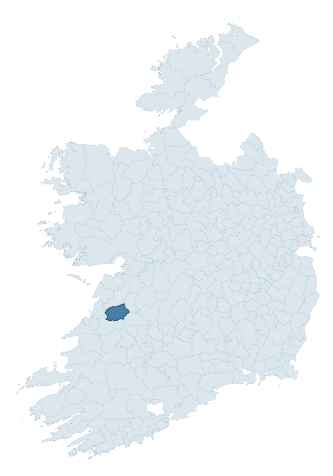
Where this barony sits in the Republic of Ireland
Geology and preservation
Bedrock geology shapes the landscape long before any settlement begins — controlling soil drainage, agricultural potential, the survival of upstanding monuments, and the preservation of buried archaeology. The figures below come from the Geological Survey Ireland 1:100,000 bedrock map.
The bedrock underlying Islands is predominantly mudstone, siltstone, sandstone (64% of the barony by area), laid down during the Carboniferous period (100% by area, around 359 to 299 million years ago). A substantial secondary geology of limestone (21%) adds further variety to the underlying landscape. The single largest mapped unit is the Central Clare Group (64% of the barony's bedrock).
Rock type composition
Largest mapped unit: Central Clare Group (64% of the barony)
Placename evidence
Logainm records 43 heritage-diagnostic placenames for Islands, drawn from townland and civil-parish names across the barony. The dominant stratum is pre-Christian and Early Medieval defensive — ráth-, lios-, dún-, and caiseal-prefixed names that mark Iron Age and early historic settlement. The leading diagnostic roots are cill- (15 — church), lios- (8 — ringfort or enclosure), and ráth- (6 — earthen ringfort). This is above the ROI average of 30.7 heritage placenames per barony. The presence of multiple heritage strata side by side indicates layered occupation of the landscape across successive prehistoric and historic periods. Logainm records 175 placenames for Islands (predominantly townland names). Of these, 43 (25%) carry one of the diagnostic Gaelic roots tracked above; the remainder draw on more generic landscape vocabulary that does not encode a heritage period.
Pre-Christian / Early Medieval Defensive
| Root | Count | Meaning |
|---|---|---|
| lios- | 8 | ringfort or enclosure |
| ráth- | 6 | earthen ringfort |
| cathair- | 3 | stone fort |
| caiseal- | 2 | stone ringfort |
Early Christian Ecclesiastical
| Root | Count | Meaning |
|---|---|---|
| cill- | 15 | church (early) |
| mainistir- | 2 | monastery |
| tobar- | 2 | holy well |
Burial, Ritual, and Norse-Contact
| Root | Count | Meaning |
|---|---|---|
| carn- | 2 | cairn |
| uaimh- | 2 | cave / souterrain |
| sián- | 1 | fairy mound |
Other baronies in Clare
- Inchiquin
- Burren
- Clonderalaw
- Tulla Lower
- Bunratty Upper
- Leitrim
- Moyarta
- Clanwilliam — Tipperary
- Kinalea — Cork
- Glenquin — Limerick
See all 280 baronies in the Republic of Ireland Heritage Tool.

Explore further
Grounding History: 10 Maps of Northern Ireland’s Past
If you’re interested in Irish heritage more widely, the companion report for Northern Ireland brings together the analysis of all 462 NI wards into one place through 10 high-quality maps — covering monument density, archaeological periods, placename heritage, terrain, wetland, and the historic landscape at first survey. Take a look.
About this profile
Click any section below to expand.
What is a barony?
A barony is a historic administrative unit in Ireland, broadly equivalent to an English hundred. The 280 baronies used here are from the OSi 2019 National Statutory Boundaries (generalised 20m), covering the 26 counties of the Republic of Ireland. Baronies derive from the Norman period, were formalised in the 17th century, and have not been redrawn for statistical purposes. They vary enormously in area, from compact urban baronies in Dublin to vast upland baronies in Connacht, and should not be compared by raw site count without accounting for area differences.
What counts as a site?
This profile combines three distinct heritage registers, each with its own definition of what constitutes a recordable site:
- Archaeological sites (NMS). The National Monuments Service Sites and Monuments Record (SMR) catalogues every known archaeological monument or site of archaeological interest in the Republic, from prehistoric burial mounds and ringforts to medieval churches and post-medieval defensive works. Inclusion does not require legal protection — only that the site has been identified, surveyed, and assessed as having archaeological value. A separate subset of these sites lies within a recorded protection zone, which gives them statutory protection under the National Monuments Acts.
- Listed buildings (NIAH). The National Inventory of Architectural Heritage records buildings of architectural, historical, archaeological, artistic, cultural, scientific, social, or technical interest. Each surveyed structure is appraised on a five-tier scale: International, National, Regional, Local, and Record-Only. The NIAH appraisal is informational rather than strictly statutory, but it underpins local-authority Record of Protected Structures (RPS) listings.
- Heritage placenames (Logainm). Logainm is the authoritative database of Irish placenames maintained by the Placenames Branch. This profile applies a heritage-diagnostic classifier to the Irish-language form of each townland name, flagging roots that signal defensive sites (ráth-, lios-, dún-, caiseal-, cathair-), ecclesiastical foundations (cill-, teampall-, domhnach-, mainistir-), prehistoric burial-ritual features (tuaim-, carn-, leaba-), or Norse-contact settlement (gall-). Townlands without one of these diagnostic roots are not flagged here — they may still carry historical significance, but that significance is not encoded in the name itself.
Editorial principles
The narrative sections of this profile follow several explicit principles:
- Evidential. Every claim about this barony’s heritage character is anchored in the underlying register data. Where a site count, a placename count, or a percentile rank is cited, it is computed from the source datasets at export time, not estimated.
- Comparative. Counts and metrics are reported alongside their percentile rank against the other 279 ROI baronies. A barony with 50 ringforts in absolute terms could be unusually high or unusually low depending on its size and regional context; percentile ranking removes that ambiguity.
- Transparent on limits. Where a register has known coverage gaps, survey biases, or data-quality issues that affect this barony’s figures, the profile flags them rather than presenting the numbers as definitive.
- No interpretation beyond what the data supports. The narrative does not speculate about historical events, social dynamics, or cultural meaning beyond what the recorded heritage and placename evidence directly attests.
Data caveats and limits
- NMS Sites and Monuments Record is the product of survey campaigns conducted at different intensities across different counties and decades. Some baronies have been surveyed more thoroughly than others, and absolute counts should be read in that light. Sites destroyed by development before survey are typically not represented; sites in heavily forested or upland terrain are sometimes under-recorded.
- NIAH coverage is broadly complete for the Republic of Ireland but the survey was conducted on a rolling county-by-county basis, and the most recent appraisal date varies. Buildings demolished or substantially altered after their original survey may still appear in the register; conversely, recent buildings of merit may not yet have been appraised.
- Logainm classification applies a deliberately conservative pattern-matching approach to the Irish-language townland forms. The classifier prioritises true positives over recall: a townland may carry a heritage signal that the classifier doesn’t recognise, particularly where the diagnostic root has been heavily anglicised or where the townland name draws on a less common term. The 60,000+ townland records and ~9,800 classified placenames give a substantial signal at barony scale, but individual townland names should be checked against Logainm directly for definitive interpretation.
- Period attribution. The chronological distribution reflects only those NMS sites that carry a recognised period attribution in the source data. Sites listed as “Unknown” period are excluded from the dated subset.
- Boundary changes. Some baronies have undergone minor boundary adjustments since their 19th-century definition; the OSi 2019 generalised boundaries used here are the current statutory definition and may differ slightly from historical maps in border areas.
- Bedrock geology is mapped at 1:100,000 scale, which means local variation within a barony — small pockets of different rock type, mineral veins, alluvium overlying bedrock — is generalised. The dominant-system and rocktype figures are area-weighted, so a barony reading “70% Carboniferous limestone” may still contain small but archaeologically important pockets of older or younger rock. Around 3% of GSI polygons do not match the lexicon and contribute no rocktype or system attribution.
Data sources
- National Monuments Service — Sites and Monuments Record (SMR) https://data.gov.ie/dataset/national-monuments-service-archaeological-survey-of-ireland
- National Inventory of Architectural Heritage (NIAH) https://data.gov.ie/dataset/national-inventory-of-architectural-heritage-niah-national-dataset
- Logainm — Placenames Database of Ireland https://www.logainm.ie/
- Ordnance Survey Ireland — National Statutory Barony Boundaries 2019 https://data-osi.opendata.arcgis.com/
- EURODEM — European Digital Elevation Model https://www.mapsforeurope.org/datasets/euro-dem
- ESA WorldCover https://esa-worldcover.org/en
- Geological Survey Ireland — 1:100,000 Bedrock Geology https://www.gsi.ie/en-ie/data-and-maps/Pages/Bedrock.aspx
Explore more: Search any of the 280 ROI baronies, browse by historical province, or read the methodology and data sources for the full Republic of Ireland Heritage Tool.