Burren is a barony of County Clare, in the historical province of Munster (Irish: Boirinn), covering 302 km² of land. The barony records 2,156 NMS archaeological sites and 28 NIAH listed buildings, placing it at around the 99th percentile among 280 ROI baronies for sites per km². This means it is in the top tenth of all baronies for sites per km². Dated archaeological evidence runs from the Mesolithic through to the Modern, spanning 9 of 9 archaeological periods, placing the barony in the 89th percentile among 280 ROI baronies for chronological depth. This means it is in the top fifth of all baronies for chronological depth. The largest dated subset of recorded sites dates to the Middle-Late Bronze Age. Logainm flags 46 placenames in the barony as carrying a recognised heritage root; the largest share — around 59% — are names associated with pre-christian defensive.
Heritage at a glance
Percentile rankings throughout this profile compare each barony only against the other 279 Republic of Ireland baronies.
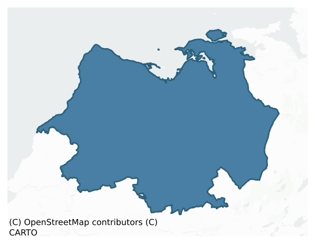
The recorded heritage of Burren
The National Monuments Service Sites and Monuments Record (SMR) is the statutory inventory of archaeological sites for the Republic of Ireland, maintained by the Department of Tourism, Culture, Arts, Gaeltacht, Sport and Media. Sites recorded here include earthworks, ringforts, megalithic tombs, ecclesiastical remains, and post-medieval features; not every record is legally protected, but each is registered as a monument of archaeological interest.
The National Monuments Service records 2,156 archaeological sites in Burren, putting it at the 99th percentile among 280 ROI baronies for sites per km². This means it is in the top tenth of all baronies for sites per km². Protection coverage is near-universal — 2,116 sites (98%) fall within a recorded monument protection zone, indicating an extensively surveyed landscape. The dominant category is defensive sites — ringforts, enclosures, hillforts, and stone forts (1,068 sites, 50% of the record). The most diagnostically specific type is Ringfort – cashel (380 records, 18% of the barony's NMS total) — compared to an ROI average of 5% across all baronies where this type occurs. Ringfort – cashel is the stone-walled equivalent of the rath, found mainly in upland or western areas, broadly dated 500–1000 AD. The broader 'Enclosure' classification — which catches unclassified ringforts and field enclosures — accounts for a further 521 records (24%) and reflects the difficulty of sub-classifying degraded earthworks from surface evidence alone. Other significant types include Hut site (178) — a low stone or earthen foundation enclosing a small circular or oval area, generally interpreted as a former dwelling, of any date from prehistory to the medieval period. Across the barony's 302 km², this gives a recorded density of 7.15 sites per km².
Most common monument types
Hover or tap a monument type to see its definition.
| Type | Count |
|---|---|
| Enclosure a banked or ditched feature of uncertain type, used as a catch-all where the original function cannot be determined from surface evidence | 521 |
| Ringfort – cashel the stone-walled equivalent of the rath, found mainly in upland or western areas, broadly dated 500–1000 AD | 380 |
| Hut site a low stone or earthen foundation enclosing a small circular or oval area, generally interpreted as a former dwelling, of any date from prehistory to the medieval period | 178 |
| Fulacht fia a horseshoe-shaped Bronze Age burnt mound built around a sunken trough beside a water source, traditionally interpreted as a cooking site | 120 |
| Cairn – unclassified a stone mound that cannot be assigned to a specific cairn type | 120 |
| House – indeterminate date a habitation building whose date cannot be determined from available evidence | 118 |
| Souterrain an underground stone-built passage and chamber, generally Early Medieval and often associated with ringforts as a defensive or storage feature | 72 |
| Field system a group of related fields forming a coherent agricultural landscape, of any date from the Neolithic onwards | 59 |
Chronological distribution
The dated archaeological record for Burren spans from the Mesolithic through to the Modern, with activity attested across 9 of 9 archaeological periods. This is the 89th percentile across ROI baronies for chronological depth — an above-average span. Every period from earliest to latest is represented in the record — an unbroken sequence of dated activity across the full chronological span. Activity concentrates most heavily in the Middle Late Bronze Age (740 sites, 38% of dated material), with the Iron Age forming a secondary peak (449 sites, 23%). A further 205 recorded sites (10% of the overall NMS register for the barony) carry no period attribution — appearing as 'Unknown' in the bar chart below. This typically reflects either records that pre-date the standardised period vocabulary or sites awaiting specialist dating review, rather than a genuine absence of chronological evidence.
Sample of recorded monuments
Show 25 sample monuments (of 2,156 total)
A representative sample of 25 recorded monuments drawn from the barony’s 2,156 total NMS entries. Sites within a recorded monument protection zone and rarer site types are prioritised so the list shows a meaningful cross-section rather than only the most common type. Each entry shows the official Sites and Monuments Record reference number and the description published by the National Monuments Service.
Industrial site
The Archaeological Survey of Ireland (ASI) is in the process of providing information on all monuments on The Historic Environment Viewer (HEV). Currently the information for this record has not been uploaded. To…
The Archaeological Survey of Ireland (ASI) is in the process of providing information on all monuments on The Historic Environment Viewer (HEV). Currently the information for this record has not been uploaded. To access available information for research purposes please make an appointment in advance with the Archive Unit (open Fridays 10.00 am – 5.00 pm), Department of Culture, Heritage and the Gaeltacht, The Custom House, Dublin 1 D01W6XO or email nmarchive@chg.gov.ie.
Stone sculpture
A carved stone head was noted by T. Coffey (pers. comm. 1994) in the ecclesiastical enclosure (CL002-008001-) at Gleninagh. This remains unlocated and is presumed stolen.
Compiled by: Mary Tunney and Ros Ó…
A carved stone head was noted by T. Coffey (pers. comm. 1994) in the ecclesiastical enclosure (CL002-008001-) at Gleninagh. This remains unlocated and is presumed stolen.
Compiled by: Mary Tunney and Ros Ó Maoldúin
Date of upload: 1 December 2020
Earthwork
On a gentle SW-facing downslope just above the shoreline with rock outcrop immediately S and E and pasture to N, at the crossing point to Scanlon’s Island. Hachured on the 1842 OS 6-inch map as a circular feature (diam.…
On a gentle SW-facing downslope just above the shoreline with rock outcrop immediately S and E and pasture to N, at the crossing point to Scanlon’s Island. Hachured on the 1842 OS 6-inch map as a circular feature (diam. c. 18m) and listed in the RMP (1996) as ‘Enclosure’. No visible trace of a monument survives. There is a rath (CL002-068001-) c. 200m NW and a cashel (CL002-019001-) c. 500m SSW on Scanlon’s Island.
Compiled by: Mary Tunney and Ros Ó Maoldúin
Date of upload: 2 December 2020
Mill – unclassified
On fairly level karst terrace and rough grazing (500–600’ OD) immediately S of a small stream, overlooking the Caher River valley. Indicated on the 1915 ed. of the 6-inch OS map and Robinson’s map (1977) and indicated…
On fairly level karst terrace and rough grazing (500–600’ OD) immediately S of a small stream, overlooking the Caher River valley. Indicated on the 1915 ed. of the 6-inch OS map and Robinson’s map (1977) and indicated and named ‘old mill’ on Geological Survey Maps. A small rectangular drystone building (int. dims. 4m E–W x 3m N-S), built of undressed randomly coursed limestone blocks and flags (walls av. Wth 0.75m), surviving to full gable height (max. H 5.5m), but unroofed. The S side wall is largely formed by a natural bedrock terrace (H 1.2m) upon which later drystone walling is built. A low doorway (H 1m; Wth 0.8m) in the W gable gives access to the interior. An ope (Wth 0.6m; H 1m) at the corner of the E gable with the N sidewall may have allowed water to flow into the building through a shallow depression (Wth 1m) which runs along the inner face of the N wall. A corresponding ope is visible on its outer face of the W gable. There are niches on the interior in the E gable at the corner with the S wall (H 1.2m; Wth 0.75m; D 0.6m), the W gable near the corner with the N wall (H 0.5m; Wth 0.4m; D 0.6m) and in the N wall near the corner with the W gable (Wth 0.5m; H 0.4m; D 0.4m). There is also a possible beam slot (Wth 0.4m; H 0.4m) near the E end of the N wall and traces of corbelling at the corner between the N wall and E gable. There is an enclosure (CL002-003—-) located c.220m NW, a house of indeterminate date (CL002-072—-) c. 410m NNE and another enclosure (CL00…
Cairn – wayside cairn
On the W side of a well-worn trackway leading from the coast road up through a hill-pass to a valley to the S. A large boulder (L 2.6m E–W; Wth 1.6m; H 1.5m) on the W side of the path. Small stones from fist size down…
On the W side of a well-worn trackway leading from the coast road up through a hill-pass to a valley to the S. A large boulder (L 2.6m E–W; Wth 1.6m; H 1.5m) on the W side of the path. Small stones from fist size down to pebble have been placed on top of the boulder and in every available crack on the S face.
Compiled by: Mary Tunney and Ros Ó Maoldúin
Date of upload: 9 December 2020
Walled garden
Listed in the RMP (1996) as ‘Walled enclosure’. A subrectangular enclosure (int. dims. c. 250m ENE-WSW; c. 210m NNW-SSE) defined by the remains of an often substantial and well-built mortared stone wall defines the…
Listed in the RMP (1996) as ‘Walled enclosure’. A subrectangular enclosure (int. dims. c. 250m ENE-WSW; c. 210m NNW-SSE) defined by the remains of an often substantial and well-built mortared stone wall defines the precincts of Corcomroe Abbey (CL003-029002-) with a gatehouse (CL003-029005-) at W. The wall is poorly preserved but is best seen at the N end of the E side (H 2.5m; Wth 0.95m) where there are undressed blocks and boulders in random courses. Along the N the wall is levelled and replaced by a later and largely tumbled field wall with the foundations of the older wall visible intermittently. The NE corner survives for 1.9m in length at the E end of the N wall and is traceable S for 25m where its line again is followed by a later wall. Midway along the E side a good 8m length survives. At S apart from a short length near the E end (Wth 3m; H 0.2m) the line is followed by an overgrown later field wall. The W side is only traceable as a foundation line between the SW corner and the road leading into the site. Immediately N of the road is the gatehouse and N of this the enclosing wall curves intermittently. The interior of the walled garden has been ‘striped’ with long narrow fields orientated NNW-SSE and the abbey stands to the S of centre within it. This is a national monument in State Care.
Compiled by: Gearóid Conroy and Mary Tunney
Date of upload: 21 April 2015
This monument is subject to a preservation order made under the National Monuments Acts 1930…
Religious house – Cistercian monks
Listed in the RMP (1996) as ‘Abbey’. Situated in an unforgettable position amidst the stony mountains of the Burren, Corcomroe Cistercian abbey lies five miles west of Kinvara, on the S side of Galway Bay. Cultivation…
Listed in the RMP (1996) as ‘Abbey’. Situated in an unforgettable position amidst the stony mountains of the Burren, Corcomroe Cistercian abbey lies five miles west of Kinvara, on the S side of Galway Bay. Cultivation of the soil can never have been easy, but the spot was not as desolate as it first appears, a point appropriately made by the latin name of the abbey, Petra Fertilis. As there is no stream beside the monastery, its water supply probably came from local springs or a well. Tober Sheela (CL003-029004-) lies within the walled garden (CL003-029001-). The site was colonised from Inislounaght in 1194-5 and the founder was either Donal Mór O’Brien, king of Thomond, or his son Donough Cairbreach. The community was always small and in the later middle ages extremely poor. Although a titular abbot is named in 1628, the house had long ceased to exist as a monastic entity. In 1554 the abbey was granted to Murrough O’Brien, earl of Thomond, the site thus reverting to the same family who gave the original endowment over three hundred years before.
The church (L 40m E-W) dates from 1210 to 1225, and was planned as a reduced version of the normal Cistercian scheme, with only one chapel opening off each transept. There is an aisled nave (Wth 7m), though the roughly built arches are not arranged symmetrically north and south and there is some doubt about whether a north aisle was ever built. The E end of the building is distinguished by the high quality of its stonework – c…
Water mill – horizontal-wheeled
Named ‘Site of Mill’ on the 1840 OS 6-inch map c. 140m E of the most easterly church (CL003-032004-) and just outside the estimated E extent of the large ecclesiastical enclosure (CL003-032007-) at Oughtmama at the N…
Named ‘Site of Mill’ on the 1840 OS 6-inch map c. 140m E of the most easterly church (CL003-032004-) and just outside the estimated E extent of the large ecclesiastical enclosure (CL003-032007-) at Oughtmama at the N foot of Turlough Hill. Noted as ‘Horizontal Mill’ on Robinson’s 1977 Burren map, Sheehan (1982, 34) notes that it may explain the presence of a church site in an otherwise sparsely populated mountain terrace. Present remains consist of a grassed-over stony mound (H 0.5-1m) defined at N by a grassed-over wall (Wth 0.7m; H over ext. 1.4m; H over int. 0.5m) and by a later field wall along the E side. A second grassed-over stone wall (L 4m; H 0.4-0.6m; Wth 1.5m) runs parallel to the first 4m to the S. A mill race comprising a wide dry channel (Wth 3.2m) dug out of the S-facing slope and forming a bank to the S (Wth at top 1.9m; Wth at base 9m; int. H 1.4m; ext. H 2.5m) extends 130m ENE. Some stone facing is evident on the N face of the bank. The mill race was listed as ‘Earthwork’ in the SMR (1992) and the RMP (1996) under the number CL003-032009-.
Compiled by: Mary Tunney
Date of upload: 19 February 2018
Water mill – unclassified
In a well-sheltered rock hollow alongside a short stretch of above-ground river, which rises to the SW and sinks to the NE, within a multiperiod field system (CL005-104001-). Indicated and named ‘site of mill (flax?)’…
In a well-sheltered rock hollow alongside a short stretch of above-ground river, which rises to the SW and sinks to the NE, within a multiperiod field system (CL005-104001-). Indicated and named ‘site of mill (flax?)’ on Robinsons (1977) map.
A water mill, surviving only as a rectangular cairn (18m NNE-SSW; 8m WNW-ESE; H 1.5-2m). A cashel is locate 90m to the W.
Compiled by: Mary Tunney and Ros Ó Maoldúin
Date of upload: 14 February 2023
Habitation site
In an area built over by a farmyard near the top of Corkscrew Hill, with views over Ballyvaughan Bay to N and within multiperiod field system (CL005-115001-). Listed as 'Settlement' in the RMP (1996). Isolated pockets…
In an area built over by a farmyard near the top of Corkscrew Hill, with views over Ballyvaughan Bay to N and within multiperiod field system (CL005-115001-). Listed as 'Settlement' in the RMP (1996). Isolated pockets of archaeological deposits were disturbed c. 35m N of a burial cairn (CL005-115002-). Slag, animal bone and flecks of burnt clay were observed and a stone dagger/knife, a bronze object with raised mid-rib (possible dagger) were recovered (ibid.).
Reference:
Cotter, C. 1989. 1988:04 – Gragan West, Clare. In I. Bennet (eds) Excavations 1988. Wordwell: Bray. Available online @ https://excavations.ie/report/1988/Clare/0000769/
Compiled by: Mary Tunney
Date of upload: 28 February 2023
Ritual site – holy/saint's stone
The Archaeological Survey of Ireland (ASI) is in the process of providing information on all monuments on The Historic Environment Viewer (HEV). Currently the information for this record has not been uploaded. To…
The Archaeological Survey of Ireland (ASI) is in the process of providing information on all monuments on The Historic Environment Viewer (HEV). Currently the information for this record has not been uploaded. To access available information for research purposes please make an appointment in advance with the Archive Unit (open Fridays 10.00 am – 5.00 pm), Department of Culture, Heritage and the Gaeltacht, The Custom House, Dublin 1 D01W6XO or email nmarchive@chg.gov.ie.
Hermitage
Under hazel forest at the foot of an E-facing cliff, c. 15m SW of ‘St Mac Duagh’s Church’ (CL006-023001-). Indicated and named ‘St Mac Duagh’s Bed’ on the 1842 and 1915 eds. of the OS 6-inch maps. Listed as ‘Megalithic…
Under hazel forest at the foot of an E-facing cliff, c. 15m SW of ‘St Mac Duagh’s Church’ (CL006-023001-). Indicated and named ‘St Mac Duagh’s Bed’ on the 1842 and 1915 eds. of the OS 6-inch maps. Listed as ‘Megalithic structure’ in the SMR (1992) and the RMP (1996). A natural cave shelter (Wth 1.4m; H 1.7m; D c. 3.5m) formed of large boulders and scree collapsed from the cliff face. The cave comprises part of the early medieval hermitage of St. Colman. According to tradition the saint spent seven years as a hermit praying and fasting in the cave. A large natural rock c. 10m to the N is recorded as a bullaun stone (CL006-023006-).
The following image has been uploaded:
CL006-023004-_01.jpg View from the interior of the cave.
Compiled by: Mary Tunney and Ros Ó Maoldúin
Date of upload: 13 May 2021
Boulder-burial
The Archaeological Survey of Ireland (ASI) is in the process of providing information on all monuments on The Historic Environment Viewer (HEV). Currently the information for this record has not been uploaded. To…
The Archaeological Survey of Ireland (ASI) is in the process of providing information on all monuments on The Historic Environment Viewer (HEV). Currently the information for this record has not been uploaded. To access available information for research purposes please make an appointment in advance with the Archive Unit (open Fridays 10.00 am – 5.00 pm), Department of Culture, Heritage and the Gaeltacht, The Custom House, Dublin 1 D01W6XO or email nmarchive@chg.gov.ie.
Cross-inscribed stone
The Archaeological Survey of Ireland (ASI) is in the process of providing information on all monuments on The Historic Environment Viewer (HEV). Currently the information for this record has not been uploaded. To…
The Archaeological Survey of Ireland (ASI) is in the process of providing information on all monuments on The Historic Environment Viewer (HEV). Currently the information for this record has not been uploaded. To access available information for research purposes please make an appointment in advance with the Archive Unit (open Fridays 10.00 am – 5.00 pm), Department of Culture, Heritage and the Gaeltacht, The Custom House, Dublin 1 D01W6XO or email nmarchive@chg.gov.ie.
Megalithic tomb – portal tomb
Situated on bare limestone pavement within sight of the main N-S routeway through the high Burren region and c. 7.5km S of Ballyvaughan village. The portal tomb at Poulnabrone (Poll na Brón or ‘hollow of the…
Situated on bare limestone pavement within sight of the main N-S routeway through the high Burren region and c. 7.5km S of Ballyvaughan village. The portal tomb at Poulnabrone (Poll na Brón or ‘hollow of the millstone’), perhaps one of Ireland’s best-known megalithic tombs, is one of some 184 portal tombs whose distribution is concentrated in the N third of the country and in the SE counties of Leinster.
Poulnabrone comprises a single rectilinear chamber (aligned NNE-SSW; L 2.8m; Wth 1.2m between the portals, c. 1.4m across the centre narrowing again to 1.1m at the backstone) with an entrance defined by two tall portal stones. The portal stones were set with their long axes parallel to the chamber. The E portal is a blocky pillar stone (H 1.75m; L 0.63m; T 0.25m) which was replaced following excavation as it had a number of horizontal and vertical cracks. The W portal stone (H 1.43m; L 1.2m; T 0.07-0.2m) narrows towards the base. A transverse slab or sillstone (L 0.87m; T 0.09-0.12m) is set on edge between the portals and the back of the chamber is formed by a backstone (L 2.1m; H 0.43m; T 0.2-0.35m). The W side is formed by a single sidestone (L 1.62m; max. H 0.38m; T 0.13m), leaning inwards at an angle of 70 degrees. The E side is defined by two sidestones. The N one (H 1.28m; L 1.3m; T 0.13-0.2m) leans inwards slightly and the S one (max. H 0.8m; L 1.1-1.2m; T 0.05-0.12m), also leaning slightly inwards, is set outside the N one and overlapping it by 0.2m. A large trap…
Cross – Market cross
On the S side of an E-W running road, immediately to the NNE of the grounds of a modern church dedicated to Saint Mochua, and on the W side of a lane leading S to a medieval church (CL009-059023-) and graveyard…
On the S side of an E-W running road, immediately to the NNE of the grounds of a modern church dedicated to Saint Mochua, and on the W side of a lane leading S to a medieval church (CL009-059023-) and graveyard (CL009-059024-). Indicated and named ‘Noughaval Cross’ on the 1842 ed. of the OS 6-inch map and simply ‘Cross’ on the 1920 ed. Labelled ‘Market Stone’ on Robinson’s map (1977). Listed as ‘Cross’ in the RMP (1996). According to Westropp (1909, 25), this ‘neat octagonal pier’ was reputedly the market cross of a long-vanished town and certain marks on it were said to be used to measure lengths of cloth and other materials sold at the fairs.
It consists of a well-preserved free-standing octagonal mortared limestone pier (1.21m) with a tapered cap (H 0.28m) and it is set off-centre on a stepped plinth (H 0.46m). The pier has been repointed. The tradition of its use for measuring cloth is still known of and, according to one local source, it is believed that the perimeter of the pier measured a length of cloth that was six feet (1.8m) long, which was known as a bandle. A settlement cluster (CL009-167—-) lies c. 85m to the S and there is a holy well (CL009-059026-) c. 134m to the E.
The following image has been uploaded: CL009-059025-_01.jpg View from NW
Compiled by: Olive Alcock and Conn Herriott
Date of upload: 30 March 2022
Chapel
Situated to the SE of a medieval church (CL009-059023-) and within the SE corner of a graveyard (CL009-059024-). Indicated on the OS 25-inch plan (1897) and the 1920 ed. of the OS 6-inch map. Labelled ‘O’Davoren Chapel’…
Situated to the SE of a medieval church (CL009-059023-) and within the SE corner of a graveyard (CL009-059024-). Indicated on the OS 25-inch plan (1897) and the 1920 ed. of the OS 6-inch map. Labelled ‘O’Davoren Chapel’ on Robinson’s map (1977). This rectangular chapel (ext. dims. 7.78m E-W; 5.75m N-S; wall Wth 0.74-0.85m) was built in the early 18th century. Both gables (H 4m) and the N wall (H 3m) are best preserved. The W half of the S wall is much reduced in height (H 1.5m). The robbed-out doorway (Wth 1.2m) is in the S wall. Only one jambstone survives on its W side. A pointed tympanum above it bears the following inscription in false relief: IHS. This chapel was built by James Davoren of Lisdoonbvarna who died the 31st of July 1723 aged 39 years. Stone piers (L c. 0.9m; Wth c. 0.9m; H c. 0.3m) at either side of it may be the remains of a porch-like construction (Large 2011). A large blocked-up rectangular window (H c. 1.2m; int. Wth c. 1m) is visible to the E of the doorway and there is another rectangular window (Wth 0.26m; H 1.14m) in the E gable. The roof, which was originally barrel vaulted, had collapsed by 1900 (Westropp 1900-1902, 133). However, the springing of the vault survives on the N wall. A leacht (CL009-059120-) and cross (CL009-059028-) lie c. 4m to the SW of the chapel and the remains of a possible round tower (CL009-0591210) lie c. 82m to the ENE. (Large 2011)
The following image has been uploaded: CL009-059027-_01.jpg view of window in E gable f…
Megalithic tomb – court tomb
On a rise in the floor of a wide valley in rough pasture and limestone pavement, a N-S ravine immediately to the W. Within a large multiperiod field system (CL009-059001-). Indicated and labelled ‘Cromlech’ on the 1842…
On a rise in the floor of a wide valley in rough pasture and limestone pavement, a N-S ravine immediately to the W. Within a large multiperiod field system (CL009-059001-). Indicated and labelled ‘Cromlech’ on the 1842 and 1920 eds. of the OS 6-inch map. Described by de Valera and Ó Nualláin (1961, 29-31; see attachment) as a damaged and partly covered court cairn (7.5m NNE-SSW; 2.2-2.7m WNW-ESE; max. H c. 1.1m) embedded in a poorly defined mound on a low natural knoll. The tomb was oriented NNE-SSW and comprised a two-chambered gallery accessed from the NNE through a narrow court. The court (L c. 2m; Wth c. 2.2m) was open at the N, and lined at the E and W by low rows of upright limestone slabs. The E row (L 2.6m) included five slabs (L 0.5-0.9m; H 0.25-0.45m; T 0.35m). The W row (L 2.1m) was composed of two in situ slabs (L 0.7-1m; Wth 0.5-0.6m; T 0.05-0.1m) which were incorporated in an overlying field boundary, as well as two slabs to the W which were more disturbed.
At the S end of the court, the gallery (4.2m NNE-SSW; 2.5-2.7m WNW-ESE; max. H c. 1.1m) was accessed through an entrance (Wth c. 0.95m) defined by two tall jambs. The E jamb (H 1.25m; Wth 0.5m; T 0.4m) is split longitudinally. The W jamb (H 1.6m; Wth 0.4m; T 0.35m) appeared to be one of a pair. Immediately to the N was the in situ base of its broken N partner (original H 1.65), most of which lay E-W in front of the gallery entrance. A low flat threshold slab (L c. 0.85m; max. Wth c. 0.45m) appeared to p…
Stone row
On a plateau with wide views, especially from S to W, and within a large multiperiod field system (CL009-084001-). Indicated and labelled ‘Standing Stone’ on the 1842 and 1920 eds. of the OS 6-inch map. Listed at…
On a plateau with wide views, especially from S to W, and within a large multiperiod field system (CL009-084001-). Indicated and labelled ‘Standing Stone’ on the 1842 and 1920 eds. of the OS 6-inch map. Listed at ‘Standing stone’ in the RMP (1996). This stone row (L 6.5m) comprises three limestone slabs set upright in a gryke and oriented NNE-SSW. The N stone (H 1.15m; Wth 1m; T 0.1m) has a rounded pointed top. Situated 1.7m to its SSW, the central stone (H 1.67m; Wth 1.4m; T 0.15m) is highest towards its N end. The flat-topped S stone (H 0.6m; Wth 1.2m; T 0.1m-0.15m) is 1.2m SSW of the central one. Coffey (1990, 61) suggested that these stones originally formed part of an ancient wall and that most of its stones were removed to build ‘a more modern wall close by’.
The stone row forms part of a concentration of prehistoric monuments in the immediate vicinity that were investigated by Grant (1995, 31-3). The closest monuments in this ‘complex’ include: a wedge tomb (CL009-084007-), an unclassified megalithic tomb (CL009-084008-) and a cist (CL009-084009-), which lie c. 20m to the SE and another standing stone (CL009-084032-), which lies c. 21m to the E. (Westropp 1907, 470)
Compiled by: Olive Alcock and Conn Herriott
Date of upload: 26 April 2022
Cross – Wayside cross
On the S side of a trackway leading from a main road to St Columkille’s church (CL010-038002-) c. 125m to the SSW. Named ‘Cross’ on the 1897 OS 25-inch plan and the 1920 ed. of the OS 6-inch map. Listed as ‘Cross’ in…
On the S side of a trackway leading from a main road to St Columkille’s church (CL010-038002-) c. 125m to the SSW. Named ‘Cross’ on the 1897 OS 25-inch plan and the 1920 ed. of the OS 6-inch map. Listed as ‘Cross’ in the RMP (1996). A wayside cross surviving as a shaft set on pyramid of stone blocks (Wth at base 2.15m SW-NE; min. 1.6m NW-SE). The upright octagonal cross shaft (H 0.84m; Wth of each face 0.07-0.08m) is set into a mortise (0.2m x 0.2m) on a chamfered block (L 0.7m; Wth 0.7m; H 0.2m). The NW side of the shaft is broken near the top. The cross itself survived into the early 20th century, but was missing by the early 1990s (Swinfen 1992, 123). A channel (Wth 0.15m; D 0.06m) on the lower surface of the chamfered block suggests that it may have originally served as a drain-stone, perhaps in the nearby church (CL010-038002-).
The following image has been uploaded:
CL010-038004-_01.jpg View of wayside cross from N
Compiled by: Mary Tunney and Conn Herriott
Date of upload: 18 April 2023
Stone head
This is the original location record for a stone head from Glencolumbkille. See CL033-190—- for present location and details.
Compiled by: Mary Tunney
Date of upload: 28 October, 2014.
Linkardstown burial
Situated under the centre of Poulawack cairn (CL009-032002-). Excavated by the Third Harvard Archaeological Expedition in Ireland, under Hugh O’Neill Hencken (Hencken and Movius 1935), who subsequently restored the…
Situated under the centre of Poulawack cairn (CL009-032002-). Excavated by the Third Harvard Archaeological Expedition in Ireland, under Hugh O’Neill Hencken (Hencken and Movius 1935), who subsequently restored the cairn. This Linkardstown burial (1.3m NNE–SSW; 1.1m WNW–ESE; H 1m), recorded as ‘Grave 8’ and ‘Grave 8A’ by Hencken (ibid., 206), was a polygonal limestone slab structure made up of two irregular parallel E–W-oriented cists. These were constructed on exposed limestone bedrock, covered by several uneven layers of overlapping capstones, and surrounded by 49 limestone propping slabs (c. 3.45m N–S; c. 2.55m E–W) set on edge, leaning toward the cists.
The N cist (int. dims. 0.7m E–W; 0.4m N–S; H 0.75–0.85m), ‘Grave 8’, had two N sidestones and one S sidestone. Its E and W endstones were set (max. D c. 0.45m) into two parallel grykes. The cist floor was paved by three flagstones. On these were found a small number of unburnt bones, which were heavily disturbed. On the basis of the relative proportions of bones in this cist and ‘Grave 8A’ adjacent to the S, Hencken (ibid., 209–10) reasoned that this cist probably originally held the unburnt remains of an infant, about one year old. Also found in the cist were a flint hollow scraper (ibid., 208) of Neolithic type (Ryan 1981; Brindley and Lanting 1992, 13), a large boar tusk and two small non-diagnostic potsherds (Hencken and Movius 1935, 206; Ryan 1981).
Separated from ‘Grave 8’ by a double partition of upright sl…
Sheepfold
Situated in an area of rocky karst outcrop overlooked by higher ground to N. An oval area (6.3m N-S by 6.1m E-W) defined by a drystone wall (H 1.15m at SW; Wth 1.4m at base) collapsed in a number of places. A pile of…
Situated in an area of rocky karst outcrop overlooked by higher ground to N. An oval area (6.3m N-S by 6.1m E-W) defined by a drystone wall (H 1.15m at SW; Wth 1.4m at base) collapsed in a number of places. A pile of rubble lies in the E quadrant.
Compiled by: Mary Tunney
Date of upload: 9 February 2016
Rock art
On the inner face of the northern and southern orthostats of Gleninsheen wedge tomb (CL005-133—-) on the Burren plateau. Five and possibly six cupmarks (Wth 0.01-0.025m; D 0.01-0.015m) are visible in particular…
On the inner face of the northern and southern orthostats of Gleninsheen wedge tomb (CL005-133—-) on the Burren plateau. Five and possibly six cupmarks (Wth 0.01-0.025m; D 0.01-0.015m) are visible in particular lighting conditions on the interior of the northern orthostat and one on the southern one. A possible circular area of light pecking is also visible adjacent to the northern group. It is possible that the largest and deepest cupmark was a natural feature augmented by pecking. (Gibbons 2007, 16-18)
Compiled by: Mary Tunney
Date of upload: 19 December 2016
Enclosure
On a narrow W-facing terrace in an area of rock outcrop and very rough grazing. Listed as ‘Enclosure’ in the SMR (1992) and in the RMP (1996) and mentioned by Westropp (1901, 8) as a ‘fort’ he didn’t manage to visit. On…
On a narrow W-facing terrace in an area of rock outcrop and very rough grazing. Listed as ‘Enclosure’ in the SMR (1992) and in the RMP (1996) and mentioned by Westropp (1901, 8) as a ‘fort’ he didn’t manage to visit. On inspection in 1997 this was found to be a small subrectangular field (c. 22m E-W; 18m N-S) enclosed by a single drystone wall (H av. 1.4m; Wth 0.6-0.8m) of apparently modern construction with a small livestock pen of similar construction in the W corner.
Compiled by: Mary Tunney
Date of upload: 26 November 2016
Listed buildings
The National Inventory of Architectural Heritage (NIAH) is a state survey appraising buildings of architectural, historical, archaeological, artistic, cultural, scientific, social, or technical interest. Each surveyed structure receives a rating from International (the highest, for buildings of European importance) through National, Regional, Local, and Record-Only.
The NIAH records only 28 listed buildings in Burren, the 12th percentile across ROI baronies — a relatively thin architectural record. The highest-graded structures include 3 of National significance. The Republic holds 937 National-graded buildings in total, so this barony accounts for around 0% of the national total. Construction dates concentrate most heavily in the Victorian (1830-1900) period. The most-recorded building type is church/chapel (6 examples, 21% of the listed stock).
Terrain and environment
Mean elevation across the barony is 138m — the 82nd percentile among 280 ROI baronies for elevation. This means it is in the top fifth of all baronies for elevation. This is a relatively elevated landscape by ROI standards. Elevation matters for heritage because higher-altitude baronies typically favour defensive monuments — ringforts and hilltop forts placed on prominent ground — while lowland baronies are more likely to carry the dense settlement and church networks of intensive agricultural landscapes. The barony reaches 342m at its highest point — a vertical span of more than 204m within its boundary, indicating significant topographic diversity. Mean slope is 6.2° — the 86th percentile among 280 ROI baronies for slope. This means it is in the top fifth of all baronies for slope. This is consistently steep terrain by ROI standards, the kind of landscape that tends to preserve upstanding archaeological features well. Slope is a key control on both land use and archaeological preservation: steep ground resists ploughing and tends to preserve earthworks intact, while gentle slopes favour intensive cultivation that damages or destroys surface archaeology over time. Localised maximum slopes reach 18°, typical of stream-cut valleys, escarpments, or coastal bluffs within the wider landscape. The Topographic Wetness Index averages 9.8, the 18th percentile among 280 ROI baronies for wetness. This means it is in the bottom fifth of all baronies for wetness. This is well-drained ground by ROI standards — typical of upland or steeply-sloping country that sheds water rapidly. Drainage matters for heritage because poorly-drained ground preserves organic archaeology (wooden trackways, leather, textiles, and on rare occasions human remains) far better than free-draining soil; well-drained ground favours arable use but destroys organic material rapidly. The land cover is dominated by improved grassland (82%) and woodland (17%). In overall character, this is an upland landscape of steep, elevated terrain, with land use dominated by improved grassland.
Terrain measurements
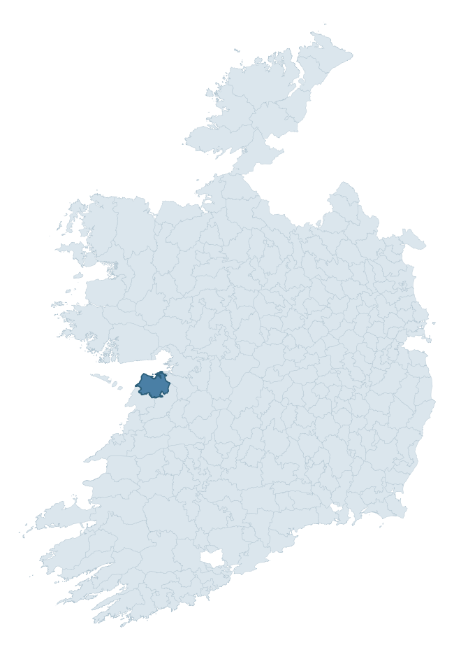
Where this barony sits in the Republic of Ireland
Geology and preservation
Bedrock geology shapes the landscape long before any settlement begins — controlling soil drainage, agricultural potential, the survival of upstanding monuments, and the preservation of buried archaeology. The figures below come from the Geological Survey Ireland 1:100,000 bedrock map.
The bedrock underlying Burren is predominantly limestone (88% of the barony by area), laid down during the Carboniferous period (100% by area, around 359 to 299 million years ago). Limestone is the most heritage-rich bedrock in Ireland. It supports fertile, well-drained soils that favoured dense Early Medieval settlement and Norman manorial agriculture, and it weathers into karst features — sinkholes, caves, swallow holes, and souterrains — that frequently carry archaeology. Where peat overlies limestone, organic preservation can be exceptional.
Rock type composition
Largest mapped unit: Aillwee Member upper (Burren Formation) (15% of the barony)
Placename evidence
Logainm records 46 heritage-diagnostic placenames for Burren, drawn from townland and civil-parish names across the barony. The dominant stratum is pre-Christian and Early Medieval defensive — ráth-, lios-, dún-, and caiseal-prefixed names that mark Iron Age and early historic settlement. The leading diagnostic roots are cill- (17 — church), lios- (12 — ringfort or enclosure), and caiseal- (7 — stone ringfort). This is above the ROI average of 30.7 heritage placenames per barony. The presence of multiple heritage strata side by side indicates layered occupation of the landscape across successive prehistoric and historic periods. Logainm records 224 placenames for Burren (predominantly townland names). Of these, 46 (21%) carry one of the diagnostic Gaelic roots tracked above; the remainder draw on more generic landscape vocabulary that does not encode a heritage period.
Pre-Christian / Early Medieval Defensive
| Root | Count | Meaning |
|---|---|---|
| lios- | 12 | ringfort or enclosure |
| caiseal- | 7 | stone ringfort |
| ráth- | 3 | earthen ringfort |
| cathair- | 3 | stone fort |
| dún- | 2 | hilltop or promontory fort |
Early Christian Ecclesiastical
| Root | Count | Meaning |
|---|---|---|
| cill- | 17 | church (early) |
Burial, Ritual, and Norse-Contact
| Root | Count | Meaning |
|---|---|---|
| carn- | 2 | cairn |
Other baronies in Clare
- Bunratty Upper
- Ibrickan
- Leitrim
- Islands
- Inchiquin
- Corcomroe
- Moyarta
- Upperthird — Waterford
- Duhallow — Cork
- Coonagh — Limerick
See all 280 baronies in the Republic of Ireland Heritage Tool.

Explore further
Grounding History: 10 Maps of Northern Ireland’s Past
If you’re interested in Irish heritage more widely, the companion report for Northern Ireland brings together the analysis of all 462 NI wards into one place through 10 high-quality maps — covering monument density, archaeological periods, placename heritage, terrain, wetland, and the historic landscape at first survey. Take a look.
About this profile
Click any section below to expand.
What is a barony?
A barony is a historic administrative unit in Ireland, broadly equivalent to an English hundred. The 280 baronies used here are from the OSi 2019 National Statutory Boundaries (generalised 20m), covering the 26 counties of the Republic of Ireland. Baronies derive from the Norman period, were formalised in the 17th century, and have not been redrawn for statistical purposes. They vary enormously in area, from compact urban baronies in Dublin to vast upland baronies in Connacht, and should not be compared by raw site count without accounting for area differences.
What counts as a site?
This profile combines three distinct heritage registers, each with its own definition of what constitutes a recordable site:
- Archaeological sites (NMS). The National Monuments Service Sites and Monuments Record (SMR) catalogues every known archaeological monument or site of archaeological interest in the Republic, from prehistoric burial mounds and ringforts to medieval churches and post-medieval defensive works. Inclusion does not require legal protection — only that the site has been identified, surveyed, and assessed as having archaeological value. A separate subset of these sites lies within a recorded protection zone, which gives them statutory protection under the National Monuments Acts.
- Listed buildings (NIAH). The National Inventory of Architectural Heritage records buildings of architectural, historical, archaeological, artistic, cultural, scientific, social, or technical interest. Each surveyed structure is appraised on a five-tier scale: International, National, Regional, Local, and Record-Only. The NIAH appraisal is informational rather than strictly statutory, but it underpins local-authority Record of Protected Structures (RPS) listings.
- Heritage placenames (Logainm). Logainm is the authoritative database of Irish placenames maintained by the Placenames Branch. This profile applies a heritage-diagnostic classifier to the Irish-language form of each townland name, flagging roots that signal defensive sites (ráth-, lios-, dún-, caiseal-, cathair-), ecclesiastical foundations (cill-, teampall-, domhnach-, mainistir-), prehistoric burial-ritual features (tuaim-, carn-, leaba-), or Norse-contact settlement (gall-). Townlands without one of these diagnostic roots are not flagged here — they may still carry historical significance, but that significance is not encoded in the name itself.
Editorial principles
The narrative sections of this profile follow several explicit principles:
- Evidential. Every claim about this barony’s heritage character is anchored in the underlying register data. Where a site count, a placename count, or a percentile rank is cited, it is computed from the source datasets at export time, not estimated.
- Comparative. Counts and metrics are reported alongside their percentile rank against the other 279 ROI baronies. A barony with 50 ringforts in absolute terms could be unusually high or unusually low depending on its size and regional context; percentile ranking removes that ambiguity.
- Transparent on limits. Where a register has known coverage gaps, survey biases, or data-quality issues that affect this barony’s figures, the profile flags them rather than presenting the numbers as definitive.
- No interpretation beyond what the data supports. The narrative does not speculate about historical events, social dynamics, or cultural meaning beyond what the recorded heritage and placename evidence directly attests.
Data caveats and limits
- NMS Sites and Monuments Record is the product of survey campaigns conducted at different intensities across different counties and decades. Some baronies have been surveyed more thoroughly than others, and absolute counts should be read in that light. Sites destroyed by development before survey are typically not represented; sites in heavily forested or upland terrain are sometimes under-recorded.
- NIAH coverage is broadly complete for the Republic of Ireland but the survey was conducted on a rolling county-by-county basis, and the most recent appraisal date varies. Buildings demolished or substantially altered after their original survey may still appear in the register; conversely, recent buildings of merit may not yet have been appraised.
- Logainm classification applies a deliberately conservative pattern-matching approach to the Irish-language townland forms. The classifier prioritises true positives over recall: a townland may carry a heritage signal that the classifier doesn’t recognise, particularly where the diagnostic root has been heavily anglicised or where the townland name draws on a less common term. The 60,000+ townland records and ~9,800 classified placenames give a substantial signal at barony scale, but individual townland names should be checked against Logainm directly for definitive interpretation.
- Period attribution. The chronological distribution reflects only those NMS sites that carry a recognised period attribution in the source data. Sites listed as “Unknown” period are excluded from the dated subset.
- Boundary changes. Some baronies have undergone minor boundary adjustments since their 19th-century definition; the OSi 2019 generalised boundaries used here are the current statutory definition and may differ slightly from historical maps in border areas.
- Bedrock geology is mapped at 1:100,000 scale, which means local variation within a barony — small pockets of different rock type, mineral veins, alluvium overlying bedrock — is generalised. The dominant-system and rocktype figures are area-weighted, so a barony reading “70% Carboniferous limestone” may still contain small but archaeologically important pockets of older or younger rock. Around 3% of GSI polygons do not match the lexicon and contribute no rocktype or system attribution.
Data sources
- National Monuments Service — Sites and Monuments Record (SMR) https://data.gov.ie/dataset/national-monuments-service-archaeological-survey-of-ireland
- National Inventory of Architectural Heritage (NIAH) https://data.gov.ie/dataset/national-inventory-of-architectural-heritage-niah-national-dataset
- Logainm — Placenames Database of Ireland https://www.logainm.ie/
- Ordnance Survey Ireland — National Statutory Barony Boundaries 2019 https://data-osi.opendata.arcgis.com/
- EURODEM — European Digital Elevation Model https://www.mapsforeurope.org/datasets/euro-dem
- ESA WorldCover https://esa-worldcover.org/en
- Geological Survey Ireland — 1:100,000 Bedrock Geology https://www.gsi.ie/en-ie/data-and-maps/Pages/Bedrock.aspx
Explore more: Search any of the 280 ROI baronies, browse by historical province, or read the methodology and data sources for the full Republic of Ireland Heritage Tool.