Moyarta is a barony of County Clare, in the historical province of Munster (Irish: Maigh Fhearta), covering 338 km² of land. The barony records 627 NMS archaeological sites and 54 NIAH listed buildings, placing it at around the 49th percentile among 280 ROI baronies for sites per km². This means it is in the lower half of all baronies for sites per km². Dated archaeological evidence runs from the Neolithic through to the Post Medieval, spanning 7 of 9 archaeological periods, placing the barony in the 35th percentile among 280 ROI baronies for chronological depth. This means it is in the lower half of all baronies for chronological depth. The largest dated subset of recorded sites dates to the Early Medieval. Logainm flags 37 placenames in the barony as carrying a recognised heritage root; the largest share — around 62% — are names associated with early Christian church and monastic foundations.

Heritage at a glance
Percentile rankings throughout this profile compare each barony only against the other 279 Republic of Ireland baronies.
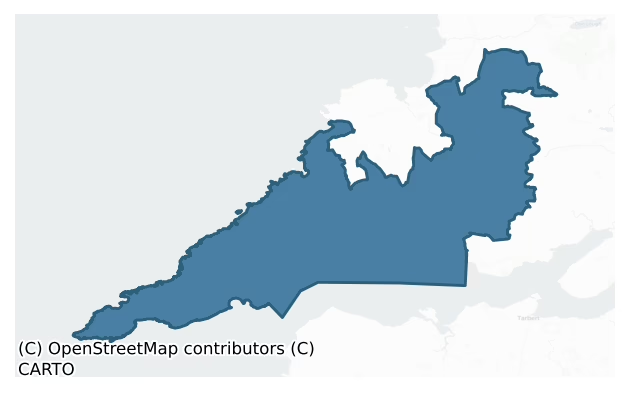
The recorded heritage of Moyarta
The National Monuments Service Sites and Monuments Record (SMR) is the statutory inventory of archaeological sites for the Republic of Ireland, maintained by the Department of Tourism, Culture, Arts, Gaeltacht, Sport and Media. Sites recorded here include earthworks, ringforts, megalithic tombs, ecclesiastical remains, and post-medieval features; not every record is legally protected, but each is registered as a monument of archaeological interest.
The National Monuments Service records 627 archaeological sites in Moyarta, putting it at the 49th percentile among 280 ROI baronies for sites per km². This means it is in the lower half of all baronies for sites per km². Protection coverage is near-universal — 608 sites (97%) fall within a recorded monument protection zone, indicating an extensively surveyed landscape. The dominant category is defensive sites — ringforts, enclosures, hillforts, and stone forts (440 sites, 70% of the record). Ringfort – rath is the most prevalent type, making up 58% of the barony's recorded sites (361 records) — well above the ROI average of 20% across all baronies where this type occurs. Ringfort – rath is an earthen ringfort enclosed by a bank and external ditch — the most common Early Medieval farmstead, broadly dated 500–1000 AD. Other significant types include Enclosure (39) and Church (26). Enclosure is a banked or ditched feature of uncertain type, used as a catch-all where the original function cannot be determined from surface evidence; Church is a building used for public Christian worship, of any date from c. 500 AD onwards. Across the barony's 338 km², this gives a recorded density of 1.86 sites per km².
Most common monument types
Hover or tap a monument type to see its definition.
| Type | Count |
|---|---|
| Ringfort – rath an earthen ringfort enclosed by a bank and external ditch — the most common Early Medieval farmstead, broadly dated 500–1000 AD | 361 |
| Enclosure a banked or ditched feature of uncertain type, used as a catch-all where the original function cannot be determined from surface evidence | 39 |
| Church a building used for public Christian worship, of any date from c. 500 AD onwards | 26 |
| Earthwork an unclassified earthen structure with no diagnostic features that allow a more specific classification | 24 |
| Ritual site – holy well a well or spring traditionally associated with a saint, often credited with healing properties; many trace earlier ritual origins but devotion is documented from the medieval period onwards | 23 |
| Graveyard a burial area associated with a church, in use from the medieval period onwards | 16 |
| Hut site a low stone or earthen foundation enclosing a small circular or oval area, generally interpreted as a former dwelling, of any date from prehistory to the medieval period | 14 |
Chronological distribution
The dated archaeological record for Moyarta spans from the Neolithic through to the Post Medieval, with activity attested across 7 of 9 archaeological periods. Every period from earliest to latest is represented in the record — an unbroken sequence of dated activity across the full chronological span. Activity concentrates most heavily in the Early Medieval (399 sites, 79% of dated material), with the Iron Age forming a secondary peak (63 sites, 13%). A further 124 recorded sites (20% of the overall NMS register for the barony) carry no period attribution — appearing as 'Unknown' in the bar chart below. This typically reflects either records that pre-date the standardised period vocabulary or sites awaiting specialist dating review, rather than a genuine absence of chronological evidence.
Sample of recorded monuments
Show 25 sample monuments (of 627 total)
A representative sample of 25 recorded monuments drawn from the barony’s 627 total NMS entries. Sites within a recorded monument protection zone and rarer site types are prioritised so the list shows a meaningful cross-section rather than only the most common type. Each entry shows the official Sites and Monuments Record reference number and the description published by the National Monuments Service.
Fish-pond
The Archaeological Survey of Ireland (ASI) is in the process of providing information on all monuments on The Historic Environment Viewer (HEV). Currently the information for this record has not been uploaded. To…
The Archaeological Survey of Ireland (ASI) is in the process of providing information on all monuments on The Historic Environment Viewer (HEV). Currently the information for this record has not been uploaded. To access available information for research purposes please make an appointment in advance with the Archive Unit (open Fridays 10.00 am – 5.00 pm), Department of Culture, Heritage and the Gaeltacht, The Custom House, Dublin 1 D01W6XO or email nmarchive@chg.gov.ie.
Megalithic structure
The Archaeological Survey of Ireland (ASI) is in the process of providing information on all monuments on The Historic Environment Viewer (HEV). Currently the information for this record has not been uploaded. To…
The Archaeological Survey of Ireland (ASI) is in the process of providing information on all monuments on The Historic Environment Viewer (HEV). Currently the information for this record has not been uploaded. To access available information for research purposes please make an appointment in advance with the Archive Unit (open Fridays 10.00 am – 5.00 pm), Department of Culture, Heritage and the Gaeltacht, The Custom House, Dublin 1 D01W6XO or email nmarchive@chg.gov.ie.
Crannog
The Archaeological Survey of Ireland (ASI) is in the process of providing information on all monuments on The Historic Environment Viewer (HEV). Currently the information for this record has not been uploaded. To…
The Archaeological Survey of Ireland (ASI) is in the process of providing information on all monuments on The Historic Environment Viewer (HEV). Currently the information for this record has not been uploaded. To access available information for research purposes please make an appointment in advance with the Archive Unit (open Fridays 10.00 am – 5.00 pm), Department of Culture, Heritage and the Gaeltacht, The Custom House, Dublin 1 D01W6XO or email nmarchive@chg.gov.ie.
Religious house – unclassified
The Archaeological Survey of Ireland (ASI) is in the process of providing information on all monuments on The Historic Environment Viewer (HEV). Currently the information for this record has not been uploaded. To…
The Archaeological Survey of Ireland (ASI) is in the process of providing information on all monuments on The Historic Environment Viewer (HEV). Currently the information for this record has not been uploaded. To access available information for research purposes please make an appointment in advance with the Archive Unit (open Fridays 10.00 am – 5.00 pm), Department of Culture, Heritage and the Gaeltacht, The Custom House, Dublin 1 D01W6XO or email nmarchive@chg.gov.ie.
Gateway
At the S end of the W wall of a walled area surrounding Carrigaholt tower house (CL065-100001-). Two limestone pillars (H just over 4m; 1.85m x 1.15m; 3.05m apart) covered over with a course of red brick (T 0.13m). On…
At the S end of the W wall of a walled area surrounding Carrigaholt tower house (CL065-100001-). Two limestone pillars (H just over 4m; 1.85m x 1.15m; 3.05m apart) covered over with a course of red brick (T 0.13m). On the more northerly pillar some of this brick has been broken away exposing the original roughly dressed neat regular limestone. A later estate wall has broken into the W side of the more southerly pillar. There are some iron hinge loops set into each of the pillars on the inside. A circular 18-19th century turret is located at the NE corner of the walled area on the line of the original bawn wall.
Compiled by: Mary Tunney
Date of upload: 5 November 2018
Barrow – mound barrow
The Archaeological Survey of Ireland (ASI) is in the process of providing information on all monuments on The Historic Environment Viewer (HEV). Currently the information for this record has not been uploaded. To…
The Archaeological Survey of Ireland (ASI) is in the process of providing information on all monuments on The Historic Environment Viewer (HEV). Currently the information for this record has not been uploaded. To access available information for research purposes please make an appointment in advance with the Archive Unit (open Fridays 10.00 am – 5.00 pm), Department of Culture, Heritage and the Gaeltacht, The Custom House, Dublin 1 D01W6XO or email nmarchive@chg.gov.ie.
House – 17th century
Recorded by Thomas Dineley in 1681 as a ‘neat box belonging to Mr Abraham Vanhogarden, who built it.’ (Shirley et al. 1864-7, 188). In 1620, it was ‘included in the Earl of Thomond's patent. Isaack Vanhogarden was…
Recorded by Thomas Dineley in 1681 as a ‘neat box belonging to Mr Abraham Vanhogarden, who built it.’ (Shirley et al. 1864-7, 188). In 1620, it was ‘included in the Earl of Thomond's patent. Isaack Vanhogarden was placed here at the Cromwellian Settlement, but at the Restoration, the Earl of Thomond leased the lands to John Wright and Humphrey Rogers for ninety-nine years, with the condition that they should build a stone house with chimneys, one and a-half stories high, 40 ft. by 18 ft., floored with boards, and covered with slate or shingles. The improvements made by this tenant are stated to have cost £600.’ (ibid. 189, n. 17) The existing Querrin House dates from the 18th century though it is possible that it may incorporate fabric from the earlier house.
Compiled by: Paul Walsh
Date of upload: 3 June 2014
Round tower
Situated within the monastic site on the E portion of Scattery Island c. 20m W of the cathedral (CL067-024008-). The tower (H 26m; diam. at base 5.08m) is complete except for the very top of the cap but is closed over…
Situated within the monastic site on the E portion of Scattery Island c. 20m W of the cathedral (CL067-024008-). The tower (H 26m; diam. at base 5.08m) is complete except for the very top of the cap but is closed over internally. There are no floors or ladders remaining and entry through the ground-floor doorway (Wth 0.66m at base narrowing to 0.61m at the top; H 1.8m) gives a clear view to the top. There appear to have been six floors originally with slight offsets at each. The ground-floor doorway is only paralleled at Castledermot, Co. Kildare (KD040-002002-). The door head is formed by corbelling in three stones on either side with the gap between them closed by a short lintel. It faces ESE towards the door of the cathedral. The windows are all small and square-headed facing in ascending order to N, S, SE, WNW and N with four slightly larger at the top facing N, S, E and W. The walls (Wth 1.34m at base) are constructed of roughly coursed sandstone masonry generally comprising small stones but occasional larger rectangular stones are interspersed. A large crack virtually from cap to base was recorded in 19th-century photographs and was later repaired. The tower has a suggested date of the 10th to the 11th century. (Westropp 1897, 282-4; Barrow 1979, 64-6; Lalor 1999, 117-18) This is a national monument in state care, no. 10.
The following images have been uploaded:
CL067-024005-_01.jpg View of round tower from NNE.
CL067-024005-_01.jpg View from NNE showing the r…
Burial
Listed as 'Potential site – name' in the SMR (1992) and the RMP (1996) and named 'Lady's Grave' on the OS 1st ed. map (1841), this clearly owes its origin to the account by John O’Donovan who writing in 1839 of the…
Listed as 'Potential site – name' in the SMR (1992) and the RMP (1996) and named 'Lady's Grave' on the OS 1st ed. map (1841), this clearly owes its origin to the account by John O’Donovan who writing in 1839 of the ecclesiastical remains recorded that ‘On the west side of Rinn Eanaigh Point there is a flag said to cover the body of the lady who desired to obtain entrance to the island for sepulture, but who was repulsed by St. Senan.’ (O'Flanagan, vol. ii, 14). The source of this legend is to be found in a metrical life of St. Senan which records the repulse of the holy nun Cannara (Westropp 1897, 276, n. 4; 278). The story also has appealed to later generations and found its way into Thomas Moore’s, Irish Melodies (Vol. 2) as ‘Oh haste and leave this sacred isle’: a more fanciful version is recorded by Lynch (2005, 121). It has not proved possible to inspect this 'flag' and confirm the existence of a monument at this location.
Revised by: Mary Tunney
Date of revision: 19 September 2016
This monument is subject to a preservation order made under the National Monuments Acts 1930 to 2014 (PO no. 1/1971).
Fortification
The Archaeological Survey of Ireland (ASI) is in the process of providing information on all monuments on The Historic Environment Viewer (HEV). Currently the information for this record has not been uploaded. To…
The Archaeological Survey of Ireland (ASI) is in the process of providing information on all monuments on The Historic Environment Viewer (HEV). Currently the information for this record has not been uploaded. To access available information for research purposes please make an appointment in advance with the Archive Unit (open Fridays 10.00 am – 5.00 pm), Department of Culture, Heritage and the Gaeltacht, The Custom House, Dublin 1 D01W6XO or email nmarchive@chg.gov.ie.
Lighthouse
This record is for the first lighthouse on Loop Head which was of stone-vaulted cottage type built about 1670. These cottages accommodated the light keeper and his family in two or three rooms and had an internal stone…
This record is for the first lighthouse on Loop Head which was of stone-vaulted cottage type built about 1670. These cottages accommodated the light keeper and his family in two or three rooms and had an internal stone stairway between two of the rooms leading up to a platform on the roof where a coal burning brazier or chauffer was positioned. Part of the old cottage with its battered outside wall can still be seen near the light-keepers dwellings. The lighthouse fell into disuse in the latter part of the seventeenth century and was re-established in 1720. (Robinson 1988, 55-7)
Compiled by: Mary Tunney
Date of upload: 8 August 2016
Ring-ditch
The Archaeological Survey of Ireland (ASI) is in the process of providing information on all monuments on The Historic Environment Viewer (HEV). Currently the information for this record has not been uploaded. To…
The Archaeological Survey of Ireland (ASI) is in the process of providing information on all monuments on The Historic Environment Viewer (HEV). Currently the information for this record has not been uploaded. To access available information for research purposes please make an appointment in advance with the Archive Unit (open Fridays 10.00 am – 5.00 pm), Department of Culture, Heritage and the Gaeltacht, The Custom House, Dublin 1 D01W6XO or email nmarchive@chg.gov.ie.
Clochan
The Archaeological Survey of Ireland (ASI) is in the process of providing information on all monuments on The Historic Environment Viewer (HEV). Currently the information for this record has not been uploaded. To…
The Archaeological Survey of Ireland (ASI) is in the process of providing information on all monuments on The Historic Environment Viewer (HEV). Currently the information for this record has not been uploaded. To access available information for research purposes please make an appointment in advance with the Archive Unit (open Fridays 10.00 am – 5.00 pm), Department of Culture, Heritage and the Gaeltacht, The Custom House, Dublin 1 D01W6XO or email nmarchive@chg.gov.ie.
Field system
The Archaeological Survey of Ireland (ASI) is in the process of providing information on all monuments on The Historic Environment Viewer (HEV). Currently the information for this record has not been uploaded. To…
The Archaeological Survey of Ireland (ASI) is in the process of providing information on all monuments on The Historic Environment Viewer (HEV). Currently the information for this record has not been uploaded. To access available information for research purposes please make an appointment in advance with the Archive Unit (open Fridays 10.00 am – 5.00 pm), Department of Culture, Heritage and the Gaeltacht, The Custom House, Dublin 1 D01W6XO or email nmarchive@chg.gov.ie.
Ogham stone
This ogham stone was formerly set against the exterior of the west wall of a church-like building known as St Senan’s Bed (CL067-024002-) where it is used as the seat of a bench-like structure. The ogham stone is…
This ogham stone was formerly set against the exterior of the west wall of a church-like building known as St Senan’s Bed (CL067-024002-) where it is used as the seat of a bench-like structure. The ogham stone is currently on display inside the refurbished exhibition centre on Scattery Island. It was described by Okasha and Forsyth (2001, 12) as ‘a large block of gritstone with 'ogham-like scores' (Westropp 1897, 285). This stone was not included by Macalister in his corpus (Macalister 1945, 1949). Close examination suggests that it is indeed a much-battered ogham stone. The stone is about 200 cm long, 60 cm wide and 14 cm thick with the inscription cut along the upper outer edge. Faint traces of individual strokes are discernible at various points but the best preserved section is towards the left end where the remains of five neatly parallel strokes of equal length, 6 cm long and 2 cm apart, are visible on the upper surface. These form an ogham letter N. Further to the left, following a gap, are the remains of four similar strokes on the upper surface, an S or part of an N.
This stone has been studied as part of the ‘Ogham in 3D’ project undertaken by the School of Celtic Studies, Dublin Institute for Advanced Studies. To access details go to the following website: http://ogham.celt.dias.ie/search.php?ciic=Scattery. This is a national monument in state care, no. 10.
Compiled by: Nora White
Revised date of upload: 8 November 2017
This monument is subject to a…
Burnt mound
Situated between the round tower (CL067-024005-) and St Senan's well (CL067-024007-). Discovered during an assessment in 2001 in advance of conservation works to facilitate visitors to the island. A low mound is evident…
Situated between the round tower (CL067-024005-) and St Senan's well (CL067-024007-). Discovered during an assessment in 2001 in advance of conservation works to facilitate visitors to the island. A low mound is evident (3.1m N-S; 2.9m E-W; max. H 0.2-0.3m). Rabbit burrowing revealed burnt and fire-cracked fragments of shattered sandstone in a rich organic silty clay. A couple of pieces of burnt clay and a piece of iron slag were also recovered. (Halpin 2002, 10; Dunne 2003, 23-4) This is a national monument in state care, no. 10.
Compiled by: Mary Tunney
Date of upload: 19 September 2016
This monument is subject to a preservation order made under the National Monuments Acts 1930 to 2014 (PO no. 1/1971).
Cross
The Archaeological Survey of Ireland (ASI) is in the process of providing information on all monuments on The Historic Environment Viewer (HEV). Currently the information for this record has not been uploaded. To…
The Archaeological Survey of Ireland (ASI) is in the process of providing information on all monuments on The Historic Environment Viewer (HEV). Currently the information for this record has not been uploaded. To access available information for research purposes please make an appointment in advance with the Archive Unit (open Fridays 10.00 am – 5.00 pm), Department of Culture, Heritage and the Gaeltacht, The Custom House, Dublin 1 D01W6XO or email nmarchive@chg.gov.ie.
Burnt spread
Identified in section, in a low cliff face on the SE foreshore of Scattery Island during an assessment in 2001 in advance of conservation works to facilitate visitors to the island. A layer of angular, heat-shattered…
Identified in section, in a low cliff face on the SE foreshore of Scattery Island during an assessment in 2001 in advance of conservation works to facilitate visitors to the island. A layer of angular, heat-shattered stone (D 0.12m; stones av. 0.06m x 0.04m) was evident overlying a possible linear trackway extending NW-SE (Wth 3.85m; D 0.3m). The linear extent of the feature is unknown as it extended into the cliff face. The stone may have been obtained from a nearby fulacht fia and reused as metalling over a peat layer in order to solidify the soft ground. (Dunne and Ryan 2001, 10-11) This is a national monument in state care, no. 10.
Compiled by: Mary Tunney
Date of upload: 19 September 2016
This monument is subject to a preservation order made under the National Monuments Acts 1930 to 2014 (PO no. 1/1971).
Slipway
Situated to the E of a ruined vernacular house on the E foreshore of Scattery Island. The slipway extends eastwards into the intertidal zone and can be traced for c. 55m. It is not consistently visible above the surface…
Situated to the E of a ruined vernacular house on the E foreshore of Scattery Island. The slipway extends eastwards into the intertidal zone and can be traced for c. 55m. It is not consistently visible above the surface of the pebble beach. It is most likely contemporaneous with the mid 19th-century house that it leads to. Two other slipways are indicated and named on the OS 6-inch map (1923) at 40m and 114m further N. (Dunne and Ryan 2001, 12) The whole of Scattery Island became subject to a Preservation Order in 1971 (no. 1/71).
Compiled by: Mary Tunney
Date of upload: 20 September 2016
This monument is subject to a preservation order made under the National Monuments Acts 1930 to 2014 (PO no. 1/1971).
Sea wall
Situated to the E of a ruined 19th-century house on the E foreshore of Scattery Island. A mostly collapsed and eroded sea wall (Wth 0.5-4m) aligned NW-SE and broken completely in places. Although built in several…
Situated to the E of a ruined 19th-century house on the E foreshore of Scattery Island. A mostly collapsed and eroded sea wall (Wth 0.5-4m) aligned NW-SE and broken completely in places. Although built in several phases, it was originally substantial and its stones differ in size and shape to the beach stones. It respects the steps to the front of the house and is likely to be contemporary. (Dunne and Ryan 2001, 13-14)
Compiled by: Mary Tunney
Date of upload: 20 September 2016
This monument is subject to a preservation order made under the National Monuments Acts 1930 to 2014 (PO no. 1/1971).
Habitation site
Excavations (Licence no. 01E0662) undertaken in 2001 to assess the impact of providing visitor facilities on Scattery Island revealed widespread remains of clay floors, metalled surfaces and scorching suggesting a large…
Excavations (Licence no. 01E0662) undertaken in 2001 to assess the impact of providing visitor facilities on Scattery Island revealed widespread remains of clay floors, metalled surfaces and scorching suggesting a large settlement close to the shore in the early or high medieval period (Pollock 2003, 24-5, no. 96). Material seen under the cottages suggests buildings may have strung themselves out along a shingle spit above the shore, as the 19th-century cottages did subsequently (Pollock 2008, 9).
Compiled by: Mary Tunney
Date of upload: 20 September 2016
This monument is subject to a preservation order made under the National Monuments Acts 1930 to 2014 (PO no. 1/1971).
Font
This record is for the original location of a carved 15th-century grey marble font. For present location and description see CL033-172—-.
Compiled by: Mary Tunney
Date of upload: 19 August 2014
Bawn
On a rocky headland on the N bank of the Shannon Estuary with extensive views over the Shannon and Carrigaholt Bay. Described (Ua Cróinín and Breen 1997) as a small bawn (25m N-S; 16m E-W) on top of a low cliff (H 5m)…
On a rocky headland on the N bank of the Shannon Estuary with extensive views over the Shannon and Carrigaholt Bay. Described (Ua Cróinín and Breen 1997) as a small bawn (25m N-S; 16m E-W) on top of a low cliff (H 5m) containing a round turret at NE. The one-storey turret is of cut stone (probably 18th-19th century) with crenellations and has a cracked flagstone as a ceiling. It has four narrow loops using 15th century jambs. A larger walled area (30m N-S; 90m E-W) contained a number of buildings (shown on the OS 25-inch map) to the N and W of the tower house (attached to the tower house at N) and incorporates the earlier bawn. The walls at N (H 3-3.5m) are of roughly dressed limestone, some recently built up while at E the wall has been strengthened to withstand sea erosion. The S wall is less well preserved (H 0.8-1.4m) and is of roughly dressed stone mixed with brick. This walled area is accessed through a gateway (CL065-100002-) at SW.
Compiled by: Mary Tunney
Date of upload: 5 November 2018
Kiln
On the W side of Scattery Island on a high eroding cliff, with views to the W over the Shannon estuary. A large pit (L c. 2m; D 0.6m) with intense in situ burning on its base (noted in the field on 17 August 2022 by AMS…
On the W side of Scattery Island on a high eroding cliff, with views to the W over the Shannon estuary. A large pit (L c. 2m; D 0.6m) with intense in situ burning on its base (noted in the field on 17 August 2022 by AMS staff and reported to the National Monuments Service by Ros Ó Maoldúin). Despite the intense burning, there was relatively little charcoal, suggesting much of the heat had transferred from another location, likely along a flue. It is most likely a corn or other type of drying kiln.
The following images have been uploaded:
CL067-024027-_01.jpg View of pit/hearth in cliff-face from SW
CL067-024027-_02.jpg Closer view
CL067-024027-_03.jpg View showing context
Compiled by: Mary Tunney and Ros Ó Maoldúin
Date of upload: 29 August 2022
Ringfort – rath
The Archaeological Survey of Ireland (ASI) is in the process of providing information on all monuments on The Historic Environment Viewer (HEV). Currently the information for this record has not been uploaded. To…
The Archaeological Survey of Ireland (ASI) is in the process of providing information on all monuments on The Historic Environment Viewer (HEV). Currently the information for this record has not been uploaded. To access available information for research purposes please make an appointment in advance with the Archive Unit (open Fridays 10.00 am – 5.00 pm), Department of Culture, Heritage and the Gaeltacht, The Custom House, Dublin 1 D01W6XO or email nmarchive@chg.gov.ie.
Listed buildings
The National Inventory of Architectural Heritage (NIAH) is a state survey appraising buildings of architectural, historical, archaeological, artistic, cultural, scientific, social, or technical interest. Each surveyed structure receives a rating from International (the highest, for buildings of European importance) through National, Regional, Local, and Record-Only.
The NIAH records 54 listed buildings in Moyarta (26th percentile across ROI baronies). The highest-graded structures include 2 of National significance. The Republic holds 937 National-graded buildings in total, so this barony accounts for around 0% of the national total. Construction dates concentrate most heavily in the Victorian (1830-1900) period. The most-recorded building type is house (17 examples, 31% of the listed stock).
Terrain and environment
Mean elevation across the barony is 26m — the 3rd percentile among 280 ROI baronies for elevation. This means it is in the bottom tenth of all baronies for elevation. This is a relatively low-lying landscape by ROI standards. Elevation matters for heritage because higher-altitude baronies typically favour defensive monuments — ringforts and hilltop forts placed on prominent ground — while lowland baronies are more likely to carry the dense settlement and church networks of intensive agricultural landscapes. A maximum elevation of 134m gives the barony meaningful vertical relief. Mean slope is 2.2° — the 14th percentile among 280 ROI baronies for slope. This means it is in the bottom fifth of all baronies for slope. This is broadly flat terrain, the kind of landscape best suited to intensive agriculture. Slope is a key control on both land use and archaeological preservation: steep ground resists ploughing and tends to preserve earthworks intact, while gentle slopes favour intensive cultivation that damages or destroys surface archaeology over time. The Topographic Wetness Index averages 11.9, the 95th percentile among 280 ROI baronies for wetness. This means it is in the top tenth of all baronies for wetness. This is wet, slow-draining ground by ROI standards — the kind of landscape that may carry waterlogged archaeological sites of unusual preservation value. Drainage matters for heritage because poorly-drained ground preserves organic archaeology (wooden trackways, leather, textiles, and on rare occasions human remains) far better than free-draining soil; well-drained ground favours arable use but destroys organic material rapidly. The land-cover mosaic combines improved grassland (73%), open water (17%), and woodland (8%), giving a mixed agricultural and semi-natural landscape. In overall character, this is low-lying, gently-sloping terrain — characteristic of Ireland's central plain and coastal lowlands, with land use dominated by improved grassland.
Terrain measurements
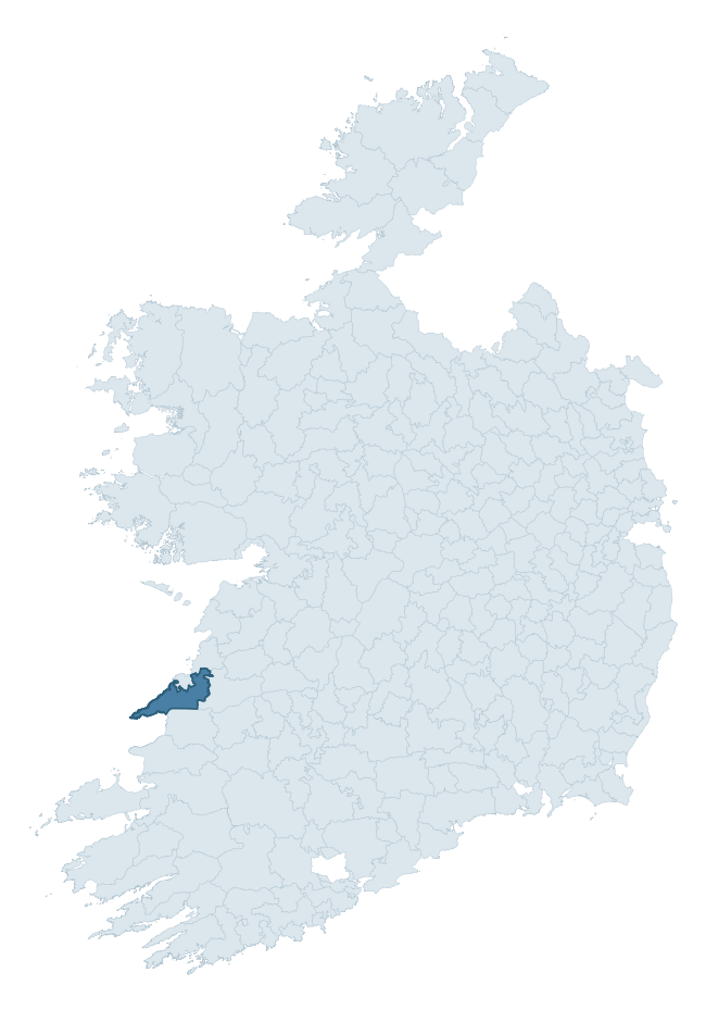
Where this barony sits in the Republic of Ireland
Geology and preservation
Bedrock geology shapes the landscape long before any settlement begins — controlling soil drainage, agricultural potential, the survival of upstanding monuments, and the preservation of buried archaeology. The figures below come from the Geological Survey Ireland 1:100,000 bedrock map.
The bedrock underlying Moyarta is predominantly siltstone (56% of the barony by area), laid down during the Carboniferous period (100% by area, around 359 to 299 million years ago). Siltstone weathers to fertile, moderately heavy soils that supported Early Medieval ringfort agriculture, often interbedded with mudstone in lowland landscapes. A substantial secondary geology of mudstone, siltstone, sandstone (37%) adds further variety to the underlying landscape. The single largest mapped unit is the Gull Island Formation (56% of the barony's bedrock).
Rock type composition
Largest mapped unit: Gull Island Formation (56% of the barony)
Placename evidence
Logainm records 37 heritage-diagnostic placenames for Moyarta, drawn from townland and civil-parish names across the barony. The dominant stratum is Early Christian ecclesiastical — cill-, teampall-, and domhnach-prefixed names that record the dense network of early church foundations established between the fifth and tenth centuries. The leading diagnostic roots are cill- (21 — church), lios- (5 — ringfort or enclosure), and dún- (3 — hilltop fort or promontory fort). This is broadly in line with the ROI average of 30.7 heritage placenames per barony. The presence of multiple heritage strata side by side indicates layered occupation of the landscape across successive prehistoric and historic periods. Logainm records 158 placenames for Moyarta (predominantly townland names). Of these, 37 (23%) carry one of the diagnostic Gaelic roots tracked above; the remainder draw on more generic landscape vocabulary that does not encode a heritage period.
Pre-Christian / Early Medieval Defensive
| Root | Count | Meaning |
|---|---|---|
| lios- | 5 | ringfort or enclosure |
| dún- | 3 | hilltop or promontory fort |
| ráth- | 2 | earthen ringfort |
| cathair- | 2 | stone fort |
| caiseal- | 1 | stone ringfort |
Early Christian Ecclesiastical
| Root | Count | Meaning |
|---|---|---|
| cill- | 21 | church (early) |
| cillín- | 1 | unconsecrated burial ground |
| bile- | 1 | sacred tree / boundary marker |
Burial, Ritual, and Norse-Contact
| Root | Count | Meaning |
|---|---|---|
| carn- | 1 | cairn |
Other baronies in Clare
- Inchiquin
- Burren
- Corcomroe
- Tulla Upper
- Tulla Lower
- Islands
- Bunratty Lower
- Owneybeg — Limerick
- Imokilly — Cork
- Orrery And Kilmore — Cork
See all 280 baronies in the Republic of Ireland Heritage Tool.

Explore further
Grounding History: 10 Maps of Northern Ireland’s Past
If you’re interested in Irish heritage more widely, the companion report for Northern Ireland brings together the analysis of all 462 NI wards into one place through 10 high-quality maps — covering monument density, archaeological periods, placename heritage, terrain, wetland, and the historic landscape at first survey. Take a look.
About this profile
Click any section below to expand.
What is a barony?
A barony is a historic administrative unit in Ireland, broadly equivalent to an English hundred. The 280 baronies used here are from the OSi 2019 National Statutory Boundaries (generalised 20m), covering the 26 counties of the Republic of Ireland. Baronies derive from the Norman period, were formalised in the 17th century, and have not been redrawn for statistical purposes. They vary enormously in area, from compact urban baronies in Dublin to vast upland baronies in Connacht, and should not be compared by raw site count without accounting for area differences.
What counts as a site?
This profile combines three distinct heritage registers, each with its own definition of what constitutes a recordable site:
- Archaeological sites (NMS). The National Monuments Service Sites and Monuments Record (SMR) catalogues every known archaeological monument or site of archaeological interest in the Republic, from prehistoric burial mounds and ringforts to medieval churches and post-medieval defensive works. Inclusion does not require legal protection — only that the site has been identified, surveyed, and assessed as having archaeological value. A separate subset of these sites lies within a recorded protection zone, which gives them statutory protection under the National Monuments Acts.
- Listed buildings (NIAH). The National Inventory of Architectural Heritage records buildings of architectural, historical, archaeological, artistic, cultural, scientific, social, or technical interest. Each surveyed structure is appraised on a five-tier scale: International, National, Regional, Local, and Record-Only. The NIAH appraisal is informational rather than strictly statutory, but it underpins local-authority Record of Protected Structures (RPS) listings.
- Heritage placenames (Logainm). Logainm is the authoritative database of Irish placenames maintained by the Placenames Branch. This profile applies a heritage-diagnostic classifier to the Irish-language form of each townland name, flagging roots that signal defensive sites (ráth-, lios-, dún-, caiseal-, cathair-), ecclesiastical foundations (cill-, teampall-, domhnach-, mainistir-), prehistoric burial-ritual features (tuaim-, carn-, leaba-), or Norse-contact settlement (gall-). Townlands without one of these diagnostic roots are not flagged here — they may still carry historical significance, but that significance is not encoded in the name itself.
Editorial principles
The narrative sections of this profile follow several explicit principles:
- Evidential. Every claim about this barony’s heritage character is anchored in the underlying register data. Where a site count, a placename count, or a percentile rank is cited, it is computed from the source datasets at export time, not estimated.
- Comparative. Counts and metrics are reported alongside their percentile rank against the other 279 ROI baronies. A barony with 50 ringforts in absolute terms could be unusually high or unusually low depending on its size and regional context; percentile ranking removes that ambiguity.
- Transparent on limits. Where a register has known coverage gaps, survey biases, or data-quality issues that affect this barony’s figures, the profile flags them rather than presenting the numbers as definitive.
- No interpretation beyond what the data supports. The narrative does not speculate about historical events, social dynamics, or cultural meaning beyond what the recorded heritage and placename evidence directly attests.
Data caveats and limits
- NMS Sites and Monuments Record is the product of survey campaigns conducted at different intensities across different counties and decades. Some baronies have been surveyed more thoroughly than others, and absolute counts should be read in that light. Sites destroyed by development before survey are typically not represented; sites in heavily forested or upland terrain are sometimes under-recorded.
- NIAH coverage is broadly complete for the Republic of Ireland but the survey was conducted on a rolling county-by-county basis, and the most recent appraisal date varies. Buildings demolished or substantially altered after their original survey may still appear in the register; conversely, recent buildings of merit may not yet have been appraised.
- Logainm classification applies a deliberately conservative pattern-matching approach to the Irish-language townland forms. The classifier prioritises true positives over recall: a townland may carry a heritage signal that the classifier doesn’t recognise, particularly where the diagnostic root has been heavily anglicised or where the townland name draws on a less common term. The 60,000+ townland records and ~9,800 classified placenames give a substantial signal at barony scale, but individual townland names should be checked against Logainm directly for definitive interpretation.
- Period attribution. The chronological distribution reflects only those NMS sites that carry a recognised period attribution in the source data. Sites listed as “Unknown” period are excluded from the dated subset.
- Boundary changes. Some baronies have undergone minor boundary adjustments since their 19th-century definition; the OSi 2019 generalised boundaries used here are the current statutory definition and may differ slightly from historical maps in border areas.
- Bedrock geology is mapped at 1:100,000 scale, which means local variation within a barony — small pockets of different rock type, mineral veins, alluvium overlying bedrock — is generalised. The dominant-system and rocktype figures are area-weighted, so a barony reading “70% Carboniferous limestone” may still contain small but archaeologically important pockets of older or younger rock. Around 3% of GSI polygons do not match the lexicon and contribute no rocktype or system attribution.
Data sources
- National Monuments Service — Sites and Monuments Record (SMR) https://data.gov.ie/dataset/national-monuments-service-archaeological-survey-of-ireland
- National Inventory of Architectural Heritage (NIAH) https://data.gov.ie/dataset/national-inventory-of-architectural-heritage-niah-national-dataset
- Logainm — Placenames Database of Ireland https://www.logainm.ie/
- Ordnance Survey Ireland — National Statutory Barony Boundaries 2019 https://data-osi.opendata.arcgis.com/
- EURODEM — European Digital Elevation Model https://www.mapsforeurope.org/datasets/euro-dem
- ESA WorldCover https://esa-worldcover.org/en
- Geological Survey Ireland — 1:100,000 Bedrock Geology https://www.gsi.ie/en-ie/data-and-maps/Pages/Bedrock.aspx
Explore more: Search any of the 280 ROI baronies, browse by historical province, or read the methodology and data sources for the full Republic of Ireland Heritage Tool.