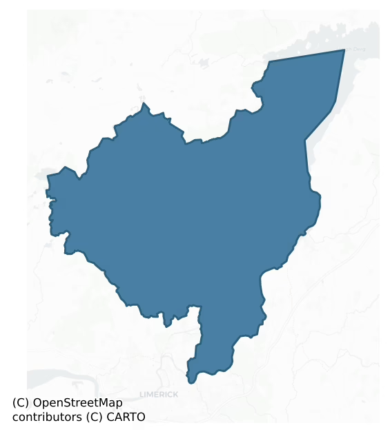
Tulla Lower is a barony of County Clare, in the historical province of Munster (Irish: An Tulach Íochtarach), covering 317 km² of land. The barony records 424 NMS archaeological sites and 30 NIAH listed buildings, placing it at around the 25th percentile among 280 ROI baronies for sites per km². This means it is in the bottom third of all baronies for sites per km². Dated archaeological evidence runs from the Neolithic through to the Modern, spanning 8 of 9 archaeological periods, placing the barony in the 47th percentile among 280 ROI baronies for chronological depth. This means it is in the lower half of all baronies for chronological depth. The largest dated subset of recorded sites dates to the Iron Age. Logainm flags 41 placenames in the barony as carrying a recognised heritage root; the largest share — around 73% — are names associated with early Christian church and monastic foundations.

Heritage at a glance
Percentile rankings throughout this profile compare each barony only against the other 279 Republic of Ireland baronies.
The recorded heritage of Tulla Lower
The National Monuments Service Sites and Monuments Record (SMR) is the statutory inventory of archaeological sites for the Republic of Ireland, maintained by the Department of Tourism, Culture, Arts, Gaeltacht, Sport and Media. Sites recorded here include earthworks, ringforts, megalithic tombs, ecclesiastical remains, and post-medieval features; not every record is legally protected, but each is registered as a monument of archaeological interest.
The National Monuments Service records 424 archaeological sites in Tulla Lower, putting it at the 25th percentile among 280 ROI baronies for sites per km². This means it is in the bottom third of all baronies for sites per km². Protection coverage is near-universal — 417 sites (98%) fall within a recorded monument protection zone, indicating an extensively surveyed landscape. The dominant category is defensive sites — ringforts, enclosures, hillforts, and stone forts (249 sites, 59% of the record). The most diagnostically specific type is Ringfort – rath (21 records, 5% of the barony's NMS total) — compared to an ROI average of 20% across all baronies where this type occurs. Ringfort – rath is an earthen ringfort enclosed by a bank and external ditch — the most common Early Medieval farmstead, broadly dated 500–1000 AD. The broader 'Enclosure' classification — which catches unclassified ringforts and field enclosures — accounts for a further 176 records (42%) and reflects the difficulty of sub-classifying degraded earthworks from surface evidence alone. Across the barony's 317 km², this gives a recorded density of 1.34 sites per km².
Most common monument types
Hover or tap a monument type to see its definition.
| Type | Count |
|---|---|
| Enclosure a banked or ditched feature of uncertain type, used as a catch-all where the original function cannot be determined from surface evidence | 176 |
| Ringfort – rath an earthen ringfort enclosed by a bank and external ditch — the most common Early Medieval farmstead, broadly dated 500–1000 AD | 21 |
| Ritual site – holy well a well or spring traditionally associated with a saint, often credited with healing properties; many trace earlier ritual origins but devotion is documented from the medieval period onwards | 18 |
| Earthwork an unclassified earthen structure with no diagnostic features that allow a more specific classification | 17 |
| Standing stone a deliberately set upright stone, used variously as a Bronze/Iron Age burial marker, route marker or commemorative monument | 14 |
| Church a building used for public Christian worship, of any date from c. 500 AD onwards | 13 |
| Children's burial ground an unconsecrated medieval and early-modern burial ground for unbaptised or stillborn children, often called a cillín or ceallúnach | 12 |
Chronological distribution
The dated archaeological record for Tulla Lower spans from the Neolithic through to the Modern, with activity attested across 8 of 9 archaeological periods. Every period from earliest to latest is represented in the record — an unbroken sequence of dated activity across the full chronological span. Activity concentrates most heavily in the Iron Age (186 sites, 56% of dated material), with the Early Medieval forming a secondary peak (72 sites, 22%). A further 92 recorded sites (22% of the overall NMS register for the barony) carry no period attribution — appearing as 'Unknown' in the bar chart below. This typically reflects either records that pre-date the standardised period vocabulary or sites awaiting specialist dating review, rather than a genuine absence of chronological evidence.
Sample of recorded monuments
Show 25 sample monuments (of 424 total)
A representative sample of 25 recorded monuments drawn from the barony’s 424 total NMS entries. Sites within a recorded monument protection zone and rarer site types are prioritised so the list shows a meaningful cross-section rather than only the most common type. Each entry shows the official Sites and Monuments Record reference number and the description published by the National Monuments Service.
House – early medieval
The Archaeological Survey of Ireland (ASI) is in the process of providing information on all monuments on The Historic Environment Viewer (HEV). Currently the information for this record has not been uploaded. To…
The Archaeological Survey of Ireland (ASI) is in the process of providing information on all monuments on The Historic Environment Viewer (HEV). Currently the information for this record has not been uploaded. To access available information for research purposes please make an appointment in advance with the Archive Unit (open Fridays 10.00 am – 5.00 pm), Department of Culture, Heritage and the Gaeltacht, The Custom House, Dublin 1 D01W6XO or email nmarchive@chg.gov.ie.
Enclosure – large enclosure
The Archaeological Survey of Ireland (ASI) is in the process of providing information on all monuments on The Historic Environment Viewer (HEV). Currently the information for this record has not been uploaded. To…
The Archaeological Survey of Ireland (ASI) is in the process of providing information on all monuments on The Historic Environment Viewer (HEV). Currently the information for this record has not been uploaded. To access available information for research purposes please make an appointment in advance with the Archive Unit (open Fridays 10.00 am – 5.00 pm), Department of Culture, Heritage and the Gaeltacht, The Custom House, Dublin 1 D01W6XO or email nmarchive@chg.gov.ie.
Ceremonial enclosure
The Archaeological Survey of Ireland (ASI) is in the process of providing information on all monuments on The Historic Environment Viewer (HEV). Currently the information for this record has not been uploaded. To…
The Archaeological Survey of Ireland (ASI) is in the process of providing information on all monuments on The Historic Environment Viewer (HEV). Currently the information for this record has not been uploaded. To access available information for research purposes please make an appointment in advance with the Archive Unit (open Fridays 10.00 am – 5.00 pm), Department of Culture, Heritage and the Gaeltacht, The Custom House, Dublin 1 D01W6XO or email nmarchive@chg.gov.ie.
Cairn – unclassified
The Archaeological Survey of Ireland (ASI) is in the process of providing information on all monuments on The Historic Environment Viewer (HEV). Currently the information for this record has not been uploaded. To…
The Archaeological Survey of Ireland (ASI) is in the process of providing information on all monuments on The Historic Environment Viewer (HEV). Currently the information for this record has not been uploaded. To access available information for research purposes please make an appointment in advance with the Archive Unit (open Fridays 10.00 am – 5.00 pm), Department of Culture, Heritage and the Gaeltacht, The Custom House, Dublin 1 D01W6XO or email nmarchive@chg.gov.ie.
Hillfort
The Archaeological Survey of Ireland (ASI) is in the process of providing information on all monuments on The Historic Environment Viewer (HEV). Currently the information for this record has not been uploaded. To…
The Archaeological Survey of Ireland (ASI) is in the process of providing information on all monuments on The Historic Environment Viewer (HEV). Currently the information for this record has not been uploaded. To access available information for research purposes please make an appointment in advance with the Archive Unit (open Fridays 10.00 am – 5.00 pm), Department of Culture, Heritage and the Gaeltacht, The Custom House, Dublin 1 D01W6XO or email nmarchive@chg.gov.ie.
Mass-house
The Archaeological Survey of Ireland (ASI) is in the process of providing information on all monuments on The Historic Environment Viewer (HEV). Currently the information for this record has not been uploaded. To…
The Archaeological Survey of Ireland (ASI) is in the process of providing information on all monuments on The Historic Environment Viewer (HEV). Currently the information for this record has not been uploaded. To access available information for research purposes please make an appointment in advance with the Archive Unit (open Fridays 10.00 am – 5.00 pm), Department of Culture, Heritage and the Gaeltacht, The Custom House, Dublin 1 D01W6XO or email nmarchive@chg.gov.ie.
Historic town
The Archaeological Survey of Ireland (ASI) is in the process of providing information on all monuments on The Historic Environment Viewer (HEV). Currently the information for this record has not been uploaded. To…
The Archaeological Survey of Ireland (ASI) is in the process of providing information on all monuments on The Historic Environment Viewer (HEV). Currently the information for this record has not been uploaded. To access available information for research purposes please make an appointment in advance with the Archive Unit (open Fridays 10.00 am – 5.00 pm), Department of Culture, Heritage and the Gaeltacht, The Custom House, Dublin 1 D01W6XO or email nmarchive@chg.gov.ie.
Cross
The Archaeological Survey of Ireland (ASI) is in the process of providing information on all monuments on The Historic Environment Viewer (HEV). Currently the information for this record has not been uploaded. To…
The Archaeological Survey of Ireland (ASI) is in the process of providing information on all monuments on The Historic Environment Viewer (HEV). Currently the information for this record has not been uploaded. To access available information for research purposes please make an appointment in advance with the Archive Unit (open Fridays 10.00 am – 5.00 pm), Department of Culture, Heritage and the Gaeltacht, The Custom House, Dublin 1 D01W6XO or email nmarchive@chg.gov.ie.
Sheela-na-gig (present location)
This stone is set into the parapet of a bridge across the Limerick to Killaloe Navigation Canal at Cloonlara. The figure is said to have come from Newtown Castle (CL053-043001-) and to have been defaced by the…
This stone is set into the parapet of a bridge across the Limerick to Killaloe Navigation Canal at Cloonlara. The figure is said to have come from Newtown Castle (CL053-043001-) and to have been defaced by the land-owner about three generations ago (local information) (Guest 1936, 117-18). It is described by Freitag (2004, 129) as a figure ‘carved on a rectangular slab; the figure was given a patent reveal surrounding it when it was inserted in the new parapet. There are signs of deliberate hammering below the waist. Thus the legs and genital area are only barely traceable. It has a bony head with a grim face; the arms flexed and both hands are indicating or touching the vulva. The legs are splayed’. (Andersen 1977, 147, No. 71)
Compiled by: Caimin O'Brein/Michael Moore
Date of upload: 6 June, 2012
House – 18th/19th century
The building recorded as ‘Trough Castle (in Ruins)’ on the OS 6-inch map (1939) was built in the 19th century by a member of the O’Donnell family. It takes its name from the castle of that name, the ruin of which lies…
The building recorded as ‘Trough Castle (in Ruins)’ on the OS 6-inch map (1939) was built in the 19th century by a member of the O’Donnell family. It takes its name from the castle of that name, the ruin of which lies c. 1.1km to the NW (CL053-029—-) (pers. comm. Martin Breen, 15 December 2014).
Compiled by: Paul Walsh
Date of upload: 17 December 2014
Field boundary
On low-lying ground, in very uneven and undulating pasture. There are ridges and rises of natural limestone rock outcrop evident across this field and that to W. Depicted on the 25-inch OS map as rock outcrop. A series…
On low-lying ground, in very uneven and undulating pasture. There are ridges and rises of natural limestone rock outcrop evident across this field and that to W. Depicted on the 25-inch OS map as rock outcrop. A series of intermittent and irregular linear and curvilinear features which appear to consist of grass and sod-covered stone. This appears to be naturally occurring stone ridges and rises rather than man-made walls. These natural formations seem to have been disturbed in antiquity by quarrying activities and together present as the features seen on modern aerial photography. For example, at the northern end of this area there is a large, low rise of limestone rock outcrop which has been quarried along the western side to form an irregular scarp (Wth 2.75m; H 0.6m) which occasionally appears regular. There is a linear feature (long axis E-W) to S which appears bank-like (Wth 4.4m; H max. 0.4m). A sinuous feature is located (long axis E-W) across the southern area and appears ‘bank-like’. There are many pockets of what appear to be quarrying test-pits and other larger and deeper pockets of quarrying. There are other levelled out/cleared areas defined by ‘banks’ suggesting that some of these ‘banks’ may be residual quarry material. There is a possibility that some of these features may prove to be sod-covered field walls, however this is inconclusive without excavation. Identified by the North Munster Project of the Discovery Programme in 2001.
The following images…
Souterrain
The Archaeological Survey of Ireland (ASI) is in the process of providing information on all monuments on The Historic Environment Viewer (HEV). Currently the information for this record has not been uploaded. To…
The Archaeological Survey of Ireland (ASI) is in the process of providing information on all monuments on The Historic Environment Viewer (HEV). Currently the information for this record has not been uploaded. To access available information for research purposes please make an appointment in advance with the Archive Unit (open Fridays 10.00 am – 5.00 pm), Department of Culture, Heritage and the Gaeltacht, The Custom House, Dublin 1 D01W6XO or email nmarchive@chg.gov.ie.
Cathedral
The Archaeological Survey of Ireland (ASI) is in the process of providing information on all monuments on The Historic Environment Viewer (HEV). Currently the information for this record has not been uploaded. To…
The Archaeological Survey of Ireland (ASI) is in the process of providing information on all monuments on The Historic Environment Viewer (HEV). Currently the information for this record has not been uploaded. To access available information for research purposes please make an appointment in advance with the Archive Unit (open Fridays 10.00 am – 5.00 pm), Department of Culture, Heritage and the Gaeltacht, The Custom House, Dublin 1 D01W6XO or email nmarchive@chg.gov.ie.
Cross – High cross (present location)
Erected in the nave of Killaloe cathedral (CL045-033002-). This high cross (H 4.2m; Wth across arms just over 1m) was, according to Swinfen (1992, 43), originally located in the same field as the West cross…
Erected in the nave of Killaloe cathedral (CL045-033002-). This high cross (H 4.2m; Wth across arms just over 1m) was, according to Swinfen (1992, 43), originally located in the same field as the West cross (CL016-015005-) at Kilfenora (see CL016-015014-) and was moved to Killaloe in 1821 by Dr. Mant, Bishop of Killaloe. The bottom of the tapering shaft is 0.46m wide and 0.14m deep. It has an imperforate head and lacks any mouldings at the corners. According to Harbison (1992, 120) the head of the E face ‘is dominated by the figure of the crucified Christ with outstretched arms, clad in a long and slightly splaying robe to above the ankles. Above and below Christ’s right arm there is a knot of pointed single-strand interlace. The interlace above his left arm is similar, but double-stranded. Under his left arm, four animal-heads emerge from a whirl. Above Christ’s head there is a simple, single-strand interlace.’ At the top of the shaft, which is otherwise undecorated, is a square panel of fretwork. Halfway up the shaft a tablet has been inserted and bears the following inscription: QVAM.SPECTAS.CRVCEM/IN.AGRO.FENABORENSI.VETVSTATE,COLLAPSAM/NE.PENITVS.INCVRIA.SITV.QVE.ABOLESCERET/HIC./APVUD SEDEM LAONENSEM/ERIGI.CVRAVIT/ANTIQVITATIS.ECCLESIASTICAE.STVDIOSUS/R.M.S.T.P./VTRIVSQUE.DIOECESEOS.EPISCOPUS/A.D. MDCCC.XXI
The other face has interlace starting near the top of the shaft and covering the arms and top of the cross, but the segments of the ring seem to be undecorated….
Font
The Archaeological Survey of Ireland (ASI) is in the process of providing information on all monuments on The Historic Environment Viewer (HEV). Currently the information for this record has not been uploaded. To…
The Archaeological Survey of Ireland (ASI) is in the process of providing information on all monuments on The Historic Environment Viewer (HEV). Currently the information for this record has not been uploaded. To access available information for research purposes please make an appointment in advance with the Archive Unit (open Fridays 10.00 am – 5.00 pm), Department of Culture, Heritage and the Gaeltacht, The Custom House, Dublin 1 D01W6XO or email nmarchive@chg.gov.ie.
Memorial stone
The Archaeological Survey of Ireland (ASI) is in the process of providing information on all monuments on The Historic Environment Viewer (HEV). Currently the information for this record has not been uploaded. To…
The Archaeological Survey of Ireland (ASI) is in the process of providing information on all monuments on The Historic Environment Viewer (HEV). Currently the information for this record has not been uploaded. To access available information for research purposes please make an appointment in advance with the Archive Unit (open Fridays 10.00 am – 5.00 pm), Department of Culture, Heritage and the Gaeltacht, The Custom House, Dublin 1 D01W6XO or email nmarchive@chg.gov.ie.
Sheela-na-gig
This sheela-na-gig is set in the side-wall of St Flannan's Well (CL045-033013-). It is described by Freitag (2004, 134) as a figure ‘carved on a slab with the head cut off. The arms are splayed out with the hands…
This sheela-na-gig is set in the side-wall of St Flannan's Well (CL045-033013-). It is described by Freitag (2004, 134) as a figure ‘carved on a slab with the head cut off. The arms are splayed out with the hands joining over the pudenda. The legs are widely splayed, and the knees bent’. (Guest 1936, 115, No. 37; Andersen 1977, 149, No. 84)
Compiled by: Caimin O'Brien/Michael Moore
Date of upload: 6 June, 2012
Church (present location)
Originally located on Friar's Island, Co. Tipperary, on the River Shannon (TN025-022001-) until its removal and re-erection in the grounds of Killaloe RC church in 1929. St. Molua's oratory (built around the 10th/11th…
Originally located on Friar's Island, Co. Tipperary, on the River Shannon (TN025-022001-) until its removal and re-erection in the grounds of Killaloe RC church in 1929. St. Molua's oratory (built around the 10th/11th century) was moved due to flooding of the River Shannon by the ESB for the Ardnacrusha power station. The church was called after St Molua of Clonfert-mulloe (Co. Laois) who is said to have had a church in the Killaloe district and who died in the early 7th century. Present remains consist of a nave (ext. dims. nave 5.57m N-S ; 8.2m E-W; wall T 0.8m) and chancel (4.2m N-S; 4m E-W; wall T 1.05m) church, the nave of which is the earlier building with the chancel being added later (Leask 1930, 130-35), as revealed when the church was being moved to its present location. The nave walls are constructed with uncoursed cyclopean sandstone masonry while the chancel walls are constructed with roughly squared stones of smaller size. The chancel has a single-light round-headed E window with stepped sillstone and unusual flat-headed doorway in the S wall. The round-headed chancel arch has curious jambstones which are not flush with the chancel arch and project inwards. The triangular-shaped stone chancel roof is bonded with lime mortar and is well preserved. The nave walls are poorly preserved and only survive several courses high with a poorly preserved trabeate doorway in the W wall. Excavations at Friar's Island prior to the removal of the church revealed that the chu…
Burial
The Archaeological Survey of Ireland (ASI) is in the process of providing information on all monuments on The Historic Environment Viewer (HEV). Currently the information for this record has not been uploaded. To…
The Archaeological Survey of Ireland (ASI) is in the process of providing information on all monuments on The Historic Environment Viewer (HEV). Currently the information for this record has not been uploaded. To access available information for research purposes please make an appointment in advance with the Archive Unit (open Fridays 10.00 am – 5.00 pm), Department of Culture, Heritage and the Gaeltacht, The Custom House, Dublin 1 D01W6XO or email nmarchive@chg.gov.ie.
House – indeterminate date
Situated in the W portion of the interior of a ringfort (CL045-031—-), 6m from the bank and aligned E-W. This rectangular house (4m x 2.5m) was revealed during excavation (O’Kelly 1962, 6-7) and was constructed of…
Situated in the W portion of the interior of a ringfort (CL045-031—-), 6m from the bank and aligned E-W. This rectangular house (4m x 2.5m) was revealed during excavation (O’Kelly 1962, 6-7) and was constructed of wooden posts with a doorway (Wth 1.3m) at the SW corner. Two posts set forward from the door jambs suggested a protecting porch and there was a flag stone passage leading through the porch into the house. The flag stones had been worn to a polish indicating a long period of use. There was a central hearth with a narrow upright stone (Wth 0.4m; H 0.5m; T 0.2m) forming a hearth-back. A Hiberno-Norse coin (dated to c. AD 1070) was found beside the hearth and a slate trial piece was found in the porch. A second coin (dated to c. AD 1035) and two bronze pins were found in a large pit (2.5m x 2m; D 1.85m) E of the E end of the house. (O'Kelly 1962, 1-27)
Compiled by: Mary Tunney
Date of upload: 16 January 2018
Castle – ringwork
Situated on a steep-sided spur of gravel on the County Clare bank of the River Shannon in a strategic location where Lough Derg narrows into the river c. 1.3km N of Killaloe town. Known as ‘Brian Boru’s Fort’ or ‘Beal…
Situated on a steep-sided spur of gravel on the County Clare bank of the River Shannon in a strategic location where Lough Derg narrows into the river c. 1.3km N of Killaloe town. Known as ‘Brian Boru’s Fort’ or ‘Beal Boru’, this monument has long been identified, though without certainty, as the seat of Brian Boru, High King of Ireland from AD 1002 until his death at the Battle of Clontarf in AD 1014. According to Gem (2006, 94-5, note 71) the site clearly formed part of the wider Kincora complex. Excavated in 1961 by M.J. O’Kelly, the site was found to have originally been a ringfort (CL045-031—-) with an internal house (CL045-031002-). Coins found during the excavation allowed the internal house to be dated to the 11th century and a reference in the Annals of the Four Masters tells us that it was raided and demolished in AD 1116 (Harbison, 1992, 55). The site was later reused but was unfinished and uninhabited and the present high bank, deep fosse and raised centre with sunken interior may represent an attempt by the Normans to build a ringwork in the early 13th century. The remains consist of a circular area (overall diam. 70-75m; int. diam. c. 20m) defined by a high rounded bank (H 4-6m; Wth at base c. 17m) a deep fosse (Wth 10m; D 1-2m). There is a large entrance feature at N with a causeway across the fosse. Stone facing on the external face of the bank and the entrance feature may have been added between 1893 and 1911 (O’Kelly 2961, 4). The bank is thickly covere…
Weir – fish
Described in the Civil Survey (1654-6) as 'belongeth to the said lands of Beallanaha fowerteene Iile weares upon the River Shannon as alsoe free piscarry upon the sd. river' (Simington 1934, vol. 2, 163). No visible…
Described in the Civil Survey (1654-6) as 'belongeth to the said lands of Beallanaha fowerteene Iile weares upon the River Shannon as alsoe free piscarry upon the sd. river' (Simington 1934, vol. 2, 163). No visible remains. This also has the number TN025-008—-.
Compiled by: Mary Tunney
Date of upload: 19 August 2019
Excavation – miscellaneous
The Archaeological Survey of Ireland (ASI) is in the process of providing information on all monuments on The Historic Environment Viewer (HEV). Currently the information for this record has not been uploaded. To…
The Archaeological Survey of Ireland (ASI) is in the process of providing information on all monuments on The Historic Environment Viewer (HEV). Currently the information for this record has not been uploaded. To access available information for research purposes please make an appointment in advance with the Archive Unit (open Fridays 10.00 am – 5.00 pm), Department of Culture, Heritage and the Gaeltacht, The Custom House, Dublin 1 D01W6XO or email nmarchive@chg.gov.ie.
Furnace
The Archaeological Survey of Ireland (ASI) is in the process of providing information on all monuments on The Historic Environment Viewer (HEV). Currently the information for this record has not been uploaded. To…
The Archaeological Survey of Ireland (ASI) is in the process of providing information on all monuments on The Historic Environment Viewer (HEV). Currently the information for this record has not been uploaded. To access available information for research purposes please make an appointment in advance with the Archive Unit (open Fridays 10.00 am – 5.00 pm), Department of Culture, Heritage and the Gaeltacht, The Custom House, Dublin 1 D01W6XO or email nmarchive@chg.gov.ie.
Enclosure
The Archaeological Survey of Ireland (ASI) is in the process of providing information on all monuments on The Historic Environment Viewer (HEV). Currently the information for this record has not been uploaded. To…
The Archaeological Survey of Ireland (ASI) is in the process of providing information on all monuments on The Historic Environment Viewer (HEV). Currently the information for this record has not been uploaded. To access available information for research purposes please make an appointment in advance with the Archive Unit (open Fridays 10.00 am – 5.00 pm), Department of Culture, Heritage and the Gaeltacht, The Custom House, Dublin 1 D01W6XO or email nmarchive@chg.gov.ie.
Listed buildings
The National Inventory of Architectural Heritage (NIAH) is a state survey appraising buildings of architectural, historical, archaeological, artistic, cultural, scientific, social, or technical interest. Each surveyed structure receives a rating from International (the highest, for buildings of European importance) through National, Regional, Local, and Record-Only.
The NIAH records only 30 listed buildings in Tulla Lower, the 13th percentile across ROI baronies — a relatively thin architectural record. The highest-graded structures include 2 of National significance. The Republic holds 937 National-graded buildings in total, so this barony accounts for around 0% of the national total. Construction dates concentrate most heavily in the Victorian (1830-1900) period. The most-recorded building type is church/chapel (10 examples, 33% of the listed stock).
Terrain and environment
Mean elevation across the barony is 113m — the 68th percentile among 280 ROI baronies for elevation. This means it is in the top third of all baronies for elevation. Elevation matters for heritage because higher-altitude baronies typically favour defensive monuments — ringforts and hilltop forts placed on prominent ground — while lowland baronies are more likely to carry the dense settlement and church networks of intensive agricultural landscapes. The barony reaches 530m at its highest point — a vertical span of more than 417m within its boundary, indicating significant topographic diversity. Mean slope is 6.0° — the 83rd percentile among 280 ROI baronies for slope. This means it is in the top fifth of all baronies for slope. This is consistently steep terrain by ROI standards, the kind of landscape that tends to preserve upstanding archaeological features well. Slope is a key control on both land use and archaeological preservation: steep ground resists ploughing and tends to preserve earthworks intact, while gentle slopes favour intensive cultivation that damages or destroys surface archaeology over time. Localised maximum slopes reach 17°, typical of stream-cut valleys, escarpments, or coastal bluffs within the wider landscape. The Topographic Wetness Index averages 9.9, the 20th percentile among 280 ROI baronies for wetness. This means it is in the bottom third of all baronies for wetness. This is well-drained ground by ROI standards — typical of upland or steeply-sloping country that sheds water rapidly. Drainage matters for heritage because poorly-drained ground preserves organic archaeology (wooden trackways, leather, textiles, and on rare occasions human remains) far better than free-draining soil; well-drained ground favours arable use but destroys organic material rapidly. The land-cover mosaic combines improved grassland (60%), woodland (33%), and open water (7%), giving a mixed agricultural and semi-natural landscape. In overall character, this is steeply-sloping terrain at modest elevation, with land use dominated by improved grassland.
Terrain measurements
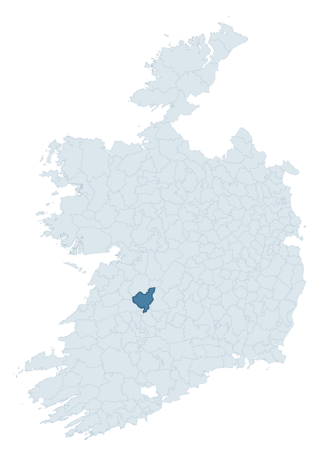
Where this barony sits in the Republic of Ireland
Geology and preservation
Bedrock geology shapes the landscape long before any settlement begins — controlling soil drainage, agricultural potential, the survival of upstanding monuments, and the preservation of buried archaeology. The figures below come from the Geological Survey Ireland 1:100,000 bedrock map.
The bedrock underlying Tulla Lower is predominantly red clastics (31% of the barony by area), with much of the rock dating to the Silurian period. A substantial secondary geology of limestone (21%) and mudstone, arenaceous horizons (16%) adds further variety to the underlying landscape. The single largest mapped unit is the Old Red Sandstone (31% of the barony's bedrock). With 8 distinct rock types mapped, the barony sits in the top third of ROI baronies for geological diversity (76th percentile) — typically a sign of complex tectonic history or coastal mosaics of differing rock units.
Rock type composition
Largest mapped unit: Old Red Sandstone (31% of the barony)
Placename evidence
Logainm records 41 heritage-diagnostic placenames for Tulla Lower, drawn from townland and civil-parish names across the barony. The dominant stratum is Early Christian ecclesiastical — cill-, teampall-, and domhnach-prefixed names that record the dense network of early church foundations established between the fifth and tenth centuries. The leading diagnostic roots are cill- (28 — church), dún- (4 — hilltop fort or promontory fort), and lios- (3 — ringfort or enclosure). This is above the ROI average of 30.7 heritage placenames per barony. The presence of multiple heritage strata side by side indicates layered occupation of the landscape across successive prehistoric and historic periods. Logainm records 236 placenames for Tulla Lower (predominantly townland names). Of these, 41 (17%) carry one of the diagnostic Gaelic roots tracked above; the remainder draw on more generic landscape vocabulary that does not encode a heritage period.
Pre-Christian / Early Medieval Defensive
| Root | Count | Meaning |
|---|---|---|
| dún- | 4 | hilltop or promontory fort |
| lios- | 3 | ringfort or enclosure |
| ráth- | 2 | earthen ringfort |
| caiseal- | 2 | stone ringfort |
Early Christian Ecclesiastical
| Root | Count | Meaning |
|---|---|---|
| cill- | 28 | church (early) |
| domhnach- | 1 | pre-Patrician or earliest Patrician church |
| cillín- | 1 | unconsecrated burial ground |
Burial, Ritual, and Norse-Contact
| Root | Count | Meaning |
|---|---|---|
| gall- | 1 | foreigner — Norse settlement marker |
Other baronies in Clare
- Clonderalaw
- Corcomroe
- Leitrim
- Inchiquin
- Bunratty Lower
- Tulla Upper
- Ibrickan
- Kerrycurrihy — Cork
- Kinalmeaky — Cork
- Clanmaurice — Kerry
See all 280 baronies in the Republic of Ireland Heritage Tool.

Explore further
Grounding History: 10 Maps of Northern Ireland’s Past
If you’re interested in Irish heritage more widely, the companion report for Northern Ireland brings together the analysis of all 462 NI wards into one place through 10 high-quality maps — covering monument density, archaeological periods, placename heritage, terrain, wetland, and the historic landscape at first survey. Take a look.
About this profile
Click any section below to expand.
What is a barony?
A barony is a historic administrative unit in Ireland, broadly equivalent to an English hundred. The 280 baronies used here are from the OSi 2019 National Statutory Boundaries (generalised 20m), covering the 26 counties of the Republic of Ireland. Baronies derive from the Norman period, were formalised in the 17th century, and have not been redrawn for statistical purposes. They vary enormously in area, from compact urban baronies in Dublin to vast upland baronies in Connacht, and should not be compared by raw site count without accounting for area differences.
What counts as a site?
This profile combines three distinct heritage registers, each with its own definition of what constitutes a recordable site:
- Archaeological sites (NMS). The National Monuments Service Sites and Monuments Record (SMR) catalogues every known archaeological monument or site of archaeological interest in the Republic, from prehistoric burial mounds and ringforts to medieval churches and post-medieval defensive works. Inclusion does not require legal protection — only that the site has been identified, surveyed, and assessed as having archaeological value. A separate subset of these sites lies within a recorded protection zone, which gives them statutory protection under the National Monuments Acts.
- Listed buildings (NIAH). The National Inventory of Architectural Heritage records buildings of architectural, historical, archaeological, artistic, cultural, scientific, social, or technical interest. Each surveyed structure is appraised on a five-tier scale: International, National, Regional, Local, and Record-Only. The NIAH appraisal is informational rather than strictly statutory, but it underpins local-authority Record of Protected Structures (RPS) listings.
- Heritage placenames (Logainm). Logainm is the authoritative database of Irish placenames maintained by the Placenames Branch. This profile applies a heritage-diagnostic classifier to the Irish-language form of each townland name, flagging roots that signal defensive sites (ráth-, lios-, dún-, caiseal-, cathair-), ecclesiastical foundations (cill-, teampall-, domhnach-, mainistir-), prehistoric burial-ritual features (tuaim-, carn-, leaba-), or Norse-contact settlement (gall-). Townlands without one of these diagnostic roots are not flagged here — they may still carry historical significance, but that significance is not encoded in the name itself.
Editorial principles
The narrative sections of this profile follow several explicit principles:
- Evidential. Every claim about this barony’s heritage character is anchored in the underlying register data. Where a site count, a placename count, or a percentile rank is cited, it is computed from the source datasets at export time, not estimated.
- Comparative. Counts and metrics are reported alongside their percentile rank against the other 279 ROI baronies. A barony with 50 ringforts in absolute terms could be unusually high or unusually low depending on its size and regional context; percentile ranking removes that ambiguity.
- Transparent on limits. Where a register has known coverage gaps, survey biases, or data-quality issues that affect this barony’s figures, the profile flags them rather than presenting the numbers as definitive.
- No interpretation beyond what the data supports. The narrative does not speculate about historical events, social dynamics, or cultural meaning beyond what the recorded heritage and placename evidence directly attests.
Data caveats and limits
- NMS Sites and Monuments Record is the product of survey campaigns conducted at different intensities across different counties and decades. Some baronies have been surveyed more thoroughly than others, and absolute counts should be read in that light. Sites destroyed by development before survey are typically not represented; sites in heavily forested or upland terrain are sometimes under-recorded.
- NIAH coverage is broadly complete for the Republic of Ireland but the survey was conducted on a rolling county-by-county basis, and the most recent appraisal date varies. Buildings demolished or substantially altered after their original survey may still appear in the register; conversely, recent buildings of merit may not yet have been appraised.
- Logainm classification applies a deliberately conservative pattern-matching approach to the Irish-language townland forms. The classifier prioritises true positives over recall: a townland may carry a heritage signal that the classifier doesn’t recognise, particularly where the diagnostic root has been heavily anglicised or where the townland name draws on a less common term. The 60,000+ townland records and ~9,800 classified placenames give a substantial signal at barony scale, but individual townland names should be checked against Logainm directly for definitive interpretation.
- Period attribution. The chronological distribution reflects only those NMS sites that carry a recognised period attribution in the source data. Sites listed as “Unknown” period are excluded from the dated subset.
- Boundary changes. Some baronies have undergone minor boundary adjustments since their 19th-century definition; the OSi 2019 generalised boundaries used here are the current statutory definition and may differ slightly from historical maps in border areas.
- Bedrock geology is mapped at 1:100,000 scale, which means local variation within a barony — small pockets of different rock type, mineral veins, alluvium overlying bedrock — is generalised. The dominant-system and rocktype figures are area-weighted, so a barony reading “70% Carboniferous limestone” may still contain small but archaeologically important pockets of older or younger rock. Around 3% of GSI polygons do not match the lexicon and contribute no rocktype or system attribution.
Data sources
- National Monuments Service — Sites and Monuments Record (SMR) https://data.gov.ie/dataset/national-monuments-service-archaeological-survey-of-ireland
- National Inventory of Architectural Heritage (NIAH) https://data.gov.ie/dataset/national-inventory-of-architectural-heritage-niah-national-dataset
- Logainm — Placenames Database of Ireland https://www.logainm.ie/
- Ordnance Survey Ireland — National Statutory Barony Boundaries 2019 https://data-osi.opendata.arcgis.com/
- EURODEM — European Digital Elevation Model https://www.mapsforeurope.org/datasets/euro-dem
- ESA WorldCover https://esa-worldcover.org/en
- Geological Survey Ireland — 1:100,000 Bedrock Geology https://www.gsi.ie/en-ie/data-and-maps/Pages/Bedrock.aspx
Explore more: Search any of the 280 ROI baronies, browse by historical province, or read the methodology and data sources for the full Republic of Ireland Heritage Tool.