
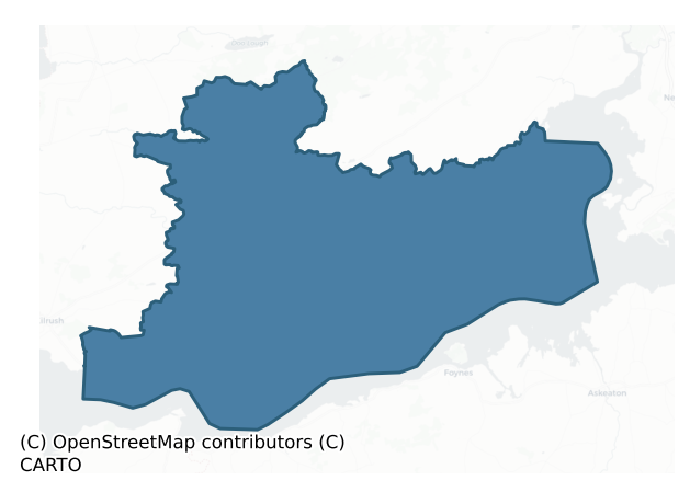
Clonderalaw is a barony of County Clare, in the historical province of Munster (Irish: Cluain idir Dhá Lá), covering 398 km² of land. The barony records 435 NMS archaeological sites and 20 NIAH listed buildings, placing it at around the 16th percentile among 280 ROI baronies for sites per km². This means it is in the bottom fifth of all baronies for sites per km². Dated archaeological evidence runs from the Neolithic through to the Medieval, spanning 6 of 9 archaeological periods, placing the barony in the 15th percentile among 280 ROI baronies for chronological depth. This means it is in the bottom fifth of all baronies for chronological depth. The largest dated subset of recorded sites dates to the Early Medieval. Logainm flags 35 placenames in the barony as carrying a recognised heritage root; the largest share — around 54% — are names associated with early Christian church and monastic foundations.
Heritage at a glance
Percentile rankings throughout this profile compare each barony only against the other 279 Republic of Ireland baronies.
The recorded heritage of Clonderalaw
The National Monuments Service Sites and Monuments Record (SMR) is the statutory inventory of archaeological sites for the Republic of Ireland, maintained by the Department of Tourism, Culture, Arts, Gaeltacht, Sport and Media. Sites recorded here include earthworks, ringforts, megalithic tombs, ecclesiastical remains, and post-medieval features; not every record is legally protected, but each is registered as a monument of archaeological interest.
The National Monuments Service records 435 archaeological sites in Clonderalaw, putting it at the 16th percentile among 280 ROI baronies for sites per km². This means it is in the bottom fifth of all baronies for sites per km². Protection coverage is near-universal — 413 sites (95%) fall within a recorded monument protection zone, indicating an extensively surveyed landscape. The dominant category is defensive sites — ringforts, enclosures, hillforts, and stone forts (277 sites, 64% of the record). Ringfort – rath is the most prevalent type, making up 46% of the barony's recorded sites (201 records) — well above the ROI average of 20% across all baronies where this type occurs. Ringfort – rath is an earthen ringfort enclosed by a bank and external ditch — the most common Early Medieval farmstead, broadly dated 500–1000 AD. Other significant types include Enclosure (27) and Ritual site – holy well (20). Enclosure is a banked or ditched feature of uncertain type, used as a catch-all where the original function cannot be determined from surface evidence; Ritual site – holy well is a well or spring traditionally associated with a saint, often credited with healing properties; many trace earlier ritual origins but devotion is documented from the medieval period onwards. Across the barony's 398 km², this gives a recorded density of 1.09 sites per km².
Most common monument types
Hover or tap a monument type to see its definition.
| Type | Count |
|---|---|
| Ringfort – rath an earthen ringfort enclosed by a bank and external ditch — the most common Early Medieval farmstead, broadly dated 500–1000 AD | 201 |
| Enclosure a banked or ditched feature of uncertain type, used as a catch-all where the original function cannot be determined from surface evidence | 27 |
| Ritual site – holy well a well or spring traditionally associated with a saint, often credited with healing properties; many trace earlier ritual origins but devotion is documented from the medieval period onwards | 20 |
| Earthwork an unclassified earthen structure with no diagnostic features that allow a more specific classification | 19 |
| Fulacht fia a horseshoe-shaped Bronze Age burnt mound built around a sunken trough beside a water source, traditionally interpreted as a cooking site | 18 |
| Church a building used for public Christian worship, of any date from c. 500 AD onwards | 12 |
| Graveyard a burial area associated with a church, in use from the medieval period onwards | 12 |
Chronological distribution
The dated archaeological record for Clonderalaw spans from the Neolithic through to the Medieval, with activity attested across 6 of 9 archaeological periods. This is the 15th percentile across ROI baronies — a relatively narrow chronological band, with much of Irish prehistory not represented in the dated record. Every period from earliest to latest is represented in the record — an unbroken sequence of dated activity across the full chronological span. Activity concentrates most heavily in the Early Medieval (251 sites, 75% of dated material), with the Iron Age forming a secondary peak (34 sites, 10%). A further 100 recorded sites (23% of the overall NMS register for the barony) carry no period attribution — appearing as 'Unknown' in the bar chart below. This typically reflects either records that pre-date the standardised period vocabulary or sites awaiting specialist dating review, rather than a genuine absence of chronological evidence.
Sample of recorded monuments
Show 25 sample monuments (of 435 total)
A representative sample of 25 recorded monuments drawn from the barony’s 435 total NMS entries. Sites within a recorded monument protection zone and rarer site types are prioritised so the list shows a meaningful cross-section rather than only the most common type. Each entry shows the official Sites and Monuments Record reference number and the description published by the National Monuments Service.
Megalithic tomb – unclassified
See linked document with details from Ruaidhrí de Valera and Seán Ó Nualláin, Survey of the Megalithic Tombs of Ireland. Volume I. County Clare. (Dublin: Stationery Office, 1961)
Date of upload: 30 December 2011
Mound
The Archaeological Survey of Ireland (ASI) is in the process of providing information on all monuments on The Historic Environment Viewer (HEV). Currently the information for this record has not been uploaded. To…
The Archaeological Survey of Ireland (ASI) is in the process of providing information on all monuments on The Historic Environment Viewer (HEV). Currently the information for this record has not been uploaded. To access available information for research purposes please make an appointment in advance with the Archive Unit (open Fridays 10.00 am – 5.00 pm), Department of Culture, Heritage and the Gaeltacht, The Custom House, Dublin 1 D01W6XO or email nmarchive@chg.gov.ie.
Standing stone – pair
The Archaeological Survey of Ireland (ASI) is in the process of providing information on all monuments on The Historic Environment Viewer (HEV). Currently the information for this record has not been uploaded. To…
The Archaeological Survey of Ireland (ASI) is in the process of providing information on all monuments on The Historic Environment Viewer (HEV). Currently the information for this record has not been uploaded. To access available information for research purposes please make an appointment in advance with the Archive Unit (open Fridays 10.00 am – 5.00 pm), Department of Culture, Heritage and the Gaeltacht, The Custom House, Dublin 1 D01W6XO or email nmarchive@chg.gov.ie.
Religious house – Augustinian canons
Situated on generally flat ground at the NE end of Canon Island, one of several islands in the broad Fergus estuary. St. Mary’s Augustinian Abbey or ‘Inisgad’ (probably built on the site of an early monastery) was…
Situated on generally flat ground at the NE end of Canon Island, one of several islands in the broad Fergus estuary. St. Mary’s Augustinian Abbey or ‘Inisgad’ (probably built on the site of an early monastery) was included in Donal Mor O’Brien’s confirmation charter for Clare Abbey, dated 1189. It was established contemporaneously with Inchicronan, Kilshanny and Killone. In 1418 a canon from Grenoble was provided to the abbey but in 1426 he was accused of misrepresentation by Diarmuid Mac Ghiolla Phádraig and for a century the Mac Ghiolla Phádraig’s dominated the abbacy. It was dissolved by Henry VIII and granted to Donogh O’Brien in 1543 when he was created baron of Ibracken. Afterwards it belonged to various Earls of Thomond. In 1577 it possessed 4 acres of arable and 14 of mountain and pasture, the half-acre site of the abbey, a church, etc., the islands nearby and other property. Henry, 7th Earl of Thomond, granted it to Richard Henn in 1712.
The complex consists of the abbey church with cloister and domestic buildings to the S and E within a possible ecclesiastical enclosure (CL060-011001-) with an arched gateway (CL060-011007-) at SW. The walls are constructed of roughly dressed or undressed limestone and mortar laid down in an uncoursed or roughly coursed fashion. Dressed limestone can be seen around most openings and primary features. The outer walls are inaccessible except at W due to dense overgrowth. An ecclesiastical enclosure (CL060-011001-) was noted by West…
Ritual site – holy tree/bush
The Archaeological Survey of Ireland (ASI) is in the process of providing information on all monuments on The Historic Environment Viewer (HEV). Currently the information for this record has not been uploaded. To…
The Archaeological Survey of Ireland (ASI) is in the process of providing information on all monuments on The Historic Environment Viewer (HEV). Currently the information for this record has not been uploaded. To access available information for research purposes please make an appointment in advance with the Archive Unit (open Fridays 10.00 am – 5.00 pm), Department of Culture, Heritage and the Gaeltacht, The Custom House, Dublin 1 D01W6XO or email nmarchive@chg.gov.ie.
Building
The Archaeological Survey of Ireland (ASI) is in the process of providing information on all monuments on The Historic Environment Viewer (HEV). Currently the information for this record has not been uploaded. To…
The Archaeological Survey of Ireland (ASI) is in the process of providing information on all monuments on The Historic Environment Viewer (HEV). Currently the information for this record has not been uploaded. To access available information for research purposes please make an appointment in advance with the Archive Unit (open Fridays 10.00 am – 5.00 pm), Department of Culture, Heritage and the Gaeltacht, The Custom House, Dublin 1 D01W6XO or email nmarchive@chg.gov.ie.
Battery
One of a number of defensive batteries built along the Shannon estuary in the early 19th century, this example at Kilkerin Point is situated directly across from another at Tarbert Island (KE003-002—-). Between them…
One of a number of defensive batteries built along the Shannon estuary in the early 19th century, this example at Kilkerin Point is situated directly across from another at Tarbert Island (KE003-002—-). Between them they commanded the river with cross-fire from their guns (Kerrigan 1995, 208). A D-shaped area (ext. dims. 108m N-S; 70m E-W) (see Kerrigan 1995, 209, Fig. 108) surrounded by a drystone moat (Wth 4-5m; D 3-4m) and a rampart (Wth 6-9m) with a blockhouse (18m N-S; 11.6m E-W) at E and six gun placements along the curved W side facing out into the estuary. The walls of the blockhouse are battered and five musket loops at each end defended the moat. On the upper level 5 musket loops covered the interior of the battery with the entrance door at one end of that façade. The doorway was recessed to accommodate the drawbridge when raised. The lower level of the blockhouse was divided into rooms for storage and a magazine. The upper floor provided accommodation with a large window at each end of the building. A narrow staircase in the thickness of the wall gives access to the gun platforms above. A small semi-basement vaulted structure lies in the interior and was noted on plans as a ‘shell-filling room’. The land at Kilkerrin was acquired by the government in March 1811 and the battery was constructed soon after that date. Other batteries along the estuary on the Clare side include Kilcredaun (CL072-027002-) on the N side of the mouth of the Shannon, Doonaha (CL066-037…
Cross-slab
The Archaeological Survey of Ireland (ASI) is in the process of providing information on all monuments on The Historic Environment Viewer (HEV). Currently the information for this record has not been uploaded. To…
The Archaeological Survey of Ireland (ASI) is in the process of providing information on all monuments on The Historic Environment Viewer (HEV). Currently the information for this record has not been uploaded. To access available information for research purposes please make an appointment in advance with the Archive Unit (open Fridays 10.00 am – 5.00 pm), Department of Culture, Heritage and the Gaeltacht, The Custom House, Dublin 1 D01W6XO or email nmarchive@chg.gov.ie.
Metalworking site
The Archaeological Survey of Ireland (ASI) is in the process of providing information on all monuments on The Historic Environment Viewer (HEV). Currently the information for this record has not been uploaded. To…
The Archaeological Survey of Ireland (ASI) is in the process of providing information on all monuments on The Historic Environment Viewer (HEV). Currently the information for this record has not been uploaded. To access available information for research purposes please make an appointment in advance with the Archive Unit (open Fridays 10.00 am – 5.00 pm), Department of Culture, Heritage and the Gaeltacht, The Custom House, Dublin 1 D01W6XO or email nmarchive@chg.gov.ie.
Gatehouse
Situated SW of Canon Island abbey (CL060-011002-) along the line of the ecclesiastical enclosure (CL060-011001-). The walls of a rectangular building (int. dims. 5.23m NW-SE; 4.35m NE-SW; wall T 0.8m) with opposing…
Situated SW of Canon Island abbey (CL060-011002-) along the line of the ecclesiastical enclosure (CL060-011001-). The walls of a rectangular building (int. dims. 5.23m NW-SE; 4.35m NE-SW; wall T 0.8m) with opposing arched openings at NE (Wth 2.12m; H 2.66m) and SW (Wth 1.93m; H 2.66m). Two draw-bar slots are present at the NE arch and one at the SW. Wicker-centring is evident beneath the SW arch. The walls are of uncoursed limestone rubble but the arched openings have reasonably dressed quoins. A window (Wth 1.7m) on the SE wall has been broken out and the wall below this has been rebuilt. The W wall is plain. The tops of the walls and previously roofed area have much ivy cover. A length of wall (L 8.6m; H 1.6m; T 0.7m) extends from the NE corner along the line of the enclosure. Vertical metal posts have been installed in the SW opening to prevent livestock encroaching on the abbey.
The following images have been uploaded:
CL060-011007-_01.jpg Gatehouse from SW showing ivy cover.
CL060-011007-_02.jpg View from SE with wall extending NE on line of ecclesiastical enclosure.
CL060-011007-_03.jpg Broken-out SE window.
Compiled by: Mary Tunney
Date of upload: 7 August 2019
Font
Situated on the floor in the SW doorway leading from the church to the cloister of the Augustinian religious house on Canon Island (CL060-011002-). A plain limestone block (H 0.3m; 0.36m x 0.34m) with a circular basin…
Situated on the floor in the SW doorway leading from the church to the cloister of the Augustinian religious house on Canon Island (CL060-011002-). A plain limestone block (H 0.3m; 0.36m x 0.34m) with a circular basin (diam. 0.25m; D 0.18m). One corner is broken away.
The following images have been uploaded:
CL060-011008-_01.jpg View of font in doorway from NW.
CL060-011008-_02.jpg View of font from above.
Compiled by: Mary Tunney
Date of upload: 7 August 2019
Bullaun stone
On the N shore of Deer Island. Described by O’Sullivan et al. (2010) as follows: ‘A possible bullaun stone was found on the northern shore of Deer Island. It consists of a hemispherical cup hollowed out of a rock. The…
On the N shore of Deer Island. Described by O’Sullivan et al. (2010) as follows: ‘A possible bullaun stone was found on the northern shore of Deer Island. It consists of a hemispherical cup hollowed out of a rock. The rock may be broken. Because most of the rocks around are limestone bullaun like rocks can frequently be seen. This one, however had a much smoother ‘cup’, leading us to believe it had been used to grind something, perhaps fishbait’. (O’Sullivan et al. 2010, Appendix 1, 81, Deer Island 10)
Compiled by: Mary Tunney
Date of upload: 9 October 2019
Moated site
The Archaeological Survey of Ireland (ASI) is in the process of providing information on all monuments on The Historic Environment Viewer (HEV). Currently the information for this record has not been uploaded. To…
The Archaeological Survey of Ireland (ASI) is in the process of providing information on all monuments on The Historic Environment Viewer (HEV). Currently the information for this record has not been uploaded. To access available information for research purposes please make an appointment in advance with the Archive Unit (open Fridays 10.00 am – 5.00 pm), Department of Culture, Heritage and the Gaeltacht, The Custom House, Dublin 1 D01W6XO or email nmarchive@chg.gov.ie.
Ringfort – unclassified
The Archaeological Survey of Ireland (ASI) is in the process of providing information on all monuments on The Historic Environment Viewer (HEV). Currently the information for this record has not been uploaded. To…
The Archaeological Survey of Ireland (ASI) is in the process of providing information on all monuments on The Historic Environment Viewer (HEV). Currently the information for this record has not been uploaded. To access available information for research purposes please make an appointment in advance with the Archive Unit (open Fridays 10.00 am – 5.00 pm), Department of Culture, Heritage and the Gaeltacht, The Custom House, Dublin 1 D01W6XO or email nmarchive@chg.gov.ie.
Ritual site – holy/saint's stone
The Archaeological Survey of Ireland (ASI) is in the process of providing information on all monuments on The Historic Environment Viewer (HEV). Currently the information for this record has not been uploaded. To…
The Archaeological Survey of Ireland (ASI) is in the process of providing information on all monuments on The Historic Environment Viewer (HEV). Currently the information for this record has not been uploaded. To access available information for research purposes please make an appointment in advance with the Archive Unit (open Fridays 10.00 am – 5.00 pm), Department of Culture, Heritage and the Gaeltacht, The Custom House, Dublin 1 D01W6XO or email nmarchive@chg.gov.ie.
Road – road/trackway
The Archaeological Survey of Ireland (ASI) is in the process of providing information on all monuments on The Historic Environment Viewer (HEV). Currently the information for this record has not been uploaded. To…
The Archaeological Survey of Ireland (ASI) is in the process of providing information on all monuments on The Historic Environment Viewer (HEV). Currently the information for this record has not been uploaded. To access available information for research purposes please make an appointment in advance with the Archive Unit (open Fridays 10.00 am – 5.00 pm), Department of Culture, Heritage and the Gaeltacht, The Custom House, Dublin 1 D01W6XO or email nmarchive@chg.gov.ie.
Ringfort – unclassified
The Archaeological Survey of Ireland (ASI) is in the process of providing information on all monuments on The Historic Environment Viewer (HEV). Currently the information for this record has not been uploaded. To…
The Archaeological Survey of Ireland (ASI) is in the process of providing information on all monuments on The Historic Environment Viewer (HEV). Currently the information for this record has not been uploaded. To access available information for research purposes please make an appointment in advance with the Archive Unit (open Fridays 10.00 am – 5.00 pm), Department of Culture, Heritage and the Gaeltacht, The Custom House, Dublin 1 D01W6XO or email nmarchive@chg.gov.ie.
Moated site
The Archaeological Survey of Ireland (ASI) is in the process of providing information on all monuments on The Historic Environment Viewer (HEV). Currently the information for this record has not been uploaded. To…
The Archaeological Survey of Ireland (ASI) is in the process of providing information on all monuments on The Historic Environment Viewer (HEV). Currently the information for this record has not been uploaded. To access available information for research purposes please make an appointment in advance with the Archive Unit (open Fridays 10.00 am – 5.00 pm), Department of Culture, Heritage and the Gaeltacht, The Custom House, Dublin 1 D01W6XO or email nmarchive@chg.gov.ie.
Standing stone
The Archaeological Survey of Ireland (ASI) is in the process of providing information on all monuments on The Historic Environment Viewer (HEV). Currently the information for this record has not been uploaded. To…
The Archaeological Survey of Ireland (ASI) is in the process of providing information on all monuments on The Historic Environment Viewer (HEV). Currently the information for this record has not been uploaded. To access available information for research purposes please make an appointment in advance with the Archive Unit (open Fridays 10.00 am – 5.00 pm), Department of Culture, Heritage and the Gaeltacht, The Custom House, Dublin 1 D01W6XO or email nmarchive@chg.gov.ie.
Mass-rock
The Archaeological Survey of Ireland (ASI) is in the process of providing information on all monuments on The Historic Environment Viewer (HEV). Currently the information for this record has not been uploaded. To…
The Archaeological Survey of Ireland (ASI) is in the process of providing information on all monuments on The Historic Environment Viewer (HEV). Currently the information for this record has not been uploaded. To access available information for research purposes please make an appointment in advance with the Archive Unit (open Fridays 10.00 am – 5.00 pm), Department of Culture, Heritage and the Gaeltacht, The Custom House, Dublin 1 D01W6XO or email nmarchive@chg.gov.ie.
Ritual site – holy/saint's stone
The Archaeological Survey of Ireland (ASI) is in the process of providing information on all monuments on The Historic Environment Viewer (HEV). Currently the information for this record has not been uploaded. To…
The Archaeological Survey of Ireland (ASI) is in the process of providing information on all monuments on The Historic Environment Viewer (HEV). Currently the information for this record has not been uploaded. To access available information for research purposes please make an appointment in advance with the Archive Unit (open Fridays 10.00 am – 5.00 pm), Department of Culture, Heritage and the Gaeltacht, The Custom House, Dublin 1 D01W6XO or email nmarchive@chg.gov.ie.
Mass-rock
The Archaeological Survey of Ireland (ASI) is in the process of providing information on all monuments on The Historic Environment Viewer (HEV). Currently the information for this record has not been uploaded. To…
The Archaeological Survey of Ireland (ASI) is in the process of providing information on all monuments on The Historic Environment Viewer (HEV). Currently the information for this record has not been uploaded. To access available information for research purposes please make an appointment in advance with the Archive Unit (open Fridays 10.00 am – 5.00 pm), Department of Culture, Heritage and the Gaeltacht, The Custom House, Dublin 1 D01W6XO or email nmarchive@chg.gov.ie.
Burial ground
The Archaeological Survey of Ireland (ASI) is in the process of providing information on all monuments on The Historic Environment Viewer (HEV). Currently the information for this record has not been uploaded. To…
The Archaeological Survey of Ireland (ASI) is in the process of providing information on all monuments on The Historic Environment Viewer (HEV). Currently the information for this record has not been uploaded. To access available information for research purposes please make an appointment in advance with the Archive Unit (open Fridays 10.00 am – 5.00 pm), Department of Culture, Heritage and the Gaeltacht, The Custom House, Dublin 1 D01W6XO or email nmarchive@chg.gov.ie.
Ringfort – rath
The Archaeological Survey of Ireland (ASI) is in the process of providing information on all monuments on The Historic Environment Viewer (HEV). Currently the information for this record has not been uploaded. To…
The Archaeological Survey of Ireland (ASI) is in the process of providing information on all monuments on The Historic Environment Viewer (HEV). Currently the information for this record has not been uploaded. To access available information for research purposes please make an appointment in advance with the Archive Unit (open Fridays 10.00 am – 5.00 pm), Department of Culture, Heritage and the Gaeltacht, The Custom House, Dublin 1 D01W6XO or email nmarchive@chg.gov.ie.
Listed buildings
The National Inventory of Architectural Heritage (NIAH) is a state survey appraising buildings of architectural, historical, archaeological, artistic, cultural, scientific, social, or technical interest. Each surveyed structure receives a rating from International (the highest, for buildings of European importance) through National, Regional, Local, and Record-Only.
The NIAH records only 20 listed buildings in Clonderalaw, the 7th percentile across ROI baronies — a relatively thin architectural record. The highest-graded structures include 2 of National significance. The Republic holds 937 National-graded buildings in total, so this barony accounts for around 0% of the national total. Construction dates concentrate most heavily in the Victorian (1830-1900) period. The most-recorded building type is church/chapel (5 examples, 25% of the listed stock).
Terrain and environment
Mean elevation across the barony is 43m — the 13th percentile among 280 ROI baronies for elevation. This means it is in the bottom fifth of all baronies for elevation. This is a relatively low-lying landscape by ROI standards. Elevation matters for heritage because higher-altitude baronies typically favour defensive monuments — ringforts and hilltop forts placed on prominent ground — while lowland baronies are more likely to carry the dense settlement and church networks of intensive agricultural landscapes. A maximum elevation of 193m gives the barony meaningful vertical relief. Mean slope is 3.1° — the 39th percentile among 280 ROI baronies for slope. This means it is in the lower half of all baronies for slope. Slope is a key control on both land use and archaeological preservation: steep ground resists ploughing and tends to preserve earthworks intact, while gentle slopes favour intensive cultivation that damages or destroys surface archaeology over time. The Topographic Wetness Index averages 11.3, the 67th percentile among 280 ROI baronies for wetness. This means it is in the top third of all baronies for wetness. Drainage matters for heritage because poorly-drained ground preserves organic archaeology (wooden trackways, leather, textiles, and on rare occasions human remains) far better than free-draining soil; well-drained ground favours arable use but destroys organic material rapidly. The land-cover mosaic combines improved grassland (62%), open water (22%), and woodland (15%), giving a mixed agricultural and semi-natural landscape.
Terrain measurements
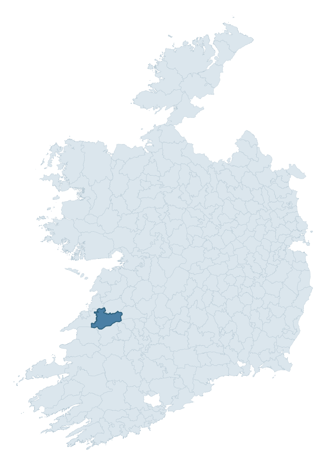
Where this barony sits in the Republic of Ireland
Geology and preservation
Bedrock geology shapes the landscape long before any settlement begins — controlling soil drainage, agricultural potential, the survival of upstanding monuments, and the preservation of buried archaeology. The figures below come from the Geological Survey Ireland 1:100,000 bedrock map.
The bedrock underlying Clonderalaw is predominantly mudstone, siltstone, sandstone (85% of the barony by area), laid down during the Carboniferous period (100% by area, around 359 to 299 million years ago). The single largest mapped unit is the Central Clare Group (85% of the barony's bedrock).
Rock type composition
Largest mapped unit: Central Clare Group (85% of the barony)
Placename evidence
Logainm records 35 heritage-diagnostic placenames for Clonderalaw, drawn from townland and civil-parish names across the barony. The dominant stratum is Early Christian ecclesiastical — cill-, teampall-, and domhnach-prefixed names that record the dense network of early church foundations established between the fifth and tenth centuries. The leading diagnostic roots are cill- (18 — church), lios- (5 — ringfort or enclosure), and dún- (4 — hilltop fort or promontory fort). This is broadly in line with the ROI average of 30.7 heritage placenames per barony. The presence of multiple heritage strata side by side indicates layered occupation of the landscape across successive prehistoric and historic periods. Logainm records 183 placenames for Clonderalaw (predominantly townland names). Of these, 35 (19%) carry one of the diagnostic Gaelic roots tracked above; the remainder draw on more generic landscape vocabulary that does not encode a heritage period.
Pre-Christian / Early Medieval Defensive
| Root | Count | Meaning |
|---|---|---|
| lios- | 5 | ringfort or enclosure |
| dún- | 4 | hilltop or promontory fort |
| cathair- | 4 | stone fort |
Early Christian Ecclesiastical
| Root | Count | Meaning |
|---|---|---|
| cill- | 18 | church (early) |
| díseart- | 1 | hermitage |
Burial, Ritual, and Norse-Contact
| Root | Count | Meaning |
|---|---|---|
| leaba- | 1 | megalithic tomb |
| sián- | 1 | fairy mound |
| uaimh- | 1 | cave / souterrain |
Other baronies in Clare
- Islands
- Bunratty Upper
- Moyarta
- Burren
- Bunratty Lower
- Tulla Lower
- Tulla Upper
- Leitrim
- Bunratty Upper
- Clanwilliam — Tipperary
See all 280 baronies in the Republic of Ireland Heritage Tool.

Explore further
Grounding History: 10 Maps of Northern Ireland’s Past
If you’re interested in Irish heritage more widely, the companion report for Northern Ireland brings together the analysis of all 462 NI wards into one place through 10 high-quality maps — covering monument density, archaeological periods, placename heritage, terrain, wetland, and the historic landscape at first survey. Take a look.
About this profile
Click any section below to expand.
What is a barony?
A barony is a historic administrative unit in Ireland, broadly equivalent to an English hundred. The 280 baronies used here are from the OSi 2019 National Statutory Boundaries (generalised 20m), covering the 26 counties of the Republic of Ireland. Baronies derive from the Norman period, were formalised in the 17th century, and have not been redrawn for statistical purposes. They vary enormously in area, from compact urban baronies in Dublin to vast upland baronies in Connacht, and should not be compared by raw site count without accounting for area differences.
What counts as a site?
This profile combines three distinct heritage registers, each with its own definition of what constitutes a recordable site:
- Archaeological sites (NMS). The National Monuments Service Sites and Monuments Record (SMR) catalogues every known archaeological monument or site of archaeological interest in the Republic, from prehistoric burial mounds and ringforts to medieval churches and post-medieval defensive works. Inclusion does not require legal protection — only that the site has been identified, surveyed, and assessed as having archaeological value. A separate subset of these sites lies within a recorded protection zone, which gives them statutory protection under the National Monuments Acts.
- Listed buildings (NIAH). The National Inventory of Architectural Heritage records buildings of architectural, historical, archaeological, artistic, cultural, scientific, social, or technical interest. Each surveyed structure is appraised on a five-tier scale: International, National, Regional, Local, and Record-Only. The NIAH appraisal is informational rather than strictly statutory, but it underpins local-authority Record of Protected Structures (RPS) listings.
- Heritage placenames (Logainm). Logainm is the authoritative database of Irish placenames maintained by the Placenames Branch. This profile applies a heritage-diagnostic classifier to the Irish-language form of each townland name, flagging roots that signal defensive sites (ráth-, lios-, dún-, caiseal-, cathair-), ecclesiastical foundations (cill-, teampall-, domhnach-, mainistir-), prehistoric burial-ritual features (tuaim-, carn-, leaba-), or Norse-contact settlement (gall-). Townlands without one of these diagnostic roots are not flagged here — they may still carry historical significance, but that significance is not encoded in the name itself.
Editorial principles
The narrative sections of this profile follow several explicit principles:
- Evidential. Every claim about this barony’s heritage character is anchored in the underlying register data. Where a site count, a placename count, or a percentile rank is cited, it is computed from the source datasets at export time, not estimated.
- Comparative. Counts and metrics are reported alongside their percentile rank against the other 279 ROI baronies. A barony with 50 ringforts in absolute terms could be unusually high or unusually low depending on its size and regional context; percentile ranking removes that ambiguity.
- Transparent on limits. Where a register has known coverage gaps, survey biases, or data-quality issues that affect this barony’s figures, the profile flags them rather than presenting the numbers as definitive.
- No interpretation beyond what the data supports. The narrative does not speculate about historical events, social dynamics, or cultural meaning beyond what the recorded heritage and placename evidence directly attests.
Data caveats and limits
- NMS Sites and Monuments Record is the product of survey campaigns conducted at different intensities across different counties and decades. Some baronies have been surveyed more thoroughly than others, and absolute counts should be read in that light. Sites destroyed by development before survey are typically not represented; sites in heavily forested or upland terrain are sometimes under-recorded.
- NIAH coverage is broadly complete for the Republic of Ireland but the survey was conducted on a rolling county-by-county basis, and the most recent appraisal date varies. Buildings demolished or substantially altered after their original survey may still appear in the register; conversely, recent buildings of merit may not yet have been appraised.
- Logainm classification applies a deliberately conservative pattern-matching approach to the Irish-language townland forms. The classifier prioritises true positives over recall: a townland may carry a heritage signal that the classifier doesn’t recognise, particularly where the diagnostic root has been heavily anglicised or where the townland name draws on a less common term. The 60,000+ townland records and ~9,800 classified placenames give a substantial signal at barony scale, but individual townland names should be checked against Logainm directly for definitive interpretation.
- Period attribution. The chronological distribution reflects only those NMS sites that carry a recognised period attribution in the source data. Sites listed as “Unknown” period are excluded from the dated subset.
- Boundary changes. Some baronies have undergone minor boundary adjustments since their 19th-century definition; the OSi 2019 generalised boundaries used here are the current statutory definition and may differ slightly from historical maps in border areas.
- Bedrock geology is mapped at 1:100,000 scale, which means local variation within a barony — small pockets of different rock type, mineral veins, alluvium overlying bedrock — is generalised. The dominant-system and rocktype figures are area-weighted, so a barony reading “70% Carboniferous limestone” may still contain small but archaeologically important pockets of older or younger rock. Around 3% of GSI polygons do not match the lexicon and contribute no rocktype or system attribution.
Data sources
- National Monuments Service — Sites and Monuments Record (SMR) https://data.gov.ie/dataset/national-monuments-service-archaeological-survey-of-ireland
- National Inventory of Architectural Heritage (NIAH) https://data.gov.ie/dataset/national-inventory-of-architectural-heritage-niah-national-dataset
- Logainm — Placenames Database of Ireland https://www.logainm.ie/
- Ordnance Survey Ireland — National Statutory Barony Boundaries 2019 https://data-osi.opendata.arcgis.com/
- EURODEM — European Digital Elevation Model https://www.mapsforeurope.org/datasets/euro-dem
- ESA WorldCover https://esa-worldcover.org/en
- Geological Survey Ireland — 1:100,000 Bedrock Geology https://www.gsi.ie/en-ie/data-and-maps/Pages/Bedrock.aspx
Explore more: Search any of the 280 ROI baronies, browse by historical province, or read the methodology and data sources for the full Republic of Ireland Heritage Tool.