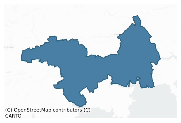
Carbery East (East Division) is a barony of County Cork, in the historical province of Munster (Irish: Cairbrigh Thoir (an Roinn Thoir)), covering 278 km² of land. The barony records 516 NMS archaeological sites and 361 NIAH listed buildings, placing it at around the 50th percentile among 280 ROI baronies for sites per km². This means it is in the upper half of all baronies for sites per km². Dated archaeological evidence runs from the Neolithic through to the Modern, spanning 8 of 9 archaeological periods, placing the barony in the 79th percentile among 280 ROI baronies for chronological depth. This means it is in the top third of all baronies for chronological depth. The largest dated subset of recorded sites dates to the Early Medieval. Logainm flags 45 placenames in the barony as carrying a recognised heritage root; the largest share — around 71% — are names associated with early Christian church and monastic foundations.

Heritage at a glance
Percentile rankings throughout this profile compare each barony only against the other 279 Republic of Ireland baronies.
The recorded heritage of Carbery East (east Division)
The National Monuments Service Sites and Monuments Record (SMR) is the statutory inventory of archaeological sites for the Republic of Ireland, maintained by the Department of Tourism, Culture, Arts, Gaeltacht, Sport and Media. Sites recorded here include earthworks, ringforts, megalithic tombs, ecclesiastical remains, and post-medieval features; not every record is legally protected, but each is registered as a monument of archaeological interest.
The National Monuments Service records 516 archaeological sites in Carbery East (East Division), putting it at the 50th percentile among 280 ROI baronies for sites per km². This means it is in the upper half of all baronies for sites per km². Protection coverage is near-universal — 505 sites (98%) fall within a recorded monument protection zone, indicating an extensively surveyed landscape. The dominant category is defensive sites — ringforts, enclosures, hillforts, and stone forts (245 sites, 47% of the record). Ringfort – rath is the most prevalent type, making up 27% of the barony's recorded sites (138 records) — well above the ROI average of 20% across all baronies where this type occurs. Ringfort – rath is an earthen ringfort enclosed by a bank and external ditch — the most common Early Medieval farmstead, broadly dated 500–1000 AD. Other significant types include Souterrain (50) and Fulacht fia (46). Souterrain is an underground stone-built passage and chamber, generally Early Medieval and often associated with ringforts as a defensive or storage feature; Fulacht fia is a horseshoe-shaped Bronze Age burnt mound built around a sunken trough beside a water source, traditionally interpreted as a cooking site. Across the barony's 278 km², this gives a recorded density of 1.86 sites per km².
Most common monument types
Hover or tap a monument type to see its definition.
| Type | Count |
|---|---|
| Ringfort – rath an earthen ringfort enclosed by a bank and external ditch — the most common Early Medieval farmstead, broadly dated 500–1000 AD | 138 |
| Souterrain an underground stone-built passage and chamber, generally Early Medieval and often associated with ringforts as a defensive or storage feature | 50 |
| Fulacht fia a horseshoe-shaped Bronze Age burnt mound built around a sunken trough beside a water source, traditionally interpreted as a cooking site | 46 |
| Church a building used for public Christian worship, of any date from c. 500 AD onwards | 30 |
| Standing stone a deliberately set upright stone, used variously as a Bronze/Iron Age burial marker, route marker or commemorative monument | 27 |
| Enclosure a banked or ditched feature of uncertain type, used as a catch-all where the original function cannot be determined from surface evidence | 22 |
| Burial ground an area set apart for burial that is not associated with a church, in use from the medieval period onwards | 22 |
| Moated site | 21 |
Chronological distribution
The dated archaeological record for Carbery East (East Division) spans from the Neolithic through to the Modern, with activity attested across 8 of 9 archaeological periods. This is the 79th percentile across ROI baronies for chronological depth — an above-average span. Every period from earliest to latest is represented in the record — an unbroken sequence of dated activity across the full chronological span. Activity concentrates most heavily in the Early Medieval (190 sites, 48% of dated material), with the Iron Age forming a secondary peak (79 sites, 20%). A further 116 recorded sites (22% of the overall NMS register for the barony) carry no period attribution — appearing as 'Unknown' in the bar chart below. This typically reflects either records that pre-date the standardised period vocabulary or sites awaiting specialist dating review, rather than a genuine absence of chronological evidence.
Sample of recorded monuments
Show 25 sample monuments (of 516 total)
A representative sample of 25 recorded monuments drawn from the barony’s 516 total NMS entries. Sites within a recorded monument protection zone and rarer site types are prioritised so the list shows a meaningful cross-section rather than only the most common type. Each entry shows the official Sites and Monuments Record reference number and the description published by the National Monuments Service.
Architectural fragment
Pair of late medieval ogee-headed window lights, with decorated spandrels, built c. 0.4m apart into N wall of Phale Court but probably from nearby Phale Castle (CO108-04002-). Phale Court rebuilt after fire in 1919, on…
Pair of late medieval ogee-headed window lights, with decorated spandrels, built c. 0.4m apart into N wall of Phale Court but probably from nearby Phale Castle (CO108-04002-). Phale Court rebuilt after fire in 1919, on site of earlier house demolished c.1814 (Collins 1950, 111). Farmbuildings to rear of house have a datestone of 1781.
The above description is derived from the published 'Archaeological Inventory of County Cork. Volume 1: West Cork' (Dublin: Stationery Office, 1992). In certain instances the entries have been revised and updated in the light of recent research.
Date of upload/revision: 14 January 2009
Castle – Anglo-Norman masonry castle
In pasture, on S-facing slope. Sharp drop down to stream on E side. Shown on O.S. map (1842) as square structure. MacCarthy castle 'which was taken down in the early 19th century' (O Murchadha 1985, 57). No surface…
In pasture, on S-facing slope. Sharp drop down to stream on E side. Shown on O.S. map (1842) as square structure. MacCarthy castle 'which was taken down in the early 19th century' (O Murchadha 1985, 57). No surface trace remaining. Adjacent to gallows tree (CO108-04001) and graveyard (CO108-04003). Pair of ogee-headed windows (CO108-03801-) built into wall of nearby Phale Court may be from this site.
The above description is derived from the published 'Archaeological Inventory of County Cork. Volume 1: West Cork' (Dublin: Stationery Office, 1992). In certain instances the entries have been revised and updated in the light of recent research.
Date of upload/revision: 14 January 2009
Courthouse
The Archaeological Survey of Ireland (ASI) is in the process of providing information on all monuments on The Historic Environment Viewer (HEV). Currently the information for this record has not been uploaded. To…
The Archaeological Survey of Ireland (ASI) is in the process of providing information on all monuments on The Historic Environment Viewer (HEV). Currently the information for this record has not been uploaded. To access available information for research purposes please make an appointment in advance with the Archive Unit (open Fridays 10.00 am – 5.00 pm), Department of Culture, Heritage and the Gaeltacht, The Custom House, Dublin 1 D01W6XO or email nmarchive@chg.gov.ie.
School
Depicted as 'Ballyneen School' on OS 6-inch map (1842); three-bay, 2-storey, gable-ended structure; pointed ground floor windows; large rectangular 1st floor windows on N elev.; original glazing bars throughout. Pointed…
Depicted as 'Ballyneen School' on OS 6-inch map (1842); three-bay, 2-storey, gable-ended structure; pointed ground floor windows; large rectangular 1st floor windows on N elev.; original glazing bars throughout. Pointed doorway in E wall; lean-to along S and W walls.
The above description is derived from the published 'Archaeological Inventory of County Cork. Volume 1: West Cork' (Dublin: Stationery Office, 1992). In certain instances the entries have been revised and updated in the light of recent research.
Date of upload/revision: 14 January 2009
Urn burial
On top of a Currane Hill. Mahr (1937, 362) records an urn 'found in the centre of three concentric stone circles, rising in height from the inner to the outer' each being covered with 'long flags extending round the…
On top of a Currane Hill. Mahr (1937, 362) records an urn 'found in the centre of three concentric stone circles, rising in height from the inner to the outer' each being covered with 'long flags extending round the uprights of each respective circle'. Covered by cairn (CO109-039002-); site destroyed in 1840. Doody (1986) describes the urn as an 'Enlarged Food Vessel'.
The above description is derived from the published 'Archaeological Inventory of County Cork. Volume 1: West Cork' (Dublin: Stationery Office, 1992). In certain instances the entries have been revised and updated in the light of recent research.
Date of upload/revision: 14 January 2009
Distillery
Built by George Allman in 1825; on tributary of Bandon river just E of Bandon (O'Flanagan 1988, 13). Large complex, built on split level around central yard enclosed by high wall. Most early 19th century structures…
Built by George Allman in 1825; on tributary of Bandon river just E of Bandon (O'Flanagan 1988, 13). Large complex, built on split level around central yard enclosed by high wall. Most early 19th century structures levelled or rebuilt. Well preserved NW range of residential/commercial structures. Imposing 5-storey corn store (date plaque 1870) to SW of complex.
The above description is derived from the published 'Archaeological Inventory of County Cork. Volume 1: West Cork' (Dublin: Stationery Office, 1992). In certain instances the entries have been revised and updated in the light of recent research.
Date of upload/revision: 14 January 2009
Cliff-edge fort
At end of gravel spur overlooking W bank of Bandon River. Roughly oval area (30.7m E-W; 23m N-S) enclosed by deep fosse (D 3.7m) and counterscarp bank (H 0.6m) S->NE; by sheer cliff face NE->S. Interior split-level; W…
At end of gravel spur overlooking W bank of Bandon River. Roughly oval area (30.7m E-W; 23m N-S) enclosed by deep fosse (D 3.7m) and counterscarp bank (H 0.6m) S->NE; by sheer cliff face NE->S. Interior split-level; W half 2.4m higher.
The above description is derived from the published 'Archaeological Inventory of County Cork. Volume 1: West Cork' (Dublin: Stationery Office, 1992). In certain instances the entries have been revised and updated in the light of recent research.
Date of upload/revision: 14 January 2009
Stone circle – multiple-stone
On level ground, in rolling pasture, c. 500m S of Argideen river. Circle consisted of nine stones. Four upright and one fallen stone remain; these include possible axial and entrance stones. Orthostats are 1.1m to 1.6m…
On level ground, in rolling pasture, c. 500m S of Argideen river. Circle consisted of nine stones. Four upright and one fallen stone remain; these include possible axial and entrance stones. Orthostats are 1.1m to 1.6m L, 0.5m to 1m T and 1.4m to 2m H. Internal measurement along main axis, aligned NNE-SSW, is c. 9.5m. Quartz stone (H 0.8m; 0.9m x 0.7m) aligned NNE-SSW, centrally placed within circle. (Ó Nualláin 1984, 22, no. 31; Roberts 1988, Ch.1, no. 16)
The above description is derived from the published 'Archaeological Inventory of County Cork. Volume 1: West Cork' (Dublin: Stationery Office, 1992). In certain instances the entries have been revised and updated in the light of recent research.
Date of upload/revision: 14 January 2009
Image provided by and copyright of Amanda Clarke 2016-2022 https://holywellscorkandkerry.com/
Cross-slab
At S end of burial ground (CO122-101001-), small stone (H 0.5m; 0.3m x 0.2m); long axis NE-SW. Inscribed on SE with face-ringed Latin cross (H 0.33m; Wth 0.2m) with expanded terminals.
The above description is…
At S end of burial ground (CO122-101001-), small stone (H 0.5m; 0.3m x 0.2m); long axis NE-SW. Inscribed on SE with face-ringed Latin cross (H 0.33m; Wth 0.2m) with expanded terminals.
The above description is derived from the published 'Archaeological Inventory of County Cork. Volume 1: West Cork' (Dublin: Stationery Office, 1992). In certain instances the entries have been revised and updated in the light of recent research.
Date of upload/revision: 14 January 2009
Cross-inscribed stone
On high knoll in pasture. Lightly incised carvings on rock outcrop on two adjacent E-facing slabs. S group consists of a line of three incised T's or Tau crosses, enclosed by incised rectangles with peaked tops, gable…
On high knoll in pasture. Lightly incised carvings on rock outcrop on two adjacent E-facing slabs. S group consists of a line of three incised T's or Tau crosses, enclosed by incised rectangles with peaked tops, gable shaped. These measure left-right H 0.15m; 0.08m: H 0.07m; 0.05m: H 0.12m; 0.06m. N group consists of two further gable shapes, one enclosing an outline Latin cross in false relief with splayed base (H 0.23m; 0.12m); other (H 0.03m; 0.03m) the suggestion of a Tau cross. Probably of recent date. Local tradition of "church" here.
The above description is derived from the published 'Archaeological Inventory of County Cork. Volume 1: West Cork' (Dublin: Stationery Office, 1992). In certain instances the entries have been revised and updated in the light of recent research.
Date of upload/revision: 14 January 2009
Barrow – mound barrow
In small clearing in forestry atop Monteen Hill. Circular earthen mound (H 1.55m; diam. 10.9m) enclosed on top (diam. c. 5m) by low earthen bank E->N giving appearance of depression in centre. Investigated by Windele in…
In small clearing in forestry atop Monteen Hill. Circular earthen mound (H 1.55m; diam. 10.9m) enclosed on top (diam. c. 5m) by low earthen bank E->N giving appearance of depression in centre. Investigated by Windele in 1842 (O'Mahoney 1909, 215-217) who describes hollow on top (2.5 feet deep and 11 feet diameter) and 'broken range of 25 stones' (diam. 35 feet) barely protruding above ground level around base. Tunnel was dug from E side and abandoned when 'no kist or remains of any kind' were found.
The above description is derived from the published 'Archaeological Inventory of County Cork. Volume 1: West Cork' (Dublin: Stationery Office, 1992). In certain instances the entries have been revised and updated in the light of recent research.
Date of upload/revision: 14 January 2009
Watchman's hut – burial ground
Remains of rectangular watchman's hut (5.1m N-S; 3.8m E-W) in NW corner of graveyard (CO123-025001-).
The above description is derived from the published 'Archaeological Inventory of County Cork. Volume 1: West Cork'…
Remains of rectangular watchman's hut (5.1m N-S; 3.8m E-W) in NW corner of graveyard (CO123-025001-).
The above description is derived from the published 'Archaeological Inventory of County Cork. Volume 1: West Cork' (Dublin: Stationery Office, 1992). In certain instances the entries have been revised and updated in the light of recent research.
Date of upload/revision: 14 January 2009
Quay
Series of quays (L c. 34m; Wth 7.5m; max. H 1m) at mouth of Argideen river; earthen core with rubble stone facing. Now disused and grass-covered.
The above description is derived from the published 'Archaeological…
Series of quays (L c. 34m; Wth 7.5m; max. H 1m) at mouth of Argideen river; earthen core with rubble stone facing. Now disused and grass-covered.
The above description is derived from the published 'Archaeological Inventory of County Cork. Volume 1: West Cork' (Dublin: Stationery Office, 1992). In certain instances the entries have been revised and updated in the light of recent research.
Date of upload/revision: 14 January 2009
Slab-lined burial
In farmyard on NW-facing slope overlooking Argideen river estuary. Uncovered during digging of foundation trench by mechanical digger. Excavated by Hurley and O Drisceoil (1978, 94-97) who found 'boat-shaped' cist, long…
In farmyard on NW-facing slope overlooking Argideen river estuary. Uncovered during digging of foundation trench by mechanical digger. Excavated by Hurley and O Drisceoil (1978, 94-97) who found 'boat-shaped' cist, long axis E-W (max. L 1.8m; max. Wth 0.5m; H 0.25m); lined and covered with slabs; floor formed by underlying bedrock. Remains of human skeleton found with skull to W end and feet to (narrow) E end.
The above description is derived from the published 'Archaeological Inventory of County Cork. Volume 1: West Cork' (Dublin: Stationery Office, 1992). In certain instances the entries have been revised and updated in the light of recent research.
Date of upload/revision: 14 January 2009
Kiln – lime
On steep S-facing slope overlooking Courtmacsherry Harbour. Front elevation (facing S) (L 5.85m; H c. 6m) gabled with arched recess (Wth 2m; H c. 1.5m). Rear of kiln enclosed by high stone wall; funnel infilled.…
On steep S-facing slope overlooking Courtmacsherry Harbour. Front elevation (facing S) (L 5.85m; H c. 6m) gabled with arched recess (Wth 2m; H c. 1.5m). Rear of kiln enclosed by high stone wall; funnel infilled. Buttressed E and W elevations with fragmentary remains of fireplace on external W elevation.
The above description is derived from the published 'Archaeological Inventory of County Cork. Volume 1: West Cork' (Dublin: Stationery Office, 1992). In certain instances the entries have been revised and updated in the light of recent research.
Date of upload/revision: 14 January 2009
Earthwork
Overlooking valley; stream runs from site into valley. Roughly L-shaped length of fosse (37.5m N-S; 16m E-W; H 0.2m) with slight bank (H 0.2m) on E side.
The above description is derived from the published…
Overlooking valley; stream runs from site into valley. Roughly L-shaped length of fosse (37.5m N-S; 16m E-W; H 0.2m) with slight bank (H 0.2m) on E side.
The above description is derived from the published 'Archaeological Inventory of County Cork. Volume 1: West Cork' (Dublin: Stationery Office, 1992). In certain instances the entries have been revised and updated in the light of recent research.
Date of upload/revision: 14 January 2009
Standing stone (present location)
In pasture overlooking Clonakilty to S. Rectangular stone (H 1.95m; 1.85m; 0.5m). Stone removed c. 50m to S when waterworks were built here c. 15 years ago.
The above description is derived from the published…
In pasture overlooking Clonakilty to S. Rectangular stone (H 1.95m; 1.85m; 0.5m). Stone removed c. 50m to S when waterworks were built here c. 15 years ago.
The above description is derived from the published 'Archaeological Inventory of County Cork. Volume 1: West Cork' (Dublin: Stationery Office, 1992). In certain instances the entries have been revised and updated in the light of recent research.
Date of upload/revision: 14 January 2009
Historic town
The town of Clonakilty was founded by the Earl of Cork and already had a corporation by 1605; it received a charter from James 1st in 1613 (Smith 1750, vol. 1, 251). The town does not appear to have been walled and is…
The town of Clonakilty was founded by the Earl of Cork and already had a corporation by 1605; it received a charter from James 1st in 1613 (Smith 1750, vol. 1, 251). The town does not appear to have been walled and is not listed by Thomas (1992). No recognisable 17th-century buildings survive in the town. (Zajac et al. 1995, 24)
The above description is derived from 'The Archaeological Inventory of County Cork. Volume 5' (Dublin: Stationery Office, 2009).
Date of upload: 22 December 2009
Brewery
Built in 1807 by Richard Deasy (Tuipear 1988, 25) on Fealge river in Clonakilty. Rectangular cobbled yard with well, enclosed by mainly 2 -storey buildings; some still in use. Imposing engine house in NE corner of…
Built in 1807 by Richard Deasy (Tuipear 1988, 25) on Fealge river in Clonakilty. Rectangular cobbled yard with well, enclosed by mainly 2 -storey buildings; some still in use. Imposing engine house in NE corner of complex with pair of brick chimneys projecting from NE and SW corners of structure (date plaque 1887 crediting builders McCarthy and Santry). Another pair of brick chimneys on N range; taller of two has date plaque of 1915. Remains of cooper's work shop on S range.
The above description is derived from the published 'Archaeological Inventory of County Cork. Volume 1: West Cork' (Dublin: Stationery Office, 1992). In certain instances the entries have been revised and updated in the light of recent research.
Date of upload/revision: 14 January 2009
Prison
The Archaeological Survey of Ireland (ASI) is in the process of providing information on all monuments on The Historic Environment Viewer (HEV). Currently the information for this record has not been uploaded. To…
The Archaeological Survey of Ireland (ASI) is in the process of providing information on all monuments on The Historic Environment Viewer (HEV). Currently the information for this record has not been uploaded. To access available information for research purposes please make an appointment in advance with the Archive Unit (open Fridays 10.00 am – 5.00 pm), Department of Culture, Heritage and the Gaeltacht, The Custom House, Dublin 1 D01W6XO or email nmarchive@chg.gov.ie.
Cross
On top of a hill on W end of Inchydoney Island, c. 200m NW of Inchydoney church (CO135-104004-). Rectangular block of stone (L 0.85m: Wth 0.55m; H 0.38m) with mortice hole (L 0.35m; Wth 0.17m; D 0.7m) on upper surface;…
On top of a hill on W end of Inchydoney Island, c. 200m NW of Inchydoney church (CO135-104004-). Rectangular block of stone (L 0.85m: Wth 0.55m; H 0.38m) with mortice hole (L 0.35m; Wth 0.17m; D 0.7m) on upper surface; resting on rough stone base. Fragment of second stone with mortice hole (L 0.28m; Wth 0.13m; D 0.28m) overlies this; nearby, rectangular stone (L 1.13m; 0.24m x 0.14m) shaped at one end to form a tenon. According to local tradition, stones mark site of battle.
The above description is derived from the published 'Archaeological Inventory of County Cork. Volume 1: West Cork' (Dublin: Stationery Office, 1992). In certain instances the entries have been revised and updated in the light of recent research.
Date of upload/revision: 14 January 2009
Burial
In pasture, on a S-facing slope. An irregular mound (10m E-W; 6m N-S; H 0.6m) covered with overgrowth. According to local information, this is the mound which was recorded in the 1940s (ITA) in which was 'a built up…
In pasture, on a S-facing slope. An irregular mound (10m E-W; 6m N-S; H 0.6m) covered with overgrowth. According to local information, this is the mound which was recorded in the 1940s (ITA) in which was 'a built up tomb' from which the top slab was accidentally displaced revealing bones. It was also recorded in the 1940s (ITA) that the field in which this mound is located was called the Chapel Field though there is now no local knowledge of any of any chapel here.
The above description is derived from 'The Archaeological Inventory of County Cork. Volume 5' (Dublin: Stationery Office, 2009).
Date of upload: 22 December 2009
Hearth
The Archaeological Survey of Ireland (ASI) is in the process of providing information on all monuments on The Historic Environment Viewer (HEV). Currently the information for this record has not been uploaded. To…
The Archaeological Survey of Ireland (ASI) is in the process of providing information on all monuments on The Historic Environment Viewer (HEV). Currently the information for this record has not been uploaded. To access available information for research purposes please make an appointment in advance with the Archive Unit (open Fridays 10.00 am – 5.00 pm), Department of Culture, Heritage and the Gaeltacht, The Custom House, Dublin 1 D01W6XO or email nmarchive@chg.gov.ie.
Megalithic tomb – unclassified
The Archaeological Survey of Ireland (ASI) is in the process of providing information on all monuments on The Historic Environment Viewer (HEV). Currently the information for this record has not been uploaded. To…
The Archaeological Survey of Ireland (ASI) is in the process of providing information on all monuments on The Historic Environment Viewer (HEV). Currently the information for this record has not been uploaded. To access available information for research purposes please make an appointment in advance with the Archive Unit (open Fridays 10.00 am – 5.00 pm), Department of Culture, Heritage and the Gaeltacht, The Custom House, Dublin 1 D01W6XO or email nmarchive@chg.gov.ie.
Ringfort – rath
In tillage, on W-facing slope. Originally circular enclosure (diam. c. 40m), levelled bank visible from air as soil mark (CASAP).
The above description is derived from the published 'Archaeological Inventory of…
In tillage, on W-facing slope. Originally circular enclosure (diam. c. 40m), levelled bank visible from air as soil mark (CASAP).
The above description is derived from the published 'Archaeological Inventory of County Cork. Volume 1: West Cork' (Dublin: Stationery Office, 1992). In certain instances the entries have been revised and updated in the light of recent research.
Date of upload/revision: 14 January 2009
Listed buildings
The National Inventory of Architectural Heritage (NIAH) is a state survey appraising buildings of architectural, historical, archaeological, artistic, cultural, scientific, social, or technical interest. Each surveyed structure receives a rating from International (the highest, for buildings of European importance) through National, Regional, Local, and Record-Only.
The National Inventory of Architectural Heritage records 361 listed buildings in Carbery East (East Division), placing it in the top 9% of ROI baronies for listed-building density. The highest-graded structures include 2 of National significance. The Republic holds 937 National-graded buildings in total, so this barony accounts for around 0% of the national total. Construction dates concentrate most heavily in the Late Georgian (1800-1830) period. The most-recorded building type is house (199 examples, 55% of the listed stock).
Terrain and environment
Mean elevation across the barony is 79m — the 40th percentile among 280 ROI baronies for elevation. This means it is in the lower half of all baronies for elevation. Elevation matters for heritage because higher-altitude baronies typically favour defensive monuments — ringforts and hilltop forts placed on prominent ground — while lowland baronies are more likely to carry the dense settlement and church networks of intensive agricultural landscapes. A maximum elevation of 230m gives the barony meaningful vertical relief. Mean slope is 5.0° — the 74th percentile among 280 ROI baronies for slope. This means it is in the top third of all baronies for slope. Slope is a key control on both land use and archaeological preservation: steep ground resists ploughing and tends to preserve earthworks intact, while gentle slopes favour intensive cultivation that damages or destroys surface archaeology over time. The Topographic Wetness Index averages 10.1, the 23rd percentile among 280 ROI baronies for wetness. This means it is in the bottom third of all baronies for wetness. This is well-drained ground by ROI standards — typical of upland or steeply-sloping country that sheds water rapidly. Drainage matters for heritage because poorly-drained ground preserves organic archaeology (wooden trackways, leather, textiles, and on rare occasions human remains) far better than free-draining soil; well-drained ground favours arable use but destroys organic material rapidly. The land-cover mosaic combines improved grassland (74%), woodland (12%), and arable farmland (10%), giving a mixed agricultural and semi-natural landscape.
Terrain measurements
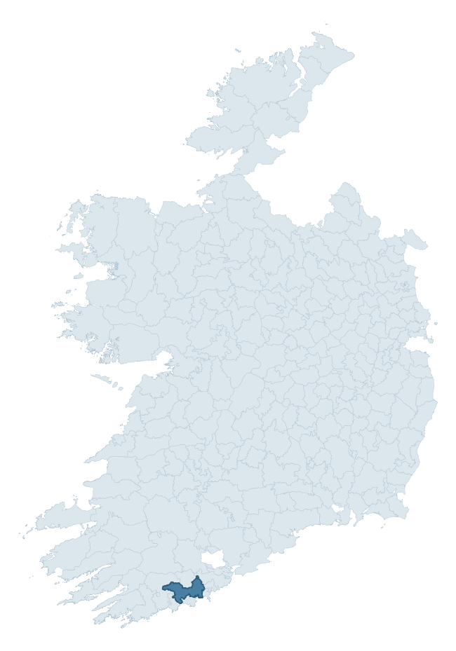
Where this barony sits in the Republic of Ireland
Geology and preservation
Bedrock geology shapes the landscape long before any settlement begins — controlling soil drainage, agricultural potential, the survival of upstanding monuments, and the preservation of buried archaeology. The figures below come from the Geological Survey Ireland 1:100,000 bedrock map.
The bedrock underlying Carbery East (East Division) is predominantly mudstone (67% of the barony by area), laid down during the Carboniferous period (68% by area, around 359 to 299 million years ago). Mudstone breaks down into heavy, often poorly-drained clay soils that historically limited intensive arable use. The lower density of ploughing tends to preserve subsurface archaeology better than in sandstone or limestone terrain, though waterlogging can be a factor for site survival. A substantial secondary geology of sandstone (32%) adds further variety to the underlying landscape. The single largest mapped unit is the Kinsale Formation (66% of the barony's bedrock).
Rock type composition
Largest mapped unit: Kinsale Formation (66% of the barony)
Placename evidence
Logainm records 45 heritage-diagnostic placenames for Carbery East (East Division), drawn from townland and civil-parish names across the barony. The dominant stratum is Early Christian ecclesiastical — cill-, teampall-, and domhnach-prefixed names that record the dense network of early church foundations established between the fifth and tenth centuries. The leading diagnostic roots are cill- (25 — church), ráth- (6 — earthen ringfort), and lios- (6 — ringfort or enclosure). This is above the ROI average of 30.7 heritage placenames per barony. The presence of multiple heritage strata side by side indicates layered occupation of the landscape across successive prehistoric and historic periods. Logainm records 213 placenames for Carbery East (East Division) (predominantly townland names). Of these, 45 (21%) carry one of the diagnostic Gaelic roots tracked above; the remainder draw on more generic landscape vocabulary that does not encode a heritage period.
Pre-Christian / Early Medieval Defensive
| Root | Count | Meaning |
|---|---|---|
| ráth- | 6 | earthen ringfort |
| lios- | 6 | ringfort or enclosure |
| caiseal- | 1 | stone ringfort |
Early Christian Ecclesiastical
| Root | Count | Meaning |
|---|---|---|
| cill- | 25 | church (early) |
| teampall- | 3 | church (later medieval) |
| díseart- | 2 | hermitage |
| cillín- | 2 | unconsecrated burial ground |
Burial, Ritual, and Norse-Contact
| Root | Count | Meaning |
|---|---|---|
| gall- | 1 | foreigner — Norse settlement marker |
Other baronies in Cork
- Courceys
- Kinatalloon
- Imokilly
- Kinalmeaky
- Carbery East (west Division)
- Muskerry West
- Kerrycurrihy
- Islands — Clare
- Cork
- Moyarta — Clare
See all 280 baronies in the Republic of Ireland Heritage Tool.

Explore further
Grounding History: 10 Maps of Northern Ireland’s Past
If you’re interested in Irish heritage more widely, the companion report for Northern Ireland brings together the analysis of all 462 NI wards into one place through 10 high-quality maps — covering monument density, archaeological periods, placename heritage, terrain, wetland, and the historic landscape at first survey. Take a look.
About this profile
Click any section below to expand.
What is a barony?
A barony is a historic administrative unit in Ireland, broadly equivalent to an English hundred. The 280 baronies used here are from the OSi 2019 National Statutory Boundaries (generalised 20m), covering the 26 counties of the Republic of Ireland. Baronies derive from the Norman period, were formalised in the 17th century, and have not been redrawn for statistical purposes. They vary enormously in area, from compact urban baronies in Dublin to vast upland baronies in Connacht, and should not be compared by raw site count without accounting for area differences.
What counts as a site?
This profile combines three distinct heritage registers, each with its own definition of what constitutes a recordable site:
- Archaeological sites (NMS). The National Monuments Service Sites and Monuments Record (SMR) catalogues every known archaeological monument or site of archaeological interest in the Republic, from prehistoric burial mounds and ringforts to medieval churches and post-medieval defensive works. Inclusion does not require legal protection — only that the site has been identified, surveyed, and assessed as having archaeological value. A separate subset of these sites lies within a recorded protection zone, which gives them statutory protection under the National Monuments Acts.
- Listed buildings (NIAH). The National Inventory of Architectural Heritage records buildings of architectural, historical, archaeological, artistic, cultural, scientific, social, or technical interest. Each surveyed structure is appraised on a five-tier scale: International, National, Regional, Local, and Record-Only. The NIAH appraisal is informational rather than strictly statutory, but it underpins local-authority Record of Protected Structures (RPS) listings.
- Heritage placenames (Logainm). Logainm is the authoritative database of Irish placenames maintained by the Placenames Branch. This profile applies a heritage-diagnostic classifier to the Irish-language form of each townland name, flagging roots that signal defensive sites (ráth-, lios-, dún-, caiseal-, cathair-), ecclesiastical foundations (cill-, teampall-, domhnach-, mainistir-), prehistoric burial-ritual features (tuaim-, carn-, leaba-), or Norse-contact settlement (gall-). Townlands without one of these diagnostic roots are not flagged here — they may still carry historical significance, but that significance is not encoded in the name itself.
Editorial principles
The narrative sections of this profile follow several explicit principles:
- Evidential. Every claim about this barony’s heritage character is anchored in the underlying register data. Where a site count, a placename count, or a percentile rank is cited, it is computed from the source datasets at export time, not estimated.
- Comparative. Counts and metrics are reported alongside their percentile rank against the other 279 ROI baronies. A barony with 50 ringforts in absolute terms could be unusually high or unusually low depending on its size and regional context; percentile ranking removes that ambiguity.
- Transparent on limits. Where a register has known coverage gaps, survey biases, or data-quality issues that affect this barony’s figures, the profile flags them rather than presenting the numbers as definitive.
- No interpretation beyond what the data supports. The narrative does not speculate about historical events, social dynamics, or cultural meaning beyond what the recorded heritage and placename evidence directly attests.
Data caveats and limits
- NMS Sites and Monuments Record is the product of survey campaigns conducted at different intensities across different counties and decades. Some baronies have been surveyed more thoroughly than others, and absolute counts should be read in that light. Sites destroyed by development before survey are typically not represented; sites in heavily forested or upland terrain are sometimes under-recorded.
- NIAH coverage is broadly complete for the Republic of Ireland but the survey was conducted on a rolling county-by-county basis, and the most recent appraisal date varies. Buildings demolished or substantially altered after their original survey may still appear in the register; conversely, recent buildings of merit may not yet have been appraised.
- Logainm classification applies a deliberately conservative pattern-matching approach to the Irish-language townland forms. The classifier prioritises true positives over recall: a townland may carry a heritage signal that the classifier doesn’t recognise, particularly where the diagnostic root has been heavily anglicised or where the townland name draws on a less common term. The 60,000+ townland records and ~9,800 classified placenames give a substantial signal at barony scale, but individual townland names should be checked against Logainm directly for definitive interpretation.
- Period attribution. The chronological distribution reflects only those NMS sites that carry a recognised period attribution in the source data. Sites listed as “Unknown” period are excluded from the dated subset.
- Boundary changes. Some baronies have undergone minor boundary adjustments since their 19th-century definition; the OSi 2019 generalised boundaries used here are the current statutory definition and may differ slightly from historical maps in border areas.
- Bedrock geology is mapped at 1:100,000 scale, which means local variation within a barony — small pockets of different rock type, mineral veins, alluvium overlying bedrock — is generalised. The dominant-system and rocktype figures are area-weighted, so a barony reading “70% Carboniferous limestone” may still contain small but archaeologically important pockets of older or younger rock. Around 3% of GSI polygons do not match the lexicon and contribute no rocktype or system attribution.
Data sources
- National Monuments Service — Sites and Monuments Record (SMR) https://data.gov.ie/dataset/national-monuments-service-archaeological-survey-of-ireland
- National Inventory of Architectural Heritage (NIAH) https://data.gov.ie/dataset/national-inventory-of-architectural-heritage-niah-national-dataset
- Logainm — Placenames Database of Ireland https://www.logainm.ie/
- Ordnance Survey Ireland — National Statutory Barony Boundaries 2019 https://data-osi.opendata.arcgis.com/
- EURODEM — European Digital Elevation Model https://www.mapsforeurope.org/datasets/euro-dem
- ESA WorldCover https://esa-worldcover.org/en
- Geological Survey Ireland — 1:100,000 Bedrock Geology https://www.gsi.ie/en-ie/data-and-maps/Pages/Bedrock.aspx
Explore more: Search any of the 280 ROI baronies, browse by historical province, or read the methodology and data sources for the full Republic of Ireland Heritage Tool.