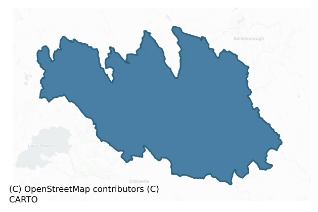
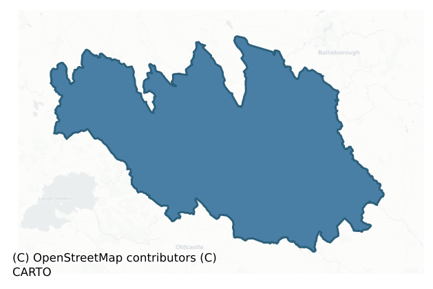
Castlerahan is a barony of County Cavan, in the historical province of Ulster (Irish: Caisleán Raithin), covering 288 km² of land. The barony records 349 NMS archaeological sites and 96 NIAH listed buildings, placing it at around the 20th percentile among 280 ROI baronies for sites per km². This means it is in the bottom third of all baronies for sites per km². Dated archaeological evidence runs from the Neolithic through to the Post Medieval, spanning 7 of 9 archaeological periods, placing the barony in the 32nd percentile among 280 ROI baronies for chronological depth. This means it is in the bottom third of all baronies for chronological depth. The largest dated subset of recorded sites dates to the Early Medieval. Logainm flags 55 placenames in the barony as carrying a recognised heritage root; the largest share — around 45% — are names associated with pre-christian defensive.
Heritage at a glance
Percentile rankings throughout this profile compare each barony only against the other 279 Republic of Ireland baronies.
The recorded heritage of Castlerahan
The National Monuments Service Sites and Monuments Record (SMR) is the statutory inventory of archaeological sites for the Republic of Ireland, maintained by the Department of Tourism, Culture, Arts, Gaeltacht, Sport and Media. Sites recorded here include earthworks, ringforts, megalithic tombs, ecclesiastical remains, and post-medieval features; not every record is legally protected, but each is registered as a monument of archaeological interest.
The National Monuments Service records 349 archaeological sites in Castlerahan, putting it at the 20th percentile among 280 ROI baronies for sites per km². This means it is in the bottom third of all baronies for sites per km². Protection coverage is near-universal — 328 sites (94%) fall within a recorded monument protection zone, indicating an extensively surveyed landscape. The dominant category is defensive sites — ringforts, enclosures, hillforts, and stone forts (229 sites, 66% of the record). Ringfort – rath is the most prevalent type, making up 42% of the barony's recorded sites (146 records) — well above the ROI average of 20% across all baronies where this type occurs. Ringfort – rath is an earthen ringfort enclosed by a bank and external ditch — the most common Early Medieval farmstead, broadly dated 500–1000 AD. Other significant types include Crannog (23) and Ringfort – unclassified (16). Crannog is an artificial or partly artificial island built up on a lake or river bed, in use from the 6th to 17th centuries AD; Ringfort – unclassified is a circular Early Medieval settlement enclosure where surviving evidence does not allow distinction between earthen and stone forms. Across the barony's 288 km², this gives a recorded density of 1.21 sites per km².
Most common monument types
Hover or tap a monument type to see its definition.
| Type | Count |
|---|---|
| Ringfort – rath an earthen ringfort enclosed by a bank and external ditch — the most common Early Medieval farmstead, broadly dated 500–1000 AD | 146 |
| Crannog an artificial or partly artificial island built up on a lake or river bed, in use from the 6th to 17th centuries AD | 23 |
| Ringfort – unclassified a circular Early Medieval settlement enclosure where surviving evidence does not allow distinction between earthen and stone forms | 16 |
| Enclosure a banked or ditched feature of uncertain type, used as a catch-all where the original function cannot be determined from surface evidence | 15 |
| Church a building used for public Christian worship, of any date from c. 500 AD onwards | 13 |
| Ritual site – holy well a well or spring traditionally associated with a saint, often credited with healing properties; many trace earlier ritual origins but devotion is documented from the medieval period onwards | 12 |
| Souterrain an underground stone-built passage and chamber, generally Early Medieval and often associated with ringforts as a defensive or storage feature | 11 |
| Graveyard a burial area associated with a church, in use from the medieval period onwards | 10 |
Chronological distribution
The dated archaeological record for Castlerahan spans from the Neolithic through to the Post Medieval, with activity attested across 7 of 9 archaeological periods. Every period from earliest to latest is represented in the record — an unbroken sequence of dated activity across the full chronological span. Activity concentrates most heavily in the Early Medieval (220 sites, 77% of dated material), with the Iron Age forming a secondary peak (29 sites, 10%). A further 64 recorded sites (18% of the overall NMS register for the barony) carry no period attribution — appearing as 'Unknown' in the bar chart below. This typically reflects either records that pre-date the standardised period vocabulary or sites awaiting specialist dating review, rather than a genuine absence of chronological evidence.
Sample of recorded monuments
Show 25 sample monuments (of 349 total)
A representative sample of 25 recorded monuments drawn from the barony’s 349 total NMS entries. Sites within a recorded monument protection zone and rarer site types are prioritised so the list shows a meaningful cross-section rather than only the most common type. Each entry shows the official Sites and Monuments Record reference number and the description published by the National Monuments Service.
House – 16th/17th century
The Archaeological Survey of Ireland (ASI) is in the process of providing information on all monuments on The Historic Environment Viewer (HEV). Currently the information for this record has not been uploaded. To…
The Archaeological Survey of Ireland (ASI) is in the process of providing information on all monuments on The Historic Environment Viewer (HEV). Currently the information for this record has not been uploaded. To access available information for research purposes please make an appointment in advance with the Archive Unit (open Fridays 10.00 am – 5.00 pm), Department of Culture, Heritage and the Gaeltacht, The Custom House, Dublin 1 D01W6XO or email nmarchive@chg.gov.ie.
Settlement cluster
The Archaeological Survey of Ireland (ASI) is in the process of providing information on all monuments on The Historic Environment Viewer (HEV). Currently the information for this record has not been uploaded. To…
The Archaeological Survey of Ireland (ASI) is in the process of providing information on all monuments on The Historic Environment Viewer (HEV). Currently the information for this record has not been uploaded. To access available information for research purposes please make an appointment in advance with the Archive Unit (open Fridays 10.00 am – 5.00 pm), Department of Culture, Heritage and the Gaeltacht, The Custom House, Dublin 1 D01W6XO or email nmarchive@chg.gov.ie.
Bawn
A castle at Doncaslan (Duffcastle) in Crosserlough parish is marked on the Down Survey (1656-8) map of County Cavan. for which see this web-page accessed on 18/04/2016 http://downsurvey.tcd.ie/down-survey-maps.php#c=Cava…
A castle at Doncaslan (Duffcastle) in Crosserlough parish is marked on the Down Survey (1656-8) map of County Cavan. for which see this web-page accessed on 18/04/2016 http://downsurvey.tcd.ie/down-survey-maps.php#c=Cavan
This location is depicted as a subrectangular area (dims c. 30m N-S; c. 25m E-W) and described as a 'Fort' on OS Fair Plan and the OS 1836 and 1876 eds. Situated on E shoulder of a natural scarp. No feature is visible at ground level.
The above description is derived from the published 'Archaeological Inventory of County Cavan' (Dublin: Stationery Office, 1995). In certain instances the entries have been revised and updated in the light of recent research.
Date of revision: 18 April 2016
Castle – ringwork
Situated on the summit of a high drumlin hill. Adjacent to the site at SW are the remains of an 18th-century church, thought to have been built on or close to the site of a medieval church (CV038-008003-;…
Situated on the summit of a high drumlin hill. Adjacent to the site at SW are the remains of an 18th-century church, thought to have been built on or close to the site of a medieval church (CV038-008003-; CV038-008002-). Raised subrectangular platform (H c. 4m; int. dims c. 42m NE-SW; c. 24m N-S) enclosed by two very substantial banks of earth and stone with wide, deep intermediate fosse. Foundations of a rectangular building (int. dims c. 11m NE-SW; c. 7m NW-SE) lie within the enclosed area in SW quadrant and those of a circular structure (int. diam. c. 6.5m) which Davies (1947a, 88) postulated was a gatehouse, occur at NE. At SW he identified the foundations of a second approximately circular structure (diam. c. 11m) which he interpreted as the remains of a tower. (CUCAP: AYS 34, AYS 35, AYS 36)
The above description is derived from the published 'Archaeological Inventory of County Cavan' (Dublin: Stationery Office, 1995). In certain instances the entries have been revised and updated in the light of recent research.
Date of upload/revision: 22 December 2008
Burial
The Archaeological Survey of Ireland (ASI) is in the process of providing information on all monuments on The Historic Environment Viewer (HEV). Currently the information for this record has not been uploaded. To…
The Archaeological Survey of Ireland (ASI) is in the process of providing information on all monuments on The Historic Environment Viewer (HEV). Currently the information for this record has not been uploaded. To access available information for research purposes please make an appointment in advance with the Archive Unit (open Fridays 10.00 am – 5.00 pm), Department of Culture, Heritage and the Gaeltacht, The Custom House, Dublin 1 D01W6XO or email nmarchive@chg.gov.ie.
Hut site
Small almost circular raised area (int. diam. c. 16.2m) partially dug into the natural SW-NE inclining slope of a hillside. Enclosed from WNW-E-SSE by a low bank of earth and stone and elsewhere by its scarped remains.…
Small almost circular raised area (int. diam. c. 16.2m) partially dug into the natural SW-NE inclining slope of a hillside. Enclosed from WNW-E-SSE by a low bank of earth and stone and elsewhere by its scarped remains. Original entrance not recognisable. Densely overgrown with vegetation.
The above description is derived from the published 'Archaeological Inventory of County Cavan' (Dublin: Stationery Office, 1995). In certain instances the entries have been revised and updated in the light of recent research.
Date of upload/revision: 22 December 2008
Windmill
The Archaeological Survey of Ireland (ASI) is in the process of providing information on all monuments on The Historic Environment Viewer (HEV). Currently the information for this record has not been uploaded. To…
The Archaeological Survey of Ireland (ASI) is in the process of providing information on all monuments on The Historic Environment Viewer (HEV). Currently the information for this record has not been uploaded. To access available information for research purposes please make an appointment in advance with the Archive Unit (open Fridays 10.00 am – 5.00 pm), Department of Culture, Heritage and the Gaeltacht, The Custom House, Dublin 1 D01W6XO or email nmarchive@chg.gov.ie.
Castle – motte and bailey
Situated on a small promontory jutting into Lough Ramor and cut off from the mainland by a substantial external bank and wide, deep fosse curving from NE-E-SE. The motte is situated in the SE of the enclosed area. It…
Situated on a small promontory jutting into Lough Ramor and cut off from the mainland by a substantial external bank and wide, deep fosse curving from NE-E-SE. The motte is situated in the SE of the enclosed area. It comprises a high, steep-sided, and flat-topped circular earthen mound (diam. of base c. 28m; H 4-5m). The summit of the mound is also circular (diam. c. 12m N-S). A shallow fosse to the NE of the motte separates it from the bailey which itself comprises two courts separated by a low stone wall. The outer court adjoins a rectangular depression which may have been a slipway for boats. No trace of any buildings within bailey. (Davies 1947a, 78)
The above description is derived from the published 'Archaeological Inventory of County Cavan' (Dublin: Stationery Office, 1995). In certain instances the entries have been revised and updated in the light of recent research.
Date of upload/revision: 22 December 2008
Megalithic tomb – wedge tomb
Situated on a ridge 150m W of Raffony Lough. A gallery, aligned WSW-ENE, is divided by a septal-stone into a portico, 1.5m long, and main chamber at least 4.3m long. To the N of the gallery there are four outer wall…
Situated on a ridge 150m W of Raffony Lough. A gallery, aligned WSW-ENE, is divided by a septal-stone into a portico, 1.5m long, and main chamber at least 4.3m long. To the N of the gallery there are four outer wall stones and two to the S. The northern of two facade-stones links the outer wall at the N to the gallery side. The portico is represented by two stones of its N side and the main chamber by two stones to the N and four to the S. Within the chamber a stone 0.7m E of the septal-stone may be displaced. An irregular mound, 13m N-S by 12m E-W, encloses the structure. (de Valera and Ó Nualláin 1972, 135, No. 38)
The above description is derived from the published 'Archaeological Inventory of County Cavan' (Dublin: Stationery Office, 1995). In certain instances the entries have been revised and updated in the light of recent research.
Date of upload/revision: 22 December 2008
See linked document with details from Ruaidhrí de Valera and Seán Ó Nualláin, Survey of the Megalithic Tombs of Ireland. Volume III. Counties Galway, Roscommon, Leitrim, Longford, Westmeath, Laoighis, Offaly, Kildare, Cavan. (Dublin: Stationery Office, 1972).
Hilltop enclosure
Situated on the spine of a NW-SE drumlin ridge towards the SE end. It is described as a 'fort' and 'Old Burial Ground' in gothic lettering on the on OS 1836 and 1908 editions of the OS 6-inch map. This is a large…
Situated on the spine of a NW-SE drumlin ridge towards the SE end. It is described as a 'fort' and 'Old Burial Ground' in gothic lettering on the on OS 1836 and 1908 editions of the OS 6-inch map. This is a large pear-shaped or D-shaped area (int dims. c. 85m NNE-SSW; c. 72m ENE-WSW) defined by a substantial, although partly denuded, earthen bank (at N: int. H 1m; ext. H 2-2.5m). The NE quadrant is separated from the remainder of the site by portion of a dividing wall (L c. 33m) comprising a single-row of boulders laid end to end extending from the centre. Davies (1948, 115) records that 'The area thus enclosed, hardly a quarter of the rath, is believed to be a graveyard and the site of a church'. Also within the enclosure is the site of a well (CV040-021002-) which has been infilled (local information).
The above description is derived from the published 'Archaeological Inventory of County Cavan' (Dublin: Stationery Office, 1995). In certain instances the entries have been revised and updated in the light of recent research.
Date of revision: 28 August 2017
Promontory fort – inland
A large irregularly shaped former island close to the N shore of Mullagh Lough. Water- levels in the lake have dropped and the island is now joined to the mainland. Davies (1947, 98) recorded that the island is 'cut off…
A large irregularly shaped former island close to the N shore of Mullagh Lough. Water- levels in the lake have dropped and the island is now joined to the mainland. Davies (1947, 98) recorded that the island is 'cut off from the mainland by a bank and fosse to form a promontory rath'. He speculated that 'this work might have been the predecessor of Cloghballybeg castle (CV040-005—-), or it may be much older'.
The above description is derived from the published 'Archaeological Inventory of County Cavan' (Dublin: Stationery Office, 1995). In certain instances the entries have been revised and updated in the light of recent research.
Date of upload/revision: 22 December 2008
Ogham stone (present location)
This is the present location, at St Kilians Heritage Centre, of the Mullagh ogham stone. It is believed (local tradition) to have originated from an early church site at Rantavan (CV044-018001-). It was subsequently…
This is the present location, at St Kilians Heritage Centre, of the Mullagh ogham stone. It is believed (local tradition) to have originated from an early church site at Rantavan (CV044-018001-). It was subsequently removed to the graveyard of 'Templekelly' at Mullagh (see CV040-044003-), and reused as a headstone positioned just W of the ruined church of Mullagh (Ferguson 1875, 303). The stone is limestone and measures 0.64 x 0.27 x 0.11m (Macalister 1945, 299). Macalister (1945, 300, no. 312) read the inscription as OSBBAR.
Compiled by: Nora White
Date of upload: 10 September 2016
Mill – unclassified
Three cut, shaped and morticed wooden beams discovered in the bed of a stream during the course of drainage works in 1984. Stream flows NW-SE and forms the boundary between the townlands of Cloghbally Upper and Fartagh.…
Three cut, shaped and morticed wooden beams discovered in the bed of a stream during the course of drainage works in 1984. Stream flows NW-SE and forms the boundary between the townlands of Cloghbally Upper and Fartagh. The location of these timbers on the downhill path of a fast-flowing stream suggests that they were components of a horizontal mill. Additional timbers were noted by the landowner at the same find-spot. Local tradition points to the site of an 'old road' aligned E-W, crossing the stream to S of mill site.
The above description is derived from the published 'Archaeological Inventory of County Cavan' (Dublin: Stationery Office, 1995). In certain instances the entries have been revised and updated in the light of recent research.
Date of upload/revision: 22 December 2008
Ogham stone
There was a local tradition that this is the original location Mullagh ogham stone (see CV040-044003-) which was later moved to Teampall Cheallaigh (Templekelly, see CV040-044001-) in Mullagh townland. It is now in St…
There was a local tradition that this is the original location Mullagh ogham stone (see CV040-044003-) which was later moved to Teampall Cheallaigh (Templekelly, see CV040-044001-) in Mullagh townland. It is now in St Kilians heritage Centre Mullagh (CV040-047—-). The stone is limestone and measures 0.64 x 0.27 x 0.11m (Macalister 1945, 299). Macalister (1945, 300, no. 312) read the inscription as OSBBAR. The exact find-spot is not known.
Compiled by: Nora White
Date of upload: 11 September 2016
Architectural fragment
The Archaeological Survey of Ireland (ASI) is in the process of providing information on all monuments on The Historic Environment Viewer (HEV). Currently the information for this record has not been uploaded. To…
The Archaeological Survey of Ireland (ASI) is in the process of providing information on all monuments on The Historic Environment Viewer (HEV). Currently the information for this record has not been uploaded. To access available information for research purposes please make an appointment in advance with the Archive Unit (open Fridays 10.00 am – 5.00 pm), Department of Culture, Heritage and the Gaeltacht, The Custom House, Dublin 1 D01W6XO or email nmarchive@chg.gov.ie.
Mass-rock
The Archaeological Survey of Ireland (ASI) is in the process of providing information on all monuments on The Historic Environment Viewer (HEV). Currently the information for this record has not been uploaded. To…
The Archaeological Survey of Ireland (ASI) is in the process of providing information on all monuments on The Historic Environment Viewer (HEV). Currently the information for this record has not been uploaded. To access available information for research purposes please make an appointment in advance with the Archive Unit (open Fridays 10.00 am – 5.00 pm), Department of Culture, Heritage and the Gaeltacht, The Custom House, Dublin 1 D01W6XO or email nmarchive@chg.gov.ie.
Stone sculpture – aniconic (present location)
The Killycluggin stone is a fragmentary decorated monolith of Iron Age date that was first brought to general public notice in 1922 (Macalister 1922). At that time the stone was in the same broken state in which it now…
The Killycluggin stone is a fragmentary decorated monolith of Iron Age date that was first brought to general public notice in 1922 (Macalister 1922). At that time the stone was in the same broken state in which it now appears and was situated some 10m SE of a stone circle (CV013-026002-). Macalister recorded local traditions which alleged that the damage to the stone had been carried out in living memory by local farmers in order to remove an obstruction to agricultural activities. Macalister also stated that people of the vicinity had dug around the stone in a vain search for buried treasure and in so doing had apparently destroyed a 'cist burial'. He did not, however, actually see this 'cist burial'. Some thirty years later a second decorated stone fragment, probably a portion of the same monolith, was discovered a short distance down-slope from the main piece. In the early summer of 1974 it was decided to remove the weathered and overgrown fragments to the National Museum of Ireland. A limited excavation was undertaken in its immediate vicinity which revealed that 'the stone stood in a flat-bottomed pit which had been deliberately sunk 80cm into the subsoil to receive it' (Raftery 1978, 51-2). Immediately E of the stone were two pits one of which may be identified as the remains of the cist burial identified by Macalister as it contained tiny fragments of burnt bone (CV013-026003-). The two fragments of the Killycluggin Stone are on display in the Cavan County Museum,…
Cist
Situated on a rise in a slight hollow in a gently undulating landscape. In 2009 a cist was discovered in landscaping work and investigated by the National Museum of Ireland. The cist (int. dims c. 7m NW-SE; c. 0.6m…
Situated on a rise in a slight hollow in a gently undulating landscape. In 2009 a cist was discovered in landscaping work and investigated by the National Museum of Ireland. The cist (int. dims c. 7m NW-SE; c. 0.6m NE-SW; D c. 0.5m) was defined by four slabs and had been covered by a single large capstone in a stony area. This suggests that there may have been a cairn at some time although no evidence of one was present. There was one large floorstone with smaller slabs around the edges. The complete tripartite Bowl Food Vessel together with the inhumation were removed on discovery and their disposition cannot be recovered, although the body was probably flexed. The bowl has two horizontal ribs and is decorated in horizontal panels of oblique and horizontal incised lines. The bones represented one juvenile, aged 6-7 years at death. A sample of a rib bone produced a C14 date of 1955-1752 cal. BC. (Sikora et al. 2018)
Compiled by: Michael Moore
Date of upload: 16/09/2020
Rock scribing – folk art
Located on a gentle S-facing slope. A piece of rock outcrop in scrub has incised markings forming rectangles and crosses. They were first noted by George V. Du Noyer in 1864 who describes them (1865, 383-4) as covering…
Located on a gentle S-facing slope. A piece of rock outcrop in scrub has incised markings forming rectangles and crosses. They were first noted by George V. Du Noyer in 1864 who describes them (1865, 383-4) as covering an area of ‘about 11 feet by nine feet (c. 3.35m x c.2.75m)’ and consisting of small crosses, sometimes within rectangles or kite-shapes, or simple incised lines, some of which he thought might be fresh. Although these might be considered to have been prehistoric in date by Du Noyer and even into the twentieth century by O’Connell (1967, 240-1), they are now known to be fairly recent rock scribing, perhaps even eighteenth century in date. Their precise location was not known until recent research by the Munterconnaught Heritage Society, brought to attention by Pauline Hankin.
Compiled by: Michael Moore
Date of upload: 3 December 2020
Megalithic tomb – court tomb
Situated on a gentle slope in rolling country. The more easterly side of a chamber, 2.5m long, is represented by three orthostats, a tall jamb at the NNW and, 1m to the S, two adjoining sidestones which in turn…
Situated on a gentle slope in rolling country. The more easterly side of a chamber, 2.5m long, is represented by three orthostats, a tall jamb at the NNW and, 1m to the S, two adjoining sidestones which in turn articulate with a backstone at the SSE. A large displaced slab leans against the jamb. Another orthostat beside the jamb seems to continue the line of the gallery to the NNW. A set stone about 1m S of the backstone suggests a continuation of the gallery in the opposite direction. There is a displaced slab alongside this, (de Valera and Ó Nualláin 1972, 132-3, No. 34)
The above description is derived from the published 'Archaeological Inventory of County Cavan' (Dublin: Stationery Office, 1995). In certain instances the entries have been revised and updated in the light of recent research.
Date of upload/revision: 22 December 2008
See linked document with details from Ruaidhrí de Valera and Seán Ó Nualláin, Survey of the Megalithic Tombs of Ireland. Volume III. Counties Galway, Roscommon, Leitrim, Longford, Westmeath, Laoighis, Offaly, Kildare, Cavan. (Dublin: Stationery Office, 1972).
Megalithic tomb – unclassified
Sited close to the base of a slope in rolling country. The tomb is largely concealed in a subcircular mound, 14m across, 0.5m high at the N and 2m at the downslope southern side. A number of set stones visible at the…
Sited close to the base of a slope in rolling country. The tomb is largely concealed in a subcircular mound, 14m across, 0.5m high at the N and 2m at the downslope southern side. A number of set stones visible at the top of the mound indicate a gallery at least 3.3m long, aligned ENE-WSW. Two stones, 1.1m apart and 0.6m high, mark its WSW end. Only the tops of four other stones, two at each side are visible. North of the presumed gallery there is a possible line of outer-walling. (Ó Nualláin 1989, 141 Cv. 43)
The above description is derived from the published 'Archaeological Inventory of County Cavan' (Dublin: Stationery Office, 1995). In certain instances the entries have been revised and updated in the light of recent research.
Date of upload/revision: 22 December 2008
Ecclesiastical enclosure
The Archaeological Survey of Ireland (ASI) is in the process of providing information on all monuments on The Historic Environment Viewer (HEV). Currently the information for this record has not been uploaded. To…
The Archaeological Survey of Ireland (ASI) is in the process of providing information on all monuments on The Historic Environment Viewer (HEV). Currently the information for this record has not been uploaded. To access available information for research purposes please make an appointment in advance with the Archive Unit (open Fridays 10.00 am – 5.00 pm), Department of Culture, Heritage and the Gaeltacht, The Custom House, Dublin 1 D01W6XO or email nmarchive@chg.gov.ie.
Megalithic tomb – court tomb
This monument, situated on a flat patch of ground on a W-facing slope, is overgrown and greatly ruined but would appear to be the remains of a dual court tomb. At the NW end of a cairn, 24m long and 1m or so high, there…
This monument, situated on a flat patch of ground on a W-facing slope, is overgrown and greatly ruined but would appear to be the remains of a dual court tomb. At the NW end of a cairn, 24m long and 1m or so high, there is an upright stone 1.15m high and alongside it a prostrate slab, both apparently entrance jambs of a gallery of which no other trace is visible. Three stones NW of the upright stone represent a court. On the main axis of the cairn and at its SE end, a line of three low orthostats are partly exposed, and at right angles to the southern of these there is another larger example. The latter may be a jamb and the others part of the side of a gallery.
The above description is derived from the published 'Archaeological Inventory of County Cavan' (Dublin: Stationery Office, 1995). In certain instances the entries have been revised and updated in the light of recent research.
Date of upload/revision: 22 December 2008
Mound
The Archaeological Survey of Ireland (ASI) is in the process of providing information on all monuments on The Historic Environment Viewer (HEV). Currently the information for this record has not been uploaded. To…
The Archaeological Survey of Ireland (ASI) is in the process of providing information on all monuments on The Historic Environment Viewer (HEV). Currently the information for this record has not been uploaded. To access available information for research purposes please make an appointment in advance with the Archive Unit (open Fridays 10.00 am – 5.00 pm), Department of Culture, Heritage and the Gaeltacht, The Custom House, Dublin 1 D01W6XO or email nmarchive@chg.gov.ie.
Ringfort – rath
Raised circular area (int. diam. c. 46m) enclosed by a very substantial earthen bank and a wide, deep, partially waterlogged fosse. The site is encircled by modern field boundaries. Break in bank at SE with accompanying…
Raised circular area (int. diam. c. 46m) enclosed by a very substantial earthen bank and a wide, deep, partially waterlogged fosse. The site is encircled by modern field boundaries. Break in bank at SE with accompanying causeway represents original entrance. Inside the bank at W is an irregularly shaped depression of unknown significance and at NE a second depression which may mark the site of a souterrain (CV031-034002-).
The above description is derived from the published 'Archaeological Inventory of County Cavan' (Dublin: Stationery Office, 1995). In certain instances the entries have been revised and updated in the light of recent research.
Date of upload/revision: 22 December 2008
Listed buildings
The National Inventory of Architectural Heritage (NIAH) is a state survey appraising buildings of architectural, historical, archaeological, artistic, cultural, scientific, social, or technical interest. Each surveyed structure receives a rating from International (the highest, for buildings of European importance) through National, Regional, Local, and Record-Only.
The NIAH records 96 listed buildings in Castlerahan (48th percentile across ROI baronies). All recorded buildings carry Regional or lower grading; the barony does not contain any structures appraised as being of National or International architectural importance. Construction dates concentrate most heavily in the Victorian (1830-1900) period. The most-recorded building type is house (23 examples, 24% of the listed stock).
Terrain and environment
Mean elevation across the barony is 119m — the 73rd percentile among 280 ROI baronies for elevation. This means it is in the top third of all baronies for elevation. This is a relatively elevated landscape by ROI standards. Elevation matters for heritage because higher-altitude baronies typically favour defensive monuments — ringforts and hilltop forts placed on prominent ground — while lowland baronies are more likely to carry the dense settlement and church networks of intensive agricultural landscapes. A maximum elevation of 250m gives the barony meaningful vertical relief. Mean slope is 4.3° — the 64th percentile among 280 ROI baronies for slope. This means it is in the upper half of all baronies for slope. Slope is a key control on both land use and archaeological preservation: steep ground resists ploughing and tends to preserve earthworks intact, while gentle slopes favour intensive cultivation that damages or destroys surface archaeology over time. The Topographic Wetness Index averages 10.3, the 32nd percentile among 280 ROI baronies for wetness. This means it is in the bottom third of all baronies for wetness. Drainage matters for heritage because poorly-drained ground preserves organic archaeology (wooden trackways, leather, textiles, and on rare occasions human remains) far better than free-draining soil; well-drained ground favours arable use but destroys organic material rapidly. The land cover is dominated by improved grassland (81%) and woodland (15%).
Terrain measurements
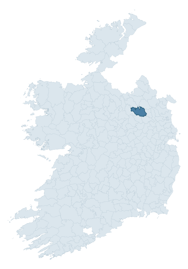
Where this barony sits in the Republic of Ireland
Geology and preservation
Bedrock geology shapes the landscape long before any settlement begins — controlling soil drainage, agricultural potential, the survival of upstanding monuments, and the preservation of buried archaeology. The figures below come from the Geological Survey Ireland 1:100,000 bedrock map.
The bedrock underlying Castlerahan is predominantly greywacke (50% of the barony by area), laid down during the Silurian period (94% by area, around 444 to 419 million years ago). Greywacke is a hard, dark, fine-grained sandstone that weathers to thin upland soils. Greywacke baronies typically carry sparser settlement archaeology but provide high-quality building stone visible in older field walls and farm buildings. A substantial secondary geology of sandstone (40%) adds further variety to the underlying landscape. The single largest mapped unit is the Castlerahan Formation (43% of the barony's bedrock).
Rock type composition
Largest mapped unit: Castlerahan Formation (43% of the barony)
Placename evidence
Logainm records 55 heritage-diagnostic placenames for Castlerahan, drawn from townland and civil-parish names across the barony. The dominant stratum is pre-Christian and Early Medieval defensive — ráth-, lios-, dún-, and caiseal-prefixed names that mark Iron Age and early historic settlement. The leading diagnostic roots are cill- (17 — church), lios- (15 — ringfort or enclosure), and ráth- (7 — earthen ringfort). This is above the ROI average of 30.7 heritage placenames per barony. The presence of multiple heritage strata side by side indicates layered occupation of the landscape across successive prehistoric and historic periods. Logainm records 262 placenames for Castlerahan (predominantly townland names). Of these, 55 (21%) carry one of the diagnostic Gaelic roots tracked above; the remainder draw on more generic landscape vocabulary that does not encode a heritage period.
Pre-Christian / Early Medieval Defensive
| Root | Count | Meaning |
|---|---|---|
| lios- | 15 | ringfort or enclosure |
| ráth- | 7 | earthen ringfort |
| dún- | 2 | hilltop or promontory fort |
| caiseal- | 1 | stone ringfort |
Early Christian Ecclesiastical
| Root | Count | Meaning |
|---|---|---|
| cill- | 17 | church (early) |
| teampall- | 3 | church (later medieval) |
Burial, Ritual, and Norse-Contact
| Root | Count | Meaning |
|---|---|---|
| carn- | 5 | cairn |
| leacht- | 3 | grave monument |
| feart- | 2 | grave mound |
| gall- | 2 | foreigner — Norse settlement marker |
Other baronies in Cavan
About this profile
Click any section below to expand.
What is a barony?
A barony is a historic administrative unit in Ireland, broadly equivalent to an English hundred. The 280 baronies used here are from the OSi 2019 National Statutory Boundaries (generalised 20m), covering the 26 counties of the Republic of Ireland. Baronies derive from the Norman period, were formalised in the 17th century, and have not been redrawn for statistical purposes. They vary enormously in area, from compact urban baronies in Dublin to vast upland baronies in Connacht, and should not be compared by raw site count without accounting for area differences.
What counts as a site?
This profile combines three distinct heritage registers, each with its own definition of what constitutes a recordable site:
- Archaeological sites (NMS). The National Monuments Service Sites and Monuments Record (SMR) catalogues every known archaeological monument or site of archaeological interest in the Republic, from prehistoric burial mounds and ringforts to medieval churches and post-medieval defensive works. Inclusion does not require legal protection — only that the site has been identified, surveyed, and assessed as having archaeological value. A separate subset of these sites lies within a recorded protection zone, which gives them statutory protection under the National Monuments Acts.
- Listed buildings (NIAH). The National Inventory of Architectural Heritage records buildings of architectural, historical, archaeological, artistic, cultural, scientific, social, or technical interest. Each surveyed structure is appraised on a five-tier scale: International, National, Regional, Local, and Record-Only. The NIAH appraisal is informational rather than strictly statutory, but it underpins local-authority Record of Protected Structures (RPS) listings.
- Heritage placenames (Logainm). Logainm is the authoritative database of Irish placenames maintained by the Placenames Branch. This profile applies a heritage-diagnostic classifier to the Irish-language form of each townland name, flagging roots that signal defensive sites (ráth-, lios-, dún-, caiseal-, cathair-), ecclesiastical foundations (cill-, teampall-, domhnach-, mainistir-), prehistoric burial-ritual features (tuaim-, carn-, leaba-), or Norse-contact settlement (gall-). Townlands without one of these diagnostic roots are not flagged here — they may still carry historical significance, but that significance is not encoded in the name itself.
Editorial principles
The narrative sections of this profile follow several explicit principles:
- Evidential. Every claim about this barony’s heritage character is anchored in the underlying register data. Where a site count, a placename count, or a percentile rank is cited, it is computed from the source datasets at export time, not estimated.
- Comparative. Counts and metrics are reported alongside their percentile rank against the other 279 ROI baronies. A barony with 50 ringforts in absolute terms could be unusually high or unusually low depending on its size and regional context; percentile ranking removes that ambiguity.
- Transparent on limits. Where a register has known coverage gaps, survey biases, or data-quality issues that affect this barony’s figures, the profile flags them rather than presenting the numbers as definitive.
- No interpretation beyond what the data supports. The narrative does not speculate about historical events, social dynamics, or cultural meaning beyond what the recorded heritage and placename evidence directly attests.
Data caveats and limits
- NMS Sites and Monuments Record is the product of survey campaigns conducted at different intensities across different counties and decades. Some baronies have been surveyed more thoroughly than others, and absolute counts should be read in that light. Sites destroyed by development before survey are typically not represented; sites in heavily forested or upland terrain are sometimes under-recorded.
- NIAH coverage is broadly complete for the Republic of Ireland but the survey was conducted on a rolling county-by-county basis, and the most recent appraisal date varies. Buildings demolished or substantially altered after their original survey may still appear in the register; conversely, recent buildings of merit may not yet have been appraised.
- Logainm classification applies a deliberately conservative pattern-matching approach to the Irish-language townland forms. The classifier prioritises true positives over recall: a townland may carry a heritage signal that the classifier doesn’t recognise, particularly where the diagnostic root has been heavily anglicised or where the townland name draws on a less common term. The 60,000+ townland records and ~9,800 classified placenames give a substantial signal at barony scale, but individual townland names should be checked against Logainm directly for definitive interpretation.
- Period attribution. The chronological distribution reflects only those NMS sites that carry a recognised period attribution in the source data. Sites listed as “Unknown” period are excluded from the dated subset.
- Boundary changes. Some baronies have undergone minor boundary adjustments since their 19th-century definition; the OSi 2019 generalised boundaries used here are the current statutory definition and may differ slightly from historical maps in border areas.
- Bedrock geology is mapped at 1:100,000 scale, which means local variation within a barony — small pockets of different rock type, mineral veins, alluvium overlying bedrock — is generalised. The dominant-system and rocktype figures are area-weighted, so a barony reading “70% Carboniferous limestone” may still contain small but archaeologically important pockets of older or younger rock. Around 3% of GSI polygons do not match the lexicon and contribute no rocktype or system attribution.
Data sources
- National Monuments Service — Sites and Monuments Record (SMR) https://data.gov.ie/dataset/national-monuments-service-archaeological-survey-of-ireland
- National Inventory of Architectural Heritage (NIAH) https://data.gov.ie/dataset/national-inventory-of-architectural-heritage-niah-national-dataset
- Logainm — Placenames Database of Ireland https://www.logainm.ie/
- Ordnance Survey Ireland — National Statutory Barony Boundaries 2019 https://data-osi.opendata.arcgis.com/
- EURODEM — European Digital Elevation Model https://www.mapsforeurope.org/datasets/euro-dem
- ESA WorldCover https://esa-worldcover.org/en
- Geological Survey Ireland — 1:100,000 Bedrock Geology https://www.gsi.ie/en-ie/data-and-maps/Pages/Bedrock.aspx
Explore more: Search any of the 280 ROI baronies, browse by historical province, or read the methodology and data sources for the full Republic of Ireland Heritage Tool.