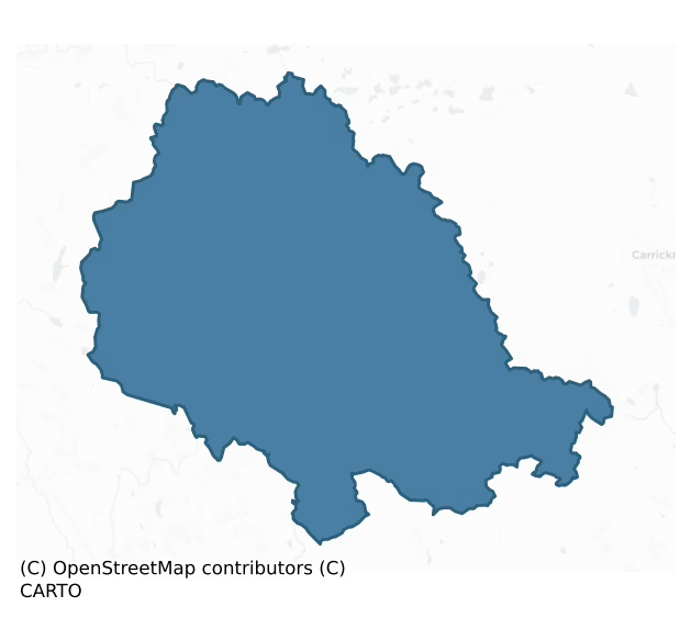
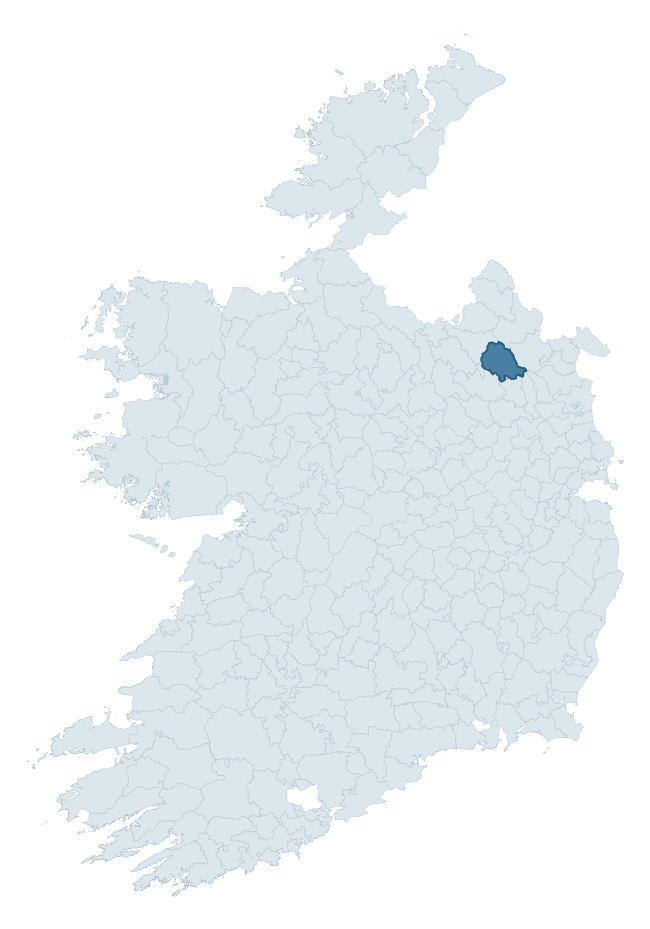
Clankee is a barony of County Cavan, in the historical province of Ulster (Irish: Clann Chaoich), covering 260 km² of land. The barony records 289 NMS archaeological sites and 124 NIAH listed buildings, placing it at around the 17th percentile among 280 ROI baronies for sites per km². This means it is in the bottom fifth of all baronies for sites per km². Dated archaeological evidence runs from the Neolithic through to the Modern, spanning 8 of 9 archaeological periods, placing the barony in the 70th percentile among 280 ROI baronies for chronological depth. This means it is in the top third of all baronies for chronological depth. The largest dated subset of recorded sites dates to the Early Medieval. Logainm flags 53 placenames in the barony as carrying a recognised heritage root; the largest share — around 57% — are names associated with pre-christian defensive.

Heritage at a glance
Percentile rankings throughout this profile compare each barony only against the other 279 Republic of Ireland baronies.
The recorded heritage of Clankee
The National Monuments Service Sites and Monuments Record (SMR) is the statutory inventory of archaeological sites for the Republic of Ireland, maintained by the Department of Tourism, Culture, Arts, Gaeltacht, Sport and Media. Sites recorded here include earthworks, ringforts, megalithic tombs, ecclesiastical remains, and post-medieval features; not every record is legally protected, but each is registered as a monument of archaeological interest.
The National Monuments Service records 289 archaeological sites in Clankee, putting it at the 17th percentile among 280 ROI baronies for sites per km². This means it is in the bottom fifth of all baronies for sites per km². Protection coverage is near-universal — 275 sites (95%) fall within a recorded monument protection zone, indicating an extensively surveyed landscape. The dominant category is defensive sites — ringforts, enclosures, hillforts, and stone forts (211 sites, 73% of the record). Ringfort – rath is the most prevalent type, making up 57% of the barony's recorded sites (164 records) — well above the ROI average of 20% across all baronies where this type occurs. Ringfort – rath is an earthen ringfort enclosed by a bank and external ditch — the most common Early Medieval farmstead, broadly dated 500–1000 AD. Other significant types include Souterrain (12) and Crannog (12). Souterrain is an underground stone-built passage and chamber, generally Early Medieval and often associated with ringforts as a defensive or storage feature; Crannog is an artificial or partly artificial island built up on a lake or river bed, in use from the 6th to 17th centuries AD. Across the barony's 260 km², this gives a recorded density of 1.11 sites per km².
Most common monument types
Hover or tap a monument type to see its definition.
| Type | Count |
|---|---|
| Ringfort – rath an earthen ringfort enclosed by a bank and external ditch — the most common Early Medieval farmstead, broadly dated 500–1000 AD | 164 |
| Souterrain an underground stone-built passage and chamber, generally Early Medieval and often associated with ringforts as a defensive or storage feature | 12 |
| Crannog an artificial or partly artificial island built up on a lake or river bed, in use from the 6th to 17th centuries AD | 12 |
| Church a building used for public Christian worship, of any date from c. 500 AD onwards | 9 |
| Enclosure a banked or ditched feature of uncertain type, used as a catch-all where the original function cannot be determined from surface evidence | 8 |
| Graveyard a burial area associated with a church, in use from the medieval period onwards | 6 |
| Castle – unclassified a castle whose form cannot be precisely classified, dating somewhere between the late 12th and 16th centuries | 5 |
| Bawn the defended courtyard of a medieval house, tower house or fortified house | 4 |
Chronological distribution
The dated archaeological record for Clankee spans from the Neolithic through to the Modern, with activity attested across 8 of 9 archaeological periods. This is the 70th percentile across ROI baronies for chronological depth — an above-average span. Every period from earliest to latest is represented in the record — an unbroken sequence of dated activity across the full chronological span. Activity concentrates most heavily in the Early Medieval (200 sites, 81% of dated material), with the Iron Age forming a secondary peak (20 sites, 8%). A further 42 recorded sites (15% of the overall NMS register for the barony) carry no period attribution — appearing as 'Unknown' in the bar chart below. This typically reflects either records that pre-date the standardised period vocabulary or sites awaiting specialist dating review, rather than a genuine absence of chronological evidence.
Sample of recorded monuments
Show 25 sample monuments (of 289 total)
A representative sample of 25 recorded monuments drawn from the barony’s 289 total NMS entries. Sites within a recorded monument protection zone and rarer site types are prioritised so the list shows a meaningful cross-section rather than only the most common type. Each entry shows the official Sites and Monuments Record reference number and the description published by the National Monuments Service.
Megalithic structure
Sited on a low ridge. This consists of an irregularly shaped boulder, 1.7m by 1.4m by 0.85m thick, supported on four blocks of stone. It is incorporated in and partly obscured by a stone field fence. A stone under the N…
Sited on a low ridge. This consists of an irregularly shaped boulder, 1.7m by 1.4m by 0.85m thick, supported on four blocks of stone. It is incorporated in and partly obscured by a stone field fence. A stone under the N side of the boulder is not set and the status of three others, one to the W and two to the S is unclear. The nature of the site remains to be determined. (de Valera and Ó Nualláin 1972, xxii, 'at Caskeanduff')
The above description is derived from the published 'Archaeological Inventory of County Cavan' (Dublin: Stationery Office, 1995). In certain instances the entries have been revised and updated in the light of recent research.
Date of upload/revision: 22 December 2008
Children's burial ground
A rath (CV023-030001-) which appears to have been utilised as a burial ground. A number of low upright stones which are believed to mark the graves of unbaptized children (local information) occur on the bank and within…
A rath (CV023-030001-) which appears to have been utilised as a burial ground. A number of low upright stones which are believed to mark the graves of unbaptized children (local information) occur on the bank and within the internal area.
The above description is derived from the published 'Archaeological Inventory of County Cavan' (Dublin: Stationery Office, 1995). In certain instances the entries have been revised and updated in the light of recent research.
Date of upload/revision: 22 December 2008
Bullaun stone
Small irregularly shaped boulder (H 0.2m; dims. 0.67m x 0.6m) containing a well-defined, basin-shaped depression (diam. 0.19m; D 0.07m). Tradition that the bullaun was used as a 'font' during Penal times (local…
Small irregularly shaped boulder (H 0.2m; dims. 0.67m x 0.6m) containing a well-defined, basin-shaped depression (diam. 0.19m; D 0.07m). Tradition that the bullaun was used as a 'font' during Penal times (local information). On the surface of the stone are a number of carvings which presumably date to this period. Situated in a farmyard c. 175m E of Knockbride church (CV023-026—-).
The above description is derived from the published 'Archaeological Inventory of County Cavan' (Dublin: Stationery Office, 1995). In certain instances the entries have been revised and updated in the light of recent research.
Date of upload/revision: 22 December 2008
Megalithic tomb – wedge tomb
Situated on a low hillock. This is a well- preserved gallery, aligned roughly SSW-NNE. There are two outer wall stones to N and S and a facade- stone stands forward of the N side of the gallery. The structure stands in…
Situated on a low hillock. This is a well- preserved gallery, aligned roughly SSW-NNE. There are two outer wall stones to N and S and a facade- stone stands forward of the N side of the gallery. The structure stands in a mound 9.5m by 7m by 1m high. The main chamber, 5.5m long, is closed by a tall, transverse slab at the W. In front of this a small stone, on which rests a displaced slab, may form the S side of a portico. Six stones form the N side of the main chamber, five remain at the S, and it is closed by a low backstone. The eastern pair of stones on both sides are stepped in from the line of the others and are markedly lower than them. (de Valera and Ó Nualláin 1972, 129-30, No. 29; CUCAP BGL 76)
The above description is derived from the published 'Archaeological Inventory of County Cavan' (Dublin: Stationery Office, 1995). In certain instances the entries have been revised and updated in the light of recent research.
Date of upload/revision: 22 December 2008
See linked document with details from Ruaidhrí de Valera and Seán Ó Nualláin, Survey of the Megalithic Tombs of Ireland. Volume III. Counties Galway, Roscommon, Leitrim, Longford, Westmeath, Laoighis, Offaly, Kildare, Cavan. (Dublin: Stationery Office, 1972).
Promontory fort – inland
Depicted on OS 1836 and 1876 eds. as a large subrectangular enclosure at the NW end of a long, low promontory, jutting into Milltown Lough. Subrectangular area (int. dims c. 42m NW-SE; 37m NE-SW) cut off from the…
Depicted on OS 1836 and 1876 eds. as a large subrectangular enclosure at the NW end of a long, low promontory, jutting into Milltown Lough. Subrectangular area (int. dims c. 42m NW-SE; 37m NE-SW) cut off from the mainland by fragmentary traces of a scarp with wide, shallow, external fosse (Wth c. 4m). Scarp is identifiable only from SE-S-SW. Davies (ITA Survey 1942) recorded 'a rather sunken causeway' at S which he believed probably represented the original entrance. A large rectangular enclosure lies c. 30m to SE (CV028-022—-).
The above description is derived from the published 'Archaeological Inventory of County Cavan' (Dublin: Stationery Office, 1995). In certain instances the entries have been revised and updated in the light of recent research.
Date of upload/revision: 22 December 2008
Ringfort – cashel
Marked 'Fort' on OS 1836 and 1876 eds. No remains visible at the location indicated. However, a partly grassed-over conical mound of stones (H 1m) with some large stones visible at its base, lies a short distance to NW.…
Marked 'Fort' on OS 1836 and 1876 eds. No remains visible at the location indicated. However, a partly grassed-over conical mound of stones (H 1m) with some large stones visible at its base, lies a short distance to NW. This is believed to be the remains of a 'Fort' (local information).
The above description is derived from the published 'Archaeological Inventory of County Cavan' (Dublin: Stationery Office, 1995). In certain instances the entries have been revised and updated in the light of recent research.
Date of upload/revision: 22 December 2008
Castle – motte and bailey
Motte comprises a roughly circular (diam. of base c. 30m; H c. 5m), very steep-sided mound, the W portion of which has been quarried away. The summit of the mound was originally flat-topped (diam. c. 12m). A fosse which…
Motte comprises a roughly circular (diam. of base c. 30m; H c. 5m), very steep-sided mound, the W portion of which has been quarried away. The summit of the mound was originally flat-topped (diam. c. 12m). A fosse which runs between the motte and bailey at E is almost completely infilled. Bailey is approximately rectangular in plan (int. dims c. 35m N-S; c. 20m E-W) and is enclosed by a substantial earthen bank with external fosse which has been infilled at N. A low counterscarp bank skirts the outer lip of the fosse. Moybolgue Church is situated 100m to SE (CV034-046—-). The motte and bailey is considered to be a national monument as defined in S.2 of the National Monuments Act 1930 on the basis of its archaeological, historical and architectural importance.
The above description is derived from the published 'Archaeological Inventory of County Cavan' (Dublin: Stationery Office, 1995). In certain instances the entries have been revised and updated in the light of recent research.
Date of revised upload: 21 April, 2017
Font
Situated just S of the N nave wall of Moybologue parish church and set into the ground so that its upper edge is just flush with the ground surface. This is a rectangular sandstone font (dims 0.56m x 0.56m) with…
Situated just S of the N nave wall of Moybologue parish church and set into the ground so that its upper edge is just flush with the ground surface. This is a rectangular sandstone font (dims 0.56m x 0.56m) with chamfers (L 0.13m) at the angles making it an 8-sided font with uneven sides. It has a circular basin with a flat base (int. diam. 0.48m; D 0.2-0.24m) sloping down to the centre.
The above description is derived from the published 'Archaeological Inventory of County Cavan' (Dublin: Stationery Office, 1995). In certain instances the entries have been revised and updated in the light of recent research.
See the attached view
Compiled by: Michael Moore
Date of revision: 19 March 2020
Holed stone
Set upright at the point where the nave and S chancel of the parish church of Moybologue would meet is a rectangular stone (Wth 0.65m; H 0.87m; T 0.1m) with a hole (diam. 0.17m) through it off-centre. The stone is…
Set upright at the point where the nave and S chancel of the parish church of Moybologue would meet is a rectangular stone (Wth 0.65m; H 0.87m; T 0.1m) with a hole (diam. 0.17m) through it off-centre. The stone is actually cut from a mill-wheel that is slightly convex on the E side and concave from wear on the W side.
The above description is derived from the published 'Archaeological Inventory of County Cavan' (Dublin: Stationery Office, 1995). In certain instances the entries have been revised and updated in the light of recent research.
See the attached image:
Compiled by: Michael Moore
Date of revision: 19 March 2020
Tomb – effigial
Located just NE of the surviving parts of the parish church of Moybologue. This is a recumbent slab (dims 1.9m x 1.24; T 0.11m plus) which has fractured. It has a representation of a cleric holding a chalice. Davies…
Located just NE of the surviving parts of the parish church of Moybologue. This is a recumbent slab (dims 1.9m x 1.24; T 0.11m plus) which has fractured. It has a representation of a cleric holding a chalice. Davies (1948, 114) was able to read an inscription to the pastor of Moybologue and Kilmainhamwood who died in 1721, but the stone is likely to be older.
The above description is derived from the published 'Archaeological Inventory of County Cavan' (Dublin: Stationery Office, 1995). In certain instances the entries have been revised and updated in the light of recent research.
Compiled by: Michael Moore
Date of revision: 19 March 2020
Castle – motte
A substantial motte enclosed by a wide, deep, partly waterlogged fosse. Motte comprises a roughly circular, high and steep-sided mound (diam. at base c. 23m) divided into two unequal portions by a field boundary running…
A substantial motte enclosed by a wide, deep, partly waterlogged fosse. Motte comprises a roughly circular, high and steep-sided mound (diam. at base c. 23m) divided into two unequal portions by a field boundary running NNW-SSE. The roughly circular summit (diam c. 10m N-S) is uneven, containing a number of large depressions.
The above description is derived from the published 'Archaeological Inventory of County Cavan' (Dublin: Stationery Office, 1995). In certain instances the entries have been revised and updated in the light of recent research.
Date of upload: 22 December 2008
Meeting-house
Situated on a slight S and W-facing slope. There was a synod of the Presbyterian Church in Ulster by 1690, and Presbyterianism was the faith of the Scottish settlers since the beginning of the century. The Secession…
Situated on a slight S and W-facing slope. There was a synod of the Presbyterian Church in Ulster by 1690, and Presbyterianism was the faith of the Scottish settlers since the beginning of the century. The Secession Church was a branch of Presbyterianism that arose in Scotland in 1733, and by 1770 there were two congregations in Co. Cavan, at an unknown location in Corraneary and at Urcher. In the 1880s the congregation, then known as the Second Bailieborough, built a new church in the town, partly with materials from Urcher, and the congregation became known as Trinity Bailieborough. The Secessionists had been reconciled with the Presbyterian Church in Ireland by 1840, and by 1956 the last of the Original Secessionist Church had merged with the Church of Scotland.
The original meeting house at Urcher is depicted on the 1836 edition of the OS 6-inch map as an oblong building (dims c. 15m NE-SW; c. 8m NW-SE), but only part of the conserved SW wall (L 9.85m; T 0.5m; H 1m) survives. It is within a subrectangular burial ground (dims c. 60m N-S; c. 20m E-W at N to c. 45m E-W at S) defined by earthen banks with hedges and has a fine wrought iron entrance gate at the S end of the E side where there is a public road. The headstones date from c. 1830-2015, and amongst them is the horizontal memorial to the congregation’s second minister, Rev. Francis Carlile who died in 1811. His widow, Anne Jane Carlile, long outlived him, dying in 1864, and is buried in Mount Jerome Cemetery in…
Megalithic tomb – unclassified
A rectangular structure, measuring 6.5m by 2m, depicted on the OS 25-inch field trace of 1908, is represented by a number of slabs incorporated in a field fence. Two of the stones are set. One, 1.2m long, 0.45m thick,…
A rectangular structure, measuring 6.5m by 2m, depicted on the OS 25-inch field trace of 1908, is represented by a number of slabs incorporated in a field fence. Two of the stones are set. One, 1.2m long, 0.45m thick, and 1.65m high, exposed in the S face of the fence, is aligned NW-SE. The other, 3.5m to the W, protrudes from the opposite side of the fence which is about 2m thick. This measures 1m long, 0.4m thick and 1.4m high. Between the set stones two partially concealed slabs are embedded in the fence. (de Valera and Ó Nualláin 1972, 134-5, No. 37)
The above description is derived from the published 'Archaeological Inventory of County Cavan' (Dublin: Stationery Office, 1995). In certain instances the entries have been revised and updated in the light of recent research.
Date of upload/revision: 22 December 2008
See linked document with details from Ruaidhrí de Valera and Seán Ó Nualláin, Survey of the Megalithic Tombs of Ireland. Volume III. Counties Galway, Roscommon, Leitrim, Longford, Westmeath, Laoighis, Offaly, Kildare, Cavan. (Dublin: Stationery Office, 1972).
Architectural fragment
The Archaeological Survey of Ireland (ASI) is in the process of providing information on all monuments on The Historic Environment Viewer (HEV). Currently the information for this record has not been uploaded. To…
The Archaeological Survey of Ireland (ASI) is in the process of providing information on all monuments on The Historic Environment Viewer (HEV). Currently the information for this record has not been uploaded. To access available information for research purposes please make an appointment in advance with the Archive Unit (open Fridays 10.00 am – 5.00 pm), Department of Culture, Heritage and the Gaeltacht, The Custom House, Dublin 1 D01W6XO or email nmarchive@chg.gov.ie.
Cross
The Archaeological Survey of Ireland (ASI) is in the process of providing information on all monuments on The Historic Environment Viewer (HEV). Currently the information for this record has not been uploaded. To…
The Archaeological Survey of Ireland (ASI) is in the process of providing information on all monuments on The Historic Environment Viewer (HEV). Currently the information for this record has not been uploaded. To access available information for research purposes please make an appointment in advance with the Archive Unit (open Fridays 10.00 am – 5.00 pm), Department of Culture, Heritage and the Gaeltacht, The Custom House, Dublin 1 D01W6XO or email nmarchive@chg.gov.ie.
Burial ground
Situated on a slight S and W-facing slope. The Secession Presbyterian Church had two congregations in Co. Cavan by 1770, at an unknown location in Corraneary and at Urcher. The Urcher meeting house (CV034-052001-) is…
Situated on a slight S and W-facing slope. The Secession Presbyterian Church had two congregations in Co. Cavan by 1770, at an unknown location in Corraneary and at Urcher. The Urcher meeting house (CV034-052001-) is within a subrectangular burial ground (dims c. 60m N-S; c. 20m E-W at N to c. 45m E-W at S) defined by earthen banks with hedges and has a fine wrought iron entrance gate at the S end of the E side where there is a public road. The headstones date from c. 1830-2015, and amongst them is the horizontal memorial to the congregation’s second minister, Rev. Francis Carlile who died in 1811. His widow, Anne Jane Carlile, long outlived him, dying in 1864, and is buried in Mount Jerome Cemetery in Dublin. She had a remarkable career as a philanthropist and was actively involved in the temperance movement.
Compiled by: Michael Moore
Date of upload: 18 March 2020
Historic town
The Archaeological Survey of Ireland (ASI) is in the process of providing information on all monuments on The Historic Environment Viewer (HEV). Currently the information for this record has not been uploaded. To…
The Archaeological Survey of Ireland (ASI) is in the process of providing information on all monuments on The Historic Environment Viewer (HEV). Currently the information for this record has not been uploaded. To access available information for research purposes please make an appointment in advance with the Archive Unit (open Fridays 10.00 am – 5.00 pm), Department of Culture, Heritage and the Gaeltacht, The Custom House, Dublin 1 D01W6XO or email nmarchive@chg.gov.ie.
Ecclesiastical enclosure
Located in a fold towards the top of a S-facing slope. The early monastic church and the medieval parish church of Moybologue are centred on a circular graveyard. This is at the S edge of what might be a large oval…
Located in a fold towards the top of a S-facing slope. The early monastic church and the medieval parish church of Moybologue are centred on a circular graveyard. This is at the S edge of what might be a large oval ecclesiastical enclosure (dims c. 270m E-W; c. 170m N-S), the perimeter of which could be fossilised in the road boundary that arcs past the graveyard E-S-W, including the S edge of the graveyard in its course. This is continued by a field bank curving W-NW which includes within it at this NW edge the motte and bailey (CV034-045—-). The perimeter is absent NNW-NE but might follow the line of a field bank NE-E where it would meet the road.
Compiled by: Michael Moore
Date of upload: 21 April, 2017
Amended: 19 March 2020
Road – road/trackway
The Archaeological Survey of Ireland (ASI) is in the process of providing information on all monuments on The Historic Environment Viewer (HEV). Currently the information for this record has not been uploaded. To…
The Archaeological Survey of Ireland (ASI) is in the process of providing information on all monuments on The Historic Environment Viewer (HEV). Currently the information for this record has not been uploaded. To access available information for research purposes please make an appointment in advance with the Archive Unit (open Fridays 10.00 am – 5.00 pm), Department of Culture, Heritage and the Gaeltacht, The Custom House, Dublin 1 D01W6XO or email nmarchive@chg.gov.ie.
Mausoleum
Situated on a knoll in an undulating landscape and at the head of a valley that extends off to the NE. Incorporated into the SW end of the parish church of Killane (CV028-027001-) is a sealed and inaccessible mausoleum…
Situated on a knoll in an undulating landscape and at the head of a valley that extends off to the NE. Incorporated into the SW end of the parish church of Killane (CV028-027001-) is a sealed and inaccessible mausoleum (int. dims c. 4m NE-SW; 6.25m NW-SE) that has a NW-SE barrel-vault, a light on the SE wall, and a sealed doorway from the nave of the church. The blocked doorway now has a sandstone plaque (Wth 0.45m; H 0.56m) of probable eighteenth century date claiming the vault for the Cosby family. In a roundel is an image of a griffin with a broken spear in false relief. Beneath this is the inscription: THIS IS THE ANCIENT VAULT / OF THE COSBY FAMILY WHICH / FOR GENERATIONS HELD / A PROMINENT POSITION IN / THE COUNTY OF CAVAN.
Compiled by: Michael Moore
Date of upload; 16 March 2020
Graveslab
Located c. 10m inside the wall of Moybologue graveyard (CV034-046007-) at SW is a sandstone slab (dims 2.04m x 0.85m; T 0.2m) supported on stones. This graveslab was first reported by Brian Callaghan. The stone is very…
Located c. 10m inside the wall of Moybologue graveyard (CV034-046007-) at SW is a sandstone slab (dims 2.04m x 0.85m; T 0.2m) supported on stones. This graveslab was first reported by Brian Callaghan. The stone is very worn but has a raised coat-of-arms crest with memento mori symbols beneath it. 3-D imagery deployed by the Moybologe Historical Society can decipher the inscription which was incised in roman capitals: THIS MONUMENT EREC / TED BY. THORLADH SMITH / NAS OWANAVALLY. AND. / MARGARET SMITH ALES GE / BROAD HIS WIFE FOR THER / FAMILIE ANNO D. 1680 (1650?). The inscription continues in a different script: This stone was erected / by Philip Smith of Leitrim / in memory of his father / …. Smith Who deprd. / …. Posterity Requiscant in pace.
All the headstones are recorded on this web-page accessed on 10/09/2019: https://historicgraves.com/graveyard/moybologue-old/cv-mool
See the attached image courtesy of Brian Callaghan
Compiled by: Michael Moore
Date of upload: 19 March 2020
Cupmarked stone
Set upright as a grave-marker in the N part of Moybologue graveyard (CV034-046007-) is a stone (dims 0.3m x 0.17m; H 0.5m) with a single hollow (diam. 0.15m; D 0.05m) on a S-facing broad side. This could be the small…
Set upright as a grave-marker in the N part of Moybologue graveyard (CV034-046007-) is a stone (dims 0.3m x 0.17m; H 0.5m) with a single hollow (diam. 0.15m; D 0.05m) on a S-facing broad side. This could be the small bullaun stone that was reported as being at the gate of the graveyard (Davies 1948, 114).
See the attached image:
Compiled by: Michael Moore
Date of upload; 19 March 2020
Inscribed stone
Fragment of a decorated stone discovered in a small hollow beside the River Annalee and on the site of a possible early church (CV023-025001-). According to Barron (1942, 120-1) it was dearly portion of a longer slab,…
Fragment of a decorated stone discovered in a small hollow beside the River Annalee and on the site of a possible early church (CV023-025001-). According to Barron (1942, 120-1) it was dearly portion of a longer slab, formerly decorated with groups of six-petalled rosettes enclosed in circles, of which only one complete and one half rosette is visible on the surviving fragment. Now in the National Museum.
The above description is derived from the published 'Archaeological Inventory of County Cavan' (Dublin: Stationery Office, 1995). In certain instances the entries have been revised and updated in the light of recent research.
Date of upload/revision: 22 December 2008
Mound
The Archaeological Survey of Ireland (ASI) is in the process of providing information on all monuments on The Historic Environment Viewer (HEV). Currently the information for this record has not been uploaded. To…
The Archaeological Survey of Ireland (ASI) is in the process of providing information on all monuments on The Historic Environment Viewer (HEV). Currently the information for this record has not been uploaded. To access available information for research purposes please make an appointment in advance with the Archive Unit (open Fridays 10.00 am – 5.00 pm), Department of Culture, Heritage and the Gaeltacht, The Custom House, Dublin 1 D01W6XO or email nmarchive@chg.gov.ie.
Ringfort – rath
Raised circular area (int. diam. c. 30m) enclosed by a substantial earthen bank the outer face of which has been modified and incorporated into the field boundary. There is a modern field drain at its foot. Original…
Raised circular area (int. diam. c. 30m) enclosed by a substantial earthen bank the outer face of which has been modified and incorporated into the field boundary. There is a modern field drain at its foot. Original entrance was probably at NNW. Possible souterrain within internal area (CV018-010002-).
The above description is derived from the published 'Archaeological Inventory of County Cavan' (Dublin: Stationery Office, 1995). In certain instances the entries have been revised and updated in the light of recent research.
Date of upload/revision: 22 December 2008
Listed buildings
The National Inventory of Architectural Heritage (NIAH) is a state survey appraising buildings of architectural, historical, archaeological, artistic, cultural, scientific, social, or technical interest. Each surveyed structure receives a rating from International (the highest, for buildings of European importance) through National, Regional, Local, and Record-Only.
The NIAH records 124 listed buildings in Clankee (58th percentile across ROI baronies). The highest-graded structures include 2 of National significance. The Republic holds 937 National-graded buildings in total, so this barony accounts for around 0% of the national total. Construction dates concentrate most heavily in the Victorian (1830-1900) period. The most-recorded building type is house (37 examples, 30% of the listed stock).
Terrain and environment
Mean elevation across the barony is 150m — the 85th percentile among 280 ROI baronies for elevation. This means it is in the top fifth of all baronies for elevation. This is a relatively elevated landscape by ROI standards. Elevation matters for heritage because higher-altitude baronies typically favour defensive monuments — ringforts and hilltop forts placed on prominent ground — while lowland baronies are more likely to carry the dense settlement and church networks of intensive agricultural landscapes. A maximum elevation of 336m gives the barony meaningful vertical relief. Mean slope is 5.9° — the 82nd percentile among 280 ROI baronies for slope. This means it is in the top fifth of all baronies for slope. This is consistently steep terrain by ROI standards, the kind of landscape that tends to preserve upstanding archaeological features well. Slope is a key control on both land use and archaeological preservation: steep ground resists ploughing and tends to preserve earthworks intact, while gentle slopes favour intensive cultivation that damages or destroys surface archaeology over time. The Topographic Wetness Index averages 9.6, the 11th percentile among 280 ROI baronies for wetness. This means it is in the bottom fifth of all baronies for wetness. This is well-drained ground by ROI standards — typical of upland or steeply-sloping country that sheds water rapidly. Drainage matters for heritage because poorly-drained ground preserves organic archaeology (wooden trackways, leather, textiles, and on rare occasions human remains) far better than free-draining soil; well-drained ground favours arable use but destroys organic material rapidly. The land cover is dominated by improved grassland (82%) and woodland (14%). In overall character, this is an upland landscape of steep, elevated terrain, with land use dominated by improved grassland.
Terrain measurements
Where this barony sits in the Republic of Ireland
Geology and preservation
Bedrock geology shapes the landscape long before any settlement begins — controlling soil drainage, agricultural potential, the survival of upstanding monuments, and the preservation of buried archaeology. The figures below come from the Geological Survey Ireland 1:100,000 bedrock map.
The bedrock underlying Clankee is predominantly sandstone (74% of the barony by area), laid down during the Silurian period (88% by area, around 444 to 419 million years ago). Sandstone weathers to free-draining, moderately fertile soils that supported Early Medieval ringfort agriculture and later manorial estates. The rock itself is a major source of building stone — visible in churches, tower houses, and farm buildings across the barony's historic landscape. A substantial secondary geology of greywacke (16%) adds further variety to the underlying landscape.
Rock type composition
Largest mapped unit: Oghill Formation (23% of the barony)
Placename evidence
Logainm records 53 heritage-diagnostic placenames for Clankee, drawn from townland and civil-parish names across the barony. The dominant stratum is pre-Christian and Early Medieval defensive — ráth-, lios-, dún-, and caiseal-prefixed names that mark Iron Age and early historic settlement. The leading diagnostic roots are lios- (19 — ringfort or enclosure), cill- (15 — church), and ráth- (6 — earthen ringfort). This is above the ROI average of 30.7 heritage placenames per barony. The presence of multiple heritage strata side by side indicates layered occupation of the landscape across successive prehistoric and historic periods. Logainm records 241 placenames for Clankee (predominantly townland names). Of these, 53 (22%) carry one of the diagnostic Gaelic roots tracked above; the remainder draw on more generic landscape vocabulary that does not encode a heritage period.
Pre-Christian / Early Medieval Defensive
| Root | Count | Meaning |
|---|---|---|
| lios- | 19 | ringfort or enclosure |
| ráth- | 6 | earthen ringfort |
| dún- | 3 | hilltop or promontory fort |
| caiseal- | 1 | stone ringfort |
Early Christian Ecclesiastical
| Root | Count | Meaning |
|---|---|---|
| cill- | 15 | church (early) |
Burial, Ritual, and Norse-Contact
| Root | Count | Meaning |
|---|---|---|
| leacht- | 5 | grave monument |
| gall- | 3 | foreigner — Norse settlement marker |
| carn- | 2 | cairn |
| feart- | 1 | grave mound |
Other baronies in Cavan
About this profile
Click any section below to expand.
What is a barony?
A barony is a historic administrative unit in Ireland, broadly equivalent to an English hundred. The 280 baronies used here are from the OSi 2019 National Statutory Boundaries (generalised 20m), covering the 26 counties of the Republic of Ireland. Baronies derive from the Norman period, were formalised in the 17th century, and have not been redrawn for statistical purposes. They vary enormously in area, from compact urban baronies in Dublin to vast upland baronies in Connacht, and should not be compared by raw site count without accounting for area differences.
What counts as a site?
This profile combines three distinct heritage registers, each with its own definition of what constitutes a recordable site:
- Archaeological sites (NMS). The National Monuments Service Sites and Monuments Record (SMR) catalogues every known archaeological monument or site of archaeological interest in the Republic, from prehistoric burial mounds and ringforts to medieval churches and post-medieval defensive works. Inclusion does not require legal protection — only that the site has been identified, surveyed, and assessed as having archaeological value. A separate subset of these sites lies within a recorded protection zone, which gives them statutory protection under the National Monuments Acts.
- Listed buildings (NIAH). The National Inventory of Architectural Heritage records buildings of architectural, historical, archaeological, artistic, cultural, scientific, social, or technical interest. Each surveyed structure is appraised on a five-tier scale: International, National, Regional, Local, and Record-Only. The NIAH appraisal is informational rather than strictly statutory, but it underpins local-authority Record of Protected Structures (RPS) listings.
- Heritage placenames (Logainm). Logainm is the authoritative database of Irish placenames maintained by the Placenames Branch. This profile applies a heritage-diagnostic classifier to the Irish-language form of each townland name, flagging roots that signal defensive sites (ráth-, lios-, dún-, caiseal-, cathair-), ecclesiastical foundations (cill-, teampall-, domhnach-, mainistir-), prehistoric burial-ritual features (tuaim-, carn-, leaba-), or Norse-contact settlement (gall-). Townlands without one of these diagnostic roots are not flagged here — they may still carry historical significance, but that significance is not encoded in the name itself.
Editorial principles
The narrative sections of this profile follow several explicit principles:
- Evidential. Every claim about this barony’s heritage character is anchored in the underlying register data. Where a site count, a placename count, or a percentile rank is cited, it is computed from the source datasets at export time, not estimated.
- Comparative. Counts and metrics are reported alongside their percentile rank against the other 279 ROI baronies. A barony with 50 ringforts in absolute terms could be unusually high or unusually low depending on its size and regional context; percentile ranking removes that ambiguity.
- Transparent on limits. Where a register has known coverage gaps, survey biases, or data-quality issues that affect this barony’s figures, the profile flags them rather than presenting the numbers as definitive.
- No interpretation beyond what the data supports. The narrative does not speculate about historical events, social dynamics, or cultural meaning beyond what the recorded heritage and placename evidence directly attests.
Data caveats and limits
- NMS Sites and Monuments Record is the product of survey campaigns conducted at different intensities across different counties and decades. Some baronies have been surveyed more thoroughly than others, and absolute counts should be read in that light. Sites destroyed by development before survey are typically not represented; sites in heavily forested or upland terrain are sometimes under-recorded.
- NIAH coverage is broadly complete for the Republic of Ireland but the survey was conducted on a rolling county-by-county basis, and the most recent appraisal date varies. Buildings demolished or substantially altered after their original survey may still appear in the register; conversely, recent buildings of merit may not yet have been appraised.
- Logainm classification applies a deliberately conservative pattern-matching approach to the Irish-language townland forms. The classifier prioritises true positives over recall: a townland may carry a heritage signal that the classifier doesn’t recognise, particularly where the diagnostic root has been heavily anglicised or where the townland name draws on a less common term. The 60,000+ townland records and ~9,800 classified placenames give a substantial signal at barony scale, but individual townland names should be checked against Logainm directly for definitive interpretation.
- Period attribution. The chronological distribution reflects only those NMS sites that carry a recognised period attribution in the source data. Sites listed as “Unknown” period are excluded from the dated subset.
- Boundary changes. Some baronies have undergone minor boundary adjustments since their 19th-century definition; the OSi 2019 generalised boundaries used here are the current statutory definition and may differ slightly from historical maps in border areas.
- Bedrock geology is mapped at 1:100,000 scale, which means local variation within a barony — small pockets of different rock type, mineral veins, alluvium overlying bedrock — is generalised. The dominant-system and rocktype figures are area-weighted, so a barony reading “70% Carboniferous limestone” may still contain small but archaeologically important pockets of older or younger rock. Around 3% of GSI polygons do not match the lexicon and contribute no rocktype or system attribution.
Data sources
- National Monuments Service — Sites and Monuments Record (SMR) https://data.gov.ie/dataset/national-monuments-service-archaeological-survey-of-ireland
- National Inventory of Architectural Heritage (NIAH) https://data.gov.ie/dataset/national-inventory-of-architectural-heritage-niah-national-dataset
- Logainm — Placenames Database of Ireland https://www.logainm.ie/
- Ordnance Survey Ireland — National Statutory Barony Boundaries 2019 https://data-osi.opendata.arcgis.com/
- EURODEM — European Digital Elevation Model https://www.mapsforeurope.org/datasets/euro-dem
- ESA WorldCover https://esa-worldcover.org/en
- Geological Survey Ireland — 1:100,000 Bedrock Geology https://www.gsi.ie/en-ie/data-and-maps/Pages/Bedrock.aspx
Explore more: Search any of the 280 ROI baronies, browse by historical province, or read the methodology and data sources for the full Republic of Ireland Heritage Tool.