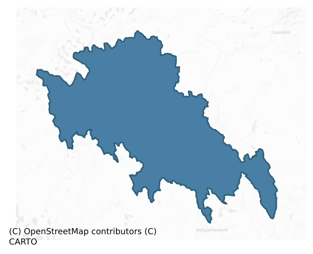
Loughtee Upper is a barony of County Cavan, in the historical province of Ulster (Irish: Lucht Tí Uachtarach), covering 269 km² of land. The barony records 383 NMS archaeological sites and 145 NIAH listed buildings, placing it at around the 30th percentile among 280 ROI baronies for sites per km². This means it is in the bottom third of all baronies for sites per km². Dated archaeological evidence runs from the Neolithic through to the Modern, spanning 8 of 9 archaeological periods, placing the barony in the 75th percentile among 280 ROI baronies for chronological depth. This means it is in the top third of all baronies for chronological depth. The largest dated subset of recorded sites dates to the Early Medieval. Logainm flags 65 placenames in the barony as carrying a recognised heritage root; the largest share — around 45% — are names associated with early Christian church and monastic foundations.

Heritage at a glance
Percentile rankings throughout this profile compare each barony only against the other 279 Republic of Ireland baronies.
The recorded heritage of Loughtee Upper
The National Monuments Service Sites and Monuments Record (SMR) is the statutory inventory of archaeological sites for the Republic of Ireland, maintained by the Department of Tourism, Culture, Arts, Gaeltacht, Sport and Media. Sites recorded here include earthworks, ringforts, megalithic tombs, ecclesiastical remains, and post-medieval features; not every record is legally protected, but each is registered as a monument of archaeological interest.
The National Monuments Service records 383 archaeological sites in Loughtee Upper, putting it at the 30th percentile among 280 ROI baronies for sites per km². This means it is in the bottom third of all baronies for sites per km². Protection coverage is near-universal — 379 sites (99%) fall within a recorded monument protection zone, indicating an extensively surveyed landscape. The dominant category is defensive sites — ringforts, enclosures, hillforts, and stone forts (265 sites, 69% of the record). Ringfort – rath is the most prevalent type, making up 50% of the barony's recorded sites (193 records) — well above the ROI average of 20% across all baronies where this type occurs. Ringfort – rath is an earthen ringfort enclosed by a bank and external ditch — the most common Early Medieval farmstead, broadly dated 500–1000 AD. Other significant types include Crannog (30) and Enclosure (19). Crannog is an artificial or partly artificial island built up on a lake or river bed, in use from the 6th to 17th centuries AD; Enclosure is a banked or ditched feature of uncertain type, used as a catch-all where the original function cannot be determined from surface evidence. Across the barony's 269 km², this gives a recorded density of 1.43 sites per km².
Most common monument types
Hover or tap a monument type to see its definition.
| Type | Count |
|---|---|
| Ringfort – rath an earthen ringfort enclosed by a bank and external ditch — the most common Early Medieval farmstead, broadly dated 500–1000 AD | 193 |
| Crannog an artificial or partly artificial island built up on a lake or river bed, in use from the 6th to 17th centuries AD | 30 |
| Enclosure a banked or ditched feature of uncertain type, used as a catch-all where the original function cannot be determined from surface evidence | 19 |
| Graveyard a burial area associated with a church, in use from the medieval period onwards | 14 |
| Church a building used for public Christian worship, of any date from c. 500 AD onwards | 10 |
| Barrow – unclassified a prehistoric burial mound where the specific barrow type cannot be determined from surface evidence | 10 |
| Burnt mound a heap of fire-cracked stone, ash and charcoal, with no surviving trough, dated Bronze Age to early medieval | 7 |
| Ritual site – holy well a well or spring traditionally associated with a saint, often credited with healing properties; many trace earlier ritual origins but devotion is documented from the medieval period onwards | 6 |
Chronological distribution
The dated archaeological record for Loughtee Upper spans from the Neolithic through to the Modern, with activity attested across 8 of 9 archaeological periods. This is the 75th percentile across ROI baronies for chronological depth — an above-average span. Every period from earliest to latest is represented in the record — an unbroken sequence of dated activity across the full chronological span. Activity concentrates most heavily in the Early Medieval (242 sites, 71% of dated material), with the Iron Age forming a secondary peak (35 sites, 10%). A further 41 recorded sites (11% of the overall NMS register for the barony) carry no period attribution — appearing as 'Unknown' in the bar chart below. This typically reflects either records that pre-date the standardised period vocabulary or sites awaiting specialist dating review, rather than a genuine absence of chronological evidence.
Sample of recorded monuments
Show 25 sample monuments (of 383 total)
A representative sample of 25 recorded monuments drawn from the barony’s 383 total NMS entries. Sites within a recorded monument protection zone and rarer site types are prioritised so the list shows a meaningful cross-section rather than only the most common type. Each entry shows the official Sites and Monuments Record reference number and the description published by the National Monuments Service.
Megalithic tomb – unclassified
Sited on a slight rise close to the village of Butler's Bridge. A gallery, open at both ends and orientated NNW-SSE, is 6m long and 1.6m wide. Five contiguous stones form the E side but only one orthostat remains on the…
Sited on a slight rise close to the village of Butler's Bridge. A gallery, open at both ends and orientated NNW-SSE, is 6m long and 1.6m wide. Five contiguous stones form the E side but only one orthostat remains on the opposite side. The northern stone at E, 1.95m high, is 0.5m or more taller than the other stones. The southern stone at E is skewed inward suggesting that the gallery may have ended here. There are three prostrate stones at the site. (de Valera and Ó Nualláin 1972, 118-9, No. 18)
The above description is derived from the published 'Archaeological Inventory of County Cavan' (Dublin: Stationery Office, 1995). In certain instances the entries have been revised and updated in the light of recent research.
Date of upload/revision: 22 December 2008
See linked document with details from Ruaidhrí de Valera and Seán Ó Nualláin, Survey of the Megalithic Tombs of Ireland. Volume III. Counties Galway, Roscommon, Leitrim, Longford, Westmeath, Laoighis, Offaly, Kildare, Cavan. (Dublin: Stationery Office, 1972).
Enclosure – large enclosure
Situated on a slight rise at the NW edge of the plateau of Inch Island. A large circular enclosure (ext. diam. c. 100m; int. diam. c. 80m) defined by a wide enclosing feature (Wth c. 10-15m) or two features is depicted…
Situated on a slight rise at the NW edge of the plateau of Inch Island. A large circular enclosure (ext. diam. c. 100m; int. diam. c. 80m) defined by a wide enclosing feature (Wth c. 10-15m) or two features is depicted on the 1835 edition of the OS 6-inch map where it is described as a 'Old Fort'. It is depicted as enclosed by a single field bank on the 1908 edition. It was described as a subcircular area (dims 32m x c. 26m) enclosed by an earthen bank and a fosse in 1942 (SMR file). The larger area was excluded from forestry established c. 2008 but the area is now overgrown (Google Earth).
The above description is derived from the published 'Archaeological Inventory of County Cavan' (Dublin: Stationery Office, 1995). In certain instances the entries have been revised and updated in the light of recent research.
Date of upload: 22 December 2008
Amended: 18 March 2021
Road – road/trackway
Marked on all OS eds. A modern narrow stretch of tarred roadway (L 960m) aligned approximately NNW-SSE. It is thought that the trackway origjnally commenced at the 'Castle Offices' (CV020-047—-) in Innisconnell Td,…
Marked on all OS eds. A modern narrow stretch of tarred roadway (L 960m) aligned approximately NNW-SSE. It is thought that the trackway origjnally commenced at the 'Castle Offices' (CV020-047—-) in Innisconnell Td, which are believed to date to the 17th century, and ran roughly NNW-SSE through Corracanvy Td to the summit of a hill in Gartbrattan Td. From there it continued to Cavan Town c. 5.5 km to ESE. (local information). Davies (ITA Survey 1942) did not consider the roadway to be contemporaneous with the 17th-century sites noted above.
The above description is derived from the published 'Archaeological Inventory of County Cavan' (Dublin: Stationery Office, 1995). In certain instances the entries have been revised and updated in the light of recent research.
Date of upload/revision: 22 December 2008
Road – unclassified togher
Davies (ITA Survey 1942) recorded that 'a long time ago' a causeway of logs was found at this location. It was c. 3.65m long and lay c. 2.75m beneath the surface of the bog. A modern pathway overlies the site.
The…
Davies (ITA Survey 1942) recorded that 'a long time ago' a causeway of logs was found at this location. It was c. 3.65m long and lay c. 2.75m beneath the surface of the bog. A modern pathway overlies the site.
The above description is derived from the published 'Archaeological Inventory of County Cavan' (Dublin: Stationery Office, 1995). In certain instances the entries have been revised and updated in the light of recent research.
Date of upload/revision: 22 December 2008
Sweathouse
Not marked on 1836 or 1876 eds. Situated in a small valley, 30m SW of a stream. The site has been quarried away. Davies (ITA Survey 1942) recorded that the site was once occupied by an extensive brickworks within which…
Not marked on 1836 or 1876 eds. Situated in a small valley, 30m SW of a stream. The site has been quarried away. Davies (ITA Survey 1942) recorded that the site was once occupied by an extensive brickworks within which was a small vaulted building. He described the building as being of 18th or early 19th-century style. No visible remains at ground level.
The above description is derived from the published 'Archaeological Inventory of County Cavan' (Dublin: Stationery Office, 1995). In certain instances the entries have been revised and updated in the light of recent research.
Date of upload/revision: 22 December 2008
House – fortified house
Built by the Culme family in the early decades of the 17th century. Under the terms of the Plantation the family also rented Clough Oughter castle (CV020-060—-) c. 200m to NW, and its associated lands. On OS 1836 ed.…
Built by the Culme family in the early decades of the 17th century. Under the terms of the Plantation the family also rented Clough Oughter castle (CV020-060—-) c. 200m to NW, and its associated lands. On OS 1836 ed. the house is designated 'Ruin of Offices belonging to Clough Oughter Castle', and depicted as an L-shaped structure with the long axis aligned NE-SW. Culme had apparently begun to build a strong fort between Lough Oughter and a nearby area of woodland in 1642, in order to defend his house. It appears that the site was abandoned after the Cromwellian wars of the early 1640s. Manning (1990, 17) speculated that it was probably levelled prior to the 1909 OS ed. Davies (1948, 99) noted black earth containing mortar and bones deposited along the top of the shore-bank and recorded that a number of possible sockets for doorposts had been found in the vicinity. There are no visible remains of house at ground level.
Geophysical survey was undertaken in this area in 2011 (Gimson and Regan 2011) and the following is a summary of the results: ‘Detailed magnetic gradiometer, magnetic susceptibility and earth resistance surveys were undertaken across the area of investigation. These detected the presence of a four celled structure located on a topographical expression affording extensive views of the castle and surrounding lough. The composition of the structure has been revealed with two internal divisions, one not central, as well as two areas of possible burning. The…
Historic town
Situated on the E bank of the S-N Cavan River, overlooked by higher hills around it. Its name, Cabhan in Gaelic, means a hollow place. Uniquely among Irish towns it was founded by the ruling Gaelic family of Ó…
Situated on the E bank of the S-N Cavan River, overlooked by higher hills around it. Its name, Cabhan in Gaelic, means a hollow place. Uniquely among Irish towns it was founded by the ruling Gaelic family of Ó Raghallaigh, or O’Reilly c. 1300 when a castle and Franciscan friary were built in close proximity. The annals (AFM, ALC) refer to the burning of the town in 1427, 1429 and 1468 by raiders from the Pale. The Irish towns of Cavan, Longford and Granard were considered such a commercial threat to the Pale towns that trade with them was forbidden by the Irish Parliament in 1479-80. The McBrady family, based in the town during the sixteenth century, also had branches in Navan and Drogheda.
The anglicisation of the O’Reilly lordship as the sixteenth century advanced facilitated the development of the town, and in 1598 a government force was established there. The garrison was re-enforced in 1601, although it was abandoned after the end of the war in 1603 (Davies 1948b 84, 101). Cavan was incorporated as the county town in 1610 to serve as the administrative centre of the Plantation. It retained a large Irish contingent in its government up to 1641 when it fell to the supporters of the rising and Sir Phelim O’Neill. In 1690 the town was defended by Jacobites against an assault by Wolseley, and the town was pillaged and burned. A plan of the town made by Netherclift c. 1593 shows the Main Street with Bridge Street extending across the river as the only thoroughfares.
Alt…
Religious house – Franciscan friars
Franciscan friary founded between 1300 and 1330 by Gilla-Isu Roe O'Reilly. Burnt in 1405, again in 1451 through the carelessness of an inebriated friar, by the English in 1468, and finally by an enraged woman of the…
Franciscan friary founded between 1300 and 1330 by Gilla-Isu Roe O'Reilly. Burnt in 1405, again in 1451 through the carelessness of an inebriated friar, by the English in 1468, and finally by an enraged woman of the O'Reilly family in 1576. Depicted on Netherclift's plan of Cavan town (c. 1593). It was demolished in 1815 and all that now remains is a three-storey square tower (ext. dims. 4.3m x 4.3m; H c. 16.7m) with 18th-century moulded opes in E and W walls and similar openings in all four walls at third-floor level. (O'Connell 1937, 335; Gwynn and Hadcock 1970, 245)
The above description is derived from the published 'Archaeological Inventory of County Cavan' (Dublin: Stationery Office, 1995). In certain instances the entries have been revised and updated in the light of recent research.
Date of upload/revision: 22 December 2008
Cross – Market cross
Netherclift's plan of Cavan Town, (c.1593) depicts a Latin cross mounted on a stepped base. Original location was at the junction of Main Street and Bridge Street. No visible remains at ground level. (Bradley and Dunne…
Netherclift's plan of Cavan Town, (c.1593) depicts a Latin cross mounted on a stepped base. Original location was at the junction of Main Street and Bridge Street. No visible remains at ground level. (Bradley and Dunne 1989, 40; O'Connell 1937, 300-1)
The above description is derived from the published 'Archaeological Inventory of County Cavan' (Dublin: Stationery Office, 1995). In certain instances the entries have been revised and updated in the light of recent research.
Date of upload/revision: 22 December 2008
Castle – Anglo-Norman masonry castle
Clogh Oughter castle is a large circular tower situated on a tiny island in Lough Oughter, Co. Cavan. It appears to have been built by the Anglo-Norman de Lacys, lords of Meath, about 1220 as part of their attempt to…
Clogh Oughter castle is a large circular tower situated on a tiny island in Lough Oughter, Co. Cavan. It appears to have been built by the Anglo-Norman de Lacys, lords of Meath, about 1220 as part of their attempt to conquer the territory of Bréifne, roughly equivalent to the modern counties of Leitrim and Cavan. The O’Reillys were the lords of East Breifne (Co. Cavan) and the island on which Clogh Oughter was built had been their royal crannog. In early references to the castle it was called the Castle of Crannog O’Reilly. The de Lacys were driven out of this part of East Bréifne by the O’Reillys in 1233 and Clogh Oughter remained mostly in O’Reilly hands from then until about 1608. During this period it served more as a fortress than a residence and there are references in the annals to it being used as a prison.
The tower measures 10.57m in internal diameter and, with walls 2.5m thick, is 15.47m in external diameter. It stands to a height of 18.35m. About one third of the circumference is missing on the south side as a result of deliberate destruction by gunpowder after the Cromwellian siege of 1653. The original entrance was at first-floor level on the south-western side and was some 5m above external ground level. Only one side of this doorway survives. It would have been accessed originally by external wooden stairs. There is good evidence for the first floor in the form of eleven large beam holes in the north wall and a slot for the floor boards on the east and wes…
Religious house – Premonstratensian canons
The priory of Holy Trinity, Lough Oughter, founded by grant of Cathal O'Reilly in 1237, was a daughterhouse of the Premontratensian abbey of Trinity Island, Loughkey, Co. Roscommon (Gwynn & Hadcock 1970, 206). Situated…
The priory of Holy Trinity, Lough Oughter, founded by grant of Cathal O'Reilly in 1237, was a daughterhouse of the Premontratensian abbey of Trinity Island, Loughkey, Co. Roscommon (Gwynn & Hadcock 1970, 206). Situated at the centre of a now disused, roughly oval-shaped graveyard (dims. 56m N-S; 40m E-W). Remains comprise ivy-clad W gable and portions of N and S walls of a rectangular church (int. dims. c. 16m E-W; c. 5m N-S) with a transept on S side (int. dims. c. 6m N-S; c. 5m E-W) which appears to have been added during restoration of the priory in the 17th century. Walls of main body of church have a pronounced base batter. Main entrance in W gable, which it is believed, may have been originally adorned by the celebrated Romanesque doorway (CV025-071002-) now at the modern cathedral of Kilmore. Additional blocked entrance with masonry arch at W end of S wall. Fenestration includes large pointed window with chamfered ashlar jambs directly above W gable entrance and stray fragments of window spandrels, tracery and mullions of 15th-century date, scattered about the graveyard. W gable may have been surmounted by a small belfry. A bevelled cross-base with square socket and possible ringed cross-head, and a grotesque head (1712) which is now in the National Museum, were noted at the site in 1948. (O'Connell 1937, 242-289; Davies 1948, 99-109)
The above description is derived from the published 'Archaeological Inventory of County Cavan' (Dublin: Stationery Office, 1995)….
Stone row
Five stones orientated NW-SE. Situated in a clearing within a modern plantation of coniferous trees, on the E shoulder of a high ridge in mountainous terrain. The stones are graded in height. The lowest (H c. 0.5m) is…
Five stones orientated NW-SE. Situated in a clearing within a modern plantation of coniferous trees, on the E shoulder of a high ridge in mountainous terrain. The stones are graded in height. The lowest (H c. 0.5m) is at the NW end with the tallest (H c. 2m) at the SE end. This is a National Monument in state care.
The above description is derived from the published 'Archaeological Inventory of County Cavan' (Dublin: Stationery Office, 1995). In certain instances the entries have been revised and updated in the light of recent research.
Date of upload/revision: 22 December 2008
Castle – motte and bailey
Built by de Lacy in 1211 and dismantled in 1224-6 by Cathal O'Reilly. A very substantial motte with exceptionally well-preserved bailey enclosed by a well-defined fosse and substantial earthen bank. Both have been…
Built by de Lacy in 1211 and dismantled in 1224-6 by Cathal O'Reilly. A very substantial motte with exceptionally well-preserved bailey enclosed by a well-defined fosse and substantial earthen bank. Both have been levelled from NE-ENE-E. Motte consists of a high (H c. 8m), steep-sided, flat-topped subcircular mound (dims of base c. 48m NNW-SSE; c. 45m WNW-ESE). The summit is oval in plan (dims c. 26m NE-SW; c. 18m NW-SE). A wide, deep fosse runs between the motte and bailey at NNW. Bailey is crescentic in plan. Site has been planted with deciduous trees and a number of relatively modern garden demesne features have been incorporated into its fabric. These include an icehouse built into the N of the bailey, a stone passageway built through the outer bank of the bailey at NNW, a low concave stone wall built into the base of the motte at SE and a demesne wall set against the outer bank at S. (Henry 1987, 9; Davies 1947a, 79-81)
The above description is derived from the published 'Archaeological Inventory of County Cavan' (Dublin: Stationery Office, 1995). In certain instances the entries have been revised and updated in the light of recent research.
Date of upload: 22 December 2008
Tomb – chest tomb
Mounted on top of a mausoleum inside the W wall of the graveyard associated with the old cathedral (CV025-070004-) of Kilmore towards its S end. When William Bedell, the Protestant Bishop of Kilmore and Ardagh since…
Mounted on top of a mausoleum inside the W wall of the graveyard associated with the old cathedral (CV025-070004-) of Kilmore towards its S end. When William Bedell, the Protestant Bishop of Kilmore and Ardagh since 1629, died in February 1642 he was buried in accordance with his wishes in an obscure corner of the graveyard, but the funeral was attended by many of the Catholic rebels who had recently imprisoned him at the castle of Clough Oughter (CV020-060—-) as he was greatly respected as the compiler of an Irish grammar and (in collaboration with three others) was the first translator of the Old Testament into the Irish language (Manning 2013, 2506). A vault had been provided by 1739 (King 1892, 10) and it may have been renewed shortly afterwards with the graveslab supported on the roof. The sandstone tablet (dims 2.04m x 1.03m; T 0.08m) has a bevel or chamfer on its upper edge and the carving is in false relief. Beneath a crest with a mitre are the memento mori of an open book, a skull and cross-bones and an hour-glass. The incised legend is now almost illegible but it has been recorded (Lyster 1896) as: GUILELMI BEDELI / QUONDEM KILMORENS / IS EPISCOPE…. / DEPOSITUM, which is also carved around the tympanum over the W doorway of the modern cathedral (Blacker 1904, 226).
Compiled by: Michael Moore
Date of upload: 16 March 2020
Cathedral
Located at the S end of a N-S drumlin ridge. Around 1454 Andrew MacBradaigh, bishop of Tír Briúin 1445-55, settled on the church of St. Feidhlimidh at Kilmore as the cathedral for the diocese that would come to take its…
Located at the S end of a N-S drumlin ridge. Around 1454 Andrew MacBradaigh, bishop of Tír Briúin 1445-55, settled on the church of St. Feidhlimidh at Kilmore as the cathedral for the diocese that would come to take its name from the new location. The existing parish church, which may be on an early site, was not enlarged or enhanced as a result of its new status, except that the Romanesque doorway from Trinity Island (CV020-077001-) was added onto its S wall where it remained until it was placed at the entrance to the vestry (CV025-071002-) of the nearby present Church of Ireland Cathedral of Kilmore c. 1860. St. Feidhlimidh’s church may have been chosen rather than any church associated with St. Maodhóg who had been the principal saint of Tír Briúin because Feilim was particularly venerated by the O’Reilly clan (Ó Riain 2011, 312-3), and is now the recognised patron of the diocese in both the Roman Catholic and Church of Ireland traditions. (Kelly 2017, 128-31)
Thomas Mogine was the first Protestant bishop of Kilmore and he was succeeded by William Bedell in 1629. Moigne seems to have built a house at Kilmore while refurbishing the Cathedral church in the 1620s when he reported that ‘The Cathedral church is newly built and repaired…A fair stone house built at Kilmore by the now bishop, which together with the building of other outhouses and of seats in the chancel and body of the church of Kilmore had cost £600’ (ibid. 251). The surviving structure probably dates to the…
Headstone
Within the graveyard associated with the old cathedral of Kilmore (CV025-070004-). This is a cross-shaped stone (H 0.7m; span 0.33m; T 0.14m) with a disc head (diam. 0.45m). On the E-face is the inscribed legend: IHS /…
Within the graveyard associated with the old cathedral of Kilmore (CV025-070004-). This is a cross-shaped stone (H 0.7m; span 0.33m; T 0.14m) with a disc head (diam. 0.45m). On the E-face is the inscribed legend: IHS / HERE LYETH / THE BODY OF / PRINSER / DAN WHO DIED / THE IIT / H DAY / OF NOV / EMBE / R 1680. The name is not certain. The W face has a wide cross in slightly raised panels extending the full length and breadth of the stone. Linked incised circles form a crude cross on the disc head and incised arcs outline another cross at the crux.
See the attached views _1 from E; _2 from W
Compiled by: Michael Moore
Date of upload: 16 March 2020
Ecclesiastical residence
Located towards the S end of a N-S ridge. Thomas Moigne was the first Protestant bishop of Kilmore and he was succeeded by William Bedell in 1629. Moigne seems to have refurbished the Cathedral church (CV025-070004-)…
Located towards the S end of a N-S ridge. Thomas Moigne was the first Protestant bishop of Kilmore and he was succeeded by William Bedell in 1629. Moigne seems to have refurbished the Cathedral church (CV025-070004-) and built a house beside it in the 1620s when he reported that ‘The Cathedral church is newly built and repaired…A fair stone house built at Kilmore by the now bishop, which together with the building of other outhouses and of seats in the chancel and body of the church of Kilmore had cost £600’ (Kelly 2017, 251). The house was a ruin by the end of the century when, according to Rev. William Henry writing in the 1730s (King 1892, 10-12), Bishop Whetnell (Bishop 1699-1713) began the construction of the present palace. Henry describes the house as: 'long, lofty and capacious, about a hundred feet in length, and forty in width; it has two fronts; the entrance is by the E side. The front is a large square court, the south side of which is formed by the church, the west by the house, the north by a wall'd enclosure … from the east side, which seems open, there is descent by several steps into a spacious gravelled terrace… the south end of the house looks into the churchyard, and from it the church goes off in right angles, being contiguous and having a communication with the house.'
When the new See House was built for the Bishop c. 200m to the NNE c. 1840 the old palace was due to be demolished (Lewis 1837, vol. 2, 185), but the ground floor of the W (L c. 35m…
Font (present location)
Lying against the NW wall of a modern dwelling-house and now utilised as a flowerpot. Small, flat-based, roughly executed sandstone mortar (H 0.26m; dims. 0.3m x 0.28m; int. diam. 0.2m) equipped with corner lugs. It is…
Lying against the NW wall of a modern dwelling-house and now utilised as a flowerpot. Small, flat-based, roughly executed sandstone mortar (H 0.26m; dims. 0.3m x 0.28m; int. diam. 0.2m) equipped with corner lugs. It is accompanied by a stone head (CV025-089003-), both items having been reputedly taken from Trinity Island (CV020-077001-) (local information).
The above description is derived from the published 'Archaeological Inventory of County Cavan' (Dublin: Stationery Office, 1995). In certain instances the entries have been revised and updated in the light of recent research.
Date of upload/revision: 22 December 2008
Castle – tower house
A three-storey tower house constructed of roughly coursed limestone blocks, with pronounced base batter rising to a height of c. 3m. Remains comprise the E and S walls and featureless N wall. W wall is largely…
A three-storey tower house constructed of roughly coursed limestone blocks, with pronounced base batter rising to a height of c. 3m. Remains comprise the E and S walls and featureless N wall. W wall is largely destroyed. Entrance with remains of masonry arch at centre of E wall above which is a well-preserved cut-stone loop. A large opening at ground-floor level flanks doorway on its N side. Fenestration in S wall includes two loops, one placed directly above the other lighting the staircase, a narrow ope with large embrasure at ground-floor level and the remains of a large window-opening at first-floor level. Inside entrance is a short hallway, with murder-hole over head, leading W to the main ground floor area. A small rectangular chamber leads off this to N and a stairwell to S. A pointed doorway leads W from the hall to an inner room containing two wall cupboards. On first floor another dressed, pointed doorway leads from the staircase to a room at W which contains large recesses, and beam slots in its S wall.
The above description is derived from the published 'Archaeological Inventory of County Cavan' (Dublin: Stationery Office, 1995). In certain instances the entries have been revised and updated in the light of recent research.
Date of upload/revision: 22 December 2008
Megalithic tomb – passage tomb
One of a complex of burial and ritual sites which occupy an area 150m by 130m on a patch of uneven elevated pasture overlooked from the NW by Slieve Glah (CV026-004001-, CV026-004003-, CV026-004006-, CV026-004002-,…
One of a complex of burial and ritual sites which occupy an area 150m by 130m on a patch of uneven elevated pasture overlooked from the NW by Slieve Glah (CV026-004001-, CV026-004003-, CV026-004006-, CV026-004002-, CV026-004005-). It consists of a large stone circle within which there is a ruined chambered cairn. The stone circle, 40m E-W by 35m N-S, is represented by twelve stones, five now upright measuring 0.65m to 1.3m high, and the others prostrate. The largely grass-grown cairn is round in outline, 22m in diameter and 1m high. Surviving kerbstones indicate an original diameter of some 15m. A number of set stones near the E side of the cairn represent some form of chamber structure. One of a number of prostrate stones here is decorated with passage tomb art. In 1972 Raftery investigated the monument on behalf on the National Museum of Ireland. An irregular area c.10m sq. had been opened to a depth of 0.8m. The mound was shown to be composed of dark earth and small stones. Three ‘cavities’, presumably cists, were recorded in proximity to the centre of the mound. Two of these, each containing a ceramic vessel and thought to have been encased in clay, disintegrated upon discovery. A number of set stones near the E side of the cairn represent some form of chamber structure. One of a number of prostrate stones here is decorated with passage tomb art. In the centre of this structure was a complete, bipartite bowl, apparent (ext. D 15.1cm; max. ext. D body 15cm; D base 7.1cm…
Megalithic tomb – portal tomb
Sited 200m E of the site of destroyed court tomb (CV026-005—-). A small chamber, 1.6m long and 1m wide, open to the SE, stands towards the S end of a low mound. The more southerly portal-stone survives. Single stones…
Sited 200m E of the site of destroyed court tomb (CV026-005—-). A small chamber, 1.6m long and 1m wide, open to the SE, stands towards the S end of a low mound. The more southerly portal-stone survives. Single stones form each side of the chamber which is closed by a backstone set between their ends. A prostrate slab just S of the chamber may be a displaced roofstone. There are two stones at right angles to each other among a group of stones towards the N end of the mound. These seem to be set and could perhaps indicate a subsidiary structure. (de Valera and Ó Nualláin 1972, 128-9, No. 28.)
The above description is derived from the published 'Archaeological Inventory of County Cavan' (Dublin: Stationery Office, 1995). In certain instances the entries have been revised and updated in the light of recent research.
Date of upload/revision: 22 December 2008
See linked document with details from Ruaidhrí de Valera and Seán Ó Nualláin, Survey of the Megalithic Tombs of Ireland. Volume III. Counties Galway, Roscommon, Leitrim, Longford, Westmeath, Laoighis, Offaly, Kildare, Cavan. (Dublin: Stationery Office, 1972).
Cross-slab
Davies (1948, 81-2) recorded a broken slab decorated with a ringed cross in low relief (Wth 0.65m), within the graveyard of Carrickaboy Glebe church (CV026-014001-). Graveyard is presently overgrown with vegetation. Not…
Davies (1948, 81-2) recorded a broken slab decorated with a ringed cross in low relief (Wth 0.65m), within the graveyard of Carrickaboy Glebe church (CV026-014001-). Graveyard is presently overgrown with vegetation. Not located.
The above description is derived from the published 'Archaeological Inventory of County Cavan' (Dublin: Stationery Office, 1995). In certain instances the entries have been revised and updated in the light of recent research.
Date of upload/revision: 22 December 2008
Sheela-na-gig
Found at the site of Lavey church (CV026-052001-). Described by Guest (1936,109) as having arms flexed in front of splayed thighs and hands directed towards the lower abdomen. Now located in the Cavan County Museum…
Found at the site of Lavey church (CV026-052001-). Described by Guest (1936,109) as having arms flexed in front of splayed thighs and hands directed towards the lower abdomen. Now located in the Cavan County Museum (CV038-071—-). According to Guest the sheela-na-gig was 'found about 1842 by Dr. Chas. Halpin laid loosely on a gate pier built "recently" at the entrance of the old church-yard. The finder believed it to come from the old church, of which scarcely a trace was then left' (Guest 1936, 109).
This sheela-na-gig has been moved from the NMI to the County Museum in Ballyjamesduff, Cavan where it is on display. One of two sheela-na-gigs (CV038-070—-) on display at the County Museum in Ballyjamesduff. Described by Freitag as a sheela-na-gig (dims. H 0.43m; Wth 0.23m) with ‘right side damaged from top to bottom giving the impression that figure was cut off vertically. Big head; ovoid eyes with pupils; fleshy nose with clearly cut nostrils; open mouth with protruding tongue and beading round lips, possibly representing teeth. Two or three bands round forehead, and hair seems to be indicated’(Freitag 2004, 127-8).
The above description is derived from the published 'Archaeological Inventory of County Cavan' (Dublin: Stationery Office, 1995). In certain instances the entries have been revised and updated in the light of recent research.
Compiled by: Caimin O'Brien
Date of upload/revision: 24 May 2012
Linear earthwork
This portion of the 'Worm Ditch or Black Pig's Race' as marked on OS 1912 ed. commences at a stream at the base of a high, steep- sided hill in Ardkill More townland. It runs for c. 1,150m approximately NW-SE along the…
This portion of the 'Worm Ditch or Black Pig's Race' as marked on OS 1912 ed. commences at a stream at the base of a high, steep- sided hill in Ardkill More townland. It runs for c. 1,150m approximately NW-SE along the W and S of the hillside. At the base of the hill in Largan townland it changes direction and runs approximately E-W for c. 750m terminating at the E side of a N-S orientated stream in Drumbarry townland. No definite surface remains of the site was identifiable in Ardkill townland N of an active quarry, but the rock-cut ditch (Wth c. 3.5m; D c. 1.3m) has been recorded in the N face of the quarry (Campbell 1997, 3). The ditch is also visible (Wth c. 4m; D c. 1.5m) in the S face of the quarry, while the bank (Wth 5-7m; H at W c. 2m) with a ditch (Wth c. 4m; D c. 1.3m) on the uphill or E side continues S of the quarry (L c. 700m), veering eastwards to the boundary with Largan (ibid. 4). In Largan townland the site is marked by stretches of a much-denuded earthen rampart (max. Wth 7m; max. H 0.9m) with remains of a fosse at its NNE foot. The rampart and fosse are much disturbed by modern field drains. A rath is built against the S face of the rampart in Largan townland (CV031-047—-). For the final c. 75m the site is marked by a narrow, modern tarred road. (CUCAP ALJ 79, ALJ 80, AYS 29, AYS 31; O'Donovan 1995, no. 180)
Revised by: Paul Walsh, Michael Moore
Date of upload: 20 August, 2014
Ringfort – rath
Raised circular area (int. diam. 28.2m) enclosed by the remains of a low earthen bank and a wide, shallow fosse. A modern field boundary has been built against the external face of bank from NE-SE, and fosse has been…
Raised circular area (int. diam. 28.2m) enclosed by the remains of a low earthen bank and a wide, shallow fosse. A modern field boundary has been built against the external face of bank from NE-SE, and fosse has been infilled. Break in bank at SE represents original entrance.
The above description is derived from the published 'Archaeological Inventory of County Cavan' (Dublin: Stationery Office, 1995). In certain instances the entries have been revised and updated in the light of recent research.
Date of upload/revision: 22 December 2008
Listed buildings
The National Inventory of Architectural Heritage (NIAH) is a state survey appraising buildings of architectural, historical, archaeological, artistic, cultural, scientific, social, or technical interest. Each surveyed structure receives a rating from International (the highest, for buildings of European importance) through National, Regional, Local, and Record-Only.
The NIAH records 145 listed buildings in Loughtee Upper (66th percentile across ROI baronies). Among these, 6 are graded National — buildings of interest to the whole of Ireland rather than only its region. The Republic holds 937 National-graded buildings in total, so this barony accounts for around 1% of the national total. Construction dates concentrate most heavily in the Victorian (1830-1900) period. The most-recorded building type is house (46 examples, 32% of the listed stock).
Terrain and environment
Mean elevation across the barony is 106m — the 63rd percentile among 280 ROI baronies for elevation. This means it is in the upper half of all baronies for elevation. Elevation matters for heritage because higher-altitude baronies typically favour defensive monuments — ringforts and hilltop forts placed on prominent ground — while lowland baronies are more likely to carry the dense settlement and church networks of intensive agricultural landscapes. The barony reaches 315m at its highest point — a vertical span of more than 209m within its boundary, indicating significant topographic diversity. Mean slope is 5.5° — the 78th percentile among 280 ROI baronies for slope. This means it is in the top third of all baronies for slope. This is consistently steep terrain by ROI standards, the kind of landscape that tends to preserve upstanding archaeological features well. Slope is a key control on both land use and archaeological preservation: steep ground resists ploughing and tends to preserve earthworks intact, while gentle slopes favour intensive cultivation that damages or destroys surface archaeology over time. The Topographic Wetness Index averages 9.9, the 20th percentile among 280 ROI baronies for wetness. This means it is in the bottom third of all baronies for wetness. This is well-drained ground by ROI standards — typical of upland or steeply-sloping country that sheds water rapidly. Drainage matters for heritage because poorly-drained ground preserves organic archaeology (wooden trackways, leather, textiles, and on rare occasions human remains) far better than free-draining soil; well-drained ground favours arable use but destroys organic material rapidly. The land cover is dominated by improved grassland (76%) and woodland (19%). In overall character, this is steeply-sloping terrain at modest elevation, with land use dominated by improved grassland.
Terrain measurements
Where this barony sits in the Republic of Ireland
Geology and preservation
Bedrock geology shapes the landscape long before any settlement begins — controlling soil drainage, agricultural potential, the survival of upstanding monuments, and the preservation of buried archaeology. The figures below come from the Geological Survey Ireland 1:100,000 bedrock map.
The bedrock underlying Loughtee Upper is predominantly greywacke (28% of the barony by area), with much of the rock dating to the Ordovician period. Greywacke is a hard, dark, fine-grained sandstone that weathers to thin upland soils. Greywacke baronies typically carry sparser settlement archaeology but provide high-quality building stone visible in older field walls and farm buildings. A substantial secondary geology of sandstone (24%) and limestone (16%) adds further variety to the underlying landscape. The single largest mapped unit is the Red Island Formation (27% of the barony's bedrock). With 8 distinct rock types mapped, the barony sits in the top third of ROI baronies for geological diversity (82nd percentile) — typically a sign of complex tectonic history or coastal mosaics of differing rock units.
Rock type composition
Largest mapped unit: Red Island Formation (27% of the barony)
Placename evidence
Logainm records 65 heritage-diagnostic placenames for Loughtee Upper, drawn from townland and civil-parish names across the barony. The dominant stratum is Early Christian ecclesiastical — cill-, teampall-, and domhnach-prefixed names that record the dense network of early church foundations established between the fifth and tenth centuries. The leading diagnostic roots are cill- (28 — church), lios- (19 — ringfort or enclosure), and ráth- (5 — earthen ringfort). This is well above the ROI average of 30.7 heritage placenames per barony — around 2.1× the typical figure. The presence of multiple heritage strata side by side indicates layered occupation of the landscape across successive prehistoric and historic periods. Logainm records 337 placenames for Loughtee Upper (predominantly townland names). Of these, 65 (19%) carry one of the diagnostic Gaelic roots tracked above; the remainder draw on more generic landscape vocabulary that does not encode a heritage period.
Pre-Christian / Early Medieval Defensive
| Root | Count | Meaning |
|---|---|---|
| lios- | 19 | ringfort or enclosure |
| ráth- | 5 | earthen ringfort |
| dún- | 1 | hilltop or promontory fort |
Early Christian Ecclesiastical
| Root | Count | Meaning |
|---|---|---|
| cill- | 28 | church (early) |
| cillín- | 1 | unconsecrated burial ground |
Burial, Ritual, and Norse-Contact
| Root | Count | Meaning |
|---|---|---|
| leacht- | 5 | grave monument |
| feart- | 3 | grave mound |
| carn- | 2 | cairn |
| gall- | 2 | foreigner — Norse settlement marker |
Other baronies in Cavan
About this profile
Click any section below to expand.
What is a barony?
A barony is a historic administrative unit in Ireland, broadly equivalent to an English hundred. The 280 baronies used here are from the OSi 2019 National Statutory Boundaries (generalised 20m), covering the 26 counties of the Republic of Ireland. Baronies derive from the Norman period, were formalised in the 17th century, and have not been redrawn for statistical purposes. They vary enormously in area, from compact urban baronies in Dublin to vast upland baronies in Connacht, and should not be compared by raw site count without accounting for area differences.
What counts as a site?
This profile combines three distinct heritage registers, each with its own definition of what constitutes a recordable site:
- Archaeological sites (NMS). The National Monuments Service Sites and Monuments Record (SMR) catalogues every known archaeological monument or site of archaeological interest in the Republic, from prehistoric burial mounds and ringforts to medieval churches and post-medieval defensive works. Inclusion does not require legal protection — only that the site has been identified, surveyed, and assessed as having archaeological value. A separate subset of these sites lies within a recorded protection zone, which gives them statutory protection under the National Monuments Acts.
- Listed buildings (NIAH). The National Inventory of Architectural Heritage records buildings of architectural, historical, archaeological, artistic, cultural, scientific, social, or technical interest. Each surveyed structure is appraised on a five-tier scale: International, National, Regional, Local, and Record-Only. The NIAH appraisal is informational rather than strictly statutory, but it underpins local-authority Record of Protected Structures (RPS) listings.
- Heritage placenames (Logainm). Logainm is the authoritative database of Irish placenames maintained by the Placenames Branch. This profile applies a heritage-diagnostic classifier to the Irish-language form of each townland name, flagging roots that signal defensive sites (ráth-, lios-, dún-, caiseal-, cathair-), ecclesiastical foundations (cill-, teampall-, domhnach-, mainistir-), prehistoric burial-ritual features (tuaim-, carn-, leaba-), or Norse-contact settlement (gall-). Townlands without one of these diagnostic roots are not flagged here — they may still carry historical significance, but that significance is not encoded in the name itself.
Editorial principles
The narrative sections of this profile follow several explicit principles:
- Evidential. Every claim about this barony’s heritage character is anchored in the underlying register data. Where a site count, a placename count, or a percentile rank is cited, it is computed from the source datasets at export time, not estimated.
- Comparative. Counts and metrics are reported alongside their percentile rank against the other 279 ROI baronies. A barony with 50 ringforts in absolute terms could be unusually high or unusually low depending on its size and regional context; percentile ranking removes that ambiguity.
- Transparent on limits. Where a register has known coverage gaps, survey biases, or data-quality issues that affect this barony’s figures, the profile flags them rather than presenting the numbers as definitive.
- No interpretation beyond what the data supports. The narrative does not speculate about historical events, social dynamics, or cultural meaning beyond what the recorded heritage and placename evidence directly attests.
Data caveats and limits
- NMS Sites and Monuments Record is the product of survey campaigns conducted at different intensities across different counties and decades. Some baronies have been surveyed more thoroughly than others, and absolute counts should be read in that light. Sites destroyed by development before survey are typically not represented; sites in heavily forested or upland terrain are sometimes under-recorded.
- NIAH coverage is broadly complete for the Republic of Ireland but the survey was conducted on a rolling county-by-county basis, and the most recent appraisal date varies. Buildings demolished or substantially altered after their original survey may still appear in the register; conversely, recent buildings of merit may not yet have been appraised.
- Logainm classification applies a deliberately conservative pattern-matching approach to the Irish-language townland forms. The classifier prioritises true positives over recall: a townland may carry a heritage signal that the classifier doesn’t recognise, particularly where the diagnostic root has been heavily anglicised or where the townland name draws on a less common term. The 60,000+ townland records and ~9,800 classified placenames give a substantial signal at barony scale, but individual townland names should be checked against Logainm directly for definitive interpretation.
- Period attribution. The chronological distribution reflects only those NMS sites that carry a recognised period attribution in the source data. Sites listed as “Unknown” period are excluded from the dated subset.
- Boundary changes. Some baronies have undergone minor boundary adjustments since their 19th-century definition; the OSi 2019 generalised boundaries used here are the current statutory definition and may differ slightly from historical maps in border areas.
- Bedrock geology is mapped at 1:100,000 scale, which means local variation within a barony — small pockets of different rock type, mineral veins, alluvium overlying bedrock — is generalised. The dominant-system and rocktype figures are area-weighted, so a barony reading “70% Carboniferous limestone” may still contain small but archaeologically important pockets of older or younger rock. Around 3% of GSI polygons do not match the lexicon and contribute no rocktype or system attribution.
Data sources
- National Monuments Service — Sites and Monuments Record (SMR) https://data.gov.ie/dataset/national-monuments-service-archaeological-survey-of-ireland
- National Inventory of Architectural Heritage (NIAH) https://data.gov.ie/dataset/national-inventory-of-architectural-heritage-niah-national-dataset
- Logainm — Placenames Database of Ireland https://www.logainm.ie/
- Ordnance Survey Ireland — National Statutory Barony Boundaries 2019 https://data-osi.opendata.arcgis.com/
- EURODEM — European Digital Elevation Model https://www.mapsforeurope.org/datasets/euro-dem
- ESA WorldCover https://esa-worldcover.org/en
- Geological Survey Ireland — 1:100,000 Bedrock Geology https://www.gsi.ie/en-ie/data-and-maps/Pages/Bedrock.aspx
Explore more: Search any of the 280 ROI baronies, browse by historical province, or read the methodology and data sources for the full Republic of Ireland Heritage Tool.