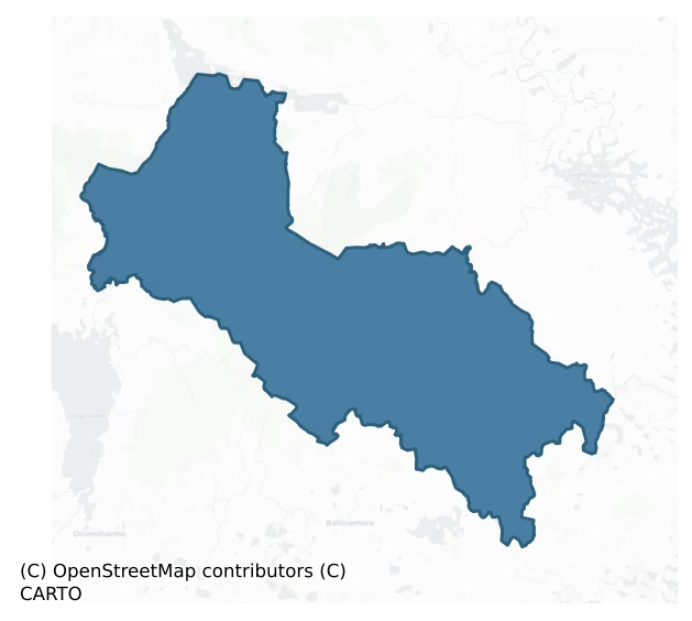
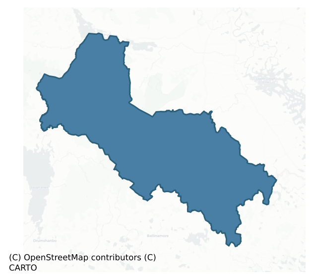
Tullyhaw is a barony of County Cavan, in the historical province of Ulster (Irish: Teallach Eathach), covering 367 km² of land. The barony records 409 NMS archaeological sites and 84 NIAH listed buildings, placing it at around the 17th percentile among 280 ROI baronies for sites per km². This means it is in the bottom fifth of all baronies for sites per km². Dated archaeological evidence runs from the Neolithic through to the Modern, spanning 8 of 9 archaeological periods, placing the barony in the 50th percentile among 280 ROI baronies for chronological depth. This means it is in the upper half of all baronies for chronological depth. The largest dated subset of recorded sites dates to the Early Medieval. Logainm flags 38 placenames in the barony as carrying a recognised heritage root; the largest share — around 58% — are names associated with early Christian church and monastic foundations.
Heritage at a glance
Percentile rankings throughout this profile compare each barony only against the other 279 Republic of Ireland baronies.
The recorded heritage of Tullyhaw
The National Monuments Service Sites and Monuments Record (SMR) is the statutory inventory of archaeological sites for the Republic of Ireland, maintained by the Department of Tourism, Culture, Arts, Gaeltacht, Sport and Media. Sites recorded here include earthworks, ringforts, megalithic tombs, ecclesiastical remains, and post-medieval features; not every record is legally protected, but each is registered as a monument of archaeological interest.
The National Monuments Service records 409 archaeological sites in Tullyhaw, putting it at the 17th percentile among 280 ROI baronies for sites per km². This means it is in the bottom fifth of all baronies for sites per km². Protection coverage is near-universal — 370 sites (90%) fall within a recorded monument protection zone, indicating an extensively surveyed landscape. The dominant category is defensive sites — ringforts, enclosures, hillforts, and stone forts (190 sites, 46% of the record). Ringfort – rath is the most prevalent type, making up 21% of the barony's recorded sites (85 records), broadly in line with the ROI average of 20% across all baronies where this type occurs. Ringfort – rath is an earthen ringfort enclosed by a bank and external ditch — the most common Early Medieval farmstead, broadly dated 500–1000 AD. Other significant types include Ringfort – cashel (38) and Enclosure (34). Ringfort – cashel is the stone-walled equivalent of the rath, found mainly in upland or western areas, broadly dated 500–1000 AD; Enclosure is a banked or ditched feature of uncertain type, used as a catch-all where the original function cannot be determined from surface evidence. Across the barony's 367 km², this gives a recorded density of 1.11 sites per km².
Most common monument types
Hover or tap a monument type to see its definition.
| Type | Count |
|---|---|
| Ringfort – rath an earthen ringfort enclosed by a bank and external ditch — the most common Early Medieval farmstead, broadly dated 500–1000 AD | 85 |
| Ringfort – cashel the stone-walled equivalent of the rath, found mainly in upland or western areas, broadly dated 500–1000 AD | 38 |
| Enclosure a banked or ditched feature of uncertain type, used as a catch-all where the original function cannot be determined from surface evidence | 34 |
| Hut site a low stone or earthen foundation enclosing a small circular or oval area, generally interpreted as a former dwelling, of any date from prehistory to the medieval period | 23 |
| Crannog an artificial or partly artificial island built up on a lake or river bed, in use from the 6th to 17th centuries AD | 19 |
| Rock art geometric and other motifs carved on earthfast boulders or rock outcrops, mainly Bronze Age but with possible Neolithic origins | 15 |
| Cairn – unclassified a stone mound that cannot be assigned to a specific cairn type | 12 |
Chronological distribution
The dated archaeological record for Tullyhaw spans from the Neolithic through to the Modern, with activity attested across 8 of 9 archaeological periods. Every period from earliest to latest is represented in the record — an unbroken sequence of dated activity across the full chronological span. Activity concentrates most heavily in the Early Medieval (158 sites, 52% of dated material), with the Early Bronze Age forming a secondary peak (56 sites, 19%). A further 107 recorded sites (26% of the overall NMS register for the barony) carry no period attribution — appearing as 'Unknown' in the bar chart below. This typically reflects either records that pre-date the standardised period vocabulary or sites awaiting specialist dating review, rather than a genuine absence of chronological evidence.
Sample of recorded monuments
Show 25 sample monuments (of 409 total)
A representative sample of 25 recorded monuments drawn from the barony’s 409 total NMS entries. Sites within a recorded monument protection zone and rarer site types are prioritised so the list shows a meaningful cross-section rather than only the most common type. Each entry shows the official Sites and Monuments Record reference number and the description published by the National Monuments Service.
Castle – Anglo-Norman masonry castle
Situated on a small rocky island in Lough Macnean, c. 500m from the Co. Cavan shoreline and close to the border between counties Cavan and Fermanagh. Possibly the castle of 'Inis-Ochta' where Melaghlin Mac Rannall was…
Situated on a small rocky island in Lough Macnean, c. 500m from the Co. Cavan shoreline and close to the border between counties Cavan and Fermanagh. Possibly the castle of 'Inis-Ochta' where Melaghlin Mac Rannall was imprisoned by Con O'Rourke in 1499 (AFM). Davies (1947a, 83) recorded the foundations of a circular tower (int. diam. 6.8m) comprising a wall of ashlar and mortar (Wth 1.37m) surviving to a height of 1.8m and having a marked batter. He noted 'three deep recesses with loopholes' and speculated that the doorway must have been on the first floor. He also recorded a number of small rectangular stone structures of uncertain age on the island including one on the W side of the tower which was not bonded into the masonry of the main structure. Island is densely overgrown with vegetation rendering inspection impossible. Not visited.
The above description is derived from the published 'Archaeological Inventory of County Cavan' (Dublin: Stationery Office, 1995). In certain instances the entries have been revised and updated in the light of recent research.
Date of upload/revision: 22 December 2008
Water mill – unclassified
The Archaeological Survey of Ireland (ASI) is in the process of providing information on all monuments on The Historic Environment Viewer (HEV). Currently the information for this record has not been uploaded. To…
The Archaeological Survey of Ireland (ASI) is in the process of providing information on all monuments on The Historic Environment Viewer (HEV). Currently the information for this record has not been uploaded. To access available information for research purposes please make an appointment in advance with the Archive Unit (open Fridays 10.00 am – 5.00 pm), Department of Culture, Heritage and the Gaeltacht, The Custom House, Dublin 1 D01W6XO or email nmarchive@chg.gov.ie.
Mass-rock
The Archaeological Survey of Ireland (ASI) is in the process of providing information on all monuments on The Historic Environment Viewer (HEV). Currently the information for this record has not been uploaded. To…
The Archaeological Survey of Ireland (ASI) is in the process of providing information on all monuments on The Historic Environment Viewer (HEV). Currently the information for this record has not been uploaded. To access available information for research purposes please make an appointment in advance with the Archive Unit (open Fridays 10.00 am – 5.00 pm), Department of Culture, Heritage and the Gaeltacht, The Custom House, Dublin 1 D01W6XO or email nmarchive@chg.gov.ie.
Building
The Archaeological Survey of Ireland (ASI) is in the process of providing information on all monuments on The Historic Environment Viewer (HEV). Currently the information for this record has not been uploaded. To…
The Archaeological Survey of Ireland (ASI) is in the process of providing information on all monuments on The Historic Environment Viewer (HEV). Currently the information for this record has not been uploaded. To access available information for research purposes please make an appointment in advance with the Archive Unit (open Fridays 10.00 am – 5.00 pm), Department of Culture, Heritage and the Gaeltacht, The Custom House, Dublin 1 D01W6XO or email nmarchive@chg.gov.ie.
Burial ground
Indicated on all OS eds. Situated on a low hill in rough mountainous terrain. At the location indicated, there is an approximately circular area (int. diam. c. 18m) defined by a series of boulders, which appears to be…
Indicated on all OS eds. Situated on a low hill in rough mountainous terrain. At the location indicated, there is an approximately circular area (int. diam. c. 18m) defined by a series of boulders, which appears to be an entirely natural feature. However, there is a tradition of an ancient burial ground on the hill (local information).
The above description is derived from the published 'Archaeological Inventory of County Cavan' (Dublin: Stationery Office, 1995). In certain instances the entries have been revised and updated in the light of recent research.
Date of upload/revision: 22 December 2008
Cross-slab
A partially split boulder (now in the National Museum) decorated with an incised ring (diam. 0.63m). Formerly located in a field wall. (Richardson, 1940, 173-4).
The above description is derived from the published…
A partially split boulder (now in the National Museum) decorated with an incised ring (diam. 0.63m). Formerly located in a field wall. (Richardson, 1940, 173-4).
The above description is derived from the published 'Archaeological Inventory of County Cavan' (Dublin: Stationery Office, 1995). In certain instances the entries have been revised and updated in the light of recent research.
Date of upload/revision: 22 December 2008
Burial
Prior to excavation, the site comprised a low, grass-covered natural knoll of limestone (dims. 11m E-W x 10m N-S; H 0.5m). Three separate graves which reputedly contained extended skeletons, one of which was accompanied…
Prior to excavation, the site comprised a low, grass-covered natural knoll of limestone (dims. 11m E-W x 10m N-S; H 0.5m). Three separate graves which reputedly contained extended skeletons, one of which was accompanied by a rimsherd of pottery of food vessel type, were discovered when the cemetery was disturbed during the course of construction of an underground water storage tank in 1956. The site was subsequently excavated by Ó Ríordáin in 1957 yielding a further seven burials, several animal teeth and bones, numerous potsherds and other artifacts, among them a small blue glass bead and chert scrapers. All but one of the skeletons were orientated NW-SE with the skull at NW, and placed individually in their own grave extended on their backs. (Ó Ríordáin 1967, 61-73)
The above description is derived from the published 'Archaeological Inventory of County Cavan' (Dublin: Stationery Office, 1995). In certain instances the entries have been revised and updated in the light of recent research.
Date of upload/revision: 22 December 2008
Exhibitionist figure (present location)
Now situated inside the Church of Ireland chapel in Ballyconnell village but originally found in the the townland of Mullynagolman (CV010-052002-). Large sandstone architectural fragment (H 0.2m; max Wth 0.33; D 0.3m) —…
Now situated inside the Church of Ireland chapel in Ballyconnell village but originally found in the the townland of Mullynagolman (CV010-052002-). Large sandstone architectural fragment (H 0.2m; max Wth 0.33; D 0.3m) — possibly the apex of a doorway or tympanum, decorated with what appears to be an exhibitionist figure of unusual form. Figure comprises a long, oval, bearded face with staring eyes and high-set ears, no body, but wide splaying arms and legs, buttocks and possible representations of testicles. The left hand holds a small purse in the form of a human face, the right, a horseshoe-shaped object. Davies (1948, 116-7) believed that it originally surmounted the doorway of Mullynagolman round tower (CV014-052003-) — a theory refuted by Barrow (1979, 58) who-claimed it more likely came from the church at that site as the round tower doorway would have been too narrow to accomodate the large figure.
According to a website on sheela-na-gig this figure was found by K.M. Dickie in 1961 near the monastic site of Tuaim Drecon (CV014-052—-), a few kilometres south of Ballyconnell, where church ruins (CV014-052001-) and a round tower (CV014-052003-) are no longer visible (http://www.irelands-sheelanagigs.org/archive/index-58272.php.html, accessed 23 May 2012). This carving which is now located inside the doorway of the Church of Ireland chapel at Ballyconnell was described by Freitag as a, ‘carving on arch-stone; long head with prominent ears, ovoid eyes with eyeballs…
Castle – tower house
Remains of rectangular building (int. dims. 9.5m E-W; 5.9m N-S) of rough, uncoursed limestone masonry. Plain splayed window in W end of S wall. Fireplace and chimney in E end of S wall. The structure was apparently two…
Remains of rectangular building (int. dims. 9.5m E-W; 5.9m N-S) of rough, uncoursed limestone masonry. Plain splayed window in W end of S wall. Fireplace and chimney in E end of S wall. The structure was apparently two stories in height. Lying on the ground is half of the doorway arch. Dressed stone indicates a late 16th or early 17th-century date. Remains of a largely destroyed stone head at NW angle. Davies (1947a, 94-5) recorded that this 'although barbarously mutilated in recent years, looks from the grooves under the chin to have been a grotesque of a type not likely to have been made after 1600'. (Wilsdon 2010, 184-6)
The above description is derived from the published 'Archaeological Inventory of County Cavan' (Dublin: Stationery Office, 1995). In certain instances the entries have been revised and updated in the light of recent research.
Date of upload/revision: 22 December 2008
Stone head
The Archaeological Survey of Ireland (ASI) is in the process of providing information on all monuments on The Historic Environment Viewer (HEV). Currently the information for this record has not been uploaded. To…
The Archaeological Survey of Ireland (ASI) is in the process of providing information on all monuments on The Historic Environment Viewer (HEV). Currently the information for this record has not been uploaded. To access available information for research purposes please make an appointment in advance with the Archive Unit (open Fridays 10.00 am – 5.00 pm), Department of Culture, Heritage and the Gaeltacht, The Custom House, Dublin 1 D01W6XO or email nmarchive@chg.gov.ie.
Hilltop enclosure
Large oval area (int. dims. 104m N-S; 58.8m E-W) enclosed by a low earthen bank, the outer face of which has been modified and incorporated into the field boundary. An earlier report (OPW 1969) noted a shallow…
Large oval area (int. dims. 104m N-S; 58.8m E-W) enclosed by a low earthen bank, the outer face of which has been modified and incorporated into the field boundary. An earlier report (OPW 1969) noted a shallow depression at the internal foot of the bank from SSW-N-SSE which may indicate the presence of an internal fosse. Original entrance not recognisable. The site is traditionally associated with the pagan idol Crom Cruaich (local information). (Dalton 1921, 23-67)
The above description is derived from the published 'Archaeological Inventory of County Cavan' (Dublin: Stationery Office, 1995). In certain instances the entries have been revised and updated in the light of recent research.
Date of upload/revision: 22 December 2008
Bullaun stone (present location)
The Archaeological Survey of Ireland (ASI) is in the process of providing information on all monuments on The Historic Environment Viewer (HEV). Currently the information for this record has not been uploaded. To…
The Archaeological Survey of Ireland (ASI) is in the process of providing information on all monuments on The Historic Environment Viewer (HEV). Currently the information for this record has not been uploaded. To access available information for research purposes please make an appointment in advance with the Archive Unit (open Fridays 10.00 am – 5.00 pm), Department of Culture, Heritage and the Gaeltacht, The Custom House, Dublin 1 D01W6XO or email nmarchive@chg.gov.ie.
Penitential station
The Archaeological Survey of Ireland (ASI) is in the process of providing information on all monuments on The Historic Environment Viewer (HEV). Currently the information for this record has not been uploaded. To…
The Archaeological Survey of Ireland (ASI) is in the process of providing information on all monuments on The Historic Environment Viewer (HEV). Currently the information for this record has not been uploaded. To access available information for research purposes please make an appointment in advance with the Archive Unit (open Fridays 10.00 am – 5.00 pm), Department of Culture, Heritage and the Gaeltacht, The Custom House, Dublin 1 D01W6XO or email nmarchive@chg.gov.ie.
Architectural fragment
The Archaeological Survey of Ireland (ASI) is in the process of providing information on all monuments on The Historic Environment Viewer (HEV). Currently the information for this record has not been uploaded. To…
The Archaeological Survey of Ireland (ASI) is in the process of providing information on all monuments on The Historic Environment Viewer (HEV). Currently the information for this record has not been uploaded. To access available information for research purposes please make an appointment in advance with the Archive Unit (open Fridays 10.00 am – 5.00 pm), Department of Culture, Heritage and the Gaeltacht, The Custom House, Dublin 1 D01W6XO or email nmarchive@chg.gov.ie.
Megalithic tomb – unclassified
The following description was derived from R. Sherlock, Northwest Co. Cavan Survey. An archaeological survey of northwest Cavan: the other Burren (2007, 39): 'The remains of this site consist of three probable…
The following description was derived from R. Sherlock, Northwest Co. Cavan Survey. An archaeological survey of northwest Cavan: the other Burren (2007, 39): 'The remains of this site consist of three probable orthostats, one of which has apparently fallen, a large slab which was probably a capstone, and a number of other stones which may have been part of the tomb structure or may have been cairn material. The northwestern orthostat is 0.6m high, 1.2m long and 0.3m thick and is orientated SW-NE. The fallen orthostat to the northeast of this appears to have had a similar alignment and probably touched the northeastern end of the northwestern orthostat. The fallen orthostat measures 1.2m by 0.8m and is c. 0.3m thick. The southwestern orthostat, which leans heavily outwards, measures 1.2m by 0.85m and is 0.3m thick. The capstone which has apparently fallen from the northern orthostats, lies between the northern and southern orthostats and now rests on the edge of the southern orthostat and on the ground. It measures 2.6m long (SW-NE) by 1.65m wide and is c. 0.2m thick. One of the interesting points about this site is the strong similarity in size and form of the three probable orthostats, each being a very regular block of sandstone. The light covering of peat and vegetation which concealed this site originally was removed on the discovery of the tomb before this survey project commenced.' Fragments of cremated human bone recovered as a result of animal activity at the tomb…
Field boundary
The Archaeological Survey of Ireland (ASI) is in the process of providing information on all monuments on The Historic Environment Viewer (HEV). Currently the information for this record has not been uploaded. To…
The Archaeological Survey of Ireland (ASI) is in the process of providing information on all monuments on The Historic Environment Viewer (HEV). Currently the information for this record has not been uploaded. To access available information for research purposes please make an appointment in advance with the Archive Unit (open Fridays 10.00 am – 5.00 pm), Department of Culture, Heritage and the Gaeltacht, The Custom House, Dublin 1 D01W6XO or email nmarchive@chg.gov.ie.
Promontory fort – inland
'The site is identified as a large sub-rectangular enclosure which is bounded from the east through to the west by a substantial curving drystone wall, from the west to the north by steep limestone crag and from the…
'The site is identified as a large sub-rectangular enclosure which is bounded from the east through to the west by a substantial curving drystone wall, from the west to the north by steep limestone crag and from the north to the east by a sheer limestone cliff. The interior of the site slopes gently to the west and displays no notable features, though it it now planted with mature forest. The internal area of the site measures 27m NW-SE and 23m SW-NE. The enclosing wall has partly collapsed and has some mature conifers growing on it, but is still stands up to 1.5m high and the outer façade is visible in a number of sections. The wall is built with both sandstone blocks and flags of limestone karst and would appear to have been 3m to 4.5m wide originally. A shallow S-W depression immediately outside the wall may represent a fosse and a small number of peat-covered stones outside this would appear to be the remains of an outer wall. A number of large stones, probably the remains of a wall were noted at the western end of the top of the nortfhwestern crag and there was limited evidence for a small wall on the top of the northeastern cliff also. The western part of the site has, however been affected by tree-fall in recent times and this may have significantly affected the evidence for a wall along the northwestern crag. The stepped northwestern crag and the sheer northeastern cliff are between 4m and 15m high. (Sherlock 2007, 95)
Date of upload: 20 January 2020
House – medieval
The Archaeological Survey of Ireland (ASI) is in the process of providing information on all monuments on The Historic Environment Viewer (HEV). Currently the information for this record has not been uploaded. To…
The Archaeological Survey of Ireland (ASI) is in the process of providing information on all monuments on The Historic Environment Viewer (HEV). Currently the information for this record has not been uploaded. To access available information for research purposes please make an appointment in advance with the Archive Unit (open Fridays 10.00 am – 5.00 pm), Department of Culture, Heritage and the Gaeltacht, The Custom House, Dublin 1 D01W6XO or email nmarchive@chg.gov.ie.
Settlement cluster
The Archaeological Survey of Ireland (ASI) is in the process of providing information on all monuments on The Historic Environment Viewer (HEV). Currently the information for this record has not been uploaded. To…
The Archaeological Survey of Ireland (ASI) is in the process of providing information on all monuments on The Historic Environment Viewer (HEV). Currently the information for this record has not been uploaded. To access available information for research purposes please make an appointment in advance with the Archive Unit (open Fridays 10.00 am – 5.00 pm), Department of Culture, Heritage and the Gaeltacht, The Custom House, Dublin 1 D01W6XO or email nmarchive@chg.gov.ie.
Millstone quarry
Located towards the bottom of a W-facing slope overlooking a fairly level shelf on the broad summit of Slieve Rushen, which has millstone grits in its solid geology. No documentary references to the quarries are known…
Located towards the bottom of a W-facing slope overlooking a fairly level shelf on the broad summit of Slieve Rushen, which has millstone grits in its solid geology. No documentary references to the quarries are known but they are probably 18th century in date and associated with the sweathouse (CV009-026—-) at the S end of the N-S line of nine separate quarries that have been identified. Most consist merely of areas where the peat has been cleared off into small banks (Wth c. 2m; H 0.1-0.4m) surrounding circular exposed expanses of bedrock (int. diam. c. 4-6m), but these clearance banks are usually open on the downslope side. Quarrying was undertaken at perhaps two locations. At one, a rough-out for a millstone (diam. 1.6m; T 0.3-0.35m) survives with a broken edge. It is beside a small rectangular house (int. dims 2.5m E-W; 1.9m N-S) or shelter excavated into the hillslope, with an entrance gap (Wth 0.5m) towards the E end of the N wall.
Compiled by: Michael Moore
Date of upload: 29 May, 2014
Burnt mound
Situated on the S bank of a small W-E stream that led into a nearby sinkhole. Archaeological monitoring (13E0154) of works connected with the development of paths in a geological park identified a burnt mound (exposed L…
Situated on the S bank of a small W-E stream that led into a nearby sinkhole. Archaeological monitoring (13E0154) of works connected with the development of paths in a geological park identified a burnt mound (exposed L 3m; Wth 1m; T 0.3m) consisting of an upper layer of black silt with frequent inclusions of carbonised woods and burnt and broken sandstone, and a lower layer of grey slit with burnt sandstone. A sample of wood from the upper layer produced a C14 date of cal AD 777-994. (Flynn 2014, 9-10)
Compiled by: Michael Moore
Date of upload: 13 October, 2014
Quarry
A large boulder is split into three sections. On the upper surface of two are a series of cup-marks (CV004-059—-) (Burns and Nolan 2007). The southern, D-shaped piece (dims 3m E-W; 2m N-S; T c. 1-1.2m) is supported on…
A large boulder is split into three sections. On the upper surface of two are a series of cup-marks (CV004-059—-) (Burns and Nolan 2007). The southern, D-shaped piece (dims 3m E-W; 2m N-S; T c. 1-1.2m) is supported on smaller stones at the S end and has two cup-marks on its upper surface at the higher, S end. This is separated (Wth 0.6-1m) from a fragment of the stone (dims 3m E-W; 1.3-1.6m N-S; T c. 1m) to the N that has five cup-marks on its upper surface. The northern part of this stone (dims 2m x 0.5m) has broken off. Excavation (15E0279) uncovered a pit (dims c. 3.4m E-W; c. 1.8-2m N-S; max. D 0.7m at W) with clearly-cut edges that was largely under the S portion. It was filled with loose stone rubble over silty loams, but no artefacts were recovered. The pit would provide leverage for a large block that may have been intended for a megalithic tomb before the stone broke and the project was abandoned. (Cummings et al. 2015)
Compiled by: Michael Moore
Date of upload: 12 January, 2017
Cist
Ó Ríordáin (1957, 53-9) discovered at least four cists within Termon cairn (157), three of which had been destroyed before he had a chance to record them. However, three food vessels were recovered from what was…
Ó Ríordáin (1957, 53-9) discovered at least four cists within Termon cairn (157), three of which had been destroyed before he had a chance to record them. However, three food vessels were recovered from what was apparently the largest of the destroyed cists. These contained flecks of cremated bone. The fourth was subrectangular in plan (dims. 0.68m N-S; 0.43m E-W) and contained two inverted food vessels covering cremated remains. 'Further scraps of cremated bone were later found at the S end of the cist, some of them lying in the space between the S end slab and the floor slab'. Not visible at ground level.
The above description is derived from the published 'Archaeological Inventory of County Cavan' (Dublin: Stationery Office, 1995). In certain instances the entries have been revised and updated in the light of recent research.
Date of upload/revision: 22 December 2008
Mound
Not marked on OS 1836 or 1876 eds. A small, circular, steep-sided earthen mound (diam. at base c.4.2m; H 1.3m) tapering to a point. Significance unknown.
The above description is derived from the published…
Not marked on OS 1836 or 1876 eds. A small, circular, steep-sided earthen mound (diam. at base c.4.2m; H 1.3m) tapering to a point. Significance unknown.
The above description is derived from the published 'Archaeological Inventory of County Cavan' (Dublin: Stationery Office, 1995). In certain instances the entries have been revised and updated in the light of recent research.
Date of upload/revision: 22 December 2008
Ringfort – rath
Raised circular area (int. diam. c. 30m) enclosed by two earthen banks with intermediate fosse. Outer bank identifiable from S-SW-W. From N-E-SSE it has been incorporated into the field boundary. Original entrance not…
Raised circular area (int. diam. c. 30m) enclosed by two earthen banks with intermediate fosse. Outer bank identifiable from S-SW-W. From N-E-SSE it has been incorporated into the field boundary. Original entrance not recognisable.
The above description is derived from the published 'Archaeological Inventory of County Cavan' (Dublin: Stationery Office, 1995). In certain instances the entries have been revised and updated in the light of recent research.
Date of upload/revision: 22 December 2008
Listed buildings
The National Inventory of Architectural Heritage (NIAH) is a state survey appraising buildings of architectural, historical, archaeological, artistic, cultural, scientific, social, or technical interest. Each surveyed structure receives a rating from International (the highest, for buildings of European importance) through National, Regional, Local, and Record-Only.
The NIAH records 84 listed buildings in Tullyhaw (43rd percentile across ROI baronies). The highest-graded structure include 1 of National significance. The Republic holds 937 National-graded buildings in total, so this barony accounts for around 0% of the national total. Construction dates concentrate most heavily in the Victorian (1830-1900) period. The most-recorded building type is church/chapel (19 examples, 23% of the listed stock).
Terrain and environment
Mean elevation across the barony is 180m — the 94th percentile among 280 ROI baronies for elevation. This means it is in the top tenth of all baronies for elevation. This is a relatively elevated landscape by ROI standards. Elevation matters for heritage because higher-altitude baronies typically favour defensive monuments — ringforts and hilltop forts placed on prominent ground — while lowland baronies are more likely to carry the dense settlement and church networks of intensive agricultural landscapes. The barony reaches 662m at its highest point — a vertical span of more than 482m within its boundary, indicating significant topographic diversity. Mean slope is 6.3° — the 87th percentile among 280 ROI baronies for slope. This means it is in the top fifth of all baronies for slope. This is consistently steep terrain by ROI standards, the kind of landscape that tends to preserve upstanding archaeological features well. Slope is a key control on both land use and archaeological preservation: steep ground resists ploughing and tends to preserve earthworks intact, while gentle slopes favour intensive cultivation that damages or destroys surface archaeology over time. The Topographic Wetness Index averages 9.6, the 10th percentile among 280 ROI baronies for wetness. This means it is in the bottom fifth of all baronies for wetness. This is well-drained ground by ROI standards — typical of upland or steeply-sloping country that sheds water rapidly. Drainage matters for heritage because poorly-drained ground preserves organic archaeology (wooden trackways, leather, textiles, and on rare occasions human remains) far better than free-draining soil; well-drained ground favours arable use but destroys organic material rapidly. The land cover is dominated by improved grassland (71%) and woodland (26%). In overall character, this is an upland landscape of steep, elevated terrain, with land use dominated by improved grassland.
Terrain measurements
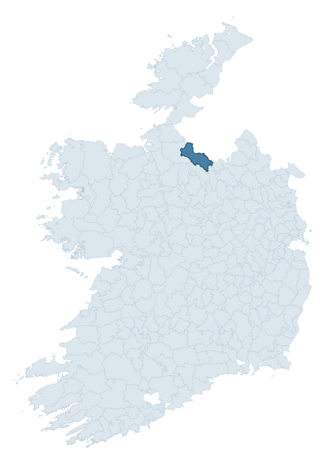
Where this barony sits in the Republic of Ireland
Geology and preservation
Bedrock geology shapes the landscape long before any settlement begins — controlling soil drainage, agricultural potential, the survival of upstanding monuments, and the preservation of buried archaeology. The figures below come from the Geological Survey Ireland 1:100,000 bedrock map.
The bedrock underlying Tullyhaw is predominantly shale (27% of the barony by area), laid down during the Carboniferous period (100% by area, around 359 to 299 million years ago). Shale weathers to thin, acidic, frequently waterlogged soils, historically marginal for arable but suited to upland pasture and bog development. Shale-dominated baronies often carry sparse ringfort records and a higher representation of bog-preserved archaeology. A substantial secondary geology of limestone (22%) and sandstone (22%) adds further variety to the underlying landscape. With 9 distinct rock types mapped, the barony sits in the top third of ROI baronies for geological diversity (85th percentile) — typically a sign of complex tectonic history or coastal mosaics of differing rock units.
Rock type composition
Largest mapped unit: Glenade Sandstone Formation (21% of the barony)
Placename evidence
Logainm records 38 heritage-diagnostic placenames for Tullyhaw, drawn from townland and civil-parish names across the barony. The dominant stratum is Early Christian ecclesiastical — cill-, teampall-, and domhnach-prefixed names that record the dense network of early church foundations established between the fifth and tenth centuries. The leading diagnostic roots are cill- (21 — church), dún- (5 — hilltop fort or promontory fort), and caiseal- (5 — stone ringfort). This is broadly in line with the ROI average of 30.7 heritage placenames per barony. The presence of multiple heritage strata side by side indicates layered occupation of the landscape across successive prehistoric and historic periods. Logainm records 334 placenames for Tullyhaw (predominantly townland names). Of these, 38 (11%) carry one of the diagnostic Gaelic roots tracked above; the remainder draw on more generic landscape vocabulary that does not encode a heritage period.
Pre-Christian / Early Medieval Defensive
| Root | Count | Meaning |
|---|---|---|
| dún- | 5 | hilltop or promontory fort |
| caiseal- | 5 | stone ringfort |
| ráth- | 1 | earthen ringfort |
| lios- | 1 | ringfort or enclosure |
Early Christian Ecclesiastical
| Root | Count | Meaning |
|---|---|---|
| cill- | 21 | church (early) |
| teampall- | 1 | church (later medieval) |
Burial, Ritual, and Norse-Contact
| Root | Count | Meaning |
|---|---|---|
| tuaim- | 2 | burial mound |
| carn- | 2 | cairn |
| gall- | 1 | foreigner — Norse settlement marker |
Other baronies in Cavan
About this profile
Click any section below to expand.
What is a barony?
A barony is a historic administrative unit in Ireland, broadly equivalent to an English hundred. The 280 baronies used here are from the OSi 2019 National Statutory Boundaries (generalised 20m), covering the 26 counties of the Republic of Ireland. Baronies derive from the Norman period, were formalised in the 17th century, and have not been redrawn for statistical purposes. They vary enormously in area, from compact urban baronies in Dublin to vast upland baronies in Connacht, and should not be compared by raw site count without accounting for area differences.
What counts as a site?
This profile combines three distinct heritage registers, each with its own definition of what constitutes a recordable site:
- Archaeological sites (NMS). The National Monuments Service Sites and Monuments Record (SMR) catalogues every known archaeological monument or site of archaeological interest in the Republic, from prehistoric burial mounds and ringforts to medieval churches and post-medieval defensive works. Inclusion does not require legal protection — only that the site has been identified, surveyed, and assessed as having archaeological value. A separate subset of these sites lies within a recorded protection zone, which gives them statutory protection under the National Monuments Acts.
- Listed buildings (NIAH). The National Inventory of Architectural Heritage records buildings of architectural, historical, archaeological, artistic, cultural, scientific, social, or technical interest. Each surveyed structure is appraised on a five-tier scale: International, National, Regional, Local, and Record-Only. The NIAH appraisal is informational rather than strictly statutory, but it underpins local-authority Record of Protected Structures (RPS) listings.
- Heritage placenames (Logainm). Logainm is the authoritative database of Irish placenames maintained by the Placenames Branch. This profile applies a heritage-diagnostic classifier to the Irish-language form of each townland name, flagging roots that signal defensive sites (ráth-, lios-, dún-, caiseal-, cathair-), ecclesiastical foundations (cill-, teampall-, domhnach-, mainistir-), prehistoric burial-ritual features (tuaim-, carn-, leaba-), or Norse-contact settlement (gall-). Townlands without one of these diagnostic roots are not flagged here — they may still carry historical significance, but that significance is not encoded in the name itself.
Editorial principles
The narrative sections of this profile follow several explicit principles:
- Evidential. Every claim about this barony’s heritage character is anchored in the underlying register data. Where a site count, a placename count, or a percentile rank is cited, it is computed from the source datasets at export time, not estimated.
- Comparative. Counts and metrics are reported alongside their percentile rank against the other 279 ROI baronies. A barony with 50 ringforts in absolute terms could be unusually high or unusually low depending on its size and regional context; percentile ranking removes that ambiguity.
- Transparent on limits. Where a register has known coverage gaps, survey biases, or data-quality issues that affect this barony’s figures, the profile flags them rather than presenting the numbers as definitive.
- No interpretation beyond what the data supports. The narrative does not speculate about historical events, social dynamics, or cultural meaning beyond what the recorded heritage and placename evidence directly attests.
Data caveats and limits
- NMS Sites and Monuments Record is the product of survey campaigns conducted at different intensities across different counties and decades. Some baronies have been surveyed more thoroughly than others, and absolute counts should be read in that light. Sites destroyed by development before survey are typically not represented; sites in heavily forested or upland terrain are sometimes under-recorded.
- NIAH coverage is broadly complete for the Republic of Ireland but the survey was conducted on a rolling county-by-county basis, and the most recent appraisal date varies. Buildings demolished or substantially altered after their original survey may still appear in the register; conversely, recent buildings of merit may not yet have been appraised.
- Logainm classification applies a deliberately conservative pattern-matching approach to the Irish-language townland forms. The classifier prioritises true positives over recall: a townland may carry a heritage signal that the classifier doesn’t recognise, particularly where the diagnostic root has been heavily anglicised or where the townland name draws on a less common term. The 60,000+ townland records and ~9,800 classified placenames give a substantial signal at barony scale, but individual townland names should be checked against Logainm directly for definitive interpretation.
- Period attribution. The chronological distribution reflects only those NMS sites that carry a recognised period attribution in the source data. Sites listed as “Unknown” period are excluded from the dated subset.
- Boundary changes. Some baronies have undergone minor boundary adjustments since their 19th-century definition; the OSi 2019 generalised boundaries used here are the current statutory definition and may differ slightly from historical maps in border areas.
- Bedrock geology is mapped at 1:100,000 scale, which means local variation within a barony — small pockets of different rock type, mineral veins, alluvium overlying bedrock — is generalised. The dominant-system and rocktype figures are area-weighted, so a barony reading “70% Carboniferous limestone” may still contain small but archaeologically important pockets of older or younger rock. Around 3% of GSI polygons do not match the lexicon and contribute no rocktype or system attribution.
Data sources
- National Monuments Service — Sites and Monuments Record (SMR) https://data.gov.ie/dataset/national-monuments-service-archaeological-survey-of-ireland
- National Inventory of Architectural Heritage (NIAH) https://data.gov.ie/dataset/national-inventory-of-architectural-heritage-niah-national-dataset
- Logainm — Placenames Database of Ireland https://www.logainm.ie/
- Ordnance Survey Ireland — National Statutory Barony Boundaries 2019 https://data-osi.opendata.arcgis.com/
- EURODEM — European Digital Elevation Model https://www.mapsforeurope.org/datasets/euro-dem
- ESA WorldCover https://esa-worldcover.org/en
- Geological Survey Ireland — 1:100,000 Bedrock Geology https://www.gsi.ie/en-ie/data-and-maps/Pages/Bedrock.aspx
Explore more: Search any of the 280 ROI baronies, browse by historical province, or read the methodology and data sources for the full Republic of Ireland Heritage Tool.