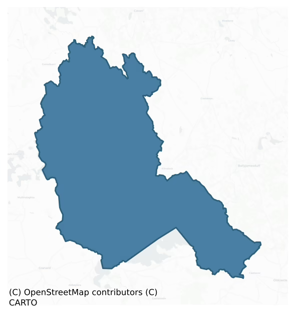
Clanmahon is a barony of County Cavan, in the historical province of Ulster (Irish: Clann Mhathúna), covering 220 km² of land. The barony records 324 NMS archaeological sites and 59 NIAH listed buildings, placing it at around the 32nd percentile among 280 ROI baronies for sites per km². This means it is in the bottom third of all baronies for sites per km². Dated archaeological evidence runs from the Neolithic through to the Modern, spanning 7 of 9 archaeological periods, placing the barony in the 34th percentile among 280 ROI baronies for chronological depth. This means it is in the lower half of all baronies for chronological depth. The largest dated subset of recorded sites dates to the Early Medieval. Logainm flags 44 placenames in the barony as carrying a recognised heritage root; the largest share — around 57% — are names associated with early Christian church and monastic foundations.
Heritage at a glance
Percentile rankings throughout this profile compare each barony only against the other 279 Republic of Ireland baronies.
The recorded heritage of Clanmahon
The National Monuments Service Sites and Monuments Record (SMR) is the statutory inventory of archaeological sites for the Republic of Ireland, maintained by the Department of Tourism, Culture, Arts, Gaeltacht, Sport and Media. Sites recorded here include earthworks, ringforts, megalithic tombs, ecclesiastical remains, and post-medieval features; not every record is legally protected, but each is registered as a monument of archaeological interest.
The National Monuments Service records 324 archaeological sites in Clanmahon, putting it at the 32nd percentile among 280 ROI baronies for sites per km². This means it is in the bottom third of all baronies for sites per km². Protection coverage is near-universal — 296 sites (91%) fall within a recorded monument protection zone, indicating an extensively surveyed landscape. The dominant category is defensive sites — ringforts, enclosures, hillforts, and stone forts (245 sites, 76% of the record). Ringfort – rath is the most prevalent type, making up 61% of the barony's recorded sites (198 records) — well above the ROI average of 20% across all baronies where this type occurs. Ringfort – rath is an earthen ringfort enclosed by a bank and external ditch — the most common Early Medieval farmstead, broadly dated 500–1000 AD. Other significant types include Crannog (15) and Enclosure (13). Crannog is an artificial or partly artificial island built up on a lake or river bed, in use from the 6th to 17th centuries AD; Enclosure is a banked or ditched feature of uncertain type, used as a catch-all where the original function cannot be determined from surface evidence. Across the barony's 220 km², this gives a recorded density of 1.47 sites per km².
Most common monument types
Hover or tap a monument type to see its definition.
| Type | Count |
|---|---|
| Ringfort – rath an earthen ringfort enclosed by a bank and external ditch — the most common Early Medieval farmstead, broadly dated 500–1000 AD | 198 |
| Crannog an artificial or partly artificial island built up on a lake or river bed, in use from the 6th to 17th centuries AD | 15 |
| Enclosure a banked or ditched feature of uncertain type, used as a catch-all where the original function cannot be determined from surface evidence | 13 |
| Church a building used for public Christian worship, of any date from c. 500 AD onwards | 11 |
| Souterrain an underground stone-built passage and chamber, generally Early Medieval and often associated with ringforts as a defensive or storage feature | 7 |
| Graveyard a burial area associated with a church, in use from the medieval period onwards | 6 |
Chronological distribution
The dated archaeological record for Clanmahon spans from the Neolithic through to the Modern, with activity attested across 7 of 9 archaeological periods. The record is near-continuous, with only the Middle Late Bronze Age period falling inside the span without any recorded sites. Activity concentrates most heavily in the Early Medieval (224 sites, 82% of dated material), with the Iron Age forming a secondary peak (25 sites, 9%). A further 52 recorded sites (16% of the overall NMS register for the barony) carry no period attribution — appearing as 'Unknown' in the bar chart below. This typically reflects either records that pre-date the standardised period vocabulary or sites awaiting specialist dating review, rather than a genuine absence of chronological evidence.
Sample of recorded monuments
Show 25 sample monuments (of 324 total)
A representative sample of 25 recorded monuments drawn from the barony’s 324 total NMS entries. Sites within a recorded monument protection zone and rarer site types are prioritised so the list shows a meaningful cross-section rather than only the most common type. Each entry shows the official Sites and Monuments Record reference number and the description published by the National Monuments Service.
Cairn – unclassified
Davies (1948, 111) recorded that there was an early church here, apparently a short distance to the NE of the present church. Not visible at ground level.
The above description is derived from the published…
Davies (1948, 111) recorded that there was an early church here, apparently a short distance to the NE of the present church. Not visible at ground level.
The above description is derived from the published 'Archaeological Inventory of County Cavan' (Dublin: Stationery Office, 1995). In certain instances the entries have been revised and updated in the light of recent research.
Date of upload/revision: 22 December 2008
Bawn
The small estate of Crenard was acquired by the Flemings of Slane (ME0190933002-), perhaps during the Plantation. According to contemporary documents there was a bawn and house of lime and stone (Davies 1948a, 94). Land…
The small estate of Crenard was acquired by the Flemings of Slane (ME0190933002-), perhaps during the Plantation. According to contemporary documents there was a bawn and house of lime and stone (Davies 1948a, 94). Land at Crenit (78) is indicated on the Down Survey (1656-8) barony map, but no house is represented. See this web-page accessed on 18/04/2016 http://downsurvey.tcd.ie/down-survey-maps.php#bm=Clonmoghan&c=Cavan Davies (ibid.) identified Crenit with Bellville where there is the remains of a low, subrectangular, grass-covered earthen platform (dims c. 53m N-S; 38m E-W) with apparently rounded corners, extending W from the present early 18th-century house and farm complex. (ITA Survey 1941)
The above description is derived from the published 'Archaeological Inventory of County Cavan' (Dublin: Stationery Office, 1995). In certain instances the entries have been revised and updated in the light of recent research.
Date of revision: 18 April 2016
Designed landscape – folly
A two-storey square tower (int. dims. 7.15m x 7.15m; max H c. 6.2m) with thick mortared walls of rough unworked stones, situated on rock outcrop. Doorways in W and S walls. Intramural stairs runs from doorway in S wall…
A two-storey square tower (int. dims. 7.15m x 7.15m; max H c. 6.2m) with thick mortared walls of rough unworked stones, situated on rock outcrop. Doorways in W and S walls. Intramural stairs runs from doorway in S wall through E wall to viewing point. Beam slots and two recesses (dims. 2.75m x 1.15m) in S wall and round-headed fireplace in N wall.
The above description is derived from the published 'Archaeological Inventory of County Cavan' (Dublin: Stationery Office, 1995). In certain instances the entries have been revised and updated in the light of recent research.
Date of upload/revision: 22 December 2008
Cist
Davies (ITA Survey, 1942) recorded that a 'stone-lined cist with capstone' was found at this location. Bones were also found, and what looked like a 'soldiers helmet' (possibly a food vessel). Not visible at ground…
Davies (ITA Survey, 1942) recorded that a 'stone-lined cist with capstone' was found at this location. Bones were also found, and what looked like a 'soldiers helmet' (possibly a food vessel). Not visible at ground level.
The above description is derived from the published 'Archaeological Inventory of County Cavan' (Dublin: Stationery Office, 1995). In certain instances the entries have been revised and updated in the light of recent research.
Date of upload/revision: 22 December 2008
Concentric enclosure
A small raised circular area (int. diam. 25m) enclosed by an inner bank and fosse separated from an outer bank and external fosse by a berm (Wth 9m).Original entrance may have been at ENE where there are corresponding…
A small raised circular area (int. diam. 25m) enclosed by an inner bank and fosse separated from an outer bank and external fosse by a berm (Wth 9m).Original entrance may have been at ENE where there are corresponding breaks in the banks.
The above description is derived from the published 'Archaeological Inventory of County Cavan' (Dublin: Stationery Office, 1995). In certain instances the entries have been revised and updated in the light of recent research.
Date of upload/revision: 22 December 2008
Stone head
Built into the wall of a modern dwelling-house, c. 30m SSE of the remains of a 16th-century castle (CV025-063001-). The head has a pointed chin, a flattened nose am slightly bulging eyes and is late medieval in…
Built into the wall of a modern dwelling-house, c. 30m SSE of the remains of a 16th-century castle (CV025-063001-). The head has a pointed chin, a flattened nose am slightly bulging eyes and is late medieval in date.
The above description is derived from the published 'Archaeological Inventory of County Cavan' (Dublin: Stationery Office, 1995). In certain instances the entries have been revised and updated in the light of recent research.
Date of upload/revision: 22 December 2008
Children's burial ground
Although this site has been levelled, the outline of the enclosing features are still visible from E-S-N, encompassing an almost circular area (diam c. 57.2m) which has been bisected by a field boundary running NE-SW.…
Although this site has been levelled, the outline of the enclosing features are still visible from E-S-N, encompassing an almost circular area (diam c. 57.2m) which has been bisected by a field boundary running NE-SW. Davies (1948, 110) believed that it was probably the site of an old church (CV025-115002-).
The above description is derived from the published 'Archaeological Inventory of County Cavan' (Dublin: Stationery Office, 1995). In certain instances the entries have been revised and updated in the light of recent research.
Date of upload/revision: 22 December 2008
Standing stone
Not marked on any OS ed. Sited on a natural knoll in dry pasture. Round-topped standing stone (H c. 1.5m; max. dim. at base c. 0.7m). Much worn as a consequence of its utilisation as a scratching post by cattle.
The…
Not marked on any OS ed. Sited on a natural knoll in dry pasture. Round-topped standing stone (H c. 1.5m; max. dim. at base c. 0.7m). Much worn as a consequence of its utilisation as a scratching post by cattle.
The above description is derived from the published 'Archaeological Inventory of County Cavan' (Dublin: Stationery Office, 1995). In certain instances the entries have been revised and updated in the light of recent research.
Date of upload/revision: 22 December 2008
Bullaun stone
Situated at NW edge of 'St Patrick's Well' (CV037-017001-). Small irregularly shaped boulder (max. dim. 0.3m) with a shallow bullaun (Wth 0.15m) at its centre.
The above description is derived from the published…
Situated at NW edge of 'St Patrick's Well' (CV037-017001-). Small irregularly shaped boulder (max. dim. 0.3m) with a shallow bullaun (Wth 0.15m) at its centre.
The above description is derived from the published 'Archaeological Inventory of County Cavan' (Dublin: Stationery Office, 1995). In certain instances the entries have been revised and updated in the light of recent research.
Date of upload/revision: 22 December 2008
Graveslab
The Archaeological Survey of Ireland (ASI) is in the process of providing information on all monuments on The Historic Environment Viewer (HEV). Currently the information for this record has not been uploaded. To…
The Archaeological Survey of Ireland (ASI) is in the process of providing information on all monuments on The Historic Environment Viewer (HEV). Currently the information for this record has not been uploaded. To access available information for research purposes please make an appointment in advance with the Archive Unit (open Fridays 10.00 am – 5.00 pm), Department of Culture, Heritage and the Gaeltacht, The Custom House, Dublin 1 D01W6XO or email nmarchive@chg.gov.ie.
Ringfort – cashel
Raised circular area (int. diam. c. 43m) enclosed by a low partly destroyed drystone wall. Original entrance not recognisable. Some 10m in from the cashel wall the internal area is level but rises to a height of c. 1.5m…
Raised circular area (int. diam. c. 43m) enclosed by a low partly destroyed drystone wall. Original entrance not recognisable. Some 10m in from the cashel wall the internal area is level but rises to a height of c. 1.5m above that of the wall at the centre of the interior.
The above description is derived from the published 'Archaeological Inventory of County Cavan' (Dublin: Stationery Office, 1995). In certain instances the entries have been revised and updated in the light of recent research.
Date of upload/revision: 22 December 2008
Megalithic tomb – court tomb
The monument stands immediately N of a rath (CV037-050—-) on a broad ridge in rolling grassland. Largely destroyed, it consists of a S-facing court, roughly semicircular in outline, formed by seven substantial stones,…
The monument stands immediately N of a rath (CV037-050—-) on a broad ridge in rolling grassland. Largely destroyed, it consists of a S-facing court, roughly semicircular in outline, formed by seven substantial stones, three to the W and four to the E, the tallest 1.45m high. Behind the inner stone at W, which also served as an entrance jamb, a stone 0.8m high is all that now remains of the gallery. A considerable number of prostrate stones of varying size lie in and around what was the gallery area. (Ó Nualláin 1989,116,Cv.42)
The above description is derived from the published 'Archaeological Inventory of County Cavan' (Dublin: Stationery Office, 1995). In certain instances the entries have been revised and updated in the light of recent research.
Date of upload/revision: 22 December 2008
Burial ground
Large approximately oval-shaped raised area (dims. c. 60m E-W; c. 40m N-S) surrounded by marshland. Believed to be the site of an ancient burial ground (local information). Not visible at ground level.
The above…
Large approximately oval-shaped raised area (dims. c. 60m E-W; c. 40m N-S) surrounded by marshland. Believed to be the site of an ancient burial ground (local information). Not visible at ground level.
The above description is derived from the published 'Archaeological Inventory of County Cavan' (Dublin: Stationery Office, 1995). In certain instances the entries have been revised and updated in the light of recent research.
Date of upload/revision: 22 December 2008
Ogham stone
Tradition of an ogham stone found during the digging of a drain in the 1930s (local information). Its subsequent fate is unknown. Situated on the W shoulder of a high drumlin ridge. Not visible at ground level.…
Tradition of an ogham stone found during the digging of a drain in the 1930s (local information). Its subsequent fate is unknown. Situated on the W shoulder of a high drumlin ridge. Not visible at ground level. (O'Donovan 1995, 36)
Compiled by: Nora White
Date of upload: 10 September 2016
Castle – tower house
Situated on a small rocky island, c. 300m from the W shore of Lough Sheelin. Constructed in the late 14th century by Thomas McMahon O'Reilly. Davies described it as a two-storey rectangular tower with base batter, a…
Situated on a small rocky island, c. 300m from the W shore of Lough Sheelin. Constructed in the late 14th century by Thomas McMahon O'Reilly. Davies described it as a two-storey rectangular tower with base batter, a barrel vault over the ground floor and remains of a doorway in S wall. Intramural staircases occur in E wall leading to first floor, and in N wall leading to roof level. Site is densely overgrown with vegetation.
The above description is derived from the published 'Archaeological Inventory of County Cavan' (Dublin: Stationery Office, 1995). In certain instances the entries have been revised and updated in the light of recent research.
Date of upload/revision: 22 December 2008
Castle – motte and bailey
Situated at a bend in a wide river which encircles the NE half of the site. Elsewhere enclosed by a wide, shallow fosse now identifiable only from SE-S-WNW. The motte comprises a high, steep-sided, flat-topped oval…
Situated at a bend in a wide river which encircles the NE half of the site. Elsewhere enclosed by a wide, shallow fosse now identifiable only from SE-S-WNW. The motte comprises a high, steep-sided, flat-topped oval earthen mound (H 3m – 5.75m; dims of base c. 38m NW-SE; c. 27m NE-SW), the summit of which (int. dims 32.4m NW-SE; 23.3m NE-SW) is enclosed by the remains of a low earthen bank. Foundations of a rectangular stone building (int. dims c. 8m E-W; c. 6m N-S) occur on the summit. Break in bank with accompanying causeway at SW represents original entrance. Traces of possible rectangular bailey to SW. Davies (1947a, 87) speculated that this may be the location of a Nugent castle noted in historical documents.
The above description is derived from the published 'Archaeological Inventory of County Cavan' (Dublin: Stationery Office, 1995). In certain instances the entries have been revised and updated in the light of recent research.
Date of upload: 22 December 2008
Castle – ringwork
Depicted as a circular enclosure with the designation 'Fort' on OS 1836 ed. of the OS 6-inch map. A rectangular structure aligned NW-SE is shown within the W portion of the enclosed area. The site comprises a large,…
Depicted as a circular enclosure with the designation 'Fort' on OS 1836 ed. of the OS 6-inch map. A rectangular structure aligned NW-SE is shown within the W portion of the enclosed area. The site comprises a large, oval-shaped, natural earthen mound with scarped sides and flattened summit (dims of summit c. 39.5m NE-SW; c. 28m NW-SW). In the SW quadrant there is a low, narrow, stone-built circular tower standing on a larger rounded stone structure which appears to be a folly probably of late 18th or early 19th-century construction. The monument is densely overgrown with vegetation rendering inspection difficult. Davies (1947a, 86) described this as a 14th or 15th-century castle 'of keep and bawn type'. However there is no documentary or archaeological evidence to validate this claim.
The above description is derived from the published 'Archaeological Inventory of County Cavan' (Dublin: Stationery Office, 1995). In certain instances the entries have been revised and updated in the light of recent research.
Date of upload/revision: 22 December 2008
Burial mound
The following is recorded by Cahill and Sikora (2011, ii, 300-05): 'In October 1992 during reclamation work on farmland a number of human burials were discovered near Mount Nugent, Co. Cavan. The site consisted of a low…
The following is recorded by Cahill and Sikora (2011, ii, 300-05): 'In October 1992 during reclamation work on farmland a number of human burials were discovered near Mount Nugent, Co. Cavan. The site consisted of a low rise, approximately 2m above the surrounding surface and approximately 20m in diameter at the top. The bones were recovered at a depth of 0.15-0.2m when the bulldozer drove into the centre of the mound. The following day bones were found around the perimeter of the raised area. The discovery was reported to the Gardaí at Kilnaleck, who visited the site and then informed the NMI. An investigation was carried out by Eamon Kelly. . . The site consisted of a mound approximately 30m by 20m across. The bulldozer had made two cuttings: cutting B on plan measured 40m by 8.5m by 0.15-0.2m deep and extended over the southern side of the mound. Cutting A was aligned north-east/south-west and measured 4m by 2m wide by 0.4m deep. Human remains were recovered from both of these cuttings. The burials appear to have been placed in simple dug graves without any stone lining. The level of disturbance was such that it is not clear whether the burials were extended. . . All of the burials were apparently aligned west/east, with the heads to the west. The sample from cutting A contained the remains of at least three individuals: two adults-one probably female-and one adolescent (1992:44). The latter had porotic hyperostosis-probably the result of iron-deficiency anaemia. The sa…
Cross-inscribed stone
The Archaeological Survey of Ireland (ASI) is in the process of providing information on all monuments on The Historic Environment Viewer (HEV). Currently the information for this record has not been uploaded. To…
The Archaeological Survey of Ireland (ASI) is in the process of providing information on all monuments on The Historic Environment Viewer (HEV). Currently the information for this record has not been uploaded. To access available information for research purposes please make an appointment in advance with the Archive Unit (open Fridays 10.00 am – 5.00 pm), Department of Culture, Heritage and the Gaeltacht, The Custom House, Dublin 1 D01W6XO or email nmarchive@chg.gov.ie.
Mound
The Archaeological Survey of Ireland (ASI) is in the process of providing information on all monuments on The Historic Environment Viewer (HEV). Currently the information for this record has not been uploaded. To…
The Archaeological Survey of Ireland (ASI) is in the process of providing information on all monuments on The Historic Environment Viewer (HEV). Currently the information for this record has not been uploaded. To access available information for research purposes please make an appointment in advance with the Archive Unit (open Fridays 10.00 am – 5.00 pm), Department of Culture, Heritage and the Gaeltacht, The Custom House, Dublin 1 D01W6XO or email nmarchive@chg.gov.ie.
House – 17th century
The small estate of Crenard was acquired by the Flemings of Slane (ME0190933002-), perhaps during the Plantation. According to contemporary documents there was a bawn and house of lime and stone (Davies 1948a, 94). Land…
The small estate of Crenard was acquired by the Flemings of Slane (ME0190933002-), perhaps during the Plantation. According to contemporary documents there was a bawn and house of lime and stone (Davies 1948a, 94). Land at Crenit (78) is indicated on the Down Survey (1656-8) barony map, but no house is represented. See this web-page accessed on 18/04/2016 http://downsurvey.tcd.ie/down-survey-maps.php#bm=Clonmoghan&c=Cavan Davies (ibid.) identified Crenit with Bellville where there is the remains of a low, subrectangular, grass-covered earthen platform (dims c. 53m N-S; 38m E-W) with apparently rounded corners, extending W from the present early 18th-century house and farm complex. (ITA Survey 1941)
Date of upload: 18 April, 2016
Field boundary
The Archaeological Survey of Ireland (ASI) is in the process of providing information on all monuments on The Historic Environment Viewer (HEV). Currently the information for this record has not been uploaded. To…
The Archaeological Survey of Ireland (ASI) is in the process of providing information on all monuments on The Historic Environment Viewer (HEV). Currently the information for this record has not been uploaded. To access available information for research purposes please make an appointment in advance with the Archive Unit (open Fridays 10.00 am – 5.00 pm), Department of Culture, Heritage and the Gaeltacht, The Custom House, Dublin 1 D01W6XO or email nmarchive@chg.gov.ie.
Structure
In the SW quadrant of the ringwork (CV042-017001-) there is a low, narrow, stone-built circular tower standing on a larger rounded stone structure which appears to be a folly probably of late 18th or early 19th-century…
In the SW quadrant of the ringwork (CV042-017001-) there is a low, narrow, stone-built circular tower standing on a larger rounded stone structure which appears to be a folly probably of late 18th or early 19th-century construction. The monument is densely overgrown with vegetation rendering inspection difficult. (Davies 1947a, 86)
Date of upload: 18 April, 2016
Promontory fort – inland
Aerial photographs (GB91.DM.28 and 29) show cropmarks of three widely spaced curved fosses defining an enclosure overlooking a river, located approximately 200 metres east of where the river enters the eastern shores of…
Aerial photographs (GB91.DM.28 and 29) show cropmarks of three widely spaced curved fosses defining an enclosure overlooking a river, located approximately 200 metres east of where the river enters the eastern shores of Lough Sheelin.
Compiled by: Dr. Gillian Barrett for the Archaeological Survey of Ireland
Date of upload: 22 December 2010
Ringfort – rath
Raised circular area (int. diam. c. 42m) enclosed by a substantial earthen bank and a shallow fosse. Site is divided into two roughly equal portions by a field boundary running NNW-SSE and has been levelled to SSW of…
Raised circular area (int. diam. c. 42m) enclosed by a substantial earthen bank and a shallow fosse. Site is divided into two roughly equal portions by a field boundary running NNW-SSE and has been levelled to SSW of field fence. Original entrance not recognisable.
The above description is derived from the published 'Archaeological Inventory of County Cavan' (Dublin: Stationery Office, 1995). In certain instances the entries have been revised and updated in the light of recent research.
Date of upload/revision: 22 December 2008
Listed buildings
The National Inventory of Architectural Heritage (NIAH) is a state survey appraising buildings of architectural, historical, archaeological, artistic, cultural, scientific, social, or technical interest. Each surveyed structure receives a rating from International (the highest, for buildings of European importance) through National, Regional, Local, and Record-Only.
The NIAH records 59 listed buildings in Clanmahon (29th percentile across ROI baronies). All recorded buildings carry Regional or lower grading; the barony does not contain any structures appraised as being of National or International architectural importance. Construction dates concentrate most heavily in the Victorian (1830-1900) period. The most-recorded building type is bridge (13 examples, 22% of the listed stock).
Terrain and environment
Mean elevation across the barony is 85m — the 46th percentile among 280 ROI baronies for elevation. This means it is in the lower half of all baronies for elevation. Elevation matters for heritage because higher-altitude baronies typically favour defensive monuments — ringforts and hilltop forts placed on prominent ground — while lowland baronies are more likely to carry the dense settlement and church networks of intensive agricultural landscapes. A maximum elevation of 192m gives the barony meaningful vertical relief. Mean slope is 3.7° — the 51st percentile among 280 ROI baronies for slope. This means it is in the upper half of all baronies for slope. Slope is a key control on both land use and archaeological preservation: steep ground resists ploughing and tends to preserve earthworks intact, while gentle slopes favour intensive cultivation that damages or destroys surface archaeology over time. The Topographic Wetness Index averages 10.7, the 44th percentile among 280 ROI baronies for wetness. This means it is in the lower half of all baronies for wetness. Drainage matters for heritage because poorly-drained ground preserves organic archaeology (wooden trackways, leather, textiles, and on rare occasions human remains) far better than free-draining soil; well-drained ground favours arable use but destroys organic material rapidly. The land-cover mosaic combines improved grassland (76%), woodland (17%), and open water (6%), giving a mixed agricultural and semi-natural landscape.
Terrain measurements
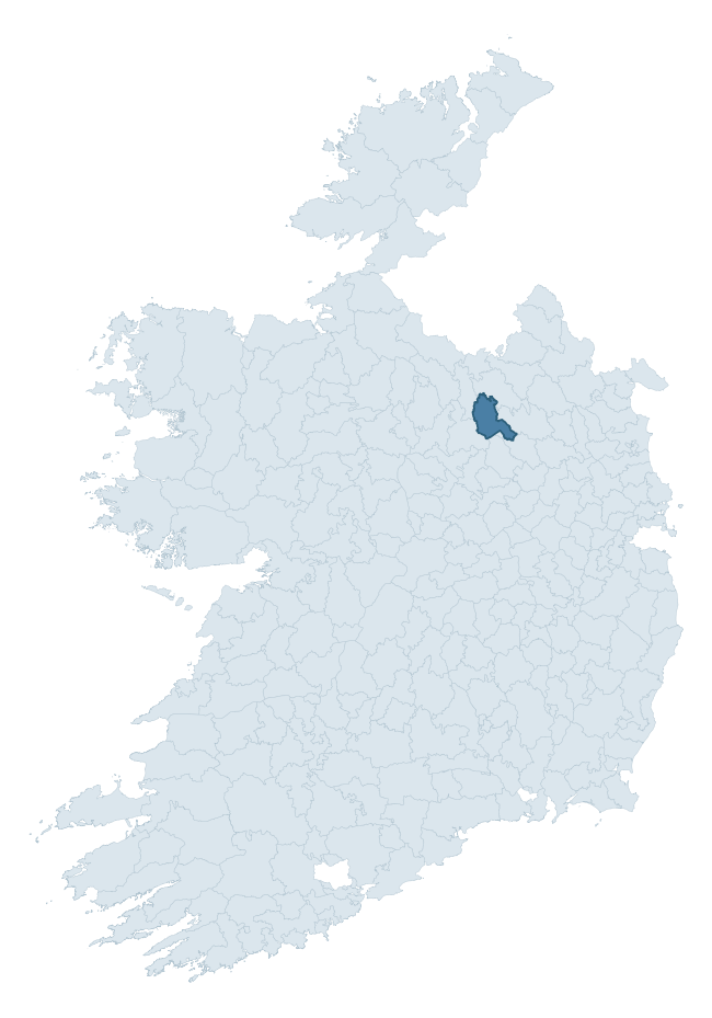
Where this barony sits in the Republic of Ireland
Geology and preservation
Bedrock geology shapes the landscape long before any settlement begins — controlling soil drainage, agricultural potential, the survival of upstanding monuments, and the preservation of buried archaeology. The figures below come from the Geological Survey Ireland 1:100,000 bedrock map.
The bedrock underlying Clanmahon is predominantly greywacke (42% of the barony by area), with much of the rock dating to the Ordovician period. Greywacke is a hard, dark, fine-grained sandstone that weathers to thin upland soils. Greywacke baronies typically carry sparser settlement archaeology but provide high-quality building stone visible in older field walls and farm buildings. A substantial secondary geology of limestone (18%) and siltstone (13%) adds further variety to the underlying landscape. The single largest mapped unit is the Red Island Formation (40% of the barony's bedrock). With 11 distinct rock types mapped, the barony sits in the top third of ROI baronies for geological diversity (93rd percentile) — typically a sign of complex tectonic history or coastal mosaics of differing rock units.
Rock type composition
Largest mapped unit: Red Island Formation (40% of the barony)
Placename evidence
Logainm records 44 heritage-diagnostic placenames for Clanmahon, drawn from townland and civil-parish names across the barony. The dominant stratum is Early Christian ecclesiastical — cill-, teampall-, and domhnach-prefixed names that record the dense network of early church foundations established between the fifth and tenth centuries. The leading diagnostic roots are cill- (23 — church), lios- (9 — ringfort or enclosure), and dún- (4 — hilltop fort or promontory fort). This is above the ROI average of 30.7 heritage placenames per barony. The presence of multiple heritage strata side by side indicates layered occupation of the landscape across successive prehistoric and historic periods. Logainm records 224 placenames for Clanmahon (predominantly townland names). Of these, 44 (20%) carry one of the diagnostic Gaelic roots tracked above; the remainder draw on more generic landscape vocabulary that does not encode a heritage period.
Pre-Christian / Early Medieval Defensive
| Root | Count | Meaning |
|---|---|---|
| lios- | 9 | ringfort or enclosure |
| dún- | 4 | hilltop or promontory fort |
| ráth- | 3 | earthen ringfort |
| caiseal- | 1 | stone ringfort |
Early Christian Ecclesiastical
| Root | Count | Meaning |
|---|---|---|
| cill- | 23 | church (early) |
| teampall- | 2 | church (later medieval) |
Burial, Ritual, and Norse-Contact
| Root | Count | Meaning |
|---|---|---|
| carn- | 2 | cairn |
| gall- | 2 | foreigner — Norse settlement marker |
Other baronies in Cavan
About this profile
Click any section below to expand.
What is a barony?
A barony is a historic administrative unit in Ireland, broadly equivalent to an English hundred. The 280 baronies used here are from the OSi 2019 National Statutory Boundaries (generalised 20m), covering the 26 counties of the Republic of Ireland. Baronies derive from the Norman period, were formalised in the 17th century, and have not been redrawn for statistical purposes. They vary enormously in area, from compact urban baronies in Dublin to vast upland baronies in Connacht, and should not be compared by raw site count without accounting for area differences.
What counts as a site?
This profile combines three distinct heritage registers, each with its own definition of what constitutes a recordable site:
- Archaeological sites (NMS). The National Monuments Service Sites and Monuments Record (SMR) catalogues every known archaeological monument or site of archaeological interest in the Republic, from prehistoric burial mounds and ringforts to medieval churches and post-medieval defensive works. Inclusion does not require legal protection — only that the site has been identified, surveyed, and assessed as having archaeological value. A separate subset of these sites lies within a recorded protection zone, which gives them statutory protection under the National Monuments Acts.
- Listed buildings (NIAH). The National Inventory of Architectural Heritage records buildings of architectural, historical, archaeological, artistic, cultural, scientific, social, or technical interest. Each surveyed structure is appraised on a five-tier scale: International, National, Regional, Local, and Record-Only. The NIAH appraisal is informational rather than strictly statutory, but it underpins local-authority Record of Protected Structures (RPS) listings.
- Heritage placenames (Logainm). Logainm is the authoritative database of Irish placenames maintained by the Placenames Branch. This profile applies a heritage-diagnostic classifier to the Irish-language form of each townland name, flagging roots that signal defensive sites (ráth-, lios-, dún-, caiseal-, cathair-), ecclesiastical foundations (cill-, teampall-, domhnach-, mainistir-), prehistoric burial-ritual features (tuaim-, carn-, leaba-), or Norse-contact settlement (gall-). Townlands without one of these diagnostic roots are not flagged here — they may still carry historical significance, but that significance is not encoded in the name itself.
Editorial principles
The narrative sections of this profile follow several explicit principles:
- Evidential. Every claim about this barony’s heritage character is anchored in the underlying register data. Where a site count, a placename count, or a percentile rank is cited, it is computed from the source datasets at export time, not estimated.
- Comparative. Counts and metrics are reported alongside their percentile rank against the other 279 ROI baronies. A barony with 50 ringforts in absolute terms could be unusually high or unusually low depending on its size and regional context; percentile ranking removes that ambiguity.
- Transparent on limits. Where a register has known coverage gaps, survey biases, or data-quality issues that affect this barony’s figures, the profile flags them rather than presenting the numbers as definitive.
- No interpretation beyond what the data supports. The narrative does not speculate about historical events, social dynamics, or cultural meaning beyond what the recorded heritage and placename evidence directly attests.
Data caveats and limits
- NMS Sites and Monuments Record is the product of survey campaigns conducted at different intensities across different counties and decades. Some baronies have been surveyed more thoroughly than others, and absolute counts should be read in that light. Sites destroyed by development before survey are typically not represented; sites in heavily forested or upland terrain are sometimes under-recorded.
- NIAH coverage is broadly complete for the Republic of Ireland but the survey was conducted on a rolling county-by-county basis, and the most recent appraisal date varies. Buildings demolished or substantially altered after their original survey may still appear in the register; conversely, recent buildings of merit may not yet have been appraised.
- Logainm classification applies a deliberately conservative pattern-matching approach to the Irish-language townland forms. The classifier prioritises true positives over recall: a townland may carry a heritage signal that the classifier doesn’t recognise, particularly where the diagnostic root has been heavily anglicised or where the townland name draws on a less common term. The 60,000+ townland records and ~9,800 classified placenames give a substantial signal at barony scale, but individual townland names should be checked against Logainm directly for definitive interpretation.
- Period attribution. The chronological distribution reflects only those NMS sites that carry a recognised period attribution in the source data. Sites listed as “Unknown” period are excluded from the dated subset.
- Boundary changes. Some baronies have undergone minor boundary adjustments since their 19th-century definition; the OSi 2019 generalised boundaries used here are the current statutory definition and may differ slightly from historical maps in border areas.
- Bedrock geology is mapped at 1:100,000 scale, which means local variation within a barony — small pockets of different rock type, mineral veins, alluvium overlying bedrock — is generalised. The dominant-system and rocktype figures are area-weighted, so a barony reading “70% Carboniferous limestone” may still contain small but archaeologically important pockets of older or younger rock. Around 3% of GSI polygons do not match the lexicon and contribute no rocktype or system attribution.
Data sources
- National Monuments Service — Sites and Monuments Record (SMR) https://data.gov.ie/dataset/national-monuments-service-archaeological-survey-of-ireland
- National Inventory of Architectural Heritage (NIAH) https://data.gov.ie/dataset/national-inventory-of-architectural-heritage-niah-national-dataset
- Logainm — Placenames Database of Ireland https://www.logainm.ie/
- Ordnance Survey Ireland — National Statutory Barony Boundaries 2019 https://data-osi.opendata.arcgis.com/
- EURODEM — European Digital Elevation Model https://www.mapsforeurope.org/datasets/euro-dem
- ESA WorldCover https://esa-worldcover.org/en
- Geological Survey Ireland — 1:100,000 Bedrock Geology https://www.gsi.ie/en-ie/data-and-maps/Pages/Bedrock.aspx
Explore more: Search any of the 280 ROI baronies, browse by historical province, or read the methodology and data sources for the full Republic of Ireland Heritage Tool.