
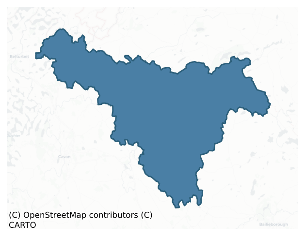
Tullygarvey is a barony of County Cavan, in the historical province of Ulster (Irish: Teallach Ghairbhíth), covering 242 km² of land. The barony records 324 NMS archaeological sites and 127 NIAH listed buildings, placing it at around the 25th percentile among 280 ROI baronies for sites per km². This means it is in the bottom third of all baronies for sites per km². Dated archaeological evidence runs from the Neolithic through to the Post Medieval, spanning 6 of 9 archaeological periods, placing the barony in the 11th percentile among 280 ROI baronies for chronological depth. This means it is in the bottom fifth of all baronies for chronological depth. The largest dated subset of recorded sites dates to the Early Medieval. Logainm flags 50 placenames in the barony as carrying a recognised heritage root; the largest share — around 52% — are names associated with pre-christian defensive.
Heritage at a glance
Percentile rankings throughout this profile compare each barony only against the other 279 Republic of Ireland baronies.
The recorded heritage of Tullygarvey
The National Monuments Service Sites and Monuments Record (SMR) is the statutory inventory of archaeological sites for the Republic of Ireland, maintained by the Department of Tourism, Culture, Arts, Gaeltacht, Sport and Media. Sites recorded here include earthworks, ringforts, megalithic tombs, ecclesiastical remains, and post-medieval features; not every record is legally protected, but each is registered as a monument of archaeological interest.
The National Monuments Service records 324 archaeological sites in Tullygarvey, putting it at the 25th percentile among 280 ROI baronies for sites per km². This means it is in the bottom third of all baronies for sites per km². Protection coverage is near-universal — 321 sites (99%) fall within a recorded monument protection zone, indicating an extensively surveyed landscape. The dominant category is defensive sites — ringforts, enclosures, hillforts, and stone forts (262 sites, 81% of the record). Ringfort – rath is the most prevalent type, making up 64% of the barony's recorded sites (207 records) — well above the ROI average of 20% across all baronies where this type occurs. Ringfort – rath is an earthen ringfort enclosed by a bank and external ditch — the most common Early Medieval farmstead, broadly dated 500–1000 AD. Other significant types include Crannog (15) and Enclosure (11). Crannog is an artificial or partly artificial island built up on a lake or river bed, in use from the 6th to 17th centuries AD; Enclosure is a banked or ditched feature of uncertain type, used as a catch-all where the original function cannot be determined from surface evidence. Across the barony's 242 km², this gives a recorded density of 1.34 sites per km².
Most common monument types
Hover or tap a monument type to see its definition.
| Type | Count |
|---|---|
| Ringfort – rath an earthen ringfort enclosed by a bank and external ditch — the most common Early Medieval farmstead, broadly dated 500–1000 AD | 207 |
| Crannog an artificial or partly artificial island built up on a lake or river bed, in use from the 6th to 17th centuries AD | 15 |
| Enclosure a banked or ditched feature of uncertain type, used as a catch-all where the original function cannot be determined from surface evidence | 11 |
| Barrow – unclassified a prehistoric burial mound where the specific barrow type cannot be determined from surface evidence | 10 |
| Church a building used for public Christian worship, of any date from c. 500 AD onwards | 9 |
| Castle – unclassified a castle whose form cannot be precisely classified, dating somewhere between the late 12th and 16th centuries | 8 |
| Bawn the defended courtyard of a medieval house, tower house or fortified house | 7 |
| Souterrain an underground stone-built passage and chamber, generally Early Medieval and often associated with ringforts as a defensive or storage feature | 7 |
Chronological distribution
The dated archaeological record for Tullygarvey spans from the Neolithic through to the Post Medieval, with activity attested across 6 of 9 archaeological periods. This is the 11th percentile across ROI baronies — a relatively narrow chronological band, with much of Irish prehistory not represented in the dated record. The record is near-continuous, with only the Medieval period falling inside the span without any recorded sites. Activity concentrates most heavily in the Early Medieval (235 sites, 80% of dated material), with the Iron Age forming a secondary peak (21 sites, 7%). A further 29 recorded sites (9% of the overall NMS register for the barony) carry no period attribution — appearing as 'Unknown' in the bar chart below. This typically reflects either records that pre-date the standardised period vocabulary or sites awaiting specialist dating review, rather than a genuine absence of chronological evidence.
Sample of recorded monuments
Show 25 sample monuments (of 324 total)
A representative sample of 25 recorded monuments drawn from the barony’s 324 total NMS entries. Sites within a recorded monument protection zone and rarer site types are prioritised so the list shows a meaningful cross-section rather than only the most common type. Each entry shows the official Sites and Monuments Record reference number and the description published by the National Monuments Service.
House – fortified house
Large almost square building (int. dims 16.7m NW-SE; 16.45m NE-SW) built of roughly coursed limestone and rubble, divided internally by a wall running NE-SW. Remains of doorway with bolt-hole in SE wall. Fragments of…
Large almost square building (int. dims 16.7m NW-SE; 16.45m NE-SW) built of roughly coursed limestone and rubble, divided internally by a wall running NE-SW. Remains of doorway with bolt-hole in SE wall. Fragments of windows survive in the SW and NE walls. The N wall has been partially reconstructed. Probably of mid-18th-century date.
The above description is derived from the published 'Archaeological Inventory of County Cavan' (Dublin: Stationery Office, 1995). In certain instances the entries have been revised and updated in the light of recent research.
Date of upload/revision: 22 December 2008
Children's burial ground
Not marked on any OS ed. Situated in a hollow in rough stony ground surrounded by a number of low hillocks. Believed to be the site of a children's burial ground (local information). No visible remains at ground…
Not marked on any OS ed. Situated in a hollow in rough stony ground surrounded by a number of low hillocks. Believed to be the site of a children's burial ground (local information). No visible remains at ground level.
The above description is derived from the published 'Archaeological Inventory of County Cavan' (Dublin: Stationery Office, 1995). In certain instances the entries have been revised and updated in the light of recent research.
Date of upload/revision: 22 December 2008
Cairn – unclassified
Sited on the summit of a drumlin hill. An approximately rectangular cairn (dims. 9.1m N-S;7.1m E-W). Much denuded (max. H. 1.1m). The remains of a megalithic structure called 'Cloghard' (CV016-015001-) lies 15m to…
Sited on the summit of a drumlin hill. An approximately rectangular cairn (dims. 9.1m N-S;7.1m E-W). Much denuded (max. H. 1.1m). The remains of a megalithic structure called 'Cloghard' (CV016-015001-) lies 15m to E.
The above description is derived from the published 'Archaeological Inventory of County Cavan' (Dublin: Stationery Office, 1995). In certain instances the entries have been revised and updated in the light of recent research.
Date of upload/revision: 22 December 2008
Ritual site – holy well
At Drumacleeskin hilltop enclosure (CV016-037001-). Just outside the fosse at E is a small circular unlined well dedicated to St Patrick (local information).
The above description is derived from the published…
At Drumacleeskin hilltop enclosure (CV016-037001-). Just outside the fosse at E is a small circular unlined well dedicated to St Patrick (local information).
The above description is derived from the published 'Archaeological Inventory of County Cavan' (Dublin: Stationery Office, 1995). In certain instances the entries have been revised and updated in the light of recent research.
Date of upload/revision: 22 December 2008
Architectural fragment
The Archaeological Survey of Ireland (ASI) is in the process of providing information on all monuments on The Historic Environment Viewer (HEV). Currently the information for this record has not been uploaded. To…
The Archaeological Survey of Ireland (ASI) is in the process of providing information on all monuments on The Historic Environment Viewer (HEV). Currently the information for this record has not been uploaded. To access available information for research purposes please make an appointment in advance with the Archive Unit (open Fridays 10.00 am – 5.00 pm), Department of Culture, Heritage and the Gaeltacht, The Custom House, Dublin 1 D01W6XO or email nmarchive@chg.gov.ie.
Ceremonial enclosure
Located at the crest of the E shoulder of a short E-W ridge. This is a large raised subrectangular area (dims. c. 115m NE-SW; c. 105m E-W) as represented on the 1835 and 1908 editions of the OS 6-inch map. It is divided…
Located at the crest of the E shoulder of a short E-W ridge. This is a large raised subrectangular area (dims. c. 115m NE-SW; c. 105m E-W) as represented on the 1835 and 1908 editions of the OS 6-inch map. It is divided into two unequal portions by a WNW-ESE field boundary, the area S of which is now reclaimed grassland. North of the field boundary the smaller portion survives as a D-shaped grass-covered area (dims c. 90m WNW-ESE; c. 25m NNE-SSW) defined by an overgrown fosse (at N: Wth of top 3.2m; int. D 1m; ext. D 1.8-2.4m) and an overgrown outer earthen bank (at N: Wth of base 2.8m; ext. H 0.6m). No entrance is identified.
The above description is derived from the published 'Archaeological Inventory of County Cavan' (Dublin: Stationery Office, 1995). In certain instances the entries have been revised and updated in the light of recent research.
Compiled by: Michael Moore
Date of upload: 22 December 2008
Revised: 18 March 2021
Megalithic tomb – portal tomb
Sited on a ridge in pasture. The chamber, incorporated in a field fence, is quite damaged. It faces NW and is about 3m long and 1.5m wide. At its more northerly side, a portal-stone 1.55m high, rises 0.85m above the…
Sited on a ridge in pasture. The chamber, incorporated in a field fence, is quite damaged. It faces NW and is about 3m long and 1.5m wide. At its more northerly side, a portal-stone 1.55m high, rises 0.85m above the adjoining sidestone. Beyond this a low backstone is set skew to the main axis of the chamber. At S a sidestone is in place but the portal-stone has fallen. An outward-leaning sillstone marks the front of the chamber. A displaced slab in the chamber may be part of a roofstone. Another displaced slab lies to the N of the fallen portal-stone. (de Valera and Ó Nualláin 1972, 121-2, No. 21)
The above description is derived from the published 'Archaeological Inventory of County Cavan' (Dublin: Stationery Office, 1995). In certain instances the entries have been revised and updated in the light of recent research.
Date of upload/revision: 22 December 2008
See linked document with details from Ruaidhrí de Valera and Seán Ó Nualláin, Survey of the Megalithic Tombs of Ireland. Volume III. Counties Galway, Roscommon, Leitrim, Longford, Westmeath, Laoighis, Offaly, Kildare, Cavan. (Dublin: Stationery Office, 1972).
Megalithic tomb – wedge tomb
Situated on sloping ground 3km NE of Laragh village. A gallery some 6m long, aligned W-E, is flanked by straight-sided outer-walling. There are two facade-stones to the N of the gallery entrance and one to the S. A lone…
Situated on sloping ground 3km NE of Laragh village. A gallery some 6m long, aligned W-E, is flanked by straight-sided outer-walling. There are two facade-stones to the N of the gallery entrance and one to the S. A lone orthostat beyond the E end of the gallery may be an outer wall stone. The structure is incorporated in a D-shaped cairn 16.5m long, 13m wide and 1.5m high. A tall septal-stone divides the gallery into a short portico and main chamber. The chamber is hidden in the cairn beneath two large slabs, perhaps originally a single roofstone. Two stones in line with the gallery backstone are of uncertain function. (de Valera and Ó Nualláin 1972, 125-6, No. 25)
The above description is derived from the published 'Archaeological Inventory of County Cavan' (Dublin: Stationery Office, 1995). In certain instances the entries have been revised and updated in the light of recent research.
Date of upload/revision: 22 December 2008
See linked document with details from Ruaidhrí de Valera and Seán Ó Nualláin, Survey of the Megalithic Tombs of Ireland. Volume III. Counties Galway, Roscommon, Leitrim, Longford, Westmeath, Laoighis, Offaly, Kildare, Cavan. (Dublin: Stationery Office, 1972).
Font
The Archaeological Survey of Ireland (ASI) is in the process of providing information on all monuments on The Historic Environment Viewer (HEV). Currently the information for this record has not been uploaded. To…
The Archaeological Survey of Ireland (ASI) is in the process of providing information on all monuments on The Historic Environment Viewer (HEV). Currently the information for this record has not been uploaded. To access available information for research purposes please make an appointment in advance with the Archive Unit (open Fridays 10.00 am – 5.00 pm), Department of Culture, Heritage and the Gaeltacht, The Custom House, Dublin 1 D01W6XO or email nmarchive@chg.gov.ie.
Meeting-house
The Archaeological Survey of Ireland (ASI) is in the process of providing information on all monuments on The Historic Environment Viewer (HEV). Currently the information for this record has not been uploaded. To…
The Archaeological Survey of Ireland (ASI) is in the process of providing information on all monuments on The Historic Environment Viewer (HEV). Currently the information for this record has not been uploaded. To access available information for research purposes please make an appointment in advance with the Archive Unit (open Fridays 10.00 am – 5.00 pm), Department of Culture, Heritage and the Gaeltacht, The Custom House, Dublin 1 D01W6XO or email nmarchive@chg.gov.ie.
Fulacht fia
The Archaeological Survey of Ireland (ASI) is in the process of providing information on all monuments on The Historic Environment Viewer (HEV). Currently the information for this record has not been uploaded. To…
The Archaeological Survey of Ireland (ASI) is in the process of providing information on all monuments on The Historic Environment Viewer (HEV). Currently the information for this record has not been uploaded. To access available information for research purposes please make an appointment in advance with the Archive Unit (open Fridays 10.00 am – 5.00 pm), Department of Culture, Heritage and the Gaeltacht, The Custom House, Dublin 1 D01W6XO or email nmarchive@chg.gov.ie.
Mass-rock
The Archaeological Survey of Ireland (ASI) is in the process of providing information on all monuments on The Historic Environment Viewer (HEV). Currently the information for this record has not been uploaded. To…
The Archaeological Survey of Ireland (ASI) is in the process of providing information on all monuments on The Historic Environment Viewer (HEV). Currently the information for this record has not been uploaded. To access available information for research purposes please make an appointment in advance with the Archive Unit (open Fridays 10.00 am – 5.00 pm), Department of Culture, Heritage and the Gaeltacht, The Custom House, Dublin 1 D01W6XO or email nmarchive@chg.gov.ie.
Ringfort – unclassified
Marked 'Fort' on OS 1836 ed. Raised circular area (int. diam. c. 34.7m) enclosed by a low earthen bank. A rectangular stone building representing the remains of a Quakers' Meeting House, marked on all OS eds, stands at…
Marked 'Fort' on OS 1836 ed. Raised circular area (int. diam. c. 34.7m) enclosed by a low earthen bank. A rectangular stone building representing the remains of a Quakers' Meeting House, marked on all OS eds, stands at the centre of the internal area. Davies (ITA Survey 1946) also noted 'a few graves' within the enclosure. Original entrance may have been at W where there was an old laneway. A wide depression at the external foot of the bank at NW probably represents the remains of another laneway. On the OS 1836 ed. dwelling-houses are depicted skirting the site from ENE-SE.
The above description is derived from the published 'Archaeological Inventory of County Cavan' (Dublin: Stationery Office, 1995). In certain instances the entries have been revised and updated in the light of recent research.
Date of upload/revision: 22 December 2008
Hilltop enclosure
A very large heart-shaped area (int. dims. c. 150m NE-SW; c. 85m NW-SE) on the summit of a hill, enclosed by a low, narrow bank and a shallow ditch similar in morphology to field boundaries in the vicinity. On the OS…
A very large heart-shaped area (int. dims. c. 150m NE-SW; c. 85m NW-SE) on the summit of a hill, enclosed by a low, narrow bank and a shallow ditch similar in morphology to field boundaries in the vicinity. On the OS 1836 and 1876 eds. a break is indicated in the perimeter from SSW-W-NW, while the OS 1912 ed. shows the same area fully enclosed. Within the past decade the enclosing elements have been levelled from SSW-W-NW (local information). Known locally as a 'fort'.
The above description is derived from the published 'Archaeological Inventory of County Cavan' (Dublin: Stationery Office, 1995). In certain instances the entries have been revised and updated in the light of recent research.
Date of upload/revision: 22 December 2008
Hilltop enclosure
Large raised oval area (int. dims. c.110m NW-SE; 90m NE-SW) enclosed by a low earthen bank and a wide, shallow fosse identifiable from SSE-S-SSW. The bank has been scarped and surmounted by a modern low bank of earth…
Large raised oval area (int. dims. c.110m NW-SE; 90m NE-SW) enclosed by a low earthen bank and a wide, shallow fosse identifiable from SSE-S-SSW. The bank has been scarped and surmounted by a modern low bank of earth and stone. Break in bank with accompanying causeway at SSW apparently marks the original entrance. Just outside the fosse at E is a holy well (CV016-037002-).
The above description is derived from the published 'Archaeological Inventory of County Cavan' (Dublin: Stationery Office, 1995). In certain instances the entries have been revised and updated in the light of recent research.
Date of upload/revision: 22 December 2008
Megalithic tomb – court tomb
This monument, a dual court tomb, sited on a low, rocky ridge, is almost completely overgrown. The two galleries, both 9.5m long, are each preceded by the remains of a court and stand at the NW and SE ends of a cairn…
This monument, a dual court tomb, sited on a low, rocky ridge, is almost completely overgrown. The two galleries, both 9.5m long, are each preceded by the remains of a court and stand at the NW and SE ends of a cairn 37m long, 17m wide and 2.5m high. The opposed ends of the galleries are 2m apart. The court at the NW is semicircular in outline but only three orthostats remain of the SE court. Both galleries are divided by jambs into three chambers. A lintel rests on the entrance jambs of the SE gallery and on the inner pair of segmenting jambs of the NW gallery. (de Valera and Ó Nualláin 1972, 119-21, No. 19)
The above description is derived from the published 'Archaeological Inventory of County Cavan' (Dublin: Stationery Office, 1995). In certain instances the entries have been revised and updated in the light of recent research.
Date of upload/revision: 22 December 2008
See linked document with details from Ruaidhrí de Valera and Seán Ó Nualláin, Survey of the Megalithic Tombs of Ireland. Volume III. Counties Galway, Roscommon, Leitrim, Longford, Westmeath, Laoighis, Offaly, Kildare, Cavan. (Dublin: Stationery Office, 1972).
Burial ground
Marked on the OS 1912 ed. as a small subrectangular enclosure (dims. c. 22m NW-SE; c. 16m ENE-WSW). Known as the burial ground for Ballyhaise Castle (local information). However, given that Ballyhaise is situated almost…
Marked on the OS 1912 ed. as a small subrectangular enclosure (dims. c. 22m NW-SE; c. 16m ENE-WSW). Known as the burial ground for Ballyhaise Castle (local information). However, given that Ballyhaise is situated almost 4km NE of Drumcarn House, this association of castle with burial ground seems unlikely. Site has been levelled.
The above description is derived from the published 'Archaeological Inventory of County Cavan' (Dublin: Stationery Office, 1995). In certain instances the entries have been revised and updated in the light of recent research.
Date of upload/revision: 22 December 2008
Hilltop enclosure
Marked 'Fort' on OS 1836 ed. Large oval area on the summit of a high drumlin hill enclosed by field boundaries. The outline of the enclosing elements, which have been levelled from NNE-ENE and SSE-S-SSW, is still…
Marked 'Fort' on OS 1836 ed. Large oval area on the summit of a high drumlin hill enclosed by field boundaries. The outline of the enclosing elements, which have been levelled from NNE-ENE and SSE-S-SSW, is still traceable. Davies (1948, 95) speculated that the site is 'almost certainly a neolithic monument of the type of Lyle's Hill and others in Ulster'. He noted that it is approached by several old roads, and was important as a fair ground in the sixteenth century. A church site (CV016-099002-) lies within the enclosure (CUCAP AVR 32)
The above description is derived from the published 'Archaeological Inventory of County Cavan' (Dublin: Stationery Office, 1995). In certain instances the entries have been revised and updated in the light of recent research.
Date of upload/revision: 22 December 2008
Burial ground
The Archaeological Survey of Ireland (ASI) is in the process of providing information on all monuments on The Historic Environment Viewer (HEV). Currently the information for this record has not been uploaded. To…
The Archaeological Survey of Ireland (ASI) is in the process of providing information on all monuments on The Historic Environment Viewer (HEV). Currently the information for this record has not been uploaded. To access available information for research purposes please make an appointment in advance with the Archive Unit (open Fridays 10.00 am – 5.00 pm), Department of Culture, Heritage and the Gaeltacht, The Custom House, Dublin 1 D01W6XO or email nmarchive@chg.gov.ie.
Megalithic tomb – court tomb
This dual court tomb is sited on a low ridge. The structure is incorporated in an oval mound, aligned E-W, 23m long, 17.5m wide and 1.5m high. At W two facade-stones articulate with the S arm of a court of semicircular…
This dual court tomb is sited on a low ridge. The structure is incorporated in an oval mound, aligned E-W, 23m long, 17.5m wide and 1.5m high. At W two facade-stones articulate with the S arm of a court of semicircular outline. The court at the E end of the cairn seems to have been of a more elongated design. Longitudinally-set jambs mark the entries to both galleries. The eastern gallery, represented by two sidestones at the S and a backstone, is 5m long. The western gallery, represented by a single sidestone at the S, was at least 5m long. It is not clear if both galleries shared a common backstone. The lengths of the galleries would suggest each was of two chambers. (de Valera and Ó Nualláin 1972, 123-4, No. 23)
The above description is derived from the published 'Archaeological Inventory of County Cavan' (Dublin: Stationery Office, 1995). In certain instances the entries have been revised and updated in the light of recent research.
Date of upload/revision: 22 December 2008
See linked document with details from Ruaidhrí de Valera and Seán Ó Nualláin, Survey of the Megalithic Tombs of Ireland. Volume III. Counties Galway, Roscommon, Leitrim, Longford, Westmeath, Laoighis, Offaly, Kildare, Cavan. (Dublin: Stationery Office, 1972).
This monument is subject to a preservation order made under the National Monuments Acts 1930 to 2014 (PO no. 178/1946).
Megalithic tomb – court tomb
Situated towards the bottom of a S-facing slope with a drumlin rising c. 300m to the SW and it is at the head of a small NW-SE valley. This dual court tomb was excavated by H. E. Kilbride-Jones in 1949 (1951). Aligned…
Situated towards the bottom of a S-facing slope with a drumlin rising c. 300m to the SW and it is at the head of a small NW-SE valley. This dual court tomb was excavated by H. E. Kilbride-Jones in 1949 (1951). Aligned N-S, both tombs were within the same cairn (dims 24.5m N-S; c. 13.5m E-W). The court at N is U-shaped (dims 6.4m E-W; 4.6m N-S) while the perimeter of the southern court describes two-thirds of a circle (diam. c. 5.5m). The excavator recorded two banks overlying four post-holes closing the N court while a row of three post-holes could have closed the S court. Sockets provide evidence of facades linking both courts to the E kerb of the cairn represented now by a few kerbstones but numerous sockets were recorded in excavation. No evidence of the W side of the cairn was recovered.
Each gallery (Wth 1.3-1.75m) is divided by jambs and a low sill into two chambers, the outer in each case being longer and wider than the inner. At the N the outer chamber (L c. 3m) leads to a shorter inner chamber (L c. 2.25m), while at the S the outer chamber is c. 2.6m long and the inner is c. 2.15m. A closed central chamber (L 2.25m) links the ends of both galleries, although it is represented by sockets on the W side. Evidence of paving was noted in the N court and some of the chambers. Traces of fires were also found in some of the chambers. The cremated and inhumed bones in the front chamber of the S gallery and a few teeth found in the closed central chamber during the exca…
Burial ground
The Archaeological Survey of Ireland (ASI) is in the process of providing information on all monuments on The Historic Environment Viewer (HEV). Currently the information for this record has not been uploaded. To…
The Archaeological Survey of Ireland (ASI) is in the process of providing information on all monuments on The Historic Environment Viewer (HEV). Currently the information for this record has not been uploaded. To access available information for research purposes please make an appointment in advance with the Archive Unit (open Fridays 10.00 am – 5.00 pm), Department of Culture, Heritage and the Gaeltacht, The Custom House, Dublin 1 D01W6XO or email nmarchive@chg.gov.ie.
Megalithic structure
Sited on a flat hilltop and 7m SE of the perimeter of a round cairn (CV016-015001-). Between two set stones, 2.7m apart, and leaning against one of them is a great block of stone. The set stone to the SW measures 0.8m…
Sited on a flat hilltop and 7m SE of the perimeter of a round cairn (CV016-015001-). Between two set stones, 2.7m apart, and leaning against one of them is a great block of stone. The set stone to the SW measures 0.8m by 0.6m by 1.1m high and the other 1m by 0.5m by 0.8m high. The intervening block, now split, leans against the latter. It measures 2.1m by 1.5m by 1.1m in size. Two prostrate slabs, the larger 1m in maximum dimension, lie at the E end of the structure. A slight grassy mound around the remains may not be original. The nature of the monument is not now clear.
The above description is derived from the published 'Archaeological Inventory of County Cavan' (Dublin: Stationery Office, 1995). In certain instances the entries have been revised and updated in the light of recent research.
Date of upload/revision: 22 December 2008
Ringfort – rath
Davies (1948, 100) recorded that this site was constructed by Col. Wolseley in 1689. It is now largely occupied by a modern Church of Ireland chapel and graveyard. Bradley and Dunne (OPW 1989, 25-6) were of the opinion…
Davies (1948, 100) recorded that this site was constructed by Col. Wolseley in 1689. It is now largely occupied by a modern Church of Ireland chapel and graveyard. Bradley and Dunne (OPW 1989, 25-6) were of the opinion that 'it had been originally square with salient angled bastions at each corner'. Only the S side has survived. This comprises a substantial linear earthen rampart with external fosse and bastions at each end. Very slight traces of the NW bastion are also identifiable. The W and E ramparts and the NE bastion have been destroyed as a result of grave-digging. The graveyard wall and the modern roadway at its external foot are built on the site of the N rampart.
The above description is derived from the published 'Archaeological Inventory of County Cavan' (Dublin: Stationery Office, 1995). In certain instances the entries have been revised and updated in the light of recent research.
Date of upload/revision: 22 December 2008
Listed buildings
The National Inventory of Architectural Heritage (NIAH) is a state survey appraising buildings of architectural, historical, archaeological, artistic, cultural, scientific, social, or technical interest. Each surveyed structure receives a rating from International (the highest, for buildings of European importance) through National, Regional, Local, and Record-Only.
The NIAH records 127 listed buildings in Tullygarvey (60th percentile across ROI baronies). The highest-graded structures include 2 of National significance. The Republic holds 937 National-graded buildings in total, so this barony accounts for around 0% of the national total. Construction dates concentrate most heavily in the Victorian (1830-1900) period. The most-recorded building type is house (27 examples, 21% of the listed stock).
Terrain and environment
Mean elevation across the barony is 106m — the 63rd percentile among 280 ROI baronies for elevation. This means it is in the upper half of all baronies for elevation. Elevation matters for heritage because higher-altitude baronies typically favour defensive monuments — ringforts and hilltop forts placed on prominent ground — while lowland baronies are more likely to carry the dense settlement and church networks of intensive agricultural landscapes. A maximum elevation of 260m gives the barony meaningful vertical relief. Mean slope is 5.8° — the 81st percentile among 280 ROI baronies for slope. This means it is in the top fifth of all baronies for slope. This is consistently steep terrain by ROI standards, the kind of landscape that tends to preserve upstanding archaeological features well. Slope is a key control on both land use and archaeological preservation: steep ground resists ploughing and tends to preserve earthworks intact, while gentle slopes favour intensive cultivation that damages or destroys surface archaeology over time. The Topographic Wetness Index averages 9.7, the 12th percentile among 280 ROI baronies for wetness. This means it is in the bottom fifth of all baronies for wetness. This is well-drained ground by ROI standards — typical of upland or steeply-sloping country that sheds water rapidly. Drainage matters for heritage because poorly-drained ground preserves organic archaeology (wooden trackways, leather, textiles, and on rare occasions human remains) far better than free-draining soil; well-drained ground favours arable use but destroys organic material rapidly. The land cover is dominated by improved grassland (80%) and woodland (18%). In overall character, this is steeply-sloping terrain at modest elevation, with land use dominated by improved grassland.
Terrain measurements
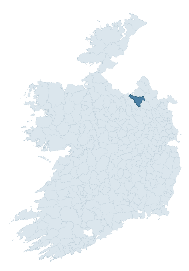
Where this barony sits in the Republic of Ireland
Geology and preservation
Bedrock geology shapes the landscape long before any settlement begins — controlling soil drainage, agricultural potential, the survival of upstanding monuments, and the preservation of buried archaeology. The figures below come from the Geological Survey Ireland 1:100,000 bedrock map.
The bedrock underlying Tullygarvey is predominantly sandstone (33% of the barony by area), laid down during the Silurian period (51% by area, around 444 to 419 million years ago). Sandstone weathers to free-draining, moderately fertile soils that supported Early Medieval ringfort agriculture and later manorial estates. The rock itself is a major source of building stone — visible in churches, tower houses, and farm buildings across the barony's historic landscape. A substantial secondary geology of greywacke (30%) adds further variety to the underlying landscape. The single largest mapped unit is the Lough Avaghon Formation (32% of the barony's bedrock). With 8 distinct rock types mapped, the barony sits in the top third of ROI baronies for geological diversity (76th percentile) — typically a sign of complex tectonic history or coastal mosaics of differing rock units.
Rock type composition
Largest mapped unit: Lough Avaghon Formation (32% of the barony)
Placename evidence
Logainm records 50 heritage-diagnostic placenames for Tullygarvey, drawn from townland and civil-parish names across the barony. The dominant stratum is pre-Christian and Early Medieval defensive — ráth-, lios-, dún-, and caiseal-prefixed names that mark Iron Age and early historic settlement. The leading diagnostic roots are cill- (20 — church), lios- (16 — ringfort or enclosure), and dún- (5 — hilltop fort or promontory fort). This is above the ROI average of 30.7 heritage placenames per barony. The presence of multiple heritage strata side by side indicates layered occupation of the landscape across successive prehistoric and historic periods. Logainm records 292 placenames for Tullygarvey (predominantly townland names). Of these, 50 (17%) carry one of the diagnostic Gaelic roots tracked above; the remainder draw on more generic landscape vocabulary that does not encode a heritage period.
Pre-Christian / Early Medieval Defensive
| Root | Count | Meaning |
|---|---|---|
| lios- | 16 | ringfort or enclosure |
| dún- | 5 | hilltop or promontory fort |
| ráth- | 4 | earthen ringfort |
| caiseal- | 1 | stone ringfort |
Early Christian Ecclesiastical
| Root | Count | Meaning |
|---|---|---|
| cill- | 20 | church (early) |
| teampall- | 1 | church (later medieval) |
Burial, Ritual, and Norse-Contact
| Root | Count | Meaning |
|---|---|---|
| leacht- | 2 | grave monument |
| gall- | 2 | foreigner — Norse settlement marker |
| carn- | 1 | cairn |
Other baronies in Cavan
About this profile
Click any section below to expand.
What is a barony?
A barony is a historic administrative unit in Ireland, broadly equivalent to an English hundred. The 280 baronies used here are from the OSi 2019 National Statutory Boundaries (generalised 20m), covering the 26 counties of the Republic of Ireland. Baronies derive from the Norman period, were formalised in the 17th century, and have not been redrawn for statistical purposes. They vary enormously in area, from compact urban baronies in Dublin to vast upland baronies in Connacht, and should not be compared by raw site count without accounting for area differences.
What counts as a site?
This profile combines three distinct heritage registers, each with its own definition of what constitutes a recordable site:
- Archaeological sites (NMS). The National Monuments Service Sites and Monuments Record (SMR) catalogues every known archaeological monument or site of archaeological interest in the Republic, from prehistoric burial mounds and ringforts to medieval churches and post-medieval defensive works. Inclusion does not require legal protection — only that the site has been identified, surveyed, and assessed as having archaeological value. A separate subset of these sites lies within a recorded protection zone, which gives them statutory protection under the National Monuments Acts.
- Listed buildings (NIAH). The National Inventory of Architectural Heritage records buildings of architectural, historical, archaeological, artistic, cultural, scientific, social, or technical interest. Each surveyed structure is appraised on a five-tier scale: International, National, Regional, Local, and Record-Only. The NIAH appraisal is informational rather than strictly statutory, but it underpins local-authority Record of Protected Structures (RPS) listings.
- Heritage placenames (Logainm). Logainm is the authoritative database of Irish placenames maintained by the Placenames Branch. This profile applies a heritage-diagnostic classifier to the Irish-language form of each townland name, flagging roots that signal defensive sites (ráth-, lios-, dún-, caiseal-, cathair-), ecclesiastical foundations (cill-, teampall-, domhnach-, mainistir-), prehistoric burial-ritual features (tuaim-, carn-, leaba-), or Norse-contact settlement (gall-). Townlands without one of these diagnostic roots are not flagged here — they may still carry historical significance, but that significance is not encoded in the name itself.
Editorial principles
The narrative sections of this profile follow several explicit principles:
- Evidential. Every claim about this barony’s heritage character is anchored in the underlying register data. Where a site count, a placename count, or a percentile rank is cited, it is computed from the source datasets at export time, not estimated.
- Comparative. Counts and metrics are reported alongside their percentile rank against the other 279 ROI baronies. A barony with 50 ringforts in absolute terms could be unusually high or unusually low depending on its size and regional context; percentile ranking removes that ambiguity.
- Transparent on limits. Where a register has known coverage gaps, survey biases, or data-quality issues that affect this barony’s figures, the profile flags them rather than presenting the numbers as definitive.
- No interpretation beyond what the data supports. The narrative does not speculate about historical events, social dynamics, or cultural meaning beyond what the recorded heritage and placename evidence directly attests.
Data caveats and limits
- NMS Sites and Monuments Record is the product of survey campaigns conducted at different intensities across different counties and decades. Some baronies have been surveyed more thoroughly than others, and absolute counts should be read in that light. Sites destroyed by development before survey are typically not represented; sites in heavily forested or upland terrain are sometimes under-recorded.
- NIAH coverage is broadly complete for the Republic of Ireland but the survey was conducted on a rolling county-by-county basis, and the most recent appraisal date varies. Buildings demolished or substantially altered after their original survey may still appear in the register; conversely, recent buildings of merit may not yet have been appraised.
- Logainm classification applies a deliberately conservative pattern-matching approach to the Irish-language townland forms. The classifier prioritises true positives over recall: a townland may carry a heritage signal that the classifier doesn’t recognise, particularly where the diagnostic root has been heavily anglicised or where the townland name draws on a less common term. The 60,000+ townland records and ~9,800 classified placenames give a substantial signal at barony scale, but individual townland names should be checked against Logainm directly for definitive interpretation.
- Period attribution. The chronological distribution reflects only those NMS sites that carry a recognised period attribution in the source data. Sites listed as “Unknown” period are excluded from the dated subset.
- Boundary changes. Some baronies have undergone minor boundary adjustments since their 19th-century definition; the OSi 2019 generalised boundaries used here are the current statutory definition and may differ slightly from historical maps in border areas.
- Bedrock geology is mapped at 1:100,000 scale, which means local variation within a barony — small pockets of different rock type, mineral veins, alluvium overlying bedrock — is generalised. The dominant-system and rocktype figures are area-weighted, so a barony reading “70% Carboniferous limestone” may still contain small but archaeologically important pockets of older or younger rock. Around 3% of GSI polygons do not match the lexicon and contribute no rocktype or system attribution.
Data sources
- National Monuments Service — Sites and Monuments Record (SMR) https://data.gov.ie/dataset/national-monuments-service-archaeological-survey-of-ireland
- National Inventory of Architectural Heritage (NIAH) https://data.gov.ie/dataset/national-inventory-of-architectural-heritage-niah-national-dataset
- Logainm — Placenames Database of Ireland https://www.logainm.ie/
- Ordnance Survey Ireland — National Statutory Barony Boundaries 2019 https://data-osi.opendata.arcgis.com/
- EURODEM — European Digital Elevation Model https://www.mapsforeurope.org/datasets/euro-dem
- ESA WorldCover https://esa-worldcover.org/en
- Geological Survey Ireland — 1:100,000 Bedrock Geology https://www.gsi.ie/en-ie/data-and-maps/Pages/Bedrock.aspx
Explore more: Search any of the 280 ROI baronies, browse by historical province, or read the methodology and data sources for the full Republic of Ireland Heritage Tool.