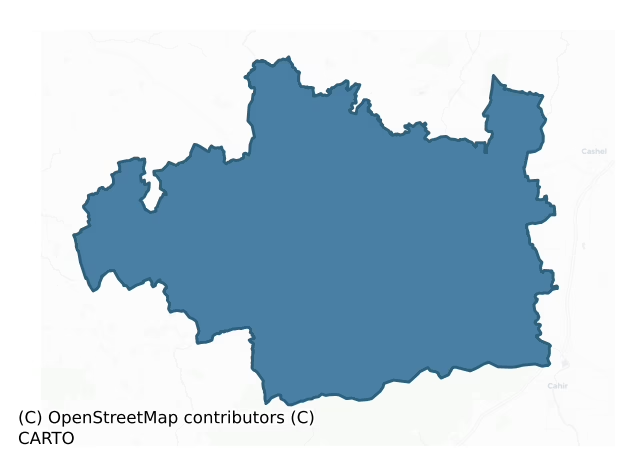
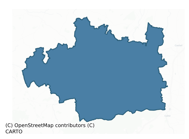
Clanwilliam is a barony of County Tipperary, in the historical province of Munster (Irish: Clann Liam), covering 469 km² of land. The barony records 1,608 NMS archaeological sites and 260 NIAH listed buildings, placing it at around the 88th percentile among 280 ROI baronies for sites per km². This means it is in the top fifth of all baronies for sites per km². Dated archaeological evidence runs from the Neolithic through to the Modern, spanning 8 of 9 archaeological periods, placing the barony in the 75th percentile among 280 ROI baronies for chronological depth. This means it is in the top third of all baronies for chronological depth. The largest dated subset of recorded sites dates to the Iron Age. Logainm flags 66 placenames in the barony as carrying a recognised heritage root; the largest share — around 50% — are names associated with early Christian church and monastic foundations.
Heritage at a glance
Percentile rankings throughout this profile compare each barony only against the other 279 Republic of Ireland baronies.
The recorded heritage of Clanwilliam
The National Monuments Service Sites and Monuments Record (SMR) is the statutory inventory of archaeological sites for the Republic of Ireland, maintained by the Department of Tourism, Culture, Arts, Gaeltacht, Sport and Media. Sites recorded here include earthworks, ringforts, megalithic tombs, ecclesiastical remains, and post-medieval features; not every record is legally protected, but each is registered as a monument of archaeological interest.
The National Monuments Service records 1,608 archaeological sites in Clanwilliam, putting it at the 88th percentile among 280 ROI baronies for sites per km². This means it is in the top fifth of all baronies for sites per km². Protection coverage is near-universal — 1,593 sites (99%) fall within a recorded monument protection zone, indicating an extensively surveyed landscape. The record is dominated by defensive sites — ringforts, enclosures, hillforts, and stone forts (647 sites, 40% of the total), with burial and ritual monuments forming a substantial secondary presence (318 sites, 20%). The most diagnostically specific type is Barrow – ring-barrow (172 records, 11% of the barony's NMS total) — compared to an ROI average of 3% across all baronies where this type occurs. Barrow – ring-barrow is a Bronze/Iron Age burial monument: a low circular area enclosed by ditch and outer bank. The broader 'Enclosure' classification — which catches unclassified ringforts and field enclosures — accounts for a further 421 records (26%) and reflects the difficulty of sub-classifying degraded earthworks from surface evidence alone. Other significant types include Ringfort – rath (117) — an earthen ringfort enclosed by a bank and external ditch — the most common Early Medieval farmstead, broadly dated 500–1000 AD. Across the barony's 469 km², this gives a recorded density of 3.43 sites per km².
Most common monument types
Hover or tap a monument type to see its definition.
| Type | Count |
|---|---|
| Enclosure a banked or ditched feature of uncertain type, used as a catch-all where the original function cannot be determined from surface evidence | 421 |
| Barrow – ring-barrow a Bronze/Iron Age burial monument: a low circular area enclosed by ditch and outer bank | 172 |
| Ringfort – rath an earthen ringfort enclosed by a bank and external ditch — the most common Early Medieval farmstead, broadly dated 500–1000 AD | 117 |
| Cross-slab a stone slab inscribed with a cross, used as a grave-marker or memorial, dated pre-1200 AD | 94 |
| Ring-ditch a circular ditch under 20m across, often the ploughed-out remains of a barrow, ring-barrow or roundhouse | 70 |
| Barrow – unclassified a prehistoric burial mound where the specific barrow type cannot be determined from surface evidence | 49 |
| Moated site | 46 |
Chronological distribution
The dated archaeological record for Clanwilliam spans from the Neolithic through to the Modern, with activity attested across 8 of 9 archaeological periods. This is the 75th percentile across ROI baronies for chronological depth — an above-average span. Every period from earliest to latest is represented in the record — an unbroken sequence of dated activity across the full chronological span. Activity concentrates most heavily in the Iron Age (568 sites, 39% of dated material), with the Early Bronze Age forming a secondary peak (504 sites, 35%). A further 159 recorded sites (10% of the overall NMS register for the barony) carry no period attribution — appearing as 'Unknown' in the bar chart below. This typically reflects either records that pre-date the standardised period vocabulary or sites awaiting specialist dating review, rather than a genuine absence of chronological evidence.
Sample of recorded monuments
Show 25 sample monuments (of 1,608 total)
A representative sample of 25 recorded monuments drawn from the barony’s 1,608 total NMS entries. Sites within a recorded monument protection zone and rarer site types are prioritised so the list shows a meaningful cross-section rather than only the most common type. Each entry shows the official Sites and Monuments Record reference number and the description published by the National Monuments Service.
Habitation site
Beneath a multi-period funerary complex consisting of a bowl-barrow (TS058-023003-), a standing stone (TS058-023004-), two ditch-barrows (TS058-023005- and TS058-023007-) and a ring-barrow (TS058-023006-), all contained…
Beneath a multi-period funerary complex consisting of a bowl-barrow (TS058-023003-), a standing stone (TS058-023004-), two ditch-barrows (TS058-023005- and TS058-023007-) and a ring-barrow (TS058-023006-), all contained within a circular enclosure (TS058-023002-). Pottery discovered during archaeological excavation during 1973-1976 indicates that the earliest phase of activity consisted of a small Neolithic camp. Beaker pottery associated with funerary and domestic activity indicates that the habitation site was re-used in the Early Bronze Age prior to the construction of the central bowl-barrow (TS058-023003-).
Compiled by: Jean Farrelly
Date of upload: 26 August 2011
Platform
On level ground at the base of a slight N-facing slope, in low-lying gently undulating improved pasture. A ditch-barrow (TS058-042004-) is located within the enclosure on the SW side while the enclosure is at the SE…
On level ground at the base of a slight N-facing slope, in low-lying gently undulating improved pasture. A ditch-barrow (TS058-042004-) is located within the enclosure on the SW side while the enclosure is at the SE edge of a relic field system (TS058-042001-) with an enclosure (TS058-042002-) 250m to the NW. Roughly rectangular raised area (dims. 19m ESE-WSW; 16.5m NNE-SSW) defined by a gently sloping earthen scarped edge (overall Wth 3m; H 1m) with an external fosse (overall Wth c. 2m). The external fosse is visible SW-N where a bare outline can be traced. The original entrance is not recognisable. The interior is level and clear of overgrowth.
Compiled by: Jean Farrelly
Date of upload: 26 August 2011
Castle – ringwork and bailey
In improved pasture, on a hillock with excellent views in all directions. A circular area (map diam. c. 44m) defined by scarp (Wth 3.8m; H 2.1m) N-ESE, SW & NW which is reduced to low scarp (Wth 3.95m; H 1.1m) at E,…
In improved pasture, on a hillock with excellent views in all directions. A circular area (map diam. c. 44m) defined by scarp (Wth 3.8m; H 2.1m) N-ESE, SW & NW which is reduced to low scarp (Wth 3.95m; H 1.1m) at E, intervening fosse (Wth 7.8m; D 1.4m) and scant remains of a possible outer bank incorporated in a field boundary (Wth 3.3m; int. H 1.4m; ext. H 0.15m) from SSW-NNW. The monument is enclosed by a townland boundary from NNW-SE. It is named 'Shanbally fort' on the 1840 edition OS 6-inch map and 'Ranacrohy' on the 1904 edition. An adjoining bailey to the SW consists of a sub-rectangular area (dims. 33m ESE-WNW; 23m NNE-SSW) defined by scarp (Wth 2.5-3.5m; H 0.25-0.55m) to S and W and levelled scarp (Wth 0.7m; H 0.2m) to E. A break of slope (Wth 3m) to the S has been utilised as a trackway and is defined by a scarp (L 20m; Wth 3m; H 0.4m) to S. The trackway accesses the interior through a gap at the E end of the S side. There are the remains of a possible bailey fosse (Wth 6.5m; D 0.2m) at the NW which appears to intercept with fosse of ringwork. The interior is generally level and grass covered.
Compiled by: Jean Farrelly
Date of revised upload: 30 November 2016
Cairn – cairn circle
In improved, level pasture. Flat topped mound (dims. 12.2m N-S; 8m E-W) of earth and stone with gentle sides (max. H 0.8m) defined at base by kerbing of upright sandstones at NW and SW. Four stones (two large and two…
In improved, level pasture. Flat topped mound (dims. 12.2m N-S; 8m E-W) of earth and stone with gentle sides (max. H 0.8m) defined at base by kerbing of upright sandstones at NW and SW. Four stones (two large and two small) at NW and two stones (one fallen over and one fixed) at SW. Linear arrangement of stones extending from top to base of mound at SE. Mature sycamore tree growing on top of mound has stones at base. Shallow depression is c. 24m to SE.
Compiled by: Jean Farrelly
Date of upload: 26 August 2011
House – fortified house
On high ground on edge of flat ridge above the flood plain of the Multeen River to W and Ballygriffin church (TS060-049001-) and graveyard (TS060-049003-) 70m to the N.
According to the Civil Survey (1654-6) the…
On high ground on edge of flat ridge above the flood plain of the Multeen River to W and Ballygriffin church (TS060-049001-) and graveyard (TS060-049003-) 70m to the N.
According to the Civil Survey (1654-6) the proprietor in 1640 was 'Doctor Garrott ffennell Esqr Irish Papist' and 'Uppon these lands stands a castle wanting repayre wth a strong Bawne' (Simington 1934, vol. 2, 8). In the interior, W of centre, of a large, roughly rectangular bawn (TS060-050002-). This building, which may have consisted of a central block with mural towers, has largely collapsed and all that remains visible is the NW tower of which the W wall (ext. L 5.15m) and partial return of the N and S wall (ext L c. 4 m) survive. It is constructed of limestone rubble, roughly coursed, with good quoins of block and start formation which are robbed towards the base and has a slight base-batter (H c. 4.7m; Wth 0.6m). There is a projecting string course c. 5m above present ground level, which continued onto the possible central block, though only a short length (L 0.5m; H 2.05m above built up ground surface; Wth 1.8m) of this return wall survives projecting southward from the S wall of the NW tower. Traces of the N wall (L 0.9m) of the main block are visible projecting eastward from the E face of the NW tower 1.48m N of the S wall of the angle tower. The tower is four or five storeys high with a parapet. Each storey has a large centrally placed window in the W wall, all within flat-headed embrasures. Ther…
Sheela-na-gig
On the external E face of Ballynahinch tower house (TS060-059001-), situated c. 2m above and slightly to the N of the broken out doorway. The sheela-na-gig is carved in raised relief on a rectangular slab (H 0.55m).…
On the external E face of Ballynahinch tower house (TS060-059001-), situated c. 2m above and slightly to the N of the broken out doorway. The sheela-na-gig is carved in raised relief on a rectangular slab (H 0.55m). Described by Freitag (2004, 124) as having a 'big round head with eyes wide open; strong billowy lines across forehead; large jug ears. Lean rib, and no breasts seem to be indicated. Arms akimbo with hands joined above pudenda, shown as a deep round hole. Squatting position, knees bend, heels touching … and toes turned out'. According to White (1892, 8) the sheela-na-gig is 'said to be a carricature of the cook, in revenge for her incivility to the tradesmen employed in building the castle'.
Compiled by: Jean Farrelly
Date of upload: 09 July 2014
Weir – fish
According to the Civil Survey (1654-6) the townland of Ballygriffin has two weirs for fishing (Simington 1934, vol. 2, 8). On the 1st (1840) ed. OS 6-inch map the E-W weir is depicted crossing the River Suir N and S of…
According to the Civil Survey (1654-6) the townland of Ballygriffin has two weirs for fishing (Simington 1934, vol. 2, 8). On the 1st (1840) ed. OS 6-inch map the E-W weir is depicted crossing the River Suir N and S of an island in the middle of the river and is called 'Mill Weir'. The two sections of the weir are indicated on the 2nd (1903-04) ed. as narrow islands which do not completely cross the river. The weir is not visible above the surface of the water, though it is likely that a large portion of the weir has been incorporated in the present island which consists of the smaller islands depicted on the 1st and 2nd ed. OS maps and intervening channels which have been infilled.
Compiled by: Jean Farrelly
Date of revised upload: 27 October 2015
Water mill – unclassified
A 'Flour Mills' on a mill race with a 'Mill Pond' is depicted on the 1st (1840) ed. 6-inch OS map on the E side of the River Suir, N of the bridge at Golden. On the 1903-04 6-inch OS map the mill is depicted as 'Mill…
A 'Flour Mills' on a mill race with a 'Mill Pond' is depicted on the 1st (1840) ed. 6-inch OS map on the E side of the River Suir, N of the bridge at Golden. On the 1903-04 6-inch OS map the mill is depicted as 'Mill (Disused)' and it was demolished in the mid 1900s. There is no evidence that this mill pre-dates the late 18th/early 19th century.
Compiled by: Jean Farrelly
Date of upload: 25 February 2013
Cathedral
According to the OS letters the early cathedral was on the site of the present cathedral (O'Flanagan 1930, vol. 3, 39-60), however, other references and the OS 6-inch maps indicate that the pre-1700 cathedral was…
According to the OS letters the early cathedral was on the site of the present cathedral (O'Flanagan 1930, vol. 3, 39-60), however, other references and the OS 6-inch maps indicate that the pre-1700 cathedral was situated on the W side of the present graveyard. Only some architectural fragments of the cathedral survive in the graveyard. In 1058 the Annals of the Four Masters record that the daimhliag or great stone church and the cloictheach or round tower and the belfry of Emly were burnt (Barrow 1979, 190). By 1607 the cathedral was totally ruined and four years later the clergy and laity of the diocese were ordered to repair it at their own expense. (O'Dwyer and O'Dwyer 1987, 1-16). However, by 1615 only the chancel had been rebuilt (ibid.). A sketch of the buildings drawn in 1680 shows that although the cathedral was roofed a number of monastic buildings to the S were in a ruinous state (ibid.). In the 1827 a new cathedral was built to the S of St. Ailbe's well as indicated on the 1st edition OS 6-inch map, however, this was dismantled in 1877 and the stones were taken to build a church in Monard (ibid.).
Compiled by: Jean Farrelly
Date of upload: 12 May 2014
Ringfort – cashel
In improved pasture, gently undulating pasture, on a gentle NW-facing slope. Circular area (dims. 17m N-S; 16m E-W) defined by low bank (Wth 4.25-6.05m; int. H 0.18-0.85m; ext. H 0.75-0.85m), fosse (overall Wth 8.25m;…
In improved pasture, gently undulating pasture, on a gentle NW-facing slope. Circular area (dims. 17m N-S; 16m E-W) defined by low bank (Wth 4.25-6.05m; int. H 0.18-0.85m; ext. H 0.75-0.85m), fosse (overall Wth 8.25m; basal Wth 5m; D 0.4m) WNW-NW and N-E-S and outer bank (Wth 4.2m; int. H 0.4m; ext. H 0.15m) WNW-NW and N-SSE. The inner bank is best defined at SSE-SSW and there is a break (Wth 5m) at SSE and less intrusive gap (Wth 3.2m) at W. The outer bank has a gap (Wth 5.2m) at ENE. Field boundary truncates monument across SW-sector and remains of levelled field boundary appear to truncate outer bank across S-arc. Interior is grass covered and contains ring-barrow (TS066-125001-) off-centre to N.
Compiled by: Jean Farrelly
Date of upload: 26 August 2011
Religious house – Augustinian friars
S of Tipperary town (TS067-004—-) and immediately S of the River Ara, at the SE junction of Abbey Street and Railway Road. There is conflicting evidence of when this Augustinian Friary was founded, sources suggesting…
S of Tipperary town (TS067-004—-) and immediately S of the River Ara, at the SE junction of Abbey Street and Railway Road. There is conflicting evidence of when this Augustinian Friary was founded, sources suggesting that this was either during the reign of Henry III (1216-1272) or later c.1300 by Stephen Butler, an ancestor of the earls of Carrick-on-Suir (Gwynn and Hadcock 1970 (1988 reprint), 302). In 1539 the friary was surrendered by the then prior, Donough O'Cuyrke (O’Quirk) and the possessions, consisting of ‘a church, chapter-house, dormitory hall, two chambers, an inner chamber, kitchen, stable, cemetery and garden, all said to be in ruins and not valued (ibid.). The jurors also stated that ‘the church has from time immemorial been the parish church of Typperare. There are no superfluous buildings, but all are necessary for the farmer, and with 2 gardens and other accommodations cont. 2 acr. And are worth nothing above repairs’ (White 1943, 327). The jurors appraisal was probably exaggerated to reduce the value of the property as one of the jurors, Dermot Ryan, subsequently gained possession of the abbey (Quane 1960, 40; Gwynn and Hadcock 1970 (1988 reprint), 302). In the 1680s the abbey was demolished and the materials were used to build an Erasmus Smith Grammar School (Quane 1960, 42). Only a pointed arch survived, with a soffit rib carried by pointed corbels, which is visible on at least two pre-1950s photographs. According to the OS Letters of 1840, ‘This ar…
School
On the E side of Railway Road, S of the River Ara and in the grounds of the Augustinian Friary (TS067-004001-). In 1669 a royal charter granted Erasmus Smith ‘several parcells of abby land, with the old abby, in…
On the E side of Railway Road, S of the River Ara and in the grounds of the Augustinian Friary (TS067-004001-). In 1669 a royal charter granted Erasmus Smith ‘several parcells of abby land, with the old abby, in Tipperary…to hold ye premisses to ye uses of his charity’ (Quane 1960, 41). This charity was the establishment of a free grammar school. Construction of the school began in 1680 when the old abbey was demolished to provide building materials. In 1690 the school was closed as the building was taken over as a headquarters by the Williamite army. The following year the school was burned down. In 1702 a new school was completed (Bourke 1989, 86). This late 17th/early 18th-century building survived for over a hundred years when in 1820 a new school replaced it. The 'Father Humphreys Memorial School' that is present today, opened in 1955, was partly built on the old Abbey School (Quane 1960, 75).
Compiled by: Jean Farrelly
Date of upload: 10 June 2014
Field boundary
In level pasture, field undulates gently. In level pasture, field undulates gently. Linear depression (L c. 200m) running NW-SE between enclosure (TS067-013001-) and enclosure (TS067-013002-) identified on aerial…
In level pasture, field undulates gently. In level pasture, field undulates gently. Linear depression (L c. 200m) running NW-SE between enclosure (TS067-013001-) and enclosure (TS067-013002-) identified on aerial photograph (GSI 16.4.1974, R. 515/4) but not visible above ground.
Compiled by: Jean Farrelly
Date of upload: 26 August 2011
Hilltop enclosure
In pasture, on top of hillock. Land slopes downward steeply to W and SW. Circular area (dims. c. 82m SE-NW) defined by curving bank (NW-SE) topped with thorn trees etc., now incorporated into field boundary. No…
In pasture, on top of hillock. Land slopes downward steeply to W and SW. Circular area (dims. c. 82m SE-NW) defined by curving bank (NW-SE) topped with thorn trees etc., now incorporated into field boundary. No enclosing element SE-S-NW, but a very sheer slope SW to NW may have served as a natural barrier. Interior tilts/slopes gently to N – no features visible within. Surviving bank (Wth. 2.75m; H int. c. 1.2m; H ext. c. 1.25m) has breach at NE. Enclosure visible on aerial photograph (GSI 16.4.1974, R.514/513). Enclosure (TS067-040—-) located c. 750m to SW; possible enclosure (TS067-107—-) located c. 600m to SW.
Compiled by: Jean Farrelly
Date of upload: 26 August 2011
Religious house – Augustinian canons
On an island on the flood-plain of the River Suir, surrounded by marshy ground. There is a natural low hill to the NW of the abbey. The aspect from abbey is relatively poor except to the S. Athassel Priory was built c.…
On an island on the flood-plain of the River Suir, surrounded by marshy ground. There is a natural low hill to the NW of the abbey. The aspect from abbey is relatively poor except to the S. Athassel Priory was built c. 1200 by William de Burgh for the Canons Regular of St. Augustine and dedicated to St. Edmund (Harbison 1970, 119). It was confirmed by King John in 1205 (Gwynn and Hadcock 1988, 157-8). In 1319 the abbey was burned by Lord FitzThomas and again in 1329 by Brian O'Brien (ibid.). Following the Dissolution of the Monasteries the priory was surrendered in 1541 and leased to Dermot Ryan (ibid.). In 1557 Athassel was granted to Thomas, Earl of Ormond and Ossory (ibid,). All the buildings in the abbey are of mostly limestone rubble construction, randomly coursed, though some of the architectural features are of sandstone. The abbey church consists of a nave (int. dims. 8.72m N-S; 37.24m E-W) with an N and S aisle, a crossing-tower (int. dims. 6.11m N-S; 10.32m E-W), N and S transepts with side chapels, a chancel (Wth 6.11m N-S; 13.68m E-W) and a bell tower at the NW angle of the nave (Craig 1982, 58). The church was entered through a W doorway in the nave which is completely broken out, above which are the remains of a window embrasure. The N and S walls of the nave are largely intact, though the piers which supported the side aisles are no longer upstanding. There are three windows in the N wall, with a doorway at the W end. The rib vaulting of the N aisle was supp…
Gatehouse
On the W edge of the abbey complex (TS068-013—-) and island which is occupied by the abbey. A bridge (TS068-013002-) provides access over the now largely dried-up river bed to the gatehouse of the abbey. The outer…
On the W edge of the abbey complex (TS068-013—-) and island which is occupied by the abbey. A bridge (TS068-013002-) provides access over the now largely dried-up river bed to the gatehouse of the abbey. The outer entrance gate consists of a round-headed arch (Wth 2.48m) with cut limstone voussoirs, the lower jambs of which do not survive. A portcullis slot (Wth 0.15m) has been covered and the upper floor of gatehouse does not survive. There is a large hanging eye on the inner N and S side, indicating a double door with draw-bar hole (Wth 0.19m; H 0.25m). The outer wall extends N from this gate on the N side. The S side has collapsed. The inner gate consists of a large round-headed arch (Wth 3.7m), chamfered externally. This was blocked up in the 15th century and a narrow pointed arch (Wth 2.38m), with chamfered limestone jambs, was inserted. The S jamb probably utilised the original jamb of the large arch. A bar broach stop terminates the N jamb. The gatehouse (int. dims. 7.62m N-S; 8.76m E-W) was originally entered through a round-headed arch at the E end of the W wall. This led into a rib vaulted antae with a second rib vaulted area immediately E of this. The N side of the gatehouse is occupied by an unvaulted room. Rib vaulting on the W wall – the S springer rests on a capital decorated with nailheads and a floral motif at the base of the capital. The N side of the springer rests on a worn carved head. There is a wall cupboard at the N end of the W wall and another a…
Megalithic tomb – wedge tomb
On a platform in gently sloping moorland on the W slope of Moanour mountain which is at the W end of Slievenamuck mountain. This wedge-tomb is partially buried in the surrounding bog. It consists of a long wedge-shaped…
On a platform in gently sloping moorland on the W slope of Moanour mountain which is at the W end of Slievenamuck mountain. This wedge-tomb is partially buried in the surrounding bog. It consists of a long wedge-shaped gallery (L 5.4m; Wth 1.1m tapering to 0.65m at the backstone), flanked at either side by the remains of an outer wall (De Valera and Ó Nualláin 1982, 95-6). A pair of orthostats stand behind the E end of the gallery (ibid.). Two roofstones lie across the middle of the gallery and a displaced roofstone rests above the orthostats at the W end of the N side (ibid.). A number of displaced stones lie in front of the entrance (ibid.). The structure is incorporated in a roughly circular mound (diam. 8-9m) which rises little above the surface of the bog (ibid.). Monument is quite heavily overgrown with gorse, brambles, ferns and scrub with a rowan tree on the S side of the E end growing on the tomb.
Compiled by: Jean Farrelly
Date of upload: 26 August 2011
See linked document with details from Ruaidhrí de Valera and Seán Ó Nualláin, Survey of the Megalithic Tombs of Ireland. Volume IV. Counties Cork, Kerry, Limerick, Tipperary. (Dublin: Stationery Office, 1982)
Megalithic tomb – passage tomb
On the summit of Shrough Hill, part of the Slievenamuck/Moanour mountains, with forestry encroaching to within 10m to N, E and W, forestry to W has been felled affording an extensive view of the Galty mountains and…
On the summit of Shrough Hill, part of the Slievenamuck/Moanour mountains, with forestry encroaching to within 10m to N, E and W, forestry to W has been felled affording an extensive view of the Galty mountains and foothills below. A cairn, possibly a passage tomb (LI058-001—-), is visible on Temple Hill c. 9km to the SSE, at the W end of the Galtys. A stone wall runs E-W along the S edge of the mound. The monument consists of a roughly circular cairn (diam. 30m; H 2m) with a small, roofless polyogonal chamber (int. dims. L 2.2m; Wth 1.2m), aligned roughly E-W, near the centre of the cairn (De Valera and Ó Nualláin 1982, 101; Ó Nualláin and Cody 1987, 76-8). The sidestones vary in height from 1.2m to 1.8m (ibid. 76). The cairn is overgrown with gorse, heather and low scrub.
Compiled by: Jean Farrelly
Date of upload: 26 August 2011
See linked document with details from Ruaidhrí de Valera and Seán Ó Nualláin, Survey of the Megalithic Tombs of Ireland. Volume IV. Counties Cork, Kerry, Limerick, Tipperary. (Dublin: Stationery Office, 1982)
Ritual site – pond
In wet, marshy terrain. A recent wooden plank walk-way has been constructed across the marsh to give access to the well, which otherwise is very difficult. The holy well consists of a large, roughly circular area (diam.…
In wet, marshy terrain. A recent wooden plank walk-way has been constructed across the marsh to give access to the well, which otherwise is very difficult. The holy well consists of a large, roughly circular area (diam. c. 30m) defined from NW-N-E-S by a bank (Wth crest 2.9-3.3m; Wth base 6-7.2m; int. H 1.45-1.75m; ext. H 0.73-0.8m at SE and NW respectively). The edge of the pool is not clearly defined in the S-W-NW sector, here the ground falls gradually towards the pool. The S bank runs into a field boundary which runs roughly E-W along the S side of the monument and joins with another field boundary which runs roughly N-S along the W side of the monument. The surrounding area and most of the S half of the enclosed pool, which is marshy, is covered in trees. Only the N half of the well is a pool, though the NW quadrant is heavily overgrown with water plants. The pool has bubbling spring water which is very clear (D 0.8-1m at least) and there is a channelled run-off in the NNE with a small foot-bridge over it. There are several rag bushes on the N side of the well which vary in size, age and species, including willow, holly, birch and oak. Suspended from the branches are ribbons, which are predominately red and green, CDs, rosary beads, scapulas, handkerchiefs and gloves as well as mugs. At the base of the oak tree there are various representations of Our Blessed Lady and prayers to saints, including one to Blessed Faustina Kowalska, a Polish nun who died in 1938 and was…
Designed landscape feature
On a natural rise overlooking the Suir river valley. The River Aherlow meets the Suir immediately below Ballydrehid House (TS075-027003-). A roughly rectangular earthwork defined by scarp is depicted on the 2nd…
On a natural rise overlooking the Suir river valley. The River Aherlow meets the Suir immediately below Ballydrehid House (TS075-027003-). A roughly rectangular earthwork defined by scarp is depicted on the 2nd (1901-05) ed. map immediately NE of the house. This is a landscape feature, contemporary with the 18th-century house, where the natural height of the hill was accentuated to create a lawn in front of the house.
Compiled by: Jean Farrelly
Date of upload: 04 April 2014
Memorial stone
Incorporated into the N face of the graveyard wall, immediately E of the E gate pier. The plaque has been painted white, with the lettering highlighted in black with a thin black border. The inscription is in latin and…
Incorporated into the N face of the graveyard wall, immediately E of the E gate pier. The plaque has been painted white, with the lettering highlighted in black with a thin black border. The inscription is in latin and reads: LOCVS IN QVEM INTRAS TERRA SANCTA EST 1641 R. IONES PCENT. There is a large O after 'IN' which appears to be decorative. The inscription roughly translates as 'The place wherein you enter is holy ground' (pers. comm. Gerard Crotty). The name at the bottom of the inscription belongs to a Robert Jones who became the Precentor of Emly cathedral in 1628 (O'Dwyer and O'Dwyer 1987, 16).
Compiled by: Jean Farrelly
Date of revised upload: 13 May 2014
Town defences
In 1300 a murage grant was given for a period of 10 years and in 1310 a further grant was given for a period of 3 years (Thomas 1992, 194). Based on the probable survival of the medieval town pattern on the modern town,…
In 1300 a murage grant was given for a period of 10 years and in 1310 a further grant was given for a period of 3 years (Thomas 1992, 194). Based on the probable survival of the medieval town pattern on the modern town, it is suggested that the town consisted of an area of c. 15 hectares, roughly rectangular in shape, incorporating the church (TS067-004003-) and graveyard (TS067-004008-) in its NW angle and the castle (TS067-004002-) in the SE angle, with the River Ara forming the southern boundary (Thomas 1992, 194-5). There is no visible trace of an enclosing wall, bank or fosse at ground level.
Compiled by: Jean Farrelly
Date of upload: 10 June 2014
Cross-inscribed stone
This stone is currently incorporated into the interior E wall of a church (TS075-023001-). It is described by Okasha and Forsyth (2001, 271-2) as a small slab (H c. 0.14m; Wth c. 0.13m; T c. 0.08m visible) and is 'part…
This stone is currently incorporated into the interior E wall of a church (TS075-023001-). It is described by Okasha and Forsyth (2001, 271-2) as a small slab (H c. 0.14m; Wth c. 0.13m; T c. 0.08m visible) and is 'part of a slab of unknown form. Incised in the middle of its visible face is a small equal-armed linear cross with expanded terminals. A similar, slightly smaller cross is incised in the bottom left-corner….Comparison with other slabs incised with five crosses (a central cross and a cross in each of the four corners) suggests …this as part of an altar slab'. It is listed as Toureen Peacaun 29 (ibid.). The stone was uncovered during the 1944 excavation (Duignan 1944, 227).
Compiled by: Jean Farrelly
Date of upload: 26 August 2011
Shrine
Two 'posts' of a corner-post shrine currently located in a small display area 5m SE of the church (TS075023001-) to the N and S of the E cross (TS075-023002-). Both posts are of similar size and design, each a tapering…
Two 'posts' of a corner-post shrine currently located in a small display area 5m SE of the church (TS075023001-) to the N and S of the E cross (TS075-023002-). Both posts are of similar size and design, each a tapering slab (L c. 1.4m) with a wheeled cross in relief on one face. Each slab has two rectangular mortises in one side and were evidently part of a composite composition (Waddell and Holland 1990, 179). Duignan postulated that the two pillars and the E cross may have formed a unit, the pillars representing the thieves' crosses at Calvery (ibid.). Ó Carragáin (2003, 166) interprets these cross-pillars as 'posts' from a 'corner-post shrine of both wood and stone; and, though not closely dateable, the ringed crosses on the posts would not be out of place in an eight or ninth century context'. The N post, though found intact is currently embedded in the ground (H above ground 1.08m). It is a roughly rectangular stone (Wth at top 0.28m; Wth at ground level 0.32m; T at top 0.13m; T at ground level 0.24m). The upper mortise also has a dowel hole. The upper portion of the S post, with the wheeled cross (Wth 0.32m; H 0.42m; max. T 0.17m), is currently upside down on top of a block of stone (Wth at top 0.29m; Wth at base 0.32m; H 0.26m; T 0.13-0.17m) which rests on another block of stone (Wth 0.33m; H 0.27m; max. T 0.2m) with a cross shaft (Wth 0.05m) and border in relief on one side. Only the upper mortise is currently visible. Okasha and Forsyth (2001, 288) suggest that tw…
Enclosure
In improved pasture, on a low, natural rise of a SE-facing slope. Levelled remains of an oval area (dims. 43m NW-SE; 26m NE-SW) defined by traces of scarp which have been levelled off into the natural rise. It is…
In improved pasture, on a low, natural rise of a SE-facing slope. Levelled remains of an oval area (dims. 43m NW-SE; 26m NE-SW) defined by traces of scarp which have been levelled off into the natural rise. It is visible as the curvilinear scarp (Wth 7.8m; H 0.8m) of a natural rise ESE-SSW and barely traceable possible scarp (Wth 2.75m; H 0.15m) from SSW-NNW. The irregular side to the NE also appears to fall with the natural slope. It is depicted on the 1840 and 1904 edition OS 6-inch map as a sub-oval enclosure truncated by a road across the NE sector. It is possibly the earthen fort mentioned by Flanagan (1930, 93) as 'Dún na Sciath', the location of which is depicted on the 1904 map c. 270m to the NE as 'Dunnasgiath (Site of)'.
Compiled by: Jean Farrelly
Date of upload: 26 August 2011
Listed buildings
The National Inventory of Architectural Heritage (NIAH) is a state survey appraising buildings of architectural, historical, archaeological, artistic, cultural, scientific, social, or technical interest. Each surveyed structure receives a rating from International (the highest, for buildings of European importance) through National, Regional, Local, and Record-Only.
The NIAH records 260 listed buildings in Clanwilliam, the 84th percentile across ROI baronies for listed-building density. The highest-graded structures include 2 of National significance. The Republic holds 937 National-graded buildings in total, so this barony accounts for around 0% of the national total. Construction dates concentrate most heavily in the Victorian (1830-1900) period. The most-recorded building type is house (129 examples, 50% of the listed stock).
Terrain and environment
Mean elevation across the barony is 130m — the 78th percentile among 280 ROI baronies for elevation. This means it is in the top third of all baronies for elevation. This is a relatively elevated landscape by ROI standards. Elevation matters for heritage because higher-altitude baronies typically favour defensive monuments — ringforts and hilltop forts placed on prominent ground — while lowland baronies are more likely to carry the dense settlement and church networks of intensive agricultural landscapes. The barony reaches 914m at its highest point — a vertical span of more than 784m within its boundary, indicating significant topographic diversity. Mean slope is 4.3° — the 66th percentile among 280 ROI baronies for slope. This means it is in the upper half of all baronies for slope. Slope is a key control on both land use and archaeological preservation: steep ground resists ploughing and tends to preserve earthworks intact, while gentle slopes favour intensive cultivation that damages or destroys surface archaeology over time. The Topographic Wetness Index averages 10.8, the 47th percentile among 280 ROI baronies for wetness. This means it is in the lower half of all baronies for wetness. Drainage matters for heritage because poorly-drained ground preserves organic archaeology (wooden trackways, leather, textiles, and on rare occasions human remains) far better than free-draining soil; well-drained ground favours arable use but destroys organic material rapidly. The land cover is dominated by improved grassland (80%) and woodland (16%). In overall character, this is elevated but relatively gentle terrain — typical of plateau country, with land use dominated by improved grassland.
Terrain measurements
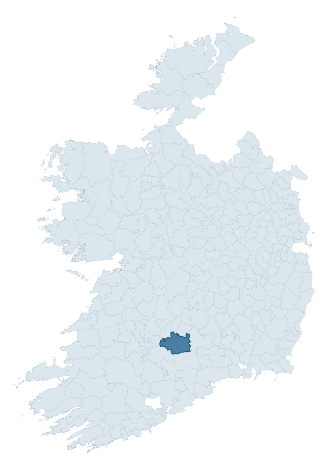
Where this barony sits in the Republic of Ireland
Geology and preservation
Bedrock geology shapes the landscape long before any settlement begins — controlling soil drainage, agricultural potential, the survival of upstanding monuments, and the preservation of buried archaeology. The figures below come from the Geological Survey Ireland 1:100,000 bedrock map.
The bedrock underlying Clanwilliam is predominantly limestone (50% of the barony by area), laid down during the Carboniferous period (70% by area, around 359 to 299 million years ago). Limestone is the most heritage-rich bedrock in Ireland. It supports fertile, well-drained soils that favoured dense Early Medieval settlement and Norman manorial agriculture, and it weathers into karst features — sinkholes, caves, swallow holes, and souterrains — that frequently carry archaeology. Where peat overlies limestone, organic preservation can be exceptional. With 7 distinct rock types mapped, the barony sits in the top third of ROI baronies for geological diversity (74th percentile) — typically a sign of complex tectonic history or coastal mosaics of differing rock units.
Rock type composition
Largest mapped unit: Ballysteen Formation (22% of the barony)
Placename evidence
Logainm records 66 heritage-diagnostic placenames for Clanwilliam, drawn from townland and civil-parish names across the barony. The dominant stratum is Early Christian ecclesiastical — cill-, teampall-, and domhnach-prefixed names that record the dense network of early church foundations established between the fifth and tenth centuries. The leading diagnostic roots are cill- (19 — church), ráth- (16 — earthen ringfort), and lios- (8 — ringfort or enclosure). This is well above the ROI average of 30.7 heritage placenames per barony — around 2.1× the typical figure. The presence of multiple heritage strata side by side indicates layered occupation of the landscape across successive prehistoric and historic periods. Logainm records 393 placenames for Clanwilliam (predominantly townland names). Of these, 66 (17%) carry one of the diagnostic Gaelic roots tracked above; the remainder draw on more generic landscape vocabulary that does not encode a heritage period.
Pre-Christian / Early Medieval Defensive
| Root | Count | Meaning |
|---|---|---|
| ráth- | 16 | earthen ringfort |
| lios- | 8 | ringfort or enclosure |
| dún- | 5 | hilltop or promontory fort |
| cathair- | 1 | stone fort |
Early Christian Ecclesiastical
| Root | Count | Meaning |
|---|---|---|
| cill- | 19 | church (early) |
| teampall- | 6 | church (later medieval) |
| gráinseach- | 3 | monastic farm / grange |
| tobar- | 2 | holy well |
| cillín- | 2 | unconsecrated burial ground |
| domhnach- | 1 | pre-Patrician or earliest Patrician church |
Burial, Ritual, and Norse-Contact
| Root | Count | Meaning |
|---|---|---|
| tuaim- | 1 | burial mound |
Other baronies in Tipperary
- Eliogarty
- Kilnamanagh Lower
- Middlethird
- Slievardagh
- Ikerrin
- Kilnamanagh Upper
- Ormond Lower
- Owneybeg — Limerick
- Corcomroe — Clare
- Upperthird — Waterford
See all 280 baronies in the Republic of Ireland Heritage Tool.

Explore further
Grounding History: 10 Maps of Northern Ireland’s Past
If you’re interested in Irish heritage more widely, the companion report for Northern Ireland brings together the analysis of all 462 NI wards into one place through 10 high-quality maps — covering monument density, archaeological periods, placename heritage, terrain, wetland, and the historic landscape at first survey. Take a look.
About this profile
Click any section below to expand.
What is a barony?
A barony is a historic administrative unit in Ireland, broadly equivalent to an English hundred. The 280 baronies used here are from the OSi 2019 National Statutory Boundaries (generalised 20m), covering the 26 counties of the Republic of Ireland. Baronies derive from the Norman period, were formalised in the 17th century, and have not been redrawn for statistical purposes. They vary enormously in area, from compact urban baronies in Dublin to vast upland baronies in Connacht, and should not be compared by raw site count without accounting for area differences.
What counts as a site?
This profile combines three distinct heritage registers, each with its own definition of what constitutes a recordable site:
- Archaeological sites (NMS). The National Monuments Service Sites and Monuments Record (SMR) catalogues every known archaeological monument or site of archaeological interest in the Republic, from prehistoric burial mounds and ringforts to medieval churches and post-medieval defensive works. Inclusion does not require legal protection — only that the site has been identified, surveyed, and assessed as having archaeological value. A separate subset of these sites lies within a recorded protection zone, which gives them statutory protection under the National Monuments Acts.
- Listed buildings (NIAH). The National Inventory of Architectural Heritage records buildings of architectural, historical, archaeological, artistic, cultural, scientific, social, or technical interest. Each surveyed structure is appraised on a five-tier scale: International, National, Regional, Local, and Record-Only. The NIAH appraisal is informational rather than strictly statutory, but it underpins local-authority Record of Protected Structures (RPS) listings.
- Heritage placenames (Logainm). Logainm is the authoritative database of Irish placenames maintained by the Placenames Branch. This profile applies a heritage-diagnostic classifier to the Irish-language form of each townland name, flagging roots that signal defensive sites (ráth-, lios-, dún-, caiseal-, cathair-), ecclesiastical foundations (cill-, teampall-, domhnach-, mainistir-), prehistoric burial-ritual features (tuaim-, carn-, leaba-), or Norse-contact settlement (gall-). Townlands without one of these diagnostic roots are not flagged here — they may still carry historical significance, but that significance is not encoded in the name itself.
Editorial principles
The narrative sections of this profile follow several explicit principles:
- Evidential. Every claim about this barony’s heritage character is anchored in the underlying register data. Where a site count, a placename count, or a percentile rank is cited, it is computed from the source datasets at export time, not estimated.
- Comparative. Counts and metrics are reported alongside their percentile rank against the other 279 ROI baronies. A barony with 50 ringforts in absolute terms could be unusually high or unusually low depending on its size and regional context; percentile ranking removes that ambiguity.
- Transparent on limits. Where a register has known coverage gaps, survey biases, or data-quality issues that affect this barony’s figures, the profile flags them rather than presenting the numbers as definitive.
- No interpretation beyond what the data supports. The narrative does not speculate about historical events, social dynamics, or cultural meaning beyond what the recorded heritage and placename evidence directly attests.
Data caveats and limits
- NMS Sites and Monuments Record is the product of survey campaigns conducted at different intensities across different counties and decades. Some baronies have been surveyed more thoroughly than others, and absolute counts should be read in that light. Sites destroyed by development before survey are typically not represented; sites in heavily forested or upland terrain are sometimes under-recorded.
- NIAH coverage is broadly complete for the Republic of Ireland but the survey was conducted on a rolling county-by-county basis, and the most recent appraisal date varies. Buildings demolished or substantially altered after their original survey may still appear in the register; conversely, recent buildings of merit may not yet have been appraised.
- Logainm classification applies a deliberately conservative pattern-matching approach to the Irish-language townland forms. The classifier prioritises true positives over recall: a townland may carry a heritage signal that the classifier doesn’t recognise, particularly where the diagnostic root has been heavily anglicised or where the townland name draws on a less common term. The 60,000+ townland records and ~9,800 classified placenames give a substantial signal at barony scale, but individual townland names should be checked against Logainm directly for definitive interpretation.
- Period attribution. The chronological distribution reflects only those NMS sites that carry a recognised period attribution in the source data. Sites listed as “Unknown” period are excluded from the dated subset.
- Boundary changes. Some baronies have undergone minor boundary adjustments since their 19th-century definition; the OSi 2019 generalised boundaries used here are the current statutory definition and may differ slightly from historical maps in border areas.
- Bedrock geology is mapped at 1:100,000 scale, which means local variation within a barony — small pockets of different rock type, mineral veins, alluvium overlying bedrock — is generalised. The dominant-system and rocktype figures are area-weighted, so a barony reading “70% Carboniferous limestone” may still contain small but archaeologically important pockets of older or younger rock. Around 3% of GSI polygons do not match the lexicon and contribute no rocktype or system attribution.
Data sources
- National Monuments Service — Sites and Monuments Record (SMR) https://data.gov.ie/dataset/national-monuments-service-archaeological-survey-of-ireland
- National Inventory of Architectural Heritage (NIAH) https://data.gov.ie/dataset/national-inventory-of-architectural-heritage-niah-national-dataset
- Logainm — Placenames Database of Ireland https://www.logainm.ie/
- Ordnance Survey Ireland — National Statutory Barony Boundaries 2019 https://data-osi.opendata.arcgis.com/
- EURODEM — European Digital Elevation Model https://www.mapsforeurope.org/datasets/euro-dem
- ESA WorldCover https://esa-worldcover.org/en
- Geological Survey Ireland — 1:100,000 Bedrock Geology https://www.gsi.ie/en-ie/data-and-maps/Pages/Bedrock.aspx
Explore more: Search any of the 280 ROI baronies, browse by historical province, or read the methodology and data sources for the full Republic of Ireland Heritage Tool.