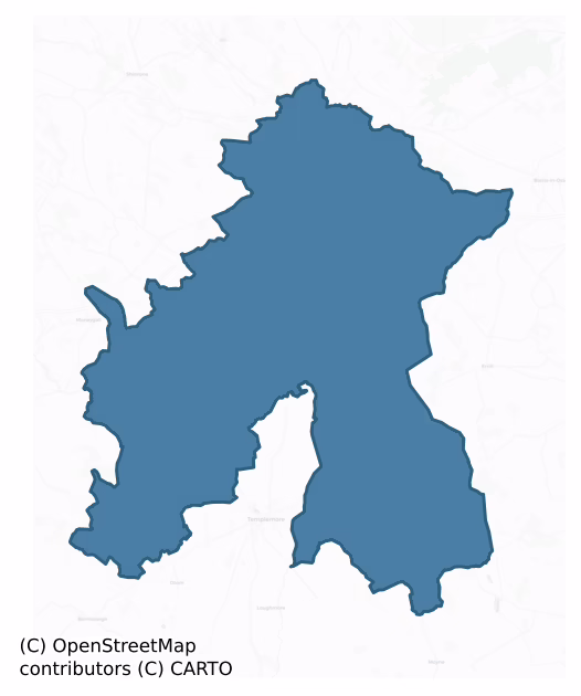
Ikerrin is a barony of County Tipperary, in the historical province of Munster (Irish: Uí Chairín), covering 282 km² of land. The barony records 688 NMS archaeological sites and 113 NIAH listed buildings, placing it at around the 70th percentile among 280 ROI baronies for sites per km². This means it is in the top third of all baronies for sites per km². Dated archaeological evidence runs from the Neolithic through to the Modern, spanning 8 of 9 archaeological periods, placing the barony in the 50th percentile among 280 ROI baronies for chronological depth. This means it is in the upper half of all baronies for chronological depth. The largest dated subset of recorded sites dates to the Early Bronze Age. Logainm flags 31 placenames in the barony as carrying a recognised heritage root; the largest share — around 58% — are names associated with early Christian church and monastic foundations.
Heritage at a glance
Percentile rankings throughout this profile compare each barony only against the other 279 Republic of Ireland baronies.
The recorded heritage of Ikerrin
The National Monuments Service Sites and Monuments Record (SMR) is the statutory inventory of archaeological sites for the Republic of Ireland, maintained by the Department of Tourism, Culture, Arts, Gaeltacht, Sport and Media. Sites recorded here include earthworks, ringforts, megalithic tombs, ecclesiastical remains, and post-medieval features; not every record is legally protected, but each is registered as a monument of archaeological interest.
The National Monuments Service records 688 archaeological sites in Ikerrin, putting it at the 70th percentile among 280 ROI baronies for sites per km². This means it is in the top third of all baronies for sites per km². Of these, 560 (81%) fall within a recorded monument protection zone. The record is dominated by defensive sites — ringforts, enclosures, hillforts, and stone forts (285 sites, 41% of the total), with prehistoric ritual monuments forming a substantial secondary presence (226 sites, 33%). Standing stone is the most prevalent type, making up 33% of the barony's recorded sites (226 records) — well above the ROI average of 4% across all baronies where this type occurs. Standing stone is a deliberately set upright stone, used variously as a Bronze/Iron Age burial marker, route marker or commemorative monument. Other significant types include Ringfort – rath (135) and Enclosure (79). Ringfort – rath is an earthen ringfort enclosed by a bank and external ditch — the most common Early Medieval farmstead, broadly dated 500–1000 AD; Enclosure is a banked or ditched feature of uncertain type, used as a catch-all where the original function cannot be determined from surface evidence. Across the barony's 282 km², this gives a recorded density of 2.44 sites per km².
Most common monument types
Hover or tap a monument type to see its definition.
| Type | Count |
|---|---|
| Standing stone a deliberately set upright stone, used variously as a Bronze/Iron Age burial marker, route marker or commemorative monument | 226 |
| Ringfort – rath an earthen ringfort enclosed by a bank and external ditch — the most common Early Medieval farmstead, broadly dated 500–1000 AD | 135 |
| Enclosure a banked or ditched feature of uncertain type, used as a catch-all where the original function cannot be determined from surface evidence | 79 |
| Earthwork an unclassified earthen structure with no diagnostic features that allow a more specific classification | 24 |
| Church a building used for public Christian worship, of any date from c. 500 AD onwards | 20 |
| Burnt mound a heap of fire-cracked stone, ash and charcoal, with no surviving trough, dated Bronze Age to early medieval | 16 |
| Graveyard a burial area associated with a church, in use from the medieval period onwards | 14 |
| Moated site | 13 |
Chronological distribution
The dated archaeological record for Ikerrin spans from the Neolithic through to the Modern, with activity attested across 8 of 9 archaeological periods. Every period from earliest to latest is represented in the record — an unbroken sequence of dated activity across the full chronological span. Activity concentrates most heavily in the Early Bronze Age (247 sites, 40% of dated material), with the Iron Age forming a secondary peak (153 sites, 25%). A further 73 recorded sites (11% of the overall NMS register for the barony) carry no period attribution — appearing as 'Unknown' in the bar chart below. This typically reflects either records that pre-date the standardised period vocabulary or sites awaiting specialist dating review, rather than a genuine absence of chronological evidence.
Sample of recorded monuments
Show 25 sample monuments (of 688 total)
A representative sample of 25 recorded monuments drawn from the barony’s 688 total NMS entries. Sites within a recorded monument protection zone and rarer site types are prioritised so the list shows a meaningful cross-section rather than only the most common type. Each entry shows the official Sites and Monuments Record reference number and the description published by the National Monuments Service.
Well
Located c.20m N of Bunow River, which runs NW-SE, in low-lying flood-plain in slight depression. Roughly horse-shoe-shaped well (0.7m x 0.65). Stone blocks forming retaining wall (H 0.8m) with concrete mortar and…
Located c.20m N of Bunow River, which runs NW-SE, in low-lying flood-plain in slight depression. Roughly horse-shoe-shaped well (0.7m x 0.65). Stone blocks forming retaining wall (H 0.8m) with concrete mortar and concrete capping. Clear water c.0.1m deep, no bubbling. Top of wall level with external ground level. Well opening orientated ESE (almost E). No title on well shown on 1st (1840) ed. OS 6-inch map. According to IKerrin Survey the well is known as 'The Lady's Well' in Schools Manuscripts but this refers to 'Lady's Well' located in the same townland, half a mile NW of the 'Boiling Well' (Stout 1984, 90). Natural spring well.
The above description is derived from 'The Archaeological Inventory of County Tipperary. Vol. 1 – North Tipperary' compiled by Jean Farrelly and Caimin O'Brien (Dublin: Stationery Office, 2002). In certain instances the entries have been revised and updated in the light of recent research.
Date of upload/revision: 22 September 2008
Historic town
Situated on a natural rise of ground in undulating countryside. Roscrea was originally an Early Christian monastic site (TN012-010001-/005-/006-) founded in the seventh century by St Cronán. In the early twelfth…
Situated on a natural rise of ground in undulating countryside. Roscrea was originally an Early Christian monastic site (TN012-010001-/005-/006-) founded in the seventh century by St Cronán. In the early twelfth century, at the Synod of Rathbreasail, Roscrea was absorbed into the newly created diocese of Killaloe (Gleeson and Gwynn 1962, 62). Due to political pressure the separate diocese of Roscrea was created at the Synod of Kells in 1152, however, this was short-lived and the diocese of Roscrea was re-absorbed into Killaloe diocese at the end of the twelfth century (Gwynn and Hadcock 1988, 192). The Romanesque church (TN012-010001-), round tower (TN012-010005-) and high cross (TN012-010006-) all date to the twelfth century. An unusual carved stone pillar (TN012-010011-), late eighth century in date (Roe 1967, 131-2), reflects the craftsmanship/activity of the earlier monastic period. In the early thirteenth century a motte (TN012-010008-) was erected on or near the site of the present castle (TN012-01007-) which was built towards the end of the thirteenth century, with rebuildings and modifications continuing up to the seventeenth century. An impressive early eighteenth-century house now occupies the centre of the bawn (TN012-010007-). There are references to an Augustinian foundation in the twelfth century but this does not appear to survive into the thirteenth century (Gwynn and Hadcock 1970, 192). The Franciscan friary (TN012-010010) to the south of the town, was fou…
Architectural fragment
A number of fragments from the Franciscan friary in Roscrea, formerly located in the gardens of Birchgrove Hse, E of the town, are on display in Damer House. These consist mainly of fragments of tracery from the E…
A number of fragments from the Franciscan friary in Roscrea, formerly located in the gardens of Birchgrove Hse, E of the town, are on display in Damer House. These consist mainly of fragments of tracery from the E window of the friary and a cloister base (Jackson 1939, 46-7). There is also a carved fragment with a Romanesque chevron design which is thought to come from St. Cronán's Romanesque church in Roscrea (TN012-010001-). A pointed doorway, traditionally said to have come from the Woman's Church at Monaincha was also formerly at Brichgrove (ibid.).
Another architectural fragment is located on the bridge over the River Moneen, which leads from the ruins of the Franciscan friary (TN012-010010-) to St. Cronán's R.C. church. It is at the S end of the W side of the parapet and consists of a limestone cloister base, 0.91m long and a max. of 0.42m wide. It originally formed part of the cloister associated with the Franciscan friary.
Compiled by: Jean Farrelly and Caimin O'Brien
Date of upload/revision: 22 September 2008
Round tower
National Monument No. 126. Situated in the NE part of Roscrea town directly across from St Cronan's Romanesque church (TN012-010001-). In 1131/1135 the round tower was struck by lightning (Gleeson and Gwynn 1962, 63).…
National Monument No. 126. Situated in the NE part of Roscrea town directly across from St Cronan's Romanesque church (TN012-010001-). In 1131/1135 the round tower was struck by lightning (Gleeson and Gwynn 1962, 63). An impressive well-preserved six-storey round tower (int. diam. 2.5m) constructed with coursed sandstone masonry supported on a basal plinth. At SE at first-floor level is a round-headed moulded doorway with an internal reveal for the door. There are three windows on the tower including two flat-headed single-lights at second and fourth-floor level and a triangular-headed window facing E at second-floor level. A single-masted ship is carved on the internal N jamb of the latter window (Barrow 1979, 189) with a possible belted cross on the opposite jamb (Stout 1984, 99). After the 1798 rebellion the tower was shortened by c. 6m by the army authorities after it had been used by snipers shooting at the castle (Harbison 1970, 235). According to Gleeson the tower was used as a belfry until the present C of I church was built in 1812 (Gleeson 1915, vol. 2, 372).
The above description is derived from 'The Archaeological Inventory of County Tipperary. Vol. 1 – North Tipperary' compiled by Jean Farrelly and Caimin O'Brien (Dublin: Stationery Office, 2002). In certain instances the entries have been revised and updated in the light of recent research.
Date of upload/revision: 22 September 2008
House – 18th/19th century
Located within the curtain wall of Roscrea castle (TN012-010007-). Known as 'Damer House', this is an early eighteenth-century house, three storeys over basement with nine bays, built of coursed sandstone rubble. It has…
Located within the curtain wall of Roscrea castle (TN012-010007-). Known as 'Damer House', this is an early eighteenth-century house, three storeys over basement with nine bays, built of coursed sandstone rubble. It has simple architraves, keystones and moulded sills and a cornice, wide eaves and hipped roof in the early eighteenth-century style (Craig 1982, 22). The central doorway, with steps up to it, has fluted Corinthian pilasters and a scroll pediment. It has retained its original carved staircase which is elaborately panelled underneath (ibid). The house was used as a barracks for most of the nineteenth century, then as a school, after which it housed the County Library and Engineering Offices (Bence-Jones 1988, 99). After a period of neglect the building was saved from demolition in the 1970s by the Irish Georgian Society and restored (ibid.) .
The above description is derived from 'The Archaeological Inventory of County Tipperary. Vol. 1 – North Tipperary' compiled by Jean Farrelly and Caimin O'Brien (Dublin: Stationery Office, 2002). In certain instances the entries have been revised and updated in the light of recent research.
Date of upload/revision: 22 September 2008
Religious house – Franciscan friars
National Monument No. 10005. Situated on the S side of Abbey Street in the town of Roscrea, the N wall and bell-tower are now used as an entrance into the RC church. A fifteenth-century Franciscan friary founded…
National Monument No. 10005. Situated on the S side of Abbey Street in the town of Roscrea, the N wall and bell-tower are now used as an entrance into the RC church. A fifteenth-century Franciscan friary founded sometime before 1477 (Gwynn and Hadcock 1970, 258). The remains are poorly preserved with only the N wall, E gable and bell-tower surviving. Originally the friary consisted of a nave and chancel (dims. 8m N-S; 13.3m E-W) church divided by a crenellated bell-tower two storeys high. In the E gable a pointed, mullioned and transomed, traceried window is now blocked up by the adjoining house which has been built onto the E end of the church. Two twin-light ogee-headed windows survive intact in the N wall of the chancel with hollow spandrels and external hood-mouldings. The bell-tower is carried on high pointed arches with a number of mason's marks incised into the stonework. There are no visible remains of the cloister area which is usually located to the S of the friary. Fragmentary architectural remains of the cloister arcade have been cemented into the base of the bell-tower. In 1568 it was recorded that the precincts of the friary measured two acres and contained the friar's house, with dormitory, hall, prior's chamber, chapel, cemetery, garden and two orchards (ibid.). The Civil Survey of 1654-6 recorded that the site had become a large ruined abbey (Simington 1934, vol. 2, 29). In the early 1800s the friary was partially destroyed by the builders of the adjacent…
Religious house – Augustinian friars
Situated on top of natural hillock in undulating terrain, now in the grounds of St Anne's Convent which was formerly the landscaped demesne of Corville House located 80m to W. The Romanesque church (TN012-010001-) of…
Situated on top of natural hillock in undulating terrain, now in the grounds of St Anne's Convent which was formerly the landscaped demesne of Corville House located 80m to W. The Romanesque church (TN012-010001-) of Roscrea is 1.7km to the NW and Monaincha church (TN018-001001-) is 1.7km to the E. The 18th century Corville House was built by the Prittie family and became the residence in the 19th century of John O'Byrne who was created a Count of the Holy Roman Empire by the pope in recognition of his family services to the church. The church in the present townland of Corville is known locally as Sean Ross Abbey and is depicted on the 1837 ed. OS 6-inch map as 'Corbally Abbey'. Today there are no surface remains of the early Christian monastery founded by St. Crónán in the 7th century. The foundation of a church by St Crónán at Sean Ross now Corbally in the 7th century was recorded in the 11th /12th century Latin Life of the saint as following: ‘St Cronan came to east Munster to his own country of Hele (Eile) and halted beside the Bog of Lurga, over aginst the land of the Osraighe (Ossory) which is the western district of Leinster. He built then a church near Loch Cré in which there is a monastery of ever religious monks. The name of the church is Sean Ross. St. Cronan died in 665, after he had transferred his monastery from Sean Ross to Roscrea’ (McNeill 1920, 22). The feastday of St Crónán is celebrated on the 28th of April (Ó Riain 2011, 235)
According to H…
Designed landscape – tree-ring
Situated in low-lying, wet, marshy terrain which has been reclaimed, 380m SE of Monaincha House and 200m N of Lady's Island (TN017-019001-/002-). A slight rise in the field would seem to indicate the location of this…
Situated in low-lying, wet, marshy terrain which has been reclaimed, 380m SE of Monaincha House and 200m N of Lady's Island (TN017-019001-/002-). A slight rise in the field would seem to indicate the location of this levelled site. Depicted as a circular earthwork with trees in the interior on the 1840 ed. OS 6-inch map and as a cluster of trees on the revised 1901 ed. OS 25-inch map. Not depicated as an antiquity on any ed. OS 6-inch map. Described in 1984 as a ringfort 'that was marked only on the OS first edition map, indicated that is was removed prior to 1904' (Stout 1984, 76). This site appears to have been a tree-ring of post-1700 date located on the demesne lands of Monaincha House.
The above description is derived from 'The Archaeological Inventory of County Tipperary. Vol. 1 – North Tipperary' compiled by Jean Farrelly and Caimin O'Brien (Dublin: Stationery Office, 2002). In certain instances the entries have been revised and updated in the light of recent research.
Date of upload/revision: 16 January 2012
Barrow – unclassified
Situated on the crest of a ridge, in undulating pastureland. A roughly circular area (diam. 20m NE-SW; 19.5m NW-SE) which has been disturbed; the perimeter of the site is obscured by brambles and scrub. The site is…
Situated on the crest of a ridge, in undulating pastureland. A roughly circular area (diam. 20m NE-SW; 19.5m NW-SE) which has been disturbed; the perimeter of the site is obscured by brambles and scrub. The site is defined by a denuded, possibly levelled bank of earth and stone (Wth c. 1.5m; int. H 0.16m; ext. H 0.3-0.5m) and there is no visible evidence of an external fosse or entrance feature. A small manure heap is dumped in the interior at E.
The above description is derived from 'The Archaeological Inventory of County Tipperary. Vol. 1 – North Tipperary' compiled by Jean Farrelly and Caimin O'Brien (Dublin: Stationery Office, 2002). In certain instances the entries have been revised and updated in the light of recent research.
Date of upload/revision: 22 September 2008
Barrow – stepped barrow
Situated in a low-lying area in very undulating, hillocky terrain. The site appears to utilise a natural hillock and consists of an oval mound (overall diam. 37m N-S; 42m E-W) enclosed by a berm (Wth 2.5m) and outer…
Situated in a low-lying area in very undulating, hillocky terrain. The site appears to utilise a natural hillock and consists of an oval mound (overall diam. 37m N-S; 42m E-W) enclosed by a berm (Wth 2.5m) and outer bank (Wth 1.3m; int. H 0.4m; ext. H 1m). The central mound, which is less evident in the SE quadrant, rises 1.56m above the berm and is steepest at W where the berm is less evident. There is a small area of disturbance in the W sector with low heaps of grassed-over spoil. Some large boulders appear to be dumped on the site at NW. The site is transected at SE by a stone wall extending NE-SW.
The above description is derived from 'The Archaeological Inventory of County Tipperary. Vol. 1 – North Tipperary' compiled by Jean Farrelly and Caimin O'Brien (Dublin: Stationery Office, 2002). In certain instances the entries have been revised and updated in the light of recent research.
Date of upload/revision: 22 September 2008
Megalithic tomb – wedge tomb
Situated on a ridge in undulating pasture. A large orthostat, 1.6m long, 0.25-0.4m thick and 0.7m high, appears to be the septal-stone or alternatively the western closing stone of a wedge tomb gallery. A smaller…
Situated on a ridge in undulating pasture. A large orthostat, 1.6m long, 0.25-0.4m thick and 0.7m high, appears to be the septal-stone or alternatively the western closing stone of a wedge tomb gallery. A smaller example at right angles to the southern end of this orthostat seems to be a sidestone. A tree has grown up around the latter stone partially covering it. In the 1980s another sidestone stood on the N side of the gallery and immediately outside it there was a further stone (Stout 1984, 16-17) possibly representing a doubling of the gallery wall. Two prostrate slabs at the site are locally claimed to have formed part of the structure.
The above description is derived from 'The Archaeological Inventory of County Tipperary. Vol. 1 – North Tipperary' compiled by Jean Farrelly and Caimin O'Brien (Dublin: Stationery Office, 2002). In certain instances the entries have been revised and updated in the light of recent research.
Date of upload/revision: 22 September 2008
Fish-pond
Fish ponds are depicted on Ledwich's map of c.1790, these are shown as lying immediately W of Moinaincha Island. This area is now planted with conifers with no visible trace of the fish ponds. These are possibly of…
Fish ponds are depicted on Ledwich's map of c.1790, these are shown as lying immediately W of Moinaincha Island. This area is now planted with conifers with no visible trace of the fish ponds. These are possibly of eighteenth-century date but may be earlier so are included in the RMP.
The above description is derived from 'The Archaeological Inventory of County Tipperary. Vol. 1 – North Tipperary' compiled by Jean Farrelly and Caimin O'Brien (Dublin: Stationery Office, 2002). In certain instances the entries have been revised and updated in the light of recent research.
Date of upload/revision: 22 September 2008
Burial
Situated on a natural rise in undulating terrain, in sandy soil. Field boundaries to the NW and SW have been removed and the road has been widened in front of a modern bungalow. The surface is gravelled over and it is…
Situated on a natural rise in undulating terrain, in sandy soil. Field boundaries to the NW and SW have been removed and the road has been widened in front of a modern bungalow. The surface is gravelled over and it is probable that the site was filled in to provide stable, solid ground. The souterrain is either under this widened section of road or under the front lawn or gravelled driveway of the house. It was discovered in September 1964 and was surveyed by Etienne Rynne (Rynne 1965b, 188-90). It consists of a passage (L 1m; Wth c. 0.6m) abutting onto a slightly narrower passage or creep (L 2m; Wth 0.4m; H 0.58m) which leads to a small chamber (L 1.1m; Wth 1.1m). The walls are mainly orthostats combined with very little drystone-walling. The roof of the initial passage and the chamber were missing, however the creep had flat stone lintels. The souterrain is orientated N-S with the chamber terminating the N end. The original floor consisted of a darker, grittier material than the surrounding sandy soil, as if mixed with clay and small pebbles. Portion of the W wall of the chamber is missing but it appears to have been of roughly hexagonal plan. Manning suggested that due to the small size and unusual construction of the monument there is the possibility that it was a corn drying kiln rather than a souterrain (Stout 1984, 83).
The above description is derived from 'The Archaeological Inventory of County Tipperary. Vol. 1 – North Tipperary' compiled by Jean Farrelly and…
Cairn – unclassified
Situated on top of a mountain with extensive views. A sunken area (diam. 2.5m; D 0.8m) enclosed by a low cairn of flat slabs some of which have names inscribed on their surface (overall diam. 5.2m; H 0.4m). This could…
Situated on top of a mountain with extensive views. A sunken area (diam. 2.5m; D 0.8m) enclosed by a low cairn of flat slabs some of which have names inscribed on their surface (overall diam. 5.2m; H 0.4m). This could be a small cairn of prehistoric date or a nineteenth-century cairn associated with a local folk tradition. Not depicted on 1st ed. (1840) OS 6-inch map.
The above description is derived from 'The Archaeological Inventory of County Tipperary. Vol. 1 – North Tipperary' compiled by Jean Farrelly and Caimin O'Brien (Dublin: Stationery Office, 2002). In certain instances the entries have been revised and updated in the light of recent research.
Date of upload/revision: 22 September 2008
Boulder-burial
Situated on flat pasture in an upland area with nearby river to SW. A large triangular-shaped conglomerate boulder (L 1.4m; T 0.9m) resting on three small support-stones with two front pad-stones to the SE and a single…
Situated on flat pasture in an upland area with nearby river to SW. A large triangular-shaped conglomerate boulder (L 1.4m; T 0.9m) resting on three small support-stones with two front pad-stones to the SE and a single backstone to the NW. A large boulder immediately W of the burial probably represents natural rock outcrop or field clearance and does not appear to be associated with the site. According to local tradition the site was known as a 'giant's grave' (Stout 1984, 17).
The above description is derived from 'The Archaeological Inventory of County Tipperary. Vol. 1 – North Tipperary' compiled by Jean Farrelly and Caimin O'Brien (Dublin: Stationery Office, 2002). In certain instances the entries have been revised and updated in the light of recent research.
Date of upload/revision: 22 September 2008
House – medieval
Unlocated dwelling within the townland of Park which is depicted on the 1654-56 Down Survey map of the barony of Ikerrin (NLI MS 721). On this map the dwelling is illustrated as a substantial two storey high single pile…
Unlocated dwelling within the townland of Park which is depicted on the 1654-56 Down Survey map of the barony of Ikerrin (NLI MS 721). On this map the dwelling is illustrated as a substantial two storey high single pile house with central chimney stack standing a short distance to the N of the church ruins (TN029-006001-) of Killea. According to local information a house known locally as the 'castle house' which contains the remains of a mural stairs may be the building depicted on the 1654-56 Down Survey map. The National Inventory of Architectural Heritage [NIAH] described 'Castle House' as a ‘freestanding square-plan castellated folly tower, built c. 1820, with roughly-dressed sandstone walls having ashlar limestone quoins and dressings. Blocked pointed window openings. Detached five-bay two-storey house to west, built c. 1820, comprising three-bay two-storey central block having castellated porch, flanked by slightly-higher single-bay two-storey blocks’ (www.buildingsofireland.ie). According to the NIAH this building was a ‘folly tower formerly related to Ash Park, a former demesne to the east’. This building is depicted as a house belonging to the 'Constabulary' on the 1840 ed. OS 6-inch map where it is shown standing on the S side of an entrance to an avenue or driveway leading from the main road to the W side or rear entrance of Ash Park.
The above description is derived from 'The Archaeological Inventory of County Tipperary. Vol. 1 – North Tipperary' compiled…
Mill – unclassified
National Monument No. 126. Depicted as the Black Mills' on the 1840 ed. OS 6-inch map and now converted into an OPW heritage centre. This is probably the site of one of two mills that are mentioned in the Civil Survey…
National Monument No. 126. Depicted as the Black Mills' on the 1840 ed. OS 6-inch map and now converted into an OPW heritage centre. This is probably the site of one of two mills that are mentioned in the Civil Survey of 1654-56. One refers to a 'Grinding Mill erected uppon a small River running through the sd towne', the other 'a corne mill upon a brooke (Simington 1931 vol. 1, 29).
Compiled by: Caimin O'Brien
Updated by: Caimin O'Brien
Date of revised upload: 27 March 2015
Cross
Listed as Monaincha 3 by Okasha & Forsyth (Okasha & Forsyth 2001, 204). According to Okasha & Forsyth this slab was`first recorded by Petrie who made a drawing of it … Petrie's drawing is initialled but not dated, but…
Listed as Monaincha 3 by Okasha & Forsyth (Okasha & Forsyth 2001, 204). According to Okasha & Forsyth this slab was`first recorded by Petrie who made a drawing of it … Petrie's drawing is initialled but not dated, but it must pre-date his death in 1866. … Monaincha 3 [this stone] was lost before 1878' (Okasha & Forsyth 2001, 204). This slab is now lost but originally measured 0.78m x 0.48m x 0.0 (Okasha & Forsyth 2001, 204). The`[published drawing] shows what appears to be a semi-circular tenon projecting from one of the narrow sides of the stone: the stone is thus most readily explained as a component of a larger structure, for example the tenoned arm of a free-standing cross' (Okasha & Forsyth 2001, 204). According to Petrie `The design upon this stone appears however to belong to a later period than the twelfth century' (Petrie 1878, 37). Macalister descriubed the slab as a`Stone apparently bearing a heart-shaped figure laid upon a saltire. Inscribed below the heart' (Macalister 1949, 102). The inscription reads O~R~ARDO[.][–] which can be expanded to read OROIT AR DO[MNALL] or perhaps OROIT AR DO[NNAN] (Okasha & Forsyth 2001, 205). Petrie translated this as 'Pray for Dom[..]' (Petrie 1878, 37)
References
Macalister 1949, 102 concise discussion
Okasha & Forsyth 2001, 204-205 drawing concise discussion
Petrie 1878 37, Plate XXIV, Fig. 51 drawing concise discussion
Compiled by: Caimin O'Brien.
Date of upload: 22 September 2008
Hilltop enclosure
Cropmark of oval-shaped hilltop enclosure (approx. diam. 56m) with possible entrance hap at SE visible on Google earth aerial imagery.
See attached image taken from Google Earth aerial photographs taken…
Cropmark of oval-shaped hilltop enclosure (approx. diam. 56m) with possible entrance hap at SE visible on Google earth aerial imagery.
See attached image taken from Google Earth aerial photographs taken 10/07/2018
Compiled by: Caimin O'Brien based on details provided by Jean-Charles Caillère
Date of upload: 29 May 2019
Cross – High cross (present location)
National Monument No. 126. High Cross replica now stands in the grounds of St Cronán's C of I graveyard in Roscrea town with the Romanesque church (TN012-010001-) and round tower (TN012-010005-) to the S and W…
National Monument No. 126. High Cross replica now stands in the grounds of St Cronán's C of I graveyard in Roscrea town with the Romanesque church (TN012-010001-) and round tower (TN012-010005-) to the S and W respectively. Original twelfth-century sandstone high cross was moved in 2004 from this location and is now housed 55m to the NW inside the OPW Black Mills Interpretative centre (TN012-010014-).
Described by Harbison (1992, vol. 1, 162-3) as following; 'The lower fragment of the shaft is 1.78m high, 80cm wide and about 40cm thick at the bottom. The upper fragment, comprising most of the head, is now 1.2m tall, and although the south arm has been broken away, it must have measured about 1.50m across the arms originally. There seems to have been a small rope moulding on the edges of the shaft. On the east and west faces the decorated panels are seperated by horizontal raised mouldings. The surviving armpit has a stepped outline, and there is the remnant of a volute on the interior surface of the ring. There is also an exterior volute or cushion-moulding where the exterior surface of the ring meets the shaft and the arm. The whole surface of the cross is sadly worn and pitted, but the carved figures in relief suggest that, in its original state, it must have been one of the most splendid of the 12th century crosses in Ireland.
Lower fragment of shaft:
EAST FACE
E 1 : ADAM AND EVE – Adam and Eve stand, seemingly clothed, on either side of a tree with a thick t…
Cross – High cross (present location)
Presently located inside the OPW Black Mills Interpretative Centre (TN012-010014-) this sculpture was previously located in Rockforest House, c. two miles east of Roscrea and was moved to Timoney Park, four miles SE of…
Presently located inside the OPW Black Mills Interpretative Centre (TN012-010014-) this sculpture was previously located in Rockforest House, c. two miles east of Roscrea and was moved to Timoney Park, four miles SE of the town, in 1907 (Roe 1967, 127). The sculpture consists of a hollow three-sided pillar (dims. 0.4m x 0.35m x H 0.9m) with a small hole on top and one side missing. The hole and the missing side may be the result of the pillar being used as a trough (ibid.). The pillar has rounded moulded corners – its E face is decorated with fanciful animals and the S face has a possible hunting scene along with geometric and interlace patterns (Harbison 1992, vol. 1, 163; Roe 1967, 127-32).
Described by Harbison (1992, vol. 1, 163-4) as following: 'Where it originally came from is unknown, and while it has been suggested that it came from Monaincha [TN018-001005-], there is no evidence for this. It has rounded mouldings at the corners.
EAST FACE
Bottom: Unidentified scene. – On the bottom of the east face three figures seem to hold up sticks or spears and advance to the right towards a (?) seated figure, behind whom there may be another figure. The seated figure seems to grasp at the stick of the foremost standing figure which projects upwards to the panel above where it crosses what seems to be an animal figure, and where it has an unusual boss that may represent DAVID PRESENTING THE SAUL THE HEAD OF GOLIATH ON A STICK.
Centre : (?) DANIEL IN THE LIONS' DEN…
Architectural feature
Situated in garden wall SE of Birchgrove Hse. Fragments consist of reconstructed pointed with roll and hollow mouldings in chamfer of doorway which narrows towards base. Pointed hood-moulding over doorway terminates in…
Situated in garden wall SE of Birchgrove Hse. Fragments consist of reconstructed pointed with roll and hollow mouldings in chamfer of doorway which narrows towards base. Pointed hood-moulding over doorway terminates in fluted chamfer-stop, N stop is better preserved. Doorway rests on stone plinth. Pock-dressing on inner face of jambs. Doorway appears to have been accurately reassembled when taken from its original late fifteenth/sixteenth century building of origin. Doorway 0.9m wide and 2.13m high above ground, actual height of doorway c.1.9m. Doorway of sandstone with one small section of jamb of limestone. According to Lewis's Topographical Dictionary the doorway was taken from the Woman's Church at Mona Incha (Jackson 1939, 46-7, Plate IX).
On either side of the doorway there is a frag. of tracery and above the doorway there is a sandstone jamb with slight curve and chamfered edge. Tracery also appears to be of sandstone.
Other loose architectural frags. mentioned in Jackson's article (ibid) have been taken into Damer House, Roscrea TN012-010003.
Compiled by: Jean Farrelly and Caimin O'Brien
Date of upload/revision: 22 September 2008
Castle – motte
Situated near S end of a roughly N-S ridge, overlooking a valley, in pasture. The land rises steadily E of the site, though the slope is still overlooked by a motte. A church (OF047-009—-) and graveyard…
Situated near S end of a roughly N-S ridge, overlooking a valley, in pasture. The land rises steadily E of the site, though the slope is still overlooked by a motte. A church (OF047-009—-) and graveyard (OF047-009001-), rectangular enclosure (OF047-008—-) and sunken ways are visible on the opposing ridge to the S-SW. The site consists of a steep-sided, flat-topped mound (max. diam. NE-SW 11m; 8.5m N-S; 9.6m E-W: H 9m) of classic pudding-bowl profile. Enclosed from E to S to NW by a fosse (Wth 1.6m; D 2m) which has been dug into the ridge. The enclosing bank (Wth 1.3m) on the SE side appears to be the remains of the original ridge and is actually a false bank or counterscarp. No bailey visible.
The above description is derived from 'The Archaeological Inventory of County Tipperary. Vol. 1 – North Tipperary' compiled by Jean Farrelly and Caimin O'Brien (Dublin: Stationery Office, 2002). In certain instances the entries have been revised and updated in the light of recent research.
Date of upload/revision: 6 September 2010
This monument is subject to a preservation order made under the National Monuments Acts 1930 to 2014 (PO no. 4/2008).
Crannog
According to Wood-Martin (1886, 212) Monaincha Island was an artificial construction surrounded by bog. There is no visible evidence indicating that the island is an artificial construction.
The above description is…
According to Wood-Martin (1886, 212) Monaincha Island was an artificial construction surrounded by bog. There is no visible evidence indicating that the island is an artificial construction.
The above description is derived from 'The Archaeological Inventory of County Tipperary. Vol. 1 – North Tipperary' compiled by Jean Farrelly and Caimin O'Brien (Dublin: Stationery Office, 2002). In certain instances the entries have been revised and updated in the light of recent research.
Date of upload/revision: 22 September 2008
Standing stone
Situated on a gentle NW-facing slope, off the crest of a hill, in undulating hilly terrain. A ringfort (TN017-021) lies c.100m to the W. A stone, rectangular in plan (H 1.37m; dims. 0.9m x 0.5m) aligned N-S with the…
Situated on a gentle NW-facing slope, off the crest of a hill, in undulating hilly terrain. A ringfort (TN017-021) lies c.100m to the W. A stone, rectangular in plan (H 1.37m; dims. 0.9m x 0.5m) aligned N-S with the apex rising to the S. The E face has been split. A hollow area around the stone has been caused by cattle trampling. Grass tufts at base but no evidence of packing-stones. A small rounded sandstone boulder (dims. 0.24m x 0.15m) lies on the relatively flat surface of the standing stone.
The above description is derived from 'The Archaeological Inventory of County Tipperary. Vol. 1 – North Tipperary' compiled by Jean Farrelly and Caimin O'Brien (Dublin: Stationery Office, 2002). In certain instances the entries have been revised and updated in the light of recent research.
Date of upload/revision: 22 September 2008
Listed buildings
The National Inventory of Architectural Heritage (NIAH) is a state survey appraising buildings of architectural, historical, archaeological, artistic, cultural, scientific, social, or technical interest. Each surveyed structure receives a rating from International (the highest, for buildings of European importance) through National, Regional, Local, and Record-Only.
The NIAH records 113 listed buildings in Ikerrin (56th percentile across ROI baronies). The highest-graded structure include 1 of National significance. The Republic holds 937 National-graded buildings in total, so this barony accounts for around 0% of the national total. Construction dates concentrate most heavily in the Victorian (1830-1900) period. The most-recorded building type is house (44 examples, 39% of the listed stock).
Terrain and environment
Mean elevation across the barony is 153m — the 86th percentile among 280 ROI baronies for elevation. This means it is in the top fifth of all baronies for elevation. This is a relatively elevated landscape by ROI standards. Elevation matters for heritage because higher-altitude baronies typically favour defensive monuments — ringforts and hilltop forts placed on prominent ground — while lowland baronies are more likely to carry the dense settlement and church networks of intensive agricultural landscapes. The barony reaches 477m at its highest point — a vertical span of more than 324m within its boundary, indicating significant topographic diversity. Mean slope is 3.6° — the 48th percentile among 280 ROI baronies for slope. This means it is in the lower half of all baronies for slope. Slope is a key control on both land use and archaeological preservation: steep ground resists ploughing and tends to preserve earthworks intact, while gentle slopes favour intensive cultivation that damages or destroys surface archaeology over time. The Topographic Wetness Index averages 10.9, the 53rd percentile among 280 ROI baronies for wetness. This means it is in the upper half of all baronies for wetness. Drainage matters for heritage because poorly-drained ground preserves organic archaeology (wooden trackways, leather, textiles, and on rare occasions human remains) far better than free-draining soil; well-drained ground favours arable use but destroys organic material rapidly. The land cover is dominated by improved grassland (79%) and woodland (18%). In overall character, this is elevated but relatively gentle terrain — typical of plateau country, with land use dominated by improved grassland.
Terrain measurements
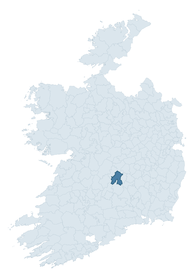
Where this barony sits in the Republic of Ireland
Geology and preservation
Bedrock geology shapes the landscape long before any settlement begins — controlling soil drainage, agricultural potential, the survival of upstanding monuments, and the preservation of buried archaeology. The figures below come from the Geological Survey Ireland 1:100,000 bedrock map.
The bedrock underlying Ikerrin is predominantly limestone (45% of the barony by area), laid down during the Carboniferous period (60% by area, around 359 to 299 million years ago). Limestone is the most heritage-rich bedrock in Ireland. It supports fertile, well-drained soils that favoured dense Early Medieval settlement and Norman manorial agriculture, and it weathers into karst features — sinkholes, caves, swallow holes, and souterrains — that frequently carry archaeology. Where peat overlies limestone, organic preservation can be exceptional. A substantial secondary geology of sandstone (24%) and greywack, siltstone and grit (15%) adds further variety to the underlying landscape. The single largest mapped unit is the Ballysteen Formation (35% of the barony's bedrock).
Rock type composition
Largest mapped unit: Ballysteen Formation (35% of the barony)
Placename evidence
Logainm records 31 heritage-diagnostic placenames for Ikerrin, drawn from townland and civil-parish names across the barony. The dominant stratum is Early Christian ecclesiastical — cill-, teampall-, and domhnach-prefixed names that record the dense network of early church foundations established between the fifth and tenth centuries. The leading diagnostic roots are cill- (16 — church), lios- (6 — ringfort or enclosure), and ráth- (4 — earthen ringfort). This is broadly in line with the ROI average of 30.7 heritage placenames per barony. The presence of multiple heritage strata side by side indicates layered occupation of the landscape across successive prehistoric and historic periods. Logainm records 178 placenames for Ikerrin (predominantly townland names). Of these, 31 (17%) carry one of the diagnostic Gaelic roots tracked above; the remainder draw on more generic landscape vocabulary that does not encode a heritage period.
Pre-Christian / Early Medieval Defensive
| Root | Count | Meaning |
|---|---|---|
| lios- | 6 | ringfort or enclosure |
| ráth- | 4 | earthen ringfort |
Early Christian Ecclesiastical
| Root | Count | Meaning |
|---|---|---|
| cill- | 16 | church (early) |
| teampall- | 1 | church (later medieval) |
| gráinseach- | 1 | monastic farm / grange |
Burial, Ritual, and Norse-Contact
| Root | Count | Meaning |
|---|---|---|
| tuaim- | 2 | burial mound |
Other baronies in Tipperary
- Ormond Lower
- Kilnamanagh Upper
- Iffa And Offa West
- Iffa And Offa East
- Ormond Upper
- Clanwilliam
- Slievardagh
- Glenquin — Limerick
- Kinsale — Cork
- Connello Lower — Limerick
See all 280 baronies in the Republic of Ireland Heritage Tool.

Explore further
Grounding History: 10 Maps of Northern Ireland’s Past
If you’re interested in Irish heritage more widely, the companion report for Northern Ireland brings together the analysis of all 462 NI wards into one place through 10 high-quality maps — covering monument density, archaeological periods, placename heritage, terrain, wetland, and the historic landscape at first survey. Take a look.
About this profile
Click any section below to expand.
What is a barony?
A barony is a historic administrative unit in Ireland, broadly equivalent to an English hundred. The 280 baronies used here are from the OSi 2019 National Statutory Boundaries (generalised 20m), covering the 26 counties of the Republic of Ireland. Baronies derive from the Norman period, were formalised in the 17th century, and have not been redrawn for statistical purposes. They vary enormously in area, from compact urban baronies in Dublin to vast upland baronies in Connacht, and should not be compared by raw site count without accounting for area differences.
What counts as a site?
This profile combines three distinct heritage registers, each with its own definition of what constitutes a recordable site:
- Archaeological sites (NMS). The National Monuments Service Sites and Monuments Record (SMR) catalogues every known archaeological monument or site of archaeological interest in the Republic, from prehistoric burial mounds and ringforts to medieval churches and post-medieval defensive works. Inclusion does not require legal protection — only that the site has been identified, surveyed, and assessed as having archaeological value. A separate subset of these sites lies within a recorded protection zone, which gives them statutory protection under the National Monuments Acts.
- Listed buildings (NIAH). The National Inventory of Architectural Heritage records buildings of architectural, historical, archaeological, artistic, cultural, scientific, social, or technical interest. Each surveyed structure is appraised on a five-tier scale: International, National, Regional, Local, and Record-Only. The NIAH appraisal is informational rather than strictly statutory, but it underpins local-authority Record of Protected Structures (RPS) listings.
- Heritage placenames (Logainm). Logainm is the authoritative database of Irish placenames maintained by the Placenames Branch. This profile applies a heritage-diagnostic classifier to the Irish-language form of each townland name, flagging roots that signal defensive sites (ráth-, lios-, dún-, caiseal-, cathair-), ecclesiastical foundations (cill-, teampall-, domhnach-, mainistir-), prehistoric burial-ritual features (tuaim-, carn-, leaba-), or Norse-contact settlement (gall-). Townlands without one of these diagnostic roots are not flagged here — they may still carry historical significance, but that significance is not encoded in the name itself.
Editorial principles
The narrative sections of this profile follow several explicit principles:
- Evidential. Every claim about this barony’s heritage character is anchored in the underlying register data. Where a site count, a placename count, or a percentile rank is cited, it is computed from the source datasets at export time, not estimated.
- Comparative. Counts and metrics are reported alongside their percentile rank against the other 279 ROI baronies. A barony with 50 ringforts in absolute terms could be unusually high or unusually low depending on its size and regional context; percentile ranking removes that ambiguity.
- Transparent on limits. Where a register has known coverage gaps, survey biases, or data-quality issues that affect this barony’s figures, the profile flags them rather than presenting the numbers as definitive.
- No interpretation beyond what the data supports. The narrative does not speculate about historical events, social dynamics, or cultural meaning beyond what the recorded heritage and placename evidence directly attests.
Data caveats and limits
- NMS Sites and Monuments Record is the product of survey campaigns conducted at different intensities across different counties and decades. Some baronies have been surveyed more thoroughly than others, and absolute counts should be read in that light. Sites destroyed by development before survey are typically not represented; sites in heavily forested or upland terrain are sometimes under-recorded.
- NIAH coverage is broadly complete for the Republic of Ireland but the survey was conducted on a rolling county-by-county basis, and the most recent appraisal date varies. Buildings demolished or substantially altered after their original survey may still appear in the register; conversely, recent buildings of merit may not yet have been appraised.
- Logainm classification applies a deliberately conservative pattern-matching approach to the Irish-language townland forms. The classifier prioritises true positives over recall: a townland may carry a heritage signal that the classifier doesn’t recognise, particularly where the diagnostic root has been heavily anglicised or where the townland name draws on a less common term. The 60,000+ townland records and ~9,800 classified placenames give a substantial signal at barony scale, but individual townland names should be checked against Logainm directly for definitive interpretation.
- Period attribution. The chronological distribution reflects only those NMS sites that carry a recognised period attribution in the source data. Sites listed as “Unknown” period are excluded from the dated subset.
- Boundary changes. Some baronies have undergone minor boundary adjustments since their 19th-century definition; the OSi 2019 generalised boundaries used here are the current statutory definition and may differ slightly from historical maps in border areas.
- Bedrock geology is mapped at 1:100,000 scale, which means local variation within a barony — small pockets of different rock type, mineral veins, alluvium overlying bedrock — is generalised. The dominant-system and rocktype figures are area-weighted, so a barony reading “70% Carboniferous limestone” may still contain small but archaeologically important pockets of older or younger rock. Around 3% of GSI polygons do not match the lexicon and contribute no rocktype or system attribution.
Data sources
- National Monuments Service — Sites and Monuments Record (SMR) https://data.gov.ie/dataset/national-monuments-service-archaeological-survey-of-ireland
- National Inventory of Architectural Heritage (NIAH) https://data.gov.ie/dataset/national-inventory-of-architectural-heritage-niah-national-dataset
- Logainm — Placenames Database of Ireland https://www.logainm.ie/
- Ordnance Survey Ireland — National Statutory Barony Boundaries 2019 https://data-osi.opendata.arcgis.com/
- EURODEM — European Digital Elevation Model https://www.mapsforeurope.org/datasets/euro-dem
- ESA WorldCover https://esa-worldcover.org/en
- Geological Survey Ireland — 1:100,000 Bedrock Geology https://www.gsi.ie/en-ie/data-and-maps/Pages/Bedrock.aspx
Explore more: Search any of the 280 ROI baronies, browse by historical province, or read the methodology and data sources for the full Republic of Ireland Heritage Tool.