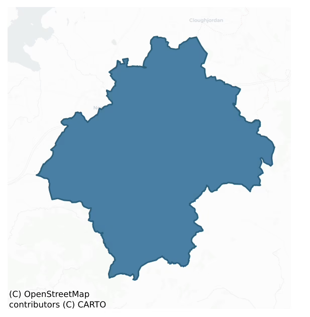
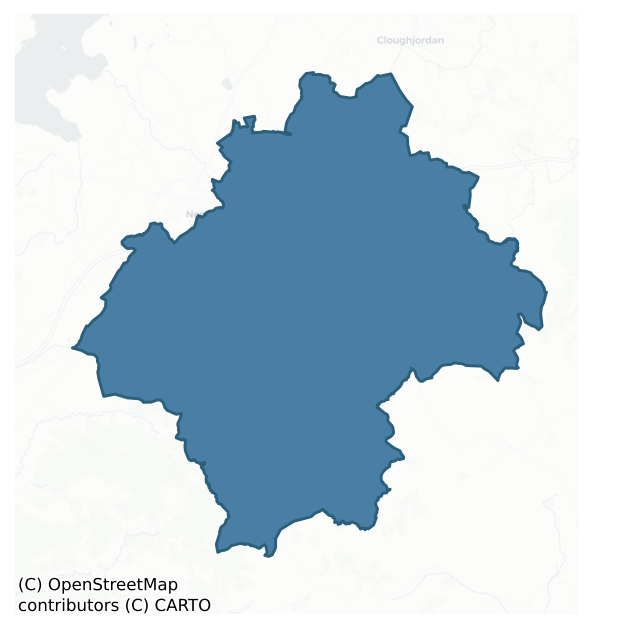
Ormond Upper is a barony of County Tipperary, in the historical province of Munster (Irish: Urumhain Uachtarach), covering 321 km² of land. The barony records 586 NMS archaeological sites and 70 NIAH listed buildings, placing it at around the 47th percentile among 280 ROI baronies for sites per km². This means it is in the lower half of all baronies for sites per km². Dated archaeological evidence runs from the Neolithic through to the Modern, spanning 8 of 9 archaeological periods, placing the barony in the 81st percentile among 280 ROI baronies for chronological depth. This means it is in the top fifth of all baronies for chronological depth. The largest dated subset of recorded sites dates to the Early Medieval. Logainm flags 51 placenames in the barony as carrying a recognised heritage root; the largest share — around 49% — are names associated with pre-christian defensive.
Heritage at a glance
Percentile rankings throughout this profile compare each barony only against the other 279 Republic of Ireland baronies.
The recorded heritage of Ormond Upper
The National Monuments Service Sites and Monuments Record (SMR) is the statutory inventory of archaeological sites for the Republic of Ireland, maintained by the Department of Tourism, Culture, Arts, Gaeltacht, Sport and Media. Sites recorded here include earthworks, ringforts, megalithic tombs, ecclesiastical remains, and post-medieval features; not every record is legally protected, but each is registered as a monument of archaeological interest.
The National Monuments Service records 586 archaeological sites in Ormond Upper, putting it at the 47th percentile among 280 ROI baronies for sites per km². This means it is in the lower half of all baronies for sites per km². Protection coverage is near-universal — 555 sites (95%) fall within a recorded monument protection zone, indicating an extensively surveyed landscape. The dominant category is defensive sites — ringforts, enclosures, hillforts, and stone forts (364 sites, 62% of the record). Ringfort – rath is the most prevalent type, making up 36% of the barony's recorded sites (209 records) — well above the ROI average of 20% across all baronies where this type occurs. Ringfort – rath is an earthen ringfort enclosed by a bank and external ditch — the most common Early Medieval farmstead, broadly dated 500–1000 AD. Other significant types include Enclosure (81) and Church (20). Enclosure is a banked or ditched feature of uncertain type, used as a catch-all where the original function cannot be determined from surface evidence; Church is a building used for public Christian worship, of any date from c. 500 AD onwards. Across the barony's 321 km², this gives a recorded density of 1.82 sites per km².
Most common monument types
Hover or tap a monument type to see its definition.
| Type | Count |
|---|---|
| Ringfort – rath an earthen ringfort enclosed by a bank and external ditch — the most common Early Medieval farmstead, broadly dated 500–1000 AD | 209 |
| Enclosure a banked or ditched feature of uncertain type, used as a catch-all where the original function cannot be determined from surface evidence | 81 |
| Church a building used for public Christian worship, of any date from c. 500 AD onwards | 20 |
| Moated site | 20 |
| Barrow – ring-barrow a Bronze/Iron Age burial monument: a low circular area enclosed by ditch and outer bank | 18 |
| Graveyard a burial area associated with a church, in use from the medieval period onwards | 18 |
| Earthwork an unclassified earthen structure with no diagnostic features that allow a more specific classification | 14 |
| House – indeterminate date a habitation building whose date cannot be determined from available evidence | 13 |
Chronological distribution
The dated archaeological record for Ormond Upper spans from the Neolithic through to the Modern, with activity attested across 8 of 9 archaeological periods. This is the 81st percentile across ROI baronies for chronological depth — an above-average span. Every period from earliest to latest is represented in the record — an unbroken sequence of dated activity across the full chronological span. Activity concentrates most heavily in the Early Medieval (189 sites, 37% of dated material), with the Iron Age forming a secondary peak (170 sites, 33%). A further 78 recorded sites (13% of the overall NMS register for the barony) carry no period attribution — appearing as 'Unknown' in the bar chart below. This typically reflects either records that pre-date the standardised period vocabulary or sites awaiting specialist dating review, rather than a genuine absence of chronological evidence.
Sample of recorded monuments
Show 25 sample monuments (of 586 total)
A representative sample of 25 recorded monuments drawn from the barony’s 586 total NMS entries. Sites within a recorded monument protection zone and rarer site types are prioritised so the list shows a meaningful cross-section rather than only the most common type. Each entry shows the official Sites and Monuments Record reference number and the description published by the National Monuments Service.
House – 16th/17th century
Depicted as 'Tullahedy Old Ho.' on the 1st ed. OS 6-inch map, described in the OS field name books as a dwelling house almost in a state of ruins occupied by a herdsman (O'Donovan et. al. 1840). No visible remains of…
Depicted as 'Tullahedy Old Ho.' on the 1st ed. OS 6-inch map, described in the OS field name books as a dwelling house almost in a state of ruins occupied by a herdsman (O'Donovan et. al. 1840). No visible remains of any pre-1700 house in this area.
The above description is derived from 'The Archaeological Inventory of County Tipperary. Vol. 1 – North Tipperary' compiled by Jean Farrelly and Caimin O'Brien (Dublin: Stationery Office, 2002). In certain instances the entries have been revised and updated in the light of recent research.
Date of upload/revision: 22 September 2008
Castle – hall-house
Situated close to the Ollatrim River, on a gentle NE-facing slope in pasture with a nearby church (TN021-029) to the S. Described in the Civil Survey 1654-6 as a 'ruined castle a Church the Walls onely standing, one…
Situated close to the Ollatrim River, on a gentle NE-facing slope in pasture with a nearby church (TN021-029) to the S. Described in the Civil Survey 1654-6 as a 'ruined castle a Church the Walls onely standing, one Orchard, a Mill & a Rivolett running through the said land & six cabbins' (Simington 1934, vol. 2, 257). A hall-keep of late thirteenth or early fourteenth-century date with alterations in the late sixteenth/early seventeenth century. The building is rectangular and roughly coursed (dims. 11.75m N-S; 16.8m E-W. wall T 2.1m), two storeys high with an external base-batter (H 1.4m; T 0.35m). The original entrance at first-floor level at the S end of the E wall consists of a slightly pointed segmental arch in a deep, pointed embrasure. There is a recess for a spiral staircase, possibly of wooden construction, in the SE angle which gave access to the ground and upper floor or wall-walk level. All floors were carried on large wooden beams set into the thickness of the wall which spanned the width of the hall. A large opening broken through the E wall at ground-floor level may have been the position of an original window similar to the flat-headed single-light windows in the N, S and W walls. The first-floor level has large window embrasures on all sides. A recess towards the centre of the N wall indicates the location of a later fireplace with the flue blocking an earlier flat-headed single-light window with sandstone surrounds, chamfered externally. A hanging-eye de…
Religious house – Fratres Cruciferi
Situated on a natural hillock with a nearby river to the E. Tyone priory and hospital of St John the Baptist was a foundation of Augustinian Hospitallers or Fratres Cruciferi (Gwynn and Hadcock 1970, 208-9). The site…
Situated on a natural hillock with a nearby river to the E. Tyone priory and hospital of St John the Baptist was a foundation of Augustinian Hospitallers or Fratres Cruciferi (Gwynn and Hadcock 1970, 208-9). The site was founded by Theobald Walter whose charter to the priory is usually dated c. 1200 (COD, vol. 1, 10). In 1541-2 Tyone Abbey was secularised and placed under the authority of a warden (Gleeson and Leask 1938, 215). The priory was dissolved in 1551 (Gwynn and Hadcock 1970, 208-9). At its dissolution, Thady O'Meara the last prior was in possession of the monastery, belfry, cemetery, water mill and various pieces of land (Gwynn and Hadcock 1970, 215). By 1553 Tyone and its estate was in the possession of Oliver Grace (ibid.). The abbey was constructed of roughly coursed limestone rubble and is now much altered and poorly preserved. It was an early thirteenth-century foundation as evidenced by the mouldings on some of the sandstone blocks. It was largely rebuilt in the late fifteenth/sixteenth century and a large quantity of cut sandstone was reused. The present remains consists of a simple rectangular church building the E end of which survives intact and a series of claustral buildings to the S of the church. The round-headed embrasures with ogee-headed windows at the W end of the church date to the late fifteenth/sixteenth century. These windows appear to have been inserted into earlier sandstone windows which are now blocked up and visible in the S wall. The E…
Weir – regulating
According to the Civil Survey (1654-6) 'upon the sd lands of Tyone … standeth an old Abby a small fishinge weare upon the river of Geagh [Nenagh] runing through it' (Simington 1934, vol. 2, 251). A weir is located in…
According to the Civil Survey (1654-6) 'upon the sd lands of Tyone … standeth an old Abby a small fishinge weare upon the river of Geagh [Nenagh] runing through it' (Simington 1934, vol. 2, 251). A weir is located in a slight bend in the Nenagh River directly E of the S wall of Tyone priory (TN021-042). It consists of a band of stones c. 1.5-2m W spanning the river. The stones are strewn across the bed of the river and are c. 0.2m below the surface of the water. The water flows rapidly over the weir at this point. Access could not be gained as the bank is very steep on both sides at this point and is nettle covered.
The above description is derived from 'The Archaeological Inventory of County Tipperary. Vol. 1 – North Tipperary' compiled by Jean Farrelly and Caimin O'Brien (Dublin: Stationery Office, 2002). In certain instances the entries have been revised and updated in the light of recent research.
Date of upload/revision: 22 September 2008
Causeway
In the S half of Lough Duff, currently surrounded by marsh. Not indicated on the 1st ed. OS 6-inch map, this site appears on the latest ed. as a crescent-shaped area (TN021-084001) with a causeway leading to dry land.…
In the S half of Lough Duff, currently surrounded by marsh. Not indicated on the 1st ed. OS 6-inch map, this site appears on the latest ed. as a crescent-shaped area (TN021-084001) with a causeway leading to dry land. The present shape of the site is difficult to define – it may have been cut away for turf to some extent. It is a roughly oval-shaped raised area (dims. 16.83m N-S; c. 24.4m E-W; H 1m) overgrown with hummocky tufts of grass. There is no timber apparent. The causeway, as depicted on the OS 6-inch map, extends WNW-ESE (L c. 90m; Wth 3m; H c. 0.3m).
The above description is derived from 'The Archaeological Inventory of County Tipperary. Vol. 1 – North Tipperary' compiled by Jean Farrelly and Caimin O'Brien (Dublin: Stationery Office, 2002). In certain instances the entries have been revised and updated in the light of recent research.
Date of upload/revision: 22 September 2008
Mill – unclassified
In flat river valley with land rising to N and S. Mill depicted on Down Survey map as being on S bank of mill race, immediately N of Ollatrim River. No visible trace of mill, however, mill race (W 4m; D 1m) still…
In flat river valley with land rising to N and S. Mill depicted on Down Survey map as being on S bank of mill race, immediately N of Ollatrim River. No visible trace of mill, however, mill race (W 4m; D 1m) still intact. Uncut stone and boulders protude along S bank of mill race, which, as depicted on OS 6-inch map, meanders at head and straightens out towards tail.
The above description is derived from 'The Archaeological Inventory of County Tipperary. Vol. 1 – North Tipperary' compiled by Jean Farrelly and Caimin O'Brien (Dublin: Stationery Office, 2002). In certain instances the entries have been revised and updated in the light of recent research.
Date of upload/revision: 22 September 2008
Tomb – unclassified
Situated on the W bank of the Ollatrim River with a nearby tower house (TN022-035) to the SE. Listed in the ecclesiastical taxation of the Diocese of Killaloe in 1302 (CDI, vol. 5, 302). A long rectangular church…
Situated on the W bank of the Ollatrim River with a nearby tower house (TN022-035) to the SE. Listed in the ecclesiastical taxation of the Diocese of Killaloe in 1302 (CDI, vol. 5, 302). A long rectangular church (TN022-034001) built with roughly coursed rubble of which the E and S walls survive intact with only the E end of the N wall surviving; the wall-footings of the W wall survive. A pointed doorway occupies the E end of the N wall while the main two-centred doorway which was at the W end of the S wall (O'Flanagan 1930, vol. 1, 196) was removed and is reused as a doorway for the nearby eighteenth/nineteenth-century MacEgan tomb.
Compiled by: Jean Farrelly and Caimin O'Brien
Date of upload/revision: 22 September 2008
Religious house – Augustinian friars
Augustinian priory
Situated on a slight rise of ground in undulating countryside in the centre of Toomevara village with church ruins (TN022-070001-) 70m to the N and R.C. Chapel immediately to S. The poorly preserved…
Augustinian priory
Situated on a slight rise of ground in undulating countryside in the centre of Toomevara village with church ruins (TN022-070001-) 70m to the N and R.C. Chapel immediately to S. The poorly preserved remains of an Augustinian priory dedicated to St Mary which was founded some time after 1140 (Gwynn and Hadcock 1970, 155) possibly on the site of an earlier monastic centre dedicated to St Donain. A cross-inscribed slab (TN022-070004-), now lost, was recovered from the vicinity of the abbey (Gleeson 1951-2, 133). The priory was a daughter-house of Monaincha (TN018-001001-) (Gwynn and Hadcock 1970, 155) and appears to have been strongly associated with the ruling O'Meara dynasty. In 1450 the warden pleaded that, on account of poverty, the value being under 16 marks he and his convent could not be decently maintained, nor repair the cloister and other buildings, most of which had been burnt down during wars (ibid., 195). Donogh O'Meara was building a castle here in 1541 (Gleeson 1951-2, 133). In 1597 Miler mac Grath was granted the 'site, circuit and precint of the late priory of Thome' with a 'butt of a ruined castle with certain ruined chambers thatched' (ibid., 133). At the dissolution the property of the priory of Toomevara is listed as 'one castle, wall and other buildings on the site' (Gleeson and Leask 1938, 213).
The present remains consist of a long rectangular building (int. dims. 6.4m N-S; 21m E-W approx.; wall T 1.15m) of which the E end is destr…
Cursing stone
Situated on SE facing slope of rising ground in upland area with centre of possible ecclesiastical enclosure (TN026-070—-) 100m to the W. Earthfast stone used as a bullaun stone (TN027-170001-) with long rectangular…
Situated on SE facing slope of rising ground in upland area with centre of possible ecclesiastical enclosure (TN026-070—-) 100m to the W. Earthfast stone used as a bullaun stone (TN027-170001-) with long rectangular mortise or slot cut into surface of rock with at least twelve water-rolled oval or spherical-shape stones jammed into slot. These water-rolled stones are very similar to cursing stones found on early Christian sites at Inishmurray Co. Sligo and Caher Island, Co. Mayo. A shallow bullaun beside the slot indicates that the earthfast stone was used at some stage as a bullaun stone for grinding purposes. At least one of these water-rolled stones fits into the bullaun suggesting that this stone was used as a rubber stone for the bullaun. At least thirteen other water-rolled stones of varying shapes and sizes can be seen lying on the surface of the earthfast boulder. Other loosely scattered angular-shaped stones appear to be the remains of field clearance debris. The egg-shaped stones are similar to stones found associated with holy wells and are often used as cursing stones (Mac Mahon 1981, 36-7). These water-rolled stones may indicate that the earthfast rock was used as a penitential station. The earthfast stone appears to have had several functions. It may originally have been used as a bullaun stone, which later had a rectangular slot cut into the surface of the stone. The slot may have been cut in order to support a cross of wood or stone. The angular ston…
Sheela-na-gig
Situated on the on the SW angle of Ballynaclogh church (TN027-003002-), on the external S face of a quoin c. 3m above ground level. The figure, carved in relief, (c. 0.5m high) has a flat-topped head, jug-shaped ears,…
Situated on the on the SW angle of Ballynaclogh church (TN027-003002-), on the external S face of a quoin c. 3m above ground level. The figure, carved in relief, (c. 0.5m high) has a flat-topped head, jug-shaped ears, pointed chin, widely spaced almond eyes and no clear mouth. One arm is pulling the face, probably the ear, while the other arm is reaching under a leg and pulling the vulva. The legs are apart and the feet are quite badly spalled. (Manning 1988, 71-3)
The above description is derived from 'The Archaeological Inventory of County Tipperary. Vol. 1 – North Tipperary' compiled by Jean Farrelly and Caimin O'Brien (Dublin: Stationery Office, 2002). In certain instances the entries have been revised and updated in the light of recent research.
Date of upload/revision: 22 September 2008
Ringfort – unclassified
Situated on a SW-facing slope in pastureland. A raised circular area (diam. 38m NE-SW) defined by a denuded earth and stone bank (Wth 2.2m; int. H 0.5m; ext. H 1m) and outer fosse (Wth 3.3m; D 0.8m). The site is…
Situated on a SW-facing slope in pastureland. A raised circular area (diam. 38m NE-SW) defined by a denuded earth and stone bank (Wth 2.2m; int. H 0.5m; ext. H 1m) and outer fosse (Wth 3.3m; D 0.8m). The site is partially damaged by bull-dozer activity, particularly at E. Scrub growing around the edge of the site has been bull-dozed into the fosse. The interior, sloping to SW, is overgrown with scrub at N and E. There is a possible entrance (Wth 2m) in the NE quadrant, though the gap is quite narrow and the corresponding causeway may be the result of more recent backfilling. A field bank and ditch, on a NE-SW axis, abuts the fosse at SW.
The above description is derived from 'The Archaeological Inventory of County Tipperary. Vol. 1 – North Tipperary' compiled by Jean Farrelly and Caimin O'Brien (Dublin: Stationery Office, 2002). In certain instances the entries have been revised and updated in the light of recent research.
Date of upload/revision: 22 September 2008
Architectural fragment
Situated on a low hillock in a mountainous region with a nearby early medieval castle (TN028-025001) to the W. A monastery was founded here by Odran in the sixth century (Gwynn and Hadcock 1970, 40). The death of Gilla…
Situated on a low hillock in a mountainous region with a nearby early medieval castle (TN028-025001) to the W. A monastery was founded here by Odran in the sixth century (Gwynn and Hadcock 1970, 40). The death of Gilla Brénainn Ua Léimíne, erenagh of Leitir Odráin is in the Annals of Innisfallen under the year AD 1074. The site is listed in the ecclesiastical taxation of the Diocese of Killaloe in 1302 (CDI, vol. 5, 302). The Royal Visitation of 1615 described the building as ' church and chancell well' (Murphy 1914, 220). The poorly preserved remains of an early medieval nave and chancel church (TN028-025002), the nave of which is now destroyed with the chancel being reused in the late medieval period. A fragment of the E window lies in the church interior. A destroyed late medieval W doorway is located where the original chancel arch existed. It is described in the OS Letters as a two-centred doorway (O'Flanagan 1930, vol. 1, 192). Several architectural fragments have been reused as headstones in the enclosing graveyard. Four Early Christian cross-inscribed slabs (TN028-025003), now housed in the Nenagh Heritage Centre, were recovered from graveyard (TN028-025005) during the digging of a grave in 1977 (Kelly 1988, 92-100).
The above description is derived from 'The Archaeological Inventory of County Tipperary. Vol. 1 – North Tipperary' compiled by Jean Farrelly and Caimin O'Brien (Dublin: Stationery Office, 2002). In certain instances the entries have been revised and…
Cross
No surface remains of cross known as "St. Johns Cross"(NLI. 21. F. 129) situated atop mountan ridge with good extensive views. Area recently ploughed and planted with conifer trees.
Compiled by: Jean Farrelly and…
No surface remains of cross known as "St. Johns Cross"(NLI. 21. F. 129) situated atop mountan ridge with good extensive views. Area recently ploughed and planted with conifer trees.
Compiled by: Jean Farrelly and Caimin O'Brien
Date of upload/revision: 22 September 2008
Stone row
Situated at the base of the N slope of a small hillock which in turn is on the SE-facing slope of a ridge in an upland area. Site indicated on 1st ed. (1840) OS 6-inch map as 'Three Stones'. Not depicted on subsequent…
Situated at the base of the N slope of a small hillock which in turn is on the SE-facing slope of a ridge in an upland area. Site indicated on 1st ed. (1840) OS 6-inch map as 'Three Stones'. Not depicted on subsequent 2nd (1902) ed. A row of four stones, aligned NE-SW, with a possible fifth stone (H 1.3m; Wth 0.45m; T 0.2m) lying prostate near a gap in the row; overall length 7.63m. These limestone orthostats are set in a slight hollow with little evidence of packing-stones, though there are tufts of grass around the bases. The largest standing stone (H 1.78m; 1.56m x 0.4m), at SW end, has a hole in the SE face into which hands were dipped as a cure for warts. From NE to SW the remaining three stones measure: (1) H 1.05m; 0.76m x c.0.3m (2) H 1.56m; 1.47m x 0.28m (3) H 0.95m; W 0.8m x 0.53m.
The above description is derived from 'The Archaeological Inventory of County Tipperary. Vol. 1 – North Tipperary' compiled by Jean Farrelly and Caimin O'Brien (Dublin: Stationery Office, 2002). In certain instances the entries have been revised and updated in the light of recent research.
Date of upload/revision: 22 September 2008
Standing stone – pair
Situated on a natural hillock in a valley, enclosed by high ground except to S. The immediate area is wet and rushy and has been planted with coniferous forest, as has the monument itself. The stone pair, composed of…
Situated on a natural hillock in a valley, enclosed by high ground except to S. The immediate area is wet and rushy and has been planted with coniferous forest, as has the monument itself. The stone pair, composed of shaly limestone, is aligned on an NE-SW axis, with the larger stone (H 0.9m; L 1.6m; T 0.76m) to the SW and the smaller (H 0.82m; L 0.98m; T 0.13-0.25m) located 0.7m to the NE. The stones are roughly centrally placed within a kerbed enclosure (TN033-041002) which consists of a bank with internal and external stone revetment. Only the SE and SW portion of the bank survives.
The above description is derived from 'The Archaeological Inventory of County Tipperary. Vol. 1 – North Tipperary' compiled by Jean Farrelly and Caimin O'Brien (Dublin: Stationery Office, 2002). In certain instances the entries have been revised and updated in the light of recent research.
Date of upload/revision: 22 September 2008
Kerb circle
Situated on a poorly drained E-facing slope in an upland area overlooking the Nenagh river valley to the NE. The site consists of a circular area (diam. 9.1m N-S; 10.3m E-W) defined by 10 low orthostats with a possible…
Situated on a poorly drained E-facing slope in an upland area overlooking the Nenagh river valley to the NE. The site consists of a circular area (diam. 9.1m N-S; 10.3m E-W) defined by 10 low orthostats with a possible entrance gap (Wth 1.69m) at N where two of the largest stones survive. The stones range from 0.4m-0.9m L; 0.10-0.15m and 0.2-0.7m H. The grass-covered interior has evidence of several slabs barely protruding above the surface.
Compiled by: Caimin O'Brien.
Date of upload: 22 September 2008
Barrow – mound barrow
In flat poorly drained pasture on N side of the Clodiagh River in an upland region. The site consists of an irregular-shaped flat-topped earthen mound (H 2m; base dims. 20m NE-SW x 16m SE-NW) the top of which is defined…
In flat poorly drained pasture on N side of the Clodiagh River in an upland region. The site consists of an irregular-shaped flat-topped earthen mound (H 2m; base dims. 20m NE-SW x 16m SE-NW) the top of which is defined by a scarp. The flat summit (diam. 12m NE-SW x 6m SE-NW) has a central depression (dims. D 0.3m; 1.7m x 1.3m) which may be an indication of a collapsed cist. Known locally as Quigley's fort.
Compiled by: Caimin O'Brien.
Date of upload: 22 September 2008
House – 17th century
Situated in rolling pastureland. A gable-ended, six-bay seventeenth-century house, two storeys over a basement with projecting block to the rear. Two-bay central breakfront, with entrance porch added in the twentieth…
Situated in rolling pastureland. A gable-ended, six-bay seventeenth-century house, two storeys over a basement with projecting block to the rear. Two-bay central breakfront, with entrance porch added in the twentieth century. Original cut limestone Gibbsian doorcase with semi-circular shaped pediment decorated with a coat of arms and the date 1695. Underneath the coat of arms was the D'Alton family motto 'Fortis et fidelis' meaning Strong and Faithful' (Burke 1832). The doorcase and steps leading up to it have been removed and inserted into Glebe House at Killeisk. Grenanstown House is rendered with concrete. One corner of the projecting return is exposed showing limestone quoins, one of which is roughly dressed with drafting at the edge. The stairs is in the projecting return at the rear of the house and the balustrades rest on the balustrade rail. The Civil Survey (1654-6) refers to an 'old stumpe of a Castle' (TN021-081001-) at Grenanstown (Simington 1934, vol. 2, 220), however, there is no visible trace of this building above ground. John Grace is listed as proprietor in 1640 (ibid.). The forfeited castle and lands of Grenanstown belonging to John Grace were granted c. 1656 to an officer in the Parliamentarian army called Captain Salt (Murphy 1994, 140). In 1666 the lands of Grenanstown were probably purchased by Peter D'Alton of Dundonnell, Co. Westmeath (ibid.). Grenanstown House was probably built by the D'Alton family in the late 17th century on the site of the…
Metalworking site
In 2002 archaeological monitoring carried out by Ruth Elliott revealed two areas of burnt material and a post-medieval drainage or field ditch. This monitoring was carried out under Licence No. 02E1254 (Bennett 2004,…
In 2002 archaeological monitoring carried out by Ruth Elliott revealed two areas of burnt material and a post-medieval drainage or field ditch. This monitoring was carried out under Licence No. 02E1254 (Bennett 2004, 484). Area 1 measured c. 30m x 40m and consisted of a post-medieval linear ditch, an area of in situ burning and a number of features of charcoal-rich soil.
Excavation of this area was carried out under licenence number 02E1413 and this revealed that the ditch was post medieval in date and probably related to drainage or field boundaries. The charcoal rich area revealed an oval pit (0.98m x 0.49m x D 0.25m) containing a large quantity of iron slag. This evidence points towards iron working activity in the area. Excavation carried out by Niall Gregory of a hearth situated c. 60m to the south may be related to this iron-working activity.
Compiled by: Caimin O'Brien.
Date of upload: 22 September 2008
Burnt spread
In 2002 archaeological monitoring carried out by Ruth Elliott revealed two areas of burnt material and a post-medieval drainage or field ditch. This monitoring was carried out under Licence No. 02E1254 (Bennett 2004,…
In 2002 archaeological monitoring carried out by Ruth Elliott revealed two areas of burnt material and a post-medieval drainage or field ditch. This monitoring was carried out under Licence No. 02E1254 (Bennett 2004, 484). Area 2 in the south-western part of the site measured c. 20m x 30m and consisted of an irregularly shaped area of in situ burning and a number of features of charcoal-rich soil, some of which exhibited burning around the edges.
Compiled by: Caimin O'Brien.
Date of upload: 22 September 2008
Souterrain
A souterrain in the centre of a ringfort (TN020-152003) was uncovered durng excavation by Donald Murphy in the year 2000. The souterrain consists of a single rectangular chamber connected to a possible creep to the NW.…
A souterrain in the centre of a ringfort (TN020-152003) was uncovered durng excavation by Donald Murphy in the year 2000. The souterrain consists of a single rectangular chamber connected to a possible creep to the NW. The chamber had partially collapsed and had clearly been disturbed, as the side-walls had been robbed of stone in recent years. A number of wooden planks were uncovered at the base of the chamber, as well as a single large wooden beam or lintel. A C 14 date of AD 661-8 was obtained from this beam (Bennett 2002, 326).
Compiled by: Caimin O'Brien.
Date of upload: 22 September 2008
Memorial stone
Situated on a slight rise of ground in undulating countryside in the centre of Toomevara village with a possible church ruins (TN022-070001-) to the N. The poorly preserved remains of an Augustinian priory…
Situated on a slight rise of ground in undulating countryside in the centre of Toomevara village with a possible church ruins (TN022-070001-) to the N. The poorly preserved remains of an Augustinian priory (TN022-070002-) dedicated to St Mary which was founded some time after 1140 (Gwynn and Hadcock 1970, 155) possibly on the site of an earlier monastic centre dedicated to St Donain. A seventeenth-century wall plaque sits off-centre to the E on the inner face of the S wall. The Latin inscription on the limestone plaque is provided by Gleeson (1982, 469), who also gives the translation as 'While the renowned offspring of O'Meara reposes in this tomb. To whom O Traveller happily open Heaven by thy prayer. To William. To Ellen Bourke open heaven. By the merits of his blood he made possible that path. He snatched thrones from earth. Let this marble be a witness to thee O reader, 1664 henceforth from Evil'. Architectural fragments from the priory are inserted as possible headstones in the surrounding graveyard.
To see a 3D model of this memorial plaque, visit; https://skfb.ly/oxJsK
Compiled by: Caimin O'Brien.
Date of upload: 22 September 2008
Tomb – effigial
Situated on a slight rise of ground in undulating countryside in the centre of Toomevara village with a possible church ruins (TN022-070001-) to the N. The poorly preserved remains of an Augustinian priory…
Situated on a slight rise of ground in undulating countryside in the centre of Toomevara village with a possible church ruins (TN022-070001-) to the N. The poorly preserved remains of an Augustinian priory (TN022-070002-) dedicated to St Mary which was founded some time after 1140 (Gwynn and Hadcock 1970, 155) possibly on the site of an earlier monastic centre dedicated to St Donain. A late fifteenth-century effigial tomb (dims. L 1.33m; top Wth 0.54m; base Wth 0.54m; T 0.17m) described by Hunt (1974, vol. 1, 94, 96, 231) lies outside the S wall at the E end of the Augustinian priory. Described by Gleeson as 'Outside the N wall is a 15th cent. Stone slab showing an ecclesiastic and inscribed in raised letters now partly erased. The name 'Joannes O'Meara' can be read' (Gleeson 1951-2, 133).
Compiled by: Caimin O'Brien.
Date of upload: 22 September 2008
Font
Sandstone octagonal shaped font (diam. 0.28m; H 0.32m) with each panel decorated with an incised quatrefoil pattern. This font is located in the SE corner of the graveyard to the E of the Augustinian priory…
Sandstone octagonal shaped font (diam. 0.28m; H 0.32m) with each panel decorated with an incised quatrefoil pattern. This font is located in the SE corner of the graveyard to the E of the Augustinian priory (TN022-070002-). Beside the font are the remains of one section of an octagonal shaped column and base belonging to the font. The font has been taken inside the R.C Church where it has been erected close to the altar of the church
Compiled and revised by: Caimin O'Brien.
Date of revised upload: 12 September 2022
Ringfort – rath
Situated on a low NE-SW ridge in an upland area. A raised circular area (diam. 25.4m E-W) enclosed by an earth and stone bank (Wth 1.3m; int. H 0.3m; ext. H 2m) with traces of a shallow external fosse (Wth 1.5m; D…
Situated on a low NE-SW ridge in an upland area. A raised circular area (diam. 25.4m E-W) enclosed by an earth and stone bank (Wth 1.3m; int. H 0.3m; ext. H 2m) with traces of a shallow external fosse (Wth 1.5m; D 0.2m). Possible destroyed entrance gap (Wth 1.8m) at E. According to the OS Letters the ringfort was used as a burial place for unbaptised infants (TN026-036002) (O'Flanagan 1930, vol. 3, 121).
The above description is derived from 'The Archaeological Inventory of County Tipperary. Vol. 1 – North Tipperary' compiled by Jean Farrelly and Caimin O'Brien (Dublin: Stationery Office, 2002). In certain instances the entries have been revised and updated in the light of recent research.
Date of upload/revision: 22 September 2008
Listed buildings
The National Inventory of Architectural Heritage (NIAH) is a state survey appraising buildings of architectural, historical, archaeological, artistic, cultural, scientific, social, or technical interest. Each surveyed structure receives a rating from International (the highest, for buildings of European importance) through National, Regional, Local, and Record-Only.
The NIAH records 70 listed buildings in Ormond Upper (38th percentile across ROI baronies). All recorded buildings carry Regional or lower grading; the barony does not contain any structures appraised as being of National or International architectural importance. Construction dates concentrate most heavily in the Late Georgian (1800-1830) period. The most-recorded building type is house (17 examples, 24% of the listed stock).
Terrain and environment
Mean elevation across the barony is 156m — the 88th percentile among 280 ROI baronies for elevation. This means it is in the top fifth of all baronies for elevation. This is a relatively elevated landscape by ROI standards. Elevation matters for heritage because higher-altitude baronies typically favour defensive monuments — ringforts and hilltop forts placed on prominent ground — while lowland baronies are more likely to carry the dense settlement and church networks of intensive agricultural landscapes. The barony reaches 538m at its highest point — a vertical span of more than 382m within its boundary, indicating significant topographic diversity. Mean slope is 5.2° — the 76th percentile among 280 ROI baronies for slope. This means it is in the top third of all baronies for slope. This is consistently steep terrain by ROI standards, the kind of landscape that tends to preserve upstanding archaeological features well. Slope is a key control on both land use and archaeological preservation: steep ground resists ploughing and tends to preserve earthworks intact, while gentle slopes favour intensive cultivation that damages or destroys surface archaeology over time. Localised maximum slopes reach 16°, typical of stream-cut valleys, escarpments, or coastal bluffs within the wider landscape. The Topographic Wetness Index averages 10.3, the 28th percentile among 280 ROI baronies for wetness. This means it is in the bottom third of all baronies for wetness. Drainage matters for heritage because poorly-drained ground preserves organic archaeology (wooden trackways, leather, textiles, and on rare occasions human remains) far better than free-draining soil; well-drained ground favours arable use but destroys organic material rapidly. The land cover is dominated by improved grassland (78%) and woodland (18%). In overall character, this is an upland landscape of steep, elevated terrain, with land use dominated by improved grassland.
Terrain measurements
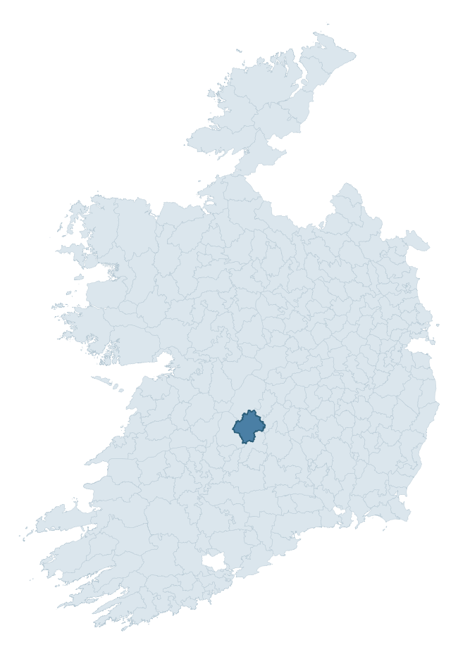
Where this barony sits in the Republic of Ireland
Geology and preservation
Bedrock geology shapes the landscape long before any settlement begins — controlling soil drainage, agricultural potential, the survival of upstanding monuments, and the preservation of buried archaeology. The figures below come from the Geological Survey Ireland 1:100,000 bedrock map.
The bedrock underlying Ormond Upper is predominantly greywack, siltstone and grit (49% of the barony by area), with much of the rock dating to the Silurian period. A substantial secondary geology of limestone (40%) adds further variety to the underlying landscape. The single largest mapped unit is the Hollyford Formation (49% of the barony's bedrock).
Rock type composition
Largest mapped unit: Hollyford Formation (49% of the barony)
Placename evidence
Logainm records 51 heritage-diagnostic placenames for Ormond Upper, drawn from townland and civil-parish names across the barony. The dominant stratum is pre-Christian and Early Medieval defensive — ráth-, lios-, dún-, and caiseal-prefixed names that mark Iron Age and early historic settlement. The leading diagnostic roots are cill- (19 — church), lios- (15 — ringfort or enclosure), and ráth- (9 — earthen ringfort). This is above the ROI average of 30.7 heritage placenames per barony. The presence of multiple heritage strata side by side indicates layered occupation of the landscape across successive prehistoric and historic periods. Logainm records 284 placenames for Ormond Upper (predominantly townland names). Of these, 51 (18%) carry one of the diagnostic Gaelic roots tracked above; the remainder draw on more generic landscape vocabulary that does not encode a heritage period.
Pre-Christian / Early Medieval Defensive
| Root | Count | Meaning |
|---|---|---|
| lios- | 15 | ringfort or enclosure |
| ráth- | 9 | earthen ringfort |
| dún- | 1 | hilltop or promontory fort |
Early Christian Ecclesiastical
| Root | Count | Meaning |
|---|---|---|
| cill- | 19 | church (early) |
| teampall- | 3 | church (later medieval) |
| domhnach- | 1 | pre-Patrician or earliest Patrician church |
| cillín- | 1 | unconsecrated burial ground |
Burial, Ritual, and Norse-Contact
| Root | Count | Meaning |
|---|---|---|
| carn- | 2 | cairn |
Other baronies in Tipperary
- Kilnamanagh Upper
- Clanwilliam
- Iffa And Offa East
- Ormond Lower
- Owney And Arra
- Eliogarty
- Middlethird
- Carbery West (east Division) — Cork
- Imokilly — Cork
- Cork — Cork
See all 280 baronies in the Republic of Ireland Heritage Tool.

Explore further
Grounding History: 10 Maps of Northern Ireland’s Past
If you’re interested in Irish heritage more widely, the companion report for Northern Ireland brings together the analysis of all 462 NI wards into one place through 10 high-quality maps — covering monument density, archaeological periods, placename heritage, terrain, wetland, and the historic landscape at first survey. Take a look.
About this profile
Click any section below to expand.
What is a barony?
A barony is a historic administrative unit in Ireland, broadly equivalent to an English hundred. The 280 baronies used here are from the OSi 2019 National Statutory Boundaries (generalised 20m), covering the 26 counties of the Republic of Ireland. Baronies derive from the Norman period, were formalised in the 17th century, and have not been redrawn for statistical purposes. They vary enormously in area, from compact urban baronies in Dublin to vast upland baronies in Connacht, and should not be compared by raw site count without accounting for area differences.
What counts as a site?
This profile combines three distinct heritage registers, each with its own definition of what constitutes a recordable site:
- Archaeological sites (NMS). The National Monuments Service Sites and Monuments Record (SMR) catalogues every known archaeological monument or site of archaeological interest in the Republic, from prehistoric burial mounds and ringforts to medieval churches and post-medieval defensive works. Inclusion does not require legal protection — only that the site has been identified, surveyed, and assessed as having archaeological value. A separate subset of these sites lies within a recorded protection zone, which gives them statutory protection under the National Monuments Acts.
- Listed buildings (NIAH). The National Inventory of Architectural Heritage records buildings of architectural, historical, archaeological, artistic, cultural, scientific, social, or technical interest. Each surveyed structure is appraised on a five-tier scale: International, National, Regional, Local, and Record-Only. The NIAH appraisal is informational rather than strictly statutory, but it underpins local-authority Record of Protected Structures (RPS) listings.
- Heritage placenames (Logainm). Logainm is the authoritative database of Irish placenames maintained by the Placenames Branch. This profile applies a heritage-diagnostic classifier to the Irish-language form of each townland name, flagging roots that signal defensive sites (ráth-, lios-, dún-, caiseal-, cathair-), ecclesiastical foundations (cill-, teampall-, domhnach-, mainistir-), prehistoric burial-ritual features (tuaim-, carn-, leaba-), or Norse-contact settlement (gall-). Townlands without one of these diagnostic roots are not flagged here — they may still carry historical significance, but that significance is not encoded in the name itself.
Editorial principles
The narrative sections of this profile follow several explicit principles:
- Evidential. Every claim about this barony’s heritage character is anchored in the underlying register data. Where a site count, a placename count, or a percentile rank is cited, it is computed from the source datasets at export time, not estimated.
- Comparative. Counts and metrics are reported alongside their percentile rank against the other 279 ROI baronies. A barony with 50 ringforts in absolute terms could be unusually high or unusually low depending on its size and regional context; percentile ranking removes that ambiguity.
- Transparent on limits. Where a register has known coverage gaps, survey biases, or data-quality issues that affect this barony’s figures, the profile flags them rather than presenting the numbers as definitive.
- No interpretation beyond what the data supports. The narrative does not speculate about historical events, social dynamics, or cultural meaning beyond what the recorded heritage and placename evidence directly attests.
Data caveats and limits
- NMS Sites and Monuments Record is the product of survey campaigns conducted at different intensities across different counties and decades. Some baronies have been surveyed more thoroughly than others, and absolute counts should be read in that light. Sites destroyed by development before survey are typically not represented; sites in heavily forested or upland terrain are sometimes under-recorded.
- NIAH coverage is broadly complete for the Republic of Ireland but the survey was conducted on a rolling county-by-county basis, and the most recent appraisal date varies. Buildings demolished or substantially altered after their original survey may still appear in the register; conversely, recent buildings of merit may not yet have been appraised.
- Logainm classification applies a deliberately conservative pattern-matching approach to the Irish-language townland forms. The classifier prioritises true positives over recall: a townland may carry a heritage signal that the classifier doesn’t recognise, particularly where the diagnostic root has been heavily anglicised or where the townland name draws on a less common term. The 60,000+ townland records and ~9,800 classified placenames give a substantial signal at barony scale, but individual townland names should be checked against Logainm directly for definitive interpretation.
- Period attribution. The chronological distribution reflects only those NMS sites that carry a recognised period attribution in the source data. Sites listed as “Unknown” period are excluded from the dated subset.
- Boundary changes. Some baronies have undergone minor boundary adjustments since their 19th-century definition; the OSi 2019 generalised boundaries used here are the current statutory definition and may differ slightly from historical maps in border areas.
- Bedrock geology is mapped at 1:100,000 scale, which means local variation within a barony — small pockets of different rock type, mineral veins, alluvium overlying bedrock — is generalised. The dominant-system and rocktype figures are area-weighted, so a barony reading “70% Carboniferous limestone” may still contain small but archaeologically important pockets of older or younger rock. Around 3% of GSI polygons do not match the lexicon and contribute no rocktype or system attribution.
Data sources
- National Monuments Service — Sites and Monuments Record (SMR) https://data.gov.ie/dataset/national-monuments-service-archaeological-survey-of-ireland
- National Inventory of Architectural Heritage (NIAH) https://data.gov.ie/dataset/national-inventory-of-architectural-heritage-niah-national-dataset
- Logainm — Placenames Database of Ireland https://www.logainm.ie/
- Ordnance Survey Ireland — National Statutory Barony Boundaries 2019 https://data-osi.opendata.arcgis.com/
- EURODEM — European Digital Elevation Model https://www.mapsforeurope.org/datasets/euro-dem
- ESA WorldCover https://esa-worldcover.org/en
- Geological Survey Ireland — 1:100,000 Bedrock Geology https://www.gsi.ie/en-ie/data-and-maps/Pages/Bedrock.aspx
Explore more: Search any of the 280 ROI baronies, browse by historical province, or read the methodology and data sources for the full Republic of Ireland Heritage Tool.