Eliogarty is a barony of County Tipperary, in the historical province of Munster (Irish: Éile Uí Fhógarta), covering 365 km² of land. The barony records 839 NMS archaeological sites and 221 NIAH listed buildings, placing it at around the 66th percentile among 280 ROI baronies for sites per km². This means it is in the upper half of all baronies for sites per km². Dated archaeological evidence runs from the Early Bronze Age through to the Modern, spanning 7 of 9 archaeological periods, placing the barony in the 41st percentile among 280 ROI baronies for chronological depth. This means it is in the lower half of all baronies for chronological depth. The largest dated subset of recorded sites dates to the Iron Age. Logainm flags 60 placenames in the barony as carrying a recognised heritage root; the largest share — around 55% — are names associated with early Christian church and monastic foundations.

Heritage at a glance
Percentile rankings throughout this profile compare each barony only against the other 279 Republic of Ireland baronies.
The recorded heritage of Eliogarty
The National Monuments Service Sites and Monuments Record (SMR) is the statutory inventory of archaeological sites for the Republic of Ireland, maintained by the Department of Tourism, Culture, Arts, Gaeltacht, Sport and Media. Sites recorded here include earthworks, ringforts, megalithic tombs, ecclesiastical remains, and post-medieval features; not every record is legally protected, but each is registered as a monument of archaeological interest.
The National Monuments Service records 839 archaeological sites in Eliogarty, putting it at the 66th percentile among 280 ROI baronies for sites per km². This means it is in the upper half of all baronies for sites per km². Of these, 630 (75%) fall within a recorded monument protection zone. The dominant category is defensive sites — ringforts, enclosures, hillforts, and stone forts (389 sites, 46% of the record). Ringfort – rath is the most prevalent type, making up 17% of the barony's recorded sites (141 records), broadly in line with the ROI average of 20% across all baronies where this type occurs. Ringfort – rath is an earthen ringfort enclosed by a bank and external ditch — the most common Early Medieval farmstead, broadly dated 500–1000 AD. Other significant types include Enclosure (138) and Graveslab (33). Enclosure is a banked or ditched feature of uncertain type, used as a catch-all where the original function cannot be determined from surface evidence; Graveslab is a recumbent grave-marking slab, dated 1200–1700 AD. Across the barony's 365 km², this gives a recorded density of 2.30 sites per km².
Most common monument types
Hover or tap a monument type to see its definition.
| Type | Count |
|---|---|
| Ringfort – rath an earthen ringfort enclosed by a bank and external ditch — the most common Early Medieval farmstead, broadly dated 500–1000 AD | 141 |
| Enclosure a banked or ditched feature of uncertain type, used as a catch-all where the original function cannot be determined from surface evidence | 138 |
| Graveslab a recumbent grave-marking slab, dated 1200–1700 AD | 33 |
| Church a building used for public Christian worship, of any date from c. 500 AD onwards | 29 |
| Fulacht fia a horseshoe-shaped Bronze Age burnt mound built around a sunken trough beside a water source, traditionally interpreted as a cooking site | 26 |
| Castle – tower house a fortified residential tower of four or five storeys, mostly built by lords in the 15th and 16th centuries and often within a defended bawn | 24 |
Chronological distribution
The dated archaeological record for Eliogarty spans from the Early Bronze Age through to the Modern, with activity attested across 7 of 9 archaeological periods. Every period from earliest to latest is represented in the record — an unbroken sequence of dated activity across the full chronological span. Activity concentrates most heavily in the Iron Age (228 sites, 40% of dated material), with the Early Medieval forming a secondary peak (170 sites, 30%). A further 276 recorded sites (33% of the overall NMS register for the barony) carry no period attribution — appearing as 'Unknown' in the bar chart below. This typically reflects either records that pre-date the standardised period vocabulary or sites awaiting specialist dating review, rather than a genuine absence of chronological evidence.
Sample of recorded monuments
Show 25 sample monuments (of 839 total)
A representative sample of 25 recorded monuments drawn from the barony’s 839 total NMS entries. Sites within a recorded monument protection zone and rarer site types are prioritised so the list shows a meaningful cross-section rather than only the most common type. Each entry shows the official Sites and Monuments Record reference number and the description published by the National Monuments Service.
Children's burial ground
Situated on flat pasture in undulating countryside. Depicted as a 'Children's Burial Ground' on the 1st edition OS 6-inch map and referred to in the OS Name Books (1840) as a graveyard for infants called 'faustemple'.…
Situated on flat pasture in undulating countryside. Depicted as a 'Children's Burial Ground' on the 1st edition OS 6-inch map and referred to in the OS Name Books (1840) as a graveyard for infants called 'faustemple'. No visible remains at ground level.
The above description is derived from 'The Archaeological Inventory of County Tipperary. Vol. 1 – North Tipperary' compiled by Jean Farrelly and Caimin O'Brien (Dublin: Stationery Office, 2002). In certain instances the entries have been revised and updated in the light of recent research.
Date of upload/revision: 22 September 2008
Barrow – mound barrow
Situated on a natural hillock with extensive views. A flat-topped earth and stone mound (H 1.3m; top diam. 4m; base diam. 7m approx.) the S half of which was levelled in the late 1970s during which a cist (TN034-093002)…
Situated on a natural hillock with extensive views. A flat-topped earth and stone mound (H 1.3m; top diam. 4m; base diam. 7m approx.) the S half of which was levelled in the late 1970s during which a cist (TN034-093002) containing two female adult skeletons was revealed. The cartographic evidence suggests that the site originally consisted of two conjoined burial mounds, only the N half of one now survives.
The above description is derived from 'The Archaeological Inventory of County Tipperary. Vol. 1 – North Tipperary' compiled by Jean Farrelly and Caimin O'Brien (Dublin: Stationery Office, 2002). In certain instances the entries have been revised and updated in the light of recent research.
Date of upload/revision: 22 September 2008
Cist
Situated on a natural hillock with extensive views. A flat-topped earth and stone mound (TN034-093001), the S half of which was levelled in the late 1970s during which a cist containing two female adult skeletons was…
Situated on a natural hillock with extensive views. A flat-topped earth and stone mound (TN034-093001), the S half of which was levelled in the late 1970s during which a cist containing two female adult skeletons was revealed. The cartographic evidence suggests that the site originally consisted of two conjoined burial mounds, only the N half of one now survives.
The above description is derived from 'The Archaeological Inventory of County Tipperary. Vol. 1 – North Tipperary' compiled by Jean Farrelly and Caimin O'Brien (Dublin: Stationery Office, 2002). In certain instances the entries have been revised and updated in the light of recent research.
Date of upload/revision: 22 September 2008
Standing stone
Situated on a rise of ground with nearby burial ground (TN035-003001) to E. A possible standing stone (H 1.1m; dims. 0.45m x 0.35m) orientated on a NW-SE axis with packing-stones at base.
The above description is…
Situated on a rise of ground with nearby burial ground (TN035-003001) to E. A possible standing stone (H 1.1m; dims. 0.45m x 0.35m) orientated on a NW-SE axis with packing-stones at base.
The above description is derived from 'The Archaeological Inventory of County Tipperary. Vol. 1 – North Tipperary' compiled by Jean Farrelly and Caimin O'Brien (Dublin: Stationery Office, 2002). In certain instances the entries have been revised and updated in the light of recent research.
Date of upload/revision: 25 July 2023
Chapel
No surface remains visible. Situated on E bank of river Suir with nearby church site (TN035-015) to E. Depicted as Chapel (in Ruins) on 1st. ed. OS 6-inch map. Possible penal church.
The above description is derived…
No surface remains visible. Situated on E bank of river Suir with nearby church site (TN035-015) to E. Depicted as Chapel (in Ruins) on 1st. ed. OS 6-inch map. Possible penal church.
The above description is derived from 'The Archaeological Inventory of County Tipperary. Vol. 1 – North Tipperary' compiled by Jean Farrelly and Caimin O'Brien (Dublin: Stationery Office, 2002). In certain instances the entries have been revised and updated in the light of recent research.
Date of upload/revision: 22 September 2008
Windmill
19th century windmill located atop high ground in upland area. No surface remains visible.
Compiled by: Jean Farrelly and Caimin O'Brien
Date of upload/revision: 22 September 2008
Town defences
Situated on flat pasture with good views in all directions. The medieval settlement at Thurles appears to have been established along a fording point of the River Suir which runs N-S along the E side of the present…
Situated on flat pasture with good views in all directions. The medieval settlement at Thurles appears to have been established along a fording point of the River Suir which runs N-S along the E side of the present town. Thurles was established as an Anglo-Norman town (TN041-042—-) by Theobald Walter in the late twelfth century around which time the earth and timber motte-castle (TN041-042004-) was constructed (Bradley 1985, 54; Empey 1989, 32, 36). This Anglo-Norman fortification known locally as the 'Moat' was located 70m NW of Liberty Square in the NW quadrant of the medieval town.
The earliest reliable reference to a castle in Thurles is in a charter granted by Theobald Walter, who died in 1206 (Curtis 1933, 18). It is recorded that Donal More O'Brien won a military victory here in 1192, presumably his target being the newly established settlement (Smyth 1991, 166-7; Nolan 1989, 12). The borough status of the town is clear from an early fourteenth-century reference (1336) to two knights' fees held as a burgage to the value of £22 17s 2d (Martin 1981, 51; Cal. inq. post mortem, 18) and almost a century later (1432) the reeve and community were summoned to the seneschal's court (Martin 1981, 51; Curtis 1933, 95).
It is unclear whether a stone wall was ever constructed around the town of Thurles and no physical remains of a town wall have yet been identified. A stone wall may have been constructed around the town in the second half of the fourteenth century wh…
Religious house – Carmelite friars
The levelled Carmelite friary stood on the E side of the River Suir where the Roman Catholic Cathedral of the Assumption now stands (Killanin and Duignan 1967, 440). It was founded in either c. 1291 or 1300 (Gwynn and…
The levelled Carmelite friary stood on the E side of the River Suir where the Roman Catholic Cathedral of the Assumption now stands (Killanin and Duignan 1967, 440). It was founded in either c. 1291 or 1300 (Gwynn and Hadcock 1970, 291-2) and dissolved during the sixteenth century. Its possessions were listed as consisting of a church, a chapter-house, three chambers, a stable and two gardens, all ruinous. They were granted to the Earl of Ormond in 1557 (ibid.). The friars returned to Thurles from time to time, 'Thurlusiae' being listed among the Irish Carmelite houses c. 1737 (ibid.). Although nothing now remains of the friary, an 'old ruinous aby' was described in Civil Survey of 1654-6 (Simington 1934, vol. 2, 53). In 1795, Topographia Hibernica recorded the following; 'A monastery was founded here by the Butler family, in A.D. 1300, a tower is still remaining on the E side of the river, and a part of the cross aisle leading to the N' (Seward 1795).
Pococke noted the remains of '…a convent, a tower and some part of the cross aisle to the N…' (Stokes 1891, 174-5). In 1892, John Davis White referred to 'a tower…on the east side of the river, and some part of the cross aisle leading to the north' (White 1892, 9). The similarity to Pococke's comment suggests Davis White may not have visited the site himself. The first Catholic Archbishop's house in Thurles was built near the ruins of the friary by James Butler (1692-1774) (Bradley 1985, 54).
According to the…
Tomb – effigial
Situated to the E of Barry's Bridge at the end of St Mary's Avenue on a natural rise of ground in undulating countryside. A modern church located in a graveyard which may have been associated with the medieval church…
Situated to the E of Barry's Bridge at the end of St Mary's Avenue on a natural rise of ground in undulating countryside. A modern church located in a graveyard which may have been associated with the medieval church (TN041-042009). It is possible that this was not the site of the medieval church as it is located outside the medieval core of the town (Bradley 1985, 54). By the late thirteenth century St Mary's church had come under the control of Owney Abbey in Limerick (Johnstone 1989, 187). There is an impressive table-tomb dedicated to the Archer family dated 1520 in the graveyard. It has a double effigy on top of the tomb with a depiction of the knight and his lady with their feet resting on a dog. The sides of the tomb contain depictions of six apostles each one contained under a round-arched niche springing from moulded capitals and columns. On one end of the tomb there is a depiction of the Crucifixion, Our Lady and St John (Hunt 1974, vol. 1, 230). There is a wall memorial (TN041-042012) dated 1683 in the graveyard, N of the church, built up against a free-standing stone wall. The coat of arms is surmounted by a side view of a helmet on which is standing a lion rampant, with tail in the air. Under the coat of arms there is a scroll with the initials IG and EP. The wall memorial rests on a limestone altar. There is a sixteenth/seventeenth-century recumbent graveslab (TN041-042011) located on the S side of the church, S of the W door, consisting of an eight-armed flo…
Memorial stone
Situated to the E of Barry's Bridge at the end of St Mary's Avenue on a natural rise of ground in undulating countryside. A modern church located in a graveyard which may have been associated with the medieval church…
Situated to the E of Barry's Bridge at the end of St Mary's Avenue on a natural rise of ground in undulating countryside. A modern church located in a graveyard which may have been associated with the medieval church (TN041-042009). It is possible that this was not the site of the medieval church as it is located outside the medieval core of the town (Bradley 1985, 54). By the late thirteenth century St Mary's church had come under the control of Owney Abbey in Limerick (Johnstone 1989, 187). There is an impressive table-tomb dedicated to the Archer family dated 1520 in the graveyard. It has a double effigy on top of the tomb with a depiction of the knight and his lady with their feet resting on a dog. The sides of the tomb contain depictions of six apostles each one contained under a round-arched niche springing from moulded capitals and columns. On one end of the tomb there is a depiction of the Crucifixion, Our Lady and St John (Hunt 1974, vol. 1, 230). There is a wall memorial (TN041-042012) dated 1683 in the graveyard, N of the church, built up against a free-standing stone wall. The coat of arms is surmounted by a side view of a helmet on which is standing a lion rampant, with tail in the air. Under the coat of arms there is a scroll with the initials IG and EP. The wall memorial rests on a limestone altar.
The above description is derived from 'The Archaeological Inventory of County Tipperary. Vol. 1 – North Tipperary' compiled by Jean Farrelly and Caimin O'Brien…
Concentric enclosure
Situated on a gentle SW-facing slope in undulating pastureland. An enclosure (diam. 30m) defined by a substantial earthen bank (Wth 2.3m; int. H 0.5m; ext. H 2.42m), a berm (Wth c. 7m) and an external bank (Wth 2.5m;…
Situated on a gentle SW-facing slope in undulating pastureland. An enclosure (diam. 30m) defined by a substantial earthen bank (Wth 2.3m; int. H 0.5m; ext. H 2.42m), a berm (Wth c. 7m) and an external bank (Wth 2.5m; int. H 0.3m; ext. H 0.95m). The site is quite overgrown, particularly around the edge of the outer bank and the E half of the inner bank. There is a possible fosse (Wth 2.5m) visible only at S and W where the field boundary runs concentrically with the site. This may be a field ditch. The inner enclosure is clearly visible on an aerial photograph taken in June 1973 (GSIAP, S 466/7).
The above description is derived from 'The Archaeological Inventory of County Tipperary. Vol. 1 – North Tipperary' compiled by Jean Farrelly and Caimin O'Brien (Dublin: Stationery Office, 2002). In certain instances the entries have been revised and updated in the light of recent research.
Date of upload/revision: 22 September 2008
Ceremonial enclosure
Situated on a low sloping E-W gravel ridge, the site utilises the downslope to the N and S, and the end of the ridge to the E. The large size of the monument along with the presence of an inner fosse suggests that this…
Situated on a low sloping E-W gravel ridge, the site utilises the downslope to the N and S, and the end of the ridge to the E. The large size of the monument along with the presence of an inner fosse suggests that this may be the remains of a prehistoric ritual enclosure rather than the remains of a large ringfort (pers. comm. Denis Power 04/12/2017). Described in 1951 by R. D. Fluskey in an Ordnance Survey Field Memorandum as 'an ancient earthwork locally known as a Fort' (SMR File). See attached file for sketch plan and section of the monument drawn by R. D Fluskey on the 22/12/1951.
Levelled site is barely visible as a raised area with a central depression, diameter c. 50m N-S. The enclosure (approx. overall diam. 85m N-S x 90m E-W) is depicted on both the 1st (1843) and current (1952-3) eds. of the OS 6-inch maps as a circular-shaped area defined by a wide inner fosse and external bank with a post-1700 quarry hole in the W quadrant. Post-1700 limekiln c. 20m to ENE with levelled field boundary intersecting enclosing bank at NE, SSE and NNW. Interior of monument appears to have been subjected to small scale agricultural quarrying from the post-1700 period onwards. The cropmark of a wide inner fosse and levelled external bank are clearly visible on aerial photographs taken between July 1968 and July 1971 (CUCAP AVT056; AYP080; BDL051; BGN100/101). These cropmarks were not visible at the time of inspection. The aerial photographs taken on 20th July 1968 (CUCAP A…
Cliff-edge fort
Situated on a low hillock in undulating pastureland on the S edge of a ridge overlooking the Drish river valley to the E. Only the S half of a semicircular enclosure survives (dims. c.15m N-S; 42.5m E-W) defined by a…
Situated on a low hillock in undulating pastureland on the S edge of a ridge overlooking the Drish river valley to the E. Only the S half of a semicircular enclosure survives (dims. c.15m N-S; 42.5m E-W) defined by a scarp as depicted on the 1st (1843) and 1952-3 ed. OS 6-inch map. Originally the site consisted of a larger semicircular enclosure utilising the river valley as a defensive element on the E side. An E-W earth and stone field boundary intersects the site probably destroying the N portion. The site is quite heavily overgrown with scrub.
The above description is derived from 'The Archaeological Inventory of County Tipperary. Vol. 1 – North Tipperary' compiled by Jean Farrelly and Caimin O'Brien (Dublin: Stationery Office, 2002). In certain instances the entries have been revised and updated in the light of recent research.
Date of upload/revision: 22 September 2008
Barrow – stepped barrow
Situated on a low hillock in undulating countryside with good views in all directions. A natural hillock, the base of which has been scarped and the top flattened to form a flat-topped mound (diam. N-S 37m; H 1.5m)…
Situated on a low hillock in undulating countryside with good views in all directions. A natural hillock, the base of which has been scarped and the top flattened to form a flat-topped mound (diam. N-S 37m; H 1.5m) enclosed by a wide berm (Wth 3-5m) with no evidence of an outer fosse.
The above description is derived from 'The Archaeological Inventory of County Tipperary. Vol. 1 – North Tipperary' compiled by Jean Farrelly and Caimin O'Brien (Dublin: Stationery Office, 2002). In certain instances the entries have been revised and updated in the light of recent research.
Date of upload/revision: 22 September 2008
Designed landscape feature
Landscape feature as depicted on 1st. ed. OS 6-inch map.
Compiled by: Jean Farrelly and Caimin O'Brien
Date of upload/revision: 22 September 2008
Ecclesiastical site
Situated on a low N-S ridge in undulating countryside with bogland to the E. A monastery was founded by St Mochoemog around the sixth century (Seymour 1912, 130). The death of Cuangus, abbot of Liath Mo-Chaemóc in AD…
Situated on a low N-S ridge in undulating countryside with bogland to the E. A monastery was founded by St Mochoemog around the sixth century (Seymour 1912, 130). The death of Cuangus, abbot of Liath Mo-Chaemóc in AD 752 is recorded in the Annals of Innisfallen. The site comprises of the remains of a small early medieval church (TN042-055001), a larger multiperiod church (TN042-055003) and the foundations of a round tower (TN042-055002) as well as extensive earthworks.
The above description is derived from 'The Archaeological Inventory of County Tipperary. Vol. 1 – North Tipperary' compiled by Jean Farrelly and Caimin O'Brien (Dublin: Stationery Office, 2002). In certain instances the entries have been revised and updated in the light of recent research.
Date of upload/revision: 22 September 2008
Round tower
Excavations by Glasscock (1971, 45) in 1968-9 revealed the wall foundations of a round tower (ext. diam. 4.9m; wall T 1.15m) located between the two churches (TN042-055001/003).
The above description is derived from…
Excavations by Glasscock (1971, 45) in 1968-9 revealed the wall foundations of a round tower (ext. diam. 4.9m; wall T 1.15m) located between the two churches (TN042-055001/003).
The above description is derived from 'The Archaeological Inventory of County Tipperary. Vol. 1 – North Tipperary' compiled by Jean Farrelly and Caimin O'Brien (Dublin: Stationery Office, 2002). In certain instances the entries have been revised and updated in the light of recent research.
Date of upload/revision: 22 September 2008
Ritual site – holy/saint's stone
Located on the NW edge of rock outcrop which has been quarried. A large lump of limestone, roughly square in plan (dims. 1.1m N-S; 1.6m E-W; max. H 1.6m). This large displaced boulder was possibly moved to its present…
Located on the NW edge of rock outcrop which has been quarried. A large lump of limestone, roughly square in plan (dims. 1.1m N-S; 1.6m E-W; max. H 1.6m). This large displaced boulder was possibly moved to its present position as a result of quarrying activity.
The above description is derived from 'The Archaeological Inventory of County Tipperary. Vol. 1 – North Tipperary' compiled by Jean Farrelly and Caimin O'Brien (Dublin: Stationery Office, 2002). In certain instances the entries have been revised and updated in the light of recent research.
Date of upload/revision: 22 September 2008
Religious house – Cistercian monks
Situated on the W bank of the River Suir in undulating countryside. A Cistercian abbey founded in 1180 possibly on the site of an earlier Benedictine abbey founded by Donal O'Brien, King of Limerick in 1169 (Gwynn and…
Situated on the W bank of the River Suir in undulating countryside. A Cistercian abbey founded in 1180 possibly on the site of an earlier Benedictine abbey founded by Donal O'Brien, King of Limerick in 1169 (Gwynn and Hadcock 1970, 134). In 1563 the abbey was granted to Gerald Earl of Ormond (ibid., 134). In the early to mid-seventeenth century an attempt was made to revive the Cistercian community but this was eventually suppressed by the Cromwellians (Stalley 1987, 29). The last professed monk from Holycross died in 1752 (Gwynn and Hadcock 1970, 135). The importance of the abbey was based on its acquisition of a fragment of the true cross which it is said was given to Muirchertach O'Brien c. 1110 by Pope Paschal II (ibid.). Holycross was granted a charter in 1185-6 by its founder Domhnall Ua Briain, King of Limerick (Stalley 1987, 245). The present remains of this well-preserved multi-period abbey, with the abbey well to the E (TN047-030004-), consist of a nave and chancel church with two chapels in each transept, a low crossing-tower with a barrel-vaulted sacristy and a small chapterhouse in the E range of buildings. There is a well-preserved cloister walk with a partially rebuilt cloister arcade to the S of the abbey with the domestic buildings in the W range and other buildings in the E range commonly referred to as the infirmary, the abbot's lodgings or the guesthouse (ibid., 245-6). Two building phases have been identified in the construction of Holycross Abbey – th…
Armorial plaque
A road bridge (TN047-030003) over the River Suir with Holycross Abbey (TN047-030001) immediately to the N. The bridge was rebuilt in 1626 by James Butler, Baron of Dunboyne (commemorated in a plaque described below)…
A road bridge (TN047-030003) over the River Suir with Holycross Abbey (TN047-030001) immediately to the N. The bridge was rebuilt in 1626 by James Butler, Baron of Dunboyne (commemorated in a plaque described below) with the addition of a gate or arch at the W end. This arch, depicted on Beranger's late eighteenth-century sketch, no longer survives. There are two armorial plaques inserted in the wall-face at the NW end of the bridge. There is a separate limestone plaque under the armorial plaques with an inscription written in latin in raised Roman script. It seems to be in its original position as two of the words on the plaque spill out onto one of the wall stones. The inscription reads: DOMINVS JACOBVS BUTLER BARO DE DONBOYNE ET D MARGARETA BRIEN EIVSVXOR HVNC PONTEM COLLAPSVM EREXERVNT ET SVIS BRIEN EIVSVXOR HVNC PONTEM COLLAPSVM EREXERVNT ET SVIS INSIGNIBVS ADORNARVN ANNO DMINI 1626 DICPRECOR ANTE ARIT VMVERBO NOAMPLIVS VNO EVADAT STIGIOSAVCT OR VTERSLACVS. The translation of the inscription is as follows: 'To the traveller. Nicholas Cowley constructed me: Lord James Butler, Baron of Dunboyne, and his wife, Lady Margaret O'Brien rebuilt the bridge which has fallen, and ornamented it with their arms in the year of Our Lord 1626. Say, I beg you before you go away this short prayer: May the two who built it escape the pit of hell'.
The above description is derived from 'The Archaeological Inventory of County Tipperary. Vol. 1 – North Tipperary' compiled by Jean Farrel…
Ritual site – holy tree/bush
Tall ash tree situated on N facing slope of low hillock in undulating countryside with possible ringwork (TN048-002) to SE.
Compiled by: Jean Farrelly and Caimin O'Brien
Date of upload/revision: 22 September 2008
Weir – fish
Described in the Civil Survey (1654-6) as having 'fower Eele fishings' (Simington 1931, vol. 1, 64) in the vicinity of Holycross abbey. Two stone weirs traversing the River Suir are indicated on the current edition OS…
Described in the Civil Survey (1654-6) as having 'fower Eele fishings' (Simington 1931, vol. 1, 64) in the vicinity of Holycross abbey. Two stone weirs traversing the River Suir are indicated on the current edition OS 6-inch map.
Compiled by: Caimin O'Brien.
Date of upload: 22 September 2008
Sarcophagus
Situated on an E-facing slope with a ringwork (TN035-030001) to the W and a tower house (TN035-030005) to the E in undulating countryside. Listed in the ecclesiastical taxation of the Diocese of Cashel in 1302 (CDI,…
Situated on an E-facing slope with a ringwork (TN035-030001) to the W and a tower house (TN035-030005) to the E in undulating countryside. Listed in the ecclesiastical taxation of the Diocese of Cashel in 1302 (CDI, vol. 5, 283). The ivy covered remains of a nave and chancel church (TN035-030002) with a barrel-vaulted tower built onto the E end of the chancel. There are seven late medieval graveslabs lying prostrate on the floor of the chancel (TN035-03008-014). There is a single late medieval graveslab (TN035-030015) in the SE angle of the nave near the chancel arch. The graveslabs and the sarcophagus are arranged in two rows of four across the width of the chancel. The sarcophagus is situated in the S row of four slabs in the chancel.
Alongside these there is an open stone sarcophagus (ext. L 2m; wall T 0.1-0.2m; H 0.13m; int. L 1.60m; int. Wth 0.63m; ext. Wth 0.9m) without its coffin lid near near the east gable of the chancel to the north of the doorway into the barrel vaulted east tower. One of the graveslabs (TN035-03008/009) on either side of the open sarcophagus may or may not have been its original cover. The graveslab to the S (TN035-030008) and the graveslab (TN035-030009) to the N may originally have acted as the cover for this stone coffin.
Compiled by: Caimin O'Brien.
Date of upload: 22 September 2008
Burnt spread
In 2002 archaeological monitoring by Richard Crumlish of a development to the south of an earthwork (TN036-005) revealed a fulacht fiadh, two burnt spreads and two charcoal spreads. This monitoring was carried out under…
In 2002 archaeological monitoring by Richard Crumlish of a development to the south of an earthwork (TN036-005) revealed a fulacht fiadh, two burnt spreads and two charcoal spreads. This monitoring was carried out under Licence No. 02E0945 (Bennett 2004, 476).
A burnt spread situated in a peaty area along a field boundary and measured 5.5m by 9.8m. One of two burnt spreads and a fulacht fiadh along with other areas of charcoal enriched soil that was uncovered during monitoring of top soil in the field. This spread was left in situ and re-covered with topsoil.
Compiled by: Caimin O'Brien.
Date of upload: 22 September 2008
Ringfort – rath
Situated on the SW-facing slope of a low hillock on poorly drained land in an upland area with a nearby possible ringfort (TN028-081) to the NE. A raised circular area (diam. NE-SW 31m) enclosed by two well-preserved…
Situated on the SW-facing slope of a low hillock on poorly drained land in an upland area with a nearby possible ringfort (TN028-081) to the NE. A raised circular area (diam. NE-SW 31m) enclosed by two well-preserved earth and stone banks with wide waterlogged intervening fosse (Wth 4.5-6m; D 0.8-1m) and a possible destroyed causewayed entrance (Wth 3.5m) at SE. The flat-topped inner bank (Wth 3-4m; int. H 0.9m; ext. H 2-4m) is the best preserved and there is evidence of drystone wall-facing on the inner face of the external bank (Wth 2m; ext. H 0.5m) at NE only.
The above description is derived from 'The Archaeological Inventory of County Tipperary. Vol. 1 – North Tipperary' compiled by Jean Farrelly and Caimin O'Brien (Dublin: Stationery Office, 2002). In certain instances the entries have been revised and updated in the light of recent research.
Date of upload/revision: 22 September 2008
Listed buildings
The National Inventory of Architectural Heritage (NIAH) is a state survey appraising buildings of architectural, historical, archaeological, artistic, cultural, scientific, social, or technical interest. Each surveyed structure receives a rating from International (the highest, for buildings of European importance) through National, Regional, Local, and Record-Only.
The NIAH records 221 listed buildings in Eliogarty, the 82nd percentile across ROI baronies for listed-building density. The highest-graded structure include 1 of National significance. The Republic holds 937 National-graded buildings in total, so this barony accounts for around 0% of the national total. Construction dates concentrate most heavily in the Victorian (1830-1900) period. The most-recorded building type is house (114 examples, 52% of the listed stock).
Terrain and environment
Mean elevation across the barony is 110m — the 67th percentile among 280 ROI baronies for elevation. This means it is in the top third of all baronies for elevation. Elevation matters for heritage because higher-altitude baronies typically favour defensive monuments — ringforts and hilltop forts placed on prominent ground — while lowland baronies are more likely to carry the dense settlement and church networks of intensive agricultural landscapes. Mean slope is 2.0° — the 8th percentile among 280 ROI baronies for slope. This means it is in the bottom tenth of all baronies for slope. This is broadly flat terrain, the kind of landscape best suited to intensive agriculture. Slope is a key control on both land use and archaeological preservation: steep ground resists ploughing and tends to preserve earthworks intact, while gentle slopes favour intensive cultivation that damages or destroys surface archaeology over time. The Topographic Wetness Index averages 11.8, the 92nd percentile among 280 ROI baronies for wetness. This means it is in the top tenth of all baronies for wetness. This is wet, slow-draining ground by ROI standards — the kind of landscape that may carry waterlogged archaeological sites of unusual preservation value. Drainage matters for heritage because poorly-drained ground preserves organic archaeology (wooden trackways, leather, textiles, and on rare occasions human remains) far better than free-draining soil; well-drained ground favours arable use but destroys organic material rapidly. The land-cover mosaic combines improved grassland (82%), woodland (10%), and arable farmland (6%), giving a mixed agricultural and semi-natural landscape.
Terrain measurements
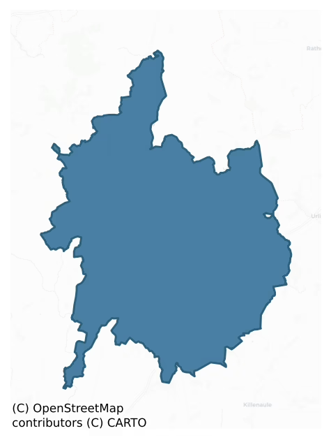
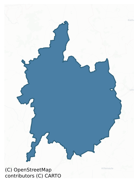
Where this barony sits in the Republic of Ireland
Geology and preservation
Bedrock geology shapes the landscape long before any settlement begins — controlling soil drainage, agricultural potential, the survival of upstanding monuments, and the preservation of buried archaeology. The figures below come from the Geological Survey Ireland 1:100,000 bedrock map.
The bedrock underlying Eliogarty is predominantly limestone (71% of the barony by area), laid down during the Carboniferous period (99% by area, around 359 to 299 million years ago). Limestone is the most heritage-rich bedrock in Ireland. It supports fertile, well-drained soils that favoured dense Early Medieval settlement and Norman manorial agriculture, and it weathers into karst features — sinkholes, caves, swallow holes, and souterrains — that frequently carry archaeology. Where peat overlies limestone, organic preservation can be exceptional. The single largest mapped unit is the Ballysteen Formation (30% of the barony's bedrock).
Rock type composition
Largest mapped unit: Ballysteen Formation (30% of the barony)
Placename evidence
Logainm records 60 heritage-diagnostic placenames for Eliogarty, drawn from townland and civil-parish names across the barony. The dominant stratum is Early Christian ecclesiastical — cill-, teampall-, and domhnach-prefixed names that record the dense network of early church foundations established between the fifth and tenth centuries. The leading diagnostic roots are cill- (24 — church), lios- (12 — ringfort or enclosure), and ráth- (11 — earthen ringfort). This is above the ROI average of 30.7 heritage placenames per barony. The presence of multiple heritage strata side by side indicates layered occupation of the landscape across successive prehistoric and historic periods. Logainm records 283 placenames for Eliogarty (predominantly townland names). Of these, 60 (21%) carry one of the diagnostic Gaelic roots tracked above; the remainder draw on more generic landscape vocabulary that does not encode a heritage period.
Pre-Christian / Early Medieval Defensive
| Root | Count | Meaning |
|---|---|---|
| lios- | 12 | ringfort or enclosure |
| ráth- | 11 | earthen ringfort |
Early Christian Ecclesiastical
| Root | Count | Meaning |
|---|---|---|
| cill- | 24 | church (early) |
| teampall- | 4 | church (later medieval) |
| cillín- | 2 | unconsecrated burial ground |
| gráinseach- | 2 | monastic farm / grange |
| mainistir- | 1 | monastery |
Burial, Ritual, and Norse-Contact
| Root | Count | Meaning |
|---|---|---|
| feart- | 2 | grave mound |
| leacht- | 1 | grave monument |
| sián- | 1 | fairy mound |
Other baronies in Tipperary
- Clanwilliam
- Kilnamanagh Lower
- Owney And Arra
- Glenahiry
- Upperthird
- Middlethird
- Iffa And Offa East
- Condons And Clangibbon — Cork
- Courceys — Cork
- Iffa And Offa East
See all 280 baronies in the Republic of Ireland Heritage Tool.

Explore further
Grounding History: 10 Maps of Northern Ireland’s Past
If you’re interested in Irish heritage more widely, the companion report for Northern Ireland brings together the analysis of all 462 NI wards into one place through 10 high-quality maps — covering monument density, archaeological periods, placename heritage, terrain, wetland, and the historic landscape at first survey. Take a look.
About this profile
Click any section below to expand.
What is a barony?
A barony is a historic administrative unit in Ireland, broadly equivalent to an English hundred. The 280 baronies used here are from the OSi 2019 National Statutory Boundaries (generalised 20m), covering the 26 counties of the Republic of Ireland. Baronies derive from the Norman period, were formalised in the 17th century, and have not been redrawn for statistical purposes. They vary enormously in area, from compact urban baronies in Dublin to vast upland baronies in Connacht, and should not be compared by raw site count without accounting for area differences.
What counts as a site?
This profile combines three distinct heritage registers, each with its own definition of what constitutes a recordable site:
- Archaeological sites (NMS). The National Monuments Service Sites and Monuments Record (SMR) catalogues every known archaeological monument or site of archaeological interest in the Republic, from prehistoric burial mounds and ringforts to medieval churches and post-medieval defensive works. Inclusion does not require legal protection — only that the site has been identified, surveyed, and assessed as having archaeological value. A separate subset of these sites lies within a recorded protection zone, which gives them statutory protection under the National Monuments Acts.
- Listed buildings (NIAH). The National Inventory of Architectural Heritage records buildings of architectural, historical, archaeological, artistic, cultural, scientific, social, or technical interest. Each surveyed structure is appraised on a five-tier scale: International, National, Regional, Local, and Record-Only. The NIAH appraisal is informational rather than strictly statutory, but it underpins local-authority Record of Protected Structures (RPS) listings.
- Heritage placenames (Logainm). Logainm is the authoritative database of Irish placenames maintained by the Placenames Branch. This profile applies a heritage-diagnostic classifier to the Irish-language form of each townland name, flagging roots that signal defensive sites (ráth-, lios-, dún-, caiseal-, cathair-), ecclesiastical foundations (cill-, teampall-, domhnach-, mainistir-), prehistoric burial-ritual features (tuaim-, carn-, leaba-), or Norse-contact settlement (gall-). Townlands without one of these diagnostic roots are not flagged here — they may still carry historical significance, but that significance is not encoded in the name itself.
Editorial principles
The narrative sections of this profile follow several explicit principles:
- Evidential. Every claim about this barony’s heritage character is anchored in the underlying register data. Where a site count, a placename count, or a percentile rank is cited, it is computed from the source datasets at export time, not estimated.
- Comparative. Counts and metrics are reported alongside their percentile rank against the other 279 ROI baronies. A barony with 50 ringforts in absolute terms could be unusually high or unusually low depending on its size and regional context; percentile ranking removes that ambiguity.
- Transparent on limits. Where a register has known coverage gaps, survey biases, or data-quality issues that affect this barony’s figures, the profile flags them rather than presenting the numbers as definitive.
- No interpretation beyond what the data supports. The narrative does not speculate about historical events, social dynamics, or cultural meaning beyond what the recorded heritage and placename evidence directly attests.
Data caveats and limits
- NMS Sites and Monuments Record is the product of survey campaigns conducted at different intensities across different counties and decades. Some baronies have been surveyed more thoroughly than others, and absolute counts should be read in that light. Sites destroyed by development before survey are typically not represented; sites in heavily forested or upland terrain are sometimes under-recorded.
- NIAH coverage is broadly complete for the Republic of Ireland but the survey was conducted on a rolling county-by-county basis, and the most recent appraisal date varies. Buildings demolished or substantially altered after their original survey may still appear in the register; conversely, recent buildings of merit may not yet have been appraised.
- Logainm classification applies a deliberately conservative pattern-matching approach to the Irish-language townland forms. The classifier prioritises true positives over recall: a townland may carry a heritage signal that the classifier doesn’t recognise, particularly where the diagnostic root has been heavily anglicised or where the townland name draws on a less common term. The 60,000+ townland records and ~9,800 classified placenames give a substantial signal at barony scale, but individual townland names should be checked against Logainm directly for definitive interpretation.
- Period attribution. The chronological distribution reflects only those NMS sites that carry a recognised period attribution in the source data. Sites listed as “Unknown” period are excluded from the dated subset.
- Boundary changes. Some baronies have undergone minor boundary adjustments since their 19th-century definition; the OSi 2019 generalised boundaries used here are the current statutory definition and may differ slightly from historical maps in border areas.
- Bedrock geology is mapped at 1:100,000 scale, which means local variation within a barony — small pockets of different rock type, mineral veins, alluvium overlying bedrock — is generalised. The dominant-system and rocktype figures are area-weighted, so a barony reading “70% Carboniferous limestone” may still contain small but archaeologically important pockets of older or younger rock. Around 3% of GSI polygons do not match the lexicon and contribute no rocktype or system attribution.
Data sources
- National Monuments Service — Sites and Monuments Record (SMR) https://data.gov.ie/dataset/national-monuments-service-archaeological-survey-of-ireland
- National Inventory of Architectural Heritage (NIAH) https://data.gov.ie/dataset/national-inventory-of-architectural-heritage-niah-national-dataset
- Logainm — Placenames Database of Ireland https://www.logainm.ie/
- Ordnance Survey Ireland — National Statutory Barony Boundaries 2019 https://data-osi.opendata.arcgis.com/
- EURODEM — European Digital Elevation Model https://www.mapsforeurope.org/datasets/euro-dem
- ESA WorldCover https://esa-worldcover.org/en
- Geological Survey Ireland — 1:100,000 Bedrock Geology https://www.gsi.ie/en-ie/data-and-maps/Pages/Bedrock.aspx
Explore more: Search any of the 280 ROI baronies, browse by historical province, or read the methodology and data sources for the full Republic of Ireland Heritage Tool.