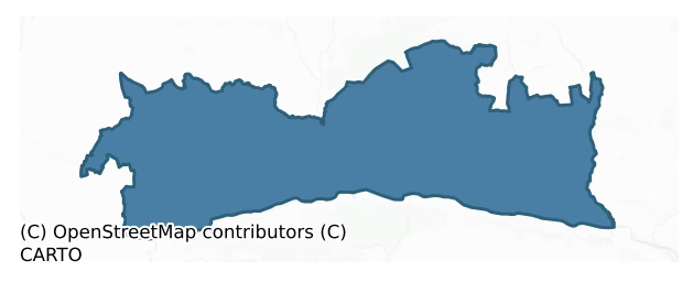
Iffa And Offa East is a barony of County Tipperary, in the historical province of Munster (Irish: Uíbh Eoghain agus Uíbh Fhathaidh Thoir), covering 232 km² of land. The barony records 560 NMS archaeological sites and 331 NIAH listed buildings, placing it at around the 69th percentile among 280 ROI baronies for sites per km². This means it is in the top third of all baronies for sites per km². Dated archaeological evidence runs from the Neolithic through to the Modern, spanning 8 of 9 archaeological periods, placing the barony in the 74th percentile among 280 ROI baronies for chronological depth. This means it is in the top third of all baronies for chronological depth. The largest dated subset of recorded sites dates to the Iron Age. Logainm flags 50 placenames in the barony as carrying a recognised heritage root; the largest share — around 52% — are names associated with early Christian church and monastic foundations.

Heritage at a glance
Percentile rankings throughout this profile compare each barony only against the other 279 Republic of Ireland baronies.
The recorded heritage of Iffa And Offa East
The National Monuments Service Sites and Monuments Record (SMR) is the statutory inventory of archaeological sites for the Republic of Ireland, maintained by the Department of Tourism, Culture, Arts, Gaeltacht, Sport and Media. Sites recorded here include earthworks, ringforts, megalithic tombs, ecclesiastical remains, and post-medieval features; not every record is legally protected, but each is registered as a monument of archaeological interest.
The National Monuments Service records 560 archaeological sites in Iffa And Offa East, putting it at the 69th percentile among 280 ROI baronies for sites per km². This means it is in the top third of all baronies for sites per km². Protection coverage is near-universal — 553 sites (99%) fall within a recorded monument protection zone, indicating an extensively surveyed landscape. The record is dominated by defensive sites — ringforts, enclosures, hillforts, and stone forts (242 sites, 43% of the total), with ecclesiastical sites forming a substantial secondary presence (120 sites, 21%). The most diagnostically specific type is Graveslab (61 records, 11% of the barony's NMS total) — compared to an ROI average of 4% across all baronies where this type occurs. Graveslab is a recumbent grave-marking slab, dated 1200–1700 AD. The broader 'Enclosure' classification — which catches unclassified ringforts and field enclosures — accounts for a further 135 records (24%) and reflects the difficulty of sub-classifying degraded earthworks from surface evidence alone. Other significant types include Ringfort – rath (57) — an earthen ringfort enclosed by a bank and external ditch — the most common Early Medieval farmstead, broadly dated 500–1000 AD. Across the barony's 232 km², this gives a recorded density of 2.42 sites per km².
Most common monument types
Hover or tap a monument type to see its definition.
| Type | Count |
|---|---|
| Enclosure a banked or ditched feature of uncertain type, used as a catch-all where the original function cannot be determined from surface evidence | 135 |
| Graveslab a recumbent grave-marking slab, dated 1200–1700 AD | 61 |
| Ringfort – rath an earthen ringfort enclosed by a bank and external ditch — the most common Early Medieval farmstead, broadly dated 500–1000 AD | 57 |
| Church a building used for public Christian worship, of any date from c. 500 AD onwards | 25 |
| Graveyard a burial area associated with a church, in use from the medieval period onwards | 22 |
| Fulacht fia a horseshoe-shaped Bronze Age burnt mound built around a sunken trough beside a water source, traditionally interpreted as a cooking site | 16 |
| Castle – tower house a fortified residential tower of four or five storeys, mostly built by lords in the 15th and 16th centuries and often within a defended bawn | 10 |
Chronological distribution
The dated archaeological record for Iffa And Offa East spans from the Neolithic through to the Modern, with activity attested across 8 of 9 archaeological periods. This is the 74th percentile across ROI baronies for chronological depth — an above-average span. Every period from earliest to latest is represented in the record — an unbroken sequence of dated activity across the full chronological span. Activity concentrates most heavily in the Iron Age (168 sites, 39% of dated material), with the Medieval forming a secondary peak (119 sites, 28%). A further 130 recorded sites (23% of the overall NMS register for the barony) carry no period attribution — appearing as 'Unknown' in the bar chart below. This typically reflects either records that pre-date the standardised period vocabulary or sites awaiting specialist dating review, rather than a genuine absence of chronological evidence.
Sample of recorded monuments
Show 25 sample monuments (of 560 total)
A representative sample of 25 recorded monuments drawn from the barony’s 560 total NMS entries. Sites within a recorded monument protection zone and rarer site types are prioritised so the list shows a meaningful cross-section rather than only the most common type. Each entry shows the official Sites and Monuments Record reference number and the description published by the National Monuments Service.
Castle – ringwork and bailey
On the flat summit of a ridge in gently undulating terrain, the field N and E of the monument is under tillage, that to the W is in grass. The field boundaries E and NE of the monument have been removed and appear to…
On the flat summit of a ridge in gently undulating terrain, the field N and E of the monument is under tillage, that to the W is in grass. The field boundaries E and NE of the monument have been removed and appear to have been bulldozed into the fosse in the N quadrant. Enclosure (TS077-099—-) is located c. 30m to E. The monument consists of a raised circular area (diam. 19.5m NE-SW) defined by a scarp (H 0.91m) and wide, deep, round-bottomed fosse (Wth 2.4m; D 1.02m) with crescent-shaped bailey (diam. 28.8m NE-SW; max. 12.3m NW-SE) to E. The W half of the ringwork is densely covered with scrub. There is a hollow area S of the bailey which is heavily overgrown with nettles. On the 2nd (1906) ed. OS 6-inch map the N-E-S sides of the ringwork are enclosed by a fosse, which is partially incorporated in a field bank, now destroyed. The fosse of the W side of the ringwork is enclosed by a curving field boundary.
Compiled by: Jean Farrelly
Date of upload: 26 August 2011
Barrow – ditch barrow
Excavated by Doody (1987, 10-21; 1988, 176-80) between April and May 1982. Circular area (diam. 11m) enclosed by a shallow fosse (Wth 1m; D 0.65m) (Doody 1988, 176). Charcoal or charred wood remains were recovered from…
Excavated by Doody (1987, 10-21; 1988, 176-80) between April and May 1982. Circular area (diam. 11m) enclosed by a shallow fosse (Wth 1m; D 0.65m) (Doody 1988, 176). Charcoal or charred wood remains were recovered from portion of the fosse and a C14 date of 1535 +/- 40 BC was obtained from one of the pieces (ibid.). The only other finds in the fosse were two fragmentary sherds of coarse pottery and some waste flint flakes (ibid.). In the centre of the ring-ditch there is a cist (TS077-046003-) which contains an urn with the cremated remains of five individuals. Surrounding this cist, and within the confines of the ring-ditch, there was the remains of a circular timber structure (TS077-046010-), interpreted by the excavator as a mortuary structure (ibid.). Within the ditch barrow there were three pits, varying in size (Wth 0.75m, D 0.29m; Wth 2.05m x 0.35-0.9m, D 0.12-0.16m; Wth 1.25m, D 0.25m), the first contained a small amount of burnt bone and charcoal and the second charcoal enriched soil with stones (Doody 1987, 13). A sample from the second pit provided a radiocarbon date of 860 +/- 90 bc (ibid.). If all three pits are contemporary they may be associated with the Late Bronze Age settlement at Ballyveelish (TS077-046002-) (ibid.).
Compiled by: Jean Farrelly
Date of upload: 26 August 2011
Cross-inscribed pillar
On the summit of a hill, at the highest point in the vicinity. S of cross-pillar is under pasture, area N of stone is planted with young conifers. In the Civil Survey (1654-6) there is a reference to 'the stones…
On the summit of a hill, at the highest point in the vicinity. S of cross-pillar is under pasture, area N of stone is planted with young conifers. In the Civil Survey (1654-6) there is a reference to 'the stones standing, upon the sd hill to the lands of Rathduffe' (Simington 1931, vol. 1, 297). This refers to at least one standing stone in Rathduff townland, part of which appears to have become Giantsgrave townland. In Lewis' topographical dictionary (1837, 508) he refers to an upright stone at Giant's Grave which is 'about eight feet [2.4m] high above the ground, on which two crosses are sculptured; that on one side of the stone is in raised relief, that on the other in bas relief'. Again the stone and two crosses are described in the OS Letters (O'Flanagan 1930, vol. 1, 51-2) at which time there was 'a small piece of land left untilled about this stone measuring eighteen feet [5.5m] from east to west and seven feet [2m] from north to south'. According to the OS Letters the hill was called 'An Cnoc Air a bhFuair Fionn Fios i.e., the hill on which Finn (Mac Cumhaill) received his (prophetic) knowledge, and the Townland is called An Chloch Fhada i.e., the Long Stone, in Irish, and Giant's Grave in English' (ibid.). Another local legend claimed that the stone was cast from the top of Slievenamon by a giant to its present position (White 1892, 28), while another tradition asserted that the stone was erected to mark the grave of some Ulstermen who fell in a sortie during the…
Religious house – Knights Templars
Gwynn and Hadcock (1988, 330) refer to Rathronan as being a manor of the Templars and 'during his brief tenure after the accession of Q. Elizabeth, Prior Massingberd of Kilmainham leased out the tithes of Rathernonane…
Gwynn and Hadcock (1988, 330) refer to Rathronan as being a manor of the Templars and 'during his brief tenure after the accession of Q. Elizabeth, Prior Massingberd of Kilmainham leased out the tithes of Rathernonane and other places: Fiant Q.Eliz. 2208'. Power (1908, 5) and the OS Letters mention this as the location of an earlier church (O'Flanagan 1930, vol. 1, 51). On top of a hill in a commanding position, with good views in every direction. The present church is a late 18th-century C of I church in ruins. There is no visible trace of an earlier church.
Compiled by: Jean Farrelly
Date of upload: 26 August 2011
Ritual site – holy tree/bush
Indicated on the 1904 ed. OS 6-inch map as 'The Bell Tree', a name which could be a corruption of the Irish 'bile' meaning holy tree. The OS letters (1840) mention 'a large ash tree in full bloom, measuring eighteen…
Indicated on the 1904 ed. OS 6-inch map as 'The Bell Tree', a name which could be a corruption of the Irish 'bile' meaning holy tree. The OS letters (1840) mention 'a large ash tree in full bloom, measuring eighteen feet six inches [5.63m] in circumference at the base, about one hundred paces to the east of it [i.e. the 'Fort of Rath Ronain' TS-77-061—-]'. According to Lucas (1963, 23), 'a local writer in 1949 referred to [it] as the "bella tree" and described [it] as in decay'. There is no trace of this tree which according to local information was felled in 1958, before which it was a popular meeting place known as the 'bella tree'. A young ash was planted in its place. There are a variety of trees in this location, all of which appear to be young.
Compiled by: Jean Farrelly
Date of upload: 26 August 2011
Ecclesiastical enclosure
Enclosure encircling the crest of a hill and part of the SW slope, in hilly terrain, under pasture. The enclosure is marked as a 'Burial Ground' on the 1st (1840) ed. OS 6-inch map. The N and W sides of the graveyard…
Enclosure encircling the crest of a hill and part of the SW slope, in hilly terrain, under pasture. The enclosure is marked as a 'Burial Ground' on the 1st (1840) ed. OS 6-inch map. The N and W sides of the graveyard (TS077-078003-) are straight, however, the S and E sides are curving, possibly indicating the curve of an earlier enclosure. The much denuded church (TS077-078001-) lies W of centre within the graveyard. Within the graveyard a low earth and stone bank runs N-S parallel to and near the W side of the enclosure. The enclosing element is typical of a field bank (Wth 0.9m crest, c. 2.8m base; int. H 1.13m) and is surmounted by hedgerow. Approx. 2m beyond the straight-sided N wall, externally, there is a curving bank (Wth 1.8m; int. H 0.6m; ext. H 0.5m) which may be the original line of the ecclesiastical enclosure. There is no trace of this bank in field to N and W, both of which are under tillage. In the field immediately S of the church and graveyard there is a low rectangular platform (diam. 19m N-S; 41m E-W) defined by a scarp (max. H 0.87m) on the S and W sides and a field bank to N and E.
Compiled by: Jean Farrelly
Date of upload: 26 August 2011
Weir – fish
The Civil Survey (1654-6) (Simington 1931, vol. 1, 291) mentions 'a weare uppon the River of Annor betweene the said lands of Ballenvohyr and the lands of Newtown-Annor in the Parrish of Killoluan'. Two weirs are…
The Civil Survey (1654-6) (Simington 1931, vol. 1, 291) mentions 'a weare uppon the River of Annor betweene the said lands of Ballenvohyr and the lands of Newtown-Annor in the Parrish of Killoluan'. Two weirs are indicated on the 1st (1840) ed., one called 'Eel Weir' while that to W is unnamed. Both are also indicated on the 2nd (1904) ed., again only the E weir is named. The Anner is fast flowing at this stretch. There was no visible evidence of either weir at time of inspection.
Compiled by: Jean Farrelly
Date of upload: 26 August 2011
Castle – motte and bailey
At the W edge of a natural N-S ridge in undulating terrain, in valley S of Slievenamon Mountain, in pasture. A tributary of the Anner River flows E-W c. 180m N of the motte and bailey and a modern road is located c. 80m…
At the W edge of a natural N-S ridge in undulating terrain, in valley S of Slievenamon Mountain, in pasture. A tributary of the Anner River flows E-W c. 180m N of the motte and bailey and a modern road is located c. 80m to W. Steep-sided oval-shaped motte (top diam. 11m N-S; 7m E-W; H 5.4-6m; basal diam. 34.7m N-S; 32.8m E-W) built into the natural ridge with a fosse (Wth 2m; D 0.15m) at base of W sector. The E quadrant and lower slope of the W quadrant has been subject to cattle erosion. Roughly triangular-shaped bailey (diam. 33m N-S; 24.5m E-W; H 1.7m to E; 1.36m to W) utilises ridge immediately S of motte, the interior slopes to the E.
Compiled by: Jean Farrelly
Date of upload: 26 August 2011
House – fortified house
According to the Civil Survey (1654-6) (Simington 1931, vol. 1, 273) the proprietor in 1640 was 'Dorothy Shea the Relict of Henry Shea of Kilkenny deceased gent Robt. Shea of Kilkenny the heire. Irish Papist….The said…
According to the Civil Survey (1654-6) (Simington 1931, vol. 1, 273) the proprietor in 1640 was 'Dorothy Shea the Relict of Henry Shea of Kilkenny deceased gent Robt. Shea of Kilkenny the heire. Irish Papist….The said Dorothy Shea Proprietrix of the said lands of Ballyglissen as her dower in right of her husband Henry Shea decd. John Grove an English Protestant was tennt. of this fearme in 1640 but for what tearme or at what rent wee know not. Uppon the said lands stands a small castle not in good repaire and severall thatcht Cabbins'. The description of the house in the OS Letters (O'Flanagan 1930, vol. 1, 60) mentions that the house was 'lighted by fourteen windows all constructed of cut limestone and divided, some into two, some into three and some into four compartments'. Most of the windows have been widened or altered but as no reference is made to this in the OS Letters it would imply that these changes were made post 1840. Some of the windows retain traces of their external hood-mouldings. Situated on level ground, however, land rises NW of fortified house. Bungalow to W and 19th-century farm buildings to NE and S. Late, probably 19th-century, wall (H 3.1m) runs SW from SW gable. Farm building abuts SW face of fortified house near S angle. Farmyard is enclosed by a stone wall which is possibly the bawn (TS078-047002-) contemporary with the fortified house. The fortified house is a rectangular building (ext. dims. 14.5m NE-SE; 9.73m NW-SE) with a semi-circular sta…
Kiln
At the base of an E-facing slope of low ridge running roughly N-S. Field under tillage. No visible trace at ground level. This kiln was excavated in 1986 and consisted of 'the side walls of a partly destroyed,…
At the base of an E-facing slope of low ridge running roughly N-S. Field under tillage. No visible trace at ground level. This kiln was excavated in 1986 and consisted of 'the side walls of a partly destroyed, keyhole-shaped corn-drying kiln, maximum dimensions 6.60m long and 1.30m wide. An area of rough pebble paving was revealed at the entrance area of the drafting flue which had a clearly defined 'fire-bowl'. Remains of charred cereal grain were retrieved from the fill of the circular drying chamber…There were no other features or finds' (O'Donnell 1987, 33). A full description of the excavation is published (Gowen 1988, 158-62).
Compiled by: Jean Farrelly
Date of upload: 26 August 2011
Barrow – embanked barrow
At foot of S slope of Slievenamon mountain, in flat terrain, under pasture. Woodland to N of E-W field boundary. Raised oval area (diam. 15m N-S; 17.3m E-W) defined by a broad earthen bank (Wth 4.3m; int. H 0.28m; ext.…
At foot of S slope of Slievenamon mountain, in flat terrain, under pasture. Woodland to N of E-W field boundary. Raised oval area (diam. 15m N-S; 17.3m E-W) defined by a broad earthen bank (Wth 4.3m; int. H 0.28m; ext. H 1.86m) best preserved in SW quadrant and external fosse (Wth 3.5m; D 0.3-0.45m). Barrow has suffered from cattle erosion and root damage from trees growing on the bank. Fosse is not visible from SE-E-N. Field clearance dumped along edge of barrow in NE and SE sectors. Bank largely reduced to scarp in N sector.
Compiled by: Jean Farrelly
Date of upload: 26 August 2011
Cross – Tau cross
According to Power (1908, 9-10) the field is known as the 'Field of the Early Church Site' and was sacred to St. Bearachan. He goes on to say that the church (TS078-061001-)was situated by the W side of a little stream…
According to Power (1908, 9-10) the field is known as the 'Field of the Early Church Site' and was sacred to St. Bearachan. He goes on to say that the church (TS078-061001-)was situated by the W side of a little stream and associated it were some quern stones (TS078-061003-), a stone cross (TS078-061002-) and a stone object resembling a chalice (ibid.). The latter object was located in Waterford Museum (ibid.). The cross of red sandstone is T-shaped (Wth 0.38m; H 0.26m; D 0.08m), typical of Tau Crosses.
Compiled by: Jean Farrelly
Date of upload: 26 August 2011
Cross
Stone cross situated on a small island in an artifical pond, formerly in wet ground, adjacent to the church (TS083-004001-) and holy well (TS083-004002-) of St. Patrick. According to Bagwell (1909, 268) 'as an act of…
Stone cross situated on a small island in an artifical pond, formerly in wet ground, adjacent to the church (TS083-004001-) and holy well (TS083-004002-) of St. Patrick. According to Bagwell (1909, 268) 'as an act of penance or devotion, poor people used to approach it on their knees'. Imperforate ring-headed cross (H 1.15m) composed of sandstone with quartz pebble inclusions. The SW face of the cross is better preserved, though there is no visible evidence of carving. The NE face (Wth 0.53m) has an undulating surface which may represent the remains of very faded carving.
Compiled by: Jean Farrelly
Date of upload: 26 August 2011
Mill – unclassified
On flat terrain in river valley of Suir, low-lying. In the 17th century there were two mills in 'Abyneslewnaght' on the land of 'Patricke Goegh of Kilmaniheen in the County of Waterford Esqr Irish Papist' (Simington…
On flat terrain in river valley of Suir, low-lying. In the 17th century there were two mills in 'Abyneslewnaght' on the land of 'Patricke Goegh of Kilmaniheen in the County of Waterford Esqr Irish Papist' (Simington 1931, vol. 1, 307). On this land 'stands the walls of an old Aby, one grist mill and one tuckinge Mill, both lately rebuilt by Thomas Batty of Clonmell Esqr' (ibid.). Abyneslewnaght has been identified with Inishlounaght townland and 200m SW of the site of the abbey, just within Marlfield townland, there was a mill marked 'Abbey Mill' on the 1st (1840-41) ed. OS 6-inch map. There is no mill marked on 1950-51 OS revision and the mill has been demolished. However, there are the remains of a wall with lime render which was probably part of the mill complex and which now acts as a field boundary. A fast flowing channelised mill race also survives.
Compiled by: Jean Farrelly
Date of upload: 26 August 2011
Religious house – Cistercian monks
In the lowlying river valley of the River Suir, c. 400m S of Marlfield village which is two miles W of Clonmel. Cistercian Abbey, founded as a daughter house of Mellifont in 1148, the affiliation was transferred to…
In the lowlying river valley of the River Suir, c. 400m S of Marlfield village which is two miles W of Clonmel. Cistercian Abbey, founded as a daughter house of Mellifont in 1148, the affiliation was transferred to Monasteranenagh three years later (Stalley 1987, 246). Malachy O'Phelan, Prince of the Decies and Donal Mor O'Brien, king of Limerick, re-endowed the monastery in 1187 (Gwynn and Hadcock 1988, 135; Stalley 1987, 246). The monastery had daughter houses in Fermoy, Cork; Corcomroe, Clare and Glanawydan, Waterford (Stalley 1987, 246). In 1467 the buildings were in need of repair (ibid.). In 1540 the monastery was dissolved and early the following year 'the jurors reported that the church could be demolished, other buildings being necessary for the farmer, Thomas Butler' (Gwynn and Hadcock 1988, 136). Despite this the walls were standing in the mid-17th century 'Uppon the sd colpe ['Abyneslewnaght'] stands the walls of an old Aby' (Simington 1931, vol. 1, 307) and in 1746 the church was described as 'in ruins' (Smith 1746, 48). Though the abbey no longer survives, fragments (TS083-017001-; TS083-017002-; TS083-017003-) are incorportated in the 19th-century C of I church which was built on the site of the monastery (Shee and Watson 1975, 56). A medieval graveslab (TS083-017004-) is embedded in the floor at the threshold of the inner W door. Carpet has been laid in the centre aisle which could not be lifted, there may be more fragments beneath this. There are early gra…
Religious house – Franciscan friars
In the SE angle of the town wall, E of Abbey Street. This Franciscan friary was founded in 1269 by Otho de Grandison (Morrissey 1909, 248-50). The former chancel of the 13th-century church is co-terminous with the…
In the SE angle of the town wall, E of Abbey Street. This Franciscan friary was founded in 1269 by Otho de Grandison (Morrissey 1909, 248-50). The former chancel of the 13th-century church is co-terminous with the present N aisle, while the nave, which was demolished in c. 1760, originally extended to the W, crossing Abbey Street (Shee and Watson 1975, 30). Its foundations now lie beneath the car park immediately W of the Friary (Shee and Watson 1975, 11-12). It is probable that the cloister and domestic buildings were located to the S of the church (Shee and Watson 1975, 11-12). A N transcept or Lady Chapel was added in 1318 (Conlan 1999, 100). At the time of the Dissolution in 1540 the friary consisted of 'a church, a belfry, a dormitory, a hall, three chambers, a kitch, a stable, …a weir' and land (Morrissey 1909, 248-50). During Cromwell's attack on Clonmel in 1650 the friary was badly damaged. The 'ffort of Clonmel' was built there soon afterwards, thereby destroying the claustral buildings (Shee and Watson 1975, 11-12). Towards the end of the 17th century a number of weavers brought from England established their factory at the old fort of Clonmel (Shee and Watson 1975, 11-12). In 1705 the chancel was repaired for use as a Dissenter's chapel and remained as such until 1789 when the friars once again took possession (Shee and Watson 1975, 11-12). In c. 1813 the building was converted into a barrack (Morrissey 1909, 248-50). The friary was reopened in 1828 (Craig and…
Courthouse
In a prominent position at the E end of O'Connell Street. The Main Guard was built by James Butler, first Duke of Ormond, between 1673 and 1684 as a prestigious courthouse for the Palatinate of County Tipperary (Quinlan…
In a prominent position at the E end of O'Connell Street. The Main Guard was built by James Butler, first Duke of Ormond, between 1673 and 1684 as a prestigious courthouse for the Palatinate of County Tipperary (Quinlan 1991, 2). Stonework from the Cistercian abbey at Inishlounaght (TS083-017—-) was reused to built the courthouse. This can be seen at the base of the southern column of the arcade which has traces of fluting and on the easternmost pier on Mitchell street which has a rare survival of plaster incised with a consecration cross. The building has many of the hallmarks of a Sir Christopher Wren design, and it is likely that its architect, possibly Sir William Robinson, Surveyor General of Ireland (Shee and Watson 1975, 35-6), was influenced by Wren's works. In c. 1715 the palatinate jurisdiction was extinguished and the building was subseqently used as a tholsel and seat of the Assize Courts until 1803, when the present courthouse was completed (Killanin and Duignan 1967, 173). It is believed that the Assize Courts stood to the rear of the Main Guard, in the return block which extended eastwards to the rear of the front building and whose outline was confirmed by excavation (Henry 1996, 81). In c. 1810 the ground floor, a loggia of open arches, was converted into shops (ibid.). It is a long rectangular building built of sandstone ashlar consisting of a open arcade at ground-floor level and a first floor. It has a moulded triangular floating pediment and heavy co…
Religious house – Dominican friars
The OS letters mention that a Dominican Friary was founded in Clonmel in 1269 (O'Flanagan 1930, vol. 3, 71). According to Lyons (1936, 288) the Dominican Priory was located on the W side of the junction between Blue…
The OS letters mention that a Dominican Friary was founded in Clonmel in 1269 (O'Flanagan 1930, vol. 3, 71). According to Lyons (1936, 288) the Dominican Priory was located on the W side of the junction between Blue Anchor Lane and O'Connell St. He refers to an ancient doorway 'in the Pointed style' in the cellar of the premises on the site (ibid.). In 1541 only two friaries, Carmelite and Franciscan, are mentioned in Clonmel and it has been suggested that the Dominican community of Clonmel were not established until shortly before 1643 and that it only existed until the Cromwellian persecution (Gwynn and Hadcock 1970, 232-3). There appear to have been four Dominican martyrs between 1649-51 (ibid.). When the Dominicans returned to Clonmel after the Restoration, they could not prove that theirs was an ancient foundation so that the Franciscans prevented them from remaining (ibid.). A sheela-na-gig (TS083-019048-) found in Blue Anchor lane in 1944 is thought to be associated with the Priory (Freitag 2004, 130). (Farrelly and FitzPatrick 1993, 75).
Compiled by: Jean Farrelly
Date of revised upload: 30 January 2015
Castle – Anglo-Norman masonry castle
At the E end of town, E of Castle Street, on the N bank of the River Suir. The Butler castle is said to have been built in 1309 on the site of a Poor Clare convent (TS085-004003-)(Killan and Duignan 1967, 143). A castle…
At the E end of town, E of Castle Street, on the N bank of the River Suir. The Butler castle is said to have been built in 1309 on the site of a Poor Clare convent (TS085-004003-)(Killan and Duignan 1967, 143). A castle at Carrick is mentioned in a grant of the castle and manor of Carrickmacgriffin by King Edward II to Edmund Butler in 1315 (Fenlon 1996, 27). The castle is mentioned in 1361 as being 'on the south, [of the town wall] upon which a chapel and ruin annexed to the said castle are situated' and again in 1366 (Fenlon 1996, 28). It would appear to have been a keepless or 'enclosure' castle consisting of a courtyard. Originally the curtain wall was D-shaped at the river end, footings of a curved section of wall are visible at the E angle of the lower courtyard (Fenlon 1996, 27). There is a watergate, at least three-stories high, on the river bank and it is probable that another gateway building stood on the N front (Fenlon 1996, 27). The arched entrance of the watergate has been blocked up and only the S wall and foundations of the E wall survive. At both first and second-floor level the is a roughly centrally placed three-light, segmental-headed window. In the 15th century, c. 1445, two tower houses were erected, supposedly by Eamonn mac Risterd Butler (Empey 1982, 207). The E tower house is five stories high with a vault over the ground floor. The ground floor is lit by arrow loops while the upper floors have mullioned windows inserted into earlier window opening…
House – 16th century
At the E end of town, E of Castle Street, on the N bank of the River Suir. In 1565 this tudor mansion was added to the existing tower house complex (TS085-004010-) by Thomas Butler or 'Black Tom', 10th Earl of Ormond…
At the E end of town, E of Castle Street, on the N bank of the River Suir. In 1565 this tudor mansion was added to the existing tower house complex (TS085-004010-) by Thomas Butler or 'Black Tom', 10th Earl of Ormond (Fenlon 2008). The castle was captured by Cromwellian forces in 1650, only to come under attack again by Royalist forces under Inchiquin. The resulting damage was repaired by the 12th Earl in 1660. However, following this Earl's death the house was not used again as a Butler residence. It was rented out to tenants during the 18th and 19th centuries (Lanigan 1965, 31-7) and gradually fell into disrepair. The building eventually became the property of the State and was fully restored by the Office of Public Works. The 16th-century house is U-shaped, forming three sides of a courtyard, with a pre-existing tower house terminating each wing. According to Leask (1951, 145-7) and Waterman (1961, 252-3) the courtyard was fully enclosed, the fourth side being formed by the 'main front of an earlier castle with large terminal towers'. The S side of the courtyard is formed by a wall with central entrance which is in an architectural style in keeping with the house. The decorative false quoin plaster work around this entrance is in keeping with mid-late 16th/early 17th-century architectural fashions and there is also evidence of this type of plasterwork on the N angle of the main house. The house is two-storey with a multi-gabled attic and is one room wide. The long hall…
Religious house – Franciscan nuns (Poor Clares)
At the E end of town, E of Castle Street, on the N bank of River Suir. The Butler Castle (TS085-004001-) is said to have been built on the site of a Poor Clare convent (Gwynn and Hadcock 1988, 314). Possibly one of the…
At the E end of town, E of Castle Street, on the N bank of River Suir. The Butler Castle (TS085-004001-) is said to have been built on the site of a Poor Clare convent (Gwynn and Hadcock 1988, 314). Possibly one of the three convents of Franciscan nuns in Ireland mentioned by Peter de Trau in 1385-99 (ibid.).
Compiled by: Jean Farrelly
Date of upload: 26 August 2011
Sheela-na-gig
Formerly located in the church at Newtown Lower (TS079-015001-), acquired by the National Museum of Ireland in 1968 (Lucas and Raftery 1971, 232). Roughly carved stone (dims. 0.36m H x 0.28m Wth x 0.18m D) to represent…
Formerly located in the church at Newtown Lower (TS079-015001-), acquired by the National Museum of Ireland in 1968 (Lucas and Raftery 1971, 232). Roughly carved stone (dims. 0.36m H x 0.28m Wth x 0.18m D) to represent a human head and torso with arms pulling the vulva apart. Head is crudely carved with hollows to represent the eyes and mouth and a raised ridge to form the nose. The pointed chin rests on the chest. No indication of breasts or legs. (Lucas 1971, 232).
Compiled by: Jean Farrelly
Date of upload: 26 August 2011
Standing stone (present location)
A standing stone (0.55m x 0.52m; H 2m), rectangular in plan, was lying prostate in its original position (see TS079-049—-) before it was moved c. 20 years ago (c. 1980) c. 300m to the S and placed in an upright…
A standing stone (0.55m x 0.52m; H 2m), rectangular in plan, was lying prostate in its original position (see TS079-049—-) before it was moved c. 20 years ago (c. 1980) c. 300m to the S and placed in an upright position in the front garden of a bungalow. It is currently completely obscured by the dense cover of a cotoneaster scrub. According to the landowner there were chisel marks on the side of the stone.
Compiled by: Jean Farrelly
Date of upload: 26 August 2011
Mass-rock
On a S-facing slope c. 25m from W bank of a stream flowing roughly N-S, in pasture. According to Power (1908, 9-10) the field is known as the 'Field of the Early Church Site' and was sacred to St. Bearachan. The red…
On a S-facing slope c. 25m from W bank of a stream flowing roughly N-S, in pasture. According to Power (1908, 9-10) the field is known as the 'Field of the Early Church Site' and was sacred to St. Bearachan. The red sandstone mass-rock (H 0.81m) is located immediately W face of a N-S field boundary. It is aligned NW-SE and is roughly rectangular in plan (L 1.12m; max.T c. 0.33m). The top surface is quite worn and water has gathered in a slight depression. The stone bears no inscription. It is located 0.62m W of a bullaun stone (TS078-061004-) and stone cross (TS078-061002-).
Compiled by: Jean Farrelly
Date of upload: 26 August 2011
Enclosure
In mature forestry, currently being felled, on a gentle E-facing slope. Access not gained. Depicted on 1st (1840) and 2nd (1904) ed. OS 6-inch maps as circular enclosure (diam. c. 32m). Field boundary depicted at…
In mature forestry, currently being felled, on a gentle E-facing slope. Access not gained. Depicted on 1st (1840) and 2nd (1904) ed. OS 6-inch maps as circular enclosure (diam. c. 32m). Field boundary depicted at tangent to E on 1843 map and truncating E-sector on current map. No buffer zone in forestry noted from vantage point of Sheegouna. It is possible that this monument has been levelled and is the one described by Keatinge (1858-9, 11) as 'the site of another fort (but which is now levelled)'.
Compiled by: Jean Farrelly
Date of revised upload: 30 September 2014
Listed buildings
The National Inventory of Architectural Heritage (NIAH) is a state survey appraising buildings of architectural, historical, archaeological, artistic, cultural, scientific, social, or technical interest. Each surveyed structure receives a rating from International (the highest, for buildings of European importance) through National, Regional, Local, and Record-Only.
The NIAH records 331 listed buildings in Iffa And Offa East, the 89th percentile across ROI baronies for listed-building density. Among these, 5 are graded National — buildings of interest to the whole of Ireland rather than only its region. The Republic holds 937 National-graded buildings in total, so this barony accounts for around 1% of the national total. Construction dates concentrate most heavily in the Victorian (1830-1900) period. The most-recorded building type is house (170 examples, 51% of the listed stock).
Terrain and environment
Mean elevation across the barony is 92m — the 52nd percentile among 280 ROI baronies for elevation. This means it is in the upper half of all baronies for elevation. Elevation matters for heritage because higher-altitude baronies typically favour defensive monuments — ringforts and hilltop forts placed on prominent ground — while lowland baronies are more likely to carry the dense settlement and church networks of intensive agricultural landscapes. The barony reaches 718m at its highest point — a vertical span of more than 625m within its boundary, indicating significant topographic diversity. Mean slope is 4.3° — the 66th percentile among 280 ROI baronies for slope. This means it is in the upper half of all baronies for slope. Slope is a key control on both land use and archaeological preservation: steep ground resists ploughing and tends to preserve earthworks intact, while gentle slopes favour intensive cultivation that damages or destroys surface archaeology over time. The Topographic Wetness Index averages 10.6, the 40th percentile among 280 ROI baronies for wetness. This means it is in the lower half of all baronies for wetness. Drainage matters for heritage because poorly-drained ground preserves organic archaeology (wooden trackways, leather, textiles, and on rare occasions human remains) far better than free-draining soil; well-drained ground favours arable use but destroys organic material rapidly. The land-cover mosaic combines improved grassland (68%), arable farmland (16%), and woodland (14%), giving a mixed agricultural and semi-natural landscape.
Terrain measurements
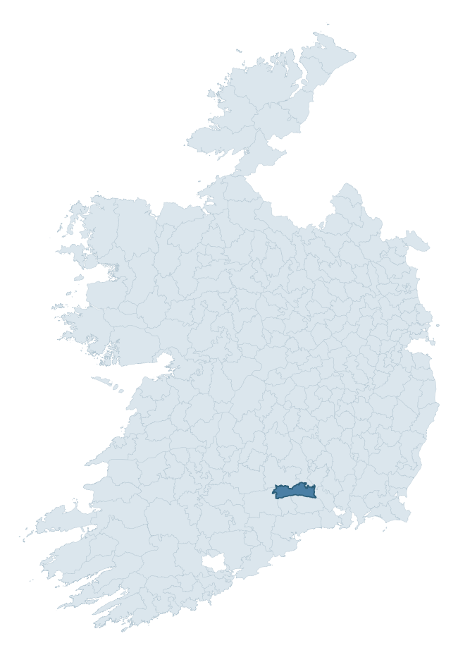
Where this barony sits in the Republic of Ireland
Geology and preservation
Bedrock geology shapes the landscape long before any settlement begins — controlling soil drainage, agricultural potential, the survival of upstanding monuments, and the preservation of buried archaeology. The figures below come from the Geological Survey Ireland 1:100,000 bedrock map.
The bedrock underlying Iffa And Offa East is predominantly limestone (75% of the barony by area), laid down during the Carboniferous period (81% by area, around 359 to 299 million years ago). Limestone is the most heritage-rich bedrock in Ireland. It supports fertile, well-drained soils that favoured dense Early Medieval settlement and Norman manorial agriculture, and it weathers into karst features — sinkholes, caves, swallow holes, and souterrains — that frequently carry archaeology. Where peat overlies limestone, organic preservation can be exceptional. The single largest mapped unit is the Waulsortian Limestones (25% of the barony's bedrock).
Rock type composition
Largest mapped unit: Waulsortian Limestones (25% of the barony)
Placename evidence
Logainm records 50 heritage-diagnostic placenames for Iffa And Offa East, drawn from townland and civil-parish names across the barony. The dominant stratum is Early Christian ecclesiastical — cill-, teampall-, and domhnach-prefixed names that record the dense network of early church foundations established between the fifth and tenth centuries. The leading diagnostic roots are cill- (17 — church), ráth- (15 — earthen ringfort), and lios- (6 — ringfort or enclosure). This is above the ROI average of 30.7 heritage placenames per barony. Logainm records 206 placenames for Iffa And Offa East (predominantly townland names). Of these, 50 (24%) carry one of the diagnostic Gaelic roots tracked above; the remainder draw on more generic landscape vocabulary that does not encode a heritage period.
Pre-Christian / Early Medieval Defensive
| Root | Count | Meaning |
|---|---|---|
| ráth- | 15 | earthen ringfort |
| lios- | 6 | ringfort or enclosure |
| dún- | 1 | hilltop or promontory fort |
| caiseal- | 1 | stone ringfort |
| cathair- | 1 | stone fort |
Early Christian Ecclesiastical
| Root | Count | Meaning |
|---|---|---|
| cill- | 17 | church (early) |
| teampall- | 3 | church (later medieval) |
| tobar- | 3 | holy well |
| domhnach- | 2 | pre-Patrician or earliest Patrician church |
| gráinseach- | 1 | monastic farm / grange |
Other baronies in Tipperary
- Clanwilliam
- Upperthird
- Kilnamanagh Lower
- Glenahiry
- Ormond Lower
- Eliogarty
- Ormond Upper
- Iveragh — Kerry
- Carbery East (east Division) — Cork
- Clonderalaw — Clare
See all 280 baronies in the Republic of Ireland Heritage Tool.

Explore further
Grounding History: 10 Maps of Northern Ireland’s Past
If you’re interested in Irish heritage more widely, the companion report for Northern Ireland brings together the analysis of all 462 NI wards into one place through 10 high-quality maps — covering monument density, archaeological periods, placename heritage, terrain, wetland, and the historic landscape at first survey. Take a look.
About this profile
Click any section below to expand.
What is a barony?
A barony is a historic administrative unit in Ireland, broadly equivalent to an English hundred. The 280 baronies used here are from the OSi 2019 National Statutory Boundaries (generalised 20m), covering the 26 counties of the Republic of Ireland. Baronies derive from the Norman period, were formalised in the 17th century, and have not been redrawn for statistical purposes. They vary enormously in area, from compact urban baronies in Dublin to vast upland baronies in Connacht, and should not be compared by raw site count without accounting for area differences.
What counts as a site?
This profile combines three distinct heritage registers, each with its own definition of what constitutes a recordable site:
- Archaeological sites (NMS). The National Monuments Service Sites and Monuments Record (SMR) catalogues every known archaeological monument or site of archaeological interest in the Republic, from prehistoric burial mounds and ringforts to medieval churches and post-medieval defensive works. Inclusion does not require legal protection — only that the site has been identified, surveyed, and assessed as having archaeological value. A separate subset of these sites lies within a recorded protection zone, which gives them statutory protection under the National Monuments Acts.
- Listed buildings (NIAH). The National Inventory of Architectural Heritage records buildings of architectural, historical, archaeological, artistic, cultural, scientific, social, or technical interest. Each surveyed structure is appraised on a five-tier scale: International, National, Regional, Local, and Record-Only. The NIAH appraisal is informational rather than strictly statutory, but it underpins local-authority Record of Protected Structures (RPS) listings.
- Heritage placenames (Logainm). Logainm is the authoritative database of Irish placenames maintained by the Placenames Branch. This profile applies a heritage-diagnostic classifier to the Irish-language form of each townland name, flagging roots that signal defensive sites (ráth-, lios-, dún-, caiseal-, cathair-), ecclesiastical foundations (cill-, teampall-, domhnach-, mainistir-), prehistoric burial-ritual features (tuaim-, carn-, leaba-), or Norse-contact settlement (gall-). Townlands without one of these diagnostic roots are not flagged here — they may still carry historical significance, but that significance is not encoded in the name itself.
Editorial principles
The narrative sections of this profile follow several explicit principles:
- Evidential. Every claim about this barony’s heritage character is anchored in the underlying register data. Where a site count, a placename count, or a percentile rank is cited, it is computed from the source datasets at export time, not estimated.
- Comparative. Counts and metrics are reported alongside their percentile rank against the other 279 ROI baronies. A barony with 50 ringforts in absolute terms could be unusually high or unusually low depending on its size and regional context; percentile ranking removes that ambiguity.
- Transparent on limits. Where a register has known coverage gaps, survey biases, or data-quality issues that affect this barony’s figures, the profile flags them rather than presenting the numbers as definitive.
- No interpretation beyond what the data supports. The narrative does not speculate about historical events, social dynamics, or cultural meaning beyond what the recorded heritage and placename evidence directly attests.
Data caveats and limits
- NMS Sites and Monuments Record is the product of survey campaigns conducted at different intensities across different counties and decades. Some baronies have been surveyed more thoroughly than others, and absolute counts should be read in that light. Sites destroyed by development before survey are typically not represented; sites in heavily forested or upland terrain are sometimes under-recorded.
- NIAH coverage is broadly complete for the Republic of Ireland but the survey was conducted on a rolling county-by-county basis, and the most recent appraisal date varies. Buildings demolished or substantially altered after their original survey may still appear in the register; conversely, recent buildings of merit may not yet have been appraised.
- Logainm classification applies a deliberately conservative pattern-matching approach to the Irish-language townland forms. The classifier prioritises true positives over recall: a townland may carry a heritage signal that the classifier doesn’t recognise, particularly where the diagnostic root has been heavily anglicised or where the townland name draws on a less common term. The 60,000+ townland records and ~9,800 classified placenames give a substantial signal at barony scale, but individual townland names should be checked against Logainm directly for definitive interpretation.
- Period attribution. The chronological distribution reflects only those NMS sites that carry a recognised period attribution in the source data. Sites listed as “Unknown” period are excluded from the dated subset.
- Boundary changes. Some baronies have undergone minor boundary adjustments since their 19th-century definition; the OSi 2019 generalised boundaries used here are the current statutory definition and may differ slightly from historical maps in border areas.
- Bedrock geology is mapped at 1:100,000 scale, which means local variation within a barony — small pockets of different rock type, mineral veins, alluvium overlying bedrock — is generalised. The dominant-system and rocktype figures are area-weighted, so a barony reading “70% Carboniferous limestone” may still contain small but archaeologically important pockets of older or younger rock. Around 3% of GSI polygons do not match the lexicon and contribute no rocktype or system attribution.
Data sources
- National Monuments Service — Sites and Monuments Record (SMR) https://data.gov.ie/dataset/national-monuments-service-archaeological-survey-of-ireland
- National Inventory of Architectural Heritage (NIAH) https://data.gov.ie/dataset/national-inventory-of-architectural-heritage-niah-national-dataset
- Logainm — Placenames Database of Ireland https://www.logainm.ie/
- Ordnance Survey Ireland — National Statutory Barony Boundaries 2019 https://data-osi.opendata.arcgis.com/
- EURODEM — European Digital Elevation Model https://www.mapsforeurope.org/datasets/euro-dem
- ESA WorldCover https://esa-worldcover.org/en
- Geological Survey Ireland — 1:100,000 Bedrock Geology https://www.gsi.ie/en-ie/data-and-maps/Pages/Bedrock.aspx
Explore more: Search any of the 280 ROI baronies, browse by historical province, or read the methodology and data sources for the full Republic of Ireland Heritage Tool.