
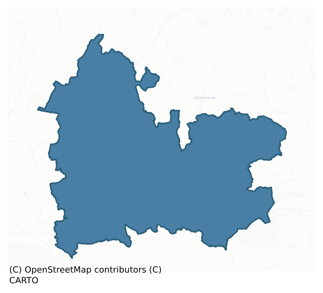
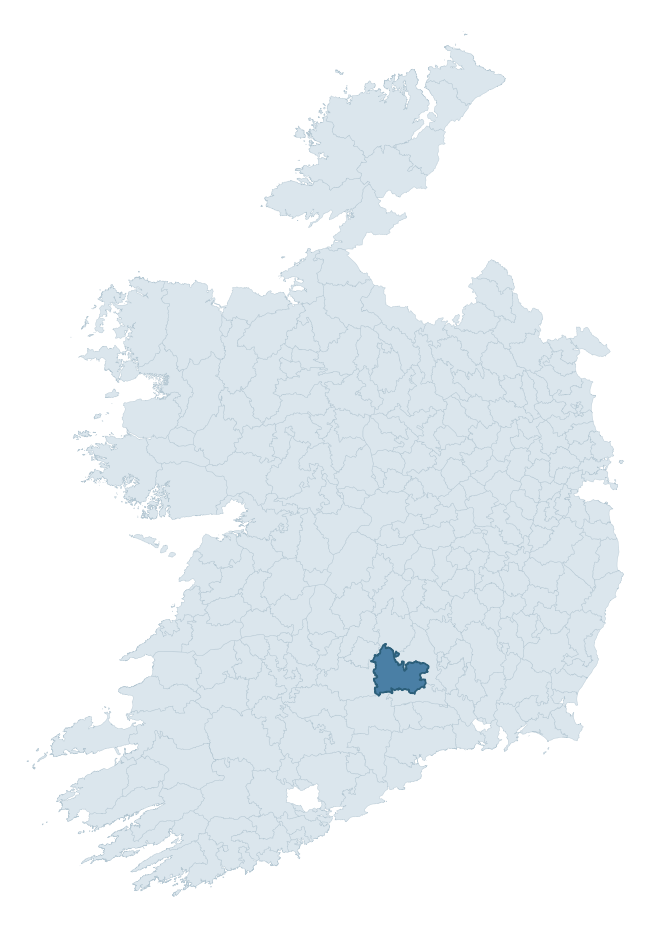
Middlethird is a barony of County Tipperary, in the historical province of Munster (Irish: An Trian Meánach), covering 460 km² of land. The barony records 1,428 NMS archaeological sites and 252 NIAH listed buildings, placing it at around the 83rd percentile among 280 ROI baronies for sites per km². This means it is in the top fifth of all baronies for sites per km². Dated archaeological evidence runs from the Mesolithic through to the Post Medieval, spanning 8 of 9 archaeological periods, placing the barony in the 64th percentile among 280 ROI baronies for chronological depth. This means it is in the upper half of all baronies for chronological depth. The largest dated subset of recorded sites dates to the Iron Age. Logainm flags 86 placenames in the barony as carrying a recognised heritage root; the largest share — around 59% — are names associated with early Christian church and monastic foundations.
Heritage at a glance
Percentile rankings throughout this profile compare each barony only against the other 279 Republic of Ireland baronies.
The recorded heritage of Middlethird
The National Monuments Service Sites and Monuments Record (SMR) is the statutory inventory of archaeological sites for the Republic of Ireland, maintained by the Department of Tourism, Culture, Arts, Gaeltacht, Sport and Media. Sites recorded here include earthworks, ringforts, megalithic tombs, ecclesiastical remains, and post-medieval features; not every record is legally protected, but each is registered as a monument of archaeological interest.
The National Monuments Service records 1,428 archaeological sites in Middlethird, putting it at the 83rd percentile among 280 ROI baronies for sites per km². This means it is in the top fifth of all baronies for sites per km². Protection coverage is near-universal — 1,405 sites (98%) fall within a recorded monument protection zone, indicating an extensively surveyed landscape. The dominant category is defensive sites — ringforts, enclosures, hillforts, and stone forts (759 sites, 53% of the record). The most diagnostically specific type is Ringfort – rath (254 records, 18% of the barony's NMS total) — compared to an ROI average of 20% across all baronies where this type occurs. Ringfort – rath is an earthen ringfort enclosed by a bank and external ditch — the most common Early Medieval farmstead, broadly dated 500–1000 AD. The broader 'Enclosure' classification — which catches unclassified ringforts and field enclosures — accounts for a further 333 records (23%) and reflects the difficulty of sub-classifying degraded earthworks from surface evidence alone. Other significant types include Graveslab (116) — a recumbent grave-marking slab, dated 1200–1700 AD. Across the barony's 460 km², this gives a recorded density of 3.11 sites per km².
Most common monument types
Hover or tap a monument type to see its definition.
| Type | Count |
|---|---|
| Enclosure a banked or ditched feature of uncertain type, used as a catch-all where the original function cannot be determined from surface evidence | 333 |
| Ringfort – rath an earthen ringfort enclosed by a bank and external ditch — the most common Early Medieval farmstead, broadly dated 500–1000 AD | 254 |
| Graveslab a recumbent grave-marking slab, dated 1200–1700 AD | 116 |
| Moated site | 58 |
| Church a building used for public Christian worship, of any date from c. 500 AD onwards | 52 |
| Graveyard a burial area associated with a church, in use from the medieval period onwards | 46 |
| House – 17th century a habitation building dated to the 17th century AD | 34 |
| Castle – tower house a fortified residential tower of four or five storeys, mostly built by lords in the 15th and 16th centuries and often within a defended bawn | 31 |
Chronological distribution
The dated archaeological record for Middlethird spans from the Mesolithic through to the Post Medieval, with activity attested across 8 of 9 archaeological periods. Every period from earliest to latest is represented in the record — an unbroken sequence of dated activity across the full chronological span. Activity concentrates most heavily in the Iron Age (121 sites, 43% of dated material), with the Early Medieval forming a secondary peak (52 sites, 19%). A further 92 recorded sites (25% of the overall NMS register for the barony) carry no period attribution — appearing as 'Unknown' in the bar chart below. This typically reflects either records that pre-date the standardised period vocabulary or sites awaiting specialist dating review, rather than a genuine absence of chronological evidence.
Sample of recorded monuments
Show 25 sample monuments (of 1,428 total)
A representative sample of 25 recorded monuments drawn from the barony’s 1,428 total NMS entries. Sites within a recorded monument protection zone and rarer site types are prioritised so the list shows a meaningful cross-section rather than only the most common type. Each entry shows the official Sites and Monuments Record reference number and the description published by the National Monuments Service.
Burial mound
In grassland on an E-facing slope of low rising ground in upland river valley with good views in all directions. A narrow drain running NW-SE intersects the S side of the base of the mound and cuts through the mound on…
In grassland on an E-facing slope of low rising ground in upland river valley with good views in all directions. A narrow drain running NW-SE intersects the S side of the base of the mound and cuts through the mound on the southern side revealing skeletal material in the exposed face of the mound. Impressive flat-topped oval-shaped mound (top diam 19m N-S; 28m E-W; base diam. 24m N-S; 35m E-W; H 3.5m at E and 1m at W) defined by a scarp, the E face of which has been eroded by cattle poaching which has revealed some skeletal material in the face of the mound located approx. 0.8m below the top of the mound. Known locally as the “Hill of Bones” which supposedly marks the burials of some Normans who were killed in battle in the vicinity (Hassett 1990, 21). Other skeletal remains have been revealed on the S face of the mound where the drain has cut out a section of the mound (NMI file 1961). This side of the mound is now covered in trees and thorn bushes making examination impossible. Appears to be a natural gravel hillock used as a burial mound. An unlocated burial mound (TS062-147—-) in Clonbrogan townland, which is immediately to the S of Buffanagh, probably refers to this monument.
Compiled by: Jean Farrelly
Date of upload: 06 November 2013
Children's burial ground
In improved pasture, in highest part of field, at terminus of broad ridge (general long axis NNE-SSW). Flood plain of River Suir in field to N and W. No visible surface trace. According to OSL (Vol. 1, 314), the…
In improved pasture, in highest part of field, at terminus of broad ridge (general long axis NNE-SSW). Flood plain of River Suir in field to N and W. No visible surface trace. According to OSL (Vol. 1, 314), the graveyard (TS060-030003-) was no longer in use except for the internment of children. John Davis White (1892, 16) confirms that 'at no distant period, unbaptized infants have been buried here.' Named 'Killeen' on latest edition OS 6-inch map. According to Meskell (2003, 16) land reclamation work in the mid 1980s removed all traces of the graveyard. At the time of the reclamation quantities of stone and human bones were uncovered (ibid.). According to local information this graveyard had been used as a burial ground for unbaptised children up to c. 1920 (ibid.).
Compiled by: Jean Farrelly
Date of upload: 22 July 2014
Religious house – unclassified
Within the NW quadrant of enclosure (TS060-107005-). Rectangular area (dims. 14.6m NNE-SSW; 6.4m ESE-WNW) defined by remains of stone wall (T 1.1m; min. int. H 0.15m; min. ext. H 0.1m) on NNE, ESE and SSW sides. Wall…
Within the NW quadrant of enclosure (TS060-107005-). Rectangular area (dims. 14.6m NNE-SSW; 6.4m ESE-WNW) defined by remains of stone wall (T 1.1m; min. int. H 0.15m; min. ext. H 0.1m) on NNE, ESE and SSW sides. Wall (max. int. H 1.1m; max. ext. H 0.45m) is cut into upslope (D 0.65m) on WNW side and is best preserved at SSW end where 1-2 courses of wall extend (H 0.45m) above exterior ground level. Stones of wall are moss covered and occasionally sod covered. Interior has been levelled off due to cutting into hillslope, but is uneven due to sod-covered stone from collapsed walls. Most of mortar has perished from joints between stones. The OS Letters (Flanagan 1930, vol. 1, 119 (314)) state that this is a 'supposed friary of which foundations remain'. Named 'Holy Well' on 1840-41 and latest edition OS 6-inch maps. According to Gwynn and Hadcock (1988, 368) the 'site of a monastery [is located] two miles south-west of Cashel'…. and is named 'Cluain-conbruin…founded by St. Abban'. However, Ó Cearbhaill (2010, 95-6) places the church of Cluain Conbhruin at Derrycloney (TS0068-098—-).
Compiled by: Jean Farrelly
Date of upload: 14 July 2014
Armorial plaque (present location)
This limestone plaque (H 0.67m; Wth 0.88m) has been inserted into a recess above the doorway into the older portion of Meldrum House (TS061-021002-) which is probably late 17th century in date. The plaque, bearing a…
This limestone plaque (H 0.67m; Wth 0.88m) has been inserted into a recess above the doorway into the older portion of Meldrum House (TS061-021002-) which is probably late 17th century in date. The plaque, bearing a date of 1622, has a central recess within a moulded frame which contains a heraldic shield. Beneath the shield are the initials G S on the dexter side and the initials M C on the sinister side. The shield is halved vertically (per pale), the dexter arms are those of the Sall family, showing the attires of a stag fesswise and in chief a portcullis and the sinister a lion passant guardant. The plaque is likely to have come from Meldrum Castle (TS061-56001-) which lies c. 400m to the E and which is possibly an early 17th-century fortified house (Simington 1931, vol. 1, 226). A graveslab (TS061-025094-) in the graveyard (TS061-025035-) of the C of I Cathedral in Cashel bears an inscription to Geoffrey Sall, who died in 1622, and his wife Margaret Corcran (FitzGerald 1902, vol. 5, 249). James Sall, probably a son of Geoffrey and Margaret, was the proprietor of Meldrum Castle in 1640 (Simington 1931, vol. 1, 226).
Compiled by: Jean Farrelly
Date of upload: 26 August 2011
Religious house – Cistercian monks
In flat terrain with a stream running roughly E-W c. 50 N of the abbey building. The cathedral (TS061-025003-) on the nearly Rock of Cashel dominates the view to the NNE. This Cistercian Abbey, founded in 1272 from…
In flat terrain with a stream running roughly E-W c. 50 N of the abbey building. The cathedral (TS061-025003-) on the nearly Rock of Cashel dominates the view to the NNE. This Cistercian Abbey, founded in 1272 from Mellifont, was the last Irish foundation of this order before the Reformation. The foundation was instigated by David McCarville, the archbishop of Cashel who reputedly wanted to replace the Benedictines of Cashel with the Cistercians (Ó Conbhuidhe 1999, 305). It was named the abbey of the Rock (de Rupe) (ibid.). The monastery was dissolved in 1540, however, the chancel remained in use as a parish church for a parish coterminous with the former lands of the abbey and was serviced by three of the former monks (Stalley 1987, 246). The lands were initially occupied by Edmund Heffernan (Ó Conbhuidhe 1999, 317). In 1561 the abbey and lands were granted to Sir Henry Radcliffe and were subsequently leased to James Butler, Earl of Ormond and Thomas Sinclair (ibid.; Grose 1791, vol. 2, 86). In 1640 the proprietor was Edward Boyton, an ‘Irish Papist’ and alderman of Cashel (Simington 1931, vol. 1, 227).
A 13th-century Cistercian Abbey with 15th-century modifications including the addition of a crossing-tower, the supporting piers of which were built onto the 13th-century piers of the original transept. Following the Dissolution various parts of the monastery, including the nave, S transept and chapter house, were converted into private houses (Stalley 1987, 246). Much o…
Chapel
On the S side of the summit of a prominent rock outcrop overlooking the town of Cashel (TS061-025—-) c. 300m to the S-SE. A round tower (TS061-025002-) is located c. 30m to the N and a high cross (TS061-025006-) lies…
On the S side of the summit of a prominent rock outcrop overlooking the town of Cashel (TS061-025—-) c. 300m to the S-SE. A round tower (TS061-025002-) is located c. 30m to the N and a high cross (TS061-025006-) lies c. 20m to the SW, though the latter's original position may have been 10m from the N portal of the Romanesque chapel (O'Keeffe 2003, 127-8). A later cathedral (TS061-025003-) was built up against the N tower and incorporates the W gable. It is likely that the church was built as a royal chapel for Cormac McCarthy, king of Munster. Historical sources give the foundation date as 1127, with its consecration in 1134. This date is generally accepted though Stalley has argued for a slightly later foundation date (O'Keeffe 2003, 128-131). The nature of the involvement of the Benedictine order has also been open to question. Gwynn and Hadcock (1988, 105) state that in 1121- c. 1133 the abbot of Ratisbon (Regensburg), Germany sent Irishmen to establish a Benedictine foundation at Cashel and that the priory was established on the Upper Rock of Cashel. Several visits of monks from Ratisbon to Cashel are recorded between 1127 and 1150 (O'Keeffe 2003, 130-1). However, as O'Keeffe argues, it would appear more likely that the royal chapel was served by a monastic clergy, rather than being a monastic church. The monks appear to have been expelled between 1269-72 and were replaced by the Cistercians at Hore Abbey (TS061-024—-) (Gwynn and Hadcock 1988, 105). The relative so…
Round tower
On the S side of the summit of a prominent rock outcrop overlooking the town of Cashel (TS061-025—-) c. 300m to the S-SE. A Romanesque chapel (TS061-025001-) is located c. 30m to the S and a high cross (TS061-025006-)…
On the S side of the summit of a prominent rock outcrop overlooking the town of Cashel (TS061-025—-) c. 300m to the S-SE. A Romanesque chapel (TS061-025001-) is located c. 30m to the S and a high cross (TS061-025006-) lies c. 50m to the SW, though the latter's original position may have been 10m from the N portal of the Romanesque chapel (O'Keeffe 2003, 127-8). It is situated at the NE corner of the N transept of the 13th-century cathedral (TS061-025003-) to which it was connected by a passage. The tower (diam. C. 5.33m; H 27.9m – including cap 4.42m) was most likely erected in the 12th century following the transfer of St. Patrick's Rock to the church. It is constructed of coursed sandstone with limestone in evidence in the lower masonry courses and was restored by the O.P.W. in 1874-5, at which times most of the masonry was repointed and the conical cap reset. The original round-headed doorway (H 1.65m; Wth 0.74m; H above ground 3.28m) faces SE, probably towards the W doorway of the first cathedral which was built by c. 1111, and is now replaced by the Gothic cathedral (Stalley 1996, 309; Manning 2000, 32). A second doorway situated in the W face of the tower gives access to the connecting triforium passage of the cathedral. The internal wooden floors, which were connected by ladder, were lit by three flat-headed single-lights at various intervals facing N, NE and SE. However, the top floor, which housed the bell or bells, has four triangular-headed single-light window…
Cathedral
Roughly centrally placed on the summit of a prominent rock outcrop overlooking the town of Cashel (TS061-025—-) c. 300m to the S-SE. An earlier Romanesque chapel (TS061-025001-) is located in the external angle…
Roughly centrally placed on the summit of a prominent rock outcrop overlooking the town of Cashel (TS061-025—-) c. 300m to the S-SE. An earlier Romanesque chapel (TS061-025001-) is located in the external angle between the choir and the S transept and a high cross (TS061-025006-) lies c. 10m SW of the W angle of the S transept, though the latter's original position may have been 10m from the N portal of the Romanesque chapel (O'Keeffe 2003, 127-8). The cathedral is constructed of limestone rubble, roughly coursed. It is cruciform in plan, comprising a long choir and short nave, a N and S transept, off which run a number of side chapels, a crossing tower at the junction of nave and choir, and a tower house built onto the W end of the nave. There are a large number of altar tombs and wall memorials within the cathedral, the majority of which date from the 16th century. The main entrance to the cathedral is the porch, with groin-vaulted ceiling, which projects from the S wall of the nave. The matching porch on the N side no longer survives apart from a smaller doorway, the inner arch of which is blocked (Manning 2000, 27). The choir (int. dims. 28.3m x c. 9m; wall T 1.5m) dates to the 1230s and is the earliest phase of the cathedral where the all the carved stonework is sandstone. It was lit by a sequence of lancet windows in the N and S walls with clerestorey quatrefoil windows, within segmental-arched embrasures with unusual curving sills, between the tops of the lancets….
College
On the S edge of the summit of a prominent rock outcrop overlooking the town of Cashel (TS061-025—-) c. 300m to the S-SE. The cathedral (TS061-025003-) is located c. 15m to the N. The building of a hall for eight…
On the S edge of the summit of a prominent rock outcrop overlooking the town of Cashel (TS061-025—-) c. 300m to the S-SE. The cathedral (TS061-025003-) is located c. 15m to the N. The building of a hall for eight Vicars Choral is attributed to Archbishop Richard O'Hedian (1406-40) and is contemporary with the residential tower house (TS061-025004-) at the W end of the nave of the cathedral. The Vicars Choral consisted of both laymen and clerics who were appointed to assist in chanting the cathedral service. This is a long building, constructed of limestone rubble, roughly coursed, the western end consists of a chamber to the W, possibly a gatehouse and to the E a vaulted undercroft and galleried hall above. Excavations immediately W of the W gable uncovered the eastern pier of two periods of gateway, one pre-dating the college and one contemporary with it (Manning 1989, 46). The eastern end of the college is on a slightly different alignment and functioned as a two-storey dormitory with four ogee-headed windows in the S wall of each level, presumably lighting the eight bed spaces provided. The main hall contains a large fireplace, which is a later insertion, bearing the latin inscription 'E.S. ET E.H. ME FIERI FE[CERUNT]' which translates as E.S. and E.H. had me made. Manning (2000, 34) suggests that the initialled surnames refer to Sall and Hayden or Hackett. The oak floor, gallery and roof date to 1985 when the building was restored by the Office of Public Works. Prior…
Religious house – Dominican friars
On the E side of Dominic Street at the northern end of the town (TS061-025—-), immediately outside the medieval town wall (TS061-025023-). This priory was founded in 1243 by Archbishop David O'Kelly of Cashel (d.…
On the E side of Dominic Street at the northern end of the town (TS061-025—-), immediately outside the medieval town wall (TS061-025023-). This priory was founded in 1243 by Archbishop David O'Kelly of Cashel (d. 1252) for the Dominican Friars (Gwynn and Hadcock 1988, 223). A S transept with a W aisle was added c. 1270 (Leask 1967, 93). Testimony to the importance of the foundation was its hosting of two general chapters of the Dominican order in Ireland in 1289 and 1307 (Harbison 1970, 225). Following an accidental fire in c. 1480 the greater part of the friary was rebuilt by Arcbishop John Cantwell (d. 1483) in return for which he was recognised as patron and co-founder (Gwynn and Hadcock 1988, 223). In April 1540 the then Prior, Edward Brown surrendered the Friary (Gwynn and Hadcock 1988, 223). In an inquisition of that time it was described as comprising a church and belfry, a cloister, dormitory, and a chamber with two cellars accompanied by an orchard, three gardens, and a cemetery (Gwynn and Hadcock 1988, 223). In the precincts there were nine cottages with six gardens and outside were two messuages with four gardens (White 1943, 334-5). In 1543-4 the entire complex was granted to Walter Fleming for a rent of £46.2s.6d (Gwynn and Hadcock 1988, 223).
The upstanding remains consist of a long rectangular church, orientated E-W, with a crossing tower (dims E-W 5.68m) at the junction of the nave (int. dims. E-W 23.1m) and choir, a S transept (int. dims. 5.75m N-S; E-…
Religious house – Franciscan friars
E of Friar Street and outside the southern end of the E length of the medieval town wall (TS061-025023-). The site is currently occupied by an RC Church and a former Convent complex. The friary, also known as Hacket's…
E of Friar Street and outside the southern end of the E length of the medieval town wall (TS061-025023-). The site is currently occupied by an RC Church and a former Convent complex. The friary, also known as Hacket's Abbey, was founded in c. 1265 by Lord William Hacket for the Conventual Franciscans (Gwynn and Hadcock 1988, 244). The foundation became Observant in 1538 and in the same year the Archbishop of Cashel Edmund Butler obtained the friary for a small rent (ibid.). During the course of the dissolution of monasteries, the Cashel friary was seized, but the friars were apparently allowed to stay on (ibid.). An inquisition of the 7th April 1540 described the precinct as comprising a church and steeple, dormitory, hall, four chambers, kitchen and two gardens, one acre, all in a ruinous state and not valued; the possessions included 18 messuages and gardens, and 16 acres of land, valued at £3 10s. 2d.(ibid.). The friars finally abandoned the premises in c. 1550 (ibid.). There are no extant structural remains of the Franciscan Friary. An 18th-century illustration (Grose 1791 (reprint 1982), 47-8) shows the friary church from the SE, with three tall lancet windows in the E gable and sequential lancets in the S wall of the chancel, though the most easterly appears enlarged with a segmental head. The partial E wall of a S transept is depicted, as well as the S gable and E wall of a possible side chapel, W of the transept. This side chapel is shown with a three-light traceri…
Prison
In the grounds of the Super Valu supermarket, immediately SW of Wesley Square. A three-storey rectangular building (original dims. c. 23.45m E-W; 10.2m N-S; surviving L of N wall 7.6m; surviving L of S wall 11.15m), the…
In the grounds of the Super Valu supermarket, immediately SW of Wesley Square. A three-storey rectangular building (original dims. c. 23.45m E-W; 10.2m N-S; surviving L of N wall 7.6m; surviving L of S wall 11.15m), the E wall and the E end of the N and S wall of which survive. It is composed of roughly coursed limestone rubble with cut limestone quoins. The building originally extended further W but this was knocked and until recently was occupied by a furniture store and warehouse before the present building was built. It had also been used as a cinema at which time the interior of the E end of first-floor level was rendered with concrete. Up until the mid-20th century the site had been occupied by a Wesleyan Chapel which was built in 1833 and according to Lewis (1837, 287) this was 'a neat building…in which part of the old prison built by Edw. I [1272-1307] was incorporated'. Prior to this the E end had been used as the coach house of the Old Rock Hotel in the 19th century. The only original fenestration to survive is the flat-headed lintel and W jamb of a single-light window in the N wall at first-floor level and a flat-headed single-light window with an external chamfer in the E wall at second-floor level. There are two garderobe chute exits, one at the base of the S end of the E wall and the other at the E end of the S wall. The 19th/20th century alterations include the insertion of a doorway in the N and S wall at ground level, the insertion of two large windows in…
Mill – unclassified
In improved pasture, on an E-facing slope. Mill buildings called 'Old Mill' are depicted on the 1st (1840) ed. OS 6-inch map with the mill, aligned N-S, depicted on the E side of the mill pond and another building to…
In improved pasture, on an E-facing slope. Mill buildings called 'Old Mill' are depicted on the 1st (1840) ed. OS 6-inch map with the mill, aligned N-S, depicted on the E side of the mill pond and another building to the NE aligned E-W. The mill pond consists of an oval area (dims. 48m E-W; 28m N-S) cut into hillslope on W-half and raised on E-half to create a level interior. Interior defined by face of cutting (scarp Wth 7.9m; D 2.95m) SW-NW and by bank (overall Wth 6.4m; Wth at top 1.0m; int. H 0.6m; ext. H 0.9m) NW-N and ESE-SW where it is best preserved. Bank (overall Wth 13.6m; Wth at top 3m; int. H 1.55m; ext. H 3.9m) has a counter scarp and is very steep on exterior N-ESE, where it has been raised highest to compensate for hillslope. Fosse (overall Wth 4.6m; basal Wth 2.2m; D 1.1m) E-SW appears to have been re-cut and terminates at large bank of earth at SW. Outer bank (overall Wth 4.45m; Wth at top 0.4m; int. H 1.6m; ext. H 0.5m) E-SW. A gap (Wth 3.5m) in inner bank at S may be later. Interior is sunken, level and poorly drained; Gap (Wth 2m) at E allows water drain to exterior. Causeway (Wth 6m) at NW allows access into a roughly triangular area (dims. 18m N-S; 14m E-W across centre) defined by bank (overall Wth 4.8m; Wth at top 2.2m; int. H 0.55m; ext. max. H 1.25m) to W (L 18m) and short return to E, on S-side (total L 16m). Bank (overall Wth 14.6m; Wth at top 5.1m; int. H 0.4m; ext. H 1.8m) defines eastern side (L 26m). Fosse (overall Wth 5.15m; basal Wth 2.6m;…
Leper hospital
In improved pasture, on an E-facing slope; Rock of Cashel clearly visible to N. There is a rectangular enclosure (TS061-167—-) c. 19m to S and a ringfort (TS061-072—-) c. 25m to WSW. According to Lee (1996, 23) Sir…
In improved pasture, on an E-facing slope; Rock of Cashel clearly visible to N. There is a rectangular enclosure (TS061-167—-) c. 19m to S and a ringfort (TS061-072—-) c. 25m to WSW. According to Lee (1996, 23) Sir David Latimer, Seneschal of Cashel, founded a hospital for lepers c. 1230 AD. A regular grant was made by Mairin O'Brien Archbishop of Cashel (1224-37) and it was later placed in the care of the Cistercian monks of Hore Abbey (TS061-024—-) (founded 1272) (Gwynn and Hadcock 1988, 347). Named the 'Hospital of St. Nicholas', it treated the sick and infirm (ibid). Long (1897, 149) states that, 'the remains of a Gothic arch and a few masses of masonry…' were still visible. The adjacent townalnd of Knocksaintlour translates to 'Hill of Saint of the Lepers' i.e. of St. Lazarus (Lee, ibid). The rectangular building (dims. 18m E-W; 10m N-S) is defined by a scarp (Wth 2.75m; H 0.35m) and the remains of sod-covered wall foundations (overall Wth 5m; Wth at top 1.7m; int. H 0.35m; ext. H 0.15m) to the N and E, which are more reduced to W and reduced to scarp at S. The monument appears to have been levelled off downslope to E where there is a build up of earthen material. A low, sub-oval rise (dims. 6.5m WNW-ESE; 4.5m NNE-SSW) defined by a scarp (Wth 1.5m; H 0.11m) adjoins the NE angle. A distinctive scarp (long-axis c. NNE-SSW), traverses the field, c. 7m to the E.
Compiled by: Jean Farrelly
Date of upload: 26 August 2011
Cultivation ridges
In improved, level pasture. No visible surface trace. Cultivation ridges show up clearly on an aerial photograph (CUCAP APD 31) taken in July 1966 and reproduced by Mitchell (1986, 175 and plate 39).
Compiled by:…
In improved, level pasture. No visible surface trace. Cultivation ridges show up clearly on an aerial photograph (CUCAP APD 31) taken in July 1966 and reproduced by Mitchell (1986, 175 and plate 39).
Compiled by: Jean Farrelly
Date of upload: 25 August 2014
Cross – Wayside cross
On top of roadside field boundary (road 2.5m below), on the NW side of tertiary road running NE-SW. An ecclesiastical enclosure (TS062-027—-) lies c. 150m to the NW. A cross base (H 1.05m) with chamfered edges around…
On top of roadside field boundary (road 2.5m below), on the NW side of tertiary road running NE-SW. An ecclesiastical enclosure (TS062-027—-) lies c. 150m to the NW. A cross base (H 1.05m) with chamfered edges around the top, which is roughly square in plan (dims. 0.46m NE-SW; 0.5m NW-SE) with a socket (Wth 0.19m; D 0.16m) in the top, the NW side of which is missing. The SE side (H 1.05m) of the base is intact, together with a short return on the NE side (H 0.81m) and the SW angle (H 0.98m), while a large portion of the NW side (H 0.55m) is missing. The base broadens out slightly on the SE side, approximately half way (0.53m) from top. There is a large sub-trapezoidal flag stone (0.89m x 0.52m x 0.19m) lying flat at the base on the NE side and a smaller stone on the SW side. Crawford (1907, 308) describes this a 'a medieval cut-stone pedestal, with a socket in the top, evidently part of a medieval roadside monument' and Reynolds (1975, 86) refers to it as the 'base of a medieval wayside cross'. The cross was apparently removed by a Protestant lady from Fethard in the 1930s (Myles pers. comm. 25 March 2010), the current location of which is unknown. On the 1st (1840) ed. OS map it is indicated as 'Crushshuvaunhenry' which is a anglicized version of the 'Crois Shiobhán Henry' and translates as 'Siobhán Henry's cross'.
Compiled by: Jean Farrelly
Date of revised upload: 30 November 2015
Inscribed stone (present location)
Built into the base of the S parapet of a 19th century bridge. According to Brennan (1854-5, 215) this stone had been 'inserted in a bridge near Drangan Castle, a residence of the Dunboyne family, and is said to have…
Built into the base of the S parapet of a 19th century bridge. According to Brennan (1854-5, 215) this stone had been 'inserted in a bridge near Drangan Castle, a residence of the Dunboyne family, and is said to have belonged to a more ancient bridge, which originally formed the private entrance to the demense attached to the castle'. Drangan castle (TS063-015002-) is c. 250m to the NW. The original location of the plaque is unknown. The limestone plaque (H 0.45m; Wth 1.17m) bears a latin inscription in raised black letter script which is quite worn but legible. The inscription was transcribed by Brennan (ibid.) as '….cobi Baronis Dunboyne defuncti viri hunc pontem posuit uxor filia superstes Margareta De Brien comitis Thumoniae Ora viator'. The upper dexter corner is broken, the portion of text in this angle is missing from Brennan's transcription.
Compiled by: Jean Farrelly
Date of upload: 26 August 2011
Ceremonial enclosure
In pasture, on upper contour of gentle S-facing slope. Large circular area (dims. 68m N-S; 69m E-W) defined by wide, flat-bottomed internal fosse (Wth 7.2m; D 0.1m) and external bank (Wth 7.45m; int. H 1.25m; ext. H…
In pasture, on upper contour of gentle S-facing slope. Large circular area (dims. 68m N-S; 69m E-W) defined by wide, flat-bottomed internal fosse (Wth 7.2m; D 0.1m) and external bank (Wth 7.45m; int. H 1.25m; ext. H 0.7m) of earth with stone inclusions. The external bank is visible at NW only due to thick furze cover around bank and fosse elsewhere. Breach (Wth min. 4m) at NE is partially covered by furze on either side; identified on aerial photograph (DPM 30th April 1979) as original entrance. Interior is generally level and tends slightly down slope to E; Ring-barrow (TS069-002002-) is off-centre to W. Linear scarp (long-axis c. N-S) to NE area has slight breach (Wth 1.5m) allowing access from a lower level at E to marginally higher level at W of interior. Named on latest edition OS 6-inch map as 'Rathnadov'. Enclosure (TS069-003—-) c. 300m to SE. Another internal ring-barrow (TS069-002003-) has been identified in the SW quadrant, clearly visible on 3-D modelling (see https://skfb.ly/KuHP).
This is a National Monument (no. 537).
Compiled by: Jean Farrelly
Date of revised upload: 3 April 2018
Crannog
In low lying area of wet field which is permanently flooded due to natural springs. Access not gained as monument is completely surrounded by water. According to Dalton (1983, pers. comm.), the area is circular (dims.…
In low lying area of wet field which is permanently flooded due to natural springs. Access not gained as monument is completely surrounded by water. According to Dalton (1983, pers. comm.), the area is circular (dims. c. 33m) with a stone-faced bank (H c. 0.5m). Series of drains (long axis c. N-S) shown on latest edition OS 6-inch map to S are also under water. Area has become a wildlife habitat. Indicated on latest edition OS 6-inch map as oval area (dims. 42m WNW-ESE; 25m NNE-SSW) enclosed by drain. Enclosure (TS069-047—-) located c. 490m to SSW and ringfort (TS069-048—-) located c. 520m to ENE.
Compiled by: Jean Farrelly
Date of upload: 26 August 2011
Religious house – Augustinian friars
At the E end of the town, at the junction of Abbey Street and Abbeyville and immediately N of the Clashawley river. The Augustinian foundation in Fethard, Holy Trinity Priory, was founded in c. 1306 on land granted by…
At the E end of the town, at the junction of Abbey Street and Abbeyville and immediately N of the Clashawley river. The Augustinian foundation in Fethard, Holy Trinity Priory, was founded in c. 1306 on land granted by Walter Mulcote (Gwynn, A. and Hadcock 1970, 299). The friars remained here until the dissolution of the monastery in 1540. According to the jurors sent to access the extent of the property, the friary church had been the parish church from time immemorial. At that time the friary possessed, ‘a church and steeple, dormitory, hall, two chambers, kitchen, etc….a mill and a bake-house’ (ibid., 300). In 1544 the property was granted to Edmund Butler, Baron of Dunboyne (ibid.). It seems that an Augustinian presence in Fethard continued up to the 17th century, when the provincial chapters were held there in 1643, 1646 and 1649, and the Provincial Superior of the Order lived in the town from 1646 to 1649. However, it was not until early in the 19th century that the friars were finally able to return. Rebuilding of their church began almost immediately in 1820 (Craig and Garner 1975, 48-51). This is a nave and chancel church (int. dims. 38m x 6.7m) dating from the 14th century, with 15th-century modifications and was rebuilt in the early 19th century. The ground level slopes by 0.4m from the W to the E end (O’Keeffe 1995, 85). There was a W tower (dims. given as ‘eighteen feet [5.5m] square’ in 1833), depicted on a Friary map of 1835, and was demolished that same ye…
Pound
Immediately S of the town wall, fronting onto the Clashawley river valley. The pound consists of an enclosed area (ext. dims. 19.1m x 6.6m) defined by the S wall of Edmond’s Castle (TS070-040002-)/town wall…
Immediately S of the town wall, fronting onto the Clashawley river valley. The pound consists of an enclosed area (ext. dims. 19.1m x 6.6m) defined by the S wall of Edmond’s Castle (TS070-040002-)/town wall (TS070-040032-) to the N, by the E wall of an almshouse (TS070-040011-) to the W, by the W gable of a building to the E and by a roughly coursed limestone rubble wall (T 0.48m) to the S, at the E of which an 18th/19th-century segmental-headed entrance has been inserted. The minutes of Fethard corporation's D'Oyer Hundred jury court which survive from 1707 record the annual income received from the pound in that year (O'Donnell 1988, 25). Between 1708 and 1718 the pound was in need of repair, requiring paving and a new door or gate (ibid.). The pound must have been in existence for some time in the 16th century to warrant such attention. A limited excavation in 1991 revealed that the W wall of the pound was originally the E wall of an earlier builiding (TS070-040011-) (Scally 1992, 43).
Compiled by: Jean Farrelly
Date of revised upload: 6 March 2015
Courthouse
In the middle of Main St., Fethard. The town is recorded as having a tholsel in 1596 (Cal. Pat. Rolls Ire., Eliz. 359). This building would have had several functions, such as a guildhall and meeting place for…
In the middle of Main St., Fethard. The town is recorded as having a tholsel in 1596 (Cal. Pat. Rolls Ire., Eliz. 359). This building would have had several functions, such as a guildhall and meeting place for merchants, a customhouse and a courthouse. On Grace’s map of 1703 (O’Keeffe 2003, map 4) a rectangle in the middle of Main St., in front of the almshouse (TS070-040003-) indicates a building. On the subsequent Grace map of 1708 (ibid., map 5) a single-storey three-bay building is shown in this position. It is not named, but a building (TS070-040108-) immediately to the E, represented by a small rectangle on the map, is described as, ‘A toft near the court house in the east’. This suggests that the toft lies E of the courthouse, as the building (TS070-040109-) indicated to the E of the toft, also represented as a rectangle, is described as a, ‘Common bakehouse and ground belonging to it’. Thus the single-storey building must have been the courthouse. In 1747 it is recorded that Fethard Corporation found it necessary to, ‘cause the under part of the s[ai]d Court House to be converted into a Markett House’ (Minute books of the Corporation of Fethard, Co. Tipperary, 1707-1834). On Steile’s map of 1752 (O’Keeffe 2003, map 8) the building indicated in the middle of Main St., in front of the almshouse (TS070-040003-) is named as the market house. The building is also depicted on Swiney’s map of 1763 (O’Keeffe 2003, map 9), as are two buildings to the E. The building had bee…
Hospital
On level ground on the outskirts of Fethard (TS070-040—-) which lies c. 400m to the NW. The field immediately E of the partially upstanding building is under pasture, while the field where the hospital is located has…
On level ground on the outskirts of Fethard (TS070-040—-) which lies c. 400m to the NW. The field immediately E of the partially upstanding building is under pasture, while the field where the hospital is located has been subjected to intensive shallow quarrying in the past, leaving a very undulating landscape. The Cashawley River flows c. 180m to the NW. Cramp's Castle (TS070-045002-) is visible c. 800m to the NNE. This building is indicated on the 1st ed. OS 6-inch map as 'Old Hospital (in Ruins)' and is immediately N of Spitalfields townland. The Augustianian friary (TS070-004004-) is located c. 300m to the NW, and though across the river, the hospital was formerly on abbey lands (Butler 1976, 3). The SE angle of a long rectangular building (dims. 19.3m E-W; 8.3m N-S) survives as a roughly coursed, limestone rubble wall (E wall L upstanding 6.1m; wall T 0.95m; S wall L upstanding c. 7m; wall T 0.85m; wall H above int. 1.95m; wall H at angle 2.65m), with no evidence of a base-batter. The western end of the building is defined by an earthen bank (N side Wth at crest 0.1m; Wth at base 2.4m; H above int. 0.4m; H above ext. 075m; W gable Wth at crest 1.2m; Wth at base 2.6m; H above int. 0.8m; H above ext. 0.45m). There is no evidence of the NE angle, where a rubble stone field wall runs northward from the upstanding E gable, and there is a gap of 7.3m between the E gable and the earthen bank defining the N side of the building. At a right angle to the W end of this buildin…
Fish-pond
In woodland, on a gentle W-facing slope, c. 20m to N of estate track. Two rectangular ponds (long-axis c. E-W) with rounded corners. Southern pond (dims. 6m N-S; 22m E-W; D min. 0.6m) has inlet drain entering at SE and…
In woodland, on a gentle W-facing slope, c. 20m to N of estate track. Two rectangular ponds (long-axis c. E-W) with rounded corners. Southern pond (dims. 6m N-S; 22m E-W; D min. 0.6m) has inlet drain entering at SE and small rectangular indent at W-end, S-side. Larger pond (dims. 7m N-S; 31m E-W; D min. 1.1m) is c. 10m to N. Ponds linked by linear, U-shaped drain (long-axis c. N-S; L 10m; basal Wth 0.55m; overall Wth 2m; D 0.60m) toward E-ends, which probably regulates water levels between them. Water in both is stagnant and probable build up of organic debris from overhanging sally trees. Possibly an estate feature associated with Grove House (TS070-076) c. 235m to SW, though on the 1st (1840) ed. OS 6-inch map they are referred to as 'Old Fish Ponds'.
Compiled by: Jean Farrelly
Date of upload: 26 August 2011
Enclosure
On flat poorly drained land, in pasture with a nearby stream 30m to the W. The enclosure is depicted on the 2nd ed. OS 6-inch map as roughly circular (map dims. c. 45m N-S; c. 48m E-W). A sketch plan and section of the…
On flat poorly drained land, in pasture with a nearby stream 30m to the W. The enclosure is depicted on the 2nd ed. OS 6-inch map as roughly circular (map dims. c. 45m N-S; c. 48m E-W). A sketch plan and section of the monument from the 1950s shows a roughly circular area enclosed by a bank (OPW files). It is described as a levelled enclosure in 1982 (Cahill 1982) and is visible on an aerial photograph as a circular cropmark (ASIAP 38 10-12). It is not visible at ground level.
Compiled by: Jean Farrelly
Date of upload: 26 August 2011
Listed buildings
The National Inventory of Architectural Heritage (NIAH) is a state survey appraising buildings of architectural, historical, archaeological, artistic, cultural, scientific, social, or technical interest. Each surveyed structure receives a rating from International (the highest, for buildings of European importance) through National, Regional, Local, and Record-Only.
The NIAH records 252 listed buildings in Middlethird, the 84th percentile across ROI baronies for listed-building density. Among these, 10 are graded National — buildings of interest to the whole of Ireland rather than only its region. The Republic holds 937 National-graded buildings in total, so this barony accounts for around 1% of the national total. Construction dates concentrate most heavily in the Victorian (1830-1900) period. The most-recorded building type is house (113 examples, 45% of the listed stock).
Terrain and environment
Mean elevation across the barony is 55m — the 19th percentile among 280 ROI baronies for elevation. This means it is in the bottom fifth of all baronies for elevation. This is a relatively low-lying landscape by ROI standards. Elevation matters for heritage because higher-altitude baronies typically favour defensive monuments — ringforts and hilltop forts placed on prominent ground — while lowland baronies are more likely to carry the dense settlement and church networks of intensive agricultural landscapes. A maximum elevation of 174m gives the barony meaningful vertical relief. Mean slope is 4.0° — the 58th percentile among 280 ROI baronies for slope. This means it is in the upper half of all baronies for slope. Slope is a key control on both land use and archaeological preservation: steep ground resists ploughing and tends to preserve earthworks intact, while gentle slopes favour intensive cultivation that damages or destroys surface archaeology over time. The Topographic Wetness Index averages 10.5, the 38th percentile among 280 ROI baronies for wetness. This means it is in the lower half of all baronies for wetness. Drainage matters for heritage because poorly-drained ground preserves organic archaeology (wooden trackways, leather, textiles, and on rare occasions human remains) far better than free-draining soil; well-drained ground favours arable use but destroys organic material rapidly. The land cover is dominated by improved grassland (74%) and woodland (17%).
Terrain measurements
Where this barony sits in the Republic of Ireland
Geology and preservation
Bedrock geology shapes the landscape long before any settlement begins — controlling soil drainage, agricultural potential, the survival of upstanding monuments, and the preservation of buried archaeology. The figures below come from the Geological Survey Ireland 1:100,000 bedrock map.
The bedrock underlying Middlethird is predominantly limestone (73% of the barony by area), laid down during the Carboniferous period (96% by area, around 359 to 299 million years ago). Limestone is the most heritage-rich bedrock in Ireland. It supports fertile, well-drained soils that favoured dense Early Medieval settlement and Norman manorial agriculture, and it weathers into karst features — sinkholes, caves, swallow holes, and souterrains — that frequently carry archaeology. Where peat overlies limestone, organic preservation can be exceptional. A substantial secondary geology of siltstone (17%) adds further variety to the underlying landscape. The single largest mapped unit is the Ballyadams Formation (26% of the barony's bedrock).
Rock type composition
Largest mapped unit: Ballyadams Formation (26% of the barony)
Placename evidence
Logainm records 86 heritage-diagnostic placenames for Middlethird, drawn from townland and civil-parish names across the barony. The dominant stratum is Early Christian ecclesiastical — cill-, teampall-, and domhnach-prefixed names that record the dense network of early church foundations established between the fifth and tenth centuries. The leading diagnostic roots are cill- (28 — church), ráth- (20 — earthen ringfort), and gráinseach- (11 — grange). This is well above the ROI average of 30.7 heritage placenames per barony — around 2.8× the typical figure. The presence of multiple heritage strata side by side indicates layered occupation of the landscape across successive prehistoric and historic periods. Logainm records 382 placenames for Middlethird (predominantly townland names). Of these, 86 (23%) carry one of the diagnostic Gaelic roots tracked above; the remainder draw on more generic landscape vocabulary that does not encode a heritage period.
Pre-Christian / Early Medieval Defensive
| Root | Count | Meaning |
|---|---|---|
| ráth- | 20 | earthen ringfort |
| dún- | 5 | hilltop or promontory fort |
| lios- | 2 | ringfort or enclosure |
| caiseal- | 2 | stone ringfort |
Early Christian Ecclesiastical
| Root | Count | Meaning |
|---|---|---|
| cill- | 28 | church (early) |
| gráinseach- | 11 | monastic farm / grange |
| mainistir- | 4 | monastery |
| teampall- | 3 | church (later medieval) |
| tobar- | 3 | holy well |
| cillín- | 2 | unconsecrated burial ground |
Burial, Ritual, and Norse-Contact
| Root | Count | Meaning |
|---|---|---|
| carn- | 3 | cairn |
| dumha- | 1 | mound |
| uaimh- | 1 | cave / souterrain |
| gall- | 1 | foreigner — Norse settlement marker |
Other baronies in Tipperary
- Ormond Lower
- Upperthird
- Slievardagh
- Ikerrin
- Kilnamanagh Upper
- Owney And Arra
- Iffa And Offa West
- Ibrickan — Clare
- Iraghticonnor — Kerry
- Shanid — Limerick
See all 280 baronies in the Republic of Ireland Heritage Tool.

Explore further
Grounding History: 10 Maps of Northern Ireland’s Past
If you’re interested in Irish heritage more widely, the companion report for Northern Ireland brings together the analysis of all 462 NI wards into one place through 10 high-quality maps — covering monument density, archaeological periods, placename heritage, terrain, wetland, and the historic landscape at first survey. Take a look.
About this profile
Click any section below to expand.
What is a barony?
A barony is a historic administrative unit in Ireland, broadly equivalent to an English hundred. The 280 baronies used here are from the OSi 2019 National Statutory Boundaries (generalised 20m), covering the 26 counties of the Republic of Ireland. Baronies derive from the Norman period, were formalised in the 17th century, and have not been redrawn for statistical purposes. They vary enormously in area, from compact urban baronies in Dublin to vast upland baronies in Connacht, and should not be compared by raw site count without accounting for area differences.
What counts as a site?
This profile combines three distinct heritage registers, each with its own definition of what constitutes a recordable site:
- Archaeological sites (NMS). The National Monuments Service Sites and Monuments Record (SMR) catalogues every known archaeological monument or site of archaeological interest in the Republic, from prehistoric burial mounds and ringforts to medieval churches and post-medieval defensive works. Inclusion does not require legal protection — only that the site has been identified, surveyed, and assessed as having archaeological value. A separate subset of these sites lies within a recorded protection zone, which gives them statutory protection under the National Monuments Acts.
- Listed buildings (NIAH). The National Inventory of Architectural Heritage records buildings of architectural, historical, archaeological, artistic, cultural, scientific, social, or technical interest. Each surveyed structure is appraised on a five-tier scale: International, National, Regional, Local, and Record-Only. The NIAH appraisal is informational rather than strictly statutory, but it underpins local-authority Record of Protected Structures (RPS) listings.
- Heritage placenames (Logainm). Logainm is the authoritative database of Irish placenames maintained by the Placenames Branch. This profile applies a heritage-diagnostic classifier to the Irish-language form of each townland name, flagging roots that signal defensive sites (ráth-, lios-, dún-, caiseal-, cathair-), ecclesiastical foundations (cill-, teampall-, domhnach-, mainistir-), prehistoric burial-ritual features (tuaim-, carn-, leaba-), or Norse-contact settlement (gall-). Townlands without one of these diagnostic roots are not flagged here — they may still carry historical significance, but that significance is not encoded in the name itself.
Editorial principles
The narrative sections of this profile follow several explicit principles:
- Evidential. Every claim about this barony’s heritage character is anchored in the underlying register data. Where a site count, a placename count, or a percentile rank is cited, it is computed from the source datasets at export time, not estimated.
- Comparative. Counts and metrics are reported alongside their percentile rank against the other 279 ROI baronies. A barony with 50 ringforts in absolute terms could be unusually high or unusually low depending on its size and regional context; percentile ranking removes that ambiguity.
- Transparent on limits. Where a register has known coverage gaps, survey biases, or data-quality issues that affect this barony’s figures, the profile flags them rather than presenting the numbers as definitive.
- No interpretation beyond what the data supports. The narrative does not speculate about historical events, social dynamics, or cultural meaning beyond what the recorded heritage and placename evidence directly attests.
Data caveats and limits
- NMS Sites and Monuments Record is the product of survey campaigns conducted at different intensities across different counties and decades. Some baronies have been surveyed more thoroughly than others, and absolute counts should be read in that light. Sites destroyed by development before survey are typically not represented; sites in heavily forested or upland terrain are sometimes under-recorded.
- NIAH coverage is broadly complete for the Republic of Ireland but the survey was conducted on a rolling county-by-county basis, and the most recent appraisal date varies. Buildings demolished or substantially altered after their original survey may still appear in the register; conversely, recent buildings of merit may not yet have been appraised.
- Logainm classification applies a deliberately conservative pattern-matching approach to the Irish-language townland forms. The classifier prioritises true positives over recall: a townland may carry a heritage signal that the classifier doesn’t recognise, particularly where the diagnostic root has been heavily anglicised or where the townland name draws on a less common term. The 60,000+ townland records and ~9,800 classified placenames give a substantial signal at barony scale, but individual townland names should be checked against Logainm directly for definitive interpretation.
- Period attribution. The chronological distribution reflects only those NMS sites that carry a recognised period attribution in the source data. Sites listed as “Unknown” period are excluded from the dated subset.
- Boundary changes. Some baronies have undergone minor boundary adjustments since their 19th-century definition; the OSi 2019 generalised boundaries used here are the current statutory definition and may differ slightly from historical maps in border areas.
- Bedrock geology is mapped at 1:100,000 scale, which means local variation within a barony — small pockets of different rock type, mineral veins, alluvium overlying bedrock — is generalised. The dominant-system and rocktype figures are area-weighted, so a barony reading “70% Carboniferous limestone” may still contain small but archaeologically important pockets of older or younger rock. Around 3% of GSI polygons do not match the lexicon and contribute no rocktype or system attribution.
Data sources
- National Monuments Service — Sites and Monuments Record (SMR) https://data.gov.ie/dataset/national-monuments-service-archaeological-survey-of-ireland
- National Inventory of Architectural Heritage (NIAH) https://data.gov.ie/dataset/national-inventory-of-architectural-heritage-niah-national-dataset
- Logainm — Placenames Database of Ireland https://www.logainm.ie/
- Ordnance Survey Ireland — National Statutory Barony Boundaries 2019 https://data-osi.opendata.arcgis.com/
- EURODEM — European Digital Elevation Model https://www.mapsforeurope.org/datasets/euro-dem
- ESA WorldCover https://esa-worldcover.org/en
- Geological Survey Ireland — 1:100,000 Bedrock Geology https://www.gsi.ie/en-ie/data-and-maps/Pages/Bedrock.aspx
Explore more: Search any of the 280 ROI baronies, browse by historical province, or read the methodology and data sources for the full Republic of Ireland Heritage Tool.