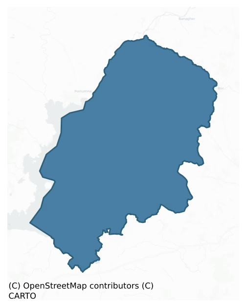
Ormond Lower is a barony of County Tipperary, in the historical province of Munster (Irish: Urumhain Íochtarach), covering 550 km² of land. The barony records 766 NMS archaeological sites and 275 NIAH listed buildings, placing it at around the 28th percentile among 280 ROI baronies for sites per km². This means it is in the bottom third of all baronies for sites per km². Dated archaeological evidence runs from the Neolithic through to the Modern, spanning 8 of 9 archaeological periods, placing the barony in the 78th percentile among 280 ROI baronies for chronological depth. This means it is in the top third of all baronies for chronological depth. The largest dated subset of recorded sites dates to the Iron Age. Logainm flags 71 placenames in the barony as carrying a recognised heritage root; the largest share — around 56% — are names associated with early Christian church and monastic foundations.

Heritage at a glance
Percentile rankings throughout this profile compare each barony only against the other 279 Republic of Ireland baronies.
The recorded heritage of Ormond Lower
The National Monuments Service Sites and Monuments Record (SMR) is the statutory inventory of archaeological sites for the Republic of Ireland, maintained by the Department of Tourism, Culture, Arts, Gaeltacht, Sport and Media. Sites recorded here include earthworks, ringforts, megalithic tombs, ecclesiastical remains, and post-medieval features; not every record is legally protected, but each is registered as a monument of archaeological interest.
The National Monuments Service records 766 archaeological sites in Ormond Lower, putting it at the 28th percentile among 280 ROI baronies for sites per km². This means it is in the bottom third of all baronies for sites per km². Protection coverage is near-universal — 738 sites (96%) fall within a recorded monument protection zone, indicating an extensively surveyed landscape. The dominant category is defensive sites — ringforts, enclosures, hillforts, and stone forts (434 sites, 57% of the record). The most diagnostically specific type is Ringfort – rath (116 records, 15% of the barony's NMS total) — compared to an ROI average of 20% across all baronies where this type occurs. Ringfort – rath is an earthen ringfort enclosed by a bank and external ditch — the most common Early Medieval farmstead, broadly dated 500–1000 AD. The broader 'Enclosure' classification — which catches unclassified ringforts and field enclosures — accounts for a further 187 records (24%) and reflects the difficulty of sub-classifying degraded earthworks from surface evidence alone. Across the barony's 550 km², this gives a recorded density of 1.39 sites per km².
Most common monument types
Hover or tap a monument type to see its definition.
| Type | Count |
|---|---|
| Enclosure a banked or ditched feature of uncertain type, used as a catch-all where the original function cannot be determined from surface evidence | 187 |
| Ringfort – rath an earthen ringfort enclosed by a bank and external ditch — the most common Early Medieval farmstead, broadly dated 500–1000 AD | 116 |
| Fulacht fia a horseshoe-shaped Bronze Age burnt mound built around a sunken trough beside a water source, traditionally interpreted as a cooking site | 47 |
| Earthwork an unclassified earthen structure with no diagnostic features that allow a more specific classification | 29 |
| Castle – tower house a fortified residential tower of four or five storeys, mostly built by lords in the 15th and 16th centuries and often within a defended bawn | 25 |
| Church a building used for public Christian worship, of any date from c. 500 AD onwards | 23 |
| Graveyard a burial area associated with a church, in use from the medieval period onwards | 22 |
| Bawn the defended courtyard of a medieval house, tower house or fortified house | 21 |
Chronological distribution
The dated archaeological record for Ormond Lower spans from the Neolithic through to the Modern, with activity attested across 8 of 9 archaeological periods. This is the 78th percentile across ROI baronies for chronological depth — an above-average span. Every period from earliest to latest is represented in the record — an unbroken sequence of dated activity across the full chronological span. Activity concentrates most heavily in the Iron Age (270 sites, 41% of dated material), with the Early Medieval forming a secondary peak (175 sites, 27%). A further 113 recorded sites (15% of the overall NMS register for the barony) carry no period attribution — appearing as 'Unknown' in the bar chart below. This typically reflects either records that pre-date the standardised period vocabulary or sites awaiting specialist dating review, rather than a genuine absence of chronological evidence.
Sample of recorded monuments
Show 25 sample monuments (of 766 total)
A representative sample of 25 recorded monuments drawn from the barony’s 766 total NMS entries. Sites within a recorded monument protection zone and rarer site types are prioritised so the list shows a meaningful cross-section rather than only the most common type. Each entry shows the official Sites and Monuments Record reference number and the description published by the National Monuments Service.
Water mill – horizontal-wheeled
Situated on flat reclaimed grassland with good views in all directions. No surface remains visible of any Horizontal watermill in area marked on six inch OS 6-inch map. Several old timber beams were visible in the field…
Situated on flat reclaimed grassland with good views in all directions. No surface remains visible of any Horizontal watermill in area marked on six inch OS 6-inch map. Several old timber beams were visible in the field beside a drain running NNE-SSW across the field. There is a small stream located to the S of the site into which the drain enters. This drain is not indicated on the latest ed. OS 6-inch map. Horizontal watermill may have been discovered when drain was being cleaned up. The timber beams may have been dug out of the nearby drain and may have been associated with a watermill site. No paper file in SMR office, unsure where source of information about Mill came from.
The above description is derived from 'The Archaeological Inventory of County Tipperary. Vol. 1 – North Tipperary' compiled by Jean Farrelly and Caimin O'Brien (Dublin: Stationery Office, 2002). In certain instances the entries have been revised and updated in the light of recent research.
Date of upload/revision: 22 September 2008
Religious house – Dominican friars
National Monument No. 361. Mistakenly identified as a Franciscan abbey on the OS 6-inch map. This is the Dominican friary founded in 1269 by Walter de Burgo, Earl of Ulster (Gleeson 1951-2, 102) and dedicated to St…
National Monument No. 361. Mistakenly identified as a Franciscan abbey on the OS 6-inch map. This is the Dominican friary founded in 1269 by Walter de Burgo, Earl of Ulster (Gleeson 1951-2, 102) and dedicated to St Peter the martyr who was canonised in 1254 (Gleeson 1915 vol. 1, 259). An indulgence for the repair of the buildings was granted in 1401 (Gwynn and Hadcock 1970, 227). After the dissolution of the monasteries in 1552 John Hogan was granted the lease of both the Dominican friary and Augustinian priory (ibid.). In 1688 a provincial chapter of the order was held in Lorrha (ibid.). In 1812 a church was built immediately to the N of the friary where the modern RC church now stands, the former church may have incorporated the W wall of the cloister range as Gleeson (1915 vol. 1, 258) suggests that the 'thickness of the wall behind the altar of the modern [1812] church seems to indicate that this wall was incorporated in the church … and that it formed part of the Dominican Friary; this wall is much thicker than the other walls of the church'. The present remains consist of a long rectangular church (ext. dims. 10m N-S; 46.3m E-W; wall T 1.17m) built with roughly coursed limestone rubble with a slight base-batter at the E end of the church only. There are six pairs of twin-light lancets of Gothic style at the E end of the S wall while internally at the E end of the S wall there is a cinquefoil aumbry with a credence and a double piscina. A pointed limestone doorway of…
Religious house – Augustinian canons
National Monument No. 357. A house of Augustinian canons founded in Lorrha sometime during the twelfth century (Gwynn and Hadcock 1970, 155). In 1401 the Calendar of Papal Letters records the 'giving of alms for the…
National Monument No. 357. A house of Augustinian canons founded in Lorrha sometime during the twelfth century (Gwynn and Hadcock 1970, 155). In 1401 the Calendar of Papal Letters records the 'giving of alms for the repair and building of the friars preachers church of Lorrha' (Cal. papal letters, 347). Despite the dissolution, a prior of Lorrha was referred to in 1599 (Gwynn and Hadcock 1970, 185) and it seems that the Augustinian friars took over from the canons in 1643 (ibid., 185). In the year 1552 in the fiants of Edward VI there is a lease to John Hogan, clerk late prior of Lorrowe in Lower Ormond, of the site of the priory of canons Regular of St Augustine and the site of the monastery of friars of St Dominick's order in Lorowe and land called Friars Rath with its tithes in the said town (Gleeson 1915, vol. 1, 252). The poorly preserved remains of a fifteenth-century priory (ext. dims. 32m E-W; 8.8m N-S) with conventual buildings attached to the S. The walls were constructed with roughly coursed limestone rubble with prominent base-batter visible. The surviving quoins are well-cut, dressed limestone blocks. The main doorway located in the W gable consists of a pointed arch with ogee-headed hood-moulding surmounted with crocket finials. The doorway has two moulded orders the apex of which is decorated with a woman's head wearing a horned headdress and collared robe all of which appears to have been painted in blue and gold, traces of which still survive. Directly ov…
Mill – corn
In the 17th century the ruins of a fulling mill and a corn mill (TN005-004—-) were described as standing on the side of Pallas River to the SW of the church in the townland of Gurteen on the lands of John Kennedy of…
In the 17th century the ruins of a fulling mill and a corn mill (TN005-004—-) were described as standing on the side of Pallas River to the SW of the church in the townland of Gurteen on the lands of John Kennedy of Gurteen, who is described as an Irish Papist (Simington 1934, vol. 2, 321). The Civil Survey of 1654-56 recorded, 'Upon the sd lands are two decayed mills vizt., a fulling mill & a corne mill standing on a little brooke running through the sd lands onely useful in winter' (Simington 1934, vol. 2, 321). The 1838 edition of the OS 6-inch map shows a 'Mill in ruins' in this location and these ruins may have been located on or in close proximity to the site of the medieval mill as shown on the 17th century Down Survey map of Lower Ormond Barony (Hib. Reg.). The mill is clearly shown standing on the W bank of the Pallas River opposite Pallas Castle on the Down Survey map of Dorrha and Bunacum parishes (NLI, MS. 721). The medieval church of Dorrha (TN005-005001-) lies 220m to the NE, with Pallas Castle (TN005-006001-) 105m to the SE.
The above description is derived from 'The Archaeological Inventory of County Tipperary. Vol. 1 – North Tipperary' compiled by Jean Farrelly and Caimin O'Brien (Dublin: Stationery Office, 2002). In certain instances the entries have been revised and updated in the light of recent research.
Compiled and revised by Caimin O'Brien
Date of upload/revision: 12 October 2020
Ritual site – holy/saint's stone
Situated on a low rise of ground with good views in all directions and nearby holy well (TN005-007001) to the E. No visible remains of St Dima's Stone which the OS Letters (O'Flanagan 1930, vol. 3, 30) describe as…
Situated on a low rise of ground with good views in all directions and nearby holy well (TN005-007001) to the E. No visible remains of St Dima's Stone which the OS Letters (O'Flanagan 1930, vol. 3, 30) describe as bearing the impression of the saint's finger in the form of a cross.
In 1840 the Ordnance Survey recorded that ‘there was a well called Tobar Dioma/St. Dioma’s Well, a short distance Eastwards of Palace Church. It is now dried up. At the place, are some whitethorn bushes growing and here also is shown a stone on which may be seen the impression of the Saint’s finger’s, representing a cross. The stone is about 1½ foot [0.45m] long and 1 foot [0.3m] broad’ (O’Flanagan 1930, vol. 3, 30; OSL Dorrha Parish RIA MS 14/F/20/4/(v)).
The above description is derived from 'The Archaeological Inventory of County Tipperary. Vol. 1 – North Tipperary' compiled by Jean Farrelly and Caimin O'Brien (Dublin: Stationery Office, 2002). In certain instances the entries have been revised and updated in the light of recent research.
Compiled and revised by: Caimin O'Brien
Date of upload/revision: 12 October 2020
Concentric enclosure
Situated on top of a natural rise of ground in undulating countryside. A circular area (approx. diam. 40m E-W) enclosed by two earth and stone banks with an unusually wide intervening space (approx. Wth 20m). The…
Situated on top of a natural rise of ground in undulating countryside. A circular area (approx. diam. 40m E-W) enclosed by two earth and stone banks with an unusually wide intervening space (approx. Wth 20m). The overall diameter of the site measures approx. 84m E-W and there is a possible destroyed entrance gap at NW. The outer bank (Wth 3m; ext. H 2m; int. H 0.5m) is destroyed by a modern road from NW to N. The interior of the site was inaccessible at time of visit.
The above description is derived from 'The Archaeological Inventory of County Tipperary. Vol. 1 – North Tipperary' compiled by Jean Farrelly and Caimin O'Brien (Dublin: Stationery Office, 2002). In certain instances the entries have been revised and updated in the light of recent research.
Date of upload/revision: 22 September 2008
Windmill
Listed in the SMR (1992) and RMP (1999) as a windmill possible. Field inspection c.1995 established that the windmill and associated vaulted building are of late-18th early 19th-century date.
Compiled by: Jean…
Listed in the SMR (1992) and RMP (1999) as a windmill possible. Field inspection c.1995 established that the windmill and associated vaulted building are of late-18th early 19th-century date.
Compiled by: Jean Farrelly and Caimin O'Brien
Date of upload/revision: 22 September 2008
Mass-rock
Situated on a tree-covered bog island known locally as the Priest's Bush. The island is covered with birch, holly, rowan, whitethorn, elder and woodbine and measures 70m in diameter with a penal mass-rock located within…
Situated on a tree-covered bog island known locally as the Priest's Bush. The island is covered with birch, holly, rowan, whitethorn, elder and woodbine and measures 70m in diameter with a penal mass-rock located within the island (Irish Archaeological Wetland Unit (UCD) 1998).
The above description is derived from 'The Archaeological Inventory of County Tipperary. Vol. 1 – North Tipperary' compiled by Jean Farrelly and Caimin O'Brien (Dublin: Stationery Office, 2002). In certain instances the entries have been revised and updated in the light of recent research.
Date of upload/revision: 22 September 2008
Ecclesiastical site
Situated on a slight rise of ground in the centre of Terryglass village. An early Christian monastery was founded in Terryglass by St Columb (Colum Mac Cremthainn) in the sixth century (Gwynn and Hadcock 1970, 45).…
Situated on a slight rise of ground in the centre of Terryglass village. An early Christian monastery was founded in Terryglass by St Columb (Colum Mac Cremthainn) in the sixth century (Gwynn and Hadcock 1970, 45). Columb died around AD 552 (Ann. Inisf., 552). The church of Tirdaglassoe contributed three marks in the taxation of the diocese in 1302-7 (Cal. doc. Ire., 302). The Royal Visitation of 1615 described the church as having a 'covered chancell' (Murphy 1914, 221) but there is no mention of the church itself in the Civil Survey of 1654-6 where it only mentions the 'church yard of Tirraglasse' (Simington 1931, 311). According to local tradition the site of the monastery lies in the present church and graveyard (Carey and Farrelly 1994, 78). The ecclesiastical complex consists of a church (TN006-003003-), a graveyard (TN006-003008-) and a holy well (TN006-003005-), all of which are situated within a possible ecclesiastical enclosure. Also sited within this possible enclosure are a bawn wall (TN006-003004-) immediately E of the church and graveyard and a linear earthwork (TN006-003006-) to the N. The ecclesiastical enclosure (diam. approx. 460m E-W, 450m N-S) is defined by an earth and stone bank (Wth 0.3-2m, ext. H 0.2-1.5m) and a stone wall from N to ENE only where it is preserved as a townland boundary. The E portion of the enclosure can be traced by a field boundary which curves S and become the townland boundary between Carrownaglogh and Crossanagh. Elsewhere the…
Cist
Depicted on the 1843 ed. OS 6-inch map as a small circular mound (TN007-018001). According to local information (NMI 1934) the mound was believed to contain a cave. This tradition of a cave may be a reference to a cist.…
Depicted on the 1843 ed. OS 6-inch map as a small circular mound (TN007-018001). According to local information (NMI 1934) the mound was believed to contain a cave. This tradition of a cave may be a reference to a cist. Not visible at ground level.
The above description is derived from 'The Archaeological Inventory of County Tipperary. Vol. 1 – North Tipperary' compiled by Jean Farrelly and Caimin O'Brien (Dublin: Stationery Office, 2002). In certain instances the entries have been revised and updated in the light of recent research.
Date of upload/revision: 22 September 2008
Meeting-house
Situated on a SE-facing slope in undulating pastureland. A circular ringfort (TN011-011001) that has been used as a burial ground (TN011-011003), the oldest visible headstone dates to 1877. A rectangular annexe (dims.…
Situated on a SE-facing slope in undulating pastureland. A circular ringfort (TN011-011001) that has been used as a burial ground (TN011-011003), the oldest visible headstone dates to 1877. A rectangular annexe (dims. 19.4m NE-SW; 18.1m NW-SE) abuts the site to the NE which is defined by an earthen bank (Wth 2.7m, int. H 0.27m; ext. H 1.22m) and fosse on the SE side (Wth 1.5m; D 0.22m). There is a causewayed entrance (Wth 2m) at SE directly facing a gateway into the site. A stone wall surrounds both the circular enclosure and the annexe. Along the NW wall of the annexe are the remains of a rectangular stone structure, probably the Quaker's Meeting House marked on the 1st ed. OS 6-inch map. The site appears to have been a ringfort which was converted into a burial ground in the nineteenth century. Meeting House is marked on 1st (1840) ed. OS 6-inch map in ruins. Meeting house is likely to be of mid-late eighteenth-century date as it was in ruins by 1840.
Compiled by: Jean Farrelly and Caimin O'Brien
Date of upload/revision: 22 September 2008
Barrow – stepped barrow
Situated on a slight rise on a N-S ridge in gently undulating pasture-land. A platform (diam. 29m NW-SE) of earth and stone with a central mound, berm (Wth 2.5m) and fosse (Wth 3m; D 0.17m). Field-clearance debris up to…
Situated on a slight rise on a N-S ridge in gently undulating pasture-land. A platform (diam. 29m NW-SE) of earth and stone with a central mound, berm (Wth 2.5m) and fosse (Wth 3m; D 0.17m). Field-clearance debris up to 2m high along the edge of the site while the interior is covered by dumped wood and heavy scrub growth which greatly hindered inspection. Possible original bank in SE quadrant (Wth 2.5m; int. H 0.26m; H above fosse 0.9m). The interior slopes with the natural topography to the E and W. Slight hollow at top of mound.
The above description is derived from 'The Archaeological Inventory of County Tipperary. Vol. 1 – North Tipperary' compiled by Jean Farrelly and Caimin O'Brien (Dublin: Stationery Office, 2002). In certain instances the entries have been revised and updated in the light of recent research.
Date of upload/revision: 22 September 2008
Hillfort
Encircling the base of Knigh Hill proper. This univallate hillfort, identified by Manning (1983, 48), is now largely levelled. It is described as a large circular area (diam. 230m) enclosed by a bank and external fosse,…
Encircling the base of Knigh Hill proper. This univallate hillfort, identified by Manning (1983, 48), is now largely levelled. It is described as a large circular area (diam. 230m) enclosed by a bank and external fosse, formerly best preserved at N and defined by field boundaries along the S and W (ibid.). The N portion has subsequently been reclaimed and the enclosing bank and fosse levelled. A possible trace of the fosse is visible at W. At the centre of the hillfort there is a cairn (TN014-033001-) with a conjoined mound. Geophysical survey (O'Driscoll 2012) has identified that Knigh hillfort is probably bivallate.
The hillfort was recently described in the Atlas of Hillforts of Britain and Ireland as following; 'Multiple enclosure following natural contours, surrounding S summit of isolated steep dome-shaped hill surrounded by low-lying terrain. Hillfort overlooks Lough Eorna to E and Dromineer Bay is visible to W. Geophysical survey (O'Driscoll 2012) has identified that Knigh hillfort is probably bivallate. It has a total site foot print of 5.4ha. There are no recorded entrance features in either enclosing element. A cairn and conjoined mound are positioned at the centre of the hillfort. Geophysical survey has identified a number of small pit features distributed throughout the interior and two possible structures. The enclosing elements are levelled are and are only visible in aerial photography. The site was first identified by Manning (1983) and O'Driscoll surv…
Castle – motte
Located on an esker ridge, oriented roughly N-S, in otherwise flat/gently undulating terrain. The esker has been extensively quarried. An oval, flat-topped mound (diam 8.4m NE-SW; 16.2m NW-SE) utilising the esker and…
Located on an esker ridge, oriented roughly N-S, in otherwise flat/gently undulating terrain. The esker has been extensively quarried. An oval, flat-topped mound (diam 8.4m NE-SW; 16.2m NW-SE) utilising the esker and raised 2.1m above it – this is particularly evident on the N side. The E and W sides are very steep. Natural platform areas lie immediately N and S of the motte. These may have served as baileys though no enclosing element is visible. Quarrying, especially to the S, may have destroyed any evidence of an original enclosing feature.
The above description is derived from 'The Archaeological Inventory of County Tipperary. Vol. 1 – North Tipperary' compiled by Jean Farrelly and Caimin O'Brien (Dublin: Stationery Office, 2002). In certain instances the entries have been revised and updated in the light of recent research.
Date of upload/revision: 22 September 2008
Megalithic tomb – portal tomb
Situated on a gently sloping ridge in rolling farmland. The northern side of na E-facing chamber and its displaced roofstone survive. To the E there is a portal-stone, 2.25m high. To the W and leaning against the last…
Situated on a gently sloping ridge in rolling farmland. The northern side of na E-facing chamber and its displaced roofstone survive. To the E there is a portal-stone, 2.25m high. To the W and leaning against the last there is a sidestone, 1.7m high. The roofstone, 2.2m x 1.8m and 0.45m thick, leans against the western end of the sidestones. A displaced slab, 1.9m in maximum dimension, rests against the outer faces of the two orthostats. (Manning 1983-4, 44-5)
The above description is derived from 'The Archaeological Inventory of County Tipperary. Vol. 1 – North Tipperary' compiled by Jean Farrelly and Caimin O'Brien (Dublin: Stationery Office, 2002). In certain instances the entries have been revised and updated in the light of recent research.
Date of upload/revision: 22 September 2008
Megalithic structure
Situated in a grove of trees on low, uneven outcrop among ruined walls of farm-buildings and paddocks. A chamber-like structure, open to the ENE, 1.7m long, 1.5m in maximum width and 0.8m high, is built against the side…
Situated in a grove of trees on low, uneven outcrop among ruined walls of farm-buildings and paddocks. A chamber-like structure, open to the ENE, 1.7m long, 1.5m in maximum width and 0.8m high, is built against the side of a slight but abrupt rise in the rocky ground. Some 3m in front of its open end there is a transversely set row of large stones. Two stones form the W side of the structure and one long stone the opposite side. The latter curves around to close part of the southern or rear end of the structure the closure of which is completed by drystone-walling. The roof, formed by a number of overlapping slabs, is level with the top of the low rise alongside. The awkard siting of this feature, its location in a disused farmyard complex, and the lack of clear diagnostic features raise uncertainty as to its nature and antiquity. (Manning 1983-4, 45-8).
The above description is derived from 'The Archaeological Inventory of County Tipperary. Vol. 1 – North Tipperary' compiled by Jean Farrelly and Caimin O'Brien (Dublin: Stationery Office, 2002). In certain instances the entries have been revised and updated in the light of recent research.
Date of upload/revision: 22 September 2008
Standing stone
Situated on a SE-facing slope in undulating pasture-land. A standing stone marked on 1st ed. (1843) OS 6-inch map but not on subsequent 2nd ed. (1903) implying it was removed between these dates. No visible trace of…
Situated on a SE-facing slope in undulating pasture-land. A standing stone marked on 1st ed. (1843) OS 6-inch map but not on subsequent 2nd ed. (1903) implying it was removed between these dates. No visible trace of standing stone in the field or surrounding field boundary, the W boundary indicated on the OS 6-inch maps has also been removed.
The above description is derived from 'The Archaeological Inventory of County Tipperary. Vol. 1 – North Tipperary' compiled by Jean Farrelly and Caimin O'Brien (Dublin: Stationery Office, 2002). In certain instances the entries have been revised and updated in the light of recent research.
Date of upload/revision: 22 September 2008
Religious house – Franciscan friars
Situated on flat ground in the SE sector of the town of Nenagh with a thirteenth-century castle (TN020-0370001) to the NW and a church site (TN020-037007) to the S. A Franciscan friary possibly founded around the year…
Situated on flat ground in the SE sector of the town of Nenagh with a thirteenth-century castle (TN020-0370001) to the NW and a church site (TN020-037007) to the S. A Franciscan friary possibly founded around the year 1250 by Donogh O'Kennedy, bishop of Killaloe, who died in 1252 (Gwynn and Hadcock 1970, 256-7). Nenagh friary was the chief house of the Irish friars and a principal house of one of the five subdivisions of the Franciscans in Ireland (Gleeson 1943a, 157). A provincial synod of the order was held in Nenagh on the feast of St Francis in 1344 (ibid., 160). The friary was destroyed and the monks driven out during the reign of Queen Elizabeth (Gwynn and Hadcock 1970, 257). The friary became observant in 1632 and was suppressed during the Cromwellian period (Gleeson 1915, vol. 1, 150). The surviving building consists of a simple undivided rectangular church (ext. dims. 10m N-S; 45.3m E-W; wall T 1.18m) built with roughly coursed limestone rubble with sandstone surrounds used for its architectural features. The OS Letters (O'Flanagan 1930, vol. 3, 100-101) mention that attached to the S wall of the E end of the friary there was 'a small building called the Sacristy, of which portions of the west and south walls remain, as also a fragment of the east wall attached to the wall of the church. This little building measured thirty three feet nine inches [10.3m] from north to south and twelve feet four inches [3.75m] from east to west'. There are fifteen sandstone lancet…
Prison
According to Analecta Hibernica 'In 1696 a Session House and Gaol were built on a piece of ground 40 feet by 20 feet situate in Nengh, and granted to James Harrison of Cloughjordan by Robert Boardman of Nenagh' (No.12,…
According to Analecta Hibernica 'In 1696 a Session House and Gaol were built on a piece of ground 40 feet by 20 feet situate in Nengh, and granted to James Harrison of Cloughjordan by Robert Boardman of Nenagh' (No.12, 1943, 131-54). These buildings have been located to Nos.10 and 11 Pearse St., though the locations are now occupied by later buildings.
The above description is derived from 'The Archaeological Inventory of County Tipperary. Vol. 1 – North Tipperary' compiled by Jean Farrelly and Caimin O'Brien (Dublin: Stationery Office, 2002). In certain instances the entries have been revised and updated in the light of recent research.
Date of upload/revision: 22 September 2008
Market-house
This market house, of seventeenth-century date, was demolished in 1812. In length it measured 12m along Pearse St. and 10m along Kenyon St. (Sheenhan 1949, 3).
The above description is derived from 'The…
This market house, of seventeenth-century date, was demolished in 1812. In length it measured 12m along Pearse St. and 10m along Kenyon St. (Sheenhan 1949, 3).
The above description is derived from 'The Archaeological Inventory of County Tipperary. Vol. 1 – North Tipperary' compiled by Jean Farrelly and Caimin O'Brien (Dublin: Stationery Office, 2002). In certain instances the entries have been revised and updated in the light of recent research.
Date of upload/revision: 22 September 2008
Town defences
Situated on a low rise of ground with good views in all directions. The Anglo-Norman town at Nenagh was founded between 1200 and 1220 by Theobald Walter, the first Butler of Ormond (Gleeson and Leask 1936, 248). There…
Situated on a low rise of ground with good views in all directions. The Anglo-Norman town at Nenagh was founded between 1200 and 1220 by Theobald Walter, the first Butler of Ormond (Gleeson and Leask 1936, 248). There was possibly an earlier settlement here as there are references to 'Aenach thete', which appears to be Nenagh, being burned during raids in 994 and 1056 (Annals of the Four Masters). An inquisition dated 1299 concerning the alteration of a roadway near the town concluded 'that it would not damage any but those who dwell in Theobalds Town of the Nanagh in the street below the castle to the east viz. Robert, son of David and his neighbours dwelling in that street' (CJR, vol. 1, 234). In 1323 the village of the Nanagh accounts for 641 for remitting the account of murage (PRI rep. DK 42nd, 42). In 1305 and 1338 burgesses are mentioned in state papers (CJR, vol. 2, 108; CIPM, vol. 8, 121). The town appears to have suffered in the fourteenth century: first in 1316 Robert Bruce's army wasted the manor of Nenagh but left the castle and settlement intact (Gleeson and Leask 1936, 250), then in 1348 the town was burnt by the O'Kennedys (Prendergast 1851, 392). At the end of this troublesome century, in 1392, the Butlers bought Kilkenny Castle and transferred their chief residence from Nenagh to there (ibid., 393-4). There is a fifteenth-century reference which mentions that the 'reeve and community [were] summoned to seneschal's court' in 1432 (Martin 1981, 47). The tow…
Courtyard
Situated in gently rolling terrain. An early eighteenth-century, five-bay, two-storey with attic over basement house (TN010-111001) with a projecting T to the rear. The main entrance, with steps up to it, is centrally…
Situated in gently rolling terrain. An early eighteenth-century, five-bay, two-storey with attic over basement house (TN010-111001) with a projecting T to the rear. The main entrance, with steps up to it, is centrally placed in the W façade. It has a Gibbsian surround with scrolls supporting a pediment. The attic storey is pedimented and bears an inscription 'RMF' which refers to Richard and Maria Faulkner and is dated 1720. It is described by Craig (1972, 50, 52) as 'an open-bed pediment, with round-headed window in the centre, flanked by paterae and a blind balustrade in the attic, surmounted by a cornice with balls at the ends and on the pediment. The pediment is emphasised by volutes at either side. Unfortunately the house was rendered in the nineteenth century, when stucco cornices were added to the windows, and a pediment to the central first-floor window'. The house is single pile and the main block is divided into three, with a central staircase and room to either side; there is another room to the rear in the projecting T. In the rear, E wall of the T-projection there are remains of two moulded string-courses, the lower is forming the lintel of a first-floor window while the upper section is c. 1m above this between the first and second floor. Most of the windows at the rear have been altered. There is a well-built courtyard to the rear enclosed by a high stone wall. One of the outbuildings on the S side has a large fireplace with brick oven.
Compiled by: Caimi…
Wall monument
17th century altar tomb dedicated to the O'Kennedy family with their coat of arms and the Latin motto Dominus pars haereditatis meae meaning 'the Lord is the portion of my inheritance' on a plaque over the altar. The…
17th century altar tomb dedicated to the O'Kennedy family with their coat of arms and the Latin motto Dominus pars haereditatis meae meaning 'the Lord is the portion of my inheritance' on a plaque over the altar. The top of the tomb bears a Latin inscription , in raised Roman script dated to 1629. The front panels of the tomb are decorated with the symbols of our Lords Passion. The tomb has been built into the inner face of the N wall of the chancel of the 13th century Domincian friary (TN004-010001-) near the NE angle beside the main altar of the friary.
Compiled by: Caimin O'Brien.
Date of upload/revision: 7 December 2011
Mausoleum
Situated on a NW-facing slope of rising ground overlooking the shores of Lough Derg to the W. Kilbarron medieval church is listed in the ecclesiastical taxation of the Diocese of Killaloe in 1302 (CDI, vol. 5, 302). The…
Situated on a NW-facing slope of rising ground overlooking the shores of Lough Derg to the W. Kilbarron medieval church is listed in the ecclesiastical taxation of the Diocese of Killaloe in 1302 (CDI, vol. 5, 302). The Royal Visitation of 1615 described the building as a 'church and chancell in ruin' (Murphy and Ormond 1914, 220). In centre of a rectangular graveyard (TN009-003002) are the ruins of the nave and chancel parish church (TN009-003001) built with roughly coursed sandstone and limestone rubble with an angle buttress at the NE. A seventeenth-century mausoleum built with some reused fabric of the medieval church stands in the NE angle of the chancel has a memorial slab on top with an inscription which reads 'GULIELLMUS CLEBURNE DE BALLICULLATAN ARMIGER OBVT VICESSIMO SECUNDO DIE MENSIS OCTOBRIS ANNO DOM 1684'. A memorial stone dated 1682 has been inserted into the W face of the 17th century mausoleum belonging to the Cleburne family of Ballycolliton Castle (TN009-042—–) located 2.9km to the SSE. O'Hart (1892, 113-15) recorded the following details about the Cleburne family of Ballycolliton; 'William Ciallmhar (or "Wise William") of St. John's Manor, co. Wexford (third son of Thomas, of Cliburne-Hall and Killerby, 14th Lord of the Manor of Cliburne), came into Ireland with his uncle, Sir Gerard Lowther, and settled in the "City of Kilkenny." He held the Manor of St. John, Enniscorthy, co. Wexford, of Sir Gerard Lowther (Lord Chief Justice of Ireland), which…
Enclosure
Situated in gently undulating pastureland on a natural rise of ground, 500m N of Cloghjordan House (TN016-001003-) and the historic village of Cloghjordan (TN016-001—-). Depicted as a large circular enclosure (approx.…
Situated in gently undulating pastureland on a natural rise of ground, 500m N of Cloghjordan House (TN016-001003-) and the historic village of Cloghjordan (TN016-001—-). Depicted as a large circular enclosure (approx. overall diam. 60m) on the 1st ed. (1840) OS 6-inch map but not marked on the revised 1901 edition suggesting that the monument was levelled between these dates.
The site consisted of a roughly circular enclosure (int. diam. c. 47m N-S; 50m E-W), the E side of which is now incorporated into the three back gardens of modern dwellings where a slight rise in the field denotes the enclosing bank (Wth c. 5m) of the monument. The W side of the site, in the field to the W of the garden plots, is defined by a gently sloping scarp (1m H). The cropmark of the W half of this enclosure is visible on OSi Digital Globe orthophotos taken 2011-13. Geophysical survey carried out under licence No. 06R0020 in this field in 2006 discovered the site of a ditch-barrow located immediately to the SW of this enclosure (Harrison 2006). Subsequent archaeological test trenching of this monument by Emer Dennehy on behalf of Margaret Gowen & Co. Ltd. in 2006 under licence number 06E0257 confirmed the feature as that of a ditch-barrow (TN011-038—-) and suggested the possibility that the large enclosure may be the site of a prehistoric ritual enclosure rather than that of a possible medieval ringfort (Dennehy 2009, 490).
See attached image showing cropmark of enclosure on Dig…
Listed buildings
The National Inventory of Architectural Heritage (NIAH) is a state survey appraising buildings of architectural, historical, archaeological, artistic, cultural, scientific, social, or technical interest. Each surveyed structure receives a rating from International (the highest, for buildings of European importance) through National, Regional, Local, and Record-Only.
The NIAH records 275 listed buildings in Ormond Lower, the 86th percentile across ROI baronies for listed-building density. The highest-graded structures include 2 of National significance. The Republic holds 937 National-graded buildings in total, so this barony accounts for around 0% of the national total. Construction dates concentrate most heavily in the Late Georgian (1800-1830) period. The most-recorded building type is house (109 examples, 40% of the listed stock).
Terrain and environment
Mean elevation across the barony is 60m — the 22nd percentile among 280 ROI baronies for elevation. This means it is in the bottom third of all baronies for elevation. This is a relatively low-lying landscape by ROI standards. Elevation matters for heritage because higher-altitude baronies typically favour defensive monuments — ringforts and hilltop forts placed on prominent ground — while lowland baronies are more likely to carry the dense settlement and church networks of intensive agricultural landscapes. A maximum elevation of 209m gives the barony meaningful vertical relief. Mean slope is 2.5° — the 28th percentile among 280 ROI baronies for slope. This means it is in the bottom third of all baronies for slope. Slope is a key control on both land use and archaeological preservation: steep ground resists ploughing and tends to preserve earthworks intact, while gentle slopes favour intensive cultivation that damages or destroys surface archaeology over time. The Topographic Wetness Index averages 11.6, the 79th percentile among 280 ROI baronies for wetness. This means it is in the top third of all baronies for wetness. This is wet, slow-draining ground by ROI standards — the kind of landscape that may carry waterlogged archaeological sites of unusual preservation value. Drainage matters for heritage because poorly-drained ground preserves organic archaeology (wooden trackways, leather, textiles, and on rare occasions human remains) far better than free-draining soil; well-drained ground favours arable use but destroys organic material rapidly. The land-cover mosaic combines improved grassland (73%), woodland (12%), and arable farmland (8%), giving a mixed agricultural and semi-natural landscape. In overall character, this is low-lying, gently-sloping terrain — characteristic of Ireland's central plain and coastal lowlands, with land use dominated by improved grassland.
Terrain measurements
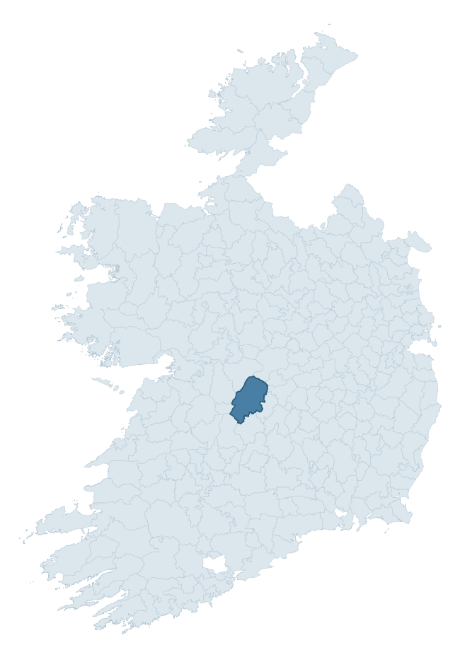
Where this barony sits in the Republic of Ireland
Geology and preservation
Bedrock geology shapes the landscape long before any settlement begins — controlling soil drainage, agricultural potential, the survival of upstanding monuments, and the preservation of buried archaeology. The figures below come from the Geological Survey Ireland 1:100,000 bedrock map.
The bedrock underlying Ormond Lower is predominantly limestone (93% of the barony by area), laid down during the Carboniferous period (98% by area, around 359 to 299 million years ago). Limestone is the most heritage-rich bedrock in Ireland. It supports fertile, well-drained soils that favoured dense Early Medieval settlement and Norman manorial agriculture, and it weathers into karst features — sinkholes, caves, swallow holes, and souterrains — that frequently carry archaeology. Where peat overlies limestone, organic preservation can be exceptional. The single largest mapped unit is the Waulsortian Limestones (38% of the barony's bedrock).
Rock type composition
Largest mapped unit: Waulsortian Limestones (38% of the barony)
Placename evidence
Logainm records 71 heritage-diagnostic placenames for Ormond Lower, drawn from townland and civil-parish names across the barony. The dominant stratum is Early Christian ecclesiastical — cill-, teampall-, and domhnach-prefixed names that record the dense network of early church foundations established between the fifth and tenth centuries. The leading diagnostic roots are cill- (32 — church), lios- (16 — ringfort or enclosure), and ráth- (7 — earthen ringfort). This is well above the ROI average of 30.7 heritage placenames per barony — around 2.3× the typical figure. The presence of multiple heritage strata side by side indicates layered occupation of the landscape across successive prehistoric and historic periods. Logainm records 432 placenames for Ormond Lower (predominantly townland names). Of these, 71 (16%) carry one of the diagnostic Gaelic roots tracked above; the remainder draw on more generic landscape vocabulary that does not encode a heritage period.
Pre-Christian / Early Medieval Defensive
| Root | Count | Meaning |
|---|---|---|
| lios- | 16 | ringfort or enclosure |
| ráth- | 7 | earthen ringfort |
| caiseal- | 1 | stone ringfort |
Early Christian Ecclesiastical
| Root | Count | Meaning |
|---|---|---|
| cill- | 32 | church (early) |
| cillín- | 4 | unconsecrated burial ground |
| gráinseach- | 3 | monastic farm / grange |
| tobar- | 1 | holy well |
Burial, Ritual, and Norse-Contact
| Root | Count | Meaning |
|---|---|---|
| carn- | 4 | cairn |
| tuaim- | 3 | burial mound |
| gall- | 1 | foreigner — Norse settlement marker |
Other baronies in Tipperary
- Kilnamanagh Lower
- Upperthird
- Ormond Upper
- Kilnamanagh Upper
- Eliogarty
- Iffa And Offa West
- Middlethird
- Kinalea — Cork
- Glenahiry
- Ibane And Barryroe — Cork
See all 280 baronies in the Republic of Ireland Heritage Tool.

Explore further
Grounding History: 10 Maps of Northern Ireland’s Past
If you’re interested in Irish heritage more widely, the companion report for Northern Ireland brings together the analysis of all 462 NI wards into one place through 10 high-quality maps — covering monument density, archaeological periods, placename heritage, terrain, wetland, and the historic landscape at first survey. Take a look.
About this profile
Click any section below to expand.
What is a barony?
A barony is a historic administrative unit in Ireland, broadly equivalent to an English hundred. The 280 baronies used here are from the OSi 2019 National Statutory Boundaries (generalised 20m), covering the 26 counties of the Republic of Ireland. Baronies derive from the Norman period, were formalised in the 17th century, and have not been redrawn for statistical purposes. They vary enormously in area, from compact urban baronies in Dublin to vast upland baronies in Connacht, and should not be compared by raw site count without accounting for area differences.
What counts as a site?
This profile combines three distinct heritage registers, each with its own definition of what constitutes a recordable site:
- Archaeological sites (NMS). The National Monuments Service Sites and Monuments Record (SMR) catalogues every known archaeological monument or site of archaeological interest in the Republic, from prehistoric burial mounds and ringforts to medieval churches and post-medieval defensive works. Inclusion does not require legal protection — only that the site has been identified, surveyed, and assessed as having archaeological value. A separate subset of these sites lies within a recorded protection zone, which gives them statutory protection under the National Monuments Acts.
- Listed buildings (NIAH). The National Inventory of Architectural Heritage records buildings of architectural, historical, archaeological, artistic, cultural, scientific, social, or technical interest. Each surveyed structure is appraised on a five-tier scale: International, National, Regional, Local, and Record-Only. The NIAH appraisal is informational rather than strictly statutory, but it underpins local-authority Record of Protected Structures (RPS) listings.
- Heritage placenames (Logainm). Logainm is the authoritative database of Irish placenames maintained by the Placenames Branch. This profile applies a heritage-diagnostic classifier to the Irish-language form of each townland name, flagging roots that signal defensive sites (ráth-, lios-, dún-, caiseal-, cathair-), ecclesiastical foundations (cill-, teampall-, domhnach-, mainistir-), prehistoric burial-ritual features (tuaim-, carn-, leaba-), or Norse-contact settlement (gall-). Townlands without one of these diagnostic roots are not flagged here — they may still carry historical significance, but that significance is not encoded in the name itself.
Editorial principles
The narrative sections of this profile follow several explicit principles:
- Evidential. Every claim about this barony’s heritage character is anchored in the underlying register data. Where a site count, a placename count, or a percentile rank is cited, it is computed from the source datasets at export time, not estimated.
- Comparative. Counts and metrics are reported alongside their percentile rank against the other 279 ROI baronies. A barony with 50 ringforts in absolute terms could be unusually high or unusually low depending on its size and regional context; percentile ranking removes that ambiguity.
- Transparent on limits. Where a register has known coverage gaps, survey biases, or data-quality issues that affect this barony’s figures, the profile flags them rather than presenting the numbers as definitive.
- No interpretation beyond what the data supports. The narrative does not speculate about historical events, social dynamics, or cultural meaning beyond what the recorded heritage and placename evidence directly attests.
Data caveats and limits
- NMS Sites and Monuments Record is the product of survey campaigns conducted at different intensities across different counties and decades. Some baronies have been surveyed more thoroughly than others, and absolute counts should be read in that light. Sites destroyed by development before survey are typically not represented; sites in heavily forested or upland terrain are sometimes under-recorded.
- NIAH coverage is broadly complete for the Republic of Ireland but the survey was conducted on a rolling county-by-county basis, and the most recent appraisal date varies. Buildings demolished or substantially altered after their original survey may still appear in the register; conversely, recent buildings of merit may not yet have been appraised.
- Logainm classification applies a deliberately conservative pattern-matching approach to the Irish-language townland forms. The classifier prioritises true positives over recall: a townland may carry a heritage signal that the classifier doesn’t recognise, particularly where the diagnostic root has been heavily anglicised or where the townland name draws on a less common term. The 60,000+ townland records and ~9,800 classified placenames give a substantial signal at barony scale, but individual townland names should be checked against Logainm directly for definitive interpretation.
- Period attribution. The chronological distribution reflects only those NMS sites that carry a recognised period attribution in the source data. Sites listed as “Unknown” period are excluded from the dated subset.
- Boundary changes. Some baronies have undergone minor boundary adjustments since their 19th-century definition; the OSi 2019 generalised boundaries used here are the current statutory definition and may differ slightly from historical maps in border areas.
- Bedrock geology is mapped at 1:100,000 scale, which means local variation within a barony — small pockets of different rock type, mineral veins, alluvium overlying bedrock — is generalised. The dominant-system and rocktype figures are area-weighted, so a barony reading “70% Carboniferous limestone” may still contain small but archaeologically important pockets of older or younger rock. Around 3% of GSI polygons do not match the lexicon and contribute no rocktype or system attribution.
Data sources
- National Monuments Service — Sites and Monuments Record (SMR) https://data.gov.ie/dataset/national-monuments-service-archaeological-survey-of-ireland
- National Inventory of Architectural Heritage (NIAH) https://data.gov.ie/dataset/national-inventory-of-architectural-heritage-niah-national-dataset
- Logainm — Placenames Database of Ireland https://www.logainm.ie/
- Ordnance Survey Ireland — National Statutory Barony Boundaries 2019 https://data-osi.opendata.arcgis.com/
- EURODEM — European Digital Elevation Model https://www.mapsforeurope.org/datasets/euro-dem
- ESA WorldCover https://esa-worldcover.org/en
- Geological Survey Ireland — 1:100,000 Bedrock Geology https://www.gsi.ie/en-ie/data-and-maps/Pages/Bedrock.aspx
Explore more: Search any of the 280 ROI baronies, browse by historical province, or read the methodology and data sources for the full Republic of Ireland Heritage Tool.