
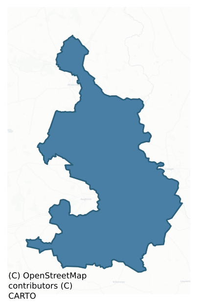
Clonmacnowen is a barony of County Galway, in the historical province of Connacht (Irish: Cluain Mhac nEoghain), covering 143 km² of land. The barony records 409 NMS archaeological sites and 93 NIAH listed buildings, placing it at around the 78th percentile among 280 ROI baronies for sites per km². This means it is in the top third of all baronies for sites per km². Dated archaeological evidence runs from the Early Bronze Age through to the Modern, spanning 7 of 9 archaeological periods, placing the barony in the 30th percentile among 280 ROI baronies for chronological depth. This means it is in the bottom third of all baronies for chronological depth. The largest dated subset of recorded sites dates to the Early Medieval. Logainm flags 31 placenames in the barony as carrying a recognised heritage root; the largest share — around 58% — are names associated with early Christian church and monastic foundations.
Heritage at a glance
Percentile rankings throughout this profile compare each barony only against the other 279 Republic of Ireland baronies.
The recorded heritage of Clonmacnowen
The National Monuments Service Sites and Monuments Record (SMR) is the statutory inventory of archaeological sites for the Republic of Ireland, maintained by the Department of Tourism, Culture, Arts, Gaeltacht, Sport and Media. Sites recorded here include earthworks, ringforts, megalithic tombs, ecclesiastical remains, and post-medieval features; not every record is legally protected, but each is registered as a monument of archaeological interest.
The National Monuments Service records 409 archaeological sites in Clonmacnowen, putting it at the 78th percentile among 280 ROI baronies for sites per km². This means it is in the top third of all baronies for sites per km². Of these, 322 (79%) fall within a recorded monument protection zone. The dominant category is defensive sites — ringforts, enclosures, hillforts, and stone forts (247 sites, 60% of the record). Ringfort – rath is the most prevalent type, making up 23% of the barony's recorded sites (94 records), broadly in line with the ROI average of 20% across all baronies where this type occurs. Ringfort – rath is an earthen ringfort enclosed by a bank and external ditch — the most common Early Medieval farmstead, broadly dated 500–1000 AD. Other significant types include Ringfort – unclassified (61) and Enclosure (59). Ringfort – unclassified is a circular Early Medieval settlement enclosure where surviving evidence does not allow distinction between earthen and stone forms; Enclosure is a banked or ditched feature of uncertain type, used as a catch-all where the original function cannot be determined from surface evidence. Across the barony's 143 km², this gives a recorded density of 2.87 sites per km².
Most common monument types
Hover or tap a monument type to see its definition.
| Type | Count |
|---|---|
| Ringfort – rath an earthen ringfort enclosed by a bank and external ditch — the most common Early Medieval farmstead, broadly dated 500–1000 AD | 94 |
| Ringfort – unclassified a circular Early Medieval settlement enclosure where surviving evidence does not allow distinction between earthen and stone forms | 61 |
| Enclosure a banked or ditched feature of uncertain type, used as a catch-all where the original function cannot be determined from surface evidence | 59 |
| Church a building used for public Christian worship, of any date from c. 500 AD onwards | 19 |
| Children's burial ground an unconsecrated medieval and early-modern burial ground for unbaptised or stillborn children, often called a cillín or ceallúnach | 18 |
| Quarry a place where stone, sand, gravel or clay was extracted | 13 |
| Earthwork an unclassified earthen structure with no diagnostic features that allow a more specific classification | 10 |
Chronological distribution
The dated archaeological record for Clonmacnowen spans from the Early Bronze Age through to the Modern, with activity attested across 7 of 9 archaeological periods. Every period from earliest to latest is represented in the record — an unbroken sequence of dated activity across the full chronological span. Activity concentrates most heavily in the Early Medieval (188 sites, 58% of dated material), with the Iron Age forming a secondary peak (108 sites, 33%). A further 83 recorded sites (20% of the overall NMS register for the barony) carry no period attribution — appearing as 'Unknown' in the bar chart below. This typically reflects either records that pre-date the standardised period vocabulary or sites awaiting specialist dating review, rather than a genuine absence of chronological evidence.
Sample of recorded monuments
Show 25 sample monuments (of 409 total)
A representative sample of 25 recorded monuments drawn from the barony’s 409 total NMS entries. Sites within a recorded monument protection zone and rarer site types are prioritised so the list shows a meaningful cross-section rather than only the most common type. Each entry shows the official Sites and Monuments Record reference number and the description published by the National Monuments Service.
Designed landscape feature
On a gentle rise in former demesne land. Marked on 1st ed. of OS 6-inch map as a circular tree-filled enclosure (D c. 30m). No visible surface trace survives. There is an enclosure (GA061-064—-) 100m to ENE, while a…
On a gentle rise in former demesne land. Marked on 1st ed. of OS 6-inch map as a circular tree-filled enclosure (D c. 30m). No visible surface trace survives. There is an enclosure (GA061-064—-) 100m to ENE, while a ringfort (GA061-065—-) lies 100m to WSW. The site's location, in a straight line between the enclosure and ringfort, might suggest a landscape feature associated with Runnamead House to E.
The above description is derived from the published 'Archaeological Inventory of County Galway Vol. II – North Galway'. Compiled by Olive Alcock, Kathy de hÓra and Paul Gosling (Dublin: Stationery Office, 1999).
Date of upload: 05 August 2010
House – vernacular house
The Archaeological Survey of Ireland (ASI) is in the process of providing information on all monuments on The Historic Environment Viewer (HEV). Currently the information for this record has not been uploaded. To…
The Archaeological Survey of Ireland (ASI) is in the process of providing information on all monuments on The Historic Environment Viewer (HEV). Currently the information for this record has not been uploaded. To access available information for research purposes please make an appointment in advance with the Archive Unit (open Fridays 10.00 am – 5.00 pm), Department of Culture, Heritage and the Gaeltacht, The Custom House, Dublin 1 D01W6XO or email nmarchive@chg.gov.ie.
Pump
This is a 19th-century water pump.
Compiled by: Olive Alcock
Date of upload: 20 October 2016
Castle – tower house
In undulating pastureland, c. 100m S of a stream. A poorly preserved rectangular tower (L 8.8m, Wth 4.9m int.) surviving to a height of three storeys and surrounded by a bawn. The partially robbed pointed arch doorway,…
In undulating pastureland, c. 100m S of a stream. A poorly preserved rectangular tower (L 8.8m, Wth 4.9m int.) surviving to a height of three storeys and surrounded by a bawn. The partially robbed pointed arch doorway, centrally placed in E wall, is defended by a gun loop in S jamb. It opens into a small lobby with a murder-hole above. The guardroom, with a cross loop in E wall and a circular loop in N wall, is to N and the spiral stairs to S. The 1st and 2nd floors of the tower comprise a main chamber with a subsidiary one to E. Traces of a stone vault survive above the subsidiary chamber on 2nd floor. A mural passage occurs on this floor in S wall. Windows consist of plain rectangular and round-headed slits as well as single lights with ogee heads. The line of the rectangular bawn (E-W c. 40m, N-S c. 30m) is indicated by a curving scarp edge from NE to SE and by a bank from SE to NW.
The above description is derived from the published 'Archaeological Inventory of County Galway Vol. II – North Galway'. Compiled by Olive Alcock, Kathy de hÓra and Paul Gosling (Dublin: Stationery Office, 1999).
Date of upload: 05 August 2010
Icehouse
The Archaeological Survey of Ireland (ASI) is in the process of providing information on all monuments on The Historic Environment Viewer (HEV). Currently the information for this record has not been uploaded. To…
The Archaeological Survey of Ireland (ASI) is in the process of providing information on all monuments on The Historic Environment Viewer (HEV). Currently the information for this record has not been uploaded. To access available information for research purposes please make an appointment in advance with the Archive Unit (open Fridays 10.00 am – 5.00 pm), Department of Culture, Heritage and the Gaeltacht, The Custom House, Dublin 1 D01W6XO or email nmarchive@chg.gov.ie.
Burial ground
The Archaeological Survey of Ireland (ASI) is in the process of providing information on all monuments on The Historic Environment Viewer (HEV). Currently the information for this record has not been uploaded. To…
The Archaeological Survey of Ireland (ASI) is in the process of providing information on all monuments on The Historic Environment Viewer (HEV). Currently the information for this record has not been uploaded. To access available information for research purposes please make an appointment in advance with the Archive Unit (open Fridays 10.00 am – 5.00 pm), Department of Culture, Heritage and the Gaeltacht, The Custom House, Dublin 1 D01W6XO or email nmarchive@chg.gov.ie.
Religious house – Augustinian canons
In flat open farmland S of Ballinure River. A house of Augustinian canons, dedicated to St Mary, was founded here by the O'Kelly family 'some time after 1140' on the site of an early monastery (Gwynn and Hadcock 1970,…
In flat open farmland S of Ballinure River. A house of Augustinian canons, dedicated to St Mary, was founded here by the O'Kelly family 'some time after 1140' on the site of an early monastery (Gwynn and Hadcock 1970, 165). Excavated in 1971-2 (Fanning 1976), this recently conserved Nat. Mon. consists of the well-preserved remains of a 13th-16th-C church along with parts of the cloister and domestic ranges. The church comprises a nave (E-W; L 16.5m, Wth 8m) and chancel (L 16m, Wth 8m) with a transept at NW end. There is a highly decorated 15th-C doorway in W gable with a holy water font in its N jamb (Leask 1960b, 74-6, also 163, 181). A 17th-C wall separates the nave from the chancel, to W of which traces of an earlier rood screen survive. The chancel is dominated by the reconstructed 15th-C traceried window in E gable; itself a replacement of a 13th-C multiple lancet window of which only fragments survive. There is also a pair of slender round-headed single-light windows in S wall. A doorway at NE end of the chancel gave access to an adjoining rectangular building, probably a 13th-C 'sacristy or side-chapel', only the foundations of which survive (Fanning ibid., 110). Immediately to W of the latter is a later structure which is in turn abutted by E wall of the 16th-C transept. At its NE corner, this transept overlies the foundations of yet another rectangular building (E-W; L 9m, Wth 5m), interpreted as possibly a 'fifteenth-century chapel' or 'even … an Early Christia…
Cross
On roadside, 430m SSW of Clontuskert Abbey (GA088-001—-). Only one piece of the shaft of this limestone cross (Wth 0.22m, H 0.45m), octagonal in section, survives. It stands in a broken rectangular limetone base (L…
On roadside, 430m SSW of Clontuskert Abbey (GA088-001—-). Only one piece of the shaft of this limestone cross (Wth 0.22m, H 0.45m), octagonal in section, survives. It stands in a broken rectangular limetone base (L 0.5m, Wth 0.4m, H 0.12m) which has a chamfered edge around the socket. The shaft and base stand on top of a small subcircular earthen mound (E-W 4.8m, N-S 4.4m, H 0.5m).
The above description is derived from the published 'Archaeological Inventory of County Galway Vol. II – North Galway'. Compiled by Olive Alcock, Kathy de hÓra and Paul Gosling (Dublin: Stationery Office, 1999).
Date of upload: 05 August 2010
Barrow – unclassified
In level farmland. Circular enclosure (D c. 40m), in fair condition, defined by a central platform, an internal fosse, intervening bank and external fosse. A gap (Wth 4m) at NNE may be original. Possible traces of an…
In level farmland. Circular enclosure (D c. 40m), in fair condition, defined by a central platform, an internal fosse, intervening bank and external fosse. A gap (Wth 4m) at NNE may be original. Possible traces of an inner bank are visible at NNE, though this may simply be due to the slightly dished profile of the central platform.
The above description is derived from the published 'Archaeological Inventory of County Galway Vol. II – North Galway'. Compiled by Olive Alcock, Kathy de hÓra and Paul Gosling (Dublin: Stationery Office, 1999).
Date of upload: 05 August 2010
Castle – hall-house
Within a moated site (GA099-168001-). Named in OS Letters (O'Flanagan 1927, Vol. 1, 648) as 'Cloch na pairce (pratirupes)'. Very poorly preserved two-storey rectangular building (L >14.7m, Wth c. 10.7m), probably of…
Within a moated site (GA099-168001-). Named in OS Letters (O'Flanagan 1927, Vol. 1, 648) as 'Cloch na pairce (pratirupes)'. Very poorly preserved two-storey rectangular building (L >14.7m, Wth c. 10.7m), probably of 13th-C date. Only sections of S, W and N walls survive, and a small fragment at SE corner. These display traces of a sharp base-batter The remains of narrow slit windows with wide internal splays are visible in each wall on the ground floor.
The above description is derived from the published 'Archaeological Inventory of County Galway Vol. II – North Galway'. Compiled by Olive Alcock, Kathy de hÓra and Paul Gosling (Dublin: Stationery Office, 1999).
Date of upload: 05 August 2010
Burial
On a gentle SW-facing slope in pastureland, c. 120m W of a stream. Discovered in May 1992, at a depth of 0.3-0.5m, while digging an ESB cable trench. A number of skeletons were discovered, possibly two adults and a…
On a gentle SW-facing slope in pastureland, c. 120m W of a stream. Discovered in May 1992, at a depth of 0.3-0.5m, while digging an ESB cable trench. A number of skeletons were discovered, possibly two adults and a child. When inspected the trench had been backfilled and all that survived were a number of human bone fragments and traces of burnt clay (Topgr. Files, OPW).
The above description is derived from the published 'Archaeological Inventory of County Galway Vol. II – North Galway'. Compiled by Olive Alcock, Kathy de hÓra and Paul Gosling (Dublin: Stationery Office, 1999).
Date of upload: 05 August 2010
House – 17th century
The Archaeological Survey of Ireland (ASI) is in the process of providing information on all monuments on The Historic Environment Viewer (HEV). Currently the information for this record has not been uploaded. To…
The Archaeological Survey of Ireland (ASI) is in the process of providing information on all monuments on The Historic Environment Viewer (HEV). Currently the information for this record has not been uploaded. To access available information for research purposes please make an appointment in advance with the Archive Unit (open Fridays 10.00 am – 5.00 pm), Department of Culture, Heritage and the Gaeltacht, The Custom House, Dublin 1 D01W6XO or email nmarchive@chg.gov.ie.
Kiln
The Archaeological Survey of Ireland (ASI) is in the process of providing information on all monuments on The Historic Environment Viewer (HEV). Currently the information for this record has not been uploaded. To…
The Archaeological Survey of Ireland (ASI) is in the process of providing information on all monuments on The Historic Environment Viewer (HEV). Currently the information for this record has not been uploaded. To access available information for research purposes please make an appointment in advance with the Archive Unit (open Fridays 10.00 am – 5.00 pm), Department of Culture, Heritage and the Gaeltacht, The Custom House, Dublin 1 D01W6XO or email nmarchive@chg.gov.ie.
Wall monument
This memorial stone has been inserted into the W end of the S wall of the chancel of Clontuskert priory (GA088-001—-) at a height of 1.97m from ground level. The inscription reads: HERE. LES / THE / BVRI/AL. OF. THE /…
This memorial stone has been inserted into the W end of the S wall of the chancel of Clontuskert priory (GA088-001—-) at a height of 1.97m from ground level. The inscription reads: HERE. LES / THE / BVRI/AL. OF. THE / SEPT. OF. VR/CHARY. BRI/A[n] KELLY / THE 2 OFMAY / 1646 HIVGH K/ELLY WAS KI. The last line of the inscription is carved along the bottom of the frame and appears to be incomplete.
The following image has been uploaded: GA088-001008-_01.jpg
Compiled by: Paul Walsh, Olive Alcock
Date of upload: 25 July 2014
This monument is subject to a preservation order made under the National Monuments Acts 1930 to 2014 (PO no. 8/1970).
Moated site
Surrounding the remains of Cloonigny Castle (GA074-027002-). A Nat. Mon., this well-preserved moated site (N-S 65m, E-W 63m) is defined by two banks and an intervening fosse. The inner bank is best preserved from W to…
Surrounding the remains of Cloonigny Castle (GA074-027002-). A Nat. Mon., this well-preserved moated site (N-S 65m, E-W 63m) is defined by two banks and an intervening fosse. The inner bank is best preserved from W to N. Quarrying has disturbed the enclosing elements from S to W and from N to NNE. Abutting the monument at SW is a mound defined by a scarp and external fosse, and a ditch runs NNE-SSW immediately outside W side. A modern drain encircles the monument from W through N to E. (O'Flanagan 1927, Vol. 1, 533-4)
The above description is derived from the published 'Archaeological Inventory of County Galway Vol. II – North Galway'. Compiled by Olive Alcock, Kathy de hÓra and Paul Gosling (Dublin: Stationery Office, 1999).
Date of upload: 05 August 2010
The monument was taken into Ownership under the National Monuments Acts 1930 to 2014 – National Monument 563.
Country house
The Archaeological Survey of Ireland (ASI) is in the process of providing information on all monuments on The Historic Environment Viewer (HEV). Currently the information for this record has not been uploaded. To…
The Archaeological Survey of Ireland (ASI) is in the process of providing information on all monuments on The Historic Environment Viewer (HEV). Currently the information for this record has not been uploaded. To access available information for research purposes please make an appointment in advance with the Archive Unit (open Fridays 10.00 am – 5.00 pm), Department of Culture, Heritage and the Gaeltacht, The Custom House, Dublin 1 D01W6XO or email nmarchive@chg.gov.ie.
Crannog
The Archaeological Survey of Ireland (ASI) is in the process of providing information on all monuments on The Historic Environment Viewer (HEV). Currently the information for this record has not been uploaded. To…
The Archaeological Survey of Ireland (ASI) is in the process of providing information on all monuments on The Historic Environment Viewer (HEV). Currently the information for this record has not been uploaded. To access available information for research purposes please make an appointment in advance with the Archive Unit (open Fridays 10.00 am – 5.00 pm), Department of Culture, Heritage and the Gaeltacht, The Custom House, Dublin 1 D01W6XO or email nmarchive@chg.gov.ie.
Moated site
In low-lying grassland. Very poorly preserved almost square enclosure (N-S c. 45m, E-W c. 45m) defined by a degraded scarp and external fosse, best preserved along N and E sides. A field wall overlies the enclosing…
In low-lying grassland. Very poorly preserved almost square enclosure (N-S c. 45m, E-W c. 45m) defined by a degraded scarp and external fosse, best preserved along N and E sides. A field wall overlies the enclosing elements at S. A hall-house (GA099-168—-) lies just inside SW corner.
The above description is derived from the published 'Archaeological Inventory of County Galway Vol. II – North Galway'. Compiled by Olive Alcock, Kathy de hÓra and Paul Gosling (Dublin: Stationery Office, 1999).
Date of upload: 05 August 2010
Bawn
The Archaeological Survey of Ireland (ASI) is in the process of providing information on all monuments on The Historic Environment Viewer (HEV). Currently the information for this record has not been uploaded. To…
The Archaeological Survey of Ireland (ASI) is in the process of providing information on all monuments on The Historic Environment Viewer (HEV). Currently the information for this record has not been uploaded. To access available information for research purposes please make an appointment in advance with the Archive Unit (open Fridays 10.00 am – 5.00 pm), Department of Culture, Heritage and the Gaeltacht, The Custom House, Dublin 1 D01W6XO or email nmarchive@chg.gov.ie.
Bridge
In pastureland on the NW bank of the Ballinure River. This bridge of is built of random rubble with a lime-based mortar. One partially collapsed semicircular arch (dims. H 0.85m; Wth 1.9m; L c. 2m) of thin voussoirs (L…
In pastureland on the NW bank of the Ballinure River. This bridge of is built of random rubble with a lime-based mortar. One partially collapsed semicircular arch (dims. H 0.85m; Wth 1.9m; L c. 2m) of thin voussoirs (L 0.5m) survives. It is grass covered but its external face is visible on the S side. The original road metal (L 4m) is covered in thick tufts of grass and no parapet wall survives. The archway is now dry as the present course of the river has been diverted c. 2m to the S and it has evidently been deepened. The bridge would have originally crossed the river at a right angle. According to local information, this bridge was in use before the existing stone bridge was constructed c. 4.2m to its E.
Compiled by: Olive Alcock
Date of upload: 4 April 2017
Bridge
The Archaeological Survey of Ireland (ASI) is in the process of providing information on all monuments on The Historic Environment Viewer (HEV). Currently the information for this record has not been uploaded. To…
The Archaeological Survey of Ireland (ASI) is in the process of providing information on all monuments on The Historic Environment Viewer (HEV). Currently the information for this record has not been uploaded. To access available information for research purposes please make an appointment in advance with the Archive Unit (open Fridays 10.00 am – 5.00 pm), Department of Culture, Heritage and the Gaeltacht, The Custom House, Dublin 1 D01W6XO or email nmarchive@chg.gov.ie.
Ringfort – rath
In level grassland. Poorly preserved subcircular ringfort (E-W 27m, N-S 23m) defined by a stone-faced bank from N to NE and from SSW to NW; elsewhere a scarp forms the enclosing element. Possible external fosse…
In level grassland. Poorly preserved subcircular ringfort (E-W 27m, N-S 23m) defined by a stone-faced bank from N to NE and from SSW to NW; elsewhere a scarp forms the enclosing element. Possible external fosse indicated by a vegetation band from NE to E.
The above description is derived from the published 'Archaeological Inventory of County Galway Vol. II – North Galway'. Compiled by Olive Alcock, Kathy de hÓra and Paul Gosling (Dublin: Stationery Office, 1999).
Date of upload: 05 August 2010
Listed buildings
The National Inventory of Architectural Heritage (NIAH) is a state survey appraising buildings of architectural, historical, archaeological, artistic, cultural, scientific, social, or technical interest. Each surveyed structure receives a rating from International (the highest, for buildings of European importance) through National, Regional, Local, and Record-Only.
The NIAH records 93 listed buildings in Clonmacnowen (47th percentile across ROI baronies). All recorded buildings carry Regional or lower grading; the barony does not contain any structures appraised as being of National or International architectural importance. Construction dates concentrate most heavily in the Victorian (1830-1900) period. The most-recorded building type is house (32 examples, 34% of the listed stock).
Terrain and environment
Mean elevation across the barony is 59m — the 22nd percentile among 280 ROI baronies for elevation. This means it is in the bottom third of all baronies for elevation. This is a relatively low-lying landscape by ROI standards. Elevation matters for heritage because higher-altitude baronies typically favour defensive monuments — ringforts and hilltop forts placed on prominent ground — while lowland baronies are more likely to carry the dense settlement and church networks of intensive agricultural landscapes. Mean slope is 2.0° — the 6th percentile among 280 ROI baronies for slope. This means it is in the bottom tenth of all baronies for slope. This is broadly flat terrain, the kind of landscape best suited to intensive agriculture. Slope is a key control on both land use and archaeological preservation: steep ground resists ploughing and tends to preserve earthworks intact, while gentle slopes favour intensive cultivation that damages or destroys surface archaeology over time. The Topographic Wetness Index averages 11.8, the 91st percentile among 280 ROI baronies for wetness. This means it is in the top tenth of all baronies for wetness. This is wet, slow-draining ground by ROI standards — the kind of landscape that may carry waterlogged archaeological sites of unusual preservation value. Drainage matters for heritage because poorly-drained ground preserves organic archaeology (wooden trackways, leather, textiles, and on rare occasions human remains) far better than free-draining soil; well-drained ground favours arable use but destroys organic material rapidly. The land cover is dominated by improved grassland (85%) and woodland (12%). In overall character, this is low-lying, gently-sloping terrain — characteristic of Ireland's central plain and coastal lowlands, with land use dominated by improved grassland.
Terrain measurements
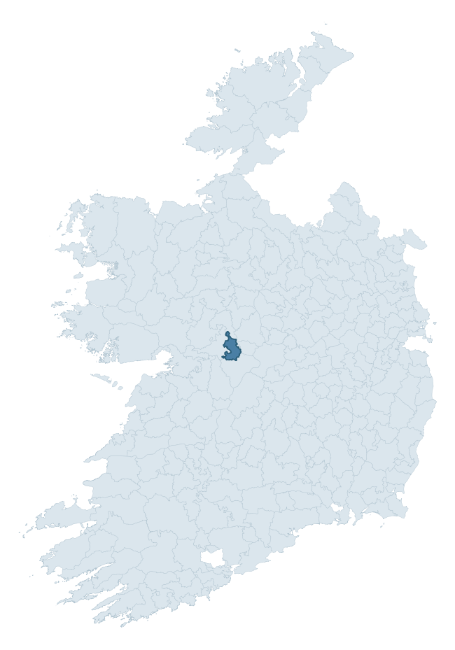
Where this barony sits in the Republic of Ireland
Geology and preservation
Bedrock geology shapes the landscape long before any settlement begins — controlling soil drainage, agricultural potential, the survival of upstanding monuments, and the preservation of buried archaeology. The figures below come from the Geological Survey Ireland 1:100,000 bedrock map.
The bedrock underlying Clonmacnowen is predominantly limestone (66% of the barony by area), laid down during the Carboniferous period (100% by area, around 359 to 299 million years ago). Limestone is the most heritage-rich bedrock in Ireland. It supports fertile, well-drained soils that favoured dense Early Medieval settlement and Norman manorial agriculture, and it weathers into karst features — sinkholes, caves, swallow holes, and souterrains — that frequently carry archaeology. Where peat overlies limestone, organic preservation can be exceptional. A substantial secondary geology of limestones (34%) adds further variety to the underlying landscape. The single largest mapped unit is the Lucan Formation (66% of the barony's bedrock). With only 2 distinct rock types mapped, the barony is geologically uniform compared to the rest of the Republic (9th percentile for diversity) — a single coherent bedrock landscape.
Rock type composition
Largest mapped unit: Lucan Formation (66% of the barony)
Placename evidence
Logainm records 31 heritage-diagnostic placenames for Clonmacnowen, drawn from townland and civil-parish names across the barony. The dominant stratum is Early Christian ecclesiastical — cill-, teampall-, and domhnach-prefixed names that record the dense network of early church foundations established between the fifth and tenth centuries. The leading diagnostic roots are cill- (14 — church), lios- (4 — ringfort or enclosure), and ráth- (3 — earthen ringfort). This is broadly in line with the ROI average of 30.7 heritage placenames per barony. The presence of multiple heritage strata side by side indicates layered occupation of the landscape across successive prehistoric and historic periods. Logainm records 143 placenames for Clonmacnowen (predominantly townland names). Of these, 31 (22%) carry one of the diagnostic Gaelic roots tracked above; the remainder draw on more generic landscape vocabulary that does not encode a heritage period.
Pre-Christian / Early Medieval Defensive
| Root | Count | Meaning |
|---|---|---|
| lios- | 4 | ringfort or enclosure |
| ráth- | 3 | earthen ringfort |
| dún- | 2 | hilltop or promontory fort |
| caiseal- | 1 | stone ringfort |
Early Christian Ecclesiastical
| Root | Count | Meaning |
|---|---|---|
| cill- | 14 | church (early) |
| teampall- | 1 | church (later medieval) |
| tobar- | 1 | holy well |
| cillín- | 1 | unconsecrated burial ground |
| gráinseach- | 1 | monastic farm / grange |
Burial, Ritual, and Norse-Contact
| Root | Count | Meaning |
|---|---|---|
| carn- | 2 | cairn |
| gall- | 2 | foreigner — Norse settlement marker |
| tuaim- | 1 | burial mound |
Other baronies in Galway
About this profile
Click any section below to expand.
What is a barony?
A barony is a historic administrative unit in Ireland, broadly equivalent to an English hundred. The 280 baronies used here are from the OSi 2019 National Statutory Boundaries (generalised 20m), covering the 26 counties of the Republic of Ireland. Baronies derive from the Norman period, were formalised in the 17th century, and have not been redrawn for statistical purposes. They vary enormously in area, from compact urban baronies in Dublin to vast upland baronies in Connacht, and should not be compared by raw site count without accounting for area differences.
What counts as a site?
This profile combines three distinct heritage registers, each with its own definition of what constitutes a recordable site:
- Archaeological sites (NMS). The National Monuments Service Sites and Monuments Record (SMR) catalogues every known archaeological monument or site of archaeological interest in the Republic, from prehistoric burial mounds and ringforts to medieval churches and post-medieval defensive works. Inclusion does not require legal protection — only that the site has been identified, surveyed, and assessed as having archaeological value. A separate subset of these sites lies within a recorded protection zone, which gives them statutory protection under the National Monuments Acts.
- Listed buildings (NIAH). The National Inventory of Architectural Heritage records buildings of architectural, historical, archaeological, artistic, cultural, scientific, social, or technical interest. Each surveyed structure is appraised on a five-tier scale: International, National, Regional, Local, and Record-Only. The NIAH appraisal is informational rather than strictly statutory, but it underpins local-authority Record of Protected Structures (RPS) listings.
- Heritage placenames (Logainm). Logainm is the authoritative database of Irish placenames maintained by the Placenames Branch. This profile applies a heritage-diagnostic classifier to the Irish-language form of each townland name, flagging roots that signal defensive sites (ráth-, lios-, dún-, caiseal-, cathair-), ecclesiastical foundations (cill-, teampall-, domhnach-, mainistir-), prehistoric burial-ritual features (tuaim-, carn-, leaba-), or Norse-contact settlement (gall-). Townlands without one of these diagnostic roots are not flagged here — they may still carry historical significance, but that significance is not encoded in the name itself.
Editorial principles
The narrative sections of this profile follow several explicit principles:
- Evidential. Every claim about this barony’s heritage character is anchored in the underlying register data. Where a site count, a placename count, or a percentile rank is cited, it is computed from the source datasets at export time, not estimated.
- Comparative. Counts and metrics are reported alongside their percentile rank against the other 279 ROI baronies. A barony with 50 ringforts in absolute terms could be unusually high or unusually low depending on its size and regional context; percentile ranking removes that ambiguity.
- Transparent on limits. Where a register has known coverage gaps, survey biases, or data-quality issues that affect this barony’s figures, the profile flags them rather than presenting the numbers as definitive.
- No interpretation beyond what the data supports. The narrative does not speculate about historical events, social dynamics, or cultural meaning beyond what the recorded heritage and placename evidence directly attests.
Data caveats and limits
- NMS Sites and Monuments Record is the product of survey campaigns conducted at different intensities across different counties and decades. Some baronies have been surveyed more thoroughly than others, and absolute counts should be read in that light. Sites destroyed by development before survey are typically not represented; sites in heavily forested or upland terrain are sometimes under-recorded.
- NIAH coverage is broadly complete for the Republic of Ireland but the survey was conducted on a rolling county-by-county basis, and the most recent appraisal date varies. Buildings demolished or substantially altered after their original survey may still appear in the register; conversely, recent buildings of merit may not yet have been appraised.
- Logainm classification applies a deliberately conservative pattern-matching approach to the Irish-language townland forms. The classifier prioritises true positives over recall: a townland may carry a heritage signal that the classifier doesn’t recognise, particularly where the diagnostic root has been heavily anglicised or where the townland name draws on a less common term. The 60,000+ townland records and ~9,800 classified placenames give a substantial signal at barony scale, but individual townland names should be checked against Logainm directly for definitive interpretation.
- Period attribution. The chronological distribution reflects only those NMS sites that carry a recognised period attribution in the source data. Sites listed as “Unknown” period are excluded from the dated subset.
- Boundary changes. Some baronies have undergone minor boundary adjustments since their 19th-century definition; the OSi 2019 generalised boundaries used here are the current statutory definition and may differ slightly from historical maps in border areas.
- Bedrock geology is mapped at 1:100,000 scale, which means local variation within a barony — small pockets of different rock type, mineral veins, alluvium overlying bedrock — is generalised. The dominant-system and rocktype figures are area-weighted, so a barony reading “70% Carboniferous limestone” may still contain small but archaeologically important pockets of older or younger rock. Around 3% of GSI polygons do not match the lexicon and contribute no rocktype or system attribution.
Data sources
- National Monuments Service — Sites and Monuments Record (SMR) https://data.gov.ie/dataset/national-monuments-service-archaeological-survey-of-ireland
- National Inventory of Architectural Heritage (NIAH) https://data.gov.ie/dataset/national-inventory-of-architectural-heritage-niah-national-dataset
- Logainm — Placenames Database of Ireland https://www.logainm.ie/
- Ordnance Survey Ireland — National Statutory Barony Boundaries 2019 https://data-osi.opendata.arcgis.com/
- EURODEM — European Digital Elevation Model https://www.mapsforeurope.org/datasets/euro-dem
- ESA WorldCover https://esa-worldcover.org/en
- Geological Survey Ireland — 1:100,000 Bedrock Geology https://www.gsi.ie/en-ie/data-and-maps/Pages/Bedrock.aspx
Explore more: Search any of the 280 ROI baronies, browse by historical province, or read the methodology and data sources for the full Republic of Ireland Heritage Tool.